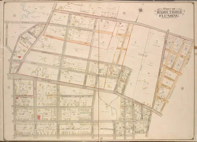
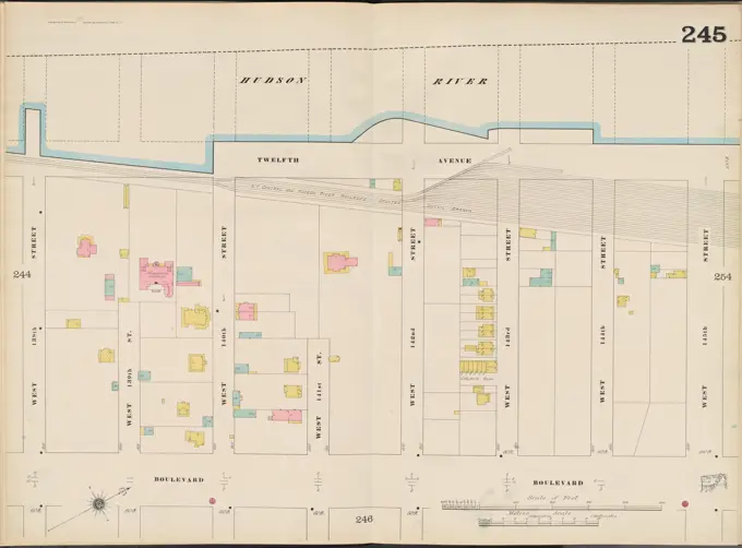
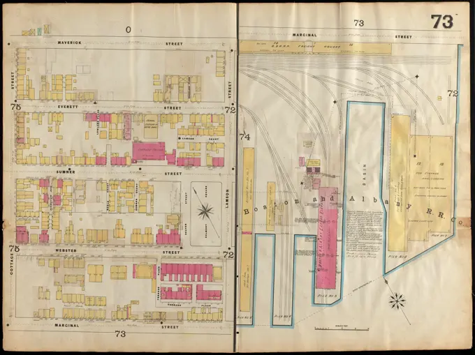
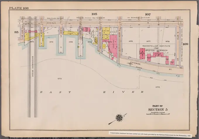
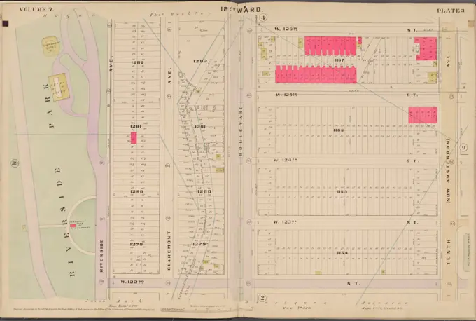
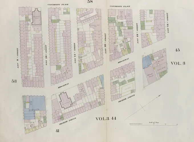
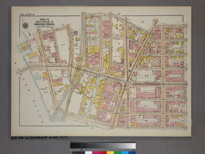
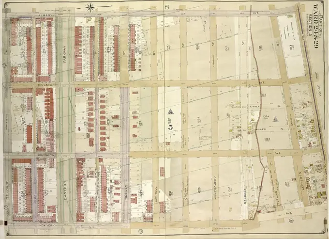
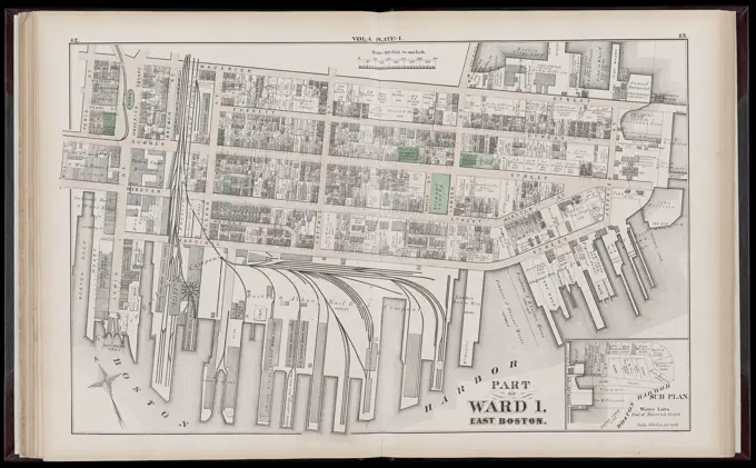
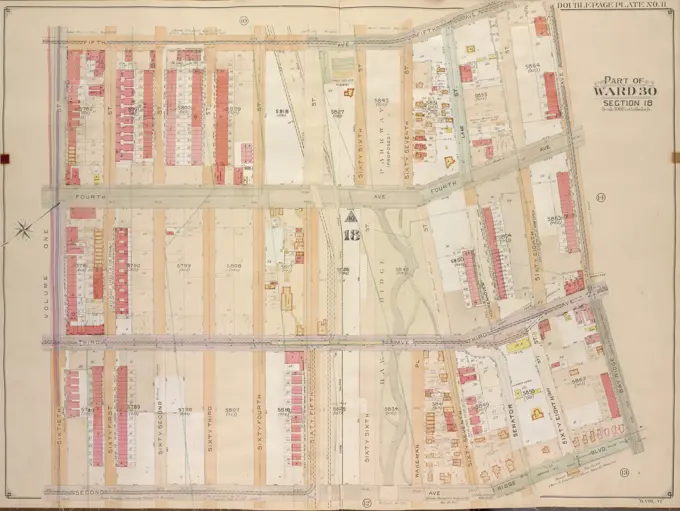
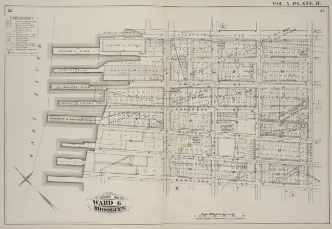
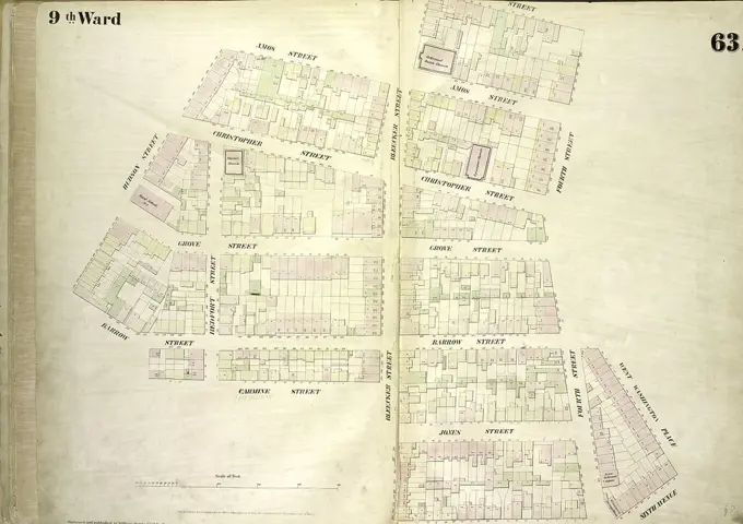
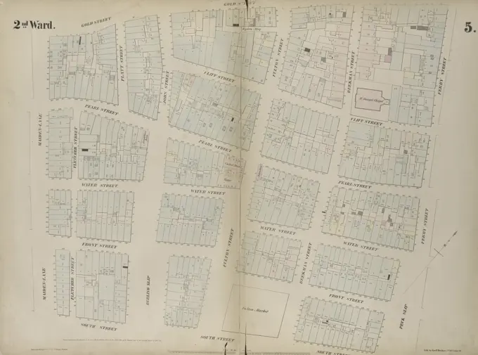
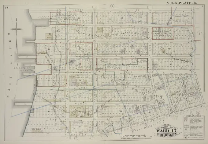
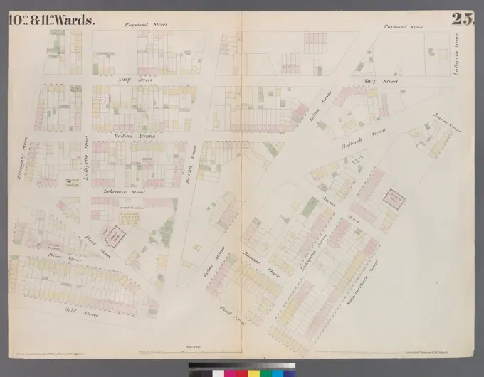
City Atlas Maps of Boston

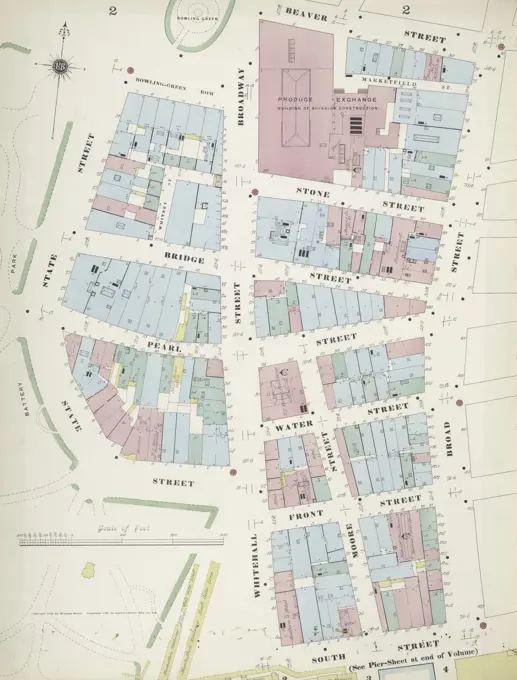
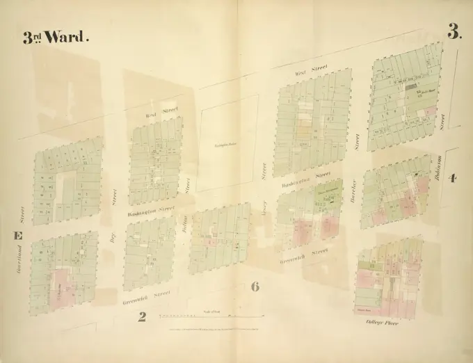
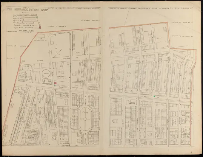
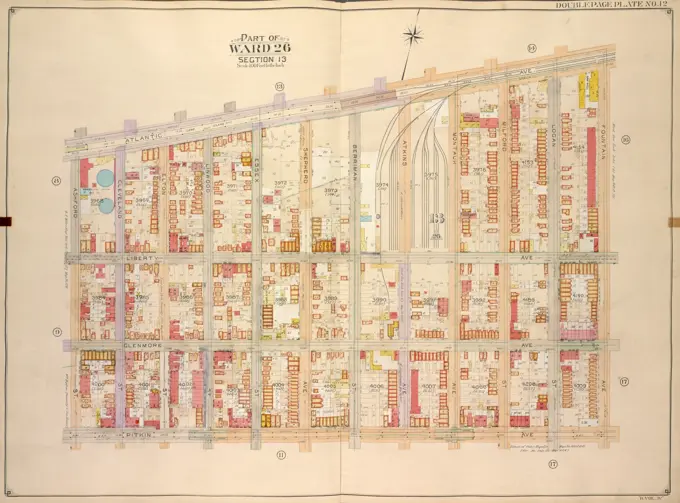
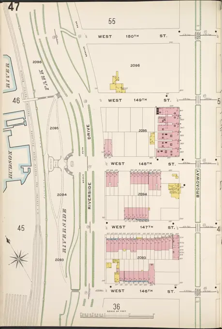
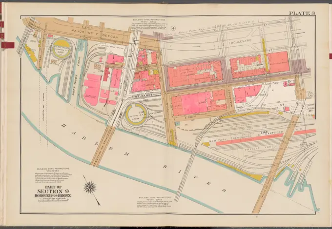
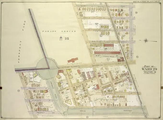
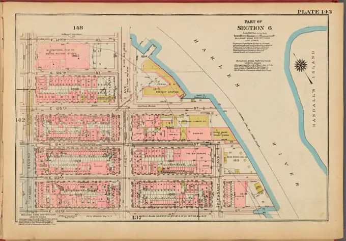
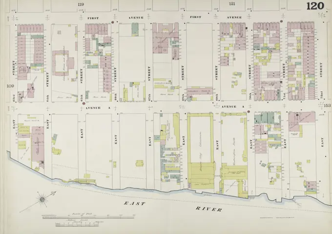
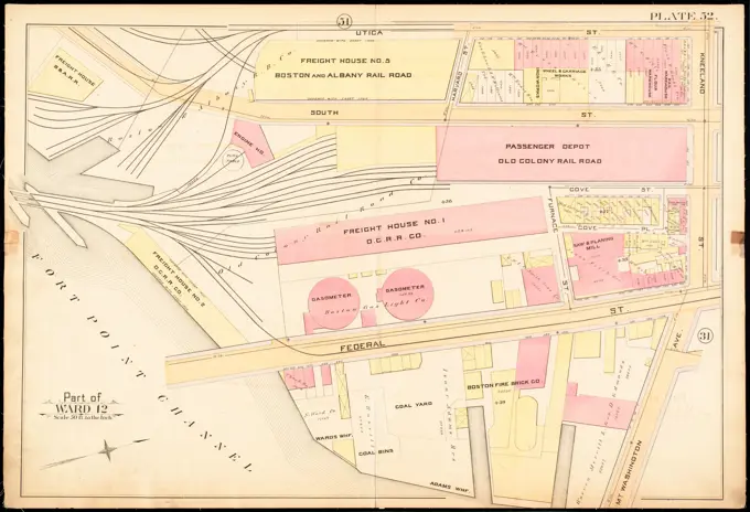
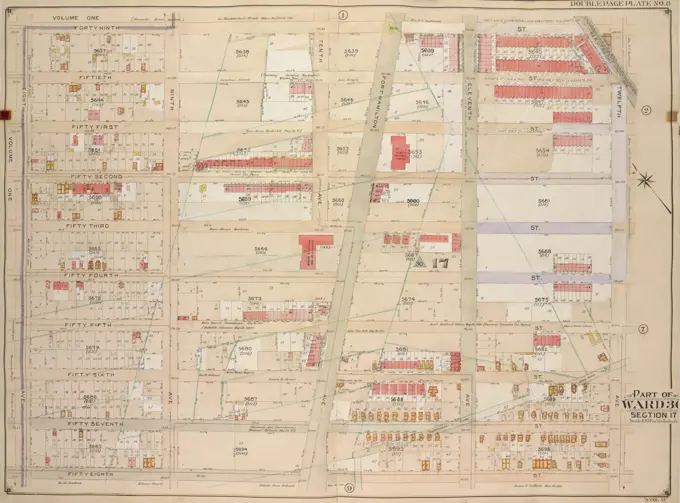
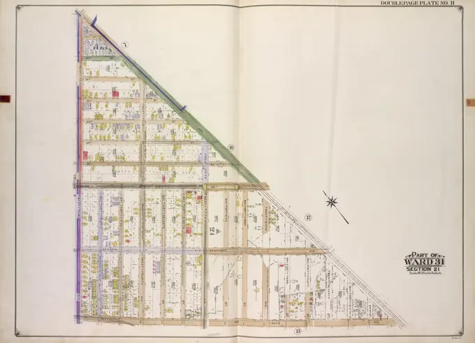
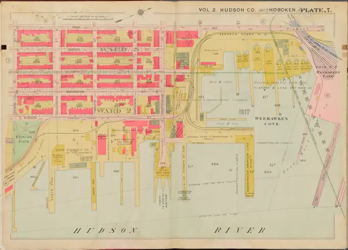
Detailed atlas maps displaying real estate and land ownership in various Boston neighborhoods, featuring color-coded property details.

Atlas of the city of Boston, Charlestown : plate 4 , Boston Mass., Maps, Real property, Massachusetts, Boston, Maps, Landowners, Massachusetts, Boston, Maps, Charlestown Boston, Mass., Maps Norman B. Leventhal Map Center Collection
Cartographic, Maps. 1955 - 1956. Lionel Pincus and Princess Firyal Map Division. Real property , New York (State) , New York (N.Y.), Manhattan (New York, N.Y.) Plate 19, Part of Section 2: Bounded by E. Houston Street, Orchard Street, Delancey Street, Bowery, Spring Street, Lafayette Street, Prince Street and Crosby Street.Cartographic, Maps. 1884 - 1936. Lionel Pincus and Princess Firyal Map Division. Fire insurance , New York (State), Real property , New York (State), Cities & towns , New York (State) Brooklyn V. 9, Plate No. 17 Map bounded by Hamburg Ave., Melrose St., Evergreen Ave., Flushing Ave.Plate 26, Part of Section 5: Bounded by Avenue A, E. 76th Street, Exterior Street and E. 67th Street.Cartographic, Maps. 1908 - 1913. Lionel Pincus and Princess Firyal Map Division. Queens (New York, N.Y.), Long Island City (New York, N.Y.) Queens, Vol. 3, Double Page Plate No. 7; Part of ward Three Flushing. Map bounded by Congress Ave., Myrtle Ave., Bayside Ave., Whitestone Ave., S. Parsons Ave., N. Parsons Ave., Bowne Ave., Brewster Ave., Claverly Pl., Vanriper Ave., Central Ave., Flushing Pl., Wilson Ave., Boerum Ave., Madison Ave., Botanic Pl., Broadway, Murray Lane, Mitchell Ave., Walter PL., Mc. Creery, Covert Pl., Osgood Pl., Washington PL.; Including Leavitt St., State St., Chestnut St., Union St., Washington St., Lincoln St., Amity St., Percy St., Murray St., 12th St., 13th St.Cartographic, Maps. 1912 - 1922. Lionel Pincus and Princess Firyal Map Division. Fire insurance , New York (State), Real property , New York (State), Cities & towns , New York (State) Queens V. 8, Plate No. 69 Map bounded by Jamaica Bay, Beach 84th St., Rockaway Beach Blvd., Beach 88th St.Manhattan, V. 11, Double Page Plate No. 242 Map bounded by Convent Ave., W. 138th St., 8th Ave., W. 130th St., 1884-1893, Sanborn Map Company., 1884-1893., New York. Publisher, Sanborn Map Company. Fire insurance, New York (State), Real property, New York (State), Cities & towns, New York (State)Cartographic, Maps. 1893. Lionel Pincus and Princess Firyal Map Division. Fire insurance , New York (State), Real property , New York (State), Cities & towns , New York (State) Manhattan, V. 11, Double Page Plate No. 245 Map bounded by Hudson River, W. 145th St., Boulevard, W. 138th St.Insurance map of Boston vol. 3 (South & East Boston) : plate 73 , Fire risk assessment, Massachusetts, Boston, Maps, East Boston Boston, Mass., Maps Norman B. Leventhal Map Center CollectionCartographic, Maps. 1916. Lionel Pincus and Princess Firyal Map Division. Atlases, Manhattan (New York, N.Y.), Real property , New York (State) , New York Plate 108: Bounded by Avenue A, E. 67th Street, Exterior Street, East River and E. 65th Street Part of Section 5Bromley, George Washington. Cartographic, Maps. 1904. Lionel Pincus and Princess Firyal Map Division. Bronx (New York, N.Y.), Real property , New York (State) , New York Plate 7: Part of Sections 9&10, Borough of the Bronx. Bounded by E. 156th Street, Trinity Avenue, E. 149th Street, St Anns Avenue, E. 147th Street, Willis Avenue, E. 148th Street and Morris Avenue.Insurance map of Charlestown : portions of Roxbury (now annexed to Boston) and Cambridge : plate 13 , Fire risk assessment, Massachusetts, Cambridge, Maps, Real property, Massachusetts, Cambridge, Maps, Cambridge Mass., Maps Norman B. Leventhal Map Center CollectionFire insurance district atlas showing the fire insurance districts of the city of Boston : north part of fire insurance district no. 27 , Real property, Massachusetts, Boston, Maps, Fire risk assessment, Massachusetts, Boston, Maps, Boston Mass., Maps Norman B. Leventhal Map Center CollectionCartographic, Maps. 1857 - 1862. Lionel Pincus and Princess Firyal Map Division. Manhattan (New York, N.Y.), Real property , New York (State) , New York Plate 57: Map bounded by 14th Street, Fourth Avenue, 9th Street, University PlaceE.B. Hyde & Co.. Cartographic, Maps. 1905. Lionel Pincus and Princess Firyal Map Division. Brooklyn (New York, N.Y.) , Maps, Real property , New York (State) , New York Brooklyn, Vol. 4, Double Page Plate No. 12; Part of Ward 26; Sections 13; Map bounded by Atlantic Ave., Fountain Ave.; Including Pitkin Ave., Ashford St.Cartographic, Maps. 1955 - 1956. Lionel Pincus and Princess Firyal Map Division. Real property , New York (State) , New York (N.Y.), Manhattan (New York, N.Y.) Plate 163, Part of Section 8: Bounded by W. 163rd Street, Broadway, W. 157th Street and (Hudson River, Fort Washington Park) Riverside Drive.Cartographic, Maps. 1909. Lionel Pincus and Princess Firyal Map Division. Fire insurance , New York (State), Real property , New York (State), Cities & towns , New York (State) Manhattan, V. 11, Plate No. 47 Map bounded by W. 150th St., Broadway, W. 146th St., Riverside DrivePlan of the grounds composing the red ball pens belonging to the civilian hospices of Paris / 1838.Cartographic, Maps. 1942 - 1957. Lionel Pincus and Princess Firyal Map Division. Real property , New York (State) , New York (N.Y.), Bronx (New York, N.Y.) , Maps Double Page Plate No. 3, Part of Section 9, Borough of the Bronx: Bounded by E. 135th Street, Willis Avenue, E. 132nd Street, Lincoln Avenue, Bruckner Boulevard, Harlem River and Park AvenueCartographic, Maps. 1884 - 1936. Lionel Pincus and Princess Firyal Map Division. Fire insurance , New York (State), Real property , New York (State), Cities & towns , New York (State) Queens V. 6, Plate No. 4 Map bounded by 85th Ave., 126th St., Jamaica Ave., 123rd St.Plate 18: Bounded by W. 127th Street, Manhattan Street, Amsterdam Avenue, W. 122nd Street and Riverside Park Riverside Drive.Brooklyn, Vol. 5, Double Page Plate No. 22; Part of Ward 29, Section 16; Map bounded by Rugby Road E. 14th St., Albemarle Road Avenue A, Church Ave., Church Lane, Ocean Parkway; Including Prospect Ave., Greenwood Ave., Parkside Ave., Cone.Cartographic, Maps. 1927. Lionel Pincus and Princess Firyal Map Division. Real property , New York (State) , New York, Manhattan (New York, N.Y.) Plate 143, Part of Section 6: Bounded by E. 127th Street, (Harlem River) First Avenue, E. 124th Street, Pleasant Avenue, E. 122nd Street and Second AvenueManhattan, V. 6, Double Page Plate No. 120 map, bounded by 1st Ave., E. 72nd St., East River, and E. 63rd St. Issued by the Sanborn Map Company, it documents fire insurance information related to real property in New York (State) and covers the date range from 1884 to 1892Atlas of the city of Boston, Roxbury : plate 16 , Boston Mass., Maps, Real property, Massachusetts, Boston, Maps, Landowners, Massachusetts, Boston, Maps, Fenway Boston, Mass., Maps Norman B. Leventhal Map Center CollectionEngelbrecht Franz (1860-1936), development of the suburbs of Berlin. Monthly competition December 1893 (12,1893): Department 1: 1000. Ink on cardboard, 74.7 x 51.8 cm (including scan edges) Engelbrecht Franz  (1860-1936): Bebauung der Vororte von Berlin. Monatskonkurrenz Dezember 1893Cartographic, Maps. 1852. Lionel Pincus and Princess Firyal Map Division. Manhattan (New York, N.Y.), Real property , New York (State) , New York, Fire insurance Plate 23: Map bounded by Bowery, Grand Street, Allen Street, Division StreetCartographic, Maps. 1942 - 1957. Lionel Pincus and Princess Firyal Map Division. Real property , New York (State) , New York (N.Y.), Bronx (New York, N.Y.) , Maps Double Page Plate No. 2, Part of Sections 9 & 10, Borough of the Bronx: Bounded by E. 135th Street, Triborough Bridge, Cypress Avenue, (Bronx Kills) E. 132nd Street and Willis AvenueCartographic, Maps. 1927. Lionel Pincus and Princess Firyal Map Division. Real property , New York (State) , New York, Manhattan (New York, N.Y.) Plate 41, Part of Section 3: Bounded by W. 20th Street, Ninth Avenue, W. 14th Street and (Hudson River Piers) Eleventh AvenueCartographic, Maps. 1890. Lionel Pincus and Princess Firyal Map Division. Real property , New York (State) , New York, New York (N.Y.) Plate 3 Map bounded by W. 126th St., 10th Ave., W. 122nd St., Riverside Ave.Atlas of the city of Boston : city proper : plate 52 , Boston Mass., Maps, Real property, Massachusetts, Boston, Maps, Landowners, Massachusetts, Boston, Maps Norman B. Leventhal Map Center CollectionE.B. Hyde & Co.. Cartographic, Maps. 1904 - 1912. Lionel Pincus and Princess Firyal Map Division. Brooklyn (New York, N.Y.) , Maps, Real property , New York (State) , New York Brooklyn, Vol. 2, Double Page Plate No. 29; Part of Wards 24, 26 & 29, Section 5; Map bounded by St. Johns PL. (Douglass St.), Howard Ave.; Including East New York Ave., Utica Ave.; Sub Plan; Map bounded by St. Johns PL., Saratoga Ave.; Including East New York Ave., Howard Ave., Eastern ParkwayPlate 57 Map bounded by 14th Street, Fourth Avenue, 9th Street, and University Place, issued between 1857 and 1862 by Perris & Browne., New York. Publisher, Perris & Browne. Real property in Manhattan, New York, New York StateG.W. Bromley & Co.. Cartographic, Maps. 1921. Lionel Pincus and Princess Firyal Map Division. Bronx (New York, N.Y.), Real property , New York (State) , New York Plate 4, Part of Section 9, Borough of the Bronx. Bounded by E. 141st Street, E. 142nd Street, Alexander Avenue, E. 135th Street, and Exterior Street.Brooklyn, Vol. 2, Double Page Plate No. 27; Part of Wards 24 & 29, Section 5; Map bounded by Albany Ave., East New York Ave. Old Earl St.; IncludingNew York Ave., St. Johns PL. Douglass St.Bronx, V. A, Plate No. 32 Map bounded by Glebe Ave., St. Peter's St., Seabury Ave., Waterbury Ave., Glover St..Atlas of the city of Boston, Boston proper and Back Bay : from actual surveys and official plans. plate 34 , Real property, Massachusetts, Boston, Maps, Landowners, Massachusetts, Boston, Maps, Fenway Boston, Mass., Maps Norman B. Leventhal Map Center CollectionG.W. Bromley & Co.. Cartographic, Maps. 1921. Lionel Pincus and Princess Firyal Map Division. Bronx (New York, N.Y.), Real property , New York (State) , New York Plate 60, Part of Sections 11&12, Borough of the Bronx. Bounded by E. Fordham Road, Bathgate Avenue, E. 191st Street, Hughes Avenue, E. Fordham Road, Southern Boulevard, E. 185th Street, Prospect Avenue, E. 187th Street and Washington Avenue.Plate 47: Bounded by Harlem River, W. 182nd Street, W. 183rd Street, and Hudson River.Atlas of the city of Boston, South Boston : plate 28 , Boston Mass., Maps, Real property, Massachusetts, Boston, Maps, Landowners, Massachusetts, Boston, Maps Norman B. Leventhal Map Center CollectionCartographic, Maps. 1884 - 1936. Lionel Pincus and Princess Firyal Map Division. Fire insurance , New York (State), Real property , New York (State), Cities & towns , New York (State) Brooklyn V. 3, Plate No. 45 Map bounded by Delmonico PL., Whipple St., Cook St., Graham Ave., Hopkins St.G.W. Bromley & Co.. Cartographic, Maps. 1921. Lionel Pincus and Princess Firyal Map Division. Bronx (New York, N.Y.), Real property , New York (State) , New York Plate 29, Part of Section 10, Borough of the Bronx. Bounded by Home Street, Southern Boulevard, Whitlock Avenue, Faile Street and Garrison Avenue.Insurance maps of Boston volume 4 : comprising portions of Charlestown, East Cambridge, Cambridge Port, Old Cambridge & Somerville : plate 102 , Fire risk assessment, Massachusetts, Cambridge, Maps, Cambridge Mass., Maps, Fire risk assessment, Massachusetts, Somerville, Maps, Somerville Mass., Maps Norman B. Leventhal Map Center CollectionMap of property of the Surf Side Syndicate, Nantucket, Mass. , Real property, Massachusetts, Nantucket, Maps, Real estate development, Massachusetts, Nantucket, Maps, Nantucket Mass., Maps, Appleton, Robert, Surfside Land Company Nantucket, Mass. Norman B. Leventhal Map Center CollectionAtlas of the city of Cambridge, Massachusetts : from actual surveys and official plans. plate 2 , Real property, Massachusetts, Cambridge, Maps, Landowners, Massachusetts, Cambridge, Maps, Cambridge Mass., Maps Norman B. Leventhal Map Center CollectionAtlas of the city of Boston : city proper : plate 52 , Boston Mass., Maps, Real property, Massachusetts, Boston, Maps, Landowners, Massachusetts, Boston, Maps Norman B. Leventhal Map Center CollectionE.B. Hyde & Co.. Cartographic, Maps. 1905. Lionel Pincus and Princess Firyal Map Division. Brooklyn (New York, N.Y.) , Maps, Real property , New York (State) , New York Brooklyn, Vol. 6, Double Page Plate No. 8; Part of Ward 30, Section 17; Map bounded by 49th St., 12th Ave.; Including 58th St., 8th Ave.Rental house , Döblergasse , floor plan nd floor, Otto Wagner -, architectE.B. Hyde & Co.. Cartographic, Maps. 1916. Lionel Pincus and Princess Firyal Map Division. Brooklyn (New York, N.Y.), Real property , New York (State) , New York Brooklyn, Vol. 1, 2nd Part, Double Page Plate No. 34; Part of Ward 17, Section 9; Map bounded by Newtown Creek, N. Henry St., Calyer St., Humboldt St., Meserole Ave.; Including Diamond St., Calyer St., Manhattan Ave., Greenpoint Ave., East River.; Sub Plan No. 1 Map bounded by Newtown Creek, Greenpoint Ave., Kingsland Ave.; Sub Plan No. 2 Map bounded by Calyer St., Diamond St., Meserole Ave., Manhattan St.Insurance maps of Boston volume one : plate 23 , Fire risk assessment, Massachusetts, Boston, Maps, Chinatown Boston, Mass., Maps Norman B. Leventhal Map Center CollectionE.B. Hyde & Co.. Cartographic, Maps. 1916 - 1920. Lionel Pincus and Princess Firyal Map Division. Brooklyn (New York, N.Y.), Real property , New York (State) , New York Brooklyn, Vol. 3, Double Page Plate No. 11; Part of Ward 31, Section 21; Map bounded by Stillwell Ave., Bath Ave.; Including 23rd Ave.Cartographic, Maps. 1925. Lionel Pincus and Princess Firyal Map Division. Real property , New York (State) , New York, Manhattan (New York, N.Y.) Plate 47, Part of Section 3: Bounded by W. 26th Street, Ninth Avenue, W. 20th Street and Eleventh AvenueCartographic, Maps. 1925. Lionel Pincus and Princess Firyal Map Division. Real property , New York (State) , New York, Manhattan (New York, N.Y.) Plate 191, Part of Section 8: Bounded by W. 228th Street, Broadway, Leyden Street, Teunissen Place and (New York Central R.R. Freight Yards) Terrace View AvenueTypical floor plan of the Hendrik Hudson Apartments.. Photographs, Floor plans. 1910-03. Irma and Paul Milstein Division of United States History, Local History and Genealogy. Apartment houses , New York (State) , New York, Dwellings , New York (State) , New YorkAtlas of the city of Boston, volume eight, South Boston, Mass. : from actual surveys and official plans. plate 15 , Real property, Massachusetts, Boston, Maps, Landowners, Massachusetts, Boston, Maps, South Boston Boston, Mass., Maps Norman B. Leventhal Map Center CollectionHudson County, V. 2, Double Page Plate No. 7 Map bounded by Park Ave., Hudson River, 10th St. Cartographic. Atlases, Maps. 1908 - 1909. Lionel Pincus and Princess Firyal Map Division. Jersey City (N.J.), Hudson County (N.J.)Böhmer Franz (1907-1943), Park Hotel in Pozen (05.04.1940): New condition: floor plan 4th upper floor with furniture plan 1: 100. Pencil, colored pencil over a break on transparent, 57.9 x 62.6 cm (including scan edges)Brooklyn, Vol. 7, Double Page Plate No. 30; Part of Ward 31, Section 21; Map bounded by E. 5th St., Atlantic Ocean, Stillwell Ave.; Including Neptune Ave., W. 8th St., Sheephead Road.Plate 189: Bounded by Cold Spring Road, Indian Road Harlem River, Broadway, and W. 215th Street.Cartographic, Maps. 1884 - 1936. Lionel Pincus and Princess Firyal Map Division. Fire insurance , New York (State), Real property , New York (State), Cities & towns , New York (State) Queens V. 2, Plate No. 1 Map bounded by East River, Halsey, FranklinInsurance map of Charlestown : portions of Roxbury (now annexed to Boston) and Cambridge : plate 4 , Fire risk assessment, Massachusetts, Boston, Maps, Real property, Massachusetts, Boston, Maps, Charlestown Boston, Mass., Maps Norman B. Leventhal Map Center CollectionCartographic, Maps. 1857 - 1862. Lionel Pincus and Princess Firyal Map Division. Manhattan (New York, N.Y.), Real property , New York (State) , New York Plate 56: Map bounded by Bleeker Street, West 10th Street, West Street, Hammond Street, Hudson River, Bank StreetAtlas of the city of Boston, Boston proper and Back Bay : plate 22 , Boston Mass., Maps, Real property, Massachusetts, Boston, Maps, Landowners, Massachusetts, Boston, Maps, Back Bay Boston, Mass., Maps Norman B. Leventhal Map Center CollectionCartographic, Maps. 1925. Lionel Pincus and Princess Firyal Map Division. Real property , New York (State) , New York, Manhattan (New York, N.Y.) Plate 88, Part of Section 4: Bounded by W. 71st Street, Amsterdam Avenue, W. 65th Street and (Hudson River Piers) West End AvenueCartographic, Maps. 1927. Lionel Pincus and Princess Firyal Map Division. Real property , New York (State) , New York, Manhattan (New York, N.Y.) Plate 162, Part of Sections 7 & 8: Bounded by W. 156th Street, Harlem River, Seventh Avenue, W. 151st Street and Eighth AvenueCartographic, Maps. 1884 - 1936. Lionel Pincus and Princess Firyal Map Division. Fire insurance , New York (State), Real property , New York (State), Cities & towns , New York (State) Queens V. 6, Plate No. 10 Map bounded by 144th St., 89th Ave., Jamaica Ave., 137th St., Hillside Ave.Plate 26, Part of Section 5: Bounded by E. 67th Street, Avenue A, E. 76th Street and Exterior Street.E.B. Hyde & Co.. Cartographic, Maps. 1916. Lionel Pincus and Princess Firyal Map Division. Brooklyn (New York, N.Y.), Real property , New York (State) , New York Brooklyn, Vol. 1, Double Page Plate No. 10; Part of Wards 8 & 30, Section 3; Map bounded by 9th Ave., 49th St., 8th Ave.; Including 60th St., 5th Ave., 39th St.Atlas of the county of Suffolk, Massachusetts : vol. 4th including East Boston, city of Chelsea, Revere and Winthrop : from actual survey official records & private plans : plate I , Real property, Massachusetts, Boston, Maps, Landowners, Massachusetts, Boston, Maps, East Boston Boston, Mass., Maps Norman B. Leventhal Map Center CollectionE.B. Hyde & Co.. Cartographic, Maps. 1905. Lionel Pincus and Princess Firyal Map Division. Brooklyn (New York, N.Y.) , Maps, Real property , New York (State) , New York Brooklyn, Vol. 6, Double Page Plate No. 11; Part of Ward 30, Section 18; Map bounded by 5th Ave., Bayridge Ave., Ridge Blvd.; Including 2nd Ave., 60th St.Atlas of the city of Boston, Boston proper and Back Bay : plate 26 , Boston Mass., Maps, Real property, Massachusetts, Boston, Maps, Landowners, Massachusetts, Boston, Maps, South End Boston, Mass., Maps Norman B. Leventhal Map Center CollectionCartographic, Maps. 1889. Lionel Pincus and Princess Firyal Map Division. Real property , New York (State) , New York, New York (N.Y.) Plate 33 Map bounded by E. 98th St., Harlem River, E. 94th St., 2nd Ave.Cartographic, Maps. 1916. Lionel Pincus and Princess Firyal Map Division. Atlases, Manhattan (New York, N.Y.), Real property , New York (State) , New York Plate 131: Bounded by E. 116th Street, Harlem River, E. 110th Street and Second Avenue Part of Section 6Vol. 5. Plate H. Map bound by Atlantic Ave., Clinton St., Harrison St., East River; including Pacific St., Amity St., Congress St., Verandan Pl., Warren St., Baltic St., Columbia St., Hicks St., Henry St., 1880, Philadelphia, Publisher, G.M. Hopkins & Co., Brooklyn (New York, N.Y.), Real property, New York (State), New YorkPlate 63: Map bounded by Amos Street, Charles Street, West 4th Street, West Washington Place, Sixth Avenue Cornelia Street, Bleecker Street, Carmine Commerce Street, Barrow Street, Hudson Street.Atlas of the city of Boston, Boston proper and Back Bay : from actual surveys and official plans : plate 22 , Real property, Massachusetts, Boston, Maps, Landowners, Massachusetts, Boston, Maps, Back Bay Boston, Mass., Maps Norman B. Leventhal Map Center CollectionPlate 5 Map bounded by Gold Street, Ferry Street, Peck Slip, South Street, and Maiden Lane., 1852, New York, NY, Publisher, William Perris, Manhattan (New York, N.Y.), Real property, New York (State), New York, Fire insuranceCartographic, Maps. 1912 - 1922. Lionel Pincus and Princess Firyal Map Division. Fire insurance , New York (State), Real property , New York (State), Cities & towns , New York (State) Queens V. 8, Plate No. 5 Map bounded by Dickens St., Beach 24th St. North, Mott Ave., Beach 28th St. NorthPlate 169: Bounded by W. 173rd Street, Amsterdam Avenue, Edgecombe Avenue High Bridge Park, Speedway, Harlem River, W. 167th Street, and Broadway.Queens, Vol. 1, Double Page Plate No. 9; Sub Plan;Map bounded by Flushing Ave., Grand Ave., Briarwood Road; Including Alsop St., Lake St., Orchard St., Hutton PL.; Part of Ward 4, Jamaica; Map bounded by Terrace Ave., Ocean View Ave., K.Manhattan, V. 12, Plate No. 9 Map bounded by Fort Washington Ave., W. 179th St., St. Nicholas Ave., W. 176th St..Brooklyn, Vol. 6, Double Page Plate No. 11; Part of Ward 30, Section 18; Map bounded by 5th Ave., Bayridge Ave., Ridge Blvd.; Including 2nd Ave., 60th St.Cartographic, Maps. 1925. Lionel Pincus and Princess Firyal Map Division. Real property , New York (State) , New York, Manhattan (New York, N.Y.) Plate 52, Part of Section 3: Bounded by (Hudson River Piers) Thirteenth Avenue, Twelfth Avenue, W. 32nd Street, Eleventh Avenue and W. 23rd StreetCartographic, Maps. 1912 - 1922. Lionel Pincus and Princess Firyal Map Division. Fire insurance , New York (State), Real property , New York (State), Cities & towns , New York (State) Queens V. 8, Plate No. 81 Map bounded by Jamaica Bay, Beach 110th St., Ocean Parkway, Beach 114th St.Plate 75: Map bounded by East 26th Street, Avenue A, East 22nd Street, Second Avenue.Cartographic, Maps. 1912 - 1922. Lionel Pincus and Princess Firyal Map Division. Fire insurance , New York (State), Real property , New York (State), Cities & towns , New York (State) Queens V. 8, Plate No. 49 Map bounded by Rockaway Beach Blvd., Beach 55th St., Atlantic Ocean, Beach 58th St.Vol. 6. Plate B. Map bound by Huron St., Oakland St., Calyer St., East River; including India St., Java St., Kent St., Green Point St., Milton St., Noble St., Oak St., West St., Franklin St., Guernsey St., Lorimer St., Manhattan Ave., Leonard St., Eckford St., 1880., Philadelphia. Publisher, G.M. Hopkins & Co. Brooklyn (New York, N.Y.), Real property, New York (State), New YorkCartographic, Maps. 1855. Lionel Pincus and Princess Firyal Map Division. Brooklyn (New York, N.Y.), Insurance, Fire , Maps Plate 25: Map bounded by Willoughby Street, Raymond Street, Lafayette Avenue, Flatbush Avenue, Powers Street, Schermerhorn Street, Bond Street, Fulton Avenue, Gold StreetAtlas of the city of Boston, Boston proper and Back Bay : from actual surveys and official plans : plate 22 , Real property, Massachusetts, Boston, Maps, Landowners, Massachusetts, Boston, Maps, Back Bay Boston, Mass., Maps Norman B. Leventhal Map Center CollectionInsurance map of Charlestown : portions of Roxbury (now annexed to Boston) and Cambridge : plate 19 , Fire risk assessment, Massachusetts, Cambridge, Maps, Real property, Massachusetts, Cambridge, Maps, Cambridge Mass., Maps Norman B. Leventhal Map Center CollectionE.B. Hyde & Co.. Cartographic, Maps. 1916. Lionel Pincus and Princess Firyal Map Division. Brooklyn (New York, N.Y.), Real property , New York (State) , New York Brooklyn, Vol. 1, Double Page Plate No. 6; Part of Ward 12, Section 2; Map bounded by Dwight St., Erie Basin, Upper Bay; Including Buttermilk Channel, Hamilton Ave., Columbia St.Cartographic, Maps. 1920. Lionel Pincus and Princess Firyal Map Division. Manhattan (New York, N.Y.), Real property , New York (State) , New York, New York (N.Y.) Plate 17, Part of Section 3: Bounded by (Hudson River Docks) Thirteenth Avenue, W. 32nd Street, Eleventh Avenue and W. 23rd Street.Cartographic, Maps. 1921 - 1923. Lionel Pincus and Princess Firyal Map Division. Real property , New York (State) , New York, Manhattan (New York, N.Y.) Plate 40: Plan of East River WharvesTypical floor plans of The Strathmore.. Photographs, Floor plans. 1910-03. Irma and Paul Milstein Division of United States History, Local History and Genealogy. Apartment houses , New York (State) , New York, Dwellings , New York (State) , New YorkManhattan, V. 1, Plate No. 1 west half map bounded by Beaver St., Broad St., South St., and State St. Issued by the Sanborn Map Company, this map covers the area in New York. The date of publication ranges from 1884 to 1894 and includes details relevant to fire insurance and real property in New York State, depicting various cities and towns within the regionG.W. Bromley & Co.. Cartographic, Maps. 1921. Lionel Pincus and Princess Firyal Map Division. Bronx (New York, N.Y.), Real property , New York (State) , New York Plate 12, Part of Section 9, Borough of the Bronx. Bounded by E. 156th Street, St. Anns Avenue, E. 149th Street and Morris Avenue.Bronx, V. 10, Double Page Plate No. 221 Map bounded by Washington Ave., George St., Trinity Ave., and Clifton St., published by the Sanborn Map Company. The map covers the area from 1884 to 1891, focusing on real property and fire insurance in cities and towns within New York StateCartographic, Maps. 1899. Lionel Pincus and Princess Firyal Map Division. Manhattan (New York, N.Y.), Real property , New York (State) , New York Plate 35, Part of Section 2: Bounded by W. 11th Street, W. 4th Street, Perry Street, Waverly Place, Charles Street, Greenwich Avenue, Sixth Avenue, W. 8th Street, West Street, Macdougal Street, W. 3rd Street, Sixth Avenue, Cornelia Street, Bleecker Street, Barrow Street, Bedford Street, Christopher Street, Hudson Street, Perry Street and Bleecker StreetCartographic, Maps. 1855. Lionel Pincus and Princess Firyal Map Division. Manhattan (New York, N.Y.), Real property , New York (State) , New York 3rd Ward. Plate 3: Map bounded by West Street, Robinson Street, College Place, Barclay Street, Greenwich Street, Courtland Street; Including Washington Street, Dey Street, Fulton Street, Vesey StreetCartographic, Maps. 1884 - 1936. Lionel Pincus and Princess Firyal Map Division. Fire insurance , New York (State), Real property , New York (State), Cities & towns , New York (State) Queens V. 6, Plate No. 68 Map bounded by 150th St., Lakewood Ave., Princeton, South Rd.Part of Wards 29 & 30, Land Map Sections, Nos. 3, 16 & 17, Volume 2, Brooklyn Borough, New York City.