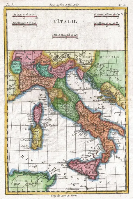
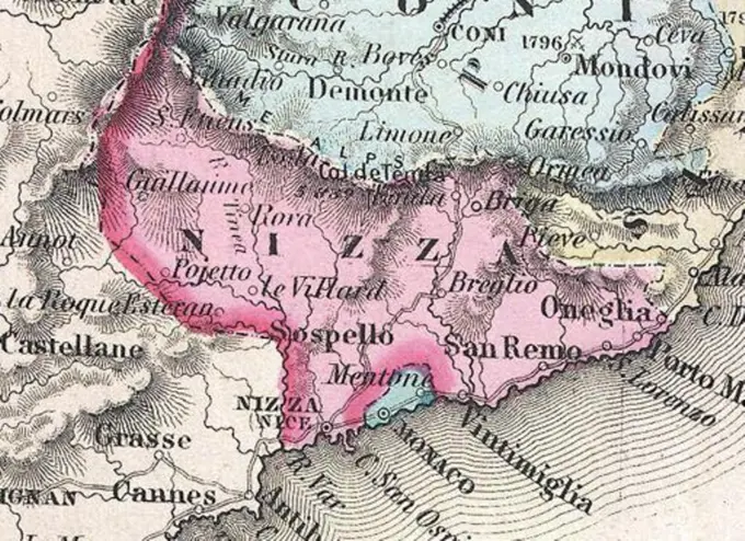
Early Maps of Italy and Eastern Europe

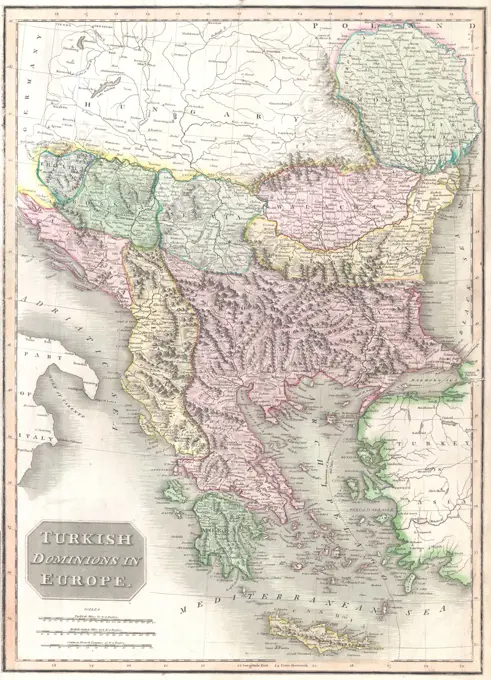
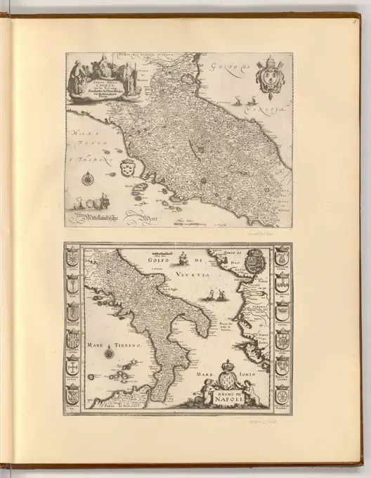
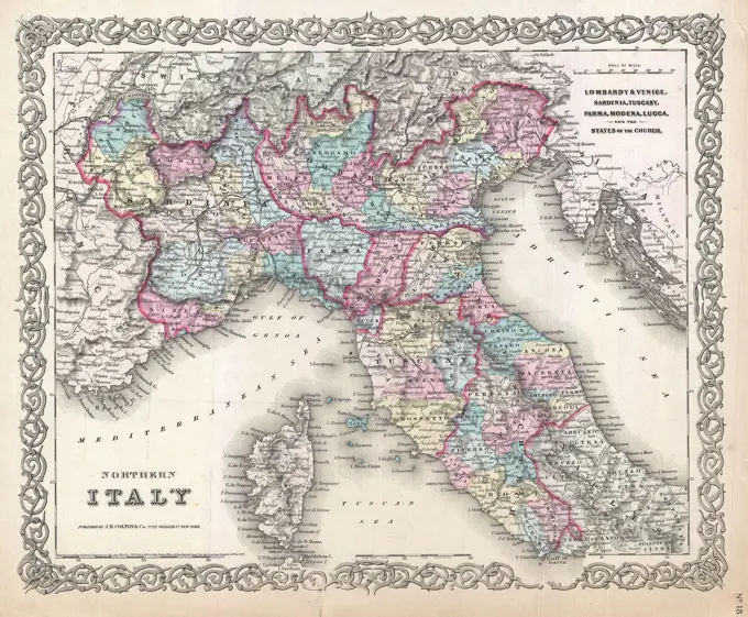
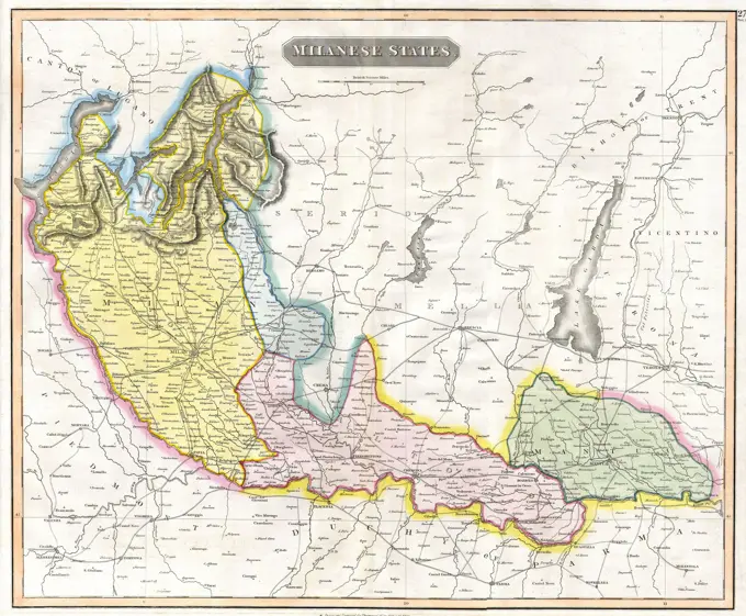
A collection of early geographic maps depicting Italy, Hungary, and surrounding regions, marked with historical boundaries and dedicated to notable figures.

Map of Ancient Greece, northern part.  From Historical Atlas, published 1923.
Map of Ancient Greece, northern part. From Historical Atlas, published 1923.
Le Royaume de France Divise Par Gouvernents, Militaires Dressee Sur Les Observations Astronomiques; Beauin, Jean (1696-1772); 1763 (1763-00-00-1763-00-00);1780 Raynal and Bonne Map of ItalyMaps for slide lectures. Reproduction from an Atlas. Europe and Fritten AsiaMAP OF INDIA, NEW CALEDONIA, TAHITI, TUAMOTU ARCHIPELAGO, MARQUESAS ISLANDS, 18961853 Mitchell Map of GreeceSketch of Dusky Bay in New Zealand. Plate 64. From the Book: Prints to Cook's Voyages rare books1794 Delisle Map of Southern Ancient Greece, Greeks Isles, and Crete1835 Bradford Map of Turkey in Asia and the CaucasesRegnum Neapolis : in quo sunt Aprutium ulterius et citerius, Comitatus Molisius, Terra Laboris, Capitaniata Principatus ulterior et citerior, Terra Bariensis et Hidruntina, Basilicata, Calabria citerior et ulterior , Italy, Southern, Maps, Early works to 1800, Naples Kingdom, Maps, Early works to 1800 Norman B. Leventhal Map Center Collection1864 Mitchell Map of Peru, Equador (Ecuador), Argentina, Columbia and VenezuelaMapa de Italia Antigua publicado en el libro Historia Universal, de Felipe Picatoste. Madrid, 1890.1810 Tardieu Map of the East Indies, Singapore, Southeast Asia, Sumatra, Borneo, JavaMeyer's Newspaper Atlas 019 - European Turkey: Croatia, Herzegovina, Serbia, Bosnia and the land of the Montenegrins. 1849Map showing his expedition  into AsiaMap of Greece, its islands and neighbouring countries.  After an early 18th century map by Guillaume De L'Isle titled Accurata totius Archipelagi et Graeciae universae tabula.  From R. and J. Ottens,Quinta Europae tabula. Map of the Balkan Peninsula, including the countries north of Greece. Relief shown pictorially. Includes names of places and natural features. In margin: Climatic and latitudinal notes. Appears in the author's Geographia, edited by Bernard Sylvanus. Venetiis : Per Iacobum Pentium de Leucho, anno Domini 1511. Text in Latin. Cataloging, conservation, and digitization made possible in part by The National Endowment for the Humanities: Exploring the human endeavor.... , Balkan Peninsula  ,area1794 Laurie and Whittle Map of Greece, Turkey andamp, the BalkansTabula X Europae. Map of Greece. Relief shown pictorially. Includes names of places and natural features. In margin: climatic notes. Descriptive text within ornamental borders on verso. Appears in the author's Geographia, translated by Willibald Pirckheimer, with annotations by Joannes Regiomontanus. Argentoragi i.e. Strasbourg : Iohannes Grieningerus, communibus Iohannis Koberger impensis excudebat, anno a Christi Natiuitate 1525 tertio Kalendas Apriles. Text in Latin. Cataloging, conservation, and digitization made possible in part by The National Endowment for the Humanities: Exploring the human endeavor... Europae tabula decima. Europae tabula decima, GreeceKaart van de Markizaat van Belle Island, ca. 1702; Marquisat and Government of Bell-Isle (...); The forces of Europe, Asia, Africa and America, or description of the main cities with their fortifications. Designed by the best ingesters, particularly those under the domination of France (...) and adorned with several superb buildings.Map of the Mapizaat of Belle Island. Plate No. 229 In The Picture in the context of a total of 276 Numbered Plates of Renowned Strong Cities and Fortresses in The Context of the Spanish Succession War. For Most Part, These Plates Have Been Cophed to the Anonymous French Flat: In The Forces of Europe and In: The Theater of War, The Netherlands, Both Originally Published by Nicolas de Iron in Paris (1693-1697 In the Framework of the Nine-Year War. Title and registrations in the flat in French.Status ecclesiasticus et magnus ducatus Thoscanae , Tuscany Italy, Maps, Early works to 1800 Norman B. Leventhal Map Center CollectionStatus ecclesiasticus et magnus ducatus Thoscanae. Map of the Grand Duchy of Tuscany in northern Italy, from Mantua to Gaeta. Bar scales in "Milliaria Germanica communia 15 in uno gradu," "Milliaria Gallica magna, sive horae itineris," and "milliaria Italica magna 60 in uno gradu." Relief shown pictorially. Verso is blank. Cataloging, conservation, and digitization made possible in part by The National Endowment for the Humanities: Exploring the human endeavor. Part of composite portfolio atlas with title "Collection of old maps.".. Collection of old maps. Collection of old maps, Italy  , Tuscany  ,regionProceedings of the Zoological Society of London, London, Academic Press, periodicals, zoology, A detailed map showcasing the geographical features and outline of Central America, prominently featuring parts of Nicaragua and Costa Rica. The map highlights significant topographical elements, including mountains, rivers, and territorial boundaries. Notable locations and place names are marked, helping to illustrate the region's landscape and its proximity to the Pacific Ocean. The map serves as a historical reference point for understanding the physical characteristics and divisions within this area of Central America.1814 Thomson Map of Greece, Turkey (in Europe) and the BalkansMap of the World as known to the AncientsThe European powers are  competing who can grab the  greater portion of these  islands : the French and  British are doing better than  the Spanish and Dutch...     Date: 1827Portsmouth Cartographic. Maps. 1839. General Research Division. Great Britain , Description and travel, Portsmouth (England), 1800-1899A new & accurate map of the islands of Hispaniola or St. Domingo, and Porto Rico. Relief shown pictorially. In lower left margin: "No. 65.".. New and accurate map of the islands of Hispaniola or St. Domingo, and Porto Rico. New and accurate map of the islands of Hispaniola or St. Domingo, and Porto Rico, Hispaniola  ,island  Puerto Rico  ,territoryMap of West Java. Map of West Java with legend and insert map of the field around Batavia. Numbered upper left: 3. With degree distribution along the edges.Austria Hungary , Austria, Maps, Hungary, Maps Norman B. Leventhal Map Center CollectionNorthamptonshire text. Maps, Atlases. 1793. Lionel Pincus and Princess Firyal Map Division. Geography, Great BritainAn etching by Matthäus Merian the Elder from 1608-1650 showing a map of Italy, depicting regions, cities, rivers, mountains, and political boundaries.Italy now all the leaders in their role accurately distinct, these addition to other animals, they join the islands of Sicily, the light of three rocks varnamum runs into the sea. the mountains, and they themselves, which he extends to the Etna perustis; Schenck, Pieter (1660-1711), Valck, Gerard (1651 or 1652-1726); 1711 (1711-00-00 - 1711-00-00); Pobrano z systemu muza muzeum Narodowego W Warszawie; graficzne / c / c2 / miedzioryt kolorowany; Wyroby z w ókien / Papier / Papier Czerpany / Papier eberkowy; WYS. 49,0 cm, Szer. 56,3 cm; Kart.438 / 3/94 MNW; WSZYSTKIE PREWA ZASTREZE One.Balkan peninsula , Balkan Peninsula, Maps Norman B. Leventhal Map Center CollectionCarte de la Guinée : contenant les Isles du Cap Verd, le Senegal, la Côte de Guinée proprement dite, les Royaumes de Loango, Congo, Angola et Benguela, avec les pays voisins autant qu'ils sont connus , Guinea, Maps, Early works to 1800, Cape Verde, Maps, Early works to 1800, Africa, West, Maps, Early works to 1800 Norman B. Leventhal Map Center Collection1855 Colton's Map of Northern Italy and CorsicaThe National Geographic magazine map of the countries bordering the Mediterranean Sea , Mediterranean Region, Maps Norman B. Leventhal Map Center CollectionVintage Pictorial Map, Antique Italy, by  Christoph Cellarius, circa 1720sPlan of Battle Lines of Boston. 1776, Williams, R. Carte de la Guinee : contenant les Isles du Cap Verd, le Senegal, la Cote de Guinee proprement dite, les Royaumes de Loango, Congo, Angola et Benguela, avec les pays voisins autant qu'ils sont connus. Relief shown pictorially. Lower right corner: "A 30." Upper right corner: "XXXI."... , West Africa  ,area  Cape Verde Guinea-BissauPlan des dernieres Operations de Civilis avant de Conclure la paix avec les Romains sur le Pont dela Nabalia, Map of the last military maneuvers of Civilis, 69-70, Colored map of the last military maneuvers of Civilis before concluding the peace with the Romans. This map belongs to the series of prints about the Batavian Revolt, copied from the series Batavorum cum Romanis bellum by Antonio Tempesta (Otto Vaenius, Antwerp 1612). Illustration for: Marquis de St. Simon, Histoire de la guerre des Bataves et des Romains, d'après César; Corneille Tacite, Aux dépens de Marc-Michel Rey, Amsterdam 1770, page 65., print, picture, historical print, map, prints, Frederik Muller Historieplaten, height 320 mm, width 355 mm, print maker, printmaker, 1768 - 1770, third quarter 18th century, paper, hand coloring, etching, engraving, engraving (printing process)MAP OF NEW CALEDONIAContado di mlose et principato vltra; Schenck, Pieter (1660-1711), Valck, Gerard (1651 cars 1652-1726); 1711 (1711-00-00-1711-00-00);A new map of Turky in Europe and parts adjoyning shewing their principal divisions and chief cities, towns, rivers, mountains &c. Turkye in Europe, &c. Cartographic. Maps, Atlases. 1700. Lionel Pincus and Princess Firyal Map Division. Atlases, British, Geography, Ancient, Maps in education , England, MapsAffrice Tabule Quatuor : Prima Libie tabula continet ambas Mauritanias. Title from verso. Map of ancient Mauritania in present day Algeria, Morocco and Tunisia. Relief shown by brown coloring. Engraved on wood with place names in moveable type. Includes names of places and natural features. In margin: notes on latitude. Appears in the author's Geographia. Ulm : Lienhart Hol, 16 July 1482. Text in Latin. Cataloging, conservation, and digitization made possible in part by The National Endowment for the Humanities: Exploring the human endeavor.... , Algeria Morocco Tunisia1862 Johnson Map of ChinaMap of the area of Rome, 1726; Les Environs de Rome; Les Forces de l'Europe, Asie, Afrique et Amerique (...) Comme Aussi Les Cartes des Côtes de France et d'Espagne. Map of the area of Rome. Plate No 390 in Part XVI of the Picture: Les Forces de l'Europe, Asia, Afrique et amic ... Comme Aussi Les Cartes des Côtes de France et d'Espagne from 1726, this second part with 271 by hand Numbered Plates of renowned strong cities and fortresses in the context of the Spanish Succession War 1701-1713. For most part, these plates have been copied to the anonymous French plates of renowned strong cities and fortresses: in Les Forces de l'Europe and in: Le Theater de la Guerre, Dans Les Pays-Bas, both originally published by Nicolas de Fer in Paris (1693-1697) In the context of the nine-year war. Title and inscriptions in French.Landkarte von Italien im Jahre 1895, digital restaurierte Reproduktion einer Originalvorlage aus dem 19. JahrhundertMap of Italy 1890City plans of Saxon cities with statistical information on the cholera victims of 1865, before 1866J Palliser's Rocky Mountains Travel Map, USA. Exploration of the Rocky Mountains in 1857-1859 by Captain John Palliser. Old 19th century engraving from Le Tour du Monde 1860Rand, McNally & Co.'s indexed atlas of the world map of Bolivia, Ecuador, and Peru. Relief shown by hachures. Insets: Galapagos Isles -- Eastern portion of Bolivia. Text on verso. Page 417 in its Rand, McNally & Co.'s indexed atlas of the world. Chicago : Rand, McNally and Company, 1892... Map of Bolivia, Ecuador, and Peru Bolivia, Ecuador, and Peru. Map of Bolivia, Ecuador, and Peru Bolivia, Ecuador, and Peru, Bolivia Ecuador PeruDie Balkan-Halbinsel in 4 blättern : Türkei, Rumänien, Griechenland, Serbien, Montenegro, Bulgarien , Balkan Peninsula, Maps Norman B. Leventhal Map Center CollectionMap of Italy, Theatro D'el Orbe La Tierra - OrteliusWest Indies, Virgin Islands, St. Thomas. Relief shown by contours and spot heights. Includes inset map of Frenchman Cap... St. Thomas. St. Thomas, Virgin Islands of the United States  ,territory   , Saint Thomas  ,islandMap of the surroundings of Rome, 1726, 1726 print Map of the surroundings of Rome. Plate no. 390 in part XVI of the print work: Les Forces de l'Europe, Asie, Afrique et Amerique ... Comme Aussi Les Cartes des Côtes de France et d'Espagne from 1726, this second part with 271 by hand numbered Plates of renowned strong cities and fortresses in the context of the Spanish War of Succession 1701-1713. For the most part, these records have been copied to the anonymous French records of renowned strong cities and forces: in Les Forces de l'Europe and in: Le Theater de la Guerre, Dans Les Pays-Bas, both originally published by Nicolas de Fer in Paris (1693-1697) in the context of the Nine Years' War. Title and inscriptions in French. print maker: Northern Netherlandspublisher: Leidenpublisher: Amsterdam paper engraving  Italy. LazioMueller, Alex, Weimar, Graap, H., Orohydrographische Karte den Süddeutsch-Österreichischen Berglandes, Photo reproduction of a map of the Austrian mountain landscape, recto - printed, photomechanical print, reproduction, page, photos, photographically illustrated books, Taf. XII., height 193 mm, width 274 mm, photographer, 1867 - 1877, paper, photolithography, German, cliché maker, Work conception1818 Pinkerton Map of Arabia and the Persian GulfA new map of that part of Africa A new map of that part of Africa called the coast of Guinea from the River Senegal in Latt. 16d. No. to Cape Lopez 1d. 00' So. with the Inland Countries from the sea so far as the great rivers Senegal and Niger Snelgrave, William. Cartographic. Maps. 1734. Rare Book Division. Africa, Benin, Bight of, GuineaEmpire of Charlemagne, Imperium Caroli magni, map from 1657The Armenian Genocide refers to the deliberate and systematic destruction of the Armenian population of the Ottoman Empire during and just after World War I. It was implemented through wholesale massacres and deportations, with the deportations consisting of forced marches under conditions designed to lead to the death of the deportees. The total number of resulting Armenian deaths is generally held to have been between one and one and a half million.  Other ethnic groups were similarly attacked by the Ottoman Empire during this period, including Assyrians and Greeks, and some scholars consider those events to be part of the same policy of extermination.  It is widely acknowledged to have been one of the first modern genocides, as scholars point to the systematic, organized manner in which the killings were carried out to eliminate the Armenians, and it is the second most-studied case of genocide after the Holocaust. The word genocide was coined in order to describe these events.Map Sicily, Italy, 19th century engravingRand, McNally & Co.'s California , California, Maps Norman B. Leventhal Map Center Collection1815 Thomson Map of the Milanese States ( Milan, Mantua, Alto Po ), ItalyTabula Italiæ antiquæ geographica. 1764. still image. The Miriam and Ira D. Wallach Division of Art, Prints and Photographs: Picture Collection. Geography, Ancient, Italy , Early works to 1800Mapa de la Republica de Nicaragua , Nicaragua, Maps Norman B. Leventhal Map Center CollectionCartography, Italy, 16th century. Map of Italy by Abraham Ortelius (1528-1598), from Theatrum Orbis Terrarum, 1570.Map of Tibet in 1821 Carey Map of IndiaAncient map of Persia. Iran. Drawing by Jules Laurens (1825-1901) Journey to Persia, 1855-1858 by Arthur de Gobineau (1816-1882) Le Tour du Monde 1860The Crimean War, 1855: Map of the theater of war in the East. EngravingIsles de Cap Verd coste, et pays des Negres , Cape Verde, Maps, Early works to 1800, Africa, West, Maps, Early works to 1800 Norman B. Leventhal Map Center CollectionMap of Oregon, Washington, and part of Idaho, 1863. Additional, Oregon, Washington Territory, and British Columbia. Issued in Philadelphia by publisher S. A. Mitchell, JrMap of the Yougoslav countries , Yugoslavia, Maps Norman B. Leventhal Map Center CollectionOverzichtskaart van den Nederlandsch-Indischen archipel , East Indies, Maps, Indonesia, Maps, Tourist maps Norman B. Leventhal Map Center CollectionL'Arabia divisa in petrea, deserta, e felice , Arabian Peninsula, Maps, Early works to 1800 Norman B. Leventhal Map Center CollectionThe Daily Telegraph war map no. 10. Inset: Northern Serbia. Covers Austria, Hungary, the Balkan peninsula, and parts of bordering states at the outbreak of World War I... Daily Telegraph war map (no. 10) : showing on a large scale the Balkans and Eastern Europe. Daily Telegraph war map (no. 10) : showing on a large scale the Balkans and Eastern Europe, Europe Balkan Peninsula  ,area  EuropeSeat of war in the east. Relief shown pictorially.... , Turkey  , Black Sea Region  ,region  Balkan Peninsula  ,area1865 Johnson's Map of India (Hindostan or British India)National Geographic Institute (IGN) (n. - D.), Brest - Aviation type - Flle NM. 30-S.O.-NL. 30-N.O. - 1/500,000.E (title awarded), 1941-06. Printed paper, ink. Museum of the Liberation of Paris - General Leclerc Museum - Jean Moulin Museum.A new map of ancient Greece Thrace, Moesia, Ilyricum and the isles adjoyning. Greece, Thrace, Illyricum, &c. Cartographic. Maps, Atlases. 1700. Lionel Pincus and Princess Firyal Map Division. Atlases, British, Geography, Ancient, Maps in education , England, MapsMap of the Mediterranean Sea with Italy, France, Algeria, Egypt, Spain and the Adriatic Sea, circa 16951835 Malte-Brun Map of Turkey or the Ottoman Empire in EuropeNicaragua. Also shows administrative divisions and routes of proposed steamer lines and intercontinental railway. Relief shown by shading and spot heights.... , NicaraguaJakob van der Schley aka Jakob van Schley (26 July 1715 Amsterdam - 12 February 1779 Amsterdam) was a Dutch draughtsman and engraver. He studied under Bernard Picart (1673-1733) whose style he subsequently copied. His main interests were engraving portraits and producing illustrations for 'La Vie de Marianne' by Pierre Carlet de Chamblain de Marivaux (1688-1763), published in The Hague between 1735 and 1747. He also engraved the frontispieces for a 15-volume edition of the complete works of Pierre de Brantôme (1540-1614), 'Oeuvres du seigneur de Brantôme', published in The Hague in 1740.Map of Italy after 275 BC.  From the book Outline of History by H.G. Wells, published 1920.Map of the countries near to the land of Oz , Oz Imaginary place, Maps, Baum, L. Frank Lyman Frank, 1856-1919 Norman B. Leventhal Map Center Collection1847-Map of Nizza and Monaco-Colton' Map of Northern Italy-croppedEuropean war map , Black Sea Region, Maps Norman B. Leventhal Map Center CollectionBalloon view, Cape Ann to Boston , Capes Coasts, Massachusetts, Aerial views, Ann, Cape Mass., Aerial views, Boston Mass., Aerial views Norman B. Leventhal Map Center CollectionSouth-east New Guinea , Papua New Guinea, Maps Norman B. Leventhal Map Center CollectionMapa de la Republica de Nicaragua. Relief shown by hachures. "Entered according to act of Congress in the Year 1858 by M.v. Sonnenstern in the Clerks Office of the District Court of the Southern District of New York." Insets: Plano de Leon -- Plano de Granada -- Plano de la Colonia Projectada de Viejo Leon. Includes 4 section profiles... Mapa de Nicaragua. Mapa de Nicaragua, NicaraguaVintage Maps / Antique Maps -  A new map of Jamaica; in which the several towns, forts, & settlements are accurately laid down, as well as the situations & depths of the most noted harbours and anchoring places ca. 1771. Vigo, 1702 - 1733 print Card from Vigo, with texts in Dutch, French and Latin. The print is part of an album.  paper etching maps of separate countries or regions VigoSouth-east New Guinea , Papua New Guinea, Maps Norman B. Leventhal Map Center Collection1855 Spruneri Map of the Empire of Alexander the GreatEuropean war map.... , Turkey  , Black Sea Region  ,region1855 Colton Map of Northeastern AfricaMAP OF PERU, ECUADOR, VENEZUELA AND COLUMBIA, 1899Partie Orientale De La Terre Ferme De L' Inde Moderne'. Gulf of Bengal, Burma & Thailand by Allain Manesson, Paris, 1683. Copper engraving, hand colored in wash and outline. Decorative engraved map showing the gulf of Bengal with Burma and Thailand and neighbouring countries. With several engraved names of rivers and regions, including the mythical 'Lake Chiamay' or 'Lake Chiang Mai', supposed source for many of the great rivers of Southeast Asia.Stadtplan, city map from the year 1892: San Francisco, America, USA, digital restaurierte Reproduktion einer Originalvorlage aus dem 19. Jahrhundert, ...Photo production of a map of the Austrian mountain landscape, Anonymous, After Alex Mueller, c. 1867 - in Or Before 1877 photomechanical print  Weimar paper photolithography maps, atlases Alps