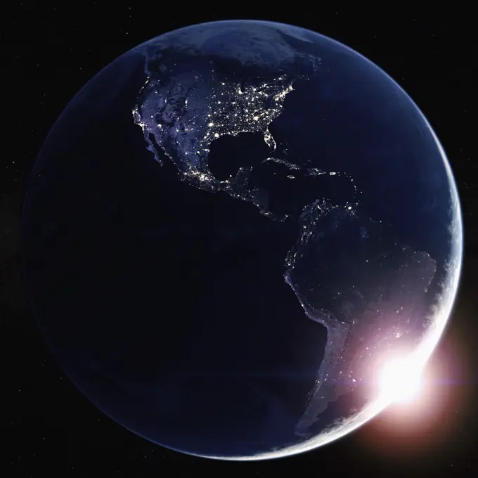
My Boards
View Pictures
  • My Boards
← Science

Earth From Space

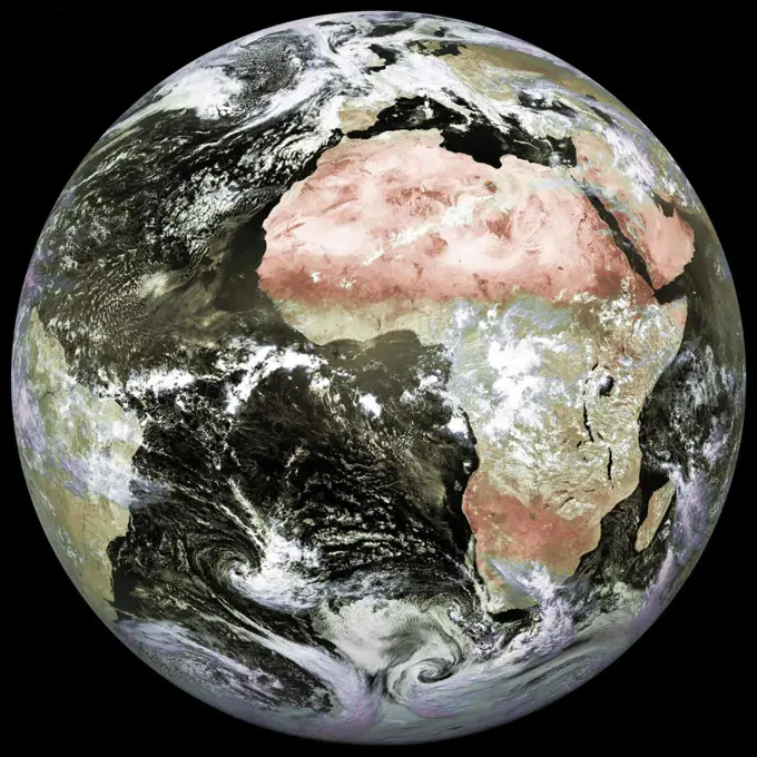
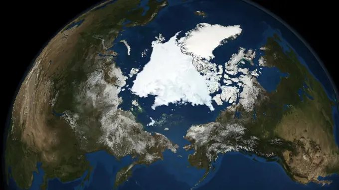
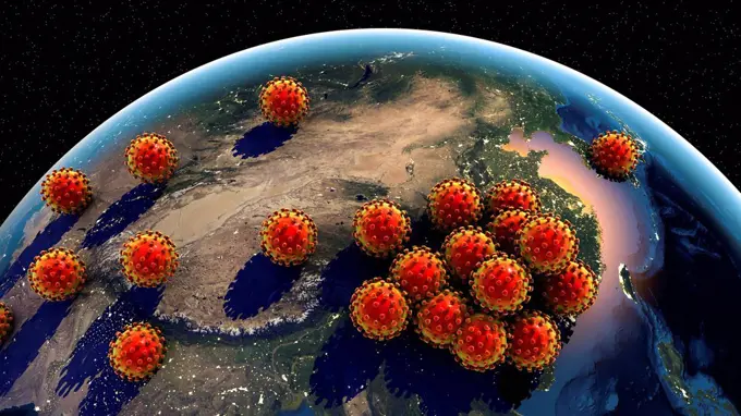
Stunning views of Earth from space, featuring realistic textures and vibrant colors against a backdrop of stars, highlighting the planet's geography and atmosphere.

Sun rising over North and South America from space
0 assets in this story
4128-V58560907
6145-44740230
ref # P-37330 Range 1.3 million miles This color image of the Earth was obtained by the Galileo spacecraft at about 6 10 am PST. The color composite used images taken through the red, green and violet filters. South America is near the center of the picture, and the white, sunlit continent of Antarctica is below. Picturesque weather fronts are visible in the South Atlantic, lower right. This is the first frame of the Galileo Earth spin movie, a 500-frame time-lapse motion picture showing a 25-hour period of Earth's rotation and atmosphertic dynamics.
1525-27220265
Planet Earth, Globe in space in nebula clouds. Elements of this image are furnished by NASA
1746-28998824
Graphic illustrating the Global Biosphere in 2006. The biosphere also known as the ecosphere, is the worldwide sum of all ecosystems. the biosphere is the global ecological system integrating all living beings and their relationships, including their interaction with the elements of the lithosphere, geosphere, hydrosphere, and atmosphere.
4128-V58615180
4128-V58560912
1525-25122972
Arctic ocean of the globe
4128-28681031
Earth's internal structure, illustration
1848-50793112
Computer generated image of the planet Mercury
1795R-5607
Computer generated map of globe
4128-V58560915
1746-19659760
Sigismund III Vasa 1566  1632 King of Poland.
4128R-11314501
Earth's interior, computer artwork. The crust is red, the mantle is orange, the outer core is yellow and the inner core is silver.
6145-45090570
N/A
1525-22677084
Around the World 3d rendering. Around the World. 3d rendering landscape, shadows, transparent water. Earth map courtesy NASA. Around the World 3d rendering
824-63164702
World map showing the proportion of people living with the AIDS virus in 2001.
1899-21290505
3D satellite image of UK and Ireland.
1525-27968330
Papua New Guinea and North Australia. Elements of this image furnished by NASA. 3d rendering. Papua New Guinea and North Australia
4128R-11314483
Earth's crust, computer artwork.
4128R-13763284
Earth from space. Computer illustration showing the Earth as viewed from space, centred over Asia.
4128-28682995
Arctic oil and gas resources, map
6145-45231874
As the sun sets over the Arctic, the end of this years melt season is quickly approaching and the sea ice cover has already shrunk to the fourth lowest in the satellite record. With possibly some days of melting left, the sea ice extent could still drop to the second or third lowest on record. Arctic sea ice, which regulates the planets temperature by bouncing solar energy back to space, has been on a steep decline for the last two decades. This animation shows the evolution of Arctic sea ice in 2015, from its annual maximum wintertime extent, reached on February 25, to September 6.
6145-44725803
The Atmospheric Infrared Sounder (AIRS) onboard NASA's Aqua satellite collects data and creates a temperature profile, September, 2008.
4128-111552928
Ozone layer protection from UV radiation, illustration
4197-V65362030
4128-28970474
Alien with stethoscope listening to the Earth, illustration
6188-58499557
Seismic activity earthquake Jamaica map Seismic activity earthquake Jamaica map Richter scale Copyright: xZoonar.com/AleksandarxVukicevicx 21521700
1899-35457
Europe With Country Borders And Major Rivers, True Colour Satellite Image. True colour satellite image of Europe with country borders and major rivers. This image in Lambert Conformal Conic projection was compiled from data acquired by LANDSAT 5 & 7 satellites.
6145-45098230
. Nighttime View of Aurora Borealis
6176-60173037
Physical map of the North Pole, Greenland. Reliefs and mountains. Northern hemisphere. Siberian Russia and Arctic Canada. 3d render. Bathymetry
6145-44015950
National Oceanic and Atmospheric Administration - SCIENCE ON A SPHERE
4462-21423360
View of planet earth
1746-19661406
National Snow and Ice Data Centre observations of the Arctic Sea ice coverage in 2008, the second-lowest amount recorded. Credit NASA: Science Earth Geology Oceanography
6145-45231875
Goddard visualizers show us how five garbage patches formed in the world's oceans using 35 years of data. Read more a href= http //1.usa.gov/1Lnj7xV rel= nofollow 1.usa.gov/1Lnj7xV /a
6177-V53442858
1746-28998826
Graphic illustrating the Global Biosphere in 2008. The biosphere also known as the ecosphere, is the worldwide sum of all ecosystems. the biosphere is the global ecological system integrating all living beings and their relationships, including their interaction with the elements of the lithosphere, geosphere, hydrosphere, and atmosphere.
1848-66244900
World Earthquake Map, Fault Lines, Epicenters, and Seismic Activity
6145-44483164
From its vantage point aboard the International Space Station (ISS), NASA's Earth Surface Mineral Dust Source Investigation (EMIT) mission will map the world's mineral-dust sources, gathering information about particle color and composition as the instrument, designed at NASA's Jet Propulsion Laboratory in Southern California, orbits over the planet's dry, sparsely vegetated regions. EMIT will collect measurements of 10 important surface minerals - hematite, goethite, illite, vermiculite, calcite, dolomite, montmorillonite, kaolinite, chlorite, and gypsum - in arid regions between 50-degree south and north latitudes in Africa, Asia, North and South America, and Australia. The data EMIT collects will help scientists better understand the role of airborne dust particles in heating and cooling Earth's atmosphere on global and regional scales.
6203-V58749626
4128R-13763289
Earth from space in night. Computer illustration showing the Earth as viewed from space, centred over Australia and New Zealand.
1525-27128391
Mediterranean at night. Elements of this image furnished by NASA. 3d rendering. Mediterranean at night
4409-17349112
Types of orbits.
6188-58499834
Seismic activity earthquake Wyoming map Seismic activity earthquake Wyoming map Richter scale Copyright: xZoonar.com/AleksandarxVukicevicx 21521774
1899-21289899
Satellite view of Russia and Central Asia in winter, with partial snow cover (with country boundaries). This image was compiled from data acquired by Landsat 7 & 8 satellites.
1525-23548596
Globe model with detailed topography without water. South America. 3d rendering isolated on white background. Elements of this image furnished by NASA
4269-25505
Breast cancer. Colored mammogram (breast X-ray) of a woman's breast showing cancerous tumor (red, left).
6188-58499106
Seismic activity earthquake Cocos Islands map Seismic activity earthquake Cocos Islands map Richter scale Copyright: xZoonar.com/AleksandarxVukicevicx 21520949
1848-66245488
World Earthquake Map, Fault Lines, Epicenters, and Seismic Activity
4128-15818867
Global spread of coronaviruses, conceptual computer illustration. Different strains of coronavirus are responsible for diseases such as the common col...
1899-53509335
World map showing the proportion of people living with the AIDS virus in 2001.
824-63164703
World map showing the proportion of people living with the AIDS virus in 2001.
1525-23511709
Night dreaming. Cute girl sleeping in bed and looking at Earth planet. Elements of this image are furnished by NASA
4128-28681033
Earth's internal structure, illustration
4128R-11314488
Earth's interior, computer artwork. The crust is red and the mantle is orange.
6188-58498816
Seismic activity earthquake Madagascar map Seismic activity earthquake Madagascar map Richter scale Copyright: xZoonar.com/AleksandarxVukicevicx 21520806
6188-58498846
Seismic activity earthquake Cape Verde map Seismic activity earthquake Cape Verde map Richter scale Copyright: xZoonar.com/AleksandarxVukicevicx 21520822
6177-V54004725
1899-35500
Oceania At Night, True Colour Satellite Image. True colour satellite image of Oceania at night. This image in Lambert Conformal Conic projection was compiled from data acquired by LANDSAT 5 & 7 satellites.
6145-54420896
Illustration showing Soviet Blackjack and Backfire aircraft coverage from Soviet bases. "Soviet Military Power," 1983, Pages 25. Country: Unknown
1525-27967094
Circumnavigation of Vega, vintage engraved illustration. Magasin Pittoresque 1880.
6177-V53838534
1525-28203525
Mediterranean - Greece and Turkey. Elements of this image furnished by NASA. 3d rendering. Mediterranean - Greece and Turkey
1525-25069860
Earth core on a black background
6188-55645163
Planet in space with atmospheric and land masses planet in space with atmospheric and land masses
1746-2289
Diagram of continental drift from an article by Alfred Wegener (1880-1930)on his theory of Continental Drift (Wegener Hypothesis: 1915) published in Discovery, London, 1922
1570R-131970
An American astronaut shaking hands with an astronaut from the European Union
6145-44740159
Viking History of Water on Mars Composite Study done by Chris McKay, Ames Scientist. Art by Michael Carroll
2401 S. Ervay, Suite 206
Dallas, Texas 75215
United States
Get Started
Free ResearchMy BoardsMy Cart
For Creators
How To License Your ContentContributor PortalFrame of Mind
Resources
API accessPricing
Contact
+1 866 236 0087help@viewpictures.co.uk Contact form
©2026 View Pictures. All Rights Reserved. -B
This site is protected by reCAPTCHA and Google Privacy Policy and Terms of Service apply.