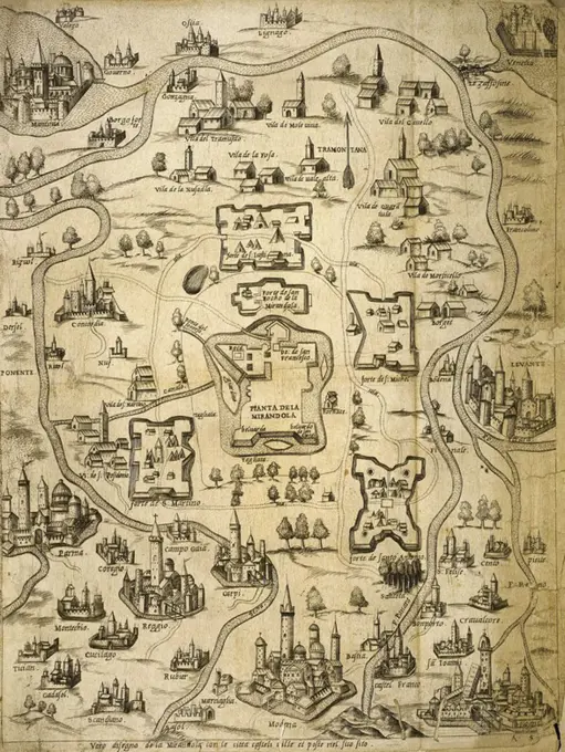
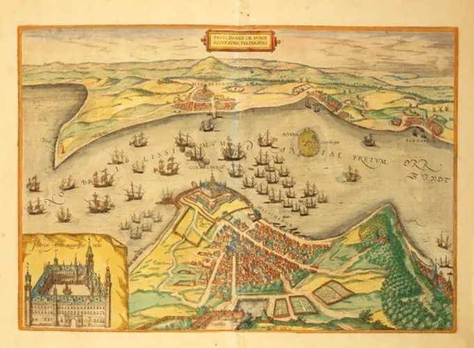
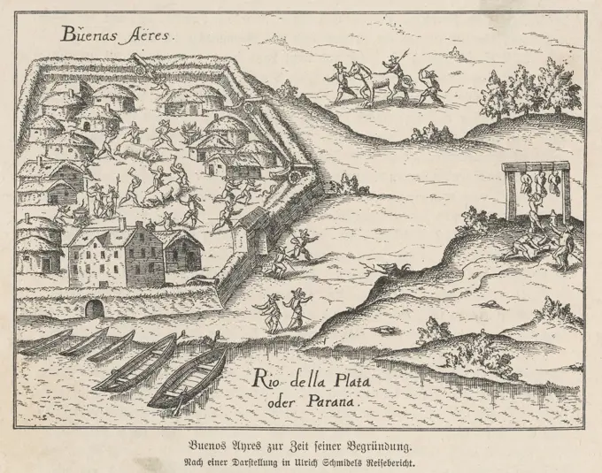
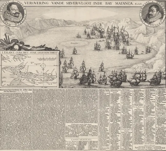
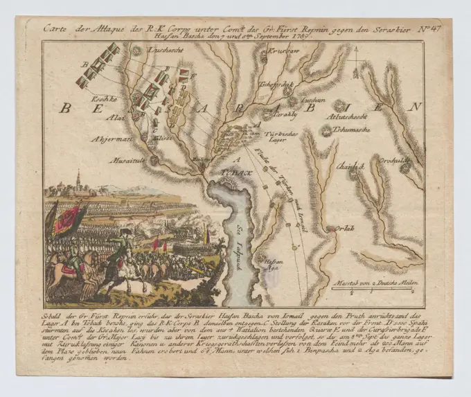
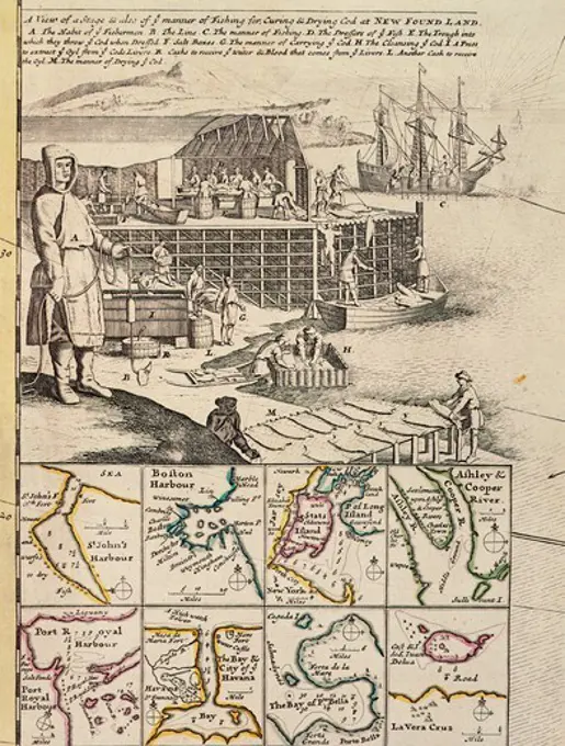
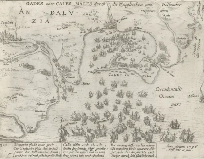
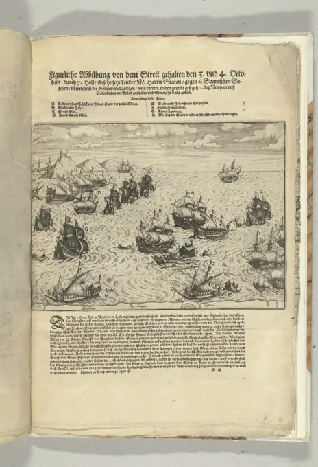
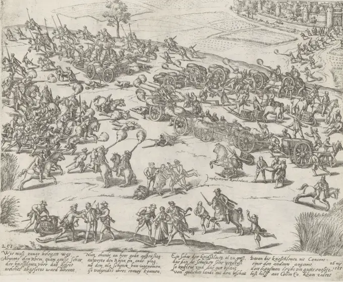
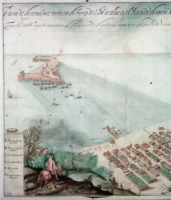
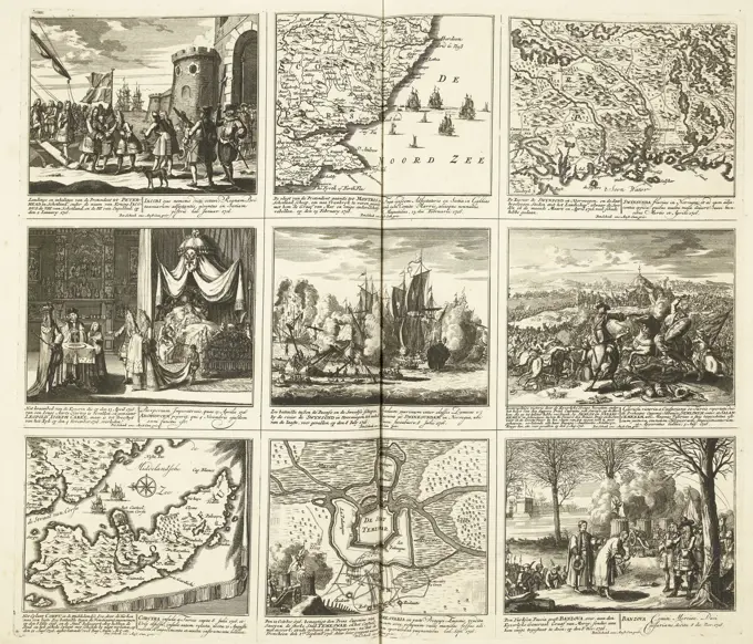
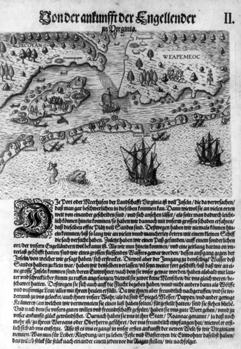
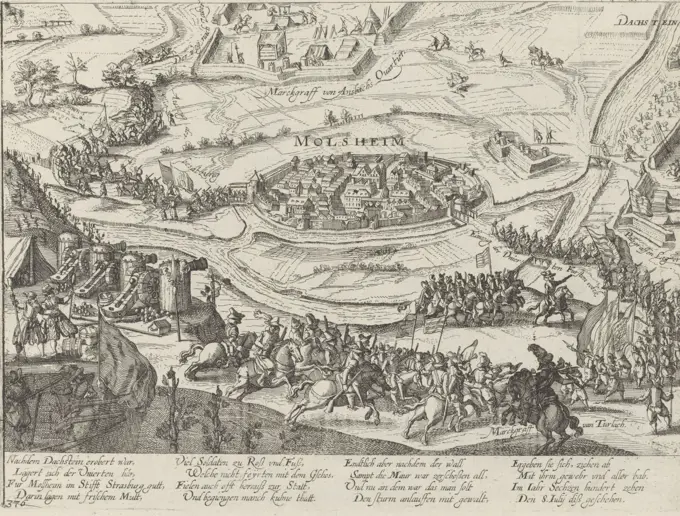
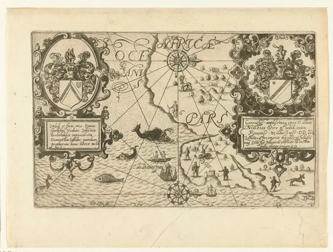
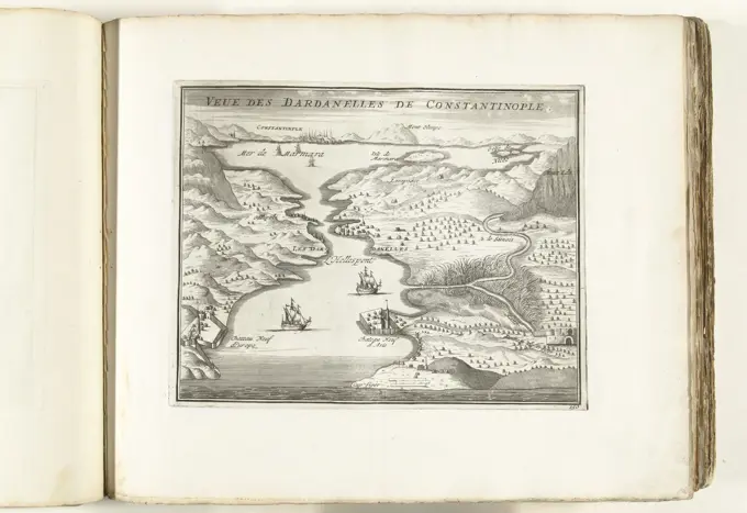
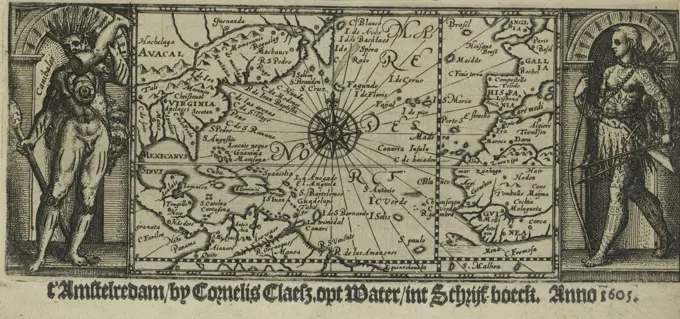
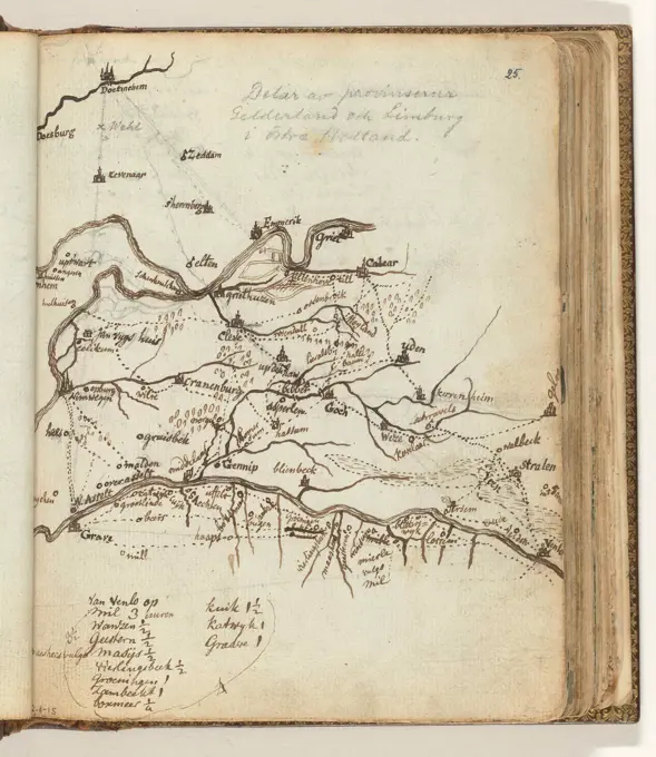
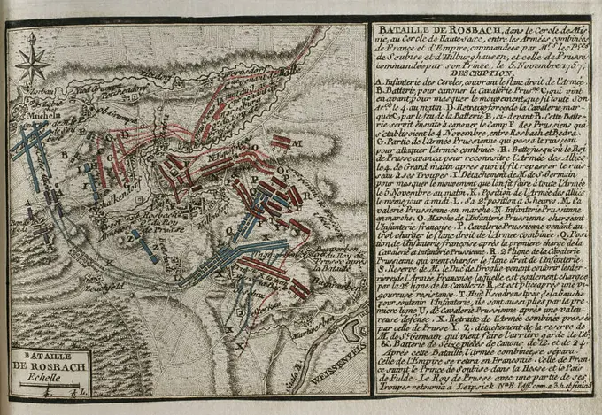
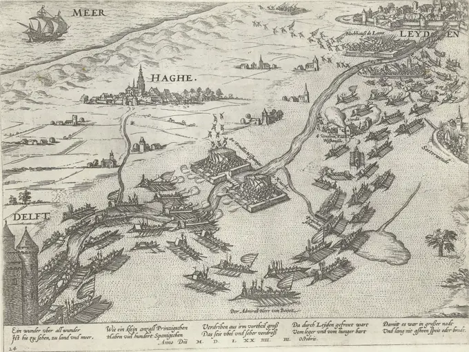
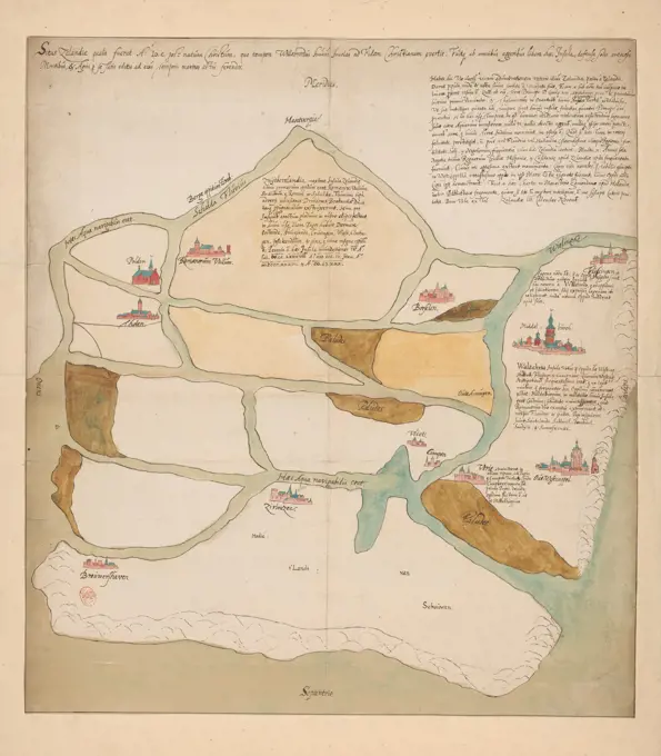
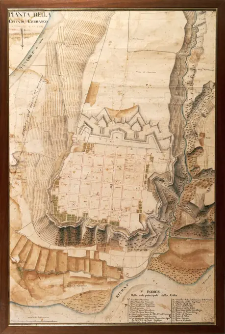
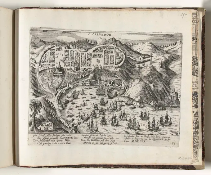
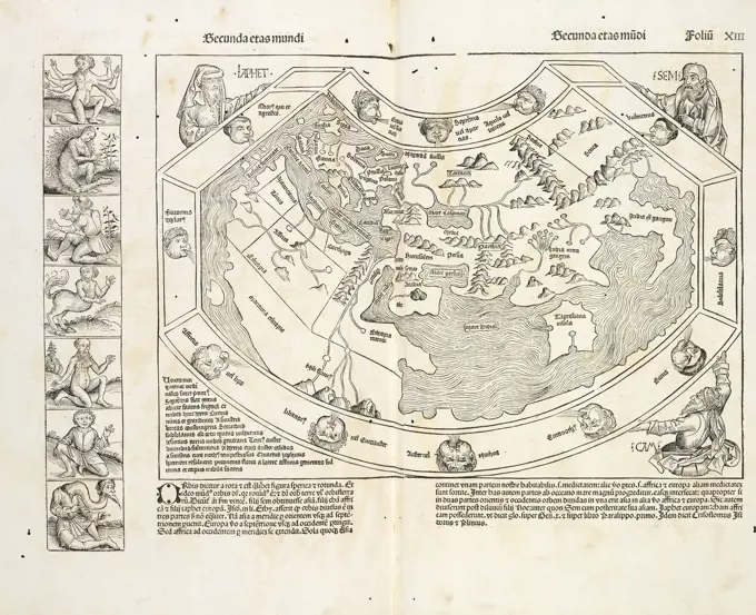
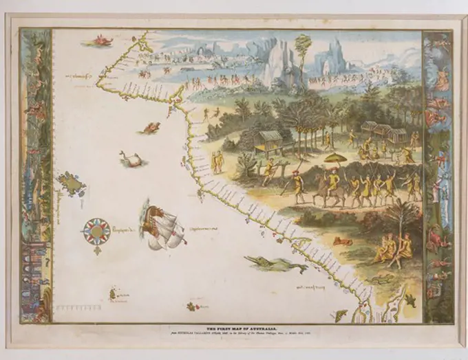
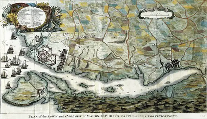
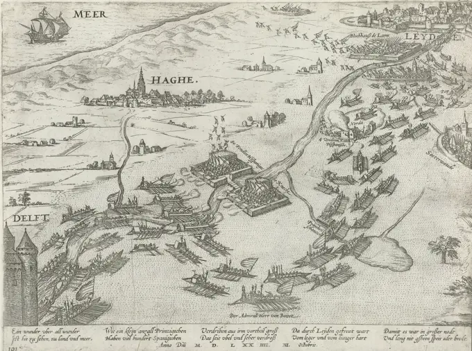
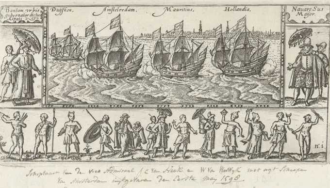
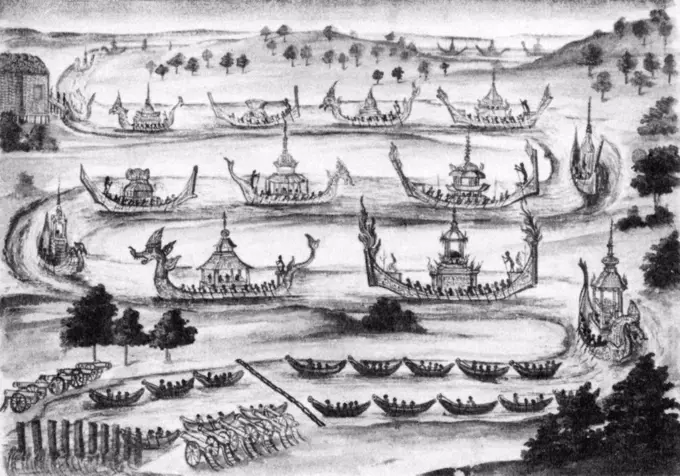
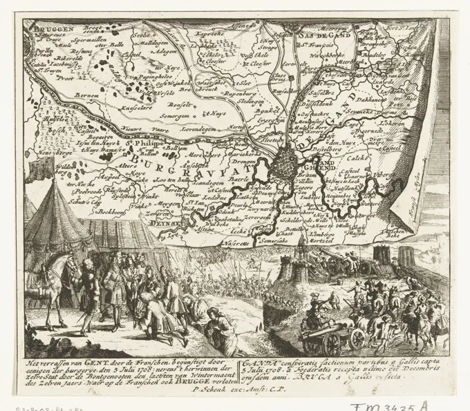
Historic Maps of Cities and Landscapes

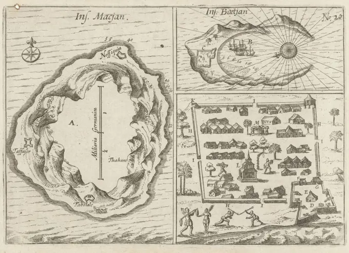
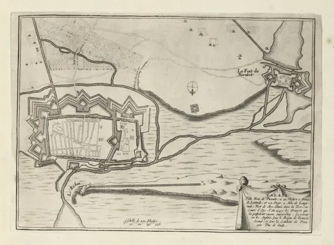
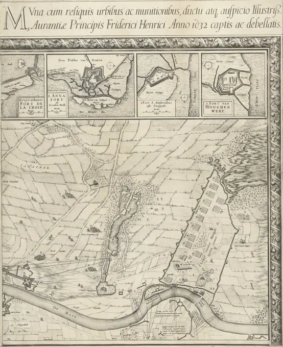
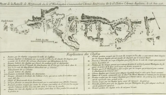
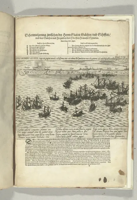
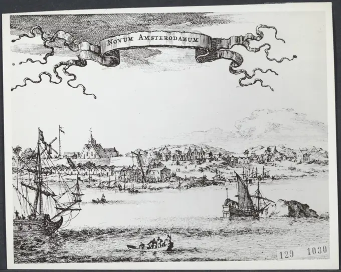
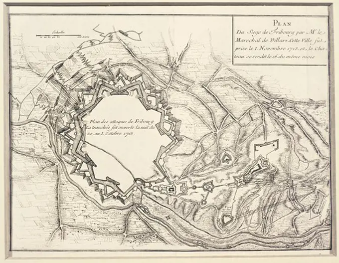
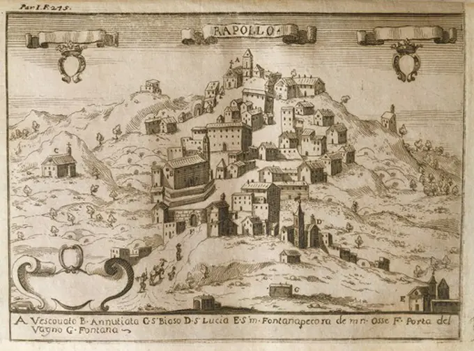
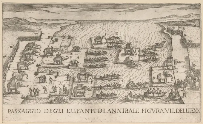
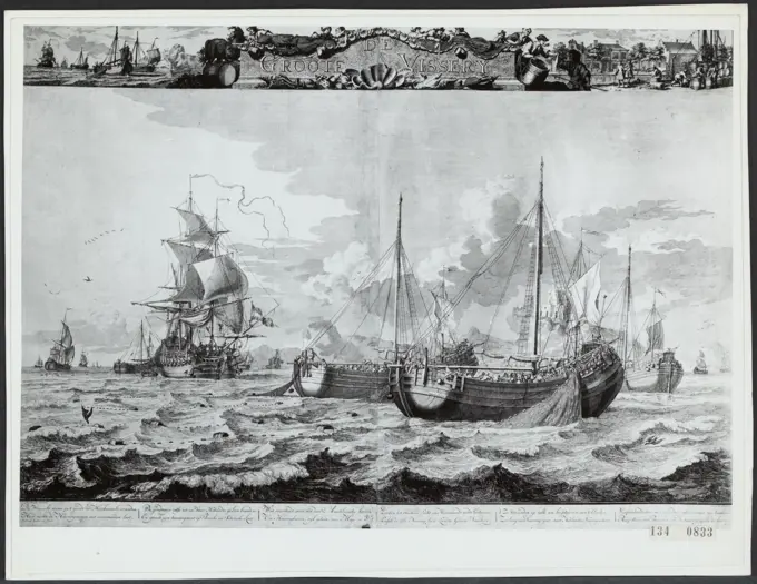
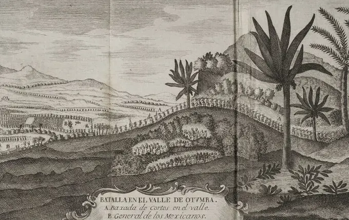
Antique maps depicting cityscapes and coastal views from different eras, showcasing detailed engravings of urban structures and natural landscapes.

View of the Dardanellen, 1726, 1726 print View of the Zeestraat the Dardanellen (Hellespont) with the Turkish city of Constantinople in the distance. Plate no. 464 in part XVIII of the print work: Les Forces de l'Europe, Asie, Afrique et Amerique ... Comme Aussi Les Cartes des Côtes de France et d'Espagne from 1726, this second part with 271 hand -numbered Plates of renowned strong cities and fortresses in the context of the Spanish War of Succession 1701-1713. For the most part, these records have been copied to the anonymous French records of renowned strong cities and forces: in Les Forces de l'Europe and in: Le Theater de la Guerre, Dans Les Pays-Bas, both originally published by Nicolas de Fer in Paris (1693-1697) in the context of the Nine Years' War. Title and inscriptions in French. Bottom traces of the PLAYED number: 150. print maker: Northern Netherlandspublisher: Leiden paper etching maps of separate countries or regions Constantinople. Dardanelles
Map with the sea battle in the bay of Vigo, 1702, 1702 - 1703 print Map with the sea battle in the bay of Vigo, where the English and Dutch fleet burns the French and Spanish fleet on October 23, 1702. Plate no. 274 in the prints consisting of a total of 276 numbered records of renowned strong cities and fortresses in the context From the Spanish Succession War. For the most part these records have been copied to the anonymous French records: in Les Forces de l'Europe and in: Le Theater de la Guerre, Dans Les Pays-Bas, both originally published by Nicolas de Fer in Paris (1693-1697) in the framework of the nine -year war. Title and inscriptions in the album in Dutch and French. print maker: Northern Netherlandspublisher: Amsterdam paper etching maps of separate countries or regions. battle (+ naval force) Vigo. GaliciaItaly. Cities of Mantua, Bologna, Venice, Modena, Ferrara and Parma. Italian engraving. Map. 16th century.Map of Springs and Conquest of Grevelingen, 1644; Plan et Siege de la Ville de Gravelines AssieTée et Prize Par Son Altesse Royal Monsigr. Le Duc d'Orleans; Les Glorieuses Conquêtes de Louis Le Grand, D'Après Le Chevalier de Beaulieu. Map of the topping and conquest of the city of Grevelingen by the French army under Gaston Duke of Orléans, 28 July 1644. Plan of the fortified city with the surrounding country, at the top of the harbor blocked by Dutch ships. In an ornamental picture frame decorated with the GG monogram, French lilies and open cartouches. A profile of the city is part of the map. Part of a series of performances of military victories achieved by King Louis XIV.Cartography, Denmark, 16th century. Kronborg. From Civitates Orbis Terrarum by Georg Braun (1541-1622) and Franz Hogenberg (1540-1590), Cologne. EngravingMap of the coast of Sweden between Kalmar and Stockholm; Sea Custe of Sweden, about the Westerwijck and Tgatt van Stockholm (...). Map of the coast of Sweden between Kalmar and Stockholm. A wind rose in the middle. Page from a book with text and a map of the island of Gotland on the verso.Famine in Buenos Aires: three  Spaniards who killed a horse  for food are hanged; settlers  steal body parts to eat while  others risk punishment by  killing more horses.     Date: 1536. Card with the arrival of the seven ships at the street of Waygats (Vaygach) at Nova Zembla, August 6, 1595. Op opposite page 27 in: "Warftige Relationship. Deryen Newen UNERHÖRTEN SELTHAMEN SCHIFFART SO Die Holländischen und Seeländischen Schiff .... Anno 1594, 1595 Und 1596 "(1598).League for Cadiz, 1596. Defeat of the Spanish fleet inflicted by the English and Dutch fleets at Cadiz, July 1, 1596. Plan of the bay with the middle of the city of Cadiz located on the Spanish peninsula.Amsterdam, Visscher, Claes Jansz. (II), Short story of the conquest of the Silver fleet in the Bay Matanca, Anno 1628, Conquest of the silver fleet in the Bay Matanca. Ao. 1628, Capture of the Silver Fleet in the Bay of Matanzas by Admiral Piet Heyn, 1628, Capture of the Silver Fleet in the Bay of Matanzas by a fleet of the WIC under the command of Admiral Piet Heyn, September 8, 1628. Bottom left a map of the island of Cuba. At the top round portraits of the admirals Hendrick Cornelisz. Loncq and Piet Heyn. Printed on the sheet below the representation a description of the events in 3 columns with the legend 1-20, followed by six columns with a list of the booty per ship., print, prent, nieuwsprent, prints, prenten, Frederik Muller Historieplaten, height 381 mm, width 443 mm, Noord-Nederlands, 1586 - 1652-06-19, print maker, printmaker, 1628 - 1628, second quarter 17th century, tweede kwart 17e eeuw, paper, papier, etching, etchings, letterpress printing, boekdruk, Publication (Event)Carte of the Attaque of the R, Corps under Comando des Gr, Prince Repnin against the Seraskier,Hassan Basha September th and th , Map of the attack of Russian troops under Prince Repnin against Ottoman troops under Hassan Basha on September th and th, UnknownCartography, Tunisia, 16th century. Map of Tunis. From Civitates Orbis Terrarum by Georg Braun (1541-1622) and Franz Hogenberg (1540-1590), Cologne. EngravingCIVITATES ORBIS TERRARUM - OLINDA DE PERNAMBUCO - GRABADO - SIGLO XVI. Author: GEORG BRAUN 1541-1622 / FRANS HOGENBERG. Location: BIBLIOTECA NACIONAL-COLECCION. MADRID. SPAIN.A fishermen colony in Newfoundland, 1709-1720, from A new and correct map of the world, laid down according to the newest discoveries, by Herman Moll, Canada 18th Century.Cologne, Hogenberg, French, Series 4: French, German and English Events, 1576-1610, Gades oder Cales Males taken by the English and the Dutch, Siege of Cadiz by the English and the Dutch, 1596, June and July 1596. Map of the coast at Cadiz and surroundings with the English fleet in the foreground. Right above the Strait of Gibraltar. With 12-line caption in German. Numbered lower left: 320. The print is part of an album., print, picture, news print, album sheet, prints, pictures, Frederik Muller History plates, height 218 mm, width 287 mm, Dutch, German, 1540 - 1590, print maker, printmaker, 1596 - 1598, fourth quarter 16th century, paper, etching, etchingsCities of Hû-quang; Yong-chew fû; Vu-chang fû, the capital; Whang-chew fû Cartographic. Prints, Maps, Illustrations. 1745 - 1747. Rare Book DivisionDestruction of Spanish Galien, October 3, 1602, 1602 - 1604 Destruction of a fleet of eight Spanish Galien under the command of Federico Spinola, by a State squadron under the leadership of Vice-Admiral Jacob van Duivenvoorde, became lord of Obdam in the canal, October 3, 1602. Above the print the title with declaration of the figures , at the bottom a description of the events, in German. Part of the illustrations at a journal of the siege of Ostend 1601-1604. Low Countries paper etching / letterpress printing  English Channel Destruction of a fleet of eight Spanish Galien under the command of Federico Spinola, by a State squadron under the leadership of Vice-Admiral Jacob van Duivenvoorde, became lord of Obdam in the canal, October 3, 1602. Above the print the title with declaration of the figures , at the bottom a description of the events, in German. Part of the illustrations at a journal of the siege of Ostend 1601-1604. Low Countries paper etching / letterpress printing  English Northern Netherlands, Images of the Islands Macjan, and Bacjan, Ins. Macjan, Ins. Baetjan, Maps of the Islands Makian and Bacan in the Moluccas, 1616, Three representations with maps of the islands Makian and Bacan in the Moluccas and a map of the city Bacan, June 1616. Part of the illustrations in the report of the voyage of Joris van Spilbergen around the world, 1614-1617, No. 20., print, picture, news print, map, prints, pictures, Frederik Muller Historieplaten, height 150 mm, width 215 mm, print maker, printmaker, 1617 - 1619, second quarter 17th century, paper, papier, etchingPlan of Chatham, surveyor's name not given, dated May 22, 1795. ,. Massachusetts. Office of the Secretary of StatePleitner, Jean, Northern Netherlands, Savery, Salomon, Expugnatio Trajecti ad Mosam, Una cum reliquis urbibus ac munitionibus, ductuatq. auspico Illustriss. Aurantiae Principis Friderici Henrici Anno 1632 captis ac debellatis, Large map of the siege of Maastricht, 1632, plate 3, Large map of the siege and capture of Maastricht by the Dutch army under stadtholder Frederik Hendrik, 9 June to 21 August 1632. Map composed of six sheets, three above and three below (the sixth sheet at the bottom right is missing). This is the sheet at the top right. On the right the army camp of the troops of the Marquis de Sancta Croce who had come to relieve the city. At the top insets with maps of various forts. With inscriptions in the representation in French and Dutch., print, prent, nieuwsprent, kaart, prints, prenten, Frederik Muller Historieplaten, height 580 mm, width 468 mm, Noord-Nederlands, 1594 - 1683-10-16, print maker, prentmaker, 1632 - 1632, second quarter 17th century, tweede kwart 17e eeMap of Calais, 1693, 1693 print Map of the reinforcements for the French city of Calais. Part of the second part (1693) of the print work in which the eight parts of Les Forces de l'Europe are published between 1693-1697. The printed work consists of 175 plates with plans (from Sébastien Le Prestre, Seigneur de Vauban) of renowned strong cities and fortresses in the Nine Years War. Title and inscriptions in French. print maker: Francepublisher: Paris paper etching maps of cities. fortress CalaisPlan de la Bataille de Monmouth où le Général Washington commandait l'armée Américaine et le Général Clinton l'armée Anglaise, le 28 Juin 1778., 1781 - 1782., Bruxelles, New Jersey, Monmouth, Battle of, Freehold, N.J., 1778., 1 map; 11 x 39 cm on sheet 27 x 43 cm, folded to 19 x 12 cmMap of the vicinity of Venice, approx. 1702; Les Environs de Venise; Les Forces de l'Europe, Asie, Afrique et Amerique, Ou Description des Principales Villes Avec Leurs Fortifications. Dessignées PAR LES MEILLEURS Engineers, private party Celles Qui Sont Sous La Domination de la France (...) Et Ornées the plusieurs Superbes Edifes. Map of the Venice area with the Laguna Veneta. Signature at the bottom right: XLVII. Plate No 192 in the picture in the context of a total of 276 numbered plates of renowned strong cities and fortresses in the context of the Spanish Succession War. For most part, these plates have been copied to the anonymous French plates: in Les Forces de l'Europe and in: Le Theater de la Guerre, Dans Les Pays-Bas, both originally published by Nicolas de Fer in Paris (1693-1697) in the framework of the nine-year war. Title and inscriptions in the plate in French.Cologne, Hogenberg, French, Series 10: Dutch and Foreign Events, 1587-1612, Battles outside Cologne, 1588, May 26, 1588. Episode from the Cologne War. With a 16-line caption in German. Numbered bottom left: 251. The print is part of an album., print, picture, history print, album page, prints, pictures, Frederik Muller History plates, height 217 mm, width 270 mm, Dutch, German, 1540 - 1590, print maker, printmaker, 1588 - 1591, fourth quarter 16th century, paper, etching, etchingsIchnographia oppidi et castri Marieburgi in Prussia Regali, a foederatis Austriacorum, et Polonorum exercitibus, d. 12. Iulij Ano. 1659, obsidione cincti, sed quae 30. Septemb. eiusdem anni iterum solvebatur , Fortification, Poland, Malbork, Maps, Early works to 1800, Swedish-Polish War, 1655-1660, Maps, Early works to 1800, Malbork Poland, Maps, Early works to 1800 Norman B. Leventhal Map Center CollectionCartography, Italy, 17th century. Map of Liguria (3rd part), by Joseph Chaffrion, 1685. Copper engraving.The Englishmans Arrival in Virginia: 1590. Th. De Bry after watercolour by John White English colonist, governor of Roanoke. Virginia coast with small islands and Roanoke at mouth of river. Secotan and Weapemeoc native lands.City of Vera Cruz, east central Mexico. First founded by Cortez 1519. Modern city dates from c1599 and was main link between Spain and Mexico. A. Fort of St Juan with ships at anchor. D. Custom house with train of pack mules. F. Horseman arriving on road from Mexico city. Detail from 17th century map.Map of West Flanders, 1707; Carte Private Des Environs de Bruges, Ostende, Damme, L'Ecluse et Autres. Map of West Flanders with the cities of Bruges, Ostend, Damme and Sluis, 1707. Part of a bundled collection of plans of battles and cities renowned in the Spanish succession war. This plate belongs to the first 24 plates that together form a very large map of the Southern Netherlands.This harbour of Boston , Nautical charts, Massachusetts, Boston Harbor, Early works to 1800, Massachusetts, Boston Harbor, Maps, Manuscript, Early works to 1800 Norman B. Leventhal Map Center CollectionThis harbour of Boston. Depth shown by soundings. Oriented with north to the right. At lower right: "M. Carroll.". Although undated, this earliest surviving plan of Boston Harbor dates from the period of Sir Edmund Andros' term as governor of New England from 1685-1689. It is most likely one of several manuscript maps of New England sent by Andros back to the Board of Trade in London. Andros was known to have received orders to secure a map of Boston Harbor as early as April 1688. The chart was prepared by Phillip Wells, one of the most highly skilled of early American cartographers, based on information provided by several ship captains. Few other important 17th-century manuscript maps of the New England colonies have survived. It is also of interest that the earliest printed chart of Boston Harbor, which was published as part of "The English Pilot: The Fourth Book" (1689), shows many similarities to this map.. Harbour of Boston Harbor of Boston. Harbour of Boston Harbor of Boston, MaFaces and maps of Maastricht, Namur, Charleroi and Fort Charlemont, 1726, 1726 print Leaf with two faces on Maastricht and names and two floor plans of the defenses around the city of Charleroi and Fort Charlemont. Plate no. 284 in part XII of the print work: Les Forces de l'Europe, Asie, Afrique et Amerique ... Comme Aussi Les Cartes des Côtes de France et d'Espagne from 1726, this second part with 271 by hand numbered Plates of renowned strong cities and fortresses in the context of the Spanish War of Succession 1701-1713. For the most part, these records have been copied to the anonymous French records of renowned strong cities and forces: in Les Forces de l'Europe and in: Le Theater de la Guerre, Dans Les Pays-Bas, both originally published by Nicolas de Fer in Paris (1693-1697) in the context of the Nine Years' War. Titles and inscriptions in French. print maker: Northern Netherlandspublisher: Leiden paper etching maps of cities. fortress Ma'nt's malencerior. Nams (city). CharlloiStaten van Holland en West-Friesland, Amsterdam, Schenk, Pieter (I), Theater of the War, Beginning with King Charles II. Up to King Charles III. Existing in IX. Historical Figures on an Elephant Leaf, as Battles, Sieges on Water and on Land, with the main Fortresses, Theatre of the War (page XVII), 1716, Sheet with nine representations of events from the year 1716 and some maps. Sheet XVII in: Theater of War (edition of 1720), the print work with the bundled series of 31 plates about the War of the Spanish Succession., print, prints, Frederik Muller Historieplaten, height 538 mm, width 635 mm, Northern Netherlands, 1660-12-26 - 1711, print maker, printmaker, 1716 - 1720, paper, papier, etching, etchings, Publication (Event), Publication, publisher, uitgever, verlener, granter van privilegeMap of Battle of Höchstädt, 1704, Zacharias Chatelain (II), 1735 Map with the battle orders of the armies at the Battle of Höchstädt, a victory of the Allies under the Duke of Marlborough on the French and Bavarian troops on August 13, 1704. At the bottom of the river god of the Danube who broke his chains, also weapons, soldiers And a medal. Part of an atlas with 223 maps of countries and cities and war scenes in Europe in the period ca. 1690-1735. print maker: Northern Netherlandspublisher: Amsterdam paper etching / engraving  Danube Map with the battle orders of the armies at the Battle of Höchstädt, a victory of the Allies under the Duke of Marlborough on the French and Bavarian troops on August 13, 1704. At the bottom of the river god of the Danube who broke his chains, also weapons, soldiers And a medal. Part of an atlas with 223 maps of countries and cities and war scenes in Europe in the period ca. 1690-1735. print maker: Northern Netherlandspublisher: Amsterdam paper etching /The Englishman's Arrival in Virginia: 1590. Th. De Bry after watercolour by John White English colonist, governor of Roanoke. Virginia coast with small islands and Roanoke at mouth of river. Secotan and Weapemeoc native lands.Plan of Rebel redoubt and barracks at "Camp Misery" : surveyed April 11th 1862 USA Civil WarAus: Mirabella and Alagona, Vincenzo: the writers prior to Bonanni: that is the statements of the plant of ancient syracuseCologne, Hogenberg, French, Series 10: Dutch and Foreign Events, 1587-1612, Conquest of Molsheim in Alsace, 1610, 8 July 1610. Episode from the Gulik-Cleves question. With a 16-line caption in German. Numbered lower left: 376. The print is part of an album., print, picture, news print, album sheet, prints, pictures, Frederik Muller History plates, height 207 mm, width 277 mm, Dutch, German, 1540 - 1590, print maker, printmaker, 1610 - 1612, first quarter 17th century, paper, etching, etchings. Fight with polar bear, 11 and 12 June 1596. The crew in two sloops kills a polar bear. In the background impressions of the visits to Beren Island and Spitsbergen. Opposite page 48 in: 'Warftige Relationship. Deryen Newen UNERHÖRTEN SELTHAMEN SCHIFFART SO Die Holländischen und Seeländischen Schiff .... Anno 1594, 1595 Und 1596 "(1598).Map of Cape Good Hope and Table Bay, 1601; Africa pars. Map of Cape Good Hope, Table Bay and Table Mountain, November 1601. The print is dedicated to Jacques de Malderé and Willem de Zoete, Lord of Haultain, their weapons are right and left in the show, with motto and assignment in Latin. Mirror-image copies to the original illustrations of Floris Balthasarsz. Van Berckenrode in the Joris van Spilbergen journey to the East Indies in 1601-1604. No 2.Title page of Historisch Verhael, band 3 (dl. 7), 1624, 1624 - 1625 Title sheet of Historisch Verhael, Band 3 (Dl. 7), 1624. Title page with two performances. Above a map of Breda and surroundings. Under the conquest of San Salvador in Brazil by the West-Indian fleet under Admiraal Jacob Willekens, 10 May 1624. In the middle a cartouche with the title. print maker: Northern Netherlandspublisher: Amsterdam paper etching  Savior. Breda Title sheet of Historisch Verhael, Band 3 (Dl. 7), 1624. Title page with two performances. Above a map of Breda and surroundings. Under the conquest of San Salvador in Brazil by the West-Indian fleet under Admiraal Jacob Willekens, 10 May 1624. In the middle a cartouche with the title. print maker: Northern Netherlandspublisher: Amsterdam paper etching  Savior. BredaSiege of Cadiz by the English and the Dutch, 1596, 1596 - 1612 print Siege of Cadiz by the English and the Dutch, June and July 1596. Map of the coast at Cadiz and surroundings with the English fleet in the foreground. Right above the Strait of Gibraltar. With caption of 12 lines in German. Unnumbered. Cologne paper etching maps of separate countries or regions. battle (+ naval force) Cádiz. Street of Gibraltar. SevilleMap of the North Sea, ca. 1706-1712, 1706 - 1712 Map of the North Sea, top left a large wind rose, bottom right Dunkirk, ca. 1706-1712. Part of a bundled collection of plans of battles and cities renowned in the Spanish Succession War. This album is one of the first 24 plates that together form a very large map of the Southern Netherlands. Brussels paper etching  North Sea Map of the North Sea, top left a large wind rose, bottom right Dunkirk, ca. 1706-1712. Part of a bundled collection of plans of battles and cities renowned in the Spanish Succession War. This album is one of the first 24 plates that together form a very large map of the Southern Netherlands. Brussels paper etching  North SeaMap of the region between Doetinchem and Venlo, Jan Brandes, 1770 - 1778 drawing Pentoring of card with inscription of towns, villages, rivers stating travel time. Part of Jan Brandes' sketchbook, dl. 1 (1808), p. 25. Draughtsman: Gelderlandlimburg (Dutch province) paper. ink pen maps of separate countries or regions Doetinchem. Venlo. Gelderland. Limburg (Dutch province)View of the Dardanellen, ca. 1702, 1702 - 1703 print View of the Zeestraat the Dardanellen (Hellespont) with the Turkish city of Constantinople in the distance. Plate no. 150 In the printed work consisting of a total of 276 numbered plates of renowned strong cities and fortresses in the context of the Spanish Succession War. For the most part these records have been copied to the anonymous French records: in Les Forces de l'Europe and in: Le Theater de la Guerre, Dans Les Pays-Bas, both originally published by Nicolas de Fer in Paris (1693-1697) in the framework of the nine -year war. Title and inscriptions in the album in French. print maker: Northern Netherlandspublisher: Amsterdam paper etching maps of separate countries or regions Constantinople. DardanellesA historical publication titled 'UUarachtighe ende grondighe beschryvinghe van het groot en gout-rijck coningrijck van Guiana,' detailing the rich and vast kingdom of Guiana located in America, north of the great river Orelliana. The text elaborates on the geographical layout of significant cities such as Manoa and Macureguarai, alongside descriptions of various surrounding regions and major rivers. Published in 1605 by C. Claesz in Amsterdam, the work comprises 3 preliminaries, 2-30 leaves, 3 leaves, 32-47 leaves, and 1 leaf, measuring 20 x 25.5 cm (8vo)Illustration for 'The Labor of Mars' by Allain Manesson Mallet. Ground plan of a fortress where a river runs through (Diksmuide). Above, as on a canvas, a face of the city in question. In the top left corner the number 91 (= the number of the page in the book to which the illustration is placed).Map of the region between Doetinchem and Venlo. Pinging of card with inscription of cities, villages, rivers with mention of travel time. Part from Jan Brandes, DL sketchbook. 1 (1808), p. 25.Great Fredericksburgh, Danish fort at Pokqueso. Prints, Plans, Illustrations. 1745 - 1747. Rare Book DivisionSeven Years War (1756-1763). Map of the Battle of Rossbach, 1757 (November 5, 1757). Frederick the Great defeated an Allied army composed of French forces augmented by a contingent of the Reichsarmee (Imperial Army) of the Holy Roman Empire, led by Charles de Rohan (Prince de Soubise) and Joseph Friedrich von Sachsen-Hildburghausen. Published in 1765 by the cartographer Jean de Beaurain (1696-1771) as an illustration of his Great Map of Germany, with the events that took place during the Seven Years War. Allied army in red and the French army in blue. Etching and engraving. French edition, 1765. Military Historical Library of Barcelona (Biblioteca Histórico Militar de Barcelona). Catalonia. Spain. Author: Jean de Beaurain (1696-1771). French geographer.Sea battle in the bay at Vigo and the conquest of the Spanish Silver Fleet, 1702, 1702 Map of the sea battle in the bay of Vigo where the French and Spanish fleet is defeated on October 23, 1702 by the combined English-Dutch fleet. At the top right a drapery with a list of the conquered and burnt French ships; Bottom left the battle order of the English and Dutch ships. Print is part of an album. print maker: Northern Netherlandspublisher: The HagueThe Hague paper etching  Vigo Map of the sea battle in the bay of Vigo where the French and Spanish fleet is defeated on October 23, 1702 by the combined English-Dutch fleet. At the top right a drapery with a list of the conquered and burnt French ships; Bottom left the battle order of the English and Dutch ships. Print is part of an album. print maker: Northern Netherlandspublisher: The HagueThe Hague paper etching  VigoReplace A Bend of a River; The art of rendering navigable rivers, in various ways, with other new inventions, and other secrets. Plans for glowing in Bend in A River Using to Dam. Numbered at the top right: 54.Ink and feather drawing by Valentin Wagner in 1631 depicting Landgrave Georgs von Hessen Luggeltrain, focusing on figure and costume.Cologne, Hogenberg, French, Series 6: Dutch Events, 1571-1576, Relief of Leiden, 1574, The relief of Leiden on 3 October 1574. Troops of the prince sail over the flooded polders from Delft past The Hague to Leiden, under the command of Admiral Louis de Boisot. Spanish besiegers flee from their positions. With a 10-line caption in German. Numbered: 24., print, picture, news print, album page, prints, pictures, Frederik Muller Historieplaten, height 210 mm, width 280 mm, Dutch, German, 1540 - 1590, print maker, printmaker, 1574 - 1576, third quarter 16th century, fourth quarter 16th century, paper, papier, etching, etchingsCARTA GEOGRAFICA DE ESPAÑA Y PORTUGAL - DETALLE DEL SUR - GRABADO DE PIO VII EN ESCENA DE ARRESTO EN 1808. Location: CONGRESO DE LOS DIPUTADOS-BIBLIOTECA. MADRID.Siege of Schenckenschans (center leaf), 1635, 1635 print Central magazine of the map of the siege of the Fort Schenckenschans taken by the Spaniards on 28 July 1635 by the State Army under Frederik Hendrik, since July 30, 1635. Map of the river area with the Schenckenschans on the split of the Rhine and Waal. Central leaf in an unassembled whole consisting of three plates and two text magazines. print maker: Northern Netherlandspublisher: The Haguepublisher: The Hague paper etching / engraving capture of city (after the siege). maps of separate countries or regions SchenkhansMap of Zeeland as the area would have looked around 600 and when Willibrord converted the inhabitants to Christianity. Orientation: north under., Map of Zeeland, 600 Situs Zelandiae qualis fuerat a:o IƆC post natum Christum, quo tempore Willebrodus huius incolas ad fidem christianam covertit (...), draughtsman: anonymous, 1650 - 1749, paper, pen, brush, h 576 mm × w 517 mmPhoto collection Government information service. Map from 1602 from 'de nasty ivrisdyctye' in the dunes between the Delfland and Rhynland Delft Mounts. undated. Delfland, North Sea, RhinelandMap of Ebrébourg, approx. 1702; Ebrébourg, Petite Ville Forte, Du Palatinat, Située Au Conflant du Ruisseau d'Alexem, dance Le Nau (...); Les Forces de l'Europe, Asie, Afrique et Amerique, Ou Description des Principales Villes Avec Leurs Fortifications. Dessignées PAR LES MEILLEURS Engineers, private party Celles Qui Sont Sous La Domination de la France (...) Et Ornées the plusieurs Superbes Edifes. Map of the reinforcements to the town of Ebrébourg in Rheinland-Pfalz. Plate No 98 in the picture in the context of a total of 276 numbered plates of renowned strong cities and fortresses in the context of the Spanish Succession War. For most part, these plates have been copied to the anonymous French plates: in Les Forces de l'Europe and in: Le Theater de la Guerre, Dans Les Pays-Bas, both originally published by Nicolas de Fer in Paris (1693-1697) in the framework of the nine-year war. Title and inscriptions in the plate in French.Siege in Ostend: Shelling of the ships providing the city, 1603; Figurliche Abbildung Auff Welcher Weise Die Schiffen In Und Auß Ostende / Fur Uber Des Ertzhertzogen Battery / Ohn Angesehen Daß Willesial Schiessen / Uber that Geule Fahren. Heavy shelling from the Spanish fortresses of the state ships trying to supply the city. By unloading many shots from the city with great guns, a smoke curtain could be laid, so that the view of the ships was deprived, 1603. Above left a cartouche with inscription in Latin. Above the printing title with declaration of the figures, at the bottom of a description of the events, in German. Part of the illustrations at a journal of the siege of Ostend 161-1604.Map of the corner of Calais, 1709; Les Costes du Boulenois, et le Pas de Calais. Map of the corner of Calais, 1709. Part of a bundled collection of plans of battles and cities renowned in the Spanish succession war. This plate belongs to the first 24 plates that together form a very large map of the Southern Netherlands.View of Valetta in a nutshell, anonymous, 1693 - 1717 print View of Valetta in a nutshell perspective. At the top left a cartouche with a map from Malta. At the top right a cartouche with an explanatory list of numbers. Bottom left a man who wears a crate with the title. On the right a sea battle. Print is part of an album. publisher: AmsterdamThe Hague paper etching maps of cities. bird's eye view ~ architectural design or model VallettaIllustration for 'The Labor of Mars' by Allain Manesson Mallet, Romeyn de Hooghe, 1672 print A group of men are busy setting out the outlines of a fortress, fort or reinforcement (pentagon). This includes a floor plan for a fortress, fort or reinforcement (square) and two profiles. There again under a face on a city. In the corner at the top right, the number 4 (= the number of the page in the book on the other hand the illustration has been placed). Amsterdam paper etching / engraving fortifications, military engineering. mathematics. prospect of city, town panorama, silhouette of city. mountainsCartography, Italy, 18th century. Map of Cherasco, Cuneo and its surroundings in 1720.Floor plan of a bend in a river and a slide; FIG. 1; Floor plans of rivers, canals and polders. Floor plan of a bend in a river and a slide. On the left a legend of A-M. Print is part of a series of prints about hydraulic engineering and inplating.Sea battle in which the eight Galien of Spinola are defeated by the fleet of Joos de Moor, 1603, 1603 - 1604 The sea battle off the coast near lock where the eight Spanish Galien under Federico Spinola (who died at this sea battle) are defeated by the State fleet of three ships and two Galien under Joos de Moor, 26 May 1603. Upstairs in the distance the coast of The Westerschelde with the cities of Breskens, Schoondijke, Oostburg, Sluis, Knokke and Damme. At the top a caption of one line in Latin; With caption of 3 verses of 4 lines in Latin. Above the print the title with explanation of the figures, at the bottom a description of the events, in German. Part of the illustrations at a journal of the siege of Ostend 1601-1604. Low Countries paper engraving / letterpress printing  Ostend. Oosterschelde The sea battle off the coast near lock where the eight Spanish Galien under Federico Spinola (who died at this sea battle) are defeated by the State fleet of three ships and two Galien undeConquest from San Salvador by the Spaniards, 1625; Series 11: Varia foreign events, 1571-1631. Conquest from San Salvador by the Spaniards on the Dutch, 30 April 1625. View of the city, a large number of ships in the bay. With caption of 8 rules in German and 3 rules in French. Leged by the bottom right: 417. The print is part of an album.Hogenberg, French, Northern Netherlands, Capture of Geertruidenberg, 1573, Capture of Geertruidenberg by the water beggars on 28 August 1573. Soldiers come ashore in the foreground and storm the city. In the water several small ships with flags. With a 4-line caption in Latin. Numbered: 42. The back is unprinted., print, picture, history print, prints, pictures, Frederik Muller History plates, height 135 mm, width 160 mm, print maker, printmaker, 1613 - 1615, first quarter 17th century, paper, etching, etchings, Work conception, Dutch, German, 1540 - 1590Photo collection Government information service. Engraving / the later New York. undated. New YorkPlan of the action at Landeshut in Schlesi- , en , Plan of the storming of Landshut in Silesia on June , UnknownOtchakow siege plan , Plan of the siege of Otschakow Otschakiw on the Black Sea, conquered on December , UnknownMap of the world, Registrum huius operis libri cronicarum cu, m, figuris et ymagi, nibus ab inicio mundi, Pleydenwurff, Wilhelm, d. 1494, Schedel, Hartmann, 1440-1514, Woodcut and letterpress, 1493, The world is surrounded by the 12 winds, the three sons of Noah who represent the three known continents of the time, and 7 fantastical creatures.Cartography, 15th century. First map of Australia, from the Atlas by Nicolas Vallards, 1547.Siege of Belgrade, 1717, Anonymous, 1735 Map of Belgrade and the positions of the Turkish and the besieging imperial troops. On the right the legend A-Z and some riders. Part of an atlas with 223 maps of countries and cities and war scenes in Europe in the period ca. 1690-1735. print maker: Northern Netherlandspublisher: Amsterdam paper etching  Vienna Map of Belgrade and the positions of the Turkish and the besieging imperial troops. On the right the legend A-Z and some riders. Part of an atlas with 223 maps of countries and cities and war scenes in Europe in the period ca. 1690-1735. print maker: Northern Netherlandspublisher: Amsterdam paper etching  ViennaA view of the Town of Boston in New England and British ships of war landing their troops, 1768 , Engravings, Historic sites, Harbors, Boston Pictorial ArchiveCartography, Italy, 18th century. Map of Freiburg siege, November 1-16, 1713.Map of the Graafschap Holland and Utrecht (plate 23), Jacob Aertsz. Colom (I), 1639 print   paper etching / engraving maps, atlases. sailing-ship, sailing-boat Medemblik. North HollandMap of Mahn with the San Felipe castle, 18th c. Engraving.View of Mantua in a nutshell, anonymous, 1693 - 1717 print View of mantua in a nutshell perspective. Bottom left a cartouche with title, two women and a putto. Print is part of an album. publisher: AmsterdamThe Hague paper etching maps of cities. bird's eye view ~ architectural design or model MantuaHandy Mirror ("Cometa Anni Mdclii") 1652. FrontSP. From: Weigel, Erhard: Speculum Uranicum Aquilae Romanae Sacrum, that is heavenly mirror / inherent in those ordinary, also the unusual phenomena of the sky with due quotations, but especially the comet created in the stirring of the eagle YoungShin; Sidelead a new heaven chart under the eagle of the H. Roman Empire is displayed. 1661. Dresden: Slub Astron.442Cologne, Hogenberg, French, Series 6: Dutch Events, 1571-1576, Relief of Leiden, 1574, The relief of Leiden on 3 October 1574. Troops of the prince sail over the flooded polders from Delft past The Hague to Leiden, under the command of Admiral Louis de Boisot. Spanish besiegers flee from their positions. With a 10-line caption in German. Numbered lower left: 101. The print is part of a album., print, picture, news print, album sheet, prints, pictures, Frederik Muller Historieplaten, height 210 mm, width 280 mm, Dutch, German, 1540 - 1590, print maker, printmaker, 1574 - 1578, paper, papier, etching, etchingsNetherlands, Copy after the original title print for Houtmans Journal of the voyage of the Dutch ships taken in East India, 1598, bottom center - handwritten, 1598. The departure of the four ships: Duyfken, Amstelredam, Mauritius and Hollandia from Amsterdam for the first sea voyage to the East Indies. On the right the governor of Bantam, on the left the native prince of Bantam and at the bottom inhabitants of the East Indies, on the right a Dutchman. Numbered lower right: no. 1., print, picture, history print, title print, prints, pictures, Frederik Muller History plates, Shipping of Vice Admiral JC van Neck and W Van Warwyk with eight ships from Amsterdam on the first of May 1598, height 108 mm, width 222 mm, print maker, printmaker, 1596 - 1601, fourth quarter 16th century, first quarter 17th century, paper, etching, etchingsTitle sheet of historic hael, tire 2 (dl. 5), 1623; T 'Vyfde-part or T' Vervolgh of the Historical Verhael Aller Deckwaeriger Gheschiedis, which in Europe, as Duytslant, VRA N Ckrijck, Englant, Spaenjen, Hungarien, Poland, (...) Nederlant: in Asia (..) In Africa (...) in America from Aprili Deses Jaers 1623 to October, Historical Verhael, Band 2 (DL. 5), 1623. Title page with two performances. Above the stroke at Stadtlohn on August 6, 1623. Under the jacques l'HEREMITS fleet meeting with the Spaniards, 1623. In the middle a canvas with the title.Twelve royal barges were dispatched to the mouth of the Chao Phraya River to receive the French delegation and lead them upriver to the capital in Ayutthaya. The Siamese, or Thais, moved from their ancestral home in southern China into mainland Southeast Asia around the 10th century CE. Prior to this, Indianized kingdoms such as the Mon, Khmer and Malay kingdoms ruled the region. The Thais established their own states starting with Sukhothai, Chiang Saen, Chiang Mai and Lanna Kingdom, before the founding of the Ayutthaya kingdom. These states fought each other and were under constant threat from the Khmers, Burma and Vietnam. Much later, the European colonial powers threatened in the 19th and early 20th centuries, but Thailand survived as the only Southeast Asian state to avoid colonial rule. After the end of the absolute monarchy in 1932, Thailand endured 60 years of almost permanent military rule before the establishment of a democratic elected-government system.Surprise and recapture of Ghent, 1708, 1708 print Map of Ghent and the surrounding area with two scenes of the surprise of Ghent by the French on 5 July 1708 and the recapture by the Allies on December 30, 1708. With captions in Dutch and Latin. Fragment of a large album with nine performances of events from the year 1708 of the Spanish Succession War. print maker: Northern Netherlandspublisher: Amsterdam paper etching maps of separate countries or regions. surrender ~ war GhentCartography, Italy, 17th century. Map of Rapolla, Potenza.Italy, Tempesta, Antonio, Famous military river crossings, Passaggio degli elefanti di Annibale, Hannibal's elephants crossing the river Rhone, verso - stamped, Hannibal's elephants are transported across the river Rhone by rafts and rowing boats., print, prent, prints, height 164 mm, width 277 mm, Italian, 1555 - 1630-08-05, print maker, printmaker, 1565 - 1630, paper, papier, etching, etchingsArrival of the Dutch English fleet with King Charles III in Lisbon, 1704; Lisbona. Arrival of the Dutch English fleet with King Charles III (Archduke Karel van Austria) in Lisbon, March 7, 1704. View of Lisbon with the ships of the fleet on the Tagus river for the city. At the top left the legend, at the top right of a bet with a map of Spain and Portugal.Sea card from a part The Gulf of Biscay at Bilbao; New pagaart of the sea coasts of Biscaia and Asturien between Bilbao and Luarca. Sea card from the Golf Biscay section in the Bilbao area, with three compass roses. At the bottom right one bet with a detailed map of the Nervión river. Left-by-year woman with an anchor and a parrot, a seated Neptune with trident and crown and two tritons at a cartouche with the title, the address of the publisher and the scale, shown in German, Spanish and English or French miles.Card with the battle to Cadiz, 1702; Rade et plan the Cadix et des environs; Les Forces de l'Europe, Asie, Afrique et Amerique (...) Comme Aussi Les Cartes des Côtes de France et d'Espagne. Map of Cadiz and the surrounding area, deployment with face on Cadiz. An English-Dutch fleet is shot by the Spaniards, set down troops at Rota by Land, August 26, 1702. Plate No 417 in Part XVII of the Picture: Les Forces de l'Europe, Asion, Afrique et Amerique ... Comme AUSSI les Cartes des Côtes de France et d'Espagne from 1726, this second part with 271 hand-numbered plates of renowned strong cities and fortresses in the context of the Spanish Succession War 1701-1713. For most part, these plates have been copied to the anonymous French plates of renowned strong cities and fortresses: in Les Forces de l'Europe and in: Le Theater de la Guerre, Dans Les Pays-Bas, both originally published by Nicolas de Fer in Paris (1693-1697) In the context of the nine-year war. Title and inscriptions in French.Title sheet of historical hael, tire 3 (dl. 7), 1624; T 'sevende-share or t'Volvolghian of the historic advance of allowatories, those in Europe, as a Duijtlant, Vranckrijck, EngheLant (...) Dutch: In Asia (...) in Africa (...) in America (...) from Aprili Deses Jaers 1624, until OctoBREM happened to Syn. Title sheet of Historical Verhael, Band 3 (dl. 7), 1624. Title page with two performances. Above a map of Breda and surroundings. Under the conquest of San Salvador in Brazil by the West Indian fleet under Admiral Jacob Willekens, 10 May 1624. In the middle a cartouche with the title.Photo collection Government information service. engraving. 1693. Amsterdam, Noord-Holland. Print at the top right labeled: p. 42. Tom. II.Photo collection Government information service. Seascape. undatedMap of Maastricht, 1678; Maestricht, Ville du Brabant Hollandois (...) Redue Aux Hollandois Par La Paix de Nimegue and 1678. Map of Maastricht, with the fortifications such as these were in the return of the city by the French at the Peace of Nijmegen in 1678.Map of the North Sea, ca. 1706-1712; La Mer du Nord. Map of the North Sea, top left a large wind rose, at the bottom right of Dunkirk, ca. 1706-1712. Part of a bundled collection of plans of battles and cities renowned in the Spanish succession war. This plate belongs to the first 24 plates that together form a very large map of the Southern Netherlands.TRUXILLO (TRUJILLO) - GRABADO DEL SIGLO XVII. Location: BIBLIOTECA NACIONAL-COLECCION. MADRID. SPAIN.Battle of Otumba (7th July 7, 1520). Confrontation between the army of the Aztecs against Spanish troops led by Hernán Cortés. Detail of an engraving depicting Cortés' forces descending into the valley where the Aztec general was positioned (plain of Otumba Valley). "Historia de la Conquista de México, población, y progresos de la América septentrional, conocida por el nombre de Nueva España" (History of the Conquest of Mexico, population, and progress of northern America, known by the name of New Spain). Written by Antonio de Solís y Rivadeneryra (1610-1686), Chronicler of the Indies. Volume II. Edition published in Barcelona and divided into two volumes, 1771. King's printer: Thomas Piferrer. Historical Military Library of Barcelona. Catalonia, Spain.Rectangular Cartouche with Rolwerk, 1598 Rectangular cartouche with in the middle of a band or crown with fruitros. The Cartouche is a fragment of a Touraine map. The print is part of an album. Antwerp paper engraving Rectangular cartouche with in the middle of a band or crown with fruitros. The Cartouche is a fragment of a Touraine map. The print is part of an album. Antwerp paper engravingLandscape with buildings and stars. Prints. 1606. Rare Book Division. Stars, NewKey to B. Tanner's print of Macdonough's victory on Lake Champlain, and defeat of the British army at Plattsburg by Genl. Macomb, September 11th. 1814.. Prints, Keys (Legends). 1816. The Miriam and Ira D. Wallach Division of Art, Prints and Photographs: Print Collection. Naval warfare , New York (State), Macdonough, Thomas, 1783-1825 , Military service, United States , History , War of 1812 , Campaigns, Plattsburgh (N.Y.), Battle of, 1814, Lake Champlain, Battle of, N.Y., 1814