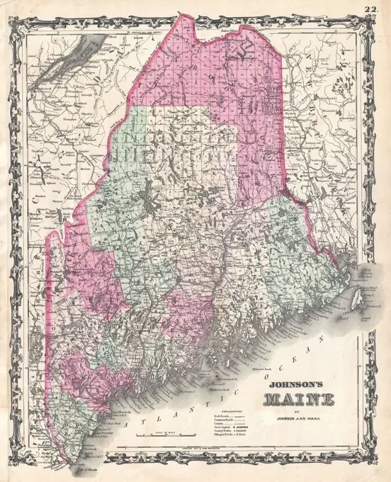
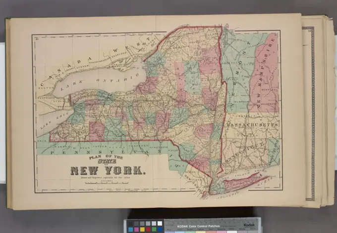
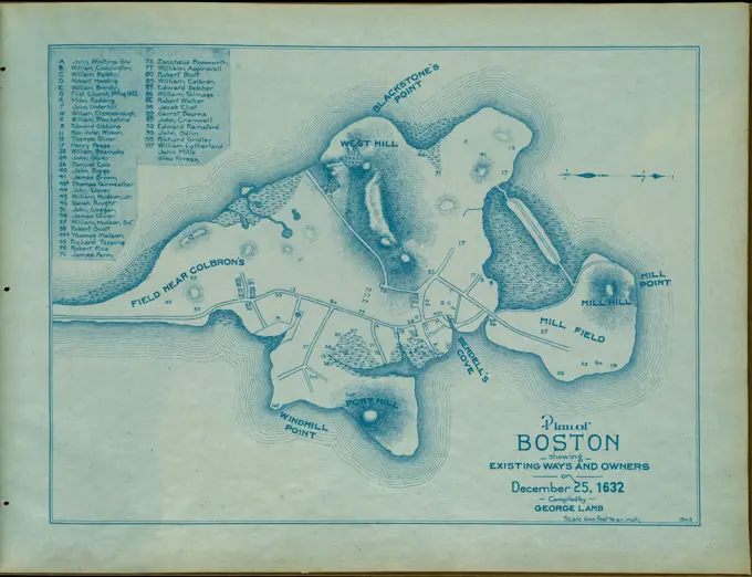
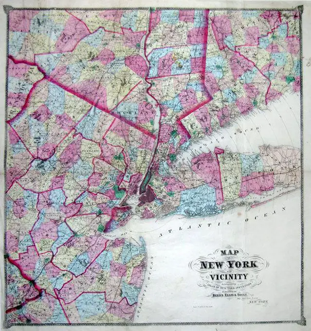
Historic Maps of the Northeastern USA

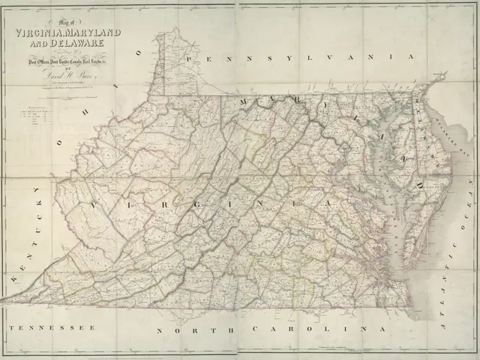
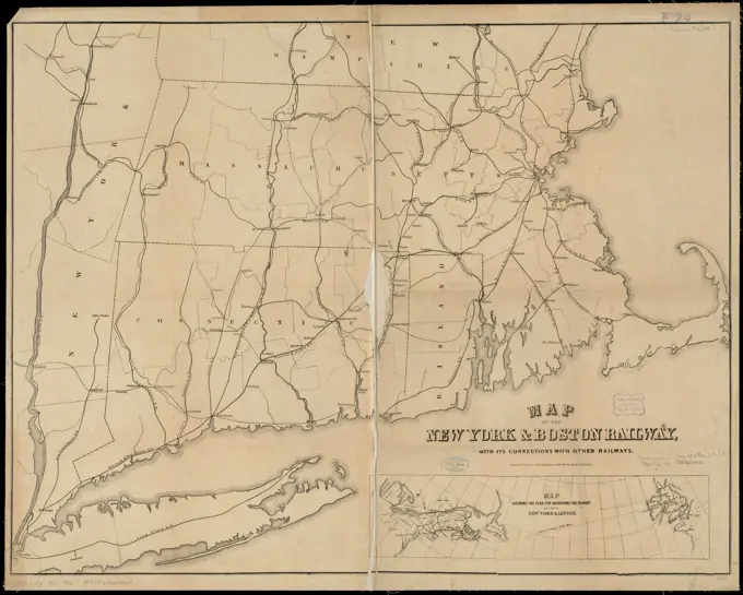
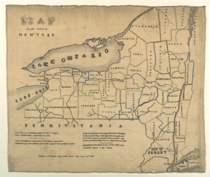
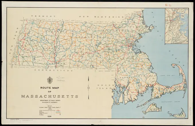
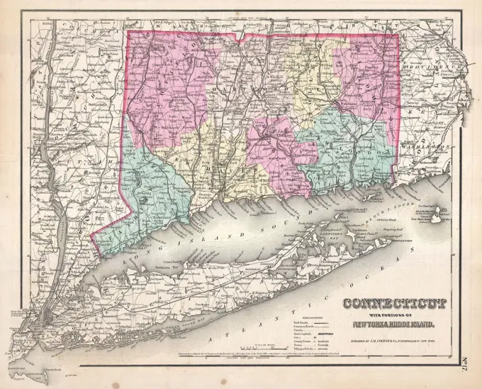
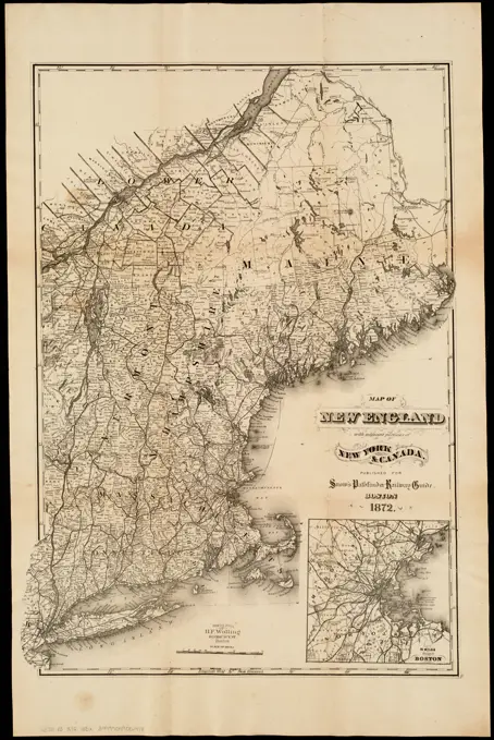
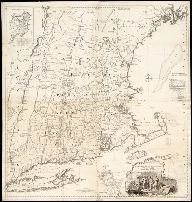
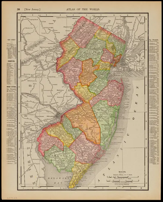
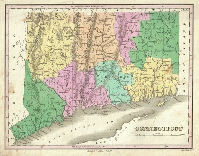
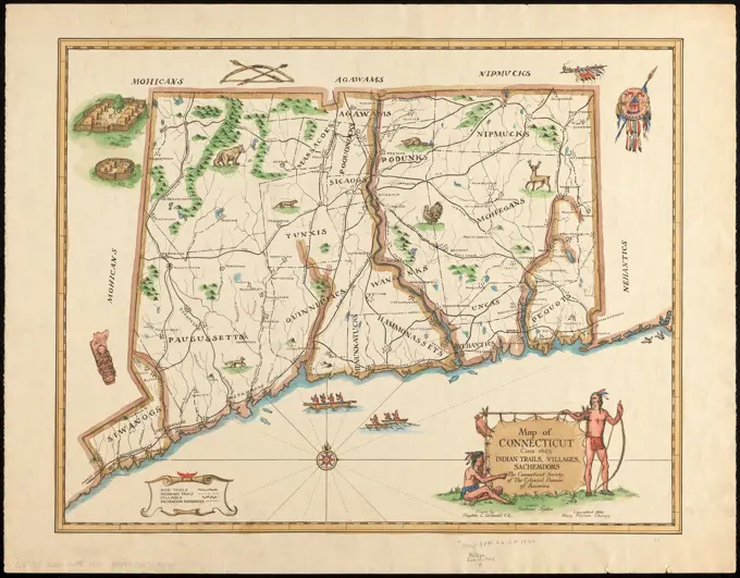
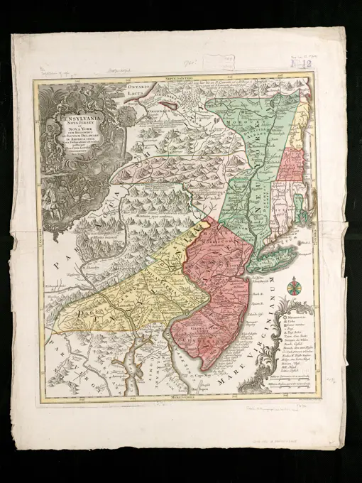
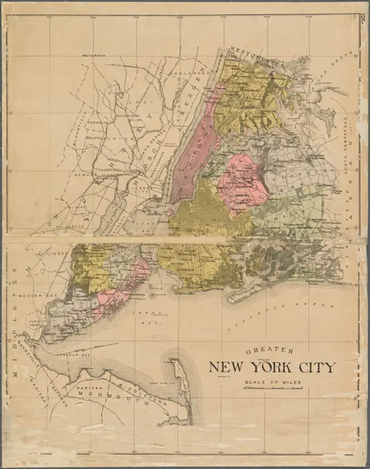
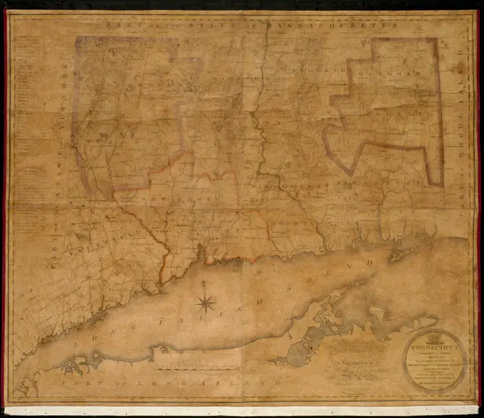
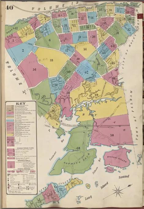
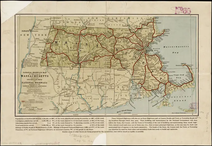
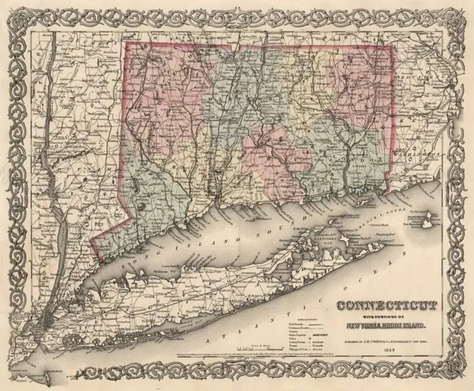
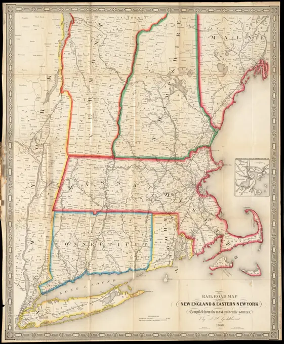
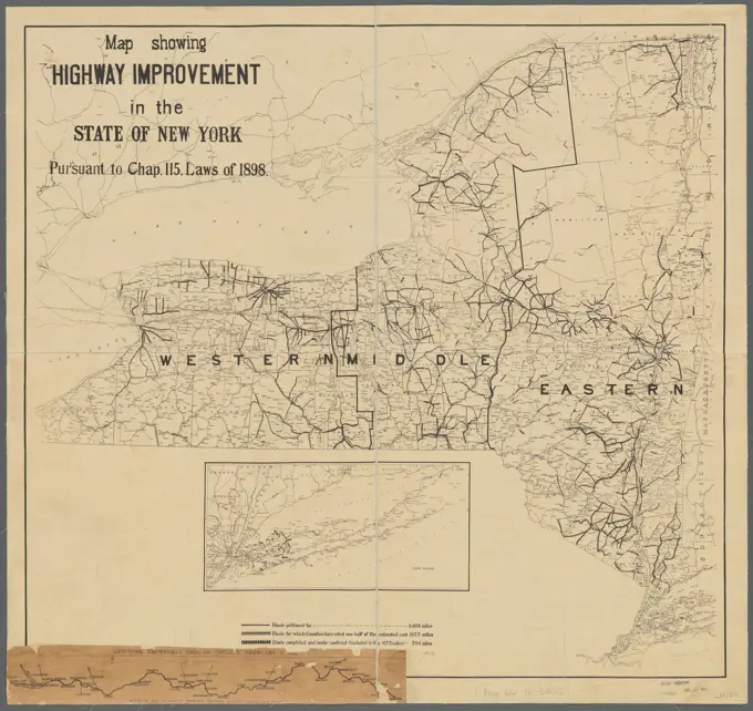
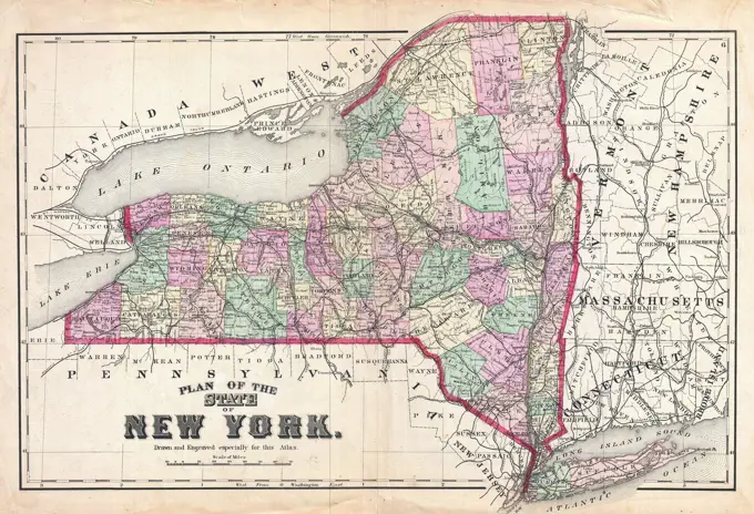
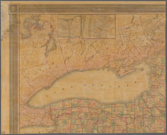
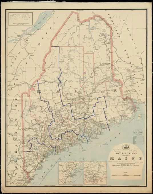
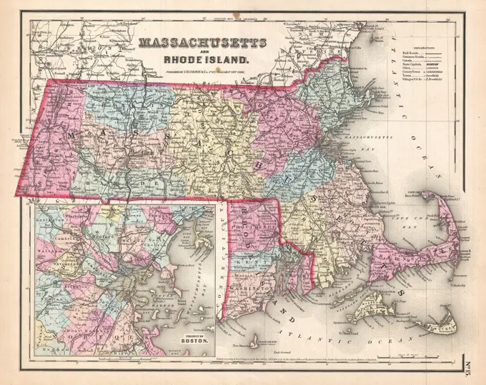
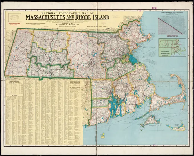
A collection of vintage maps depicting Massachusetts, Rhode Island, New York, and Connecticut, showing geographical details and urban layouts from the late 19th and early 20th centuries.

Map of Virginia, Maryland, and Delaware from 1839, showing post offices, post roads, canals, and railroads. It consists of 1 map on 2 sheets, hand-colored, measuring 89 x 122 cm, with sheets sized at 97 x 66 cm. Issued in London by an unspecified publisher
Map of the New York & Boston Railway, with its connections with other railways. Covers Connecticut, Rhode Island, Massachusetts, and part of New York. Inset: Map showing the plan for shortning sic the transit between New York & London.... , New England  ,areaA new map of part of the United States of North America, containing those of New York, Vermont, New Hampshire, Massachusets sic, Connecticut, Rhode Island, Pennsylvania, New Jersey, Delaware, Maryland and Virginia : from the latest authorities. Relief shown by hachures. Includes navigational and vegetational notes.... , Northeastern United States  ,areaMap of British and French settlement in North America, 1755. Created at the beginning of the French and Indian War, it shows provincial boundaries and important forts  (BSLOC_2019_3_1)Russell's map of Massachusetts , Massachusetts, Maps Norman B. Leventhal Map Center CollectionOutline map of New York Harbor & vicinity: showing main tidal flow, sewer outlets, shellfish beds & analysis points Cartographic. Maps. 1906. Lionel Pincus and Princess Firyal Map Division. New York Harbor (N.Y. and N.J.), Tidal currents , New York Harbor (N.Y. and N.J.), Sewerage , New York Harbor (N.Y. and N.J.), Shellfish fisheries , New York Harbor (N.Y. and N.J.), Environmental monitoring , New York Harbor (N.Y. and N.J.)Index map showing the principal river basins within the state of Massachusetts, 1875., 1875., Boston, Mass. Publisher, publisher not identified. Subjects include watersheds, rivers, and water supply in Massachusetts., 1 map, hand colored, measuring 46 x 74 cm on a sheet of 53 x 79 cmThe United States of America with the British possessions of Canada, Nova Scotia, New Brunswick and Newfoundland divided with the French, also the Spanish territories of Louisiana and Florida according to the preliminary articles of peace signed at Versailles the 20th of Jany. 1783. Relief shown pictorially. Cataloging, conservation, and digitization made possible in part by The National Endowment for the Humanities: Exploring the human endeavor.... , Canada United StatesThe Rand McNally new commercial atlas map of North Carolina. Relief shown by hachures. Inset: Western portion of North Carolina on same scale. Includes key to railroads and index with population figures. In lower right: 116A... New commercial atlas map of North Carolina. New commercial atlas map of North Carolina, North CarolinaWestchester, Plate No. 1 Map of Westchester County and Surroundings Cartographic. Atlases, Maps. 1893. Lionel Pincus and Princess Firyal Map Division. Westchester County (N.Y.)A map titled 'A new map of the most considerable plantations of the English in America,' issued in 1700. It measures 34 x 46 cm and is published by the Sheldonian Theatre in Oxford. The map focuses on English plantations in America and includes regions such as the Middle Atlantic States and New England. It is categorized under early works related to maps of Great Britain's colonies in America and maps of North AmericaA map of New England and New York , New England, Maps, Early works to 1800, Facsimiles, New York State, Maps, Early works to 1800, Facsimiles, New Jersey, Maps, Early works to 1800, Facsimiles, 1676 Norman B. Leventhal Map Center CollectionEmbroidered Map, Map of the State of New York; Embroidered by Elizabeth Ann Goldin, American (American, 1814 - 1896); USA; silk embroidery, wool foundation, pencilRoute map of Massachusetts , Roads, Massachusetts, Maps, Massachusetts, Maps, Boston Mass., Maps Norman B. Leventhal Map Center Collection1857 Colton Map of Connecticut and Long IslandMap of New England : with adjacent portions of New York & Canada. Relief shown by hachures. Shows railroads, townships, counties, and populated places. "Published for Snow's pathfinder railway guide." Inset: 15 miles around Boston. On verso: advertisements.... , New England  ,areaMap of the state of New York : showing the boundaries of counties & townships, the location of cities, towns and villages: the courses of railroads, canals & stage roads Cartographic. Maps. 1848. Lionel Pincus and Princess Firyal Map Division. New York (State), Canals , New York (State), New York (State) , Administrative and political divisions, New York (State) , Maps, Railroads , New York (State), Saint Lawrence River Valley , Maps, New York Metropolitan Area , MapsMap of part of Virginia, Maryland and Delaware from the best authorities , Middle Atlantic States, Maps Norman B. Leventhal Map Center CollectionMap of part of Virginia, Maryland and Delaware from the best authorities. Another issue. Lithographer's name has been dropped. Forts Corcoran, Runyon, Albany, and Ellsworth are shown on the Virginia side of the Potomac River at Washington, DC. Description derived from published bibliography.... , Middle Atlantic  ,areaOutline map of Massachusetts showing senatorial districts as established by the General Court of 1906 with legal voters according to Census of 1905. Includes lists of the Members of the Committee and the number of legal voters in senatorial districts. Inset: Suffolk districts. "Geo. H. Walker & Co. Lith. Boston." "Wright & Potter Printing Co."... , MassachusettsA map of the most inhabited part of New England : containing the provinces of Massachusets Bay and New Hampshire, with the colonies of Conecticut and Rhode Island, divided into counties and townships : the whole composed from actual surveys and its situation adjusted by astronomical observations. 2nd edition, 1st issue (Stevens & Tree). 2nd state (LC). Prime meridians: London and Ferro. Relief shown pictorially. Insets: A plan of the town of Boston -- A plan of Boston Harbor from an accurate survey ca. 1:150,000. Imprint November 29th 1755 but published ca. 1763.... , New England  ,area  Massachusetts  , Boston Harbor Massachusetts  , Suffolk  ,county   , BostonNational Highways map of the state of Massachusetts showing one thousand miles of national highways proposed by the National Highways Association, Washington D.C , Roads, Massachusetts, Maps, Massachusetts, Maps Norman B. Leventhal Map Center CollectionBacon's Large Print War Map showing 50 miles round Washington and Richmond, Bacon & Co, London, 1864New Jersey ,. Robert E. Diefenbach Map Collection1827 Finley Map of ConnecticutMap of Connecticut, circa 1625, Indian trails, villages, sachemdoms. Relief shown pictorially. Includes illustrations. Accompanied by booklet titled Connecticut circa 1625, its Indian trails, villages and Sachemdoms.... , ConnecticutPrima Europe tabula , British Isles, Maps, Early works to 1800, Ireland, Maps, Early works to 1800 Norman B. Leventhal Map Center CollectionMap of Massachusetts showing state highways laid out & petitioned for , Roads, Massachusetts, Massachusetts, Maps Norman B. Leventhal Map Center CollectionA map or plot of the twenty-five divisions of land ... late in the Township of Dorchester and now in the Township of Stoughton, it being part of that land commonly called Dorchester New-Grant beyond the Blew-hills ... finished May 8th, 1730 , Real property, Massachusetts, Stoughton, Maps, Real property, Massachusetts, Dorchester Boston, Mass., Maps, Stoughton Mass., Maps Norman B. Leventhal Map Center CollectionA map of Massachusetts, Connecticut and Rhodeisland , New England, Maps, Connecticut, Maps, Massachusetts, Maps, Rhode Island, Maps Norman B. Leventhal Map Center CollectionMap of the rail roads of the state of New York Cartographic. Maps. 1870. Lionel Pincus and Princess Firyal Map Division. Railroads , New York (State), Railroads , Pennsylvania, Railroads , New Jersey, Railroads , Vermont, Railroads , Massachusetts, Railroads , Connecticut, Canals , New York (State), New York (State) , Administrative and political divisions, New York (State)Pensylvania Nova Jersey et Nova York cum Regionibus ad Fluvium Delaware in America sitis. Relief shown pictorially. Also covers New England (distorted) and northern Chesapeake region. Title in Latin; notes in German and Latin; legend in Latin, German, and English. According to T.R. Smith published sometime between the death of Matthaeus Seutter in 1756 and its appearance in Atlas geographique, 1778. Appears in: Atlas geographique de cent et huit cartes generales et speciales, 1778. Includes notes in map area, ill. in title cartouche, and coat-of-arms at head of title.... , Pennsylvania Middle Atlantic  ,area  New York New JerseyMap of the railroads of the state of Massachusetts : accompanying the report of the Railroad Commissioners : 1884. From the 1884 Annual report of the Board of Railroad Commissioners. Shows railroads; money order post offices; county towns; county towns if also a money order office; railroads stations, villages and ordinary post offices; and population of cities and towns by census of 1875. Shows continuation of railroads into neighboring states. Prime meridian: Washington, D.C.... , MassachusettsMap of Massachusetts showing state highways laid out & petitioned for , Roads, Massachusetts, Massachusetts, Maps Norman B. Leventhal Map Center CollectionGreater New York City. 1911. Cartographic. Maps. Lionel Pincus and Princess Firyal Map DivisionJ.H. Colton's topographical map of North and South Carolina : a large portion of Georgia & part of adjoining states , North Carolina, Maps, South Carolina, Maps Norman B. Leventhal Map Center CollectionPost route map of the State of New York and parts of Vermont, Massachusetts, Connecticut, New Jersey, and Pennsylvania also the adjacent portions of the Dominion of Canada, showing post offices with the intermediate distances and mail routes in operation on the 1st of December 1895 , Counties, New York State, Maps, Postal service, New York State, Maps, Railroads, New York State, Maps, New York State, Maps Norman B. Leventhal Map Center CollectionMap of New York and vicinity: accompanying Atlas of Westchester County McGuigan, James, approximately 1819-. Cartographic. Maps. 1872 - 1872. Lionel Pincus and Princess Firyal Map Division. New York Metropolitan Area, New York Region, New York Region , Administrative and political divisions, Connecticut, New Jersey, New York (State), New York (State) , New York Metropolitan AreaPlan of the State of New York, published in 1873 by Beers, Comstock & ClineMap of eastern Virginia , Virginia, Maps, Maryland, Maps Norman B. Leventhal Map Center CollectionA new and general map of the middle dominions belonging to the United States of America, viz. Virginia, Maryland, the Delaware-counties, Pennsylvania, New Jersey &c. with the addition of New York, & of the greatest part of New England &c as also of the bordering parts of the British possessions in Canada , East U.S., Maps, Early works to 1800 Norman B. Leventhal Map Center CollectionThe New England commercial and route survey , Roads, New England, Maps, New England, Maps Norman B. Leventhal Map Center CollectionStaten Island drive and bicycle road map Cartographic. Maps. 1896. Lionel Pincus and Princess Firyal Map Division. Staten Island (New York, N.Y.), New York (N.Y.), Staten Island Rapid Transit Railway Company, Local transit , New York (State) , New York, Roads , New York (State) , New York, Bicycles , New Jersey, Bicycles , New York (State) , New YorkA map of the State of New York. Morse, Jedidiah, 1761-1826. Cartographic. Maps, Atlases. 1794. Lionel Pincus and Princess Firyal Map Division. United States, Geography, United StatesNew York State, Double Page Plate No. 7 Map of City of New York, City of Brooklyn Cartographic. Atlases, Maps. 1895. Lionel Pincus and Princess Firyal Map Division. New York (State) - - vMaps.Map of the United States of North America. Relief shown by hachures. Shows counties, Indian tribes and villages, roads, etc. Insets: Topographical view of the Erie and Champlain Canal -- Topographical view of the Pennsylvania and Union Canal -- Map of North America including all the recent geographical discoveries Includes "Comparative elevation of the principal mountains and hills in the United States," and "Statistical table of the United States."... , North America  ,area  United StatesConnecticut, from actual survey. Shows county boundaries. Relief shown by hachures. Dedication: To His Excellency Roger Griswold, Esq. and to the Honourable, the Legislature of the State of Connecticut, this map is respectfully inscribed by the publishers. Includes legend and list of Connecticut governors.... , ConnecticutMap of senatorial districts of Massachusetts, as established by the legislature of 1886 : with population and legal voters according to census of 1885. Includes inset of Map of Boston by wards, with legal voters in each ward amd list of the Joint Special Committee on Redistricing the State.... , MassachusettsMaine , Maine, Maps Norman B. Leventhal Map Center CollectionMaine. Relief shown pictorially. Prime meridians: Washington and Greenwich. From his New general atlas. Philadelphia : Published by Anthony Finley, 1829.... , MaineMap of eastern Virginia , Virginia, Maps, Maryland, Maps Norman B. Leventhal Map Center CollectionCartographic, Maps. 1905 - 1908. Lionel Pincus and Princess Firyal Map Division. New York (N.Y.) Key Plan ContinuedMap of the state of New York : showing the boundaries of counties & townships, the location of cities, towns and villages, the courses of rail roads, canals & stage roads Cartographic. Maps. 1850. Lionel Pincus and Princess Firyal Map Division. New York (State), Canals , New York (State), New York (State) , Administrative and political divisions, Railroads , New York (State)Map of the rail roads of New Jersey 1887. By authority of the State Board of Assessors of N.J.. Township and county map showing drainage, cities and towns, and the railroad system with names. A table of railroads by system is in the lower right of map... , New JerseyA hand-colored map titled 'The state of Connecticut including parts of New York and New Jersey,' created by Roderick Nevers in 1851. The map measures 57 x 70 cm, mounted on a sheet of 59 x 72 cm. It depicts the administrative and political divisions of Connecticut, as well as portions of New York and New Jersey, including Long Island and the New York Metropolitan Area. The map was published in Hartford, ConnecticutA Map of the Provinces of New York and New Jersey, with a part of Pennsylvania and the Province of Quebec 1700sConnecticut, from actual survey , Connecticut, Maps Norman B. Leventhal Map Center CollectionHodgman's new map showing location and classification golf and country clubs of New England with automobile roads and distances. Includes list of clubs. Information tables, advertisements, and map of the tour in England on verso.... , New England  ,areaNational Highways map of the state of Massachusetts showing one thousand miles of national highways proposed by the National Highways Association, Washington D.C , Roads, Massachusetts, Maps, Massachusetts, Maps Norman B. Leventhal Map Center CollectionMap of Connecticut with Portions of New York and Rhode Island, Published by J.H. Colton & Co., New York, 1859The colonies in 1660, Virginia, Maryland, and the Dutch and Swedish settlements on the Delaware showing extent and dates of settlement , Maryland, Colonies, Maps, Delaware, Colonies, Maps, Virginia, Colonies, Maps Norman B. Leventhal Map Center CollectionA New and Accurate Map of the Colony of Massachusetts Bay. Original caption: A new and accurate map of the Colony of Massachusetts Bay - Universal Magazine of Knowledge and Pleasure, London, England. p. 281, vol. 67, July - Dec. 1780. State: Massachusetts.A general map of the middle British colonies in America, viz. Virginia, Maryland, Delaware, Pensilvania, New Jersey, New York, Connecticut and Rhode Island, 1771New Engelland, New York, New Yersey und Pensilvania , New Jersey, Maps, Early works to 1800, New York State, Maps, Early works to 1800, Pennsylvania, Maps, Early works to 1800, New England, Maps, Early works to 1800, Northeastern States, Maps, Early works to 1800 Norman B. Leventhal Map Center CollectionMap of the railroads of the state of Massachusetts : accompanying the report of the Railroad Commissioners : 1900. From the 1890 Annual report of the Board of Railroad Commissioners. Shows railroads; money order post offices; county towns; county towns if also a money order office; and railroads stations, villages and ordinary post offices. Shows continuation of railroads into neighboring states. Prime meridian: Washington, D.C.... , MassachusettsRailroad map of New England & eastern New York complied from the most authentic sources , Railroads, New England, Maps, Railroads, New York State, Maps, New England, Maps Norman B. Leventhal Map Center CollectionMap showing highway improvement in the state of New York, pursuant to Chap. 115, Laws of 1898 Cartographic. Maps, Road maps. 1898. Lionel Pincus and Princess Firyal Map Division. Roads , New York (State), Express highways , New York (State), Highway law , New York (State), New York (State) , Administrative and political divisions, New York (State)1873 Beers Map of New York StateMap of the state of New-York: with parts of the adjacent country, embracing plans of the cities, and some of the larger villages Cartographic. Maps. 1852. Lionel Pincus and Princess Firyal Map Division. Cities and towns , New York (State), New York (State), New York (State) , Administrative and political divisions, New York (N.Y.)Post route map of the State of Maine showing post offices with the intermediate distances and mail routes in operation on the 1st December 1895 , Counties, Maine, Maps, Postal service, Maine, Maps, Railroads, Maine, Maps, Maine, Maps Norman B. Leventhal Map Center CollectionCharte uber die XIII Vereinigte Staaten von Nord-America. Title in margin: Les XIII Etats Unis de l'Amerique septentrionale, d'apress les meilleurs & speciales cartes angloises qui ont parues jusqu'ici. Relief shown pictorially. Prime meridian: Ferro. Hand colored. Featured in the Faces & Places Exhibit, Kravis Center, Palm Beach, FL, since 2005. MB (BRL). Following the American Revolution, European map makers were quick to publish maps recognizing the independence of the new country known as the United States. One example is this map, which was prepared by the German cartographer Franz Ludwig Güssefeld for inclusion in atlases published by the German firm Homann Heirs. The map clearly focuses on showing the extent of the new nation from the Atlantic Coast west to the Mississippi River, and north to the Great Lakes, but excluding the Spanish territories of Florida and Louisiana. However, the boundaries of the individual states were crudely drawn, with obvious mistakes made in delineatiMap of Massachusetts , Massachusetts, Maps, Boston Mass., Maps Norman B. Leventhal Map Center CollectionMap of Massachusetts. Direct routes and State highways shown in red. Includes insets: Central part of Boston and Part of the metropolitan district.... , Massachusetts  , Suffolk  ,county   , BostonRailway and highway map of the famous Berkshire Hills region, showing also villages and points of interest : from official records and other information. Relief shown by hachures and spot heights. Differs from other 1883 ed. in that it does not show main roads, school houses, cemeteries, churches, and railroads stations in red and does not include a key in upper right corner. Includes text and ill.. The Berkshire Hills of western Massachusetts are home to a number of Trustees properties. Farms, meadows, ponds, hills, mountains and historic homes make up the fourteen sites in the Berkshires, several of which are depicted on this 1883 map designed to promote tourism in the region. The mountainous topography of the area is highlighted in this map to emphasize the numerous recreational activities available to visitors. Monument Mountain in Great Barrington - one of The Trustees earliest properties - was a popular destination for nature lovers in the 19th century because of its majestic vieMap showing 100 miles around New York City. 1916. Cartographic. Maps. Lionel Pincus and Princess Firyal Map Division1862 Johnson Map of MaineMap of eastern Virginia , Virginia, Maps, Maryland, Maps Norman B. Leventhal Map Center CollectionKaart Van Sumatra, Covens & Mortier, 1707 - 1741 print Map of Sumatra, the north on the left, the different areas in color differently. At the top left cartouche with title, below the scale sticks (in German and French miles), both decorated with putti and plant and animal motifs. Amsterdam paper engraving maps of separate countries or regions SumatraMap of Massachusetts showing population according to census of 1910 , Massachusetts, Population, Maps, Boston Mass., Population, Maps Norman B. Leventhal Map Center Collection1853 Mitchell Map of ChinaPlan of the State of New York. Cartographic. Atlases, Maps. 1880. Lionel Pincus and Princess Firyal Map Division. Erie County (N.Y.), Real property , New York (State) , Erie CountyMap of Chile, Argentina etc. Artist: Unknown.A map of the United States. Manuscript map drawn by a schoolgirl in ink, watercolor, pencil and crayon. Shows states and territories, rivers, and towns. Prime meridian: Washington D.C..... , United States1857 Colton Map of Massachusetts and Rhode IslandPlan of Boston showing existing ways and owners on December 25, 1631 , Boston Mass., Maps, Landowners, Massachusetts, Boston, Maps Norman B. Leventhal Map Center CollectionNational topographic map of Massachusetts and Rhode Island : showing counties, townships, cities, villages and post offices ... according to the latest census , Massachusetts, Maps, Rhode Island, Maps Norman B. Leventhal Map Center CollectionA map of the British and French dominions in North America: with the roads, distances, limits, and extent of the settlements, humbly inscribed to the Right Honourable the Earl of Halifax, and the other Right Honourable the Lords Commissioners for Trade & Plantations Cartographic. Maps. 1755. Lionel Pincus and Princess Firyal Map Division. North AmericaPlan of the State of New York Cartographic. Atlases, Maps. 1875. Lionel Pincus and Princess Firyal Map Division. Niagara County (N.Y.), Orleans County (N.Y.), Real property , New York (State) , Niagara County, Real property , New York (State) , Orleans CountyPennsylvania, Nova Jersey, et Nova York cum regionibus ad Fluvium Delaware in America sitisNational topographic map of Massachusetts and Rhode Island : showing counties, townships, cities, villages and post offices ... according to the latest census. Relief shown by hachures and spot heights. Includes index, population figures, distance table, and map showing congressional districts.... , Massachusetts Rhode IslandMassachusetts tourists map : showing tourways, picnic sites, beaches, and camp grounds , Outdoor recreation, Massachusetts, Maps, Massachusetts, Maps Norman B. Leventhal Map Center CollectionPlan of Boston showing existing ways and owners on December 25, 1632 , Boston Mass., Maps, Landowners, Massachusetts, Boston, Maps Norman B. Leventhal Map Center CollectionThe Commonwealth of Connecticut. Amy Drevenstedt ---26. Land forms shown pictorially. Shows roads, railroads, rivers, colleges and universities. Includes text and illustrations Illustrations and text in border.... , ConnecticutProvincia de Santa Fé registro gráfico : construido con los datos recopilados por la dirección de Obras Públicas y Geodesia en la administración del Gobernador Dr. Don Manuel J. Menchaca , Landowners, Argentina, Santa Fe Province, Maps, Real property, Argentina, Santa Fe Province, Maps, Santa Fe Argentina : Province, Maps Norman B. Leventhal Map Center Collection1867 Beers Map of New York City and Vicinity ( Westchester, Long Island, Newark, Bergen )The State of South Carolina, from the bests authorities Cartographic. Maps. 1814. Lionel Pincus and Princess Firyal Map Division. South CarolinaA draught of Boston Harbor by Capt. Cyprian Southake. Depths shown by soundings. Item is an 1884 manuscript copy of the original 1694 edition in the British Library. Item was made for Mr. H.F. Waters Esqr. and sent from London to Boston (cf. Proceedings of the Massachusetts Historical Society, vol. II, sceond series, 1885-186, p. 479).. The 1694 copy of Southack's original chart was made by Augustine Fitzhugh. Boston Public Library copy is an exact duplicate, with exception of title and north point, of Boston Harbor in New England, 1689(), in the English Pilot (book IV). Southack's earliest known effort was a chart of Boston Harbor, probably drawn in the late 1680s but now lost. It remains available, however, through the derivative displayed here. This chart is an 1884 copy of an ornate manuscript made in 1694 by London draughtsman Augustine Fitzhugh. Though the cartography is crude, the chart is an important example of how the work of colonial mapmakers was circulated back in the homeNew Windsor Township; New Windsor Village Cartographic. Atlases, Maps. 1875. Lionel Pincus and Princess Firyal Map Division. Orange County (N.Y.), Real property , New York (State) , Orange County, Orange County (N.Y.) , History, Business enterprises , New York (State) , Orange CountyThe National Publishing Company's railroad, post office, township and county map of Massachusetts, Rhode Island and Connecticut : with distances in figures compiled from the latest government surveys and original sources. Relief shown by hachures and spot heights. Inset: United States, showing political divisions. Includes list of cities and towns, counties and county seats, tables of travel distances, and population statistics... Railroad, post office, township and county map of Massachusetts, Rhode Island and Connecticut. Railroad, post office, township and county map of Massachusetts, Rhode Island and Connecticut, Massachusetts New England  ,area  Rhode Island ConnecticutMap of the United States exhibiting the post-roads, the situations, connections & distances of the post-offices, stage roads, counties, ports of entry and delivery for foreign vessels, and the principal rivers , Post roads, United States, Maps, Early works to 1800, United States, Maps, Early works to 1800 Norman B. Leventhal Map Center CollectionCities and county map of the states of Florida, prepared for the 10th census, 1880. Tenth census of the United States, 1884., Washington, D.C. Publisher, Census Office. Florida, Administrative and political divisions, United States, Census, 1880., 1 map; 21 x 24 cm, on sheet 25 x 31 cm