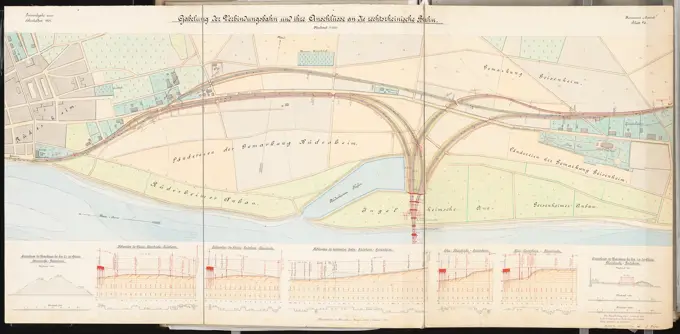
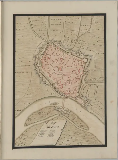
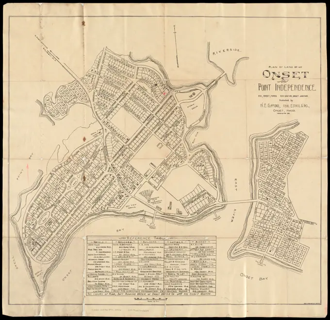
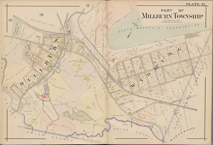
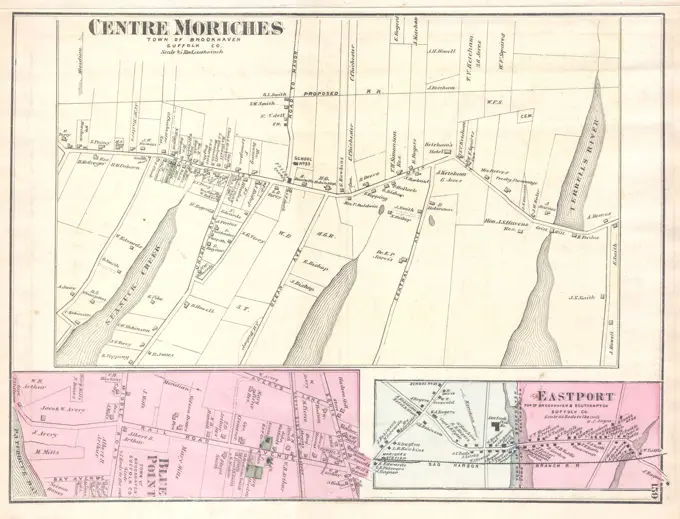
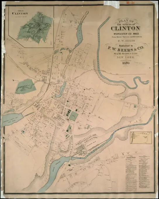
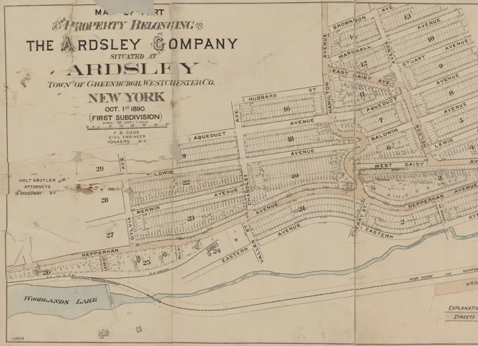
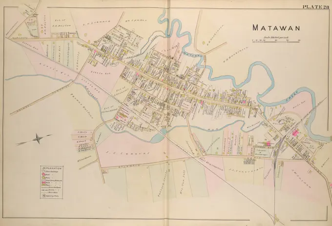
Historical City Maps

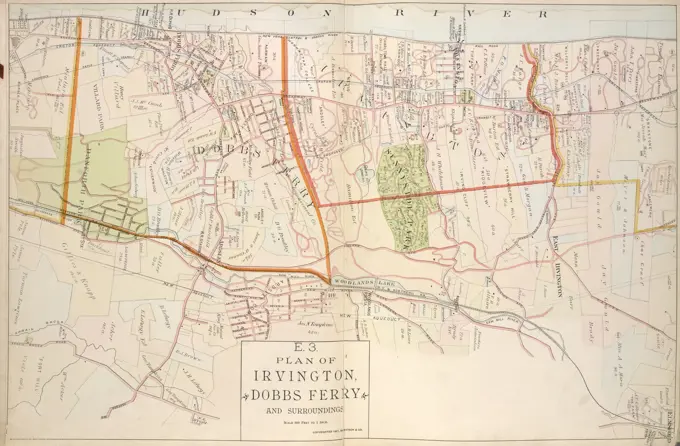
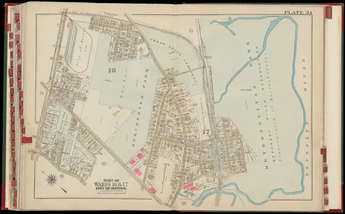
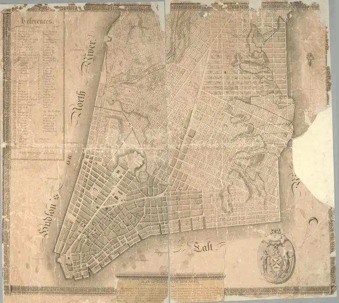
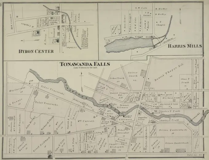
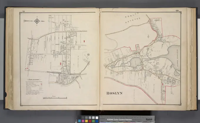
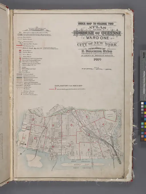
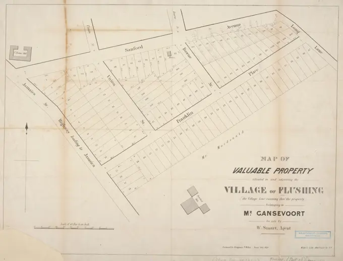
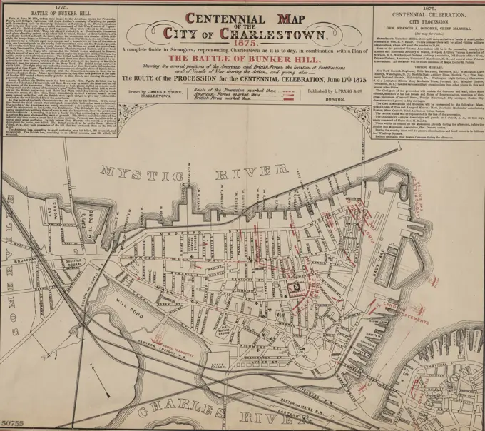
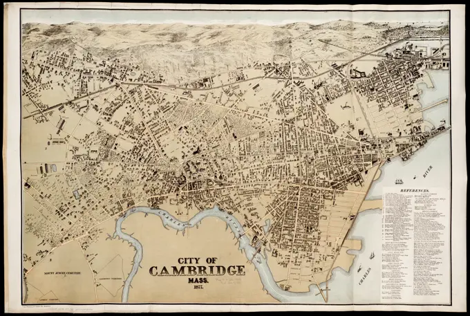
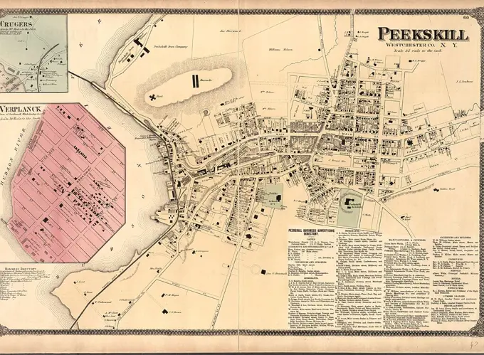
Detailed atlases and plates of Boston and Cambridge, showcasing land ownership and real property with artistic cartographic designs.

Atlas of the city of Boston, Dorchester : from actual surveys and official plans : plate 34 , Real property, Massachusetts, Boston, Maps, Landowners, Massachusetts, Boston, Maps, Dorchester Boston, Mass., Maps Norman B. Leventhal Map Center Collection
New map of Boston, comprising the whole city, with the new boundaries of the wards , Boston Mass., Maps Norman B. Leventhal Map Center CollectionAtlas of the towns of Revere and Winthrop, Suffolk County, Massachusetts. sheet 22 , Real property, Massachusetts, Winthrop, Maps, Landowners, Massachusetts, Winthrop, Maps, Winthrop Mass., Maps Norman B. Leventhal Map Center CollectionPlan des paroisses de Paris : avec la distinction des parties eparses qui de dépendent , Paris France, Maps Norman B. Leventhal Map Center Collectionunknown artist, A Collection of Surveys of Scottish Estates of the Earl of Selkirk: Bishopton, undated. Graphite, watercolor, pen and black ink on slightly textured, moderately thick, cream wove paper.Center Moriches. Village Cartographic. Atlases, Maps. 1888. Lionel Pincus and Princess Firyal Map Division. Atlases , New York (State) , Suffolk CountyMap of New Orleans, depicting the scenes of outbreaks on July 30, 1866, March 5, 1873, and September 14, 1874. Created by James Gordon Bennett, this map, issued in 1874, measures 46 x 36 cm on a sheet of 55 x 39 cm. It is associated with themes of riots, real property, and the administrative and political divisions of New Orleans in the 19th century. The verso of the map is covered with clothMengel Gustav (1843-1876), crossing station. Monthly competition November 1875 (11.1875): site plan, various longitudinal sections and cross sections; Scale bar, dimensions. Tusche watercolor on the box, 70.4 x 100.8 cm (including scan edges) Mengel Gustav  (1843-1876): Kreuzungsbahnhof. Monatskonkurrenz November 1875B1, 1799, 1799, London, Fire risk assessment, EnglandGiese Erich (born 1876), connection between Rhein-Nahe-Bahn and right-wing railway near Rüdesheim. Schinkel competition 1901 (March 15, 1901): fork for the connecting railway and its connections to the right -wing railway. Site plan 1: 2000; Substructure. Cross -sections 1: 300, 1: 200. Ink, ink colored watercolor on the box, 67.7 x 137.6 cm (including scan edges) Giese Erich  (geb. 1876): Verbindung zwischen Rhein-Nahe-Bahn und rechtsheinischer Eisenbahn bei Rüdesheim. Schinkelwettbewerb 1901Atlas of the city of Boston, volume five, Dorchester Mass. : from actual surveys and official plans. plate 23 , Real property, Massachusetts, Boston, Maps, Landowners, Massachusetts, Boston, Maps, Dorchester Boston, Mass., Maps Norman B. Leventhal Map Center CollectionAtlas of the city of Cambridge, Massachusetts : from actual surveys and official plans. plate 34 , Real property, Massachusetts, Cambridge, Maps, Landowners, Massachusetts, Cambridge, Maps, Cambridge Mass., Maps Norman B. Leventhal Map Center CollectionPlan of MindenMap of Plymouth County, Mass.Plan of land of Onset and Point Independence , Real property, Massachusetts, Onset, Maps, Real property, Massachusetts, Wareham, Maps, Onset Mass., Maps, Wareham Mass., Maps Norman B. Leventhal Map Center CollectionJansen Hermann (1869-1945), total development plan in Gaziantep (10.12.1938): (Break break from Inv.No. 23414): Zone plan 1: 5000, scale bar. Pencil and colored pencil over a break on paper, 93.3 x 131.4 cm (including scan edges) Jansen Hermann  (1869-1945): Gesamtbebauungsplan, GaziantepPlan of MünsterTown of Dedham Massachusetts , Dedham Mass., Maps Norman B. Leventhal Map Center CollectionMap of the Wieringerwaard; Wieringer-Waert. Map of the Verkiven Wieringerwaard with a rear rose at the top left and a Fleur-de-Lys, at the top right of a weapon with two birds and bottom left cattle and agricultural equipment around the scale.Map of battles on Bull Run, near Manassas, on the line of Fairfax & Prince William Counties, in Virginia, fought between the forces of the Confederate States and of the United States of America : Gene'ls. Beauregard and Johnston commanding the Confederate and Genl. McDoweel, the United States forces, on the 21st of July, 1861, from 7 a.m.-9 p.m , Bull Run, 1st Battle of, Va., 1861, Maps, Manassas Va., Maps Norman B. Leventhal Map Center CollectionMap of Condé; Plan De La Ville De Condé. Map of the reinforcements to the city of Condé, 1711. On the right the legend A-V in French. Part of a collection of signed plans of reinforced places in the Netherlands and surrounding countries at the time of the Spanish Succession War (part c).Plan of Boston comprising a part of Charlestown and Cambridge , Boston Mass., Maps Norman B. Leventhal Map Center CollectionPlan of the city of New-York Cartographic. Maps. 1803-11. Lionel Pincus and Princess Firyal Map Division. Manhattan (New York, N.Y.) , Maps, New York (N.Y.) , Administrative and political divisions , Maps, New York (N.Y.) , MapsHistorical floor plan of the 1st floor of the Hofburg, Vienna, by Johann Aman, rendered in graphite, black ink, and multicolored details, early 19th century.To His Excellency Sr. Henry Moore, Bart., captain general and governour in chief, in & over the Province of New York & the territories depending thereon in America, chancellor & vice admiral of the same, this plan of the city of New York, is most humbly inscribed Cartographic. Maps. 1776-01-12. Lionel Pincus and Princess Firyal Map Division. New York (N.Y.) , Maps , Early works to 1800, New York (N.Y.) , Administrative and political divisions , Maps , Early works to 1800Map of Condé, 1711 drawing Map of the reinforcements around the city of Condé, 1711. On the right-hand side the Legenda A-V in French. Part of a collection of signed plans of reinforced places in the Netherlands and surrounding countries at the time of the Spanish Succession War (part C). Brussels paper  maps of cities. fortress CondéBronx, Topographical Map Sheet 3; Map bounded by Bates St., Riverdale Ave., Moshold Ave., Broadway, Vancortlandt Ave., Bailey Ave., Ft. Independence St.; Including Albany Road, Church Kingsbridge Ave., Webbers Lane, Ackerman St., Johnson Ave., Spuyten Duyvil Parkway, Hudson River Railroad., 1873, New York, Publisher, Department of Public Parks, Westchester County (N.Y.), New York (N.Y.)Proposed Charles River Park. An earlier proof copy of the map with errors in the legend and manuscript corrections. Insets: View from the foot of Mt. Vernon St. -- Boston and vicinity. Includes radial lines showing distance from the State House and a table listing acreage. "To be obtained at A. William & Co."... , Massachusetts  , Middlesex  ,county   , Cambridge Massachusetts  , Charles  ,river  Massachusetts  , Suffolk  ,county   , BostonSuffolk County, V. 2, Double Page Plate No. 26 Map bounded by South Hold, East Marion Cartographic. Atlases, Maps. 1902 - 1909. Lionel Pincus and Princess Firyal Map Division. Suffolk County (N.Y.)Jansen Hermann (1869-1945), Hagen development plan (1931-1931): Worksheet basic map with altitude lines, department 222, sheet 24 1: 2000. Lithograph on paper, 74.1 x 101.5 cm (including scan edges) Jansen Hermann  (1869-1945): Hagen BebauungsplanJansen Hermann (1869-1945), Dortmund development plan (20.01.1941): Outdoor districts, map section 131/22 1: 2000. Light break on paper, 71.4 x 98.8 cm (including scan edges) Jansen Hermann  (1869-1945): Bebauungsplan DortmundPart of New York in 1742 : showing the site of the present park, the collect and the little collect ponds, and a portion of the west side of Broadway , Manhattan New York, N.Y., Maps, Early works to 1800, New York N.Y., Maps, Early works to 1800 Norman B. Leventhal Map Center CollectionMapa antiguo de la ciudad de Santander, 1930.From New York (7) to Stratford. Colles, Christopher, 1738-1816. Cartographic. Maps, Atlases. 1789. Lionel Pincus and Princess Firyal Map Division. Middle Atlantic States , Road maps , To 1800, United States , Road maps , To 1800N.N., Canalization of the Aller. Staufanlage, Oldau: site plan 1: 1000. Lithograph colored on the cardboard, 93.9 x 135.9 cm (including scan edges)Port Jervis Map of Port Jervis, N.Y. and vicinity Daily Graphic (New York, N.Y.) Cartographic. Maps. 1875. Lionel Pincus and Princess Firyal Map Division. Landowners , New York (State) , Port Jervis, Port Jervis (N.Y.), Port Jervis Region (N.Y.)Map of New York State reservation at Niagara and Queen Victoria Niagara Falls Park New York State reservation at Niagara Queen Victoria Niagara Falls Park Cartographic. Maps. 1890. Lionel Pincus and Princess Firyal Map Division. Niagara Reservation (N.Y.), Queen Victoria Park (Ont.), National parks and reserves , New York (State) , Niagara Falls (N.Y. and Ont.), National parks and reserves , Ontario , Niagara Falls (N.Y. and Ont.), Niagara Falls (N.Y.), Niagara Falls (Ont.), Niagara Falls (N.Y. and Ont.)Rio de Janeiro, Brazil, circa 1831Plan d'AntwerpJansen Hermann (1869-1945), Hagen development plan (1931-1931): Worksheet basic map with altitude lines, department 233, sheet 2 1: 2000. Lithograph on paper, 74.4 x 101.5 cm (including scan edges) Jansen Hermann  (1869-1945): Hagen BebauungsplanMorris County, Double Page Plate No. 14 Map bounded by Madison Ave., Woodland Ave., Miller Rd., Boyken St., South St. 1910. Cartographic. Atlases, Maps. Lionel Pincus and Princess Firyal Map Division. Morris County (N.J.)Auxiliary troops from the German princes en route to France, 1591; Der Teutschen Fursten Neuwen Zug Auff targeted an. 1591; Series 4: French, German and English events, 1576-1610. Help troops of the German princes travel on the way to France, 1591. With caption of 8 rules in German. Left below numbered: 279. The print is part of an album.Plan of the Country Club Land Association, Westchester, N.Y., 1889, Hyde & Company., 1889., 48 Exchange Place, N.Y. Publisher, Hyde & Company. Real property, New York (State), Westchester; Landowners, New York (State), Westchester; Country clubs, New York (State), Pelham, Westchester (N.Y.); Pelham Manor (N.Y.); Bronx (New York, N.Y.)., 1 map, hand colored; 26 x 34 cm, on sheet 28 x 37 cmRue de la Gare 1867A map of the foreign settlements at Shanghai Cartographic. Maps. 1912. Lionel Pincus and Princess Firyal Map Division. China, Shanghai (China)North Easterly Part of Southampton Cartographic. Atlases, Maps. 1915 - 1917. Lionel Pincus and Princess Firyal Map Division. Suffolk County (N.Y.)Plüddemann Richard (1846-1910), central cemetery for Berlin in Berlin-Charlottenburg. Schinkel competition 1876 (1876): site plan 1: 2500; 2 scale strips. Tusche watercolor on the box, 65.7 x 79.2 cm (including scan edges) Plüddemann Richard  (1846-1910): Zentralfriedhof für Berlin, Berlin-Charlottenburg. Schinkelwettbewerb 1876Jansen Hermann (1869-1945), revision of a opening plan for Aachen-Süd (04.1912): Street and construction lines plan 1: 2500. Ink colored, about pressure on paper, 53.2 x 75.2 cm (including scan edges) Jansen Hermann  (1869-1945): Revision eines Aufschließungsplanes für Aachen-SüdPlan of a part of Cambridge showing the location of the Fayerweather Estate , Real property, Massachusetts, Cambridge, Maps, Cambridge Mass., Maps Norman B. Leventhal Map Center CollectionN.N., Kaiananlagen am Becken I des Hafen, Hamburg-Harburg: Location plans 1: 5000, 1: 2000, cut 1: 400. Lithograph colored on cardboard, 68.9 x 48.5 cm (including scan edges)Map of the cities of Albany and Rensselaer, New York , Albany N.Y., Maps, Rensselaer N.Y., Maps Norman B. Leventhal Map Center CollectionA historical map depicting Tonawanda Falls Village, Byron Center Village, and Harris Mills Village in Genesee County, New York, issued in 1876. The map shows real property details relevant to the areaA sketch of a plan of the Town of Rockport as it was laid out previous to its being settled ,Atlantic City, Double Page Plate No. 19 Map bounded by Risleys Channel, Atlantic Ocean, Great Egg Harbor Inlet Cartographic. Atlases, Maps. 1896. Lionel Pincus and Princess Firyal Map Division. Atlantic City (N.J.)Plan of the Daigoma dera Temple in the Totomi province unknownRoslyn Cartographic. Atlases, Maps. 1914. Lionel Pincus and Princess Firyal Map Division. Nassau County (N.Y.) , Maps, Real property , New York (State) , Nassau CountyKlinke Heinrich (born 1852), traffic planning at Potsdamer Platz in Berlin. Monthly competition May 1897 (05.1897): Department 1: 250; Scale bar. Tusche watercolor over pressure on paper, 60.2 x 77.9 cm (including scan edges) Klinke Heinrich  (geb. 1852): Verkehrsplanung am Potsdamer Platz, Berlin. Monatskonkurrenz Mai 1897Cartographic, Maps. 1868. Lionel Pincus and Princess Firyal Map Division. Real property , New York Metropolitan Area, Westchester County (N.Y.), New York Metropolitan Area Plate 41: White Plains, Westchester Co. N.Y. Large folder - L1Camping of the Prussia in Heusden, 1787, Anonymous, 1790 - 1792 print Map with the location of the camp of the Prussian troops near Heusden on September 15, 1787. Part of a group of fourteen numbered cards of the camps of the Prussian troops during the intervention in the Netherlands in September 1787. Northern Netherlands paper etching maps of cities HeusdenCartographic, Maps. 1919. Lionel Pincus and Princess Firyal Map Division. Queens (New York, N.Y.), Real property , New York (State) , New York , Queens (Borough) Index Map to Volume TwoMap of valuable property situated in and adjoining the village of Flushing (the village line running through the property), belonging to Mr. Gansevoort for sale by W. Smart, agent., 1850., N.Y. Publisher, Miller's Lith., 140 Pearl St., New York., 1 map; 43 x 57 cmCartographic, Maps. 1893. Lionel Pincus and Princess Firyal Map Division. New York (N.Y.) Plate 26: Piers from Battery to 14th St., Hudson RiverPlan de MannheimBatavia planCochituate, town of Wayland , History, Land owners, Real property. Wayland Historical Maps and PlansPlan of School House Lane at Pigeon-Cove, Rockport , StreetsMap of the Schieland Hoogheemraad; The Hoogheemraad Schijk van Schieland. Map of Schieland Hoogheemraad. Along the top the title. Above left a cartouche with information. Right the weapon of the water board. At the bottom right: a scale of 2000 Rhynlandsche rods.Atlas of the county of Suffolk, Massachusetts : vol. 2nd late city of Roxbury, now wards 13-14 and 15, city of Boston : plate M , Real property, Massachusetts, Boston, Maps, Landowners, Massachusetts, Boston, Maps, Roxbury Boston, Mass., Maps, Jamaica Plain Boston, Mass., Maps Norman B. Leventhal Map Center CollectionMap of the City of Toluca. raised from higher order Gl. the Lieutenant added to the Rl Corps of Engineers Dn. Jose Mariano Domingz. of Mendoza in the year 1817.Cartographic, Maps. 1874. Lionel Pincus and Princess Firyal Map Division. Staten Island (New York, N.Y.) Part of Village of New Brighton Section 7unknown artist, A Plan of the Fire in Bishopsgate Street, 1825. Engraving.Monroe County, Double Page Plate No. 26 Map of Churchville town of Riga, Scottsville Wheatland Cartographic. Atlases, Maps. 1902. Lionel Pincus and Princess Firyal Map Division. Monroe County (N.Y.), Real property , New York (State) , Monroe CountyN.N., plan from the port of Swinemünde (10.1879): map, scale bar. Print colored on paper, 63.6 x 53.9 cm (including scan edges) N.N. : Plan vom Hafen SwinemündeEssex County, V. 3, Double Page Plate No. 32 Map bounded by Part of Millburn Township A.H. Mueller (Publisher). Cartographic. Atlases, Maps. 1906. Lionel Pincus and Princess Firyal Map Division. Essex County (N.J.), Newark (N.J.)Unknown architect, polyclinic for skin and venereal diseases of the Charité, Berlin (approx. 1908): site plan 1: 500. Lithograph colored on the cardboard, 62.4 x 93.7 cm (including scan edges) N.N. : Poliklinik für Haut- und Geschlechtskrankheiten der Charité, Berlin1873 Beers Map of Moriches, Eastport and Southampton, Long Island, New YorkCentennial map of the city of Charlestown, 1875 a complete guide to strangers, representing Charlestown as it is today, in combination with a plan of the Battle of Bunker Hill., 1875, Boston, Publisher, L. Prang & Co., 1 map color; 38 x 42 cm, on sheet 40 x 49 cmPlan of the towns of Clinton, Worcester Co. Mass : from recent surveys and records , Real property, Massachusetts, Clinton, Maps, Landowners, Massachusetts, Clinton, Maps, Clinton Mass., Maps Norman B. Leventhal Map Center CollectionPlan of the city of Philadelphia, 1794. Publisher, Jacob Johnson. Philadelphia (Pa.) Maps Early works to 1800., 1 map; 24 x 37 cmSurveying Office in Cologne, green space plan, Cologne (1929): Department 1: 50000. Lithography colored on paper, 38.2 x 32.5 cm (including scan edges) Vermessungsamt Köln : Grünflächenplan, KölnThe Bonner map of Boston, created in 1722. It is a print measuring 44.4 x 60.6 cm, featuring engravings of the town of Boston in New EnglandMap of part of the property belonging to the Ardsley Company, situated in Ardsley, town of Greenburgh, Westchester County, New York. Dated October 1, 1890, this is the first subdivision. It was published by E. Robinson, Lithographer & Publisher. The hand-colored map measures 50 x 102 cm on a sheet of 53 x 104 cmCartographic, Maps. 1868. Lionel Pincus and Princess Firyal Map Division. Real property , New York Metropolitan Area, Westchester County (N.Y.), New York Metropolitan Area Plate 60: Peekskill, Westchester Co. N.Y. Large folder- L1A plan of Andover taken for the town. Shows buildings with names of property owners. Covers also town of North Andover and a portion of the City of Lawrence, Massachusetts. Relief shown by hachures. Includes 1830 statistics.. Ward Reservation in Andover is a place to discover the unique geology of the Merrimack Valley. Comprised of three major hills - Holt, Shrub and Boston - the property contains more than 700 acres for hiking and exploring. Holt Hill - the highest point in Essex County - is a glacial drumlin. At the foot of the hill is a rare quaking bog named Pine Hole Pond. Both of these geological features are illustrated in this 1830 town plan. Nearby Weir Hill, identified here as "Wire Hill," is a scenic landscape situated on Lake Cochichewick with miles of hiking trails among unique habitat types and rare plant species... , Massachusetts  , Essex  ,county   , Andover Massachusetts  , Essex  ,county   , Lawrence Massachusetts  , Essex  ,county   , North AndoverCity of Cambridge, Mass : 1877. Bird's-eye view. Includes index to points of interest.. Using conventional cartographic techniques and orientation, the artist views Cambridge from the south southwest as if he hovers above Brighton looking north across the Charles River. His presentation includes all of Cambridge, encompassing its several neighborhoods and their varied functions. The original village center focusing on Harvard Square and Harvard University is positioned just right of center, while Cambridgeport with its numerous commercial activities clustered around Central Square is placed left of center. Meanwhile, East Cambridge with its industrial activities is located in the upper right hand corner of the drawing. An extensive directory lists 132 references. Thirty-two of these, representing the city hall, the county court house, and the churches, are numbered and located on the view. However, the remaining entries, recording an extensive number of commercial and industrial establAn 1832 multicolored graphite and pen drawing by Anton Ortner showing the ground floor plan of the Reich Chancellery in Viennas Hofburg, based on the total measurement of the Hofburg.Map of Boston Common and Public Garden , Boston Common Boston, Mass., Maps, Public Garden Boston, Mass., Maps, Boston Mass., Maps Norman B. Leventhal Map Center CollectionAn east prospect of the city of Philadelphia, 1756, by George Heap. Published in London by T. Jefferys. The print measures 50.2 x 92.5 cm and depicts forts and fortifications in Philadelphia, Pennsylvania. Engraving, 2nd stateAtlas of the city of Boston, Charlestown : plate 23 , Boston Mass., Maps, Real property, Massachusetts, Boston, Maps, Landowners, Massachusetts, Boston, Maps, Charlestown Boston, Mass., Maps Norman B. Leventhal Map Center CollectionPlan of Ocean View, Pigeon Cove, Mass., property of estate, Maria L. Phillips : Extreme point of Cape Ann, thirty-five miles from Boston, via Eastern Division Boston & Maine Railroad ,Monmouth County, Double Page Plate No. 28 Map Bounded by Matawan Creek, Atlantic Ave., Holmdel Turnpike., 1889 ., New York. Publisher, C. Wolverton, Monmouth County (N.J.)Plan of Irvington, Dobbs Ferry and Surroundings. Cartographic. Atlases, Maps. 1891. Lionel Pincus and Princess Firyal Map Division. Hudson River Valley (N.Y. and N.J.), New York (State)Vieux Paris et ses monuments (XVIIe siecle) : avec le trace de ses limites sous Philippe-Auguste, Charles VI, Louis XII et les limites actuelles. Below title: Encyclopedie Bouasse-Lebel. At upper right: No. 83. "Avis: le noms de edifices encore existants en 1856 sont suivis d'un E." On the map are perspective views of the main monuments and buildings in the early seventeenth century. Tables in the margins: Notice sur les monuments representes sur ce tableau -- Superficie de Paris a diverses epoques -- Population. Includes views in the margins: Ancienne Abbaye de St Germain des Pres en 1370 -- Pyramide de J. Chastel et des Jesuites -- Pierres druidiques sur la terrasse de Meudon -- Pompe de la Samaritaine -- Thermes Gallo-Romains avant leur restauration, etc... Encyclopedie Bouasse-Lebel. Encyclopedie Bouasse-Lebel, France  , Île-de-France  ,region   , ParisA plan of the city of New York from an actual survey , Manhattan New York, N.Y., Maps, Early works to 1800, Facsimiles Norman B. Leventhal Map Center CollectionMap of the Siege van den Bosch by Frederik Hendrik, 1629; Nouvelle Carte Representant La Ville De Bolduc and Plan, Avec Ses Brake Pars, Fossez, Fortresses d'Alentour etc. Ensemble Les Aproches de Chaq. Quartier de Ceux de Dehors Jusques a la Dite Ville.; 'S Investgh Van' s Hertogen Bosch. Map of the Siege van den Bosch by the state army under Frederik Hendrik, from May 1 to September 17, 1629. Card with centrally the fortified city, left Fort Isabella. At the bottom right of a cartouche with the French title. Double blade taken from the cities book of Blaeu, printed on the back with text in Dutch.Plan of Groton Cemetery , Cemeteries, Massachusetts, Groton Town, Maps, Groton Mass. : Town, Maps Norman B. Leventhal Map Center CollectionMilford Village; New Germantown Village Cartographic. Atlases, Maps. 1873. Lionel Pincus and Princess Firyal Map Division. Hunterdon County (N.J.) , MapsMap Van Den Briel, ca. 1701-1715; Briel. Map of the reinforcements around the city of Den Briel, ca. 1701-1715. Above left a cartouche with the legend A-K in Dutch, with two putti with falcons. Part of a collection of signed plans of reinforced places in the Netherlands and surrounding countries at the time of the Spanish Succession War (Part A).North West part of Ballston Spa. Village Cartographic. Atlases, Maps. 1876. Lionel Pincus and Princess Firyal Map Division. Real property , New York (State)Plate 60: Peekskill, Westchester Co. N.Y.N.N., security harbor, trappy: site plan 1: 2000. Lithograph colored on paper, 32.2 x 50.3 cm (including scan edges) N.N. : Sicherheitshafen, Trappönen