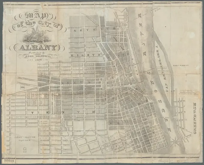
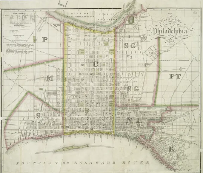
Historical City Maps of Massachusetts

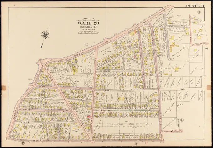
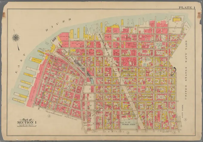
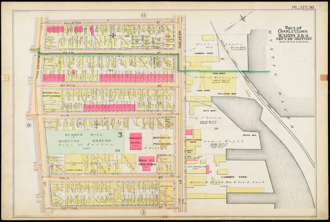
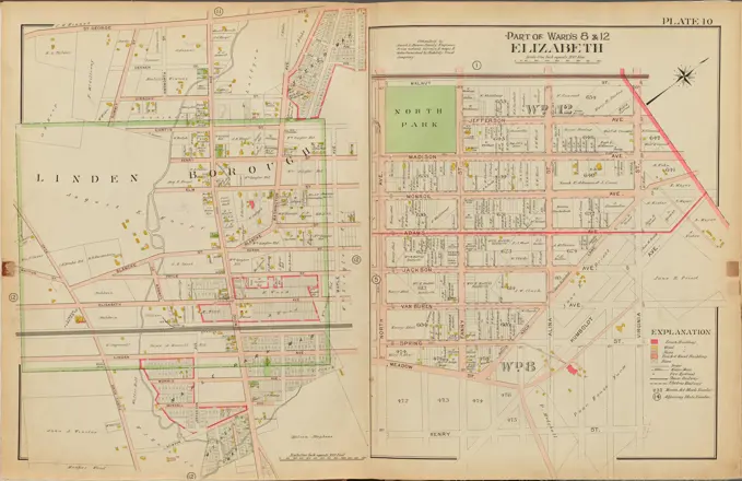
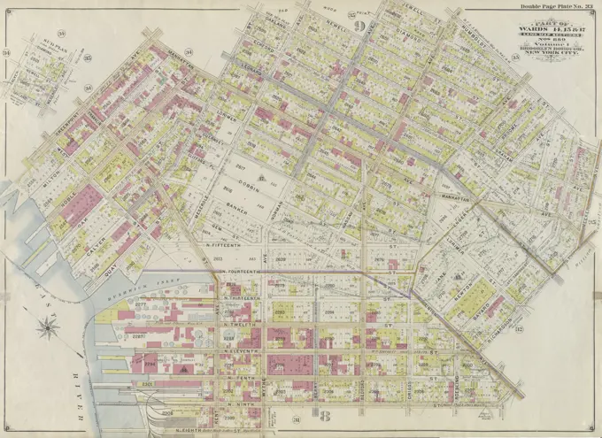
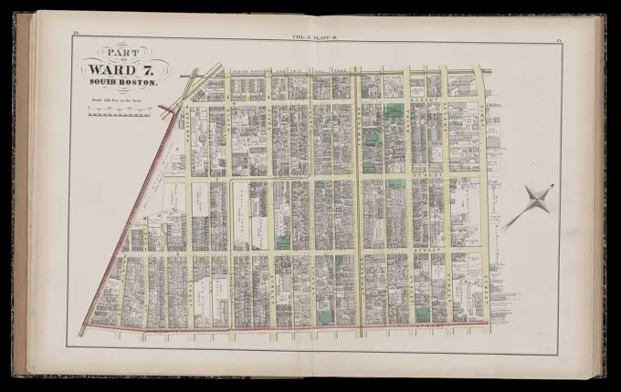
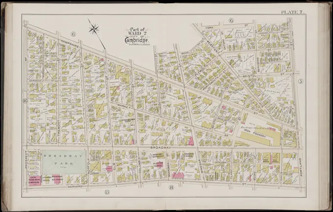
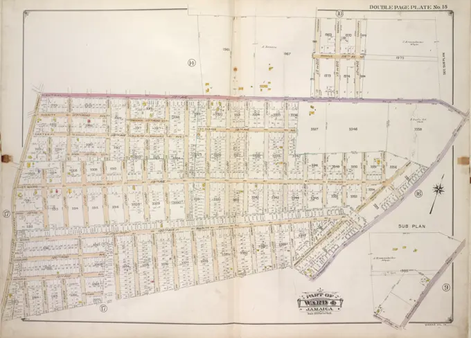
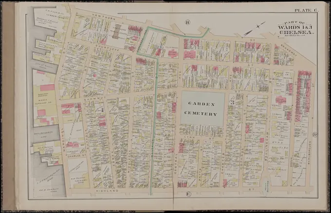
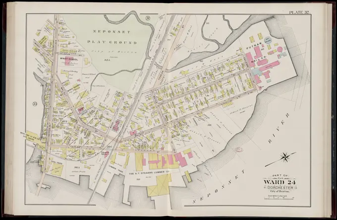
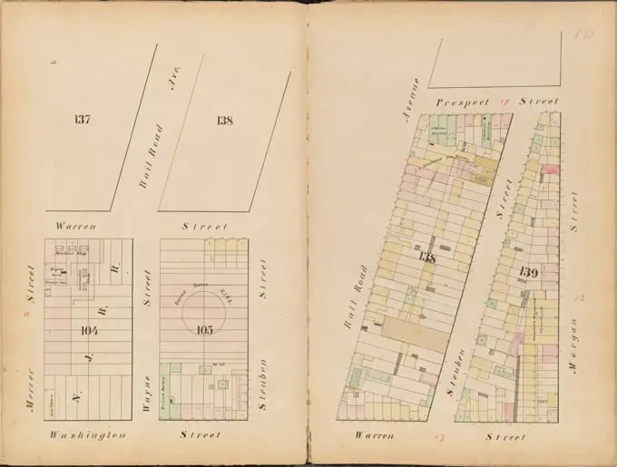
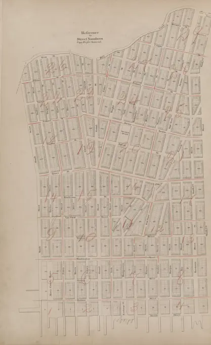
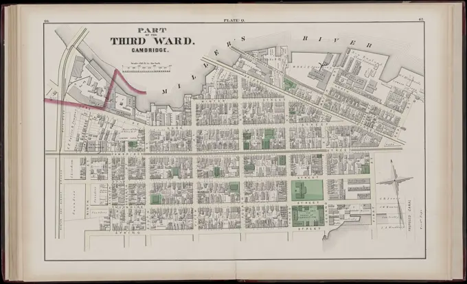
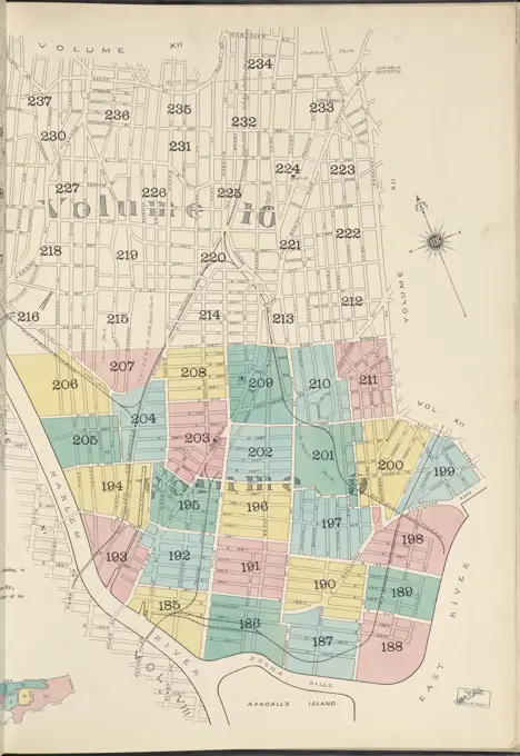
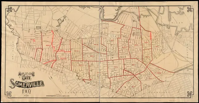
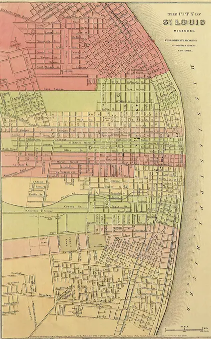
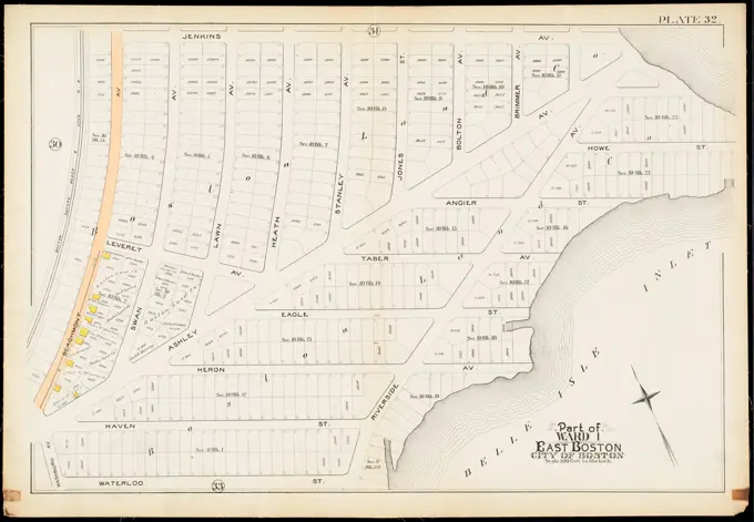
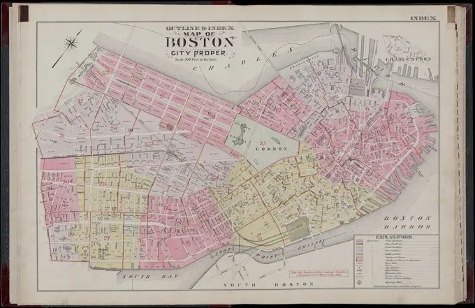
Colorful, detailed maps from the 19th century showing property lines and landowners in Cambridge and Boston, including notable areas like Dorchester and Brighton.

Atlas of the city of Cambridge, Massachusetts : from actual surveys and official plans. plate 20 , Real property, Massachusetts, Cambridge, Maps, Landowners, Massachusetts, Cambridge, Maps, Cambridge Mass., Maps Norman B. Leventhal Map Center Collection
Atlas of the city of Boston, Roxbury : plate 29 , Boston Mass., Maps, Real property, Massachusetts, Boston, Maps, Landowners, Massachusetts, Boston, Maps, Roxbury Boston, Mass., Maps Norman B. Leventhal Map Center CollectionCartographic, Maps. 1898. Lionel Pincus and Princess Firyal Map Division. Brooklyn (New York, N.Y.), Real property , New York (State) , New York Double Page Plate No. 19: Bounded by 92nd Street, Third Avenue, 91st Street, Fifth Avenue, 86th Street, Fort Hamilton Avenue (Smith Avenue) and (Proposed Bay Ridge Parkway) Narrows Avenue. Part of Ward 30, Land Map Section, No. 18. Volume 2, Brooklyn Borough, New York City.Newark, V. 2, Double Page Plate No. 53 Map bounded by Passaic River, Brown St., Cornelia St., Catherine St., Lexington St. Cartographic. Atlases, Maps. 1911-12. Lionel Pincus and Princess Firyal Map Division. Newark (N.J.)Newark, V. 2, Double Page Plate No. 46 Map bounded by Runyon St., Frelinghuysen Ave., Lehigh Ave., Mapes Ave. Cartographic. Atlases, Maps. 1911-12. Lionel Pincus and Princess Firyal Map Division. Newark (N.J.)Cartographic, Maps. 1925. Lionel Pincus and Princess Firyal Map Division. Real property , New York (State) , New York, Manhattan (New York, N.Y.) Plate 190, Part of Section 8: Bounded by Broadway, (Harlem River) Columbus Avenue and W. 214th StreetCartographic, Maps. 1898. Lionel Pincus and Princess Firyal Map Division. Brooklyn (New York, N.Y.), Real property , New York (State) , New York Double Page Plate No. 30: Bounded by Heyward Street, Harrison Avenue, Lynch Street, Broadway, Stockton Street, Marcy Avenue, Willoughby Avenue, Bedford Avenue, Flushing Avenue and Lee Avenue. Part of Wards 19 & 21. Land Map Sections, No. 6 & 8, Volume 1, Brooklyn Borough, New York City.Cartographic, Maps. 1880. Lionel Pincus and Princess Firyal Map Division. Brooklyn (New York, N.Y.), Real property , New York (State) , New York Plate 21: Bounded by Grand Street, First Street, N. 1st Street, Third Street, N. 2nd Street, Union Avenue, Twelfth Street, Broadway, S. 11th Street, and (East River) First Street. Plate 21: Part of Wards 13, 14, 15, 16 & 19 City of Brooklyn.Cartographic, Maps. 1879. Lionel Pincus and Princess Firyal Map Division. Real property , New York (State) , New York Plate 25: : Bounded by Twelfth Avenue, W. 101st Street, Ninth Avenue and W. 81st Street.Fire insurance district atlas showing the fire insurance districts of the city of Boston : fire insurance district no. 14 ; fire insurance district no. 15 , Real property, Massachusetts, Boston, Maps, Fire risk assessment, Massachusetts, Boston, Maps, Boston Mass., Maps Norman B. Leventhal Map Center CollectionCartographic, Maps. 1879. Lionel Pincus and Princess Firyal Map Division. Real property , New York (State) , New York Plate 22:: Bounded by E. 98th Street, (East River) Avenue B, E. 86th Street and Fifth Avenue. Part of Ward 12. New York City.Atlas of the city of Boston, Dorchester : from actual surveys and official plans : plate 8 , Real property, Massachusetts, Boston, Maps, Landowners, Massachusetts, Boston, Maps, Dorchester Boston, Mass., Maps Norman B. Leventhal Map Center CollectionAtlas of the city of Boston, Dorchester, Mass. : plate 11 , Boston Mass., Maps, Real property, Massachusetts, Boston, Maps, Landowners, Massachusetts, Boston, Maps, Dorchester Boston, Mass., Maps Norman B. Leventhal Map Center CollectionCartographic, Maps. 1916. Lionel Pincus and Princess Firyal Map Division. Atlases, Manhattan (New York, N.Y.), Real property , New York (State) , New York Plate 26: Bounded by Columbia Street, Avenue D, E. 8th Street, East River, and Stanton Street Part of Section 2Atlas of the city of Chelsea and the towns of Revere & Winthrop, Massachusetts : from actual surveys and official plans. plate 6 , Real property, Massachusetts, Chelsea, Maps, Landowners, Massachusetts, Chelsea, Maps, Chelsea Mass., Maps Norman B. Leventhal Map Center CollectionCartographic, Maps. 1879. Lionel Pincus and Princess Firyal Map Division. Real property , New York (State) , New York Plate 16:: Bounded by W. 62nd Street, Eight Avenue, W. 59th Street, Sixth Avenue, W. 50th Street and Eleventh Avenue. Part of Ward 22. New York City.Bromley, George Washington. Cartographic, Maps, Atlases, land surveys. 1908. Lionel Pincus and Princess Firyal Map Division. Brooklyn (New York, N.Y.) , Maps Plate 1: Bounded by Plymouth Street, Washington Street, John Street, Bridge Street, Marshall Street, Little Street, Evans Street, Hudson Avenue (United States Navy Yard), Prospect Street, Navy Street, Tillary Street, Fulton Street, Clark Street, Furman Street (East River Piers), Water Street, and Dock Street Plate 1: Part of Section 1Newark, V. 2, Double Page Plate No. 41 Map bounded by S. Orange Ave., Bergen St., Springfield Ave., 17th Ave., S. 20th St. Cartographic. Atlases, Maps. 1911-12. Lionel Pincus and Princess Firyal Map Division. Newark (N.J.)Atlas of the county of Suffolk, Massachusetts : vol. 4th including East Boston, city of Chelsea, Revere and Winthrop : from actual survey official records & private plans : plate C , Real property, Massachusetts, Chelsea, Maps, Landowners, Massachusetts, Chelsea, Maps, Chelsea Mass., Maps Norman B. Leventhal Map Center CollectionAtlas of the city of Boston, ward 26, Hyde Park : plate 5 , Boston Mass., Maps, Real property, Massachusetts, Boston, Maps, Landowners, Massachusetts, Boston, Maps, Hyde Park Boston, Mass., Maps Norman B. Leventhal Map Center CollectionBromley, George Washington. Cartographic, Maps, Atlases, land surveys. 1907. Lionel Pincus and Princess Firyal Map Division. Brooklyn (New York, N.Y.) , Maps Plate 3: Bounded by (Greenwood Cemetery) 37th Street, Fort Hamilton Avenue, West Street, 16th Avenue, 43rd Street & 9th Avenue Plate 3Atlas of the city of Boston : Charlestown : plate 10 , Boston Mass., Maps, Real property, Massachusetts, Boston, Maps, Landowners, Massachusetts, Boston, Maps, Charlestown Boston, Mass., Maps Norman B. Leventhal Map Center CollectionCartographic, Maps. 1917. Lionel Pincus and Princess Firyal Map Division. Real property , New York (State) , New York, Fire insurance , New York (State) , New York, Staten Island (New York, N.Y.) Staten Island, V. 1, Plate No. 41 Map bounded by St. Johns Ave., Bay, Tompkins Ave.Union County, Double Page Plate No. 10 Map bounded by Walnut St., Henry St., 40 Acre Rd., St. George Ave. 1906. Bauer, Jacob L.. Cartographic. Atlases, Maps. Lionel Pincus and Princess Firyal Map Division. Union County (N.J.)Atlas of the city of Boston, Dorchester : from actual surveys and official plans : plate 11 , Real property, Massachusetts, Boston, Maps, Landowners, Massachusetts, Boston, Maps, Dorchester Boston, Mass., Maps Norman B. Leventhal Map Center CollectionPlate 17: Map bounded by Division Street, Grand Street, Jackson Street, South Street, Montgomery Street. 1852, 1854, William Perris, New York, N.Y., USA.Plate 51, Part of Section 11, Borough of the Bronx. Bounded by E. 182nd Street, Bronx Park South, Boston Road, E. 180th Street, Bronx Street, E. Tremont Avenue and Mapes Avenue.Double Page Plate No. 43: Bounded by Pitkin Avenue, Berriman Street, New Lots Avenue and Williams Avenue.Plate 28, Part of Section 10, Borough of the Bronx. Bounded by Southern Boulevard, E. 163rd Street, Stebbins Avenue, E. 165th Street, Hall Place, and Home Street.Bromley, George Washington. Cartographic, Maps, Atlases, land surveys. 1907. Lionel Pincus and Princess Firyal Map Division. Brooklyn (New York, N.Y.) , Maps Plate 19: Bounded by Albemarle Avenue, Ocean Parkway, Church Avenue, Coney Island Avenue, Avenue A., Ocean Avenue, Ditmas Avenue, Coney Island Avenue, Ditmas Avenue and West Street. Plate 19E.B. Hyde & Co.. Cartographic, Maps. 1916. Lionel Pincus and Princess Firyal Map Division. Brooklyn (New York, N.Y.), Real property , New York (State) , New York, Maps Brooklyn, Vol. 2, Double Page Plate No. 21; Part of Ward 30, Section 18; Map bounded by 3rd Ave., Shore Road; Including 86th St.Double Page Plate No. 33 Bounded by Manhattan Avenue, Calyer Street, Oakland Street, Meserole Avenue, Newell Street, Norman Avenue, Jewell Street, Nassau Avenue, Humboldt Street, Meeker Avenue, Richardson Street, Union Avenue, N. Ninth Street, Wythe Avenue, N. Eighth Street, (East River) Kent Avenue, Quay Street, West Street, and Greenpoint Avenue, 1898. Additional, Part of Wards 14, 15 & 17. Land Map Sections, No. 8 & 9, Volume 1, Brooklyn Borough, New York City., 1898., New York. Publisher, E.B. Hyde & Co., Brooklyn (New York, N.Y.). Real property, New York (State), New YorkAtlas of the county of Suffolk, Massachusetts : vol. 3rd including Boston and Dorchester : from actual surveys and official records : plate B , Real property, Massachusetts, Boston, Maps, Landowners, Massachusetts, Boston, Maps, South Boston Boston, Mass., Maps Norman B. Leventhal Map Center CollectionBuffalo, V. 2, Double Page Plate No. 46 Map bounded by Griswold St., Cochrane St., Seneca St., Bailey Ave. Cartographic. Atlases, Maps. 1915. Lionel Pincus and Princess Firyal Map Division. Buffalo Metropolitan Area (N.Y.) , vMaps.Atlas of the city of Cambridge, Massachusetts : from actual surveys and official plans. plate 7 , Real property, Massachusetts, Cambridge, Maps, Landowners, Massachusetts, Cambridge, Maps, Cambridge Mass., Maps Norman B. Leventhal Map Center CollectionMap of Jersey City, New Jersey showing streets and lots, 1800 - 1900, Jersey City, N.J., Publisher, publisher not identified, 1 map ; 64 x 79 cm, on sheet 67 x 81 cmE.B. Hyde & Co.. Cartographic, Maps. 1916. Lionel Pincus and Princess Firyal Map Division. Brooklyn (New York, N.Y.), Real property , New York (State) , New York Brooklyn, Vol. 1, 2nd Part, Double Page Plate No. 45; Part of Wards 26, Section 13; Map bounded by McKinley Ave. (Magenta St.), Autumn Ave., McKinley Ave., boundary line of the boroughs of Brooklyn and Queens, Dumont Ave., Crystal Ave.; Including New Lots Ave., Berriman St., Atlantic Ave., Fountain Ave., McKinley Ave., Conduit Ave.Insurance maps of Boston volume 4 : comprising portions of Charlestown, East Cambridge, Cambridge Port, Old Cambridge & Somerville : plate 99 , Fire risk assessment, Massachusetts, Cambridge, Maps, Cambridge Mass., Maps Norman B. Leventhal Map Center CollectionNewark, V. 1, Double Page Plate No. 10 Map bounded by Crane St., Clark St., Passaic River, Cross St., Grant St., State St., Nassau St., Boyden St., Sheffield St. Cartographic. Atlases, Maps. 1911-12. Lionel Pincus and Princess Firyal Map Division. Newark (N.J.)E.B. Hyde & Co.. Cartographic, Maps. 1905. Lionel Pincus and Princess Firyal Map Division. Brooklyn (New York, N.Y.) , Maps, Real property , New York (State) , New York Brooklyn, Vol. 4, Double Page Plate No. 4; Part of Wards 26 & 32; Sections 12; Map bounded by Lott Ave., Powell St.; Including Avenue D, East Ninetyeight St.; Sub Plan; Map bounded by Rockaway Ave., Avenue D, Chester St.Cartographic, Maps. 1907 - 1908. Lionel Pincus and Princess Firyal Map Division. Flushing (New York, N.Y.) Queens, Vol. 2, Double Page No. 7; Part of Long Island City Ward One (Part of Old Wards 3 & 4); Map bounded by Webster Ave., Washington Ave., Pierce Ave., Graham Ave., Franklyn Ave., Vernon Ave., Broadway, Jamaica Ave., Rapelje Ave., 4th Ave., 3rd Ave., Debevoise Ave., 2nd Ave., 1st Ave., Vanalst Ave., Hopkins Ave., Ely Ave.; Including Lathrop St., Lockwood St., Academy St., Crescent St., Prospect St., Catherine St., William St., Spring St., Fulton St., Greenwich St., Henry St., Jay St., Front St., Sunswick St., Emerald St., Remsen St., Marion St., Radde St., Ridge St., Sherman St., Warren St., Hancock St., Hamilton St., Rutledge St., Camelia St., Lincoln St.Atlas of the city of Boston, Dorchester : from actual surveys and official plans : plate 37 , Real property, Massachusetts, Boston, Maps, Landowners, Massachusetts, Boston, Maps, Dorchester Boston, Mass., Maps Norman B. Leventhal Map Center CollectionCartographic, Maps. 1955 - 1956. Lionel Pincus and Princess Firyal Map Division. Real property , New York (State) , New York (N.Y.), Manhattan (New York, N.Y.) Outline and Index Map of Borough of Manhattan. Battery to 14th St.Hudson County, V. 1, Double Page Plate No. 12 Map bounded by Paterson Plank Rd., South St., Nelson Ave., Seacaucus Rd. Cartographic. Atlases, Maps. 1908 - 1909. Lionel Pincus and Princess Firyal Map Division. Jersey City (N.J.), Hudson County (N.J.)Cartographic, Maps. 1880. Lionel Pincus and Princess Firyal Map Division. Brooklyn (New York, N.Y.), Real property , New York (State) , New York Plate 5: Bounded by Baltic Street, Fifth Avenue, Second Street and Hoyt Street. Plate 5: Part of Wards 10 & 22.Bergen County, V. 2, Double Page Plate No. 14 Map bounded by Essex St., Terrace Ave., Williams Ave., Main St. Cartographic. Atlases, Maps. 1912 - 1913. Lionel Pincus and Princess Firyal Map Division. Bergen County (N.J.)Jansen Hermann (1869-1945), development proposal African Straße, Berlin-Wedding (06.03.1916): Grund- und Dialtplan 1: 2000. Pressure on paper, 51.8 x 70.9 cm (including scan edges) Jansen Hermann  (1869-1945): Bebauungsvorschlag Afrikanische Straße, Berlin-WeddingCartographic, Maps. 1868. Lionel Pincus and Princess Firyal Map Division. Brooklyn (New York, N.Y.), Fire insurance , New York (State) , New York Brooklyn, Vol. 4, Double Page Plate No. 67; Map bounded by Wythe Ave., North 6th St., East River, Kent Ave.; Including North 12th St., North 11th St., North 10th St., North 9th St., North 8th St., North 7th St.Cartographic, Maps. 1913. Lionel Pincus and Princess Firyal Map Division. Bronx (New York, N.Y.), New York (N.Y.) Plate 16 Map bounded by Burke Ave., Laconia Ave., Allerton Ave., Bronx Park EastCartographic, Maps. 1908 - 1913. Lionel Pincus and Princess Firyal Map Division. Queens (New York, N.Y.), Long Island City (New York, N.Y.) Queens, Vol. 3, Double Page Plate No. 5; Part of ward Three Flushing. Map bounded by Linden Ave., Bayside Ave., Clinton Ave., Myrtle Ave., Lawrence Ave., Tailor Ave., Congress Ave., Madison Ave., Bradford Ave., Prospect Ave., Jaggar Ave., Jamaica Ave.; Including Farrington St., Bradley St., Downing St., Higgins St., Center St., Orchard St., Miller St., Park Pl., Prince St., Collins Pl., Pine St., Myrtle St., State St., Bridge St., Old Lawrence St., Lawrence St., Warren St., Hamilton St., Sylvester St., Main St., Union St., Washing St., Garden St., Lincoln St., Church St., Locust St., Amity St., Cedar St., Grove St., W. Grove St., Charles St.E.B. Hyde & Co.. Cartographic, Maps. 1916. Lionel Pincus and Princess Firyal Map Division. Brooklyn (New York, N.Y.), Real property , New York (State) , New York, Maps Brooklyn, Vol. 2, Double Page Plate No. 14; Part of Ward 30, Section 17; Map bounded by 45th St., 15th Ave., 61st St.; Including 8th Ave., 49th St., 9th Ave.Cartographic, Maps. 1918. Lionel Pincus and Princess Firyal Map Division. Queens (New York, N.Y.), Real property , New York (State) , New York , Queens (Borough) Queens, Vol. 1A, Double Page Plate No. 15; Part of Ward 4 Jamaica. Map bounded by 117th Ave., 202nd St., 203rd St., 204th St., Springfield Rd., 117th Ave., Farmers Blvd.; Sub Plan; Map bounded by Springfield Rd., 117th Ave.Cartographic, Maps. 1917. Lionel Pincus and Princess Firyal Map Division. Staten Island (New York, N.Y.) Plate 27, Part of Wards 1 & 2 Map bound by Dongan Ave, Fairview Ave, Knox PL (1st St), Slosson Ave, Richmond Turnpike, Clove Road, Schoharie St, Cayuga St, Oswego St, Saratoga Ave, Little Clove Road, Ocean Terrace, Chestnut Ave, Todt Hill Road, Schmidts Lane, Manor RoadAtlas of the city of Somerville, Massachusetts : from actual surveys and official plans. plate 25 , Real property, Massachusetts, Somerville, Maps, Landowners, Massachusetts, Somerville, Maps, Somerville Mass., Maps Norman B. Leventhal Map Center CollectionAtlas of the city of Cambridge, Massachusetts : from actual surveys and official plans. plate 15 , Real property, Massachusetts, Cambridge, Maps, Landowners, Massachusetts, Cambridge, Maps, Cambridge Mass., Maps Norman B. Leventhal Map Center CollectionHudson County, V. 1, Double Page Plate No. 18 Map bounded by Van Horne St., Grand St., New York Bay Cartographic. Atlases, Maps. 1908 - 1909. Lionel Pincus and Princess Firyal Map Division. Jersey City (N.J.), Hudson County (N.J.)Cartographic, Maps. 1884 - 1936. Lionel Pincus and Princess Firyal Map Division. Fire insurance , New York (State), Real property , New York (State), Cities & towns , New York (State) Brooklyn Vol. B Plate No. 193 Map bounded by E. 16th St., Voorhies Ave., E. 19th St., Sheepshead BayCartographic, Maps. 1886. Lionel Pincus and Princess Firyal Map Division. Brooklyn (New York, N.Y.), Real property , New York (State) , New York Plate 19: Bounded by Stuyvesant Avenue, Fulton Street, Utica Avenue, Atlantic Avenue, Brooklyn Avenue, Fulton Street, Tompkins Street and Lafayette Avenue. Plate 19: Part of Wards 23 & 25. Brooklyn, N.Y.Hudson County, V. 1, Double Page Plate No. 28 Map bounded by Hackensack River, Boyd Ave., West Side Ave., Newark Bay Cartographic. Atlases, Maps. 1908 - 1909. Lionel Pincus and Princess Firyal Map Division. Jersey City (N.J.), Hudson County (N.J.)Part of Long Island City, Ward No. 1 & 3.Plan no. 1 of building lots near Spring St. Station West Roxbury belonging to the West Roxbury Land Co , Real property, Massachusetts, Boston, Maps, West Roxbury Boston, Mass., Maps, West Roxbury Boston, Mass. Norman B. Leventhal Map Center CollectionParts of the City Auburn. Wards 6.&10. Cartographic. Atlases, Maps. 1882. Lionel Pincus and Princess Firyal Map Division. Auburn (N.Y.)Hudson County, V. 2, Double Page Plate No. 22 Map bounded by Passaic River, Central Ave., Davis Ave., S. 7th St. Cartographic. Atlases, Maps. 1908 - 1909. Lionel Pincus and Princess Firyal Map Division. Jersey City (N.J.), Hudson County (N.J.)Atlas of the city of Chelsea and the towns of Revere and Winthrop : from actual surveys and official plans. plate C , Real property, Massachusetts, Chelsea, Maps, Landowners, Massachusetts, Chelsea, Maps, Chelsea Mass., Maps Norman B. Leventhal Map Center CollectionAtlas of the city of Boston, Dorchester, Mass., vol. 5 : from actual surveys and official plans : plate 32 , Real property, Massachusetts, Boston, Maps, Landowners, Massachusetts, Boston, Maps, Dorchester Boston, Mass., Maps Norman B. Leventhal Map Center CollectionOld map of New York, USA.Jersey City, V. 1, Double Page Plate No. 12 Map bounded by Prospect St., Morgen St., Warren St., Washington St., Mercer St. Cartographic. Atlases, Maps. 1866. Lionel Pincus and Princess Firyal Map Division. Jersey City (N.J.), Fire insurance , New Jersey , Jersey CityCartographic, Maps. 1896. Lionel Pincus and Princess Firyal Map Division. Fire insurance , New York (State), Real property , New York (State), Cities & towns , New York (State) Bronx, V. 12, Double Page Plate No. 266 1/2 Map bounded by Kingbridge Rd., Anthony Ave., E. 184th St., Fordham Rd., Harlem RiverMap of the city of Albany Cartographic. Maps, Cadastral maps. 1871. Lionel Pincus and Princess Firyal Map Division. Real property , New York (State) , Albany, Albany (N.Y.), Albany (N.Y.) , Administrative and political divisionsCartographic, Maps. 1918. Lionel Pincus and Princess Firyal Map Division. Queens (New York, N.Y.), Real property , New York (State) , New York , Queens (Borough) Queens, Vol. 1A, Double Page Plate No. 1; Part of Ward 4 Jamaica. Map bounded by Boundary between 3rd and 4th Ward, Road avon Road, Hillside Ave.; Including Jamaica Ave., Hardenbrook St., Park Ave.Outline & index map of Boston city proper , Boston Mass., Maps, Real property, Massachusetts, Boston, Maps, Landowners, Massachusetts, Boston, Maps Norman B. Leventhal Map Center CollectionPlan of the city of Philadelphia, 1830, by Carey & Hart., 1830., Philadelphia, Pa. Publisher, E.L. Carey & A. Hart., 1 hand-colored map; dimensions 39 x 44 cm. The map includes administrative and political divisions of PhiladelphiaReference to street numbers, 1866, I.B. Culver & Co., 1866, Jersey City, N.J., Publisher, I.B. Culver & Co., Fire insurance, New Jersey, Jersey CityAtlas of the city of Cambridge, Middlesex Co., Massachusetts. plate Q , Real property, Massachusetts, Cambridge, Maps, Landowners, Massachusetts, Cambridge, Maps, Cambridge Mass., Maps Norman B. Leventhal Map Center CollectionHudson County, V. 2, Double Page Plate No. 11 Map bounded by Oak St., 5th St., Hudson Ave., Dubois St. Cartographic. Atlases, Maps. 1908 - 1909. Lionel Pincus and Princess Firyal Map Division. Jersey City (N.J.), Hudson County (N.J.)Part of the village of South Orange. Double Page Plate No. 22 Map bounded by Ridgewood Rd., Berkeley Ave., Charlton Ave., Grove Rd., Riggs Pl., 3rd St. Cartographic. Atlases, Maps, Cadastral maps. 1904. Lionel Pincus and Princess Firyal Map Division. Essex County (N.J.), Real property , New Jersey , Essex County (N.J.)Cayuga County, Left Page Plate No. 2 Map bounded by Frederick St., Hamilton St. Cartographic. Atlases, Maps. 1904. Lionel Pincus and Princess Firyal Map Division. Real property , New York (State) , Herkimer County, Herkimer County (N.Y.) , Description and travelNewark, V. 2, Double Page Plate No. 49 Map bounded by Harper St., Concord St., Elizabeth Ave. Cartographic. Atlases, Maps. 1911-12. Lionel Pincus and Princess Firyal Map Division. Newark (N.J.)Cartographic, Maps. 1891. Lionel Pincus and Princess Firyal Map Division. Fire insurance , New York (State), Real property , New York (State), Cities & towns , New York (State) KeyMap of property at Van Buren Harbor, Chautauqua County, New York, issued in 1836. The map measures 99 x 73 cm, displayed on a sheet of 112 x 77 cm. Publisher not identified. The map features details related to real property and harbors in Van Buren Point, New YorkCartographic, Maps. 1886. Lionel Pincus and Princess Firyal Map Division. Brooklyn (New York, N.Y.), Real property , New York (State) , New York Plate 1: Pier area from the Navy Yard to Clark Street.Cartographic, Maps. 1880. Lionel Pincus and Princess Firyal Map Division. Brooklyn (New York, N.Y.), Real property , New York (State) , New York Vol. 5. Plate, O. Map bound by Court St., Lorraine St., Columbia St., Carroll St.; Including Clinton St., Henry St., Manhasset Place, Hicks St., Hamilton Ave., First Place, Summit St., Second Place, Woodhull St., Third Place, Papelye St., Fourth Place, Coles St., Luquer St., Nelson St., Huntington St., Church St., Mill St., Centre St., Bush St.Map of the city of Somerville, 1907 , Election districts, Massachusetts, Somerville, Somerville Mass., Maps Norman B. Leventhal Map Center CollectionVol. 6. Plate, P. Map bound by Ten Eyck St., Old Bushwick Ave., Broadway, Boerum St., Union Ave.; Including Stagg St., Scholes St., Meserole St., Montrose Ave., Johnson St., Lorimer St., Leonard St., Ewen St., Graham Ave., Humboldt St., Bushwick Ave.St. Louis in 1865, Colton, G.W. Map of property at Van Buren Harbor, Chatauque Co. N.Y. Cartographic. Maps, Bathymetric maps, Cadastral maps. 1836. Lionel Pincus and Princess Firyal Map Division. Harbors , New York (State) , Van Buren Point (N.Y.), Real property , New York (State) , Van Buren Point (N.Y.), Van Buren Point (N.Y.)Cartographic, Maps. 1897. Lionel Pincus and Princess Firyal Map Division. Fire insurance , New York (State), Real property , New York (State), Cities & towns , New York (State) Bronx, V. B, Plate Letter. C Map bounded by Long Island Sound, Centre Ave., Eastchester Bay, Bay Ave., Adams St., Cemetery LaneAtlas of the city of Boston : East Boston, Mass. : plate 32 , Boston Mass., Maps, Real property, Massachusetts, Boston, Maps, Landowners, Massachusetts, Boston, Maps, East Boston Boston, Mass., Maps Norman B. Leventhal Map Center CollectionCartographic, Maps. 1884 - 1936. Lionel Pincus and Princess Firyal Map Division. Fire insurance , New York (State), Real property , New York (State), Cities & towns , New York (State) Queens V. 6, Plate No. 104 Map bounded by 155th St., 159th St., ConduitE.B. Hyde & Co.. Cartographic, Maps, Index maps. 1904 - 1912. Lionel Pincus and Princess Firyal Map Division. Brooklyn (New York, N.Y.) , Maps, Real property , New York (State) , New York Index to Volume Three. Atlas of the Borough of Brooklyn. Sections 8, 9, 10 & 11. Wards 13, 14, 15, 16, 17, 18, 19, 27 & 28. City of New York. E. Belcher Hyde, 97 Liberty St., Brooklyn Borough. 1904.Cartographic, Maps. 1909. Lionel Pincus and Princess Firyal Map Division. Fire insurance , New York (State), Real property , New York (State), Cities & towns , New York (State) KeyCartographic, Maps. 1913. Lionel Pincus and Princess Firyal Map Division. Queens (New York, N.Y.), Real property , New York (State) , New York , Queens (Borough) Queens, V. 1, Double Page Plate No. 6; Part of Jamaica, Ward 4; Map bounded by Atlantic Ave., Van Wyck Ave., Roanoke Ave., Walnut St.Buffalo, V. 3, Double Page Plate No. 5 Map bounded by Town of Hamburg, Erie Rail Rd. Cartographic. Atlases, Maps. 1915. Lionel Pincus and Princess Firyal Map Division. Buffalo Metropolitan Area (N.Y.) , vMaps.Newark, Double Page Plate No. 16 Map bounded by 8th Ave., High St., Central Ave., 1st St. 1889. Cartographic. Atlases, Maps, Plans, Surveying. Lionel Pincus and Princess Firyal Map Division. Newark (N.J.)Atlas of the city of Boston, Boston proper : from actual surveys and official plans : index map , Boston Mass., Maps Norman B. Leventhal Map Center CollectionNewark, V. 1, Double Page Plate No. 14 Map bounded by Halleck St., Grafton Ave., Passaic River, Delavan Ave., Parker St. Cartographic. Atlases, Maps. 1911-12. Lionel Pincus and Princess Firyal Map Division. Newark (N.J.)Union County, Double Page Plate No. 35 Map bounded by Green Brook, Sherman Ave., W. 7th St., Elk St., Jefferson Ave. 1906. Bauer, Jacob L.. Cartographic. Atlases, Maps. Lionel Pincus and Princess Firyal Map Division. Union County (N.J.)Atlantic City, Double Page Plate No. 13 Map bounded by Inside Thoroughfare, Boston Ave., Atlantic Ave., Jackson Ave., 1896. Published by A.H. Mueller Co., PhiladelphiaAtlas of the city of Chelsea and the towns of Revere and Winthrop : from actual surveys and official plans. plate C , Real property, Massachusetts, Chelsea, Maps, Landowners, Massachusetts, Chelsea, Maps, Chelsea Mass., Maps Norman B. Leventhal Map Center CollectionCartographic, Maps. 1880. Lionel Pincus and Princess Firyal Map Division. Brooklyn (New York, N.Y.), Real property , New York (State) , New York Vol. 6. Plate, P. Map bound by Ten Eyck St., Old Bushwick Ave., Broadway, Boerum St., Union Ave.; Including Stagg St., Scholes St., Meserole St., Montrose Ave., Johnson St., Lorimer St., Leonard St., Ewen St., Graham Ave., Humboldt St., Bushwick Ave.Plan of the city of New-York Cartographic. Maps. 1832. Lionel Pincus and Princess Firyal Map Division. Manhattan (New York, N.Y.) , Maps, New York (N.Y.) , Administrative and political divisions , Maps, New York (N.Y.) , Maps