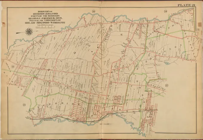
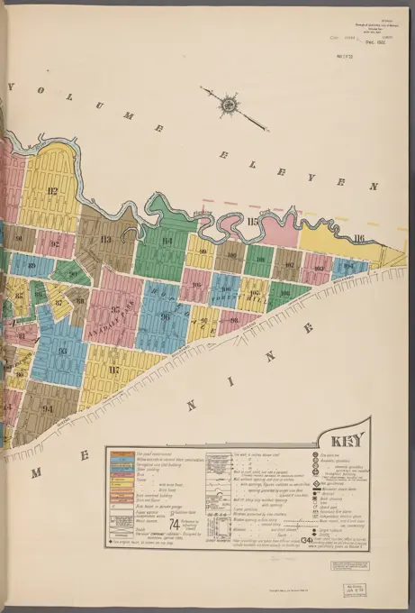
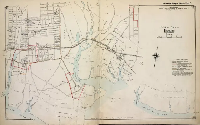
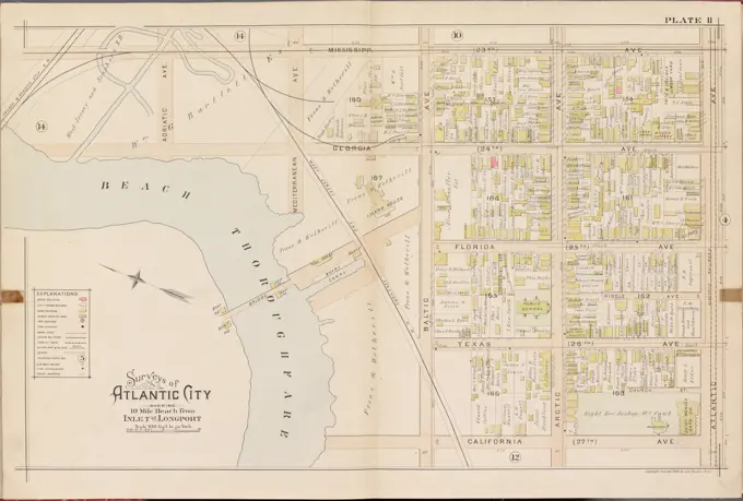
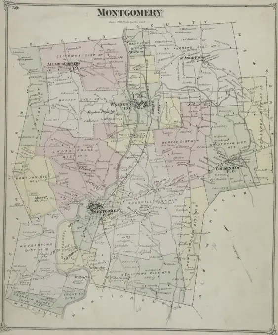
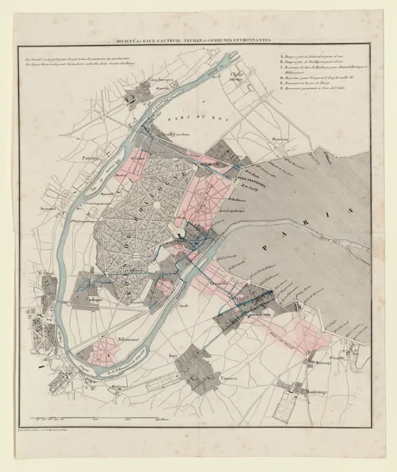
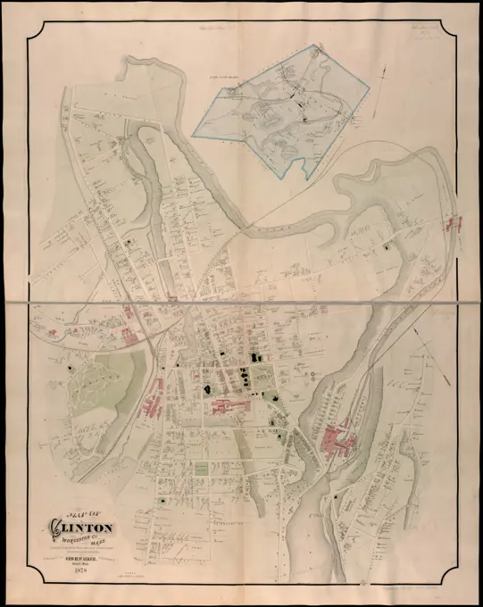
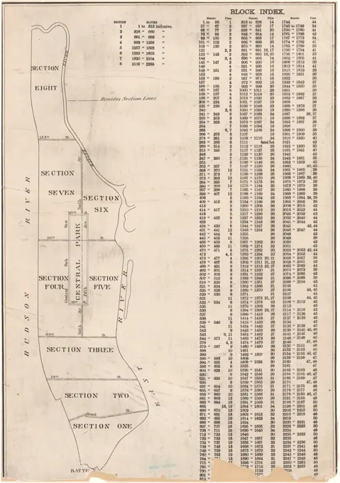
Historical Maps of Boston and New York

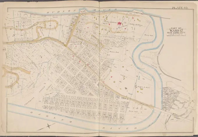
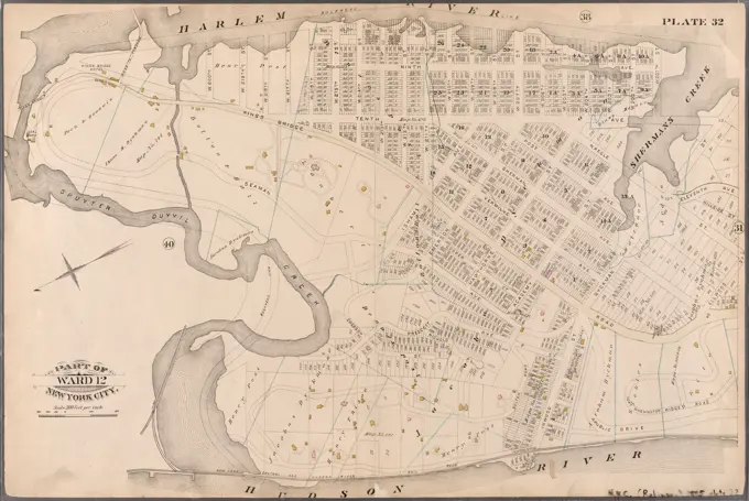
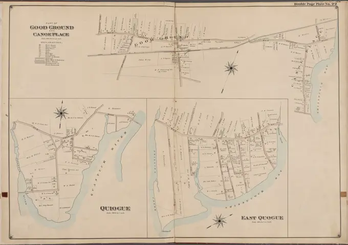
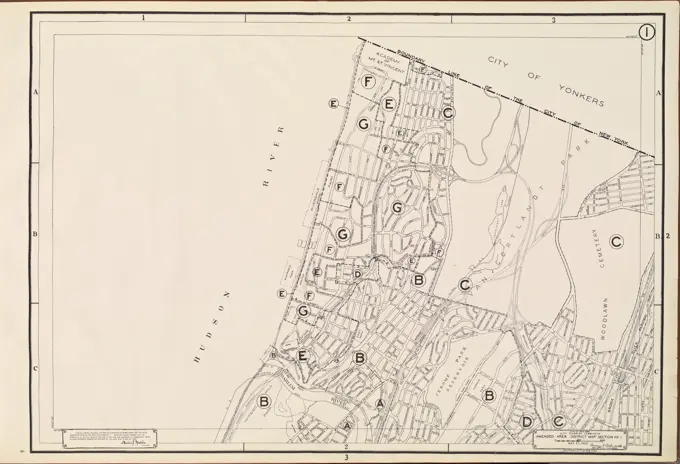
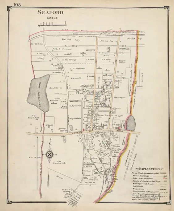
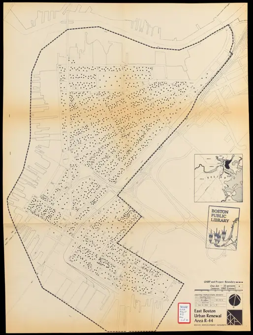
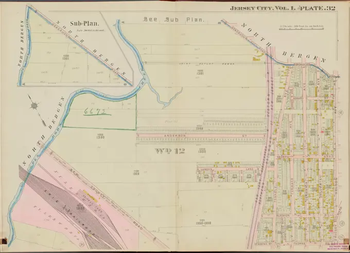
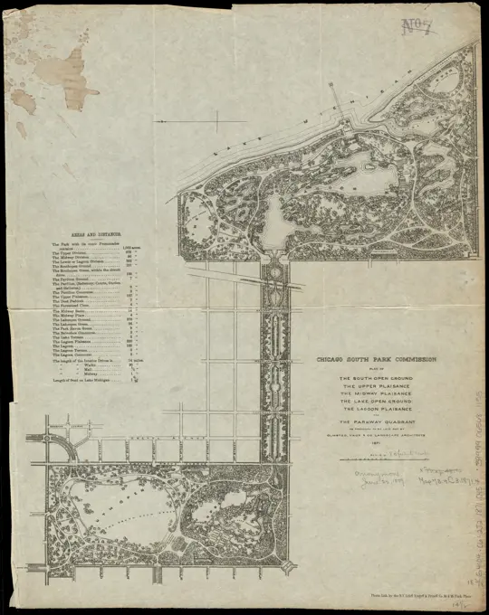
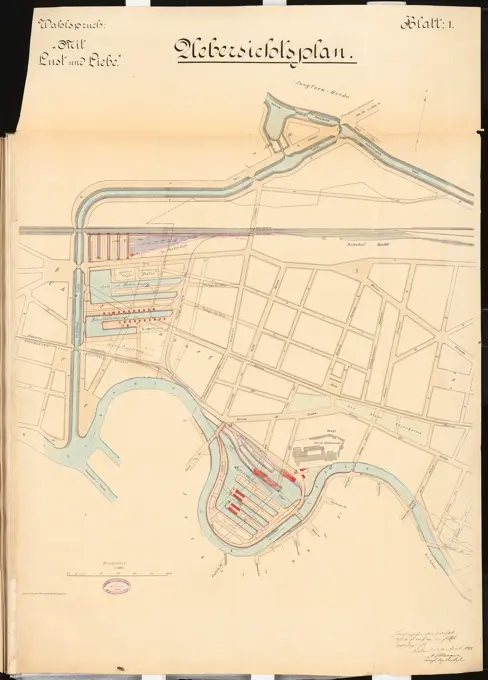
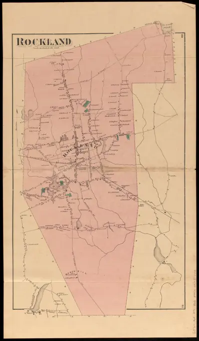
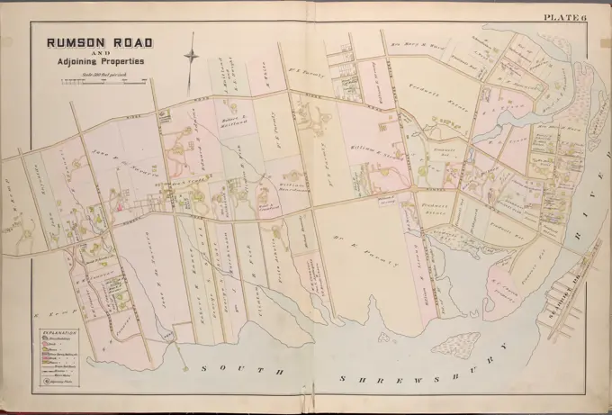
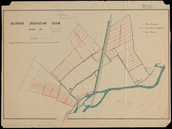
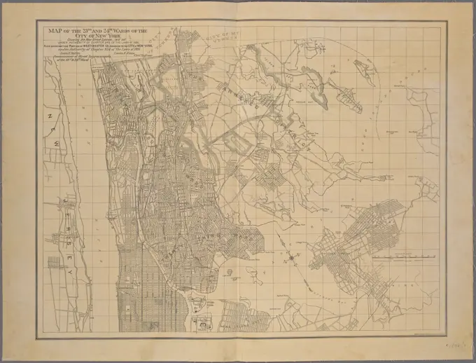
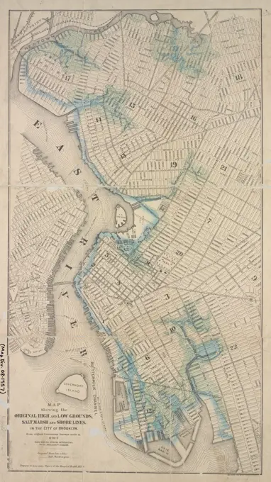
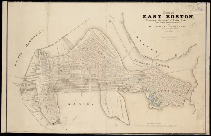
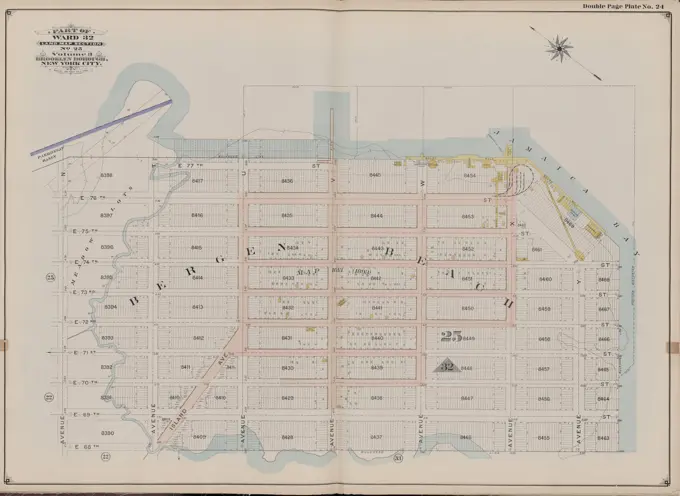
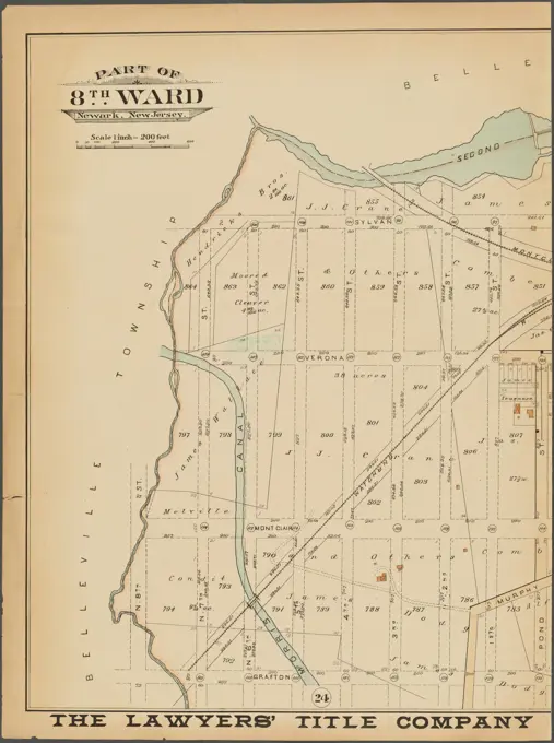
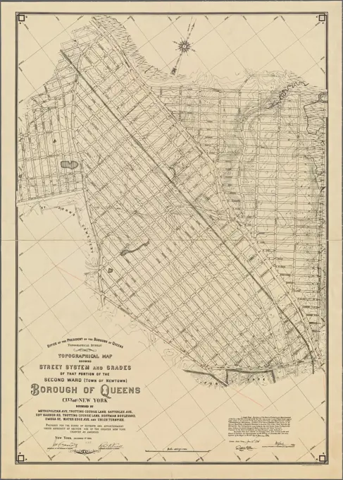
Antique maps illustrating various wards and neighborhoods in Boston and New York, highlighting land ownership and property details from the late 19th century.

Map of the city of Lynn Massachusetts , Real property, Massachusetts, Lynn, Maps, Landowners, Massachusetts, Lynn, Maps, Lynn Mass., Maps Norman B. Leventhal Map Center Collection
Cartographic, Maps. 1891. Lionel Pincus and Princess Firyal Map Division. Manhattan (New York, N.Y.), Real property , New York (State) , New York Plate 45 Map bounded by Hudson River, Harlem RiverCartographic, Maps. 1885. Lionel Pincus and Princess Firyal Map Division. Real property , New York (State) , New York, New York (N.Y.) Plate 32: Bounded by Harlem River, W. 120th Street, Tenth Avenue, Dyckman Street, Naegle Street, Ellwood Street, Kings Bridge Road, Inwood Street, Hudson River, and Spuyten Duyvil Creek. Part of Ward 12, New York City.City of Lawrence , Lawrence Mass., Administrative and political divisions, Maps Norman B. Leventhal Map Center CollectionSuffolk County, V. 1, Double Page Plate No. 22 Map bounded by Part of Good Ground and Canoeplace, East Quogue, Quiogue Cartographic. Atlases, Maps. 1902 - 1909. Lionel Pincus and Princess Firyal Map Division. Suffolk County (N.Y.)Cartographic, Maps. 1953-05-27. Lionel Pincus and Princess Firyal Map Division Area Zoning Map Section No. 1Newark, V. 2, Double Page Plate No. 59 Map bounded by Concord St., Avenue E, Fenwick St., Frelinghuysen Ave. Cartographic. Atlases, Maps. 1911-12. Lionel Pincus and Princess Firyal Map Division. Newark (N.J.)Map of Boston and vicinity , Boston Mass., Maps Norman B. Leventhal Map Center CollectionSeaford Cartographic. Atlases, Maps. 1914. Lionel Pincus and Princess Firyal Map Division. Nassau County (N.Y.) , Maps, Real property , New York (State) , Nassau CountyEast Boston urban renewal area r-44 : existing population density , East Boston Boston, Mass., Maps, City planning, Massachusetts, Boston, Maps, Population density, Massachusetts, Boston, Maps, Urban renewal, Massachusetts, Boston, MapsSheet 1: Map encompassing Sunset Park, Greenwood Cemetery, Gowanus Canal and Greenwood Heights.Atlas of the city of Chelsea and the towns of Revere & Winthrop, Massachusetts : from actual surveys and official plans. plate 15 , Real property, Massachusetts, Revere, Maps, Landowners, Massachusetts, Revere, Maps, Revere Mass., Maps Norman B. Leventhal Map Center CollectionAtlas of the city of Boston : Roxbury : plate T , Boston Mass., Maps, Real property, Massachusetts, Boston, Maps, Landowners, Massachusetts, Boston, Maps, Fenway Boston, Mass., Maps Norman B. Leventhal Map Center CollectionAtlas of the towns of Revere and Winthrop, Suffolk County, Massachusetts. sheet 5 , Real property, Massachusetts, Revere, Maps, Landowners, Massachusetts, Revere, Maps, Revere Mass., Maps Norman B. Leventhal Map Center CollectionNew York State, Plate No. 13 Map of city of Albany Cartographic. Atlases, Maps. 1895. Lionel Pincus and Princess Firyal Map Division. New York (State) - - vMaps.Hudson County, V. 1, Double Page Plate No. 32 Map bounded by Seacaucus Rd., Nelson Ave., Thorne St., North Bergen Cartographic. Atlases, Maps. 1908 - 1909. Lionel Pincus and Princess Firyal Map Division. Jersey City (N.J.), Hudson County (N.J.)Newark, V. 2, Double Page Plate No. 60 Map city of Newark Cartographic. Atlases, Maps. 1911-12. Lionel Pincus and Princess Firyal Map Division. Newark (N.J.)Plan of the South Open Ground, the Upper Plaisance, the Midway Plaisance, the Lake Open Ground, the Lagoon Plaisance and the Parkway Quadrant : as proposed to be laid out by Olmsted, Vaux & Co. landscape architects. Oriented with north to the left. Includes table of areas and distances. "Photo lith by the N.Y. Lithg. Engrg. & Printg. Co.". America Transformed: As people flocked to cities in the late 19th century, Americans recognized that cities lacked space where locals could enjoy nature and its health benefits. In 1869, Chicago decided that it needed a system of parks and green boulevards. City officials hired Frederick Law Olmsted, who had designed New York City's Central Park and Boston's Emerald Necklace. This plan, published in 1871, offers a vision of Chicago with open lawns, trees, and a lagoon along Lake Michigan. This site was chosen for the location of the 1893 Chicago World's Fair, and today this chain of green spaces is Washington Park, the Midway Plaisance, and Jackson PA map of the town of Providence from actual survey , Providence R.I., Maps, Facsimiles Norman B. Leventhal Map Center CollectionQueens, Vol. 3, Double Page Plate No. 4; Part of ward Three College Point. Map bounded by 11th Ave., 10th Ave., 7th Ave., 6th Ave., Linden Ave., 5th Ave., Simths Lane, 4th Ave., Lawrence Ave., 3rd Ave., Nostrand Lane, Old Flushing Rd., Whitestone.Atlas of the city of Boston, East Boston : plate 27 , Boston Mass., Maps, Real property, Massachusetts, Boston, Maps, Landowners, Massachusetts, Boston, Maps, East Boston Boston, Mass., Maps Norman B. Leventhal Map Center CollectionAtlas of the city of Cambridge, Middlesex Co., Massachusetts. plate N , Real property, Massachusetts, Cambridge, Maps, Landowners, Massachusetts, Cambridge, Maps, Cambridge Mass., Maps Norman B. Leventhal Map Center CollectionPart of Town of Easthampton Cartographic. Atlases, Maps. 1915 - 1917. Lionel Pincus and Princess Firyal Map Division. Suffolk County (N.Y.)Proposed street railroad over the Back Bay to Brookline , Street-railroads, Massachusetts, Boston, Maps, Boston Mass., Maps Norman B. Leventhal Map Center CollectionCity atlas of Boston, Massachusetts : complete in one volume : from official records, private plans and actual surveys : plate 8 , Real property, Massachusetts, Boston, Maps, Landowners, Massachusetts, Boston, Maps, Boston, Mass., Maps Norman B. Leventhal Map Center CollectionUthemann Maximilian, port facility on the Unterpree in Berlin with a harbor railway. Schinkel competition 1888 (03.04.1888): Department 1: 4000. Ink, ink colored, watercolor on cardboard, 101.7 x 73.1 cm (including scan edges) Uthemann Maximilian : Hafenanlage mit Hafenbahn an der Unterspree, Berlin. Schinkelwettbewerb 1888Essex County, V. 3, Double Page Plate No. 3 Map bounded by Hawthorne Ave., Meeker Ave., Weequahic Ave., Lyons Ave., Clinton Pl. A.H. Mueller (Publisher). Cartographic. Atlases, Maps. 1906. Lionel Pincus and Princess Firyal Map Division. Essex County (N.J.), Newark (N.J.)Atlas of the city of Boston, East Boston : plate 27 , Boston Mass., Maps, Real property, Massachusetts, Boston, Maps, Landowners, Massachusetts, Boston, Maps, East Boston Boston, Mass., Maps Norman B. Leventhal Map Center CollectionRockland. Relief shown by hachures. Shows residences and landownership. Pages 30-31 from an undetermined atlas. Does not show adjacent town of Whitman (established 1875).... , Massachusetts  , Plymouth  ,county   , RocklandAtlas of the city of Boston, Brighton : plate 21 , Boston Mass., Maps, Real property, Massachusetts, Boston, Maps, Landowners, Massachusetts, Boston, Maps, Allston Boston, Mass., Maps Norman B. Leventhal Map Center CollectionMonmouth County, Double Page Plate No. 6 Map of Rumson Rd., and Adjaining Properties 1889. Breou, Forsey. Cartographic. Atlases, Maps, Surveys, Plans. Lionel Pincus and Princess Firyal Map Division. Monmouth County (N.J.)The Firemen's Guide A map of the City of New York, showing fire districts, fire limits, hydrants, public cisterns, fire stations, and firefighting equipment. Issued in 1834 by P. Desobry under the direction of U. Wenman, the map measures 41 x 50 cm and is hand-colored. It details fire protection districts and various firefighting resources within New York StateMap of Staten Island o Richmond County. 16 views of buildings on border. Also view of Elliottville the property of Dr. S. M. Elliott 1853. Cartographic. Maps. Lionel Pincus and Princess Firyal Map DivisionCartographic, Maps. 1908 - 1912. Lionel Pincus and Princess Firyal Map Division Queens, Vol. 2, Double Page Plate No. 5; Part of Long Island City Ward One (Part of Old Ward 2) Newtown Ward Two; Map bounded by Woodside Ave., Celtic Ave. (Highway to Calvary Cemetery), Thomson Ave.; Including Greenpoint Ave., Bushwick and Newtown Turnpike, Hunters Point Ave., Borden Ave., Van Pelt St., Harold Ave., Middleburg Ave.Cartographic, Maps. 1914. Lionel Pincus and Princess Firyal Map Division. Fire insurance , New York (State), Real property , New York (State), Cities & towns , New York (State) KeyAtlas of the city of Boston, West Roxbury : plate 15 , Boston Mass., Maps, Real property, Massachusetts, Boston, Maps, Landowners, Massachusetts, Boston, Maps, Roslindale Boston, Mass., Maps Norman B. Leventhal Map Center CollectionCartographic, Maps. 1915. Lionel Pincus and Princess Firyal Map Division. Queens (New York, N.Y.), Real property , New York (State) , New York , Queens (Borough) Queens, Vol. 2A, Double Page Plate No. 10; Part of Ward Two Newtown. Map bounded by 5th St., Betts Ave., Barden Ave.; Including Celtic Ave., Greenpoint Ave., Skilman Ave.Atlas of the city of Boston, Boston proper and Roxbury : plate 24 , Boston Mass., Maps, Real property, Massachusetts, Boston, Maps, Landowners, Massachusetts, Boston, Maps, Roxbury Boston, Mass., Maps Norman B. Leventhal Map Center CollectionCartographic, Maps. 1884 - 1936. Lionel Pincus and Princess Firyal Map Division. Fire insurance , New York (State), Real property , New York (State), Cities & towns , New York (State) KeyProposed plan of the estate of the Cary Improvement Compy : in Chelsea opposite Boston, and in the same county , Real property, Massachusetts, Chelsea, Maps, Chelsea Mass., Maps Norman B. Leventhal Map Center CollectionMap of the South Mountain and Boston Railroad & connections showing territory passed through, rail-roads and canals crossed or connected with, together with mineral and geographical features of country passed through , Railroads, New England, Maps, Railroads, Middle Atlantic States, Maps, New England, Maps, Middle Atlantic States, Maps Norman B. Leventhal Map Center CollectionBedford irrigation farm. Oriented with north towards the left. Shows main conduits, distributing conduits and cart paths.... , England  , Bedfordshire  ,county   , BedfordPlan of oven like such from hero Röm: Kaysian Maj: Carl den VI. Started to FortificirenCartographic, Maps. 1907. Lionel Pincus and Princess Firyal Map Division Queens, Vol. 1, Double Page Plate No. 36; Sub Plan; Map bounded by Isabel Ave., Amstel Canal; Including Grand Ave., Boulevard.; Part of Ward 5; Farrockaway; Map bounded by Amstel Boulevard, Alexander Ave., Seaview Ave., Amerman Ave., Meredith Ave., Gaston Ave., Vernam Ave., Jessica Ave., Remington Ave., Summerfield Ave., Carlton Ave., Wavecrest Ave.; Including Cedar Ave., Atlantic Ave., Park Ave., Mertens PL., Wygand Ave., Kieley Ave., Brandreth Ave., Pleasant Ave., Dodge Ave., Ocean Ave., Division Ave., Chase Ave., Fairview Ave., Bayside PL.Map of the city of Tacoma & vicinity, Washington , Real property, Washington State, Tacoma, Maps, Tacoma Wash., Maps, 1907 Norman B. Leventhal Map Center CollectionMap of the city of Tacoma & vicinity, Washington. Shows additions, and block and lot nos... Map of Tacoma, Washington. Map of Tacoma, Washington, Washington  , Pierce  ,county   , TacomaNew map of Brooklyn and vicinity: published for the Brooklyn City directory Cartographic. Maps. 1880. Lionel Pincus and Princess Firyal Map Division. Brooklyn (New York, N.Y.), Railroads , New York (State) , New YorkCity of Washington. Shows wards, built-up areas, and major buildings. Also covers Georgetown. Plate 16 from atlas by S.A. Mitchell: New universal atlas ... of the world. Philadelphia : Thomas, Cowperthwait & Co., 1854. G1019.M64 1854. "Entered according to act of Congress in the year 1850, by Thomas, Cowperthwait & Co. in the Clerk's office of the District court of the Eastern District of Pennsylvania." Includes note, index to points of interest, and Capitol floorplan.... , District of ColumbiaCayuga County, Left Page Map of village of Fairhaven Cartographic. Atlases, Maps. 1904. Lionel Pincus and Princess Firyal Map Division. Real property , New York (State) , Herkimer County, Herkimer County (N.Y.) , Description and travelAtlas of the towns of Revere and Winthrop, Suffolk County, Massachusetts. sheet 20 , Real property, Massachusetts, Winthrop, Maps, Landowners, Massachusetts, Winthrop, Maps, Winthrop Mass., Maps Norman B. Leventhal Map Center CollectionAtlas of the city of Cambridge, Massachusetts : from official records, private plan and actual surveys. plate 23 , Real property, Massachusetts, Cambridge, Maps, Landowners, Massachusetts, Cambridge, Maps, Cambridge Mass., Maps Norman B. Leventhal Map Center CollectionBergen County, V. 2, Double Page Plate No. 21 Boroughs of Riverside and Delford parts of the boroughs Hillsdale, Emerson and Orvil, parts of the town ships of Midland, Ridge Wood, Washington Cartographic. Atlases, Maps. 1912 - 1913. Lionel Pincus and Princess Firyal Map Division. Bergen County (N.J.)Plan of Orange made by Jonathan Blake, Jr., dated February 15, 1831 ,. Massachusetts. Office of the Secretary of StateProposed plan of the estate of the Cary Improvement Compy : in Chelsea opposite Boston, and in the same county. Oriented with north toward the upper right. Includes inset: Map of the vicinity of Boston, 1849.... , Massachusetts  , Suffolk  ,county   , ChelseaCartographic, Maps. 1884 - 1936. Lionel Pincus and Princess Firyal Map Division. Fire insurance , New York (State), Real property , New York (State), Cities & towns , New York (State) Key ContinuedPlan of Grand View, Rockland County, N.Y. ; Plans of Nyack, South Nyack and part of Piermont, Rockland County, N.Y. Cartographic. Atlases, Maps. 1891. Lionel Pincus and Princess Firyal Map Division. Hudson River Valley (N.Y. and N.J.), New York (State)Part of Town of Islip Cartographic. Atlases, Maps. 1915 - 1917. Lionel Pincus and Princess Firyal Map Division. Suffolk County (N.Y.)Plan of land of Onset and Point Independence. Cadastral plan showing lots available in Onset and Point Independence. Includes reference table to places of interest.... , Massachusetts  , Plymouth  ,county   , Wareham Massachusetts  , Plymouth  ,county   , OnsetAtlantic City, Double Page Plate No. 11 Map bounded by Mississippi Ave., Atlantic Ave., California Ave., Beach Thoroughfare Cartographic. Atlases, Maps. 1896. Lionel Pincus and Princess Firyal Map Division. Atlantic City (N.J.)Part of Ward 12, New York City.Queens, Vol. 1, Double Page Plate No. 35; Part of Ward 5; Rockaway; Map bounded by Jamaica Bay, Charmttoir Island, Mc. Caffertys Island, Nortons Creek, Hudson Ave., Columbus Ave., Rochester Ave., Wave Crest Ave., Surf Ave., Grand-View Ave., B.Brooklyn, Double Page Section 7; Including Wards 18, 24, 25, 1874, Brooklyn, Brooklyn (New York, N.Y.)Plate 26: Willets Point Road Little Bay, Bell Avenue Little Neck Bay, Bayside Road and Weststone Road.New York (N.Y.). Department of Parks. Topographical Division. Cartographic, Maps. 1873. Lionel Pincus and Princess Firyal Map Division. Westchester County (N.Y.), New York (N.Y.) Bronx, Topographical Map Sheet 4; Map bounded by Mosholu Ave., Jerome Ave., Bronx River, Richard St., Lorillard Terrace, Tillotson Ave., Railroad Ave., Hull Ave., Perry Ave., Bainbridge Ave., Briggs Ave., Carlin PL.; Including Marion Ave., Antony Ave., Sedgwick Ave., Giles PL., Boston Ave., Heath Ave., Ft. Independence St., Bailey Ave., Albany Road, Van Cortlanat Ave., New York Boston RailroadMap of the 23rd and 24th wards of the City of New York: showing the new street system, laid out under authority of chapter 545 of the laws of 1890, also showing that portion of Westchester Co. annexed to the City of New York, under authority of chapter 934 of the laws of 1895 Cartographic. Maps. 1896. Lionel Pincus and Princess Firyal Map Division. Bronx (New York, N.Y.), Manhattan (New York, N.Y.), New York (N.Y.), Manhattan (New York, N.Y.) , Administrative and political divisions, City planning , New York (State) , New York, Streets , New York (State) , New YorkJansen Hermann (1869-1945), total development plan Ankara (1930): Grund and site plan 1: 2000, partial sheet 4c, university district. Ink, colored pencil over a break on transparent, 83.5 x 83.2 cm (including scan edges) Jansen Hermann  (1869-1945): Gesamtbebauungsplan AnkaraAtlas of the towns of Revere and Winthrop, Suffolk County, Massachusetts. sheet 20 , Real property, Massachusetts, Winthrop, Maps, Landowners, Massachusetts, Winthrop, Maps, Winthrop Mass., Maps Norman B. Leventhal Map Center CollectionProposed Extension of Southampton Village Line; Part of Watermill; Montauk Cartographic. Atlases, Maps. 1915 - 1917. Lionel Pincus and Princess Firyal Map Division. Suffolk County (N.Y.)Map of the Woodlawn Cemetery, 1877, Bronx, New York., 1877Part of Town of Brookhaven Cartographic. Atlases, Maps. 1915 - 1917. Lionel Pincus and Princess Firyal Map Division. Suffolk County (N.Y.)Map showing the original high and low grounds, salt marsh and shore lines in the city of Brooklyn: from original government surveys made in 1776-7. American Photo-Lithographic Company. Cartographic. Maps. 1876. Lionel Pincus and Princess Firyal Map Division. Brooklyn (New York, N.Y.), Brooklyn (New York, N.Y.) , Historical geography , Maps, Brooklyn (New York, N.Y.) , Maps, Physical, Shorelines , New York (State) , New YorkAtlas of the city of Chelsea and the towns of Revere & Winthrop, Massachusetts : from actual surveys and official plans. plate 12 , Real property, Massachusetts, Revere, Maps, Landowners, Massachusetts, Revere, Maps, Revere Mass., Maps Norman B. Leventhal Map Center CollectionFlushing Bay, Long Island, New York. Surveyed in compliance with river and Harbor Act. 1909. Cartographic. Maps. Lionel Pincus and Princess Firyal Map DivisionNautical chart of the mouth of the Galien River in Michigan, created by the United States Army Corps of Topographical Engineers in 1835. The map measures 51 x 74 cm, mounted on a sheet of 57 x 80 cm. It depicts nautical information relevant to the Galien River and its surrounding area, including details about Lake Michigan and New Buffalo, Michigan. The chart was likely issued in Washington, D.CMap of Union Township; Carmal Grove Campground Village Cartographic. Atlases, Maps. 1876. Lionel Pincus and Princess Firyal Map Division. Broome County (N.Y.), Camp meetings, Union (N.Y. : Town)Suffolk County, V. 2, Double Page Plate No. 7 Map bounded by Plum Island, Yaphank Cartographic. Atlases, Maps. 1902 - 1909. Lionel Pincus and Princess Firyal Map Division. Suffolk County (N.Y.)Jansen Hermann (1869-1945), development plan Berlin-Gatow and Berlin-Kladow: military facility, surveying card in 4 parts, southwestern part 1: 4000. Ink, pencil and colored pencil over a break on transparent, 126.50 x 86.50 cm (including scan edge). Architecture Museum of the Technical University of Berlin Inv. No. 22497. Jansen Hermann  (1869-1945): Bebauungsplan Berlin-Gatow und Berlin-KladowPlan of Medennblick in West FrieslandAtlas of the city of Boston, West Roxbury : plate 15 , Boston Mass., Maps, Real property, Massachusetts, Boston, Maps, Landowners, Massachusetts, Boston, Maps, Roslindale Boston, Mass., Maps Norman B. Leventhal Map Center CollectionCity of Melrose. Oriented with north toward the upper right. Shows ward boundaries. Part of Massachusetts Atlas, c1904. Has "84" and "85" in upper margin.... , Massachusetts  , Middlesex  ,county   , MelrosePlan of city lands and streets s.w. of Dover St : prepared from new surveys , Real property, Massachusetts, Boston, Maps, Landowners, Massachusetts, Boston, Maps, South End Boston, Mass., Maps, South End Boston, Mass. Norman B. Leventhal Map Center CollectionPlan of East Boston : exhibiting the land & water lots and other improvements , East Boston Boston, Mass., Maps Norman B. Leventhal Map Center CollectionDouble Page Plate No. 24 Bounded by E. 76th St., Avenue T, E. 77th St., Avenue V, Avenue Y, E. 69th St., and Avenue N, 1899, E.B. Hyde & Co. Additional, Part of Ward 32, Land Map Section, No. 25, Volume 3, Brooklyn Borough, New York City., 1899., New York. Publisher, E.B. Hyde & Co., Brooklyn (New York, N.Y.). Real property, New York (State), New YorkMontgomery Township, 1875., 1875., Chicago. Publisher, Andreas, Baskin & Burr. Real property, History, Business enterprises in Orange County, New YorkMap of Van Courtlandt Park, Bronx New York City, from a reconnaissance by Corp. Chas. L. Schuettler, Co. K, 22nd Regt., Corps of Engineers, N.G.N.Y. 1912. Cartographic. Maps. Lionel Pincus and Princess Firyal Map DivisionAtlas of the city of Chelsea and the towns of Revere & Winthrop, Massachusetts : from actual surveys and official plans. plate 12 , Real property, Massachusetts, Revere, Maps, Landowners, Massachusetts, Revere, Maps, Revere Mass., Maps Norman B. Leventhal Map Center CollectionCity of Lawrence , Lawrence Mass., Administrative and political divisions, Maps Norman B. Leventhal Map Center CollectionPlaces and Projects of Auteuil Waters, Neuilly and Surrounding CommunesNewark, Double Page Plate No. 22 Map bounded by Second River, Summer Ave., Grafton Ave., N. 8th St. 1889. Cartographic. Atlases, Maps, Plans, Surveying. Lionel Pincus and Princess Firyal Map Division. Newark (N.J.)Map of the Zijpe and Hazepolder (part top left), Reinier van Persijn, 1665 - 1760 print Share (top left) of a map of the Zijpepolder.  paper engraving / etching maps of separate countries or regions. polder, reclaimed land Zijpe and HazepolderNew York (N.Y.). Department of Parks. Topographical Division. Cartographic, Maps. 1873. Lionel Pincus and Princess Firyal Map Division. Westchester County (N.Y.), New York (N.Y.) Bronx, Topographical Map Sheet 3; Map bounded by Bates St., Riverdale Ave., Moshold Ave., Broadway, Vancortlandt Ave., Bailey Ave., Ft. Independence St.; Including Albany Road, Church Kingsbridge Ave., Webbers Lane, Ackerman St., Johnson Ave., Spuyten Duyvil Parkway, Hudson River BailroadSketch of Pensacola Navy Yard and Fort Pickens from U.S. coast surveys , Pensacola Navy Yard Fla., Maps, Fort Pickens Fla., Maps Norman B. Leventhal Map Center CollectionE.B. Hyde & Co.. Cartographic, Maps. 1916. Lionel Pincus and Princess Firyal Map Division. Brooklyn (New York, N.Y.), Real property , New York (State) , New York Brooklyn, Vol. 1, 2nd Part, Double Page Plate No. 49; Part of Wards 26, Section 14; Map bounded by Vandalia Ave., Cleveland St., Border Ave., Louisiana Ave., Fresh or First Creek; Including Malta St., Alabama Ave., Georgia Ave., Sheffield Ave.Queens Borough, Topographical Bureau. Topographic map showing street system and grades of that portion of the second ward (Town of Newtown), Borough of Queens, City of New York. 1906. Cartographic. Maps. Lionel Pincus and Princess Firyal Map DivisionMap of Clinton Worcester Co. Mass. Oriented with north toward the upper left. Relief shown by hachures. Includes inset of the town on a larger scale.... , Massachusetts  , Worcester  ,county   , ClintonBuffalo, V. 3, Double Page Plate No. 3 Map bounded by Olcott Ave., Erie Rail Rd., Town of Hamburg, Lake Erie Cartographic. Atlases, Maps. 1915. Lionel Pincus and Princess Firyal Map Division. Buffalo Metropolitan Area (N.Y.) , vMaps.Cartographic, Maps. 1897. Lionel Pincus and Princess Firyal Map Division. Real property , New York (State) , New York, Manhattan (New York, N.Y.) BLOCK INDEX. Includes the map of Manhattan, Sections 1-8.Messtischblatt 2416 = 1020 : Stollhamm, 1916Map of part of New York City: showing underground mains of The Edison Electric Illuminating Co. of New York Cartographic. Maps. 1894. Lionel Pincus and Princess Firyal Map Division. Manhattan (New York, N.Y.), New York (N.Y.), Underground utility lines , New York (State) , New YorkAtlas of the county of Suffolk, Massachusetts : vol. 2nd late city of Roxbury, now wards 13-14 and 15, city of Boston : plate Q , Real property, Massachusetts, Boston, Maps, Landowners, Massachusetts, Boston, Maps, Roxbury Boston, Mass., Maps, Fenway Boston, Mass., Maps Norman B. Leventhal Map Center CollectionMap of the cities of Albany and Rensselaer, New York. Shows steam engines, steam railroad, electric railroad, and radial distances from city hall. Inset: Sub plan showing continuation of Washington and Western Avenues. Includes index to streets.... , New York  , Albany  ,county   , Albany New York  , Rensselaer  ,county   , Rensselaer