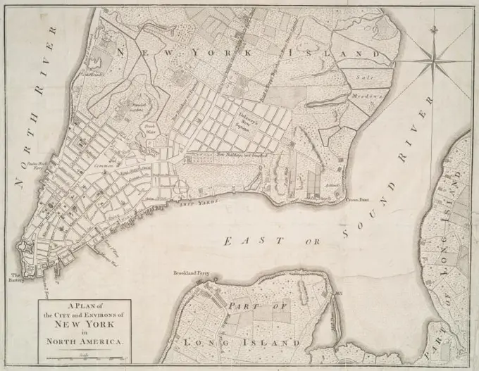
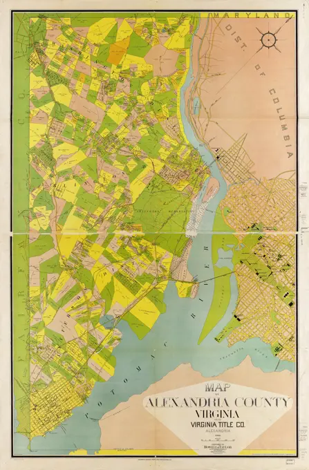
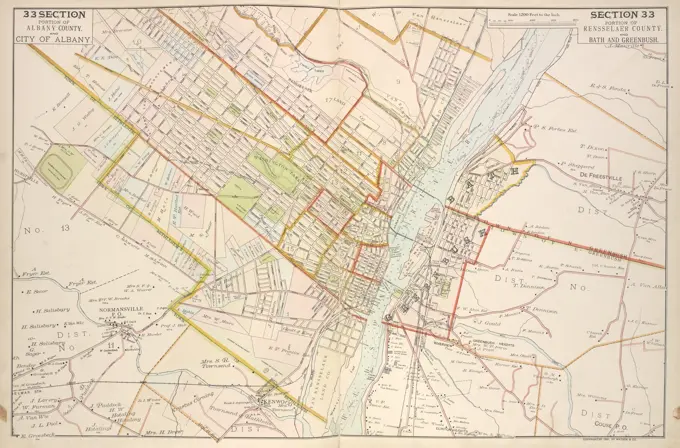
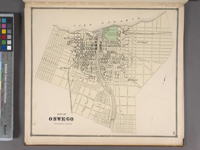
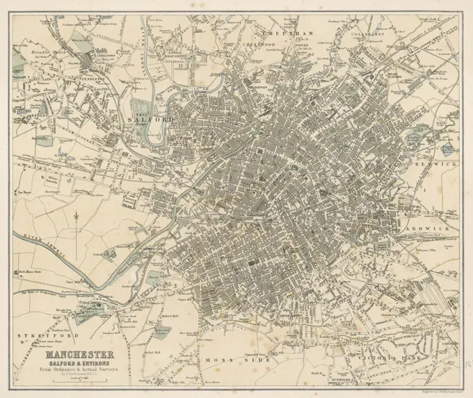
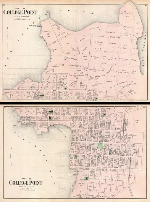
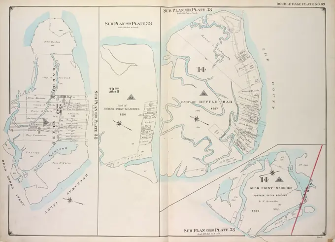
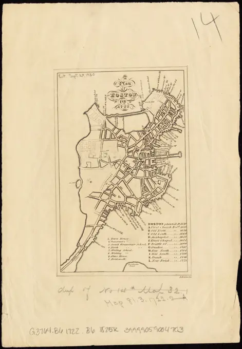
Historical Maps of New York and Boston

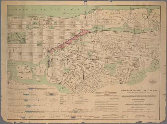
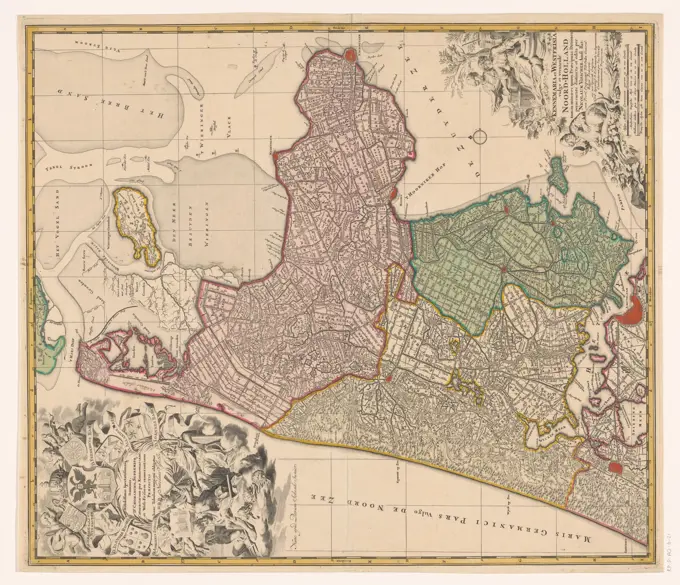
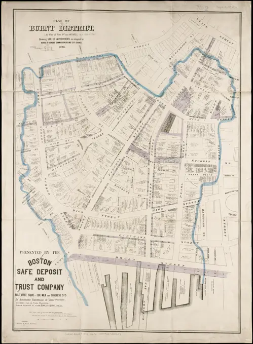
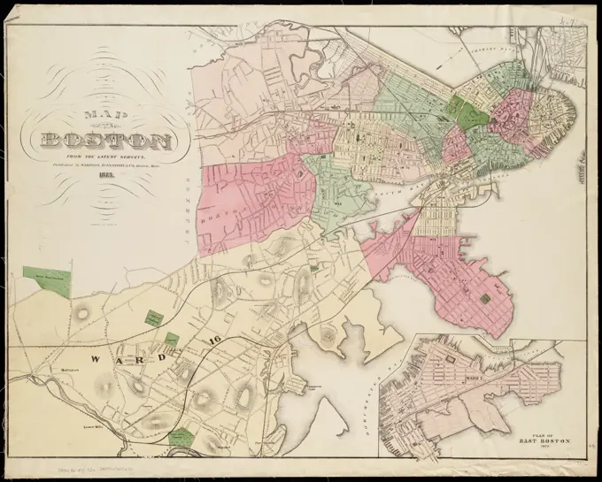
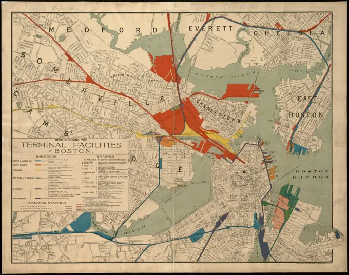
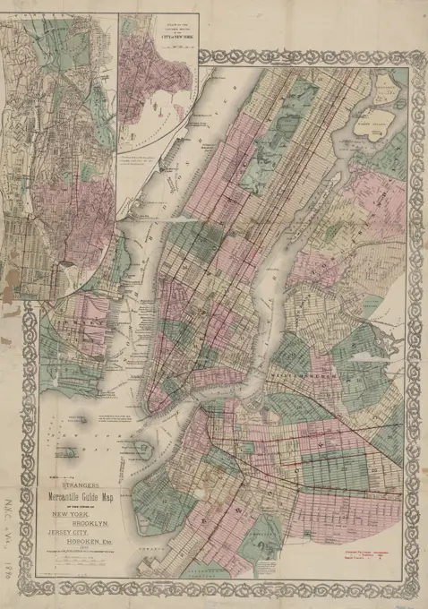
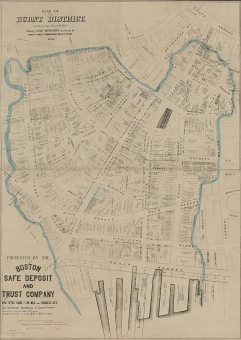
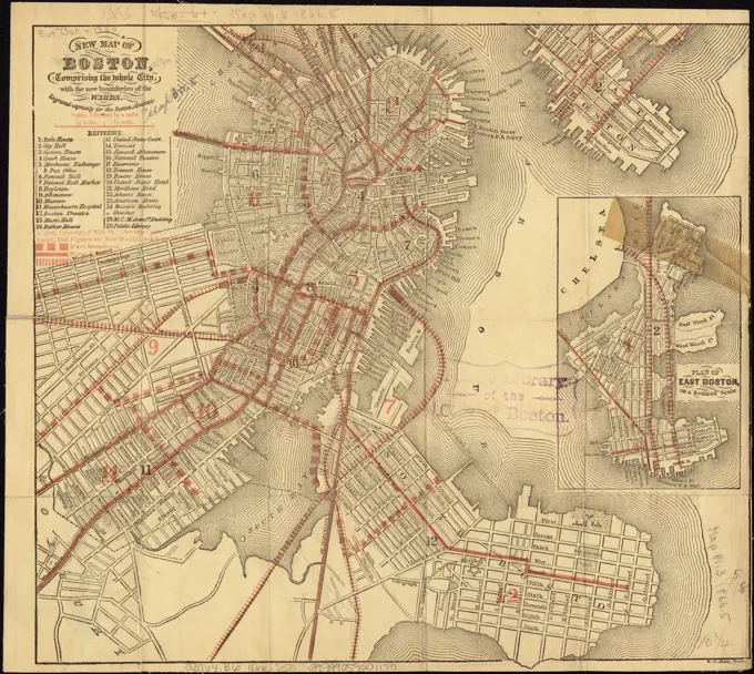
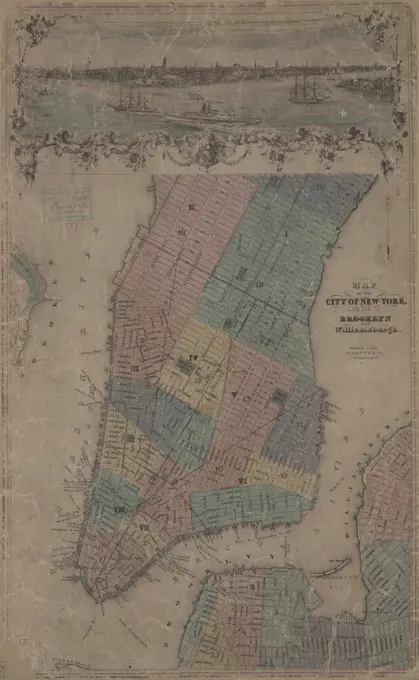
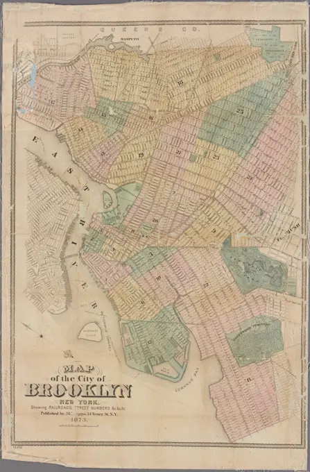
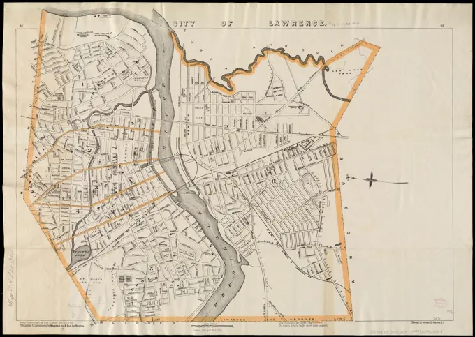
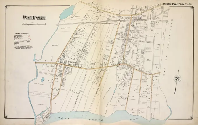
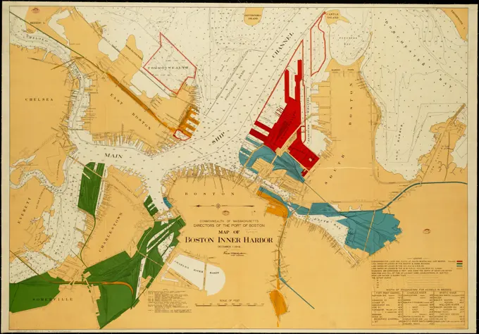
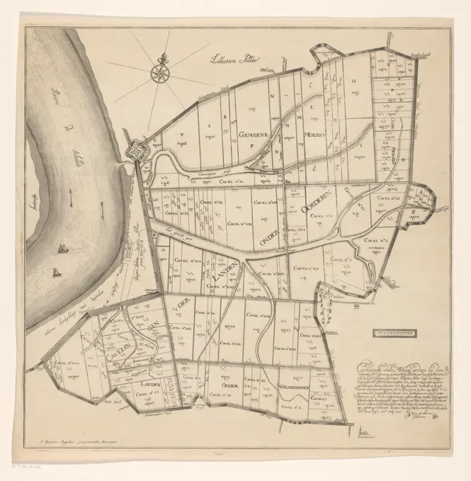
Collection of vintage maps depicting areas in New York, Brooklyn, Coney Island, and Boston, showcasing detailed layouts and historical cartography.

Sectional map of New York, Brooklyn, and Coney Island, 1882: published for the Coney Island Souvenir Cartographic. Maps. 1882. Lionel Pincus and Princess Firyal Map Division. Brooklyn (New York, N.Y.), Coney Island (New York, N.Y.), Railroads , New York (State) , New York
Barcelona. Siglo XIX. Plano de la ciudad amurallada en 1840, actualizado en 1848. Grabado de 1848.Map of the Harlem River 1892. Cartographic. Maps. Lionel Pincus and Princess Firyal Map DivisionBoston traffic map showing one way streets and parking spaces , Traffic flow, Massachusetts, Boston, Maps, Traffic regulations, Massachusetts, Boston, Maps, Boston Mass., Maps Norman B. Leventhal Map Center CollectionSt. Christophers , Real property, Saint Kitts and Nevis, Saint Kitts, Maps, Early works to 1800, Saint Kitts, Maps, Early works to 1800 Norman B. Leventhal Map Center CollectionWashington Park urban renewal area : report on feasibility of placing utility services underground , Roxbury Boston, Mass., Maps, City planning, Massachusetts, Boston, Maps, Underground utility lines, Massachusetts, Boston, Maps, Road work zones, Massachusetts, Boston, Maps, Streets, Massachusetts, Boston, Maps, Urban renewal, Massachusetts, Boston, MapsMap of Boston, for 1889 , Boston Mass., Maps Norman B. Leventhal Map Center CollectionSouth End urban renewal area R-56 : proposed treatment areas , South End Boston, Mass., Maps, City planning, Massachusetts, Boston, Maps, Real property, Massachusetts, Boston, Maps, Eminent domain, Massachusetts, Boston, MapsMap of the city of Worcester, Mass. Oriented with north toward the upper left "Lith. Haskell & Allen ... Boston". Also shows landowners and major industrial buildings. Includes insets of entire city at scale 1:18,000, and part of Wards 3 and 4.... , Massachusetts  , Worcester  ,county   , WorcesterWashington Park urban renewal area : treatment sections , Roxbury Boston, Mass., Maps, City planning, Massachusetts, Boston, Maps, Urban renewal, Massachusetts, Boston, MapsA new and correct plan of the town of Boston, and provincial camp. Engrav'd for the Pennsylva. magazine v. 1, 1775, p. 29. Relief shown pictorially. Includes inset of provincial camp, ca. 1:125,000.. Published in the July 1775 issue of the Pennsylvania Magazine or American Monthly edited by Thomas Paine, this was the earliest printed depiction of Boston after the battle at Bunker Hill, June 17, 1775. The inset shows the location of the battle, as well as provincial (American) lines in the communities surrounding Boston. Printed weeks before news of the battle reached England, this simple sketch made clear the commanding position enjoyed by the Continental Army. During the following months, these lines were strengthened by thousands of American volunteers, forcing a British retreat from Boston... , Massachusetts  , Suffolk  ,county   , BostonPlan of Kingston made by John Gray, dated 1831.... , Massachusetts  , Middlesex  ,county   , KingstonMap of Kennemerland and West -Friesland, Anonymous, 1720 - 1775 print At the top left a cartouche with the assignment, the weapon of the Water Board of the Outdating Sluizen in Kennemerland and West-Friesland and the family weapons of the Dijkgraaf and the Hoogheemraaden. This includes a female figure that a mill has in her hands and a female figure that holds a piece of dust, among other things, with which a river god and Neptune are chained under her. Among them two female figures, Jupiter and a river god. At the bottom right the title cartouche with a number of figures and objects that refer to agriculture. Among them two scale sticks: Sesqui Milliare Germanicum Quorum 15 in Uno Gradu / one and a half Duytsche Myl of 15 in a degree; Milliaria Gallica quae et horae itineris 20 in Uno Gradu / French mylen or hours of 20 in a degree. The card is equipped with a search schedule and a degree distribution along the edges.  paper engraving maps of separate countries or regions. coat of armOutline & index map of Charlestown and East Boston , Boston Mass., Maps, Real property, Massachusetts, Boston, Maps, Landowners, Massachusetts, Boston, Maps, East Boston Boston, Mass., Maps, Charlestown Boston, Mass., Maps Norman B. Leventhal Map Center CollectionWestchester, V. 2, Double Page Plate No. 33 Map bounded by Hudson River, Husted Ave., Boulevard, Maple Ave. Cartographic. Atlases, Maps. 1910 - 1911. Lionel Pincus and Princess Firyal Map Division. Westchester County (N.Y.), Real property , New York (State) , Westchester CountyPlan of burnt district, by fire of Nov. 9th and 10th 1872 : showing street improvements as adopted by Board of Street Commissioners and City Council , Great Fire, Boston, Mass., 1872, Maps, Boston Mass., Maps Norman B. Leventhal Map Center CollectionCartographic, Maps. 1897. Lionel Pincus and Princess Firyal Map Division. Fire insurance , New York (State), Real property , New York (State), Cities & towns , New York (State) KeyMap of Boston from the latest surveys , Boston Mass., Maps Norman B. Leventhal Map Center CollectionMap illustrating the defence sic of Savannah, Ga. and the operations resulting in its capture by the army commanded by Maj. Genl. W.T. Sherman, Dec. 21st, 1864 , Fortification, Georgia, Savannah, Maps, Savannah Ga., History, Siege, 1864, Maps, Savannah Region Ga., History, Civil War, 1861-1865, Maps Norman B. Leventhal Map Center CollectionPlan of Boston. Date estimated from development in the West End (Courthouse and Almshouse).... , Massachusetts  , Suffolk  ,county   , BostonMap of the northern portion of the City of New York: comprising the 12th ward, and the new 23d and 24th wards, recently annexed under chapter 613, laws of 1873, State of New York Cartographic. Maps. 1873. Lionel Pincus and Princess Firyal Map Division. New York (N.Y.), Bronx (New York, N.Y.), Landowners , New York (State) , New York, Real property , New York (State) , New York, Election districts , New York (State) , New York, New York (N.Y.) , Administrative and political divisionsGeneral and zoning map for town of Wakefield, Mass. , Zoning. Lucius Beebe Memorial Library Historic MapsJansen Hermann (1869-1945), development plan for Berlin-Treptow (08.08.1913): Overview plan 1: 6000. Tusche watercolor over pressure on paper, 73.7 x 69.5 cm (including scan edges) Jansen Hermann  (1869-1945): Bebauungsplan Berlin-TreptowMap showing the terminal facilities of Boston. Shows railroads and water transportation facilities in Boston and vicinity... Latest map of the terminal facilities of Boston, Massachusetts. Latest map of the terminal facilities of Boston, Massachusetts, Massachusetts  , Suffolk  ,county   , BostonPlan von CoellnDallas, Texas ,. Robert E. Diefenbach Map CollectionSoutheastern part of the borough of the Bronx, the old township of Westchester, with Throgs Neck, and with Cornells Neck or Clasons Point, Map VII D Cartographic. Maps. 1912. Lionel Pincus and Princess Firyal Map Division. Indian trails , New York (State) , New York, Indians of North America , New York (State) , New York, New York (N.Y.), Bronx (New York, N.Y.)North Harvard project area : location map , Allston Boston, Mass., Maps, Brighton Boston, Mass., Maps, City planning, Massachusetts, Boston, Maps, Urban renewal, Massachusetts, Boston, Maps, Express highways, Massachusetts, Boston, Maps, Streets, Massachusetts, Boston, MapsStrangers mercantile guide map of the cities of New York, Brooklyn, Jersey City, Hoboken, etc., 1890South End project no. Mass. r-56 : existing land use , South End Boston, Mass., Maps, City planning, Massachusetts, Boston, Maps, Urban renewal, Massachusetts, Boston, Maps, Land use, Massachusetts, Boston, MapsPlan of burnt district (by fire of Nov. 9th and 10th, 1872) showing street improvements as adopted by Board of Street Commissioners and City Council, 1873., 1876., Boston. Publisher, Boston Safe Deposit and Trust Company., 1 map hand colored; 73 x 52 cm, sheet 78 x 56 cmGeneral and zoning map for town of Wakefield Mass. , Zoning. Lucius Beebe Memorial Library Historic MapsNew map of Boston, comprising the whole city, with the new boundaries of the wards , Boston Mass., Maps Norman B. Leventhal Map Center CollectionMap of the Bronx. including part of Yonkers, Mount Vernon, and New Rochelle. 1905. Cartographic. Maps. Lionel Pincus and Princess Firyal Map DivisionJohn Preston Neale, 1771/80-1847, British, London after the Fire Anno Domini 1666 Plan, undated. Engraving.Map of Pittsburgh and Allegheny cities with principal street car lines indicated in red, 1893., 1893., 421 Wood Street, corner Diamond Street, Pittsburgh. Publisher, Bureau of Information, rooms of the Chamber of Commerce. Street-railroads, Pennsylvania, Pittsburgh, Administrative and political divisions., 1 map color; 52 x 66 cm. NYPL Map Div. copy blue star stamped in upper left margin, with manuscript notations Benjamin F. Pabodie, 25 July 1913Outline and index map of Boston proper and Roxbury , Boston Mass., Maps, Real property, Massachusetts, Boston, Maps, Landowners, Massachusetts, Boston, Maps, Roxbury Boston, Mass., Maps Norman B. Leventhal Map Center CollectionAmended zoning map for town of Wakefield Mass.. Map depicts entire town of Wakefield as of 1946, showing zoning districts, existing and proposed streets, parks, schoolgrounds, other town property, and semi-public property. "Area enclosed in heavy black lines changed from general residence district to single residence district."-- Text from map.... , Massachusetts  , Middlesex  ,county   , WakefieldPortion of Orange County. ; Portion of Dutchess & Putnam County. Cartographic. Atlases, Maps. 1891. Lionel Pincus and Princess Firyal Map Division. Hudson River Valley (N.Y. and N.J.), New York (State)Map of the City of New York with part of Brooklyn and Williamsburgh, 1851Map of the city of Brooklyn Cartographic. Maps. 1864. Lionel Pincus and Princess Firyal Map Division. Brooklyn (New York, N.Y.), New York (State) , New York , Brooklyn, Brooklyn (New York, N.Y.) , Administrative and political divisions, Administrative and political divisions, Horse-drawn rail cars , New York (State) , New YorkMap of Chelsea, Everett, Revere, & Winthrop , Chelsea Mass., Maps, Everett Mass., Maps, Revere Mass., Maps, Winthrop Mass., Maps, Massachusetts, Maps Norman B. Leventhal Map Center CollectionPlan of Boston comprising a part of Charlestown and Cambridge , Boston Mass., Maps Norman B. Leventhal Map Center CollectionPlan of Boston comprising a part of Charlestown and Cambridge. Relief shown by hachures. Shows city wards by color and no. Insets: Plan of South Boston from a drawing by S.P. Fuller. Scale ca. 1:17,600 -- Plan of East Boston from actual survey by R.H. Eddy. Scale ca. 1:17,000. Includes indexes to points of interest and streets.... , Massachusetts  , Suffolk  ,county   , BostonA new and correct plan of the city of Bath , Bath England, Maps Norman B. Leventhal Map Center CollectionJamaica Plain urban renewal area r-49 : existing land use. Shows residential; commercial; industrial; institutional, public and private; parks and playground, and vacant. Inset: Location map.. Part of an urban renewal plan for Boston's Jamaica Plain neighborhood... , Massachusetts  , Suffolk  ,county   , Boston  , Jamaica PlainJansen Hermann (1869-1945), development plan for Berlin-Treptow (08.08.1913): Overview plan 1: 6000. Tusche watercolor over pressure on paper, 73.8 x 69.8 cm (including scan edges) Jansen Hermann  (1869-1945): Bebauungsplan Berlin-TreptowCity atlas of Boston, Massachusetts : complete in one volume : from official records, private plans and actual surveys : plate 28 , Real property, Massachusetts, Boston, Maps, Landowners, Massachusetts, Boston, Maps, Dorchester Boston, Mass., Maps Norman B. Leventhal Map Center CollectionNeighborhoods of Petit-Montrouge and Malakoff and Montrouge communes / Leaf 316 / 1951Map of the city of Brooklyn, New York: showing, railroads, street numbers Cartographic. Maps. 1873. Lionel Pincus and Princess Firyal Map Division. Brooklyn (New York, N.Y.), Street addresses , New York (State) , New York, Ferries , New York (State) , New York, Railroads , New York (State) , New YorkMap of Portland, Me. and vicinity , Portland Me., Maps Norman B. Leventhal Map Center CollectionA map of the town of Providence from actual survey. Bar scale given in rods. Facsimile reprint of the 1803 ed.... , Rhode Island  , Providence  ,county   , ProvidenceJansen Hermann (1869-1945), total development plan Ankara (06.05.1932): Basic plan 1: 4000. Pressure on paper, 85.5 x 123.4 cm (including scan edges) Jansen Hermann  (1869-1945): Gesamtbebauungsplan AnkaraCartographic, Maps. 1886. Lionel Pincus and Princess Firyal Map Division. Brooklyn (New York, N.Y.), Real property , New York (State) , New York Outline & Index Map of the City of Brooklyn, Kings County, N.Y.MAP OF LILLECity of Lawrence. Oriented with north toward the upper left. Relief shown by contours ans spot heights. Part of Massachusetts atlas. "43" and "43" in upper margins. Shows ward boundaries... Latest map of lawrence city Massachusetts. Latest map of lawrence city Massachusetts, Massachusetts  , Essex  ,county   , LawrencePlan of the battles at Quatre-Bras and Waterloo, 15-18 June, 1815, Anonymous, 1815 print Map of the region between Brussels and Charleroi where between 15-18 June 1815 were fought at Ligny, Wavre, Quatre-Bras and Waterloo battles between the armies of the Allies and the French army under Napoleon. The patterns of the armies are indicated on the map. The different places and armies with colors. print maker: Netherlandspublisher: Amsterdam paper etching maps of separate countries or regions. battle arrays BelgiumWest Orange, Orange, East Orange. Double Page Plate No. 3 Map bounded by Columbia St., Watson St., Orange Rd., N. Brighton Ave., Park St., Wallace Ave., White Ave., Standish Ave. Cartographic. Atlases, Maps, Cadastral maps. 1904. Lionel Pincus and Princess Firyal Map Division. Essex County (N.J.), Real property , New Jersey , Essex County (N.J.)Topographic map of Monroe County, Illinois , Monroe County Ill., Maps Norman B. Leventhal Map Center CollectionA plan of Boston in 1722 , Boston Mass., Maps, Early works to 1800, Facsimiles Norman B. Leventhal Map Center CollectionMap showing the terminal facilities of Boston. Shows connections between railroads, wharves, and transfer stations.... , Massachusetts  , Suffolk  ,county   , BostonJansen Hermann (1869-1945), Competition development plan for Heiligkreuz, Trier (1925-1925): Planning pad: Map of the city of Trier with construction class division 1: 1500, scale bar. Colored pencil over lithography colored on paper, 122.3 x 84.1 cm (including scan edges) Jansen Hermann  (1869-1945): Wettbewerb Bebauungsplan für Heiligkreuz, TrierAuction Sale of Bronx Residential Water Front Property in beautiful Throg's Neck Gardens by order of the Bruce-Brown Land Co. 261 High Class Lots (40 Lots, with the Turnbull Estate Mansion, on Long Island Sound, in an unexcelled location.) text. Maps, Pamphlets. 1910-06-25. Lionel Pincus and Princess Firyal Map Division. Real property auctions , New York (State) , New YorkBayport Cartographic. Atlases, Maps. 1915 - 1917. Lionel Pincus and Princess Firyal Map Division. Suffolk County (N.Y.)The Price & Lee Co's map of Orange , Orange Mass., Maps Norman B. Leventhal Map Center CollectionGeneral and zoning map for town of Wakefield Mass. , Zoning. Lucius Beebe Memorial Library Historic MapsPlan of the action at Huberton under Brigadier Genl. Frazer, supported by Major Genl. Reidesel, on the 7th July 1777. Relief shown by hachures. Includes references. From Faden's Atlas of the American Revolution.... , Vermont  , Rutland  ,county   , HubbardtonPlan of Dorchester , Dorchester Boston, Mass., Maps Norman B. Leventhal Map Center CollectionPlan of East Boston : exhibiting the land & water lots and other improvements , East Boston Boston, Mass., Maps Norman B. Leventhal Map Center CollectionCartographic, Maps. 1880. Lionel Pincus and Princess Firyal Map Division. Brooklyn (New York, N.Y.), Real property , New York (State) , New York Index Map of BrooklynA Plan of the city and environs of New York in North America. Cartographic. Maps. 1776. Lionel Pincus and Princess Firyal Map Division. Manhattan (New York, N.Y.)Russell's map of Boston from the latest surveys , Boston Mass., Maps Norman B. Leventhal Map Center CollectionMap of the original grants of village lots from the Dutch West India Company to the inhabitants of New-Amsterdam (now New-York) lying below the present line of Wall Street : Grants commencing A.D. 1642 Cartographic. Maps. 1897. Lionel Pincus and Princess Firyal Map Division. Manhattan (New York, N.Y.), Real property , New York (State) , New York, Land grantsMap of Alexandria County, Virginia for the Virginia Title Co. - Copy 2 | Library of CongressPortion of Albany County. and City of Albany. ; Portion of Rensselaer County. and Bath and Greenbush. Cartographic. Atlases, Maps. 1891. Lionel Pincus and Princess Firyal Map Division. Hudson River Valley (N.Y. and N.J.), New York (State)City of Oswego Village Cartographic. Atlases, Maps. 1867. Lionel Pincus and Princess Firyal Map Division. Oswego County (N.Y.), Real property , New York (State) , Oswego County, Business enterprises , New York (State) , Oswego CountyMap of Dorchester. Includes index.... , Massachusetts  , Suffolk  ,county   , Boston  , DorchesterCity of Melrose , Melrose Mass., Administrative and political divisions, Maps Norman B. Leventhal Map Center CollectionBrooklyn and vicinity. Cartographic. Maps. 1906. Lionel Pincus and Princess Firyal Map Division. Brooklyn (New York, N.Y.), Maps Map of Manchester and its environs        Date: 1878A new & complete map of the city of Boston, with part of Charlestown, Cambridge & Roxbury : from the best authorities , Boston Mass., Maps Norman B. Leventhal Map Center CollectionMap of Dorchester , Dorchester Boston, Mass., Maps Norman B. Leventhal Map Center CollectionPocket map of the borough of Brooklyn, New York City. Cartographic. Maps. 1906. Lionel Pincus and Princess Firyal Map Division. Brooklyn (New York, N.Y.), MapsA plan of the city of New-York , Manhattan New York, N.Y., Maps, Early works to 1800, Facsimiles, New York N.Y., Maps, Early works to 1800, Facsimiles Norman B. Leventhal Map Center CollectionWestchester, V. 1, Double Page Plate No. 24 Map bounded by Titus Mill Pond, Long Island Sound, New Rochelle Creek Cartographic. Atlases, Maps. 1910 - 1911. Lionel Pincus and Princess Firyal Map Division. Westchester County (N.Y.), Real property , New York (State) , Westchester CountyMap of the northern part of the Borough of Manhattan and the Borough of the Bronx of the City of New York. Prepared expressly for the Trow Directory, printing, and Bookbinding Co. 1907. Cartographic. Maps. Lionel Pincus and Princess Firyal Map Division1873 Beers Map of College Point, Queens, New York City (set of 2 maps)Brooklyn ,. Robert E. Diefenbach Map CollectionJansen Hermann (1869-1945), development plan for Boldixum and Wyk on the island of Föhr: Basic Plan, in parts of the site plan 1: 2000. Light break watercolor on the box, 109.00 x 96.00 cm (including scan edge). Architecture Museum of the Technical University of Berlin Inv. No. 20650. Jansen Hermann  (1869-1945): Bebauungsplan für Boldixum und Wyk auf der Insel FöhrPLAN DIRECTOR DEL AREA METROPOLITANA DE BARCELONA.The nation's capital : Washington D.C. , Washington D.C., Maps Norman B. Leventhal Map Center CollectionThis plan of the city of Philadelphia and it's sic environs, (shewing the improved parts,) is dedicated to the mayor, aldermen and citizens thereof , Philadelphia Pa., Maps, Early works to 1800 Norman B. Leventhal Map Center CollectionE.B. Hyde & Co.. Cartographic, Maps. 1916 - 1920. Lionel Pincus and Princess Firyal Map Division. Brooklyn (New York, N.Y.), Real property , New York (State) , New York Brooklyn, Vol. 3, Double Page Plate No. 39; Sub Plan from Plate 38; Map bounded by Barren Island, Part of Ruffle Bar; Including Duck Point Marshes, Pumpkin Patch MeadowsCartographic, Maps. 1901. Lionel Pincus and Princess Firyal Map Division. Fire insurance , New York (State), Real property , New York (State), Cities & towns , New York (State) Key continuedA plan of Boston in 1722 , Boston Mass., Maps, Early works to 1800, Facsimiles Norman B. Leventhal Map Center CollectionNew map of the city of Philadelphia from the latest city surveys , Philadelphia Pa., Maps Norman B. Leventhal Map Center CollectionMap of Mons with attacks the year 1709Map of Boston inner harbor. Oriented with north to the left. Depths shown by soundings. Includes partial directory of piers and widths of bridge passageways for vessels.... , Massachusetts  , Boston HarborMap of the Polders of Oorsen, Wilmarsdonk and Ordam, Jan Baptist Jongelinx, 1723 print Map of the Polders of Oorsen, Wilmarsdonk and Ordam, with plot distribution. At the bottom right a text about the polder and the measurements of the country. A bowl of bowl above the text.  paper engraving / etching polder, reclaimed land. maps of separate countries or regions Oorderen. Wilmarsdonk. LilloHooker's new pocket plan of the city of New York text. Maps. 1836. Lionel Pincus and Princess Firyal Map Division. Manhattan (New York, N.Y.) , Maps, New York (N.Y.) , Administrative and political divisions , Maps, New York (N.Y.) , MapsTown plan for the town of Wakefield, Mass. , Zoning. Lucius Beebe Memorial Library Historic Maps