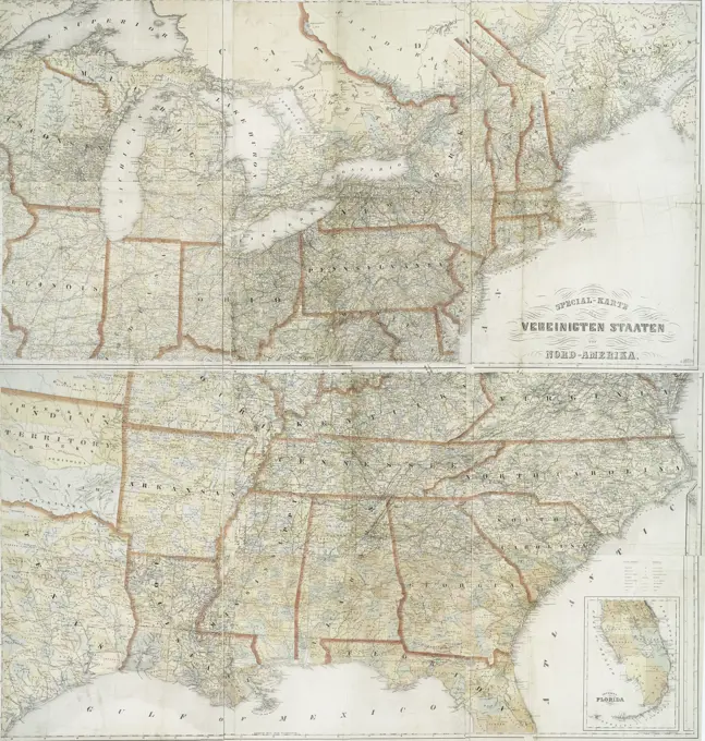
Maps of the United States

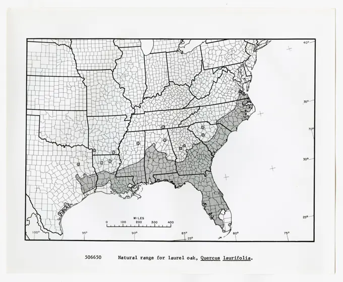
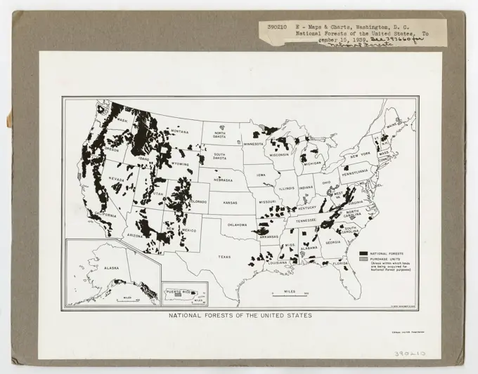
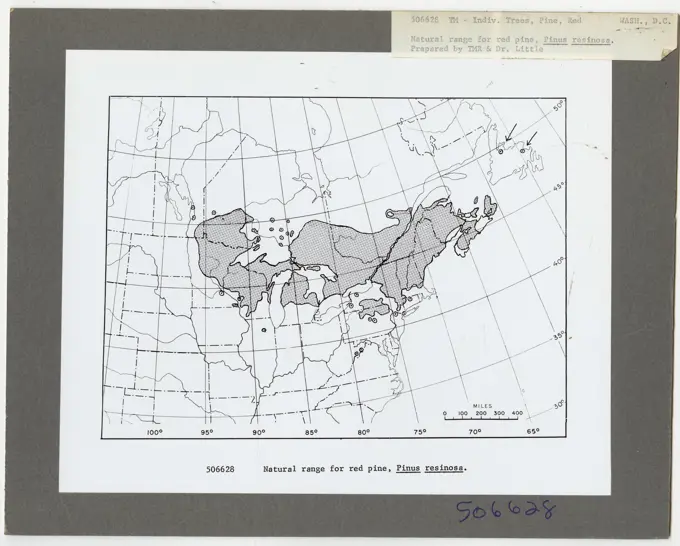
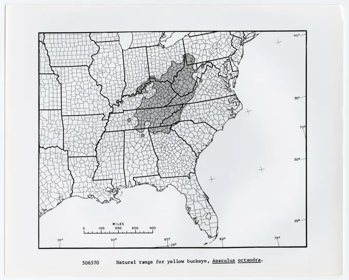
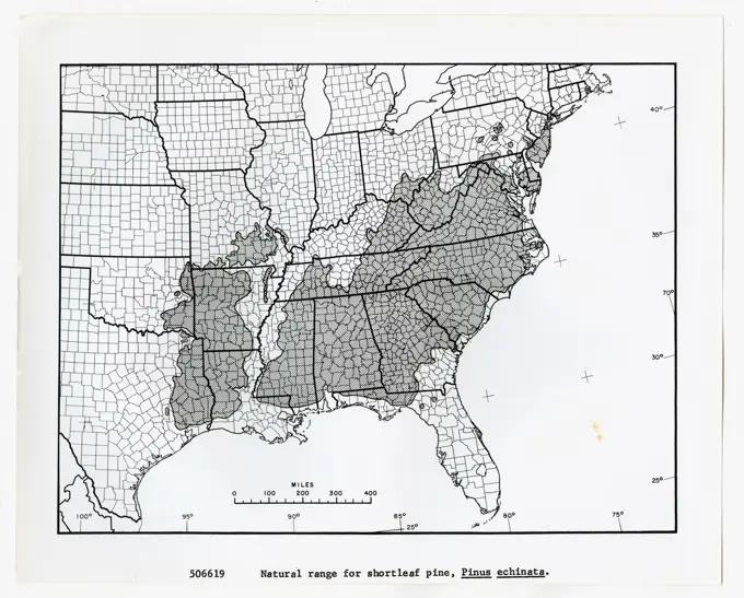
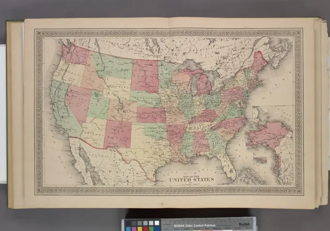
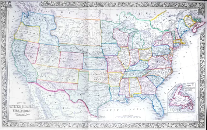
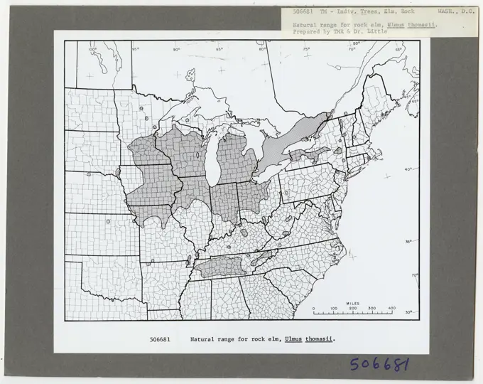
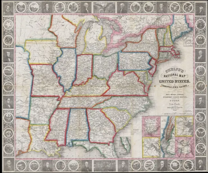
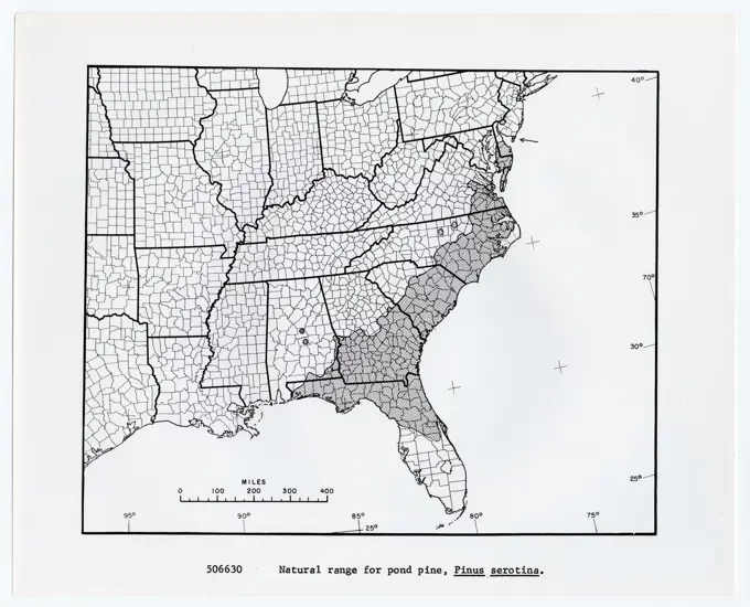
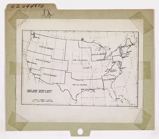
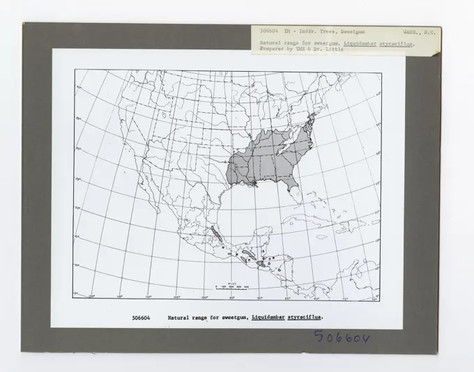
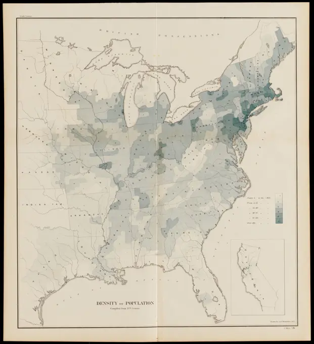
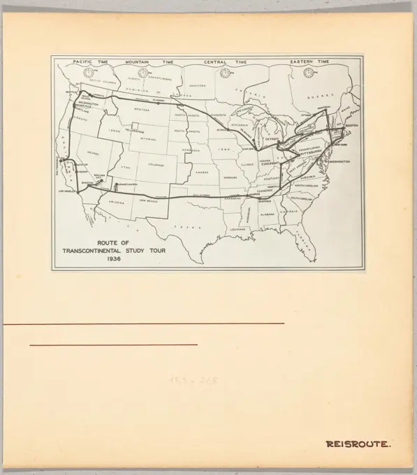
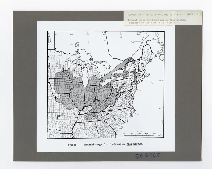
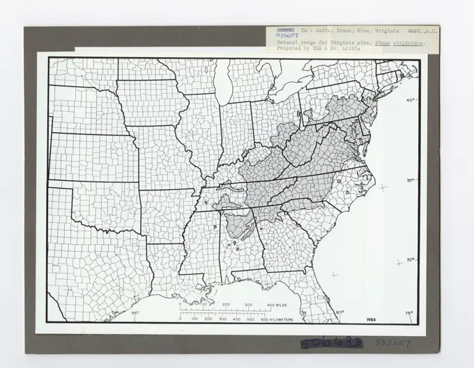
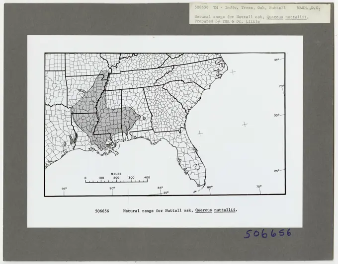
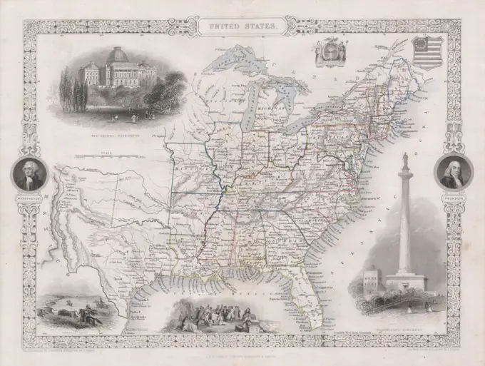
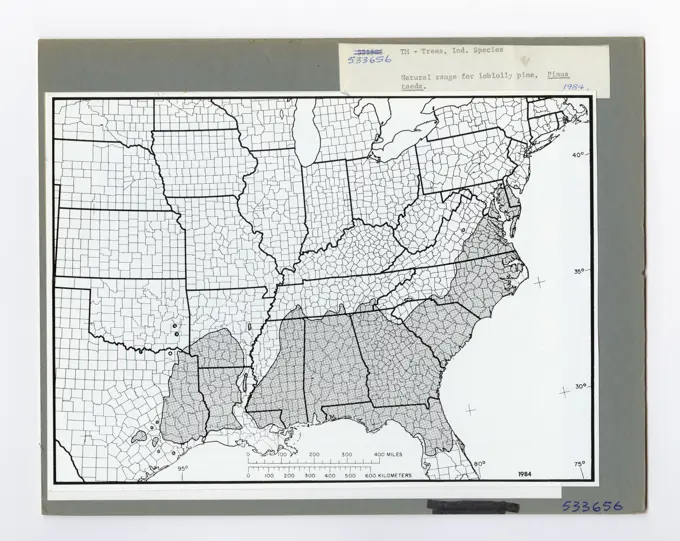
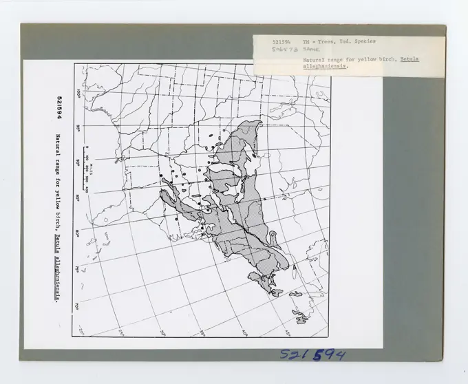
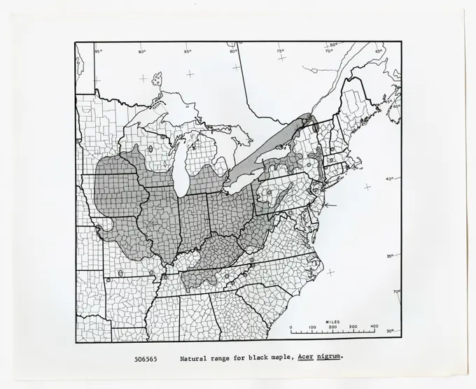
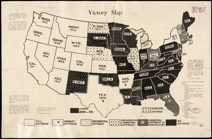
A variety of maps illustrating territorial delineations, military posts, and geographic information of the United States from the 19th century.

Special map of the United States of North America, 1850, published by Th. Fischer in Cassel. The map is hand-colored and consists of 2 sheets, measuring 141 x 136 cm in total and 76 x 142 cm for each sheet. It includes detailed geographic information about the United States and North America
Tree Identification - Oak: Blackjack. Photographs Relating to National Forests, Resource Management Practices, Personnel, and Cultural and Economic HistoryNorth America. Relief shown by hachures. Shows major cities, areas of Indian habitation, Russian and British territories, Mexico, "Guatimala," Greenland, the United States, and the West Indies; U.S. territories as "Western Territory" west of the Rocky Mountains and extending beyond the 50 line of latitude, and "Missouri Territory" east of the Rocky Mountains. "Published September 1st. 1829, by Longman, Rees, Orme, Brown & Green."... , North America  ,area  United StatesTree Identification - Oak: Willow. Photographs Relating to National Forests, Resource Management Practices, Personnel, and Cultural and Economic HistoryMaps and Charts - All States. Photographs Relating to National Forests, Resource Management Practices, Personnel, and Cultural and Economic HistoryTree Identification - Basswood. Photographs Relating to National Forests, Resource Management Practices, Personnel, and Cultural and Economic HistoryTree Identification - Elm. Photographs Relating to National Forests, Resource Management Practices, Personnel, and Cultural and Economic HistoryMaps and Charts - All States. Photographs Relating to National Forests, Resource Management Practices, Personnel, and Cultural and Economic HistoryMaps and Charts - All States. Photographs Relating to National Forests, Resource Management Practices, Personnel, and Cultural and Economic HistoryMaps and Charts - All States. Photographs Relating to National Forests, Resource Management Practices, Personnel, and Cultural and Economic HistoryMaps and Charts - All States. Photographs Relating to National Forests, Resource Management Practices, Personnel, and Cultural and Economic HistoryMaps and Charts - All States. Photographs Relating to National Forests, Resource Management Practices, Personnel, and Cultural and Economic HistoryTree Identification - Pine, Red. Photographs Relating to National Forests, Resource Management Practices, Personnel, and Cultural and Economic HistoryMaps and Charts - All States. Photographs Relating to National Forests, Resource Management Practices, Personnel, and Cultural and Economic History. Atlas of the rare vascular plants of Ontario. Rare plants; Botany. HABITAT: Moist woods. STATUS: Extirpated in Canada, but under cultivation in Ontario. Rare in Connecticut and Iowa. NOTES: Planted in many places throughout southern Ontario. It is uncertain that this species is indigenous, however. Fox & Soper (1953) are of the opinion that the tree seen by Macoun on Pelee Island in 1892, but now extirpated, was native to Ontario. HABITAT: Foríªts humides. SITUATION: Déracinée au Canada, mais cultivée en Ontario. Rare au Connecticut et en lowa. REMARQUES: Plantée í de nombreux endroiA new and accurate map of North America: laid down according to the latest, and most approved observations and discoveries Cartographic. Maps. 1763. Lionel Pincus and Princess Firyal Map Division. North AmericaMap of the British Colonies south of Canada up to 1783. From British History in Periods, published 1904.Maps and Charts - All States. Photographs Relating to National Forests, Resource Management Practices, Personnel, and Cultural and Economic HistoryMaps and Charts - All States. Photographs Relating to National Forests, Resource Management Practices, Personnel, and Cultural and Economic HistoryTree Identification - Oak: Swamp White. Photographs Relating to National Forests, Resource Management Practices, Personnel, and Cultural and Economic HistoryNational map of the United States , United States, Maps Norman B. Leventhal Map Center CollectionMaps and Charts - All States. Photographs Relating to National Forests, Resource Management Practices, Personnel, and Cultural and Economic HistoryMaps and Charts - All States. Photographs Relating to National Forests, Resource Management Practices, Personnel, and Cultural and Economic HistoryMaps and Charts - All States. Photographs Relating to National Forests, Resource Management Practices, Personnel, and Cultural and Economic HistoryMaps and Charts - All States. Photographs Relating to National Forests, Resource Management Practices, Personnel, and Cultural and Economic HistoryTree Identification - Oak: Pin. Photographs Relating to National Forests, Resource Management Practices, Personnel, and Cultural and Economic HistoryMaps of The United States Cartographic. Atlases, Maps. 1875. Lionel Pincus and Princess Firyal Map Division. Niagara County (N.Y.), Orleans County (N.Y.), Real property , New York (State) , Niagara County, Real property , New York (State) , Orleans County, United States1800s 1860s 1867 MAP OF UNITED STATESTree Identification - Elm. Photographs Relating to National Forests, Resource Management Practices, Personnel, and Cultural and Economic HistoryForest Diseases - Minnesota. Photographs Relating to National Forests, Resource Management Practices, Personnel, and Cultural and Economic HistoryMaps and Charts - All States. Photographs Relating to National Forests, Resource Management Practices, Personnel, and Cultural and Economic History1848 Phelps National Map of the United States (pocket map)Here Comes the Band - Radio Program. Photographs of Marshall Plan Programs, Exhibits, and PersonnelTree Identification - Chinquapin. Photographs Relating to National Forests, Resource Management Practices, Personnel, and Cultural and Economic HistoryMaps and Charts - All States. Photographs Relating to National Forests, Resource Management Practices, Personnel, and Cultural and Economic HistoryTree Identification - Sweetgum. Photographs Relating to National Forests, Resource Management Practices, Personnel, and Cultural and Economic HistoryTree Identification - Pine, Ponderosa. Photographs Relating to National Forests, Resource Management Practices, Personnel, and Cultural and Economic HistoryMaps and Charts - All States. Photographs Relating to National Forests, Resource Management Practices, Personnel, and Cultural and Economic HistoryCoast Guard Districts Within Continental United States.Maps and Charts - All States. Photographs Relating to National Forests, Resource Management Practices, Personnel, and Cultural and Economic HistoryTree Identification - Hazel. Photographs Relating to National Forests, Resource Management Practices, Personnel, and Cultural and Economic HistoryTree Identification - Sweetgum. Photographs Relating to National Forests, Resource Management Practices, Personnel, and Cultural and Economic HistoryTree Identification - Ash. Photographs Relating to National Forests, Resource Management Practices, Personnel, and Cultural and Economic HistoryTree Identification - Chestnut. Photographs Relating to National Forests, Resource Management Practices, Personnel, and Cultural and Economic HistoryDensity of population , Census, United States. Bureau of the Census. Ralph Finos Map CollectionTree Identification - Hornbeam. Photographs Relating to National Forests, Resource Management Practices, Personnel, and Cultural and Economic HistoryPhoto production of a map of the United States, on which the route is indicated by the tour through the United States and Canada; 'Route or Transcontinental Study Tour 1936'.Maps and Charts - All States. Photographs Relating to National Forests, Resource Management Practices, Personnel, and Cultural and Economic HistoryTree Identification - Hickory: Mockernut. Photographs Relating to National Forests, Resource Management Practices, Personnel, and Cultural and Economic HistoryMaps and Charts - All States. Photographs Relating to National Forests, Resource Management Practices, Personnel, and Cultural and Economic HistoryMaps and Charts - All States. Photographs Relating to National Forests, Resource Management Practices, Personnel, and Cultural and Economic HistoryTree Identification - Oak: Chestnut. Photographs Relating to National Forests, Resource Management Practices, Personnel, and Cultural and Economic HistoryMap of the United States, from the latest surveys : with the heights of mountains and length of the principle rivers , United States, Maps Norman B. Leventhal Map Center CollectionMap of the United States, from the latest surveys : with the heights of mountains and length of the principle rivers. Entered according of act of Congress in the year of 1841 by the Tremont Print Company in the Clerk's Office in the District Court of Massachusetts. Cloth map. Includes inset "Length of the principal rivers and indexed inset of "Principal mountains."... , United StatesMaps and Charts - All States. Photographs Relating to National Forests, Resource Management Practices, Personnel, and Cultural and Economic HistoryTree Identification - Sycamore: American. Photographs Relating to National Forests, Resource Management Practices, Personnel, and Cultural and Economic HistoryTree Identification - Maple: Black. Photographs Relating to National Forests, Resource Management Practices, Personnel, and Cultural and Economic HistoryMap of the United States and territories, showing the possessions and aggressions of the slave power. Shows free, slave, and undetermined states. Includes text and statistics. Text, poems, and excerpts on slavery below map. Text references 1856 events.. America Transformed: While Coltons map suggests a unified nation extending from the Atlantic to the Pacific, this broadside published about the same time boldly addresses the slavery issue. It identifies free states in white, slave states in black, and contested territories in gray. Issued during the 1856 presidential election, this stark graphic implicitly supports the candidacy of Republican John C. Frémont, who opposed slaverys expansion. It also forcefully challenges the so-called Three-Fifths Compromise which counted three out of five slaves toward calculating southern political representation, while denying those enslaved peoples any voting privileges or freedom... , United StatesTree Identification - Pine, Virginia. Photographs Relating to National Forests, Resource Management Practices, Personnel, and Cultural and Economic HistoryTree Identification - Oak: Nuttall. Photographs Relating to National Forests, Resource Management Practices, Personnel, and Cultural and Economic HistoryTree Identification - Pecan. Photographs Relating to National Forests, Resource Management Practices, Personnel, and Cultural and Economic HistoryMap of The United States, and Territories. Together with Canada & c. ; Island of Newfoundland Cartographic. Atlases, Maps. 1874. Lionel Pincus and Princess Firyal Map Division. United StatesMaps and Charts - All States. Photographs Relating to National Forests, Resource Management Practices, Personnel, and Cultural and Economic History1850 Tallis Map of the United States ( Texas at fullest extent)Tree Identification - Ash. Photographs Relating to National Forests, Resource Management Practices, Personnel, and Cultural and Economic HistoryTree Identification - Oak: Black. Photographs Relating to National Forests, Resource Management Practices, Personnel, and Cultural and Economic HistoryTree Identification - Oak: Overcup. Photographs Relating to National Forests, Resource Management Practices, Personnel, and Cultural and Economic HistoryThe colonies of North America at the declaration of independence, 1776 (1894). Artist: UnknownTree Identification - Aspen. Photographs Relating to National Forests, Resource Management Practices, Personnel, and Cultural and Economic HistoryTree Identification - Hickory: Shellbark. Photographs Relating to National Forests, Resource Management Practices, Personnel, and Cultural and Economic HistoryTree Identification - Pine, Longleaf. Photographs Relating to National Forests, Resource Management Practices, Personnel, and Cultural and Economic HistoryTree Identification - Oak: Live. Photographs Relating to National Forests, Resource Management Practices, Personnel, and Cultural and Economic HistoryMaps and Charts - All States. Photographs Relating to National Forests, Resource Management Practices, Personnel, and Cultural and Economic HistoryMaps and Charts - All States. Photographs Relating to National Forests, Resource Management Practices, Personnel, and Cultural and Economic HistoryMaps and Charts - All States. Photographs Relating to National Forests, Resource Management Practices, Personnel, and Cultural and Economic HistoryVictory map 1919 , Women, Suffrage, United States, Maps, United States, Maps Norman B. Leventhal Map Center CollectionMap showing the relation existing between slave labor and cotton production 1860. Cartographic. Maps. 1897. Schomburg Center for Research in Black Culture, Jean Blackwell Hutson Research and Reference Division. Cotton industry, Cotton plantations , Southern States, Slavery , United StatesMaps and Charts - All States. Photographs Relating to National Forests, Resource Management Practices, Personnel, and Cultural and Economic HistoryTree Identification - Spruce: White. Photographs Relating to National Forests, Resource Management Practices, Personnel, and Cultural and Economic HistoryMaps and Charts - All States. Photographs Relating to National Forests, Resource Management Practices, Personnel, and Cultural and Economic HistoryMaps and Charts - All States. Photographs Relating to National Forests, Resource Management Practices, Personnel, and Cultural and Economic HistoryTree Identification - Hickory: Shagbark. Photographs Relating to National Forests, Resource Management Practices, Personnel, and Cultural and Economic HistoryMaps and Charts - All States. Photographs Relating to National Forests, Resource Management Practices, Personnel, and Cultural and Economic HistoryMaps and Charts - All States. Photographs Relating to National Forests, Resource Management Practices, Personnel, and Cultural and Economic HistoryTree Identification - Walnut. Photographs Relating to National Forests, Resource Management Practices, Personnel, and Cultural and Economic HistoryTree Identification - Pine, Loblolly. Photographs Relating to National Forests, Resource Management Practices, Personnel, and Cultural and Economic HistoryVictory map , Women, Suffrage, United States, Maps, United States, Maps Norman B. Leventhal Map Center CollectionVictory map 1919 , Women, Suffrage, United States, Maps, United States, Maps Norman B. Leventhal Map Center CollectionTree Identification - Birch. Photographs Relating to National Forests, Resource Management Practices, Personnel, and Cultural and Economic HistoryMaps and Charts - All States. Photographs Relating to National Forests, Resource Management Practices, Personnel, and Cultural and Economic HistoryMaps and Charts - All States. Photographs Relating to National Forests, Resource Management Practices, Personnel, and Cultural and Economic HistoryTree Identification - White Cedar. Photographs Relating to National Forests, Resource Management Practices, Personnel, and Cultural and Economic HistoryVictory map , Women, Suffrage, United States, Maps, United States, Maps Norman B. Leventhal Map Center CollectionTree Identification - Pine, Slash. Photographs Relating to National Forests, Resource Management Practices, Personnel, and Cultural and Economic HistoryMaps and Charts - All States. Photographs Relating to National Forests, Resource Management Practices, Personnel, and Cultural and Economic HistoryMaps and Charts - All States. Photographs Relating to National Forests, Resource Management Practices, Personnel, and Cultural and Economic HistoryTree Identification - Hickory: Nutmeg. Photographs Relating to National Forests, Resource Management Practices, Personnel, and Cultural and Economic HistoryTree Identification - Beech. Photographs Relating to National Forests, Resource Management Practices, Personnel, and Cultural and Economic HistoryPhysical and political map of the United States. Encapsulated Postscript File (.eps); 3507x2480.Surveying, Study Aids - ArithmaticTree Identification - Pine, Sand. Photographs Relating to National Forests, Resource Management Practices, Personnel, and Cultural and Economic History