My Boards
View Pictures
  • My Boards
← Documents & Records

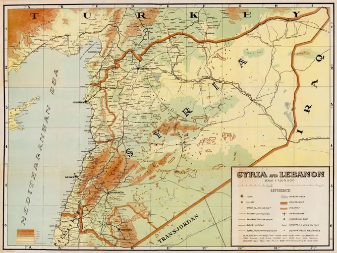
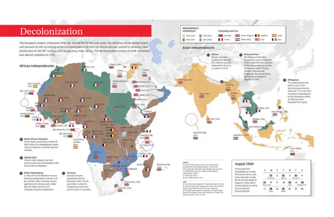
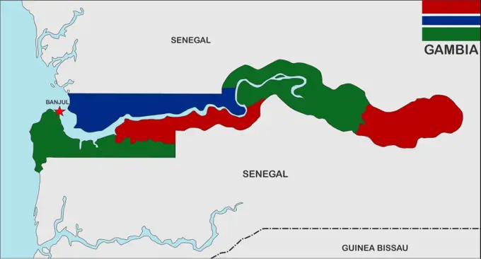
19th Century Maps of Africa

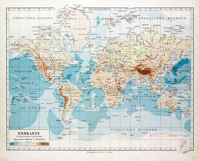
Colorful and detailed maps of Africa and surrounding regions, highlighting geographic features and historical boundaries from the 19th century.

MAP OF THE WORLD, 1899
290 assets in this story
1525-24409512
close up magnifying glass showing spain
1899-18791929
The Persian Royal Road was an ancient highway reorganized and rebuilt by the Persian king Darius the Great (Darius I) of the Achaemenid Empire in the 5th century BC. Darius built the road to facilitate rapid communication throughout his empire. The course of the road has been reconstructed from the writings of Herodotus, archeological research, and other historical records. It began in the west in Sardis (on the Aegean coast of Lydia, about 60 miles east of Izmir in present-day Turkey), traveled east through what is now the middle northern section of Turkey, (crossing the Halys according to Herodotus) and passed through the Cilician Gates to the old Assyrian capital Nineveh (present-day Mosul, Iraq), then turned south to Babylon (near present-day Baghdad, Iraq). From near Babylon, it is believed to have split into two routes, one traveling northeast then east through Ecbatana and on along the Silk Road, the other continuing east through the future Persian capital Susa (in present-day I
1525-21440095
oiuoiudsofds428fsdufioisdf
4409-17289512
Ana Mercedes Hoyos / 'Triangulo comercial' Litograph. 56,0 x 76,0 cm, 2005.
6188-71728124
Japan Map Provinces Detailed color-coded map showcasing the provinces and prefectures of Japan. This map illustrates the geographic divisions of the country. Copyright: xVolinax
6188-64617045
Japan map black map of Japan country with neighbors and national flag Copyright: xZoonar.com/tudorxantonelxadrianx 2196873
6145-54268810
Boston shoreline 1852. Cartography by Herb Heidt and Eliza McClennen of MapWorks for Mapping Boston edited by Alex Krieger and David Cobb with Amy Turner. Cambridge, MA : MIT Press, 1999.... , Massachusetts  , Suffolk  ,county   , Boston
6176-66093210
Syria and Lebanon. Vintage Archive Map, circa 1930s
6188-71728127
North Korea Administrative Map A detailed map showcasing the administrative divisions of North Korea. It displays the country s provinces and regions, offering a visual representation of its governance structure. Copyright: xVolinax
6176-67071228
Map of New Zealand, c1910. Artist: Gull Engraving Company.
6188-56005501
Map of Africa - Map of Africa Map by Africa - Map of Africa
6145-52105628
Soviet global power projection. Courtesy of Soviet Military Power, 1984. PHOTO No. 129, pages 114 and 115. Country: Unknown
6145-54268841
Boston shoreline composite. Cartography by Herb Heidt and Eliza McClennen of MapWorks for Mapping Boston edited by Alex Krieger and David Cobb with Amy Turner. Cambridge, MA : MIT Press, 1999.... , Massachusetts  , Suffolk  ,county   , Boston
4048-5373
Map showing ethnology and linguistic groups of Africa that conflict with  national boundaries, based on European colonization.  The conflict  contributes to the instability of modern African nations.
1525-25320803
A vintage 1956 map of the island Haiti and Dominican Repulblic
1746-30008688
Map showing conquests by soviets. October 1917 - February, 1918.

4409-28579106
Infographic about silk route, that linked the Far-East with Europe between the 2nd and 15th centuries. . [Adobe InDesign (.indd); 4960x8503.
4409-28577956
Infographic about the process of decolonization after the Second World War in African and Asian countries. Encapsulated Postscript File (.eps); 5000x3256.
6188-64619160
nicaragua map very big size nicaragua political map with flag Copyright: xZoonar.com/tudorxantonelxadrianx 4161696
6145-48667181
Java and Madoera : Indonesian ethnic groups, elementary education, and Christian missions , Ethnology, Indonesia, Java, Maps, Ethnology, Indonesia, Madura Island, Maps, Education, Elementary, Indonesia, Java, Maps, Education, Elementary, Indonesia, Madura Island, Maps, Missions, Indonesia, Java, Geography, Maps, Missions, Indonesia, Madura Island, Geography, Maps, Java Indonesia, Maps, Madura Island Indonesia, Maps Norman B. Leventhal Map Center Collection
6145-54455899
DD-ST-88-09403. Country: Unknown
6188-62376233
Road map of the Egyptian Sinai Peninsula Road map of the Egyptian Sinai Peninsula Copyright: xZoonar.com/RainerxLesniewskix 22111689
1788-38463
History of Explorations, 18th century. Itinerary of the expedition around the world made by Jean Francois de Galaup de Laperouse with its frigates Boussole and Astrolabe, 1785-1788. Map by Jacques Liozu, Albi, 1941. Detail: natives.
6188-64617042
Cuba map political map of Cuba country with neighbors and national flag Copyright: xZoonar.com/tudorxantonelxadrianx 2181709
6145-54267354
China, military regions. 800600 (545114) 2-86.... , China
1525-25049072
Europe map on a brick wall
6176-66100099
This image shows Africa as it was known after DaGamas Expeditions. It is from Juan de la Cosas map of 1500. de la Cosa was a Castilian navigator and cartographer, known for designing the earliest European world map that incorporated the territories of the Americas that were discovered in the 15th century. Da Gama was a Portuguese explorer and the first European to reach India by sea. His initial voyage to India was the first to link Europe and Asia by an ocean route, connecting the Atlantic and the Indian oceans and therefore, the West and the Orient.
6188-64617046
Japan map political map of Japan country with neighbors and national flag Copyright: xZoonar.com/tudorxantonelxadrianx 2196880
4409-73098913
pins marking possible travel points on a Europe map, Republic of Malta, Europe.
6188-71719628
Uzbekistan Administrative Map Detailed map showcasing the geographical boundaries and administrative divisions of Uzbekistan. This map highlights the country s regions and provinces, providing a clear visual representation of its political structure. Copyright: xVolinax
6145-50571856
Carriers of the new black plague , World politics, 20th century, Maps, Anti-fascist movements, World War, 1939-1945, Causes, World maps Norman B. Leventhal Map Center Collection
6145-54442891
A map depicting likely Soviet strategic and operational routes in the Western theater of military operations. Country: Unknown
6145-54460528
A map of Soviet global power projections. From Soviet Military Power 1985. Country: Unknown
6145-51944138
Map showing the fourth plan of the river's world sailing in 1954-55 .. Map showing the fourth plan of the river's world sailing in 1954-55.
6188-64618034
tajikistan map very big size tajikistan political map with flag Copyright: xZoonar.com/tudorxantonelxadrianx 3550272
6188-56004064
Karte von Europa - Map of Europe Karte von Europa - Map of Europe Copyright: xZoonar.com/RobertxBiedermannx 17604469
1848-55338036
Map, Canada highlighted red
1525-25325061
very big size thailand country black map
1899-19709
Palestine in the 1890s From The Citizen's Atlas of the World published London circa 1899
6188-71719626
Turkmenistan Administrative Map Detailed map showcasing the administrative divisions and regions of Turkmenistan. This map illustrates the country s geographical layout and political boundaries. Copyright: xVolinax
6145-51393871
Iraq , Iraq, Maps Norman B. Leventhal Map Center Collection
4409-20926219
MAPA INDICANDO LA SITUACION DE TARIFA EN EL MAPA DE ESPAÑA - TARIFA LA CIUDAD MAS MERIDIONAL DE EUROPA. Location: EXTERIOR. TARIFA. Cadiz.
6145-54688732
At War Against the Axis. Country: England. 1942 - 1945.  Office for Emergency Management. Office of War Information. Domestic Operations Branch. Bureau of Special Services. 3/9/1943-9/15/1945. World War II Foreign Posters
6145-54460469
DD-ST-85-06518. Country: Unknown
1525-25087456
sgoapsapo0
6188-64566437
Karte von Afrika auf altem Leinen - Map of Africa on old linen Karte von Afrika auf altem Leinen - Map of Africa on old linen Copyright: xZoonar.com/lantapixx 10875933
1558-15340140
Close-up of a billboard with torn scraps of paper of posters and billboards.
6145-54442889
A map depicting likely Soviet strategic and operational routes in the Western theater of military operations. Country: Unknown
6188-66539600
One Belt, One Road - Chinesische strategische Investitionen auf der Landkarte des 21. One Belt, One Road, Chinese strategic investment in the 21st century map. Chinese words on the map are the name such like china, one belt one road, Europe, Copyright: xZoonar.com/XINGJIANxLIANGx 22723646
6188-71728130
Taiwan Map - Regional Divisions Detailed map showcasing the political divisions of Taiwan. The map clearly displays the different regions of the island, highlighting its administrative structure. Perfect for geography studies or exploring the diverse territories of Taiwan. Copyright: xVolinax
6145-51393872
Iraq country profile , Petroleum, Iraq, Maps, Ethnic groups, Iraq, Maps, Population density, Iraq, Maps, Land use, Iraq, Maps, Kurds, Iraq, Maps, Physical geography, Iraq, Maps, Iraq, Maps, Iraq, Religion, Maps
6188-71719621
Kazakhstan Administrative Map A detailed map showcasing the administrative divisions of Kazakhstan. It displays the country s regions and provinces with clear borders and outlines. Copyright: xVolinax
4408-18589
Flags of Foreign Nations, 1880, Flags
1848-55338040
Map, Egypt highlighted red
6145-52114188
The strategic direction of the Soviet southern theater of operations. Country: Unknown
6145-52096439
Outline of the Soviet Union showing strategic nuclear forces, their numbers and location. "Soviet Military Power," 1983, Page 14. Country: Unknown
6145-50512478
Population of the world divided according to states , Population, Charts, diagrams, etc. Norman B. Leventhal Map Center Collection
6145-46750826
Big Kopparberg's mountain team. From Carl Sahlin's mountain historical collection.
6145-52114240
A map of key Soviet military production centers. Country: Unknown
6188-71728126
Mongolia Map Map of administrative divisions of Mongolia Copyright: xVolinax
1525-22274057
Afghanistan Pakistan map
4409-28577628
Infographic about the long conflict lived in the Greek city of Troy, where the mythical War of Troy took place (1250 B.C.). Adobe InDesign (.indd); 4960x3188.
6145-52105528
BLACKJACK and BACKFIRE Coverage from Soviet Bases. Courtesy of Soviet Military Power, 1984. PHOTO No. 22, (Page 28). Country: Unknown
6188-64566077
Karte von Afrika auf rostigem Metall - Map of Africa on rusty metal Karte von Afrika auf rostigem Metall - Map of Africa on rusty metal Copyright: xZoonar.com/lantapixx 10740976
6145-54442888
A map depicting likely Soviet strategic and operational routes in the Western theater of military operations. Country: Unknown
1899-77896118
Italy, Milan, Shelter for refugees at the Holocaust Memorial. Shoah Memorial
4220-20428460
Flag of Turkey  circa 1903
4409-28578679
Infographic about economic activity in Africa in the late 20th century and the human development index at the beginning of 21st. Encapsulated Postscript File (.eps); 5000x3256.
4413-18972537
Arjuzanx Nature Reserve located on the territory of 4 Landes communes (Arjuzanx, Morcenx, Rion des Landes and Villenave), Landes, France. The site is the largest French wintering site for Common Cranes.
6145-52145286
Zones of Operation Map of Bosnia-Herzegovina and Croatia. Exact Date Shot Unknown. Subject Operation/Series: JOINT ENDEAVOR Country: Bosnia And/I Herzegovina (BIH)
1525-25328728
very big size gambia country political map
1525-21110243
Italian map
6145-52096471
Chart showing major Soviet equipment delivered to the Third World 1977-1982. "Soviet Military Power," 1983, Page 91. Country: Unknown
1525-56188646
Close up macro detail of EURO money banknotes, detail photo of EURO. World money concept, inflation and economy concept
4443-73195512
Netherlands, Sheet from a flag book with flags from Europe, North Africa, Near and Far East, depicting the flag of, drawing, teken, paper, papier, drawings, tekeningen, height 265 mm, width 190 mm, draughtsman, tekenaar, 1669 - 1670, ink, inkt, watercolor (paint), waterverf
1525-25008755
Map of Jamaica, West Indies
1525-25087451
dofjoijdofgfdgdgaodfg
1525-22043938
angola country on map
6145-52129489
DD-ST-85-06538. Country: Unknown
4409-28579400
Infographic about the location and organization of the Nazi concentration and extermination camps. Encapsulated Postscript File (.eps); 5000x3256.
4409-73098893
pins marking possible travel points on a Europe map, Republic of Malta, Europe.
6243-71428222
The flag of North Korea was adopted on 8 September 1948, as the national flag and ensign of this isolationist Stalinist state. Officially the Democratic People's Republic of Korea (DPRK). A Unitary one-party socialist republic under a totalitarian hereditary dictatorship.
1525-25148105
Vector map of Chechen Republic country
1525-25087186
fsdfsdfdsfsg
6145-54442881
A map depicting coverage of Soviet ballistic missile early warning, target tracking and battle management radars. Country: Unknown
4220-20412965
The brief text which announced Richard Conyngham Corfield's (1882-1913) death in the Illustrated London News in 1913.     Date: 1913
6188-68389487
Koreanischsprachiges Buch mit Karte von Südkorea, 3D-Rendering Korean language book with map of South Korea, 3D rendering isolated on white background LicenseRF Copyright: xZoonar.com/alexlmxx 23320992
6145-52129481
DD-ST-85-06524. Country: Unknown
1525-20361332
Malaysian Ringgit Indicating Foreign Exchange And Words
6145-54455918
DD-ST-88-09433. Base: Unknown
PREVIOUS
of 3
NEXT
2401 S. Ervay, Suite 206
Dallas, Texas 75215
United States
Get Started
Free ResearchMy BoardsMy Cart
For Creators
How To License Your ContentContributor PortalFrame of Mind
Resources
API accessPricing
Contact
+1 866 236 0087help@viewpictures.co.uk Contact form
©2026 View Pictures. All Rights Reserved. -A
This site is protected by reCAPTCHA and Google Privacy Policy and Terms of Service apply.