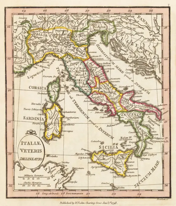
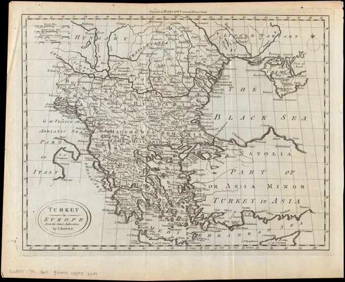
My Boards
View Pictures
  • My Boards

Ancient Empire Maps

Maps depicting ancient geographical territories, including the empire of Alexander and the regions in Europe and the Balkans.

 THE EMPIRE OF ALEXANDER         Date: 323 BC
THE EMPIRE OF ALEXANDER Date: 323 BC
133 assets in this story
4220-21851399
 THE EMPIRE OF ALEXANDER         Date: 323 BC
6145-29096339
1799 Clement Cruttwell Map of Turkey in Europe
6176-67045402
Map of the Ancient World, (1902).   Creator: Unknown.
6145-29096587
1832 Delamarche Map of Greece and the Balkans
1899-65660290
This map, which dates to 1903, delineates the ancient Persian Empire.The Persian Empire is the name given to a series of dynasties centered in modern-day Iran that spanned several centuries. The first Persian Empire, founded by Cyrus the Great around 550 B.C., became one of the largest empires in history, stretching from Europes Balkan Peninsula in the West to Indias Indus Valley in the East (as seen here). This Iron Age dynasty, sometimes called the Achaemenid Empire, was a global hub of culture, religion, science, art and technology for more than 200 years before it fell to the invading armies of Alexander the Great.
6145-29095445
1866 Mitchell Map of Persia, Turkey and Afghanistan (Iran, Iraq)
1899-61455232
This map dates to 1897 and shows the western Provinces of the ancient Roman Empire. Among them are: Hispania, Mauretania, Numidia, Itralia, Gallia, Britannia, Germania, Illyricum, Moesia, Macedonia, Egyptus, Noricum, Narbonensis, Sardinia, Corsica, Sicilia, Rhaetia, Pannonia.
6176-66099618
This map, which dates to 1903, delineates the ancient Persian Empire.The Persian Empire is the name given to a series of dynasties centered in modern-day Iran that spanned several centuries. The first Persian Empire, founded by Cyrus the Great around 550 B.C., became one of the largest empires in history, stretching from Europes Balkan Peninsula in the West to Indias Indus Valley in the East (as seen here). This Iron Age dynasty, sometimes called the Achaemenid Empire, was a global hub of culture, religion, science, art and technology for more than 200 years before it fell to the invading ar
6145-50565824
Schedler's map of Turkey and Greece , Balkan Peninsula, Maps, Greece, Maps Norman B. Leventhal Map Center Collection
6145-29096241
1787 Bonne Map of the Dispersal of the Sons of Noah
6176-66088381
Mapa of Northern Anatolia, ancient Bithynia region, Anatolia. Turkey. Agricultural Excursion in Northern Anatolia by J E Dauzats 1855
6145-29096605
1834 Malte-Brun Map of Greece
6145-51388226
Tabulae maximae quibus illustrantur terrae veterum in usum scholarum , Geography, Ancient, Maps, Italy, Maps Norman B. Leventhal Map Center Collection
6145-55917304
Tabulae maximae quibus illustrantur terrae veterum in usum scholarum. Relief shown by hachures and spot heights. Inset: Italiae regionines XI... Tabula II. Italia Italia. Tabula II. Italia Italia, Italy
6145-29095373
1865 Spruner Map of the Mediterranean from the Punic Wars to Mithridates the Great
6145-29096212
1780 Raynal and Bonne Map of the East Indies (Singapore, Java, Sumatra, Borneo)
4048-5354
1712 French map of Southwest Asia and Southeast Europe recreating the geography of the late Roman Empire of 400 AD.  Map uses Latin place names
6145-29095997
1753 Vaugondy Map of Persia, Arabia and Turkey
6145-48718605
Italy , Italy, Maps Norman B. Leventhal Map Center Collection
6145-29096580
1829 Lapie Map of the Eastern Mediterranean, Morocco, and the Barbary Coast
6145-50565832
Regni Hungariae, et regionum, quae ei quondam fuêre unitae, ut Transilvaniae, Valachiae, Moldaviae, Serviae, Romaniae, Bulgariae, Bessarabiae, Croatiae, Bosniae, Dalmatiae, Sclavoniae, Morlachiae, Ragusanae Reipublicae, maximaeque partis Danubii Fluminis, novissima delineatio , Balkan Peninsula, Maps, Early works to 1800, Hungary, Maps, Early works to 1800 Norman B. Leventhal Map Center Collection
6145-48719941
West Indien und Mittel America , West Indies, Maps, Central America, Maps Norman B. Leventhal Map Center Collection
6176-66915889
Map of The Babylon Empire and its Surroundings
1889-60416912
Map of Asia Minor, showing the expedition of Cyrus the Younger and retreat of the Ten Thousand.  From Cassell's Universal History, published 1888.
4220-2570
Tunisia and Tripoli (now largely Libya)Date: circa 1850
1033-205
Italy, 1825
1788-35003
Cartography, 18th century. Map of Italy in 1743.
6145-50524349
Türkei und Griechenland , Balkan Peninsula, Maps, Turkey, Maps, Greece, Maps Norman B. Leventhal Map Center Collection
6145-29095988
1752 Homann Heirs Map of Hungary, the Balkans, Northern Greece
6145-55917481
Turquie d'Europe. Relief shown pictorially. Prime meridian: Ferro. Conservation of this piece was funded by Alan and Sherry Leventhal in memory of his father, Norman B. Leventhal whose vision to create this Map Center will inspire generations to come. Map 23 in a composite atlas with the title "Atlas of the world."... , Balkan Peninsula  ,area  Turkey
6176-67056531
'Map to Illustrate the Mesopotamian Expedition', 1919. Creator: George Philip & Son Ltd.
6145-51396401
General-strassen & ortskarte des Österreichisch-Ungarischen Reiches nebst ganz süd-west-Deutschland einem grossen theile von nord-Italien, der Schweiz der Türkei und der übrigen angrenzenden länder , Europe, Central, Maps, Austria, Maps, Balkan Peninsula, Maps Norman B. Leventhal Map Center Collection
1525-28025721
Map of Ancient East, vintage engraved illustration. Dictionary of words and things - Larive and Fleury - 1895.
6145-50565828
Kriegsschauplatz uebersichtskarte der Europäischen Türkei mit den vasallenstaaten Montenegro, Serbien, Rumænien u. Griechenland , Balkan Peninsula, Maps Norman B. Leventhal Map Center Collection
6145-51397921
Accuratissima et maxima totius Turcici Imperii tabula cum omnibus suis regionibus novissima delineatio , Middle East, Maps, Early works to 1800, Turkey, Maps, Early works to 1800 Norman B. Leventhal Map Center Collection
6145-51823081
Persia John Menzies (born 1780). , n.d. Engraving, Sheet: 28 3/8 x 21 1/4 in. (72 x 54 cm).   European Art n.d.
6145-51391790
Carta geografica e postale dell' Italia ridotta dalle migliori carte fin' ora esistenti coll' indicazione di tutte le strade ferrale ed il corso dei battelli a vapore , Italy, Maps Norman B. Leventhal Map Center Collection
6145-29096257
1794 D'Anville Map of Italy
1889-60420093
Italiae veteris delineatio.  Ancient Italy.  1798 map by cartographer William Faden, engraved by Hatchett.  Faden was the royal geographer to King George III.  This map comes from his Atlas minimus un
6145-54269467
Turkey in Europe, from the latest authorities. From The general history of Europe / Percival Barlow. London: W. & J. Stratford, 1791. Relief shown pictorially. In upper margin: Engraved for Barlow's General history of Europe.... , Balkan Peninsula  ,area
6145-51392131
Charte von Italien : Nach seiner neuesten Eintheilung und den vorzüglichsten Hülfsmitteln , Italy, Maps Norman B. Leventhal Map Center Collection
6145-29096638
1837 Malte-Brun Map of India, Burma and Southeast Asia (Siam , Vietnam )
6145-29096657
1839 Monin Map of the Hebrew Peoples Dispersal After the Flood
1899-19798
Map of Syria Mesopotamia Assyria From The Atlas of Ancient Geography by Samuel Butler published London circa 1829
4430-11538
cartography maps Ottoman Empire copper engraving ""Atlas Novus"" by Georg Matthaeus Seutter printed by Peter von Bhelen Vienna 1728 private collection,
6145-59099996
Tabula italiae antiquae in regions xi ab Augusto divisae ...; Beauin, Jean (1696-1772); 1763 (1763-00-00-1763-00-00);
4409-20994582
Map of the world showing the boundaries of the Roman, Macedonian, Persian and Assyrian Empires. Handcoloured copperplate engraving by Andrea Bernieri from Giulio Ferrario's Ancient and Modern Costumes of all the Peoples of the World, Florence, Italy, 1843.
1899-18713196
Map of ancient Syria published in 1900. The boundaries of Syria are shown to include Palestine as far as Gaza, all of Lebanon, and Antakya in Turkey. This corresponds quite closely to Syria before the French Mandate was imposed in 1920. Lebanon was separated from Syria by the French in 1926, and Turkey occupied Antakya unilaterally in 1939.
6176-67071994
Map of Ancient Greece, 1902. Artist: Unknown
6176-66097831
This map dating to the last months of World war I, shows the battle lines on all Fronts as of August 1, 1917. The map shows also the extent of the German submartine blockade. According to the legend, the diagonal lines shows the Allied territory occupied by the enemy. The vertical lines show enemy territory occupied by the Allies. The dotted black line shows the international frontiers. The black-outlined red line shows the battle lines on August 1, 1917. The horizontal lines show the war zones the German submarine blockade.
6145-29096532
1827 Finley Map of Asia and Australia
6145-29095342
1865 Spruner Map of Arabia and Egypt in Antiquity
6176-66909803
Map of Asia, with an inset of Palestine, circa 1861
1848-50435330
Map, Persia, Arabia, India, Turkestan, historical illustration 1885, 19th century, Central Asia, Asia
1848-50225347
Map of Brandenburg and Prussia at the time of the Great Elector, 1688, Historical, digitally restored reproduction of a 19th century original, exact date unknown
6145-50567492
Tabula Italiae antiquae geographica : quam excellentissimus dominus Dex de la Rochefoucauld in oere incidi curavit , Classical geography, Maps, Early works to 1800, Italy, Historical geography, Maps, Early works to 1800 Norman B. Leventhal Map Center Collection
6145-29095266
1742 Homann Heirs Map of Italy
6176-66914699
Indexed pocket map of Austria-Hungary. circa 1906
6145-51392515
The Daily Telegraph war map of Egypt and the Near East (No. 6) , World War, 1914-1918, Middle East, Maps, World War, 1914-1918, Egypt, Maps, Egypt, Maps, Middle East, Maps Norman B. Leventhal Map Center Collection
6145-46604014
. Print at the top right labeled: Pag: 346.
6176-66098938
Peloponnesian War BC 431-404.  Pink: Athens and Allies; Orange: Sparta and Allies; Green: Neutral Allies
4443-20305999
Turkey and Greece, atlas by Th. von Liechtenstern and Henry Lange, antique map 1869
6145-29094927
1855 Spruner Map of Asia in the 9th and 10th Centuries
1848-78023413
Map from 1890, The Empires of the Persians and Alexander the Great, illustration, reproduction from a model from the 19th century. Authentic, file restored for optimal use, exact date of original unknown, historical, historical map showing the ancient Persian Empire and the conquests of Alexander the Great with detailed landscape features
1838-22161328
Map of Rome and Old Italy
1525-27918758
Itinerary of a thought transmitted from Paris to Algeria by the telegraph electricque, vintage engraved illustration. Magasin Pittoresque 1858.
1838-20279503
Map V, Greece and her Colonies, Illustration, Ridpath's History of the World, Volume I, by John Clark Ridpath, LL. D., Merrill & Baker Publishers, New York, 1894
6145-45552871
Bliżej Kultury Dubois de Montpéreux, Frédéric (1798 1850), Thez, A. (Fl. 1835 1843), lithography of H. Nicolet (Neuchtel)
1848-19344932
Map of Brandenburg and Prussia at the time of the Great Elector, 1688, Historical, digitally restored reproduction of a 19th century original, exact d...
6176-66098464
Battle lines on all fronts August 1, 1917. The map shows also the extent of the German submarine blockade. Legend: diagonal lines show Allied territory occupied by enemy; vertical lines show enemy territory occupied by Allies, dotted black line shows international frontiers; red line shows battle lines on August 1, 1917; horizontal lines show war zones of German submarine blockade
1848-61706861
Map of Italy at the foundation of the Norman Empire around 1050, historical illustration, Italy, Europe
1899-18787986
East Indies is a term used by Europeans from the 16th century onwards to identify what is now known as the Indian subcontinent or South Asia, Southeastern Asia, and the islands of Oceania, including the Malay Archipelago and the Philippines. The term has traditionally excluded China, Japan, and other countries to the north of India and the Himalayas. The names 'India' and 'the Indies', derived from the Indus River in modern-day Pakistan, were applied by the ancient Greeks to most of the regions of Asia that lay further to the east than Persia. This usage dates at least from the time of Herodotus, in the 5th century BCE.
6145-29094803
1855 Colton Map of Asia
6145-55914199
Asiatische Turkei. Prime meridians: Paris and Ferro. Relief shown by hachures. In upper left corner: H. Kiepert's Neuer handatlas no. 27. Includes notes. Panel on verso includes list of other publications... Politische ubersichtskarte der Asiatischen Turkei : (separat-ausgabe aus dem Handatlas uber alle theile der erde, no. 27). Politische ubersichtskarte der Asiatischen Turkei : (separat-ausgabe aus dem Handatlas uber alle theile der erde, no. 27), Turkey Middle East  ,area
6145-50571864
The Daily Telegraph war map of Egypt and the Near East (No. 6) , World War, 1914-1918, Middle East, Maps, World War, 1914-1918, Egypt, Maps, Egypt, Maps, Middle East, Maps Norman B. Leventhal Map Center Collection
6176-67044693
Map of Modern Italy, c1910s. Creator: Emery Walker Ltd.
6145-29095286
1864 Mitchell Map of Asia
6176-66907115
A New Map of Chinese & Independent Tartary - An exceptionally beautiful example of John Carys important 1806 map of Chinese and Independent Tartary. Covers Central Asia from the Caspian Sea to Japan, extends as far north as the Obskaia Sea and as far south as India, Burma and the Philippines. Includes the modern day nations of Uzbekistan, Kazakhstan, Turkmenistan, Kirgizstan, Tajikistan and Mongolia. One of Carys most interesting maps. Central Asia, despite hundreds of years of passing trade on the Silk Routes, was still, at the turn of the century a largely unknown land. 1806
1899-20868
India circa 1930. Before partition. From Bacon's Excelsior Atlas of the World, published circa 1930.
4048-5438
1743 map of west coast of Africa  where slave trade thrived.  Ignoring key European interest, the slave trade, scene at lower left  shows free Africans processing elephant ivory, smoking, and buildings.
6145-50571478
Asiatische Türkei , Turkey, Maps, Middle East, Maps Norman B. Leventhal Map Center Collection
1899-18713523
The son of a mapmaker, Fer turned the family business into a flourishing map publishing company in Paris and was appointed geographer to the French dauphin. This map, printed in the last year of Fers life, credits a number of Jesuits, including Pedro Páez and Jerónimo Lobo, for its geographic information. The sources of the Blue Nile are called 'les yeux du Nil' (the eyes of the Nile), probably based on Lobos descriptions of the two springs, and they are shown  on or in a mountain. The White Nile is barely represented.
1848-49321461
Discoveries of the Phoenicians and Carthaginians, historical map, Mare Internum, Mediterranean Sea, Aethopia, Ethiopia, Palestine, Iberia, Iberian Peninsula, Europe, North Africa, England, Amber Coast, Hellas, Asiaminor, Turkey, Greece, Africa
6145-59601504
Map of the trips of the Apostles, Dirk Janszoon van Santen, after Johannes L. van Luchtenburg, 1700 print Map of the area around the Mediterranean Sea on which the journeys of the apostles are indicated. In the middle: 'In the N. Testament, p. 114 '. Expandable map in the second part of the print Bible with the New Testament, published by Pieter Mortier, Amsterdam 1700.  paper. deck paint. engraving maps of separate countries or regions. lives and acts of the apostles of Christ; epistles
6176-66097471
This map dates to 1917, the time of the First World War, and shows the intricate racial distribution (Italian, Slav, German, and Magyar) in the Austro-Hungarian monarchy.
463-3660
Detail Map of Southern Europe Maps Post Museum, Berlin
1788-38503
Cartography, 16th century. Italy, from Atlas of the World in thirty-three Maps, by Battista Agnese, 1553
6145-51392518
The Daily Telegraph war map no. 10 , World War, 1914-1918, Europe, Maps, World War, 1914-1918, Balkan Peninsula, Maps, Balkan Peninsula, Maps, Europe, Maps Norman B. Leventhal Map Center Collection
6188-55554178
Agricultural map of the Northwest Region, vintage engraving. Agricultural map of the Northwest Region, vintage engraved illustration. Magasin Pittoresque 1861. Copyright: xZoonar.com/PatrickxGuenettex 10674068
6176-66083659
Old Map of railways in the east. Old 19th century engraving from La Nature 1887
1848-19282778
Karte des Römischen Reiches. Die Karte ist in der unteren rechten Ecke von I. Laurus signiert. Der eingefügte Text in der Mitte beschreibt die Ausdehn...
1889-60422276
Map of the empire of Otto the Great, 10th century.  From the book Outline of History by H.G. Wells, published 1920.
6145-54267733
Kingdom of the Caliphs. Shows Arabic expansion from 622-1353. Appears on pages 6-7 in the author's A literary & historical atlas of Africa and Australasia. London : J.M. Dent & Sons ; New York : E.P. Dutton & Co., 1913.... , North Africa  ,area
6145-29096402
1814 Thomson Map of Tartary ( Mongolia, Tibet )
6176-67070576
''Variations du Tchad; L'Ouest Africain', 1914. From "Grande Geographie Bong Illustree", 1914.
6145-30287839
Post card of all K, also K, Austrian states with most of Germany, Holland, France and Italy, Franz Landschau, cartographer
1525-27713423
The map of Austria-Hungary with explanation of signs on map.
1848-50242610
Map of Italy in 1895, digitally restored reproduction of an original 19th-century original
1899-65659733
This map shows The Aetolian and Achaean Leagues about 229 BC. The legend reads: Pink: Aetolians; Green: Achaeans.
1889-60423445
Map of the Roman Empire at the death of Caesar Augustus, AD14.  From the book Outline of History by H.G. Wells, published 1920.
PREVIOUS
of 2
NEXT
2401 S. Ervay, Suite 206
Dallas, Texas 75215
United States
Get Started
Free ResearchMy BoardsMy Cart
For Creators
How To License Your ContentContributor PortalFrame of Mind
Resources
API accessPricing
Contact
+1 866 236 0087help@viewpictures.co.uk Contact form
©2026 View Pictures. All Rights Reserved. -A
This site is protected by reCAPTCHA and Google Privacy Policy and Terms of Service apply.