My Boards
View Pictures
  • My Boards
← Documents & Records

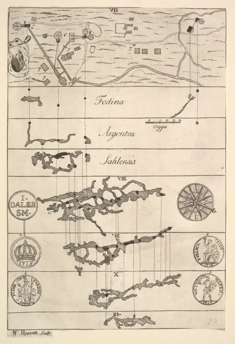
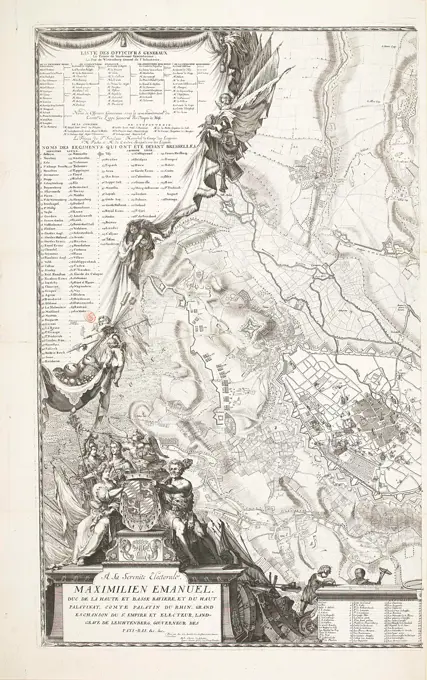
Antique Maps and Battle Plans

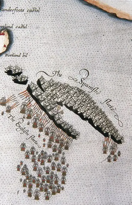
Collection of antique maps and battle plans from different historical contexts, illustrating troop movements, city defenses, and strategic locations.

Map of Muscovy by Ptolemy (Octava Europe Tabula) by Anonymous master   / Private Collection / 1480-1490 /Woodcut / History / 36,5x47,5 / Cartography
Map of Muscovy by Ptolemy (Octava Europe Tabula) by Anonymous master / Private Collection / 1480-1490 /Woodcut / History / 36,5x47,5 / Cartography
263 assets in this story
4409-17566960
Map of Rome. Unknown Artist; English, 19th century. Date: 1889. Dimensions: . Engraving in black on cream laid paper. Origin: England. Museum: The Chicago Art Institute, Chicago, USA.
4409-17420411
La Pratique de l'Aiguille, page 10 (recto). Author: Matthias Mignerak. Dedicatee: Dedicated to Marie de Medici (Florence 1575-1642 Colgne). Dimensions: Overall: 9 1/4 x 7 1/16 in. (23.5 x 18 cm). Engraver: Title by Pierre Firens (French, born Paris 1641). Publisher: Published by Jean Le Clerc , Paris. Date: 1605.Written by Matthias Mignerak, title page engraved by Pierre Firens, French, born Paris 1641, dedicated to Marie de Medici, Florence 1575-1642 Cologne, published by Jean Le Clerc, Paris.From top to bottom, and left to right:Design is printed upon a grid and is decorated with a scene depicting Mary Magdalene witnessing the Resurrection of Christ ().. Museum: Metropolitan Museum of Art, New York, USA.
6145-46481384
Break through the French lines in Brabant, 1705; The through through the Vyandlyke Linie in Brabant, through the Allied armies, under the authority of the Duke of Marlbourg and the HR. Van Ouwerkerk on the 18. Julij 1705. Map With the location of the French Lines in Brabant, broken by the Allies during the Battle of Eliksem, at Tienen near Leuven, July 18, 1705. Left on the legend A weapent trial with banners and weapons from the Allies and two chained prisoners. Part of an Atlas with 223 maps of countries and cities and war scaffolding in Europe in the period approx. 1690-1735.
6145-44041640
Plan of Camorra
6145-59103345
Lviv (Lviv, Ukraine). City plan Leopopolis = lemberg - reproduction of copperplate by Johann Christoph Hafner; Jaworski, Józef Kościesza- (Fl. Ca 1911-Ca 1929); 1911 (negative); 1911-1927 (print) (1911-00-00-1927-00-00);
6145-48927010
Map of the Transvaal, circa 1900, maker unknown. Gift of an anonymous donor, 1972.
6145-29717246
Fodina argentea Sahlensis - A Silver Mine at Sala - II (Aubry de La Mottraye's "Travels throughout Europe, Asia and into Part of Africa...," London, 1724, vol. II, pl. 33, no. 2) 1723-24 William Hogarth British Hogarth made this print early in his career to illustrate a travel book by the French author Aubry de La Mottraye. It includes sectional views and maps of a silver mine at Sala, as well as images of four silver coins.. Fodina argentea Sahlensis - A Silver Mine at Sala - II (Aubry de La Mottraye's "Travels throughout Europe, Asia and into Part of Africa...," London, 1724, vol. II, pl. 33, no. 2) 396280
6145-30095963
Beleg van Brussel (linkerhelft), 1697; Plan de la ville de Brusselles avec la situation, les retranchemens et campemens des armées des alliez sous le commendement de sa majesté Britannique au mois d'août l án 1697.Leerh half of a large map of Brussels and the surrounding area during the siege of the city by the Allies under King Willem III from August 1697. On the left a curtain ceased by angels with lists of the officers and regiments, bottom left a cartouche with allegorical figures and the assignment in French. At the bottom of a part of the legend 1-48 in French.
6145-45701997
Sketch of a sitting figure with a book ().
6145-54598146
Glass Furniture Design. Osler Design Pattern Book - 21 Light Alabaster On Ruby Gilt Candelabra for Shades, 1850-1900. Designer: F & C Osler (Ltd).. The Osler Archive, presented by Peter Osler, 1977.
6145-50572358
Circular world map , World maps, Early works to 1800, Incunabula
6145-29252367
Johannes Rogers. Pen drawing after J. Brand, 1664.
4409-17949324
Vista de la Nouvelle Cythere (Tahití) con la fragata Boudeuse y la urca la Étoile. Louis-Antoine de Bougainville (1729-1811), Vue de la Nouvelle Cythère... 1768. Dessin à la plume aquarellé. (13 x 21 cm)BNF, Cartes et plans, S. H. Pf 176, div. 7, p. 1 D.
6145-46493940
Braid with leaf motifs. Publisher number 243
6145-59503088
Stuurmanskunstkbook: "De Zeevaert of Conste van Ter Zee", Peter de Medina, c. 1580 book Two books from two different authors, bound in one band. One of the Spaniard P. de Medina, theoretical in nature, and one of the southern Dutch M. Coignet, practical in nature. Titles: 1) "The Zeevaert oft Conste van Ter Zee Vanden Excellent Pilote M. ter Peeter de Medina Spaignaert. In the welcke not only the rules, secreses, practices and constant instruments of the selver cones are understood, but ooc de clare and sincere foundations of the astronomy and gantschen loop of heaven, on the most lightest ende duydelijkckste. All coopers, pilots, skippers and the other lovers of the astronomies. From the Spaensche and the Fransoysche in our Lower Tale Eenthesche Tale M.R. Merten Everaert Brug. Neither with another new education on the principal punctures of the Navigatien, by Michiel Coignet t'hanewerpen, at Hendrick Hendricksen, On Onser Women Kerckhof in the Lelie-Bloeme, in 1580. With Co. Ma TS Cur
6145-30347404
Isaac Johnson, 1754-1835, British, An Estate in Naughton, Bricett, Bildeston and Offton, Suffolk, 1781. Graphite, pen and black ink and watercolor on smooth, moderately thick, white wove paper.
6145-45786001
In the corner of carnation a prark with post holder. Color drawing over two pages of coastal profile in pieces among each other from the corner of Anjer (Anyer) on West Javanese coast and the prawn with the post holder who took the post of the Vocjip and brought Overland to Batavia. Native praug. With inscription. Part from Jan Brandes, DL sketchbook. 2 (1808), p. 90-91.
6145-29094798
1855 Colton Map of Antarctica, the South Pole, or the Southern Polar Regions
4409-18174233
Pietro (or Pierino) Vesconte, Maps of Jerusalem and Acre. From Marino Sanudo Torsello, Liber Secretorum fidelium crucis, c. 1320-25. Add. MS 27376, ff.189v-190.
6145-46481380
Map of coast at Dunkirk; Mapere of Duinkerke places of Duinkerke as well as the plan of the new port of Mardyk. Map of the Flemish coast between Dunkirk and Grevelingen on which indicated the plan for the new port of Mardijk. At the bottom of the legend on a wall, with playing putti. Part of an Atlas with 223 maps of countries and cities and war scaffolding in Europe in the period approx. 1690-1735.
6145-45596510
Illustration for 'The Labor of Mars' by Allain Manesson Mallet. Ground plan of a fortress (ATH). In the top right the number 106 (= the number of the page in the book to which the illustration is placed).
6145-55951375
Olinda De Phernambuco. Ogilby, John, 1600-1676. Maps, Atlases. 1671. Lionel Pincus and Princess Firyal Map Division. America, West Indies, British , History
6145-59585131
Map of Ameland, 1809 print Under the title a bowl: scale of 400 rods in the Rynandche Duim. With grid.  paper. pencil engraving maps of separate countries or regions Friesland. Ameland
4409-169513
PLANTA DE LA CIUDAD DE TRUJILLO DEL PERU-1687-MYP 14-. Location: ARCHIVO DE INDIAS, SEVILLE, SPAIN.
4409-17275473
MAP OF THE CITY OF TRUJILLO DEL PERU-1687-MYP 14-. Location: Archivo General de Indias. Sevilla. Seville. SPAIN.
6145-30126433
Gibraltar; Gibraltar with all his fortififiers and improvements up to season. Face on Gibraltar with a city map, with two bets with faces on the rock. Legal and stacks of dead rabbits. Probably related to the conquest of Gibraltar by the combined English and Dutch fleet in 1704 and it relieves in 1705 after investment by the French. Part of an Atlas with 223 maps of countries and cities and war scaffolding in Europe in the period approx. 1690-1735.
4409-20890912
Cartel La razón de un caudillaje, con episodios de la vida de Francisco Franco Bahamonde durante la guerra civil española. Año 1940.
6145-58832521
View of Cape Sint Augustijn, ca. 1636-1644, 1645 - 1647 Map of Cape Sint Augustijn (Cabo de Santo Agostinho) with the forts, in Pernambuco, ca. 1636-1644. In the air a winged banderol with the title. In the caption the explanation of the letters A-i in Latin. Plate nr. 37 In a series of 55 performances from the trip to and the stay in Brazil by Count Johan Maurits van Nassau in the years 1636-1644. print maker: Northern Netherlandspublisher: Amsterdam paper etching / engraving  Cabo de Santo Agostinho Map of Cape Sint Augustijn (Cabo de Santo Agostinho) with the forts, in Pernambuco, ca. 1636-1644. In the air a winged banderol with the title. In the caption the explanation of the letters A-i in Latin. Plate nr. 37 In a series of 55 performances from the trip to and the stay in Brazil by Count Johan Maurits van Nassau in the years 1636-1644. print maker: Northern Netherlandspublisher: Amsterdam paper etching / engraving  Cabo de Santo Agostinho
4409-21485865
Museo de Luxor.
1788-36585
Cartography, Dominican Republic, 17th century. Map of Santo Domingo city showing the city's defensive wall, 1619. Watercolor.
6145-45785486
Map of Doetinchem. Map of Doetinchem. City plan of the city where Brandes was from 1770 to 1778 pastor of the Lutheran municipality. He indicated the map who (from the limbs of his municipality) where lives. With inscriptions.
6145-52813611
Ink and feather drawing by Valentin Wagner from 1632 depicting the Lüneburg Fortress Diffold.
6145-52813612
A travel sketch by Valentin Wagner, created between 1631 and 1638 using ink and feather, depicting the Lüneburg Fortress Diffold with architectural details and surrounding landscape.
1788-36271
Cartography, Italy. Map of Val Baganza, Parma.
6145-59440636
Illustration for 'The Labor of Mars' by Allain Manesson Mallet, Romeyn de Hooghe, 1672 print Floor plan for a fortress, fort or reinforcement (hexagon). Below that a rider fight. In the corner at the top right the number 138 (= the number of the page in the book on the other hand the illustration has been placed). Amsterdam paper etching fortifications, military engineering. mathematics. warfare; military affairs (+ cavalry, horsemen). battle
1788-35593
India, by Muhammad Al Idrisi (1099-1165), taken from the Altas of the World, 12th Century.
6145-45724534
Wind rose, ca. 1702; Boussole des Vents (...); Les Forces de l'Europe, Asie, Afrique et Amerique, Ou Description des Principales Villes Avec Leurs Fortifications. Dessignées PAR LES MEILLEURS Engineers, private party Celles Qui Sont Sous La Domination de la France (...) Et Ornées the plusieurs Superbes Edifes. Diagram or table with all wind directions and the corresponding terms shown in six languages. In the four corners the blowing wind couples. In the middle of the wind rose a sun with a French lily. Signature at the bottom right: 49. Part of the first of two parts of the picture: Les Costes de France et d'Espagne (or part 13 of: Les Forces de l'Europe, Asie, Afrique et Amerique), issued approx. 1702. The In the context, consists of a total of 43 labeled plates of the coast of France and Spain, in the context of the Spanish Succession War. These plates have been copied to anonymous French plates originally published by Nicolas de Fer in Paris. Title in French.
6145-44071332
Plan Von's Hitler's Scanties
6145-59242242
Windroos, ca. 1702, 1702 - 1703 print Diagram or table with all directions and the corresponding terms shown in six languages. In the four corners the blowing wind heads. In the middle of the wind rose a sun with a French lily. Marked at the bottom right: 49. Part of the first of two parts of the print work: Les Costes de France et d'Espagne (or part 13 of: Les Forces de l'Europe, Asie, Afrique et Amerique), issued ca. 1702. The Prent work consists of a total of 43 marked plates from the coast of France and Spain, in the context of the Spanish War of Succession. These plates were copied to anonymous French plates originally published by Nicolas de Fer in Paris. Title in French. print maker: Northern Netherlandspublisher: Amsterdam paper engraving winds according to several divisions
4409-21514952
Recortable infantil. Construcción de barcos. Barco de Vela. Ediciones La Tijera. Madrid, años 1925.
1788-37931
Cartography, Mexico, 18th century. Survey on the course of water as far as the village of San Andres Chalchicomula.
6145-46204999
Who Luy and Lecker is / who needs to Leckerlandt // that eats' Vleesch and Visch / and Repter Hand Neither tooth. Leaf with a big representation of partying and eating people in the Luilekkerland. There is drink from a fountain, there is meat in the trees and food comes out of the sky. Under the show a caption in five columns.
6145-54603122
Official tourist map of Imperial County, California
1788-36369
Cartography, Italy, 16th century. Map of Mola di Bari, Apulia region. From Civitates Orbis Terrarum by Georg Braun (1541-1622) and Franz Hogenberg (1540-1590), Cologne. Engraving
6145-55180715
Americae sive novi orbis, nova descriptio. Ortelius, Abraham, 1527-1598. Cartographic. Maps. 1606. Lionel Pincus and Princess Firyal Map Division. America, America , Maps , Early works to 1800
6145-52847372
Color print from around 1900 depicting a board game featuring cities such as Paris, Madrid, and Constantinople, illustrating European recreational practices and map-based gameplay.
6145-55946704
Lacs de Natroun. 1. Vue d'El-Rahâouy, près Omm-Dynâr, prise du côté de l'ouest; 2. Carte topographique des deux principaux lacs de Natroun; 3. Vue du batiment appelé Qasr, prise du côté du sud-ouest.. Prints, Illustrations, Maps. 1817. Rare Book Division. Egypt, Forts & fortifications , Egypt, Lakes & ponds , Egypt, Troop movements , French , Egypt, Natrun Valley (Egypt)
6145-29913461
Chart of the monkies papers / who had been course since the epoch of the French Revolution. (IT)
1848-49382702
Tabula Peutingeriana, Peutinger Map, Peutinger's Tabula, Peutinger Table, illustrated itinerarium, ancient Roman road map
4409-21514967
Recortable infantil. Construcción de barcos. Lancha torpedera. Barcelona, años 1960.
6145-59253259
Menning with an emblem and with the names of the Ottoman sultans, Anonymous, After Nicolas Chevalier, 1708 print Design of a round medal with, in four concentric circles, the names of Ottoman sultans and their government years, starting at Sultan Selim I and ending with Sultan Ahmed II. In the middle of the medal an emblem with a sea landscape and the motto: "Tacito splendent mea lumina cursu". Amsterdam paper etching seal (symbol of sovereignty). other sovereign (with TITLE). device (as symbol of the state, etc.). Abstract Ideas and Concepts (+ emblematical representation of concept). sea (seascape)
1899-18718759
Map of the Jutgelt Gun's hoshuu (banner) of the Altai Urianhai in western Mongolia. Material is Chinese paper, original size is 36x45 cm.
6145-50633155
Diary of Żółkiewski W.H.K. knowing on the road from Mohilev on the Dniester . unknown
6145-59474230
View of tours in a nutshell perspective, anonymous, c. 1610 - 1657 print This print is part of an album. publisher: AmsterdamThe Hague paper engraving / etching city-view in general; 'veduta' Tours
6145-30306420
Viennam Austriae cum sua vicinis , District plan , birds eye view of the destroyed fortifications and suburbs of Vienna in , Albert von Camesina -, Lithographer, after, Heinrich Schmidts, Etcher
6145-29672415
Photo collection Government information service. carpet. undated
6145-45590287
The Malle ship of Rotterdam, 1653; Wahrhaffte Abildung, Dess Wunderbahren Schiffs So Zu Rotterdam Ao. 1653 are mentioned. The silly or wonderful ship of Rotterdam, designed by Nicolas Desson, 1653. Closed diamond-shaped wooden ship with a scream wheel or screw in the middle (covered by a trapped leaf). On top of the ship a flag, at the bottom of a description in 8 lines and the legend 1-9.
6145-50567461
Chili , Chile, Maps, Early works to 1800 Norman B. Leventhal Map Center Collection
1788-32423
Plate showing nautical signals of correspondence: day signals. Engraving from Denis Diderot, Jean Baptiste Le Rond d'Alembert, L'Encyclopedie, 1751-1757. Entitled Marine (Sailing).
4409-3797
CIVITATES ORBIS TERRARUM - SEVILLA - DETALLE DE LAS LAVANDERAS EN EL RIO - GRABADO - SIGLO XVI - (CONJUNTO Nº 3063). Author: GEORG BRAUN 1541-1622 / FRANS HOGENBERG. Location: BIBLIOTECA NACIONAL-COLECCION. MADRID. SPAIN.
1788-34952
Board depicting the Fables in the Labyrinth and the layout of the labyrinth at Versailles, France 18th Century.
4435-9004
Detail of map No.6 by Robert Adams, engraved by Augustine Ryther, showing the route of the Spanish Armada fleet druing its expedition to the British Isalnds. Engraving. SPAIN. MADRID (AUTONOMOUS COMMUNITY). San Lorenzo de El Escorial. Royal Monastery of San Lorenzo de El Escorial.
4409-37602
CHILE. Physical map of the Andes. Illustration of the book "Des cordilleres et monuments des peuples de l'Amerique" by Alexander Humboldt (1769-1835). Ppublished in Paris in 1810.
PREVIOUS
of 3
NEXT
2401 S. Ervay, Suite 206
Dallas, Texas 75215
United States
Get Started
Free ResearchMy BoardsMy Cart
For Creators
How To License Your ContentContributor PortalFrame of Mind
Resources
API accessPricing
Contact
+1 866 236 0087help@viewpictures.co.uk Contact form
©2026 View Pictures. All Rights Reserved. -A
This site is protected by reCAPTCHA and Google Privacy Policy and Terms of Service apply.