Antique Maps of Africa and America

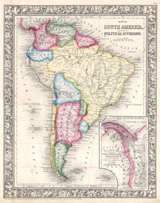
Early maps depicting Africa and the Americas, featuring detailed geographical outlines and historical annotations. Vintage aesthetic.

Map Africa, 19th century engraving
1864 Mitchell Map of South AmericaCentral and South Africa. Date from cover. Relief shown by hachures and spot heights. Insets: England & Wales on same scale as large map -- Cape Town -- Port Elizabeth -- Lorenzo Marquez -- Port Natal -- Mouths of the Zambezi River... Bartholomew's new map of Central & South Africa. Bartholomew's new map of Central & South Africa, Africa AfricaThis map of South America, according to the newest and most exact observations , South America, Maps, Early works to 1800 Norman B. Leventhal Map Center CollectionAfrica. Edition materially improved to 1831... Relief shown by hachures.... , Africa AfricaMap showing route taken by William Dampier on his expedition which reached the shores of New HollandAfrica Elaboratissima; Schenck, Pieter (1660-1711), Valck, Gerard (1651 cars 1652-1726); 1711 (1711-00-00-1711-00-00);Südamerika , Children's maps, Germany, Relief models, Specimens, South America, Maps Norman B. Leventhal Map Center Collection1724 map of Asia and islands of the East Indies. Central and Western Asia are occupied by Tatars.America Cartographic. Maps. 1843. Lionel Pincus and Princess Firyal Map Division. America , MapsSouth America divided into its IIII principall parts : I Spanish part: vizt. Firmland, Guiana, Peru, Chili, pt of the country of Amazones, & Paraguay: III English pt vizt Magellanick-land & pt of Firmland: IIII Dutch pt vizt pt of Firmland & ye isles. Relief shown pictorially. Title is partially damaged. Cataloging, conservation, and digitization made possible in part by The National Endowment for the Humanities: Exploring the human endeavor. Part of composite portfolio atlas with title "Collection of old maps.".. Collection of old maps. Collection of old maps, South America South AmericaTreaty map of Africa Sanderson, Edgar, 1838-1907. Cartographic. Maps. 1898. Schomburg Center for Research in Black Culture, Jean Blackwell Hutson Research and Reference Division. Africa , Colonization, AfricaSüdamerika , Children's maps, Germany, Relief models, Specimens, South America, Maps Norman B. Leventhal Map Center CollectionDistribution of animals according to Brehms Tierleben in the 19th century, Historical, digitally restored reproduction from an 18th century originalMAPA 1759-DIVISION ENTRE BRASIL Y POSESIONES ESPAÑOLAS-SEGÚN TRATADO DE TORDESILLAS. Location: ARCHIVO-COLECCION. Simancas. Valladolid. SPAIN.This map was produced at the height of British Imperial power and shows direct British rule extending all the way from Iran (Persia) to Thailand (Siam). Most of the contiguous Indian Ocean littoral, from South Africa to Singapore and Australia, was also under British administration or de facto control. It is relevant to note that the map shows Sikkim extending north into the present-day territory of China's Tibetan Autonomous Region. Similarly Darjeeling is shown in eastern Nepal, while Bhutan is elongated to the east and most of India's Arunachal Pradesh province is shown as part of the Qing Empire. In Kashmir, by contrast, the disputed Aksai Chin region, now under Chinese control, is shown as part of India.Overview of the German colonies, illustration, Meyers Konversations-Lexikon encyclopedia, 1897Mapa do Brazil : (esboço) (outline) , Brazil, Maps Norman B. Leventhal Map Center CollectionMAP OF ASIA, 18991837 Malte-Brun Map of the World According to the AncientsHistorische Karte des Byzantinischen Reiches im Jahr 1000, Historisch, digital restaurierte Reproduktion einer Originalvorlage aus dem 19. Jahrhundert1785 Japanese world map based on Jesuit missionary, Matteo Ricci's 1602 maps, and made during Japan's Age of National Isolation (1636-1854). Map shows continents and oceans of the world at about 1600 and is indicative of the effect of Japan's isolation from world events.1833 Malte-Brun Map of Asia in Ancient TimesMap of India, Jacob Keyser, 1744 print Map of India, different areas different, at the bottom right wind rose, bottom left under the inscription the scale in German, English and French miles (1: 12.5 million). Amsterdam paper engraving maps of separate countries or regions India. Sri LankaMap showing the distrubution of the Koklass Pheasants. Beebe, William (1877-1962). Cartographic. Scientific illustrations, Prints, Ornithological illustrations, Illustrations. 1918 - 1922. General Research Division. PheasantsGerman map of Europe; Russia and Asia dated to 1890. The British India colony and Dutch East Indies are shown as well as The Russian Empire1943 World War II Japanese Aeronautical Map of BorneoIndia map  the british possession in the East India  with the dependent states and countries adjacent Copyright: xJehangirxSorabjee/DinodiaxPhotoxAustralia on vintage 1920s map, selective focus (printed in 1926 - copyrights expired)Mapa físico-político de América Meridional, editado por Luis Tasso, Barcelona. Grabado de 1870.China and Japan Map, 1869Africa Tertia Pars Terrae, Antique World MapsMAPA DE SUDAMERICA S XVIII LOS VIRREINATOS.1865 Johnson Map of AustraliaMap showing the regions of Spanish colonial administration in their 17th century South and Central American empire.Pictorial map of the American continent : featuring the Pan American Highway and showing some of the natural resources, scenic wonders, and points of interest , America, Maps, Pan American Highway System, Maps, Natural resources, America, Maps Norman B. Leventhal Map Center CollectionThe Continent of Africa and its Explorers, 1910, Historic, digitally restored reproduction of an original artwork from the early 20th century, exact original date unknownSketch map of Nigeria, showing suggested rearrangement of provinces. Cartographic. Photographs. 1911. Schomburg Center for Research in Black Culture, Jean Blackwell Hutson Research and Reference Division. Africa, Nigeria , Description and travelCover of 'El ingenio. Fábrica de artículos para fiestas', 20th century.