Antique Maps of Italy and the Mediterranean

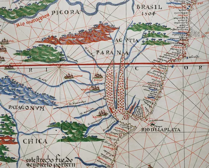
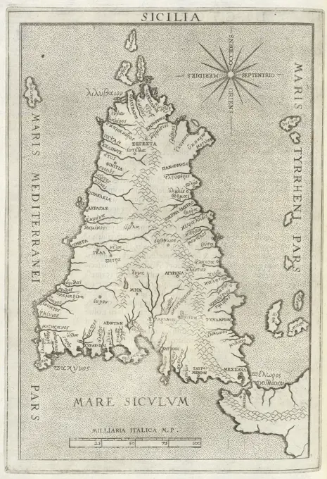
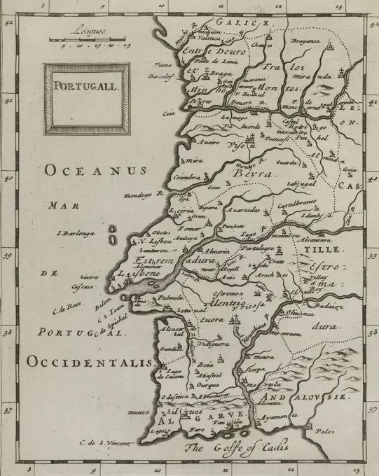
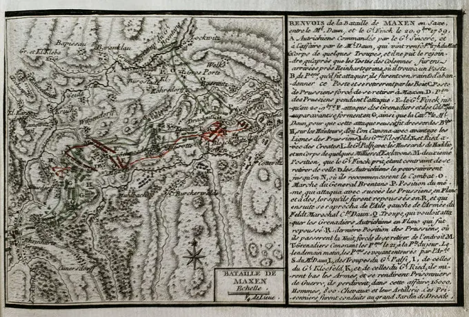
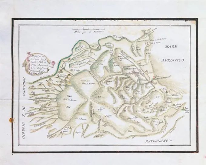
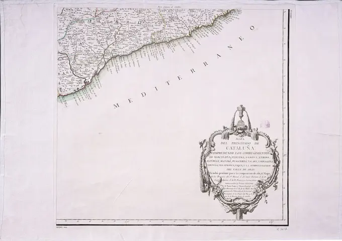
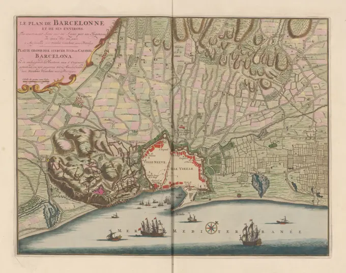
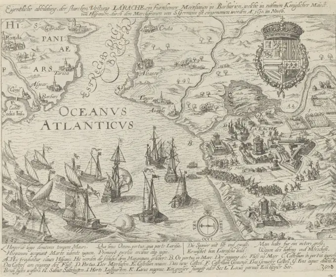
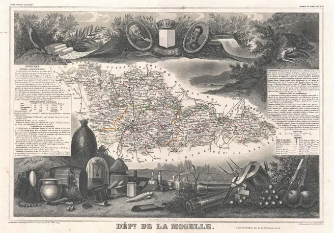
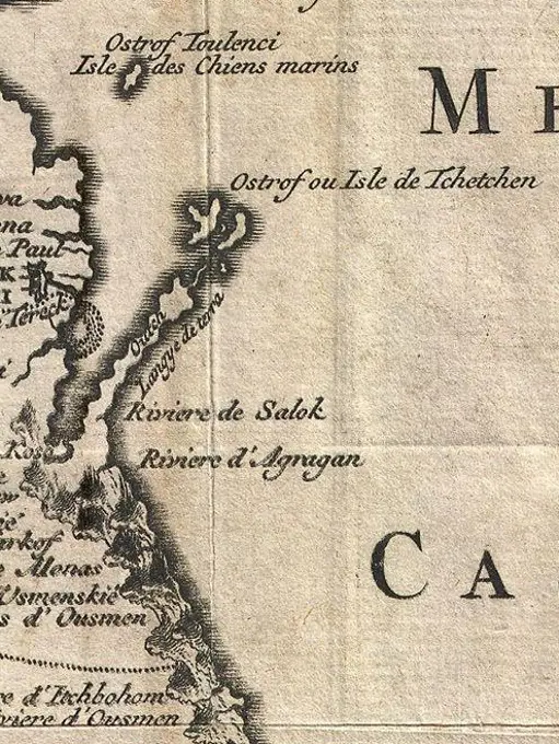
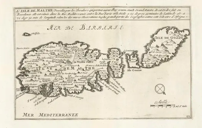
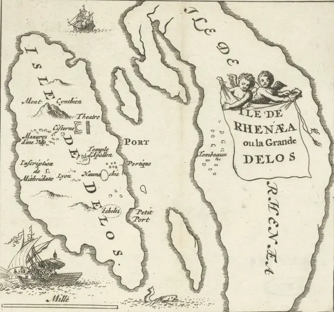
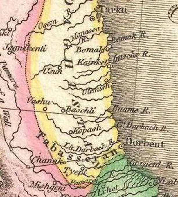
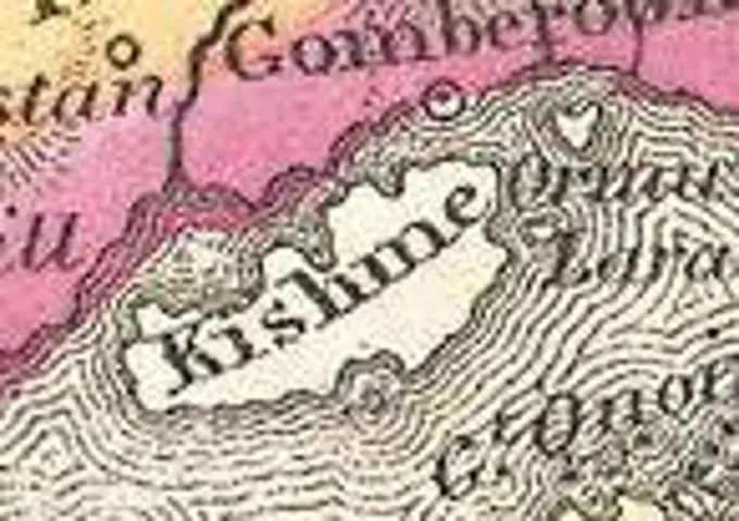
A series of detailed antique maps illustrating historical locations in Italy and the Mediterranean, highlighting geographic and cultural significance.

Virginiae partis australis et Floridae partis orientalis, interjacentiumque regionum nova descriptio , South Atlantic States, Maps, Early works to 1800, Virginia, Maps, Early works to 1800, North Carolina, Maps, Early works to 1800, South Carolina, Maps, Early works to 1800, Georgia, Maps, Early works to 1800, Florida, Maps, Early works to 1800 Norman B. Leventhal Map Center Collection
A new map of Denmark and Sweden : according to ye newest and most exact observations. Relief shown pictorially. Prime meridians: London and Ferro Island. Dedication: To His Excellency John Lord Bishop of Bristol Ld. Privy Seal and Her Majesty's first Plenipotentiary at the Treaty of Utrecht. This map is Humbly Dedicated by your Excellency's most humble Servant. H: Moll Geographer. Inset: The north part of Norway, Lapland and Greenland. Includes notes and 5 vignettes pertaining to Laplanders. Appears in Moll's The world described, 1709-1736, plate 14.... , Baltic Countries  ,area  Scandinavia  ,areaSiege of Bergen op Zoom by Spinola, 1622. Map of the failed Siege of Bergen op Zoom by the Spanish army under Spinola and Velasco, July 18 - October 3, 1622. Plan of the city and surroundings with waterways and omsing through the Spanish troops. Two text sheets belong to the print.North America : from the French of Mr. d'Anville, improved with the back settlements of Virginia and course of Ohio, illustrated with geographical and historical remarks , North America, Maps, Early works to 1800 Norman B. Leventhal Map Center CollectionMartinico, Dominica. Relief shown by hachures. Includes inset of Cul de Sac Royal. Appears in John Thomson's New general atlas. Edinburgh. 1817. Exhibited in Faces and Places, at the Boston Public Library, Boston, MA, October 2003 - September 2004. MB (BRL). This combination map of Dominica and Martinique, two neighboring islands in the Lesser Antilles, was published in the 1817 edition of Thomson's "New General Atlas". Both islands were originally settled by the French, but at this time Dominica was British while Martinique was French. These maps are primarily topographical, recording very few human settlements, but mountains, rivers, inlets, bays, capes, and other coastal features are recorded in detail... , Dominica Martinique  ,territoryLord Baltimore's own plan for the proposed Maryland/Pennsylvania boundary from 1735. The map measures 37 x 24 cm and is associated with the Chesapeake Bay Region, specifically Maryland and Virginia. The place of publication is questioned but is noted as London. The map illustrates the boundaries of Maryland and PennsylvaniaGlobe gore featuring North American coastline. Title supplied by cataloger. Relief shown pictorially. Includes ill.. Displayed here is a globe gore (segments of paper printed with map images and cut to fit over the globe's sphere) showing North America's northeast coast and the North Atlantic. The gore is the work of Coronelli, a member of the Franciscan Order in Venice and the most prolific globe maker at the end of the 17th century. He made globes of all sizes, including his largest globe, with a diameter of 15 feet, which was presented to France's King Louis XIV. With place names in Italian, there are some familiar geographical features, although not necessarily applied to their correct historical locations: New York (Il Nouvo Jorck applied to the Hudson River and southern New England), New England (Nouva Inghilterra applied only to eastern Massachusetts), Boston (identified as Briston) and Cape Cod (interestingly labeled N. Hollan)... , New England  ,area  Northeastern United StateVigo; Vigo, a Spanish city, fortress and harbor (...) here is 1702 19 Sept Ember D'Spanish Silver Fleet (...) In the event of N and 22 Oct waiter burned (...).; Les Principales Forterses & Villes Fortes, D'Espagne, De France, D'Italie, The Savoia, D'Allemagne & des Païs-Bas (...) / Sittingurial images of the main strong cities and fortresses in Spanjen, Vrankryk, Italien, Savoy, Duytsland and Nederlanden (...). Ticket by Vigo, with texts in Dutch, French and Latin. The print is part of an album.. Print at the top right labeled: Pag: 506.Carta particolare della costa di Florida è di Virginia , Coasts, South Atlantic States, Maps, Early works to 1800, Coasts, Middle Atlantic States, Maps, Early works to 1800, Nautical charts, Early works to 1800, South Atlantic States, Maps, Early works to 1800, Middle Atlantic States, Maps, Early works to 1800 Norman B. Leventhal Map Center CollectionOld map of Montenegro. Europe. Trip to Albania and Montenegro in 1858 by French explorer Guillaume Lejean. Old 19th century engraving from Le Tour du Monde 1860. Print at the top right labeled: Pag: 693.Map covering the area from the  Nile delta to the Mountains of  the Moon.  Zambia and the  Zaire river are marked.       Date: 16th century1719 Mallet Map of the Source of the Nile, Ethiopia (Abyssinia)Map of Seeland, Denmark, Anonymous, 1550 - 1599 print   paper etching maps of cities ZealandAntique Canadian Map 1685Map of the western coast of Africa from Cap Blanc to Tanit, 1747., 1747., Netherlands. 15 x 23 cmMap of Friesland, Groningen, Drenthe and Overijssel, Anonymous, After Jacob van Deventer, 1566 print Map of Friesland, Groningen, Drenthe and Overijssel. Bottom left cartouche with title, hereby the passer with the scales. At the top left the imperial weapon with Golden Fleece. All inscriptions in Latin. Rome paper engraving maps of separate countries or regions Friesland. Groningen (Province). Drenthe. OverijsselMap of Russia, 1819, J. Mawman, J. MawmanSea card of the street of Gibraltar, Hendrik Lynslager, 1726 - 1727 print Sea map of the Strait of Gibraltar with the coasts of Spain and the coast of present -day Morocco, referred to here as 'barbarie'. A compass rose in the Mediterranean Sea, the north is on the left. On the left a cartouche with title and the assignment to F. van Aerssen van Sommelsdyk, vice-admiral van Holland and West-Friesland. The cartouche with crowned coat of arms. Rights of two scale sticks with Dutch and English or French miles. Amsterdam paper engraving marine charts Street of Gibraltar. Spain. MoroccoThe large sea battle at Duins (plate 6), 1639; Pugna Navalis in Hispanos Vicere in Duins Angliae Belgae Foederati AO. MDCXXXIX. Large representation of the sea battle at DUINS between the Spanish fleet under the command of Antonio de Oquendo and the State fleet among Maarten Harpertsz. Tromp, October 21, 1639. Sheet 6: Presentation in two shared. At the top of a portrait of trump in bust in laurel wreath. Below you have a map of the canal and the English coast with the movements and location of the Spanish and State fleets in the month of September prior to the battle at Duins on October 21. Unassembled ensemble consisting of 7 numbered plates, the black strips with the title and text sheet with the description.Muscovy and Tartary, published in 1562.Scotland. Flamsteed, John, 1646-1719. Godbid, A.. Cartographic. Maps, Atlases. 1681. Lionel Pincus and Princess Firyal Map Division. Astronomy, 1681, Geography, MathematicsPortolan atlas of the world by Joan Martines (1556-1590). Messina, 1587. Detail of South America. Atlantic Coast. National Library. Madrid. Spain.PLANO DE LA LAGUNA DE TERMINOS EN LA COSTA CAMPECHE-MEXICO-1756. Author: PEREZ RAMIREZ JUAN. Location: MUSEO NAVAL / MINISTERIO DE MARINA, MADRID, SPAIN.Carta particolare della costa di Cili , Coasts, Chile, Maps, Early works to 1800, Nautical charts, Early works to 1800 Norman B. Leventhal Map Center CollectionMap of Sicily, Sicilia et magna Graecia, siue, Historiae vrbium et populorum Graeciae ex antiquis nomismatibus liber primus, -secundus, Goltzius, Hubert, 1526-1583, Plantijnsche Drukkerij, Schottus, Andreas, 1552-1629, Etching, 1644Cartography, Italy, 17th century. Map of Genoa with the new city walls by Ludovico di Lespine, 1695. Engraving.Map of the Cartagena area with the Battle of Cartagena, 1741, Anonymous, After William Laws, 1741 print   paper etching / engraving marine charts. battle (+ sailing-ships) CartagenaA title page from a publication titled 'Portugall' issued in 1681, printed in London by A. Godbid and J. Playford for bookseller R. Scott. The page includes references to subjects such as Astronomy, Geography, and MathematicsSeven Years War (1756-1763). Third Silesian War. Battle of Maxen (November 20 and 21, 1759). Saxony. Prussian troops under General Friedrich August von Fink were moved to attack the lines of communication between Marshal Daun's Austrian army in Dresden and Bohemia. On 20 November 1759, Daun succeeded in defeating Finck's Prussians. The next day Finck surrendered. Ppublished in 1765 by the cartographer Jean de Beaurain (1696-1771) as an illustration of his Great Map of Germany, with the events that took place during the Seven Years War. Etching and engraving. French edition, 1765. Military Historical Library of Barcelona (Biblioteca Histórico Militar de Barcelona). Catalonia. Spain. Author: Jean de Beaurain (1696-1771). French geographer.Pologne, vol. 4, fig. 37, p. 93 Cartographic. Maps. 1683. Rare Book Division. Poland , Maps , Early works to 1800Cartography, Italy. Map of Comacchio and the surrounding valleys.Map of the Ottoman Empire, Anonymous, 1636 - 1658 print   paper engraving maps of separate countries or regions. Asiatic races and peoples: Turks Ottoman EmpireTabula geographica qua pars septentrionalis sive Inferior Rheni, Mosae, et Mosellae, maximaeque partes Visurgis, Moeni, Amasi, Scaldis, Isalae, et alia in eosdem inluentia flumina, nec non provinciae Germaniae inferioris, Westphaliae, Hassiae, archiepiscopatus et electoratus Coloniensis ac Trevirensis, cum partibus Moguntini, et Palatinus Rheni, et aliae regiones adjacentes. Map of Belgium, the Netherlands, and western Germany. Relief shown pictorially. Includes reference grid. Cum privil. Ordin. General. Belgii Foederati. Cataloging, conservation, and digitization made possible in part by The National Endowment for the Humanities: Exploring the human endeavor. Part of composite portfolio atlas with title "Collection of old maps.".. Collection of old maps. Collection of old maps, Germany Low Countries  ,areaMap Sampler (England); Embroidered by Jane Tinkler; silk; 52 x 47 cm (20 1/2 x 18 1/2 in.); Bequest of Mrs. Henry E. Coe; 1941-69-92Map of the British and French dominions in North America, drawn by order of the British government in 1755, showing what that government then conceded as New England , New England, Maps Norman B. Leventhal Map Center CollectionCongo. Angola. Cafres. Monoemugi. Monomotapa. Zanguebar & Madagascar. Cartographic. Maps, Atlases. 1701. Lionel Pincus and Princess Firyal Map Division. GeographyTabu. nova Can , Crete Greece, Maps, Early works to 1800 Norman B. Leventhal Map Center CollectionMAPA DE PARTE DEL PRINCIPADO DE CATALUÑA - 1776 - (PARTE PRIMERA). Author: LOPEZ TOMAS. Location: BIBLIOTECA NACIONAL-COLECCION. MADRID. SPAIN.Map of source of Nile, Ethiopia, engraving from Description of Africa, 1653-65, for East India CompanyHistorical map of the Duke Domes, counties and dioceses of the Netherlands, 1853 - 1861 print Historical map of the Duke Domes, counties and dioceses of the Netherlands. Placed by Muller at the beginning of the thirteenth century. after drawing by: Netherlandsprinter: Amsterdam paper  maps of separate countries or regions NetherlandsMap of North America, published by The London Printing and Publishing Company in 1851. Features include details about the Indians of North America and regions of Mexico. The map is hand-colored and measures 30 x 22 cm. The NYPL Map Division copy has an accession number stamped in the lower left corner 54065Cartography, Italy, 17th century. Cottian and Maritime Alps. Map by Philip Cluever from the historical atlas Italia Antiqua, 1624. Copper engraving.The Hague, Beeck, Anna, unknown, Amsterdam, Visscher, widow Nicolaes (II), Nicolaes (II), Plan of the Stercke City and Castle of Barcelona, Le Plan de Barcelonne et de ses environs, Plan of Barcelona, Plan of the city of Barcelona and its surroundings. The print is part of an album., print, map, album sheet, prints, height 408 mm, width 527 mm, 1649 - 1702, print maker, printmaker, 1706 - 1706, paper, papier, etching, etchings, hand colouring, Publication (Event), Publication, Northern Netherlands - 1726, publisher, granter of privilege, Netherlands, 1657 - 1717, colouristDie Gros-Britannis che colonie-laender in Nord-America : in accuraten special-mappen nach den LondonCologne, Hogenberg, French, Series 10: Dutch and Foreign Events, 1587-1612, Eigentiche abbildung, der starcken Fortress La'rache, ein furnhemer Meerhaven in Barbarien, welche in nahmen Kingly Majesty of Spain, taken by the Marckgraves of S. Germein Ao. 1610 in Novemb., Capture of Larache in Morocco by the Spaniards, 1610, recto lower right within the plate border - written, Capture of Larache (El-Araich) in Morocco by the Spaniards, November 1610. Map of the coastal region, upper right the coat of arms of the King of Spain. With a caption of 4 lines in Latin and 4 lines in German and with legend AL. Numbered lower left: 380. The print is part of an album., print, picture, news print, album sheet, prints, pictures, Frederik Muller Historieplaten, 381, height 224 mm, width 282 mm, Dutch, German, 1540 - 1590, print maker, printmaker, 1610 - 1612, first quarter 17th century, paper, etching, etchingsOld engraving (1728) representing the French Cap in Saint Domingue (Haiti)The legendary island of Atlantis, vintage engraved illustration. From the Universe and Humanity, 1910.Octava Asie tabula continet Scythiam que citra Imaū est & seras , Tajikistan, Maps, Early works to 1800, Kyrgyzstan, Maps, Early works to 1800, Xinjiang Uygur Zizhiqu China, Maps, Early works to 1800 Norman B. Leventhal Map Center CollectionDetail of plate showing Porlok and Minhed, from Theatrvm orbis terrarvm / Opus nunc denuò ab ipso auctore recognitum, multisquè locis castigatum, et quamplurimis nouis tabulis atquè commentarijs auctum.1852 Levasseur Map of the Department De La Moselle, FrancePalatinatus Bavariae. The Palatinat of Northgoya in Bavaria. Cartographic. Maps, Atlases. 1603. Lionel Pincus and Princess Firyal Map Division. Geography, Bavaria (Germany)Maps of Kos and Chios Greece, Jan Luyken, Cornelis Boutesteyn, Jordaan LuchtmansChechen Island on a map of 1730Canada and Scenic Views 1889. Kaart van Malta, ca. 1702; Isle of Malthe (...); The forces of Europe, Asia, Africa and America, or description of the main cities with their fortifications. Designed by the best ingesters, particularly those under the domination of France (...) and adorned with several superb buildings.Map of the Island of Malta. Plate No. 152 In The Picture in the context of a total of 276 Numbered Plates of Renowned Strong Cities and Fortresses in The Context of the Spanish Succession War. For Most Part, These Plates Have Been Cophed to the Anonymous French Flat: In The Forces of Europe and In: The Theater of War, The Netherlands, Both Originally Published by Nicolas de Iron in Paris (1693-1697 In the Framework of the Nine-Year War. Title and registrations in the flat in French.Cartography, Italy, 16th century. Map of Italy. Woodcut from a relief map by Claudius Ptolemy, Vienna-Lyon, 1541.. Print at the top right labeled: Pag: 618.Print marked top right: Pag. 131. Tom. I., Map of the Cycladic Islands of Delos and Rinia Ile De Rhenaea ou la Grande Delos , print maker: Jan Luyken, publisher: Hendrick en Dirk Boom, Amsterdam, 1679, paper, etching, h 124 mm × w 130 mmPlan de la ville de Genes , Genoa Italy, Maps Norman B. Leventhal Map Center CollectionCarthaginis Celeberrimi Sinus Typus. The Porte of Carthage or Tunis. Cartographic. Maps, Atlases. 1603. Lionel Pincus and Princess Firyal Map Division. Geography, Tunis (Tunisia)Iaponia Insula. The Ile of Iapan. Cartographic. Maps, Atlases. 1603. Lionel Pincus and Princess Firyal Map Division. Geography, Japan , MapsJohn Pinkerton. Map of Persia. 1818.F. DaghistanLa Mans, Cenomanorum Typus. Lemans, or Le Maine, or Manseaux. Cartographic. Maps, Atlases. 1603. Lionel Pincus and Princess Firyal Map Division. Geography, FranceMap of Japan; Iaponia. Map of Japan with the surrounding sea and a small part of China. At the top right a cartouche containing the title of the print.Map of Niagara County, New York, issued in 1838. The map is for sale by the principal booksellers in New York State. It measures 9 x 12 cmMap of Japan, Pieter van der Keere, 1628 - 1630 print Map of Japan with the surrounding sea and a small part of China. At the top right a cartouche with the title of the print.  paper engraving / etching maps of separate countries or regionsVirginia. Facsimile of the tenth state. Date of facsimile taken from date of acquisition. Relief shown pictorially. Oriented with north to the right. Ill. in upper left: Powhatan. Includes ill. In lower right: page 41 Smith. Page numbers in upper corners of map: 1690 -- 1691.... , VirginiaMap with the old banks of the Haarlemmermeer, ca. 1770, 1766 - 1770 print Leaf from the large map of the Rijnland Water Board, ca. 1770. Reissue of the original magazine from 1687 on which the banks measured in the years 1687, 1745, 1764 and 1766. Hand written by caption, scale and wind directions. Northern Netherlands paper etching / engraving maps of separate countries or regions. polder, reclaimed land HaarlemmermeerMap of the French South Coast at Saint-Tropez, 1726, 1726 print Map of the French south coast at Saint-Tropez. Plate no. 139 in part VI of the print work: Les Forces de l'Europe, Asie, Afrique et Amerique ... Comme Aussi Les Cartes des Côtes de France et d'Espagne from 1726, this first part with 238 by hand numbered Plates of renowned strong cities and fortresses in the context of the Spanish War of Succession 1701-1713. For the most part, these records have been copied to the anonymous French records of renowned strong cities and forces: in Les Forces de l'Europe and in: Le Theater de la Guerre, Dans Les Pays-Bas, both originally published by Nicolas de Fer in Paris (1693-1697) in the context of the Nine Years' War. Inscriptions in French. print maker: Northern Netherlandspublisher: Leiden paper engraving maps of separate countries or regions FranceMap of the French South Coast at Saint-Tropez, 1726; Les Forces de l'Europe, Asie, Afrique et Amerique (...) Comme Aussi Les Cartes des Côtes de France et d'Espagne. Map of the French South Coast at Saint-Tropez. Plate No. 139 in Part Vi of the Picture: Les Forces de l'Europe, Asia, Afrique et amic ... Comme Aussi Les Cartes des Côtes de France et d'Espagne from 1726, this first part with 238 by hand Numbered Plates of renowned strong cities and fortresses in the context of the Spanish Succession War 1701-1713. For most part, these plates have been copied to the anonymous French plates of renowned strong cities and fortresses: in Les Forces de l'Europe and in: Le Theater de la Guerre, Dans Les Pays-Bas, both originally published by Nicolas de Fer in Paris (1693-1697) In the context of the nine-year war. Inscriptions in French.Early map of Massachusetts Bay, USA. Artist: UnknownThe Golden Hind at Java. From the chart of Drake's Voyages.Map of Barbados, c1764. Artist: UnknownPutnam County. Cartographic. Atlases, Maps. 1838. Lionel Pincus and Princess Firyal Map Division. New York (State), Putnam County (N.Y.) , MapsA map of the mouth of the River Kongo, or Zayre with the adjacent coast; Bay of Kabinda Cartographic. Prints, Maps. 1745 - 1747. Rare Book DivisionGheshm in 1850 Mitchell Map of Arabia, Persia, Afghanistan