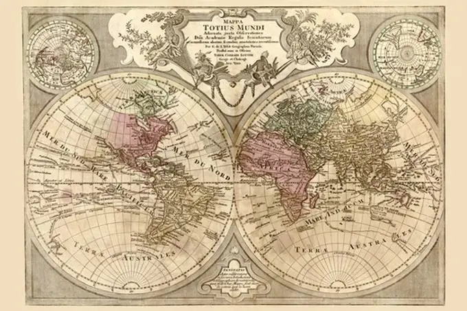
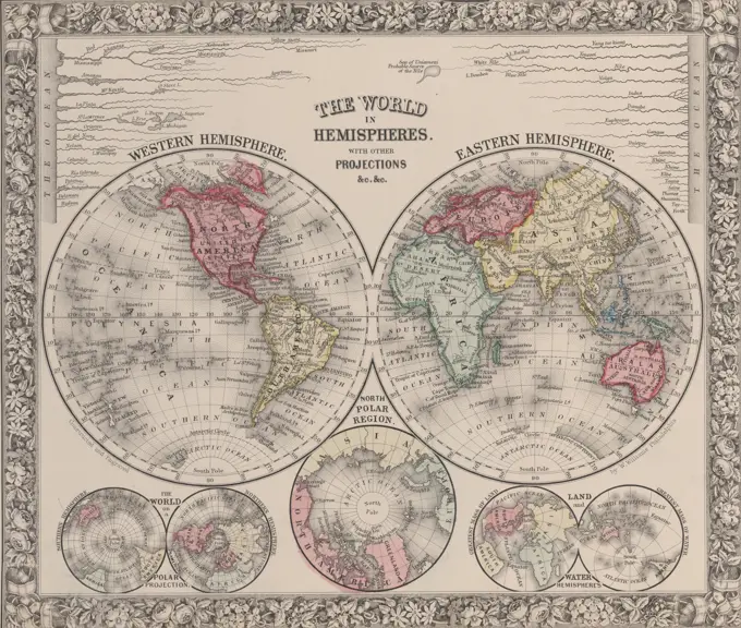
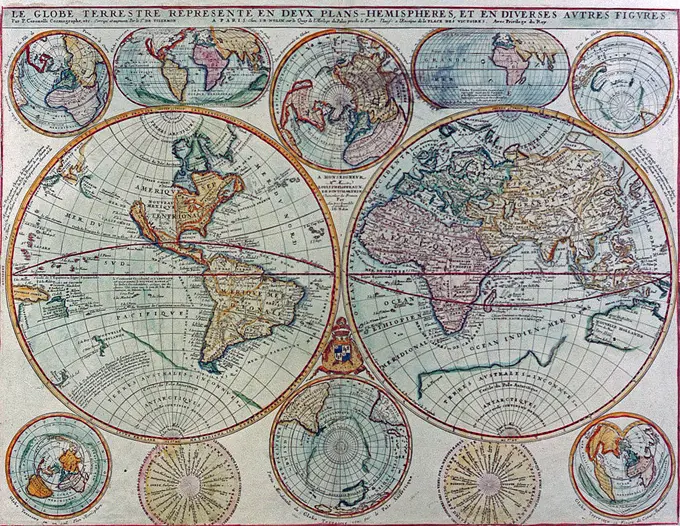
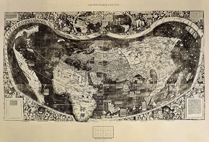
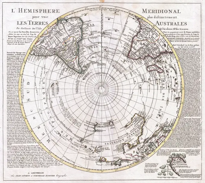
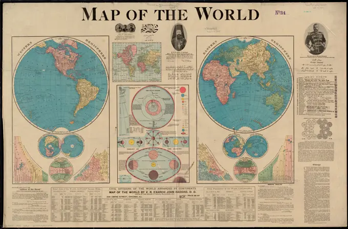
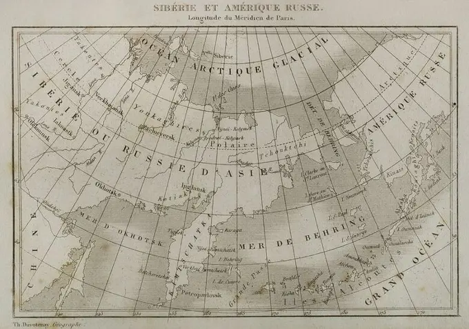
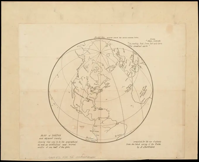
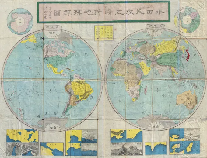
My Boards
View Pictures
  • My Boards

Antique World Maps

Early world maps displaying exploration and trade routes, highlighting cartographic techniques and geographic understanding from the 18th century.

World Map Prepared for then French King, Antique World Maps
191 assets in this story
6145-51392788
The Earth's Western planisphere , Planispheres, Early works to 1800, Western Hemisphere, Maps, Early works to 1800, America, Maps, Early works to 1800 Norman B. Leventhal Map Center Collection
6145-55913548
The Earth's Western planisphere. Relief shown pictorially. Also shows climatic zones, compass variations, and declination of the sun. Includes notes and table of statistics of celestial bodies.... , North and Central America South America Mesoamerica  ,area  North America  ,area  South America America
6145-59425538
Map of Brabant, Abraham Goos, 1622 print Map of Brabant with figures, coats of arms, portraits and cityscapes.  paper etching / engraving maps of separate countries or regions Brabant
1848-51000457
Historical world map, Map of 1875, France, Europe
6145-45848174
Map of the world with Joris journey from Spilbergen and Jacob Le Maire to the world, 1614-1617; Nova Totius Orbis Terrarum descriptio. Map of the world that stated the journeys of Joris van Spilbergen and Jacob Le Maire to the world, 1614-1617. At the bottom of a detail of the north coast of New Guinea. Part of the illustrations in Joris Journey Report from Spilbergen to the world, 1614-1617, No. 1.
6145-52348407
A map of the Old World, as it appeared before God destroy'd it with the waters of the flood. Maps. 1736-12. General Research Division
6145-51389137
Western hemisphere , Western Hemisphere, Maps Norman B. Leventhal Map Center Collection
6145-59568981
Siege of Bergen op Zoom, 1622, 1622 print Map of the failed siege of Bergen op Zoom by the Spanish army under Spinola and Velasco, July 18 - October 3, 1622. Plan of the city and surroundings with waterways and surrounding by the Spanish troops. At the bottom right a map of the larger area in Brabant with curling edges. At the top right a small banderole with 3 lines of text stating that Spinola has stopped the siege between 2 and 3 October. Two text magazines belong to the performance.  paper etching Victory, position was Bergen op Zoom
6145-29096406
1814 Thomson Map of the Northern Hemipshere Arctic
6145-48827051
Map of Germany, 1: 9 000 000, etching, around 1825
6145-50557705
The north part of America : conteyning Newfoundland, new England, Virginia, Florida, new Spaine, and Noua Francia wth ye rich Iles of Hispaniola, Cuba, Iamaica, and Porto Rieco on the south, and upon ye west the large and goodly Iland of California , North America, Maps, Early works to 1800 Norman B. Leventhal Map Center Collection
6145-51388002
America noviter delineata , America, Maps, Early works to 1800, Western Hemisphere, Maps, Early works to 1800 Norman B. Leventhal Map Center Collection
4409-20917088
MAPAMUNDI (1577). Author: JUAN MARTINEZ (-1591) CARTOGRAFO. Location: PRIVATE COLLECTION. MADRID. SPAIN.
4409-17231841
Japanese World Map by Japanese cartographer Nagakuno Sekisui (1717-1801). 29,3 x 53,6 cm.
6145-48725114
India Orientalis ,. Ralph Finos Map Collection
6145-59598230
World Map, Johannes L. van Luchtenburg, 1685 - 1711 print World map. Above the map a beam with the title in Dutch and French. At the top of the card five bulbs with, from left to right, display of day and night on earth, the earth without water, the sham figures of the moon and the western and eastern hemisphere. In the first three bulbs there are references to Genesis passages, which makes it plausible that the card was originally intended for a Bible. The card is equipped with a search schedule and a degree distribution along the edges. At the top right marked: Tom 1. p. 2.  paper engraving map of the world. Genesis from the creation to the expulsion from paradise, and later years of Adam and Eve. full moon
6145-51394937
A map of the countries thirty degrees round the north pole , Arctic regions, Maps, North Pole, Maps Norman B. Leventhal Map Center Collection
1899-67417289
Abraham Ortelius's map of the Americas, Americae sive Novi Orbis, Nova Descriptio.   Originally published in 1570, the first plate of this map was based off of Gerard Mercator's multi-sheet map of the world from 1569. Engraved by Frans Hogenberg, this became one of the most famous influential maps of the New World and the basis for a great deal of future cartography of the Americas.  Abraham Ortelius (1527-1598) was a Dutch cartographer, geographer, and cosmographer, conventionally recognized as the creator of the first modern atlas, the Theatrum Orbis Terrarum.
6145-29096315
1658 Jansson Map of the Indian Ocean (Erythrean Sea) in Antiquity
6145-50571826
Map of the world, on Mercator's projection , World maps Norman B. Leventhal Map Center Collection
1899-41402
Map of Asia, circa. 1760. From 'Atlas de Toutes Les Parties Connues du Globe Terrestre ' by Cartographer Rigobert Bonne. Published Geneva circa. 1760.
6145-29095075
1860 Black Map of the World
6145-55956310
A new map of the whole continent of America : divided into North and South and West Indies with a descriptive account of the European possessions, as settled by the definitive treaty of peace, concluded at Paris Feby. 10th 1763 Cartographic. Maps. 1777-02-15. Lionel Pincus and Princess Firyal Map Division. America , Maps , Early works to 1800
6145-50497288
Map Sampler, An Outline Map of the World for Ladies Needlework and Young Students of Geography; England; silk
6145-59128917
Nouvelle carte routière du voyageur aux environs de Paris : contenant les départemens de la Seine, de Seine et Oise, et partie de ceux adjacens : la seule ornée des vues des principaux monumens qui s'y trouvent situés / revue et augmentée par Achin, 1829. 1829 Relief shown by hachures. Scale bars in lieues de poste and kilometres below map. Includes "Tableau chronologique des principales foires environs de Paris." Engravings of 25 important buildings in margin. Two ancillary maps (scales approximately 1:1,600,000): Carte des routes et des lieux de poste aux environs de Paris; Carte des routes et des lieux d'étapes aux environs de Paris. Le Roi's reproduced signature below map. Map cut into 28 rectangles and mounted on toile. Scale approximately 1:100,000. On Getty copy boundaries of city of Paris and departments traced in color. Indexed by: Vallée, L. Catalogue des plans de Paris, 1884.
6145-50565744
A map of the countries thirty degrees round the north pole , Arctic regions, Maps, North Pole, Maps Norman B. Leventhal Map Center Collection
4443-75466451
A map titled 'The world in hemispheres,' featuring the Eastern and Western hemispheres. It was published in 1863 by S. A. Mitchell, Jr. in Philadelphia
6145-29901561
Department of Tarn divided into 5 districts. (IT)
1899-20225109
Map of the Americas 1685, de Ram, Johannes.
1899-20225795
Early World Map 1630.
6145-59219785
Map of America, Anonymous, 1774 print  Germany paper etching (map of) America Northern and Central America. South America
6145-58932634
Map - Le Globe terrestre représenté en deux plans-hemispheres et en diverses autres figures
6145-58835270
Cartouche with the World Map, 1598 - 1601 Rolwerkcartouche with the world map. In the edge of Psalm 24. The Cartouche is a fragment of a map of the old world. The print is part of an album. Antwerp paper engraving Rolwerkcartouche with the world map. In the edge of Psalm 24. The Cartouche is a fragment of a map of the old world. The print is part of an album. Antwerp paper engraving
4409-13375
PRIMER MAPAMUNDI EN EL QUE APARECE AMERICA - 1507. Author: MARTIN WALDSEEMÜLLER (1470-1520) IIACOMINUS. Location: BIBLIOTECA NACIONAL-COLECCION. MADRID. SPAIN.
6145-30170787
Map of the World Tradewinds Made 1889 England. Woodcut in black on cream laid paper . Bernardi Sylvani (Publisher)
6145-48673001
A map of the countries situate about the North Pole as far as the 50th. degree of north latitude , Arctic regions, Maps Norman B. Leventhal Map Center Collection
6188-56063186
Authentic antique map. Exploration, geography, vintage background Genova, Italy - 8 August 2023: Spinola Palace. Authentic antique map shows the world known to Europeans in the mid 17-th Century. Exploration, geography, vintage background Copyright: xZoonar.com/PAOLOxGALLOxMODENAx 21208257
6145-29095288
1741 Covens and Mortier Map of the Southern Hemisphere ( South Pole, Antarctic)
6145-51384092
Map Sampler (England); Made by Lucy C. Berry; silk embroidery, watercolor paint, silk foundation
1899-20225282
Old World Map 1595.
6145-51397527
Nieuwe kaart van America uitgegeven te Amsterdam , Western Hemisphere, Maps, Early works to 1800, America, Maps, Early works to 1800 Norman B. Leventhal Map Center Collection
6145-54268005
A map of the North Pole with all the territories that lye near it, known to us &c. According to the latest discoveries, and most exact observations : agreeable to modern history. Inset map of the North Pole. Part of a hemisphere 27 cm in diameter. Notes about the sun and search for the North East passage. London meridian. Appears in Moll's Atlas Minor. London: Thomas Bowles and John Bowles, 1732 or 1736 Area from 60 north to the Pole, from Hudson Bay in the west to the Bering Straits in the east.... , Arctic  ,area
6145-55915132
Map of the world. Relief shown by hachures. Ancillary maps: Northern hemisphere -- Southern hemisphere -- Western hemisphere climate -- World on Mercator's projection -- Land hemisphere -- Water hemisphere -- Eastern hemisphere climate. Includes 5 diagrams showing the comparative lengths of rivers, comparative heights of mountains, and comparative time. Includes text and diagrams about the solar system and earth's orbit. Includes portraits, text, "Letters of the Great," examples of languages spoken in the U.S., and table "Civil divisions of the world arranged by continents." In English. Includes a passage in French and lines in other languages.... , World
4409-17357576
Siberia and Russian America. Map by Thunot Duvotenay (1796-1875). History of Russia by Jean Marie Chopin (1796-1870). Panorama Universal, Spanish edition, 1839.
1899-20225410
Heart-Shaped World Map 1530.
1899-20225121
Map of the World 1511, Corte-Real, Gaspard and Miguel.
6145-50552615
Map of Boston and adjacent country showing that city to be the geographical as well as intellectual and moral centre of one half of the globe , Map projection, Maps, Maps in education, Massachusetts, Boston, Map reading, Massachusetts, Boston, World maps, Boston Mass., Maps Norman B. Leventhal Map Center Collection
6145-51397038
Map of the world , World maps Norman B. Leventhal Map Center Collection
6145-55913981
Imperial Federation, map of the world showing the extent of the British Empire in 1886. Includes inset of a map of the world, showing the extent of British territories in 1786. Published as a supplement to The Graphic, July 24, 1886.. Everything about the design of this elaborately decorated world map glorifies the late-19th-century British Empire. Cartographically it used a Mercator projection centered on the Greenwich Prime Meridian, placing Great Britain just above the map's central focal point. The Greenwich Prime Meridian (near London) was adopted as the international standard in October 1884. The British Isles, as well as all of the British colonies spreading out to the east and the west, were highlighted with red, while other geographical areas were left blank with only a minimum number of place names. In addition, an inset box was placed near each of the major colonies, listing statistics about geographical area, population, and trade. The words "Freedom, Fraternity, Federation
4408-12481
People of Many Nations, Japanese Prints
6145-29095662
1875 Meiji 8 Japanese Map of the World
6145-50571824
Imperial Federation, map of the world showing the extent of the British Empire in 1886 , World maps, Imperial federation, Maps, Great Britain, Colonies, Maps Norman B. Leventhal Map Center Collection
6145-59077232
Map of Europe; Lelewel, Joachim (1786-1861); 1822 (1822-00-00-1822-00-00);
6145-29094872
1855 Colton Map of the Arctic or North Pole
6145-50565631
Africae nova descriptio , Africa, Maps, Early works to 1800 Norman B. Leventhal Map Center Collection
1848-19255556
Globus der Erde, 1895, digital restaurierte Reproduktion einer Originalvorlage aus dem 19. Jahrhundert
6145-55959262
Carte des variations de la boussole et des vents generaux ... Cartographic. Maps. 1765. Lionel Pincus and Princess Firyal Map Division. Magnetic declination , Atlantic Ocean, Atlantic Ocean, Magnetic declination , Indian Ocean, Winds , Atlantic Ocean, Winds , Indian Ocean, Indian Ocean
1525-24680815
Map of the South Pole, vintage engraved illustration. Magasin Pittoresque (1882).
6145-58894976
World map. World map
1746-19662238
world map is believed by some to have been compiled by Zheng He.Zheng He (1371-1435), or Cheng Ho, Chinas most famous navigator. Starting from the beginning of the 15th Century, he travelled to the West seven times. For 28 years, he travelled more than 50,000km and visited over 30 countries, including Singapore.
1788-38461
History of Explorations, 18th century. Itinerary of the expedition around the world made by Jean Francois de Galaup de Laperouse with its frigates Boussole and Astrolabe, 1785-1788. Map by Jacques Liozu, Albi, 1941.
6145-45831660
Map of Africa, 1726; L'Afrique, Suivant Les Nouvelles Observations (...); Les Forces de l'Europe, Asie, Afrique et Amerique (...) Comme Aussi Les Cartes des Côtes de France et d'Espagne. Map of Africa. Plate No. 484 in Part XX of the Picture: Les Forces de l'Europe, Asia, Afrique et amic ... Comme Aussi Les Cartes des Côtes de France et d'Espagne from 1726, this second part with 271 by hand Numbered Plates of renowned strong cities and fortresses in the context of the Spanish Succession War 1701-1713. For most part, these plates have been copied to the anonymous French plates of renowned strong cities and fortresses: in Les Forces de l'Europe and in: Le Theater de la Guerre, Dans Les Pays-Bas, both originally published by Nicolas de Fer in Paris (1693-1697) In the context of the nine-year war. Title and inscriptions in French.
6145-58932359
Astronomical chart - Tabula Selenographica in qua Lunarium Macularum
1899-18852672
This map showing the two hemispheres of the world was made for the 2nd Qing Emperor, Kangxi (1662-1722) by the Jesuit  Ferdinand Verbiest (1623-88), in 1674. Verbiest was one of a few Jesuits who were employed at the Chinese court during the period. Printed from woodblocks using Mercator's projection, the map was part of a larger geographical work called Kunyu tushuo (Illustrated Discussion of the Geography of the World) and called: Kunyu wanguo quantu (A Map of the Myriad Countries of the World). It was one of a series of maps produced by the Jesuits at the Court in Beijing, beginning with Matteo Ricci's two maps of 1584 and 1602.
6176-66093463
Vintage Illustrated World Map. First edition of Munster's map of the World, from the second woodblock, circa 1552.  Titled "La Figure du Monde Universel".
4443-21205522
Anonymous. Map: The World of Volpellio (Typo de la carta Cosmographia de Gaspar Volpellio Medeburgense?), ca. 1520-1540 (modern restrike). Woodcut.
1558-30474107
England, London, Greenwich, The Queen's House, Exhibit of The Maritime Atlas or Water World by Pieter Goos
4443-75457893
World map by Timothy Childe, issued in 1701, published in London. Printed for Timothy Childe at the White Hart at the West-end of St. Paul's Church-yard
6145-29673129
Photo collection Government information service. World map / Johannes Visscher 1587-1637. 1666
1746-30000640
A map of the then-known world during the 18th century. Dated 18th century
6145-54548589
A new map of the terraqueous globe according to the ancient discoveries and most general divisions of it into continents and oceans. Ancient world. Cartographic. Maps, Atlases. 1700. Lionel Pincus and Princess Firyal Map Division. Atlases, British, Geography, Ancient, Maps in education , England, Maps
6145-29095778
1902 L'Armee Case Map of Paris and Environs
6145-46412209
Cloth of linen, printed with the world map and signs of the zodiac .. Cloth of linen, printed with the world map and signs of the zodiac.
6145-46620389
. Map of the northern hemisphere in a polar projection. The card follows the map image of Mercator and shows several large islands on the North Pole that match the then common idea of a pool continent that consists of several parts. Opposite page 51 in: 'Warftige Relationship. Deryen Newen UNERHÖRTEN SELTHAMEN SCHIFFART SO Die Holländischen und Seeländischen Schiff .... Anno 1594, 1595 Und 1596 "(1598).
6176-66094680
1852 Map of the World - - Planisphere by Victor Levasseur   Vintage 19th Century Colour pictorial Map of the World.
1443-1048
World Map in Heart Shape 1536 Oronce Fine (1494-1555 French) Woodcut print
4220-21914071
'A MAP OF THE WORLD SHOWING IT  TO BE A PLANE' - and those of  us who suppose it to be a  globe are clearly mistaken.       Date: 1893
1746-30000638
A map of the Western Hemisphere as of 1816. Dated 19th century
6145-50571825
Index diagram of sheets for the International map on the scale of 1:1,000,000 , World maps Norman B. Leventhal Map Center Collection
6145-29672318
Photo collection Government information service. Drawing. Dutch settlements in the western hemisphere. undated
6145-43255018
Magalhaes, Fernao de.
6145-29901559
Department of Vendée divided into 6 districts (IT)
6145-48733832
Globe of the earth, Pan American terminal building, Miami, Florida , Airports, Tichnor Brothers Collection, postcards of the United States
4408-6345
Southern Circumpolar Map, Celestial & Astrological Charts
1746-111906739
Chart of the first half of the star chart of the Southern Skies. Dated 18th century
6145-55959074
Carte generale du monde, ou, Description du monde terrestre & aquatique = Generale waereld kaart, of, Beschryving van de land en water aereld Cartographic. Maps. 1700. Lionel Pincus and Princess Firyal Map Division. World maps, Maps
6145-55915314
Mercator map of the world united : a pictorial history of transport and communications and paths to permanent peace. Copyright Oliver K. Whiting, New York. "Railroads, radio, radar" in left border; "telegram, telephone, television" in right border; "The unit of peace has grown through the ages, tomorrow it will embrace the whole earth" in top border; "Nations can no longer live unto themselves alone - therefore let us strive to find a system of law and order by which we can all abide" in bottom border. Includes decorative border, color illustrations, historical notes, quote from Lord Alfred Tennyson dated 1854, comparative "advancements" vignettes and more... Map of the world united. Map of the world united, World
6145-29901560
Department of Yonne, divided into seven districts (IT)
4430-8029
cartography globes Eastern hemisphere with illustration of the winds woodcut 1515,
5513-76374895
Challenge price of Danish Bicycle Club - German Cyclists' Federation. Industrial power rate of *****The entire German cycling world faces two major Ereggnissent: On 11 July, at the Velodrome Leipzig deciding battle in Challenge price of Dansk Bicycle Club-German Cyclists' Federation to discharge coming. This event was previously held four times; each twice of Germany and Denmark the prize has been won.February 18, 1939.
6188-66520866
The first geographical globe in Bulgaria, made by Hieromonk Neofit Rilski in 1836 the first geographical globe in Bulgaria, made by Hieromonk Neofit Rilski in 1836
PREVIOUS
of 2
NEXT
2401 S. Ervay, Suite 206
Dallas, Texas 75215
United States
Get Started
Free ResearchMy BoardsMy Cart
For Creators
How To License Your ContentContributor PortalFrame of Mind
Resources
API accessPricing
Contact
+1 866 236 0087help@viewpictures.co.uk Contact form
©2026 View Pictures. All Rights Reserved. -A
This site is protected by reCAPTCHA and Google Privacy Policy and Terms of Service apply.