My Boards
View Pictures
  • My Boards
← Documents & Records

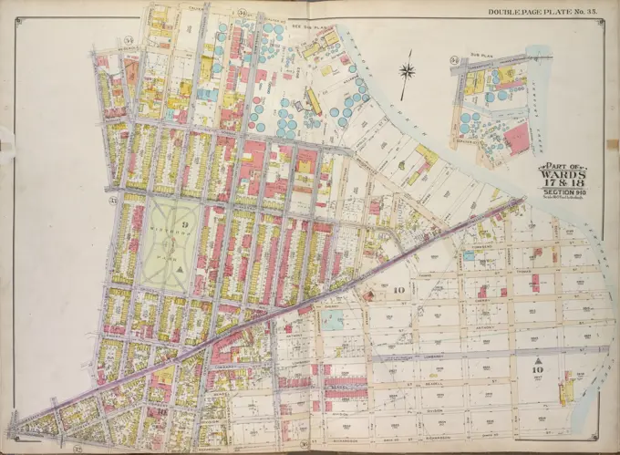
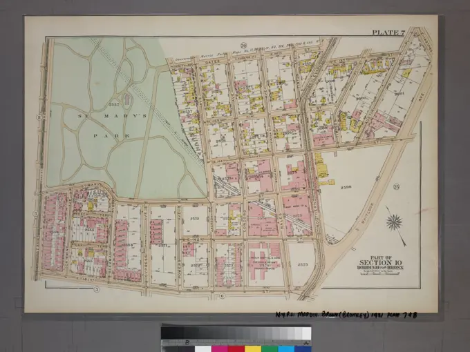
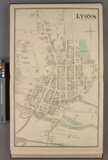
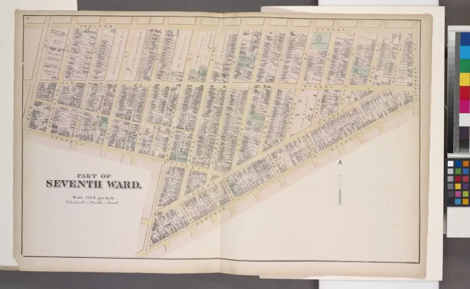
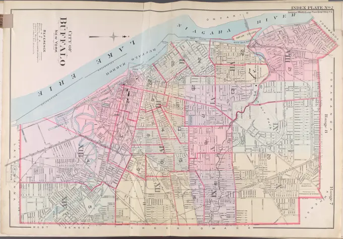
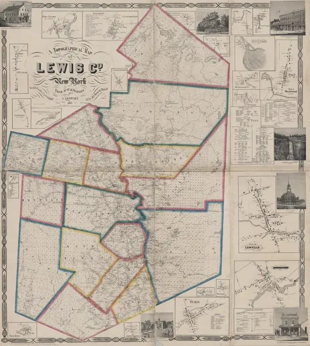
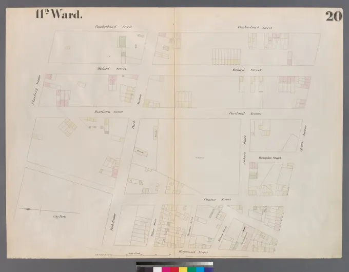
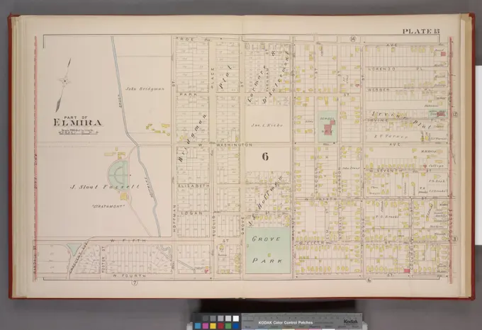
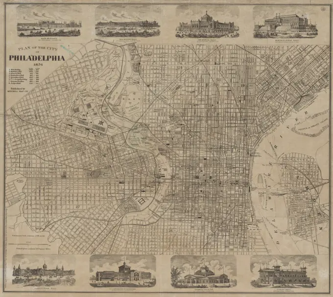
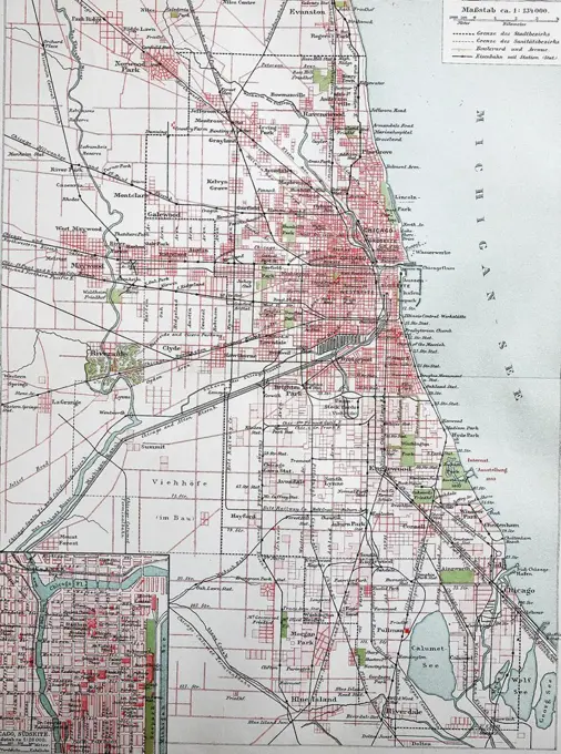
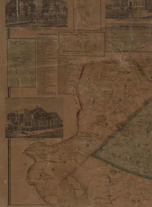
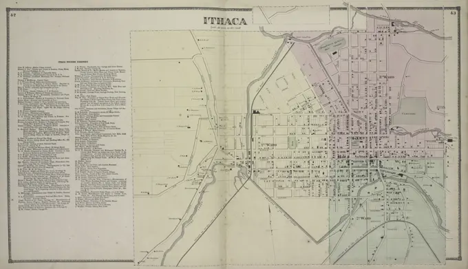
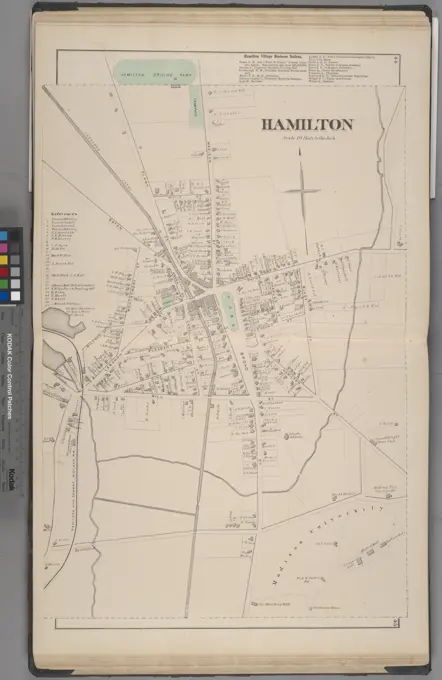
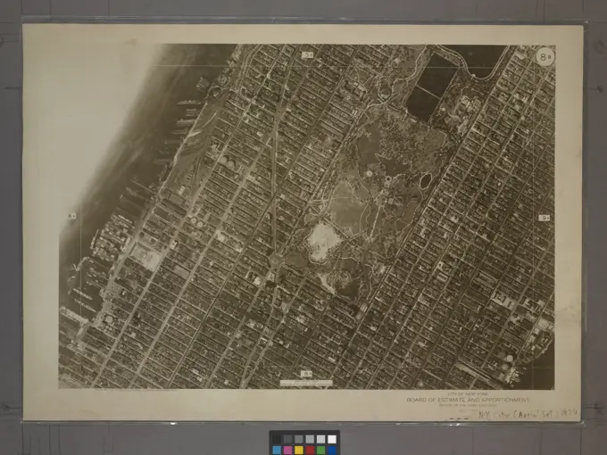
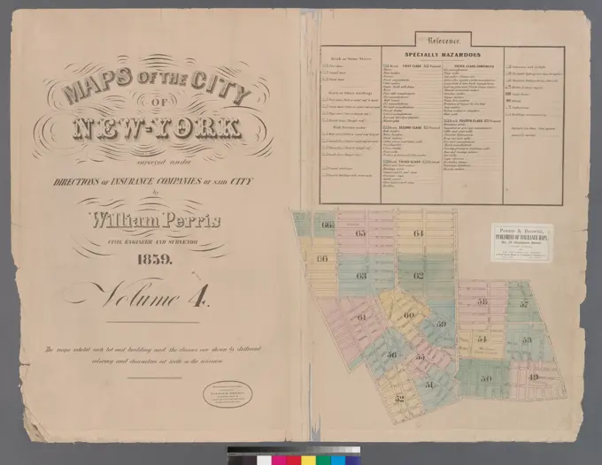
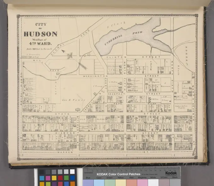
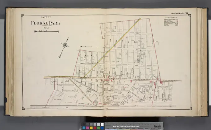
Cadastral Maps of New York

Detailed maps representing land divisions in New York areas, illustrating property boundaries and infrastructure, with intricate cartographic style.

Cartographic, Maps. 1913. Lionel Pincus and Princess Firyal Map Division. Queens (New York, N.Y.), Real property , New York (State) , New York , Queens (Borough) Queens, V. 1, Double Page Plate No. 2; Part of Jamaica, Ward 4; Map bounded by Fulton St., Ocean View, Atlantic Ave., Hopkinton Ave., Liberty Ave., Elderts Ln.
171 assets in this story
6145-55175992
E.B. Hyde & Co.. Cartographic, Maps. 1916. Lionel Pincus and Princess Firyal Map Division. Brooklyn (New York, N.Y.), Real property , New York (State) , New York Brooklyn, Vol. 1, 2nd Part, Double Page Plate No. 35; Part of Wards 17 & 18, Section 9-10; Map bounded by Calyer St., Newtown Creek, Richardson St. (Amos St.), Manhattan Ave., Meeker Ave.; Including Humboldt St., Nassau St., Jewel St., Meserole Ave., Humboldt St.; Sub Plan Map bounded by Greenpoint Ave., Newtown Creek, Wright St.; Including Calyer St., Kingsland Ave.
6145-55175692
Cartographic, Maps. 1880. Lionel Pincus and Princess Firyal Map Division. Brooklyn (New York, N.Y.), Real property , New York (State) , New York Vol. 6. Plate, H. Map bound by Van Cott Ave., Van Pelt Ave., Monitor St., Meeker Ave., Richardson St., Humboldt St., Conselyea St., Union Ave.; Including Jane St., Newton St., Bayard St., Frost St., Withers St., Jackson St., Skillman St., Lorimer St., Leonard St., Eckford St., Ewen St., Graham Ave., Russell St., N. Henry St.
6145-55924638
G.W. Bromley & Co.. Cartographic, Maps. 1921. Lionel Pincus and Princess Firyal Map Division. Bronx (New York, N.Y.), Real property , New York (State) , New York Plate 7, Part of Section 10, Borough of the Bronx. Bounded by E. 147th Street, Southern Boulevard, E. 147th Street, Austin Place, 149th Street, Whitlock Avenue, E. 141st Street and (St.Mary's Park) St. Anns Avenue.
6145-55175659
Cartographic, Maps. 1891. Lionel Pincus and Princess Firyal Map Division. Queens County (N.Y.) Plate 27: Village of Part of Garden City and Hempstead. - Grounds of the Meadow Brook Hunt Club. Grounds of the Meadow Brook Hunt Club.
6145-55180911
Part of Fifth Ward. Cartographic. Maps. 1872. Lionel Pincus and Princess Firyal Map Division. Buffalo (N.Y.)
6145-55181238
Lyons Village Cartographic. Atlases, Maps. 1874. Lionel Pincus and Princess Firyal Map Division. Real property , New York (State) , Wayne County, Wayne County (N.Y.), Business enterprises , New York (State) , Wayne County
6145-54549028
Part of Seventh Ward. Cartographic. Maps. 1872. Lionel Pincus and Princess Firyal Map Division. Buffalo (N.Y.)
6145-55957912
Index Plate No. 2 Cartographic. Atlases, Maps. 1915. Lionel Pincus and Princess Firyal Map Division. Buffalo Metropolitan Area (N.Y.) , vMaps.
4443-75465638
A topographical map of Lewis County, New York, based on actual surveys from 1857, published by S. & R.S. Taintor Jr. & Co. The image features real property and railroad details of the area. The map measures 137 x 91 cm, with the overall sheet size being 141 x 127 cm
6145-55958871
New National authentic map of Detroit and environs Cartographic. Atlases, Maps. 1947. Lionel Pincus and Princess Firyal Map Division. Detroit (Mich.), Streets , Michigan , Detroit (Mich.)
6145-54522147
Cartographic, Maps. 1855. Lionel Pincus and Princess Firyal Map Division. Brooklyn (New York, N.Y.), Insurance, Fire , Maps Plate 20: Map bounded by Flushing Avenue, Cumberland Street, Myrtle Avenue, Raymond Street, Park Avenue, Navy Street
6145-55957248
Map of the City of New York with the adjacent cities of Brooklyn & Jersey City & the Village of Williamsburg Map of the City of New York with the adjacent cities of Brooklyn and Jersey City and the Village of Williamsburg Cartographic. Maps. 1851. Lionel Pincus and Princess Firyal Map Division. Manhattan (New York, N.Y.), Brooklyn (New York, N.Y.), Jersey City (N.J.), Piers , New York (State) , New York, Buildings , New York (State) , New York, Fire protection districts , New York (State) , New York, New York (N.Y.), New York (N.Y.) , Administrative and political divisions
6145-55181207
Brentwood. Village; Greenville. Village; Bayshore Village Cartographic. Atlases, Maps. 1888. Lionel Pincus and Princess Firyal Map Division. Atlases , New York (State) , Suffolk County
6145-51394416
Map City of Baltimore , Baltimore Md., Maps Norman B. Leventhal Map Center Collection
6145-55956674
Map of New York showing Lehigh Valley terminals and ticket offices 1904. Cartographic. Maps. Lionel Pincus and Princess Firyal Map Division
6145-51385968
Plan of Boston , Boston Mass., Maps Norman B. Leventhal Map Center Collection
6145-55956927
Map of the Borough of Manhattan, New York City, centering on the campus of Columbia University 1913. Cartographic. Maps. Lionel Pincus and Princess Firyal Map Division
6145-55956793
1907 Library map of Manhattan, City of New York Cartographic. Maps, Manuscript maps. 1907. Lionel Pincus and Princess Firyal Map Division. Manhattan (New York, N.Y.), New York (N.Y.), Library sites , New York (State) , New York
6145-54549066
Part of Elmira cont. Cartographic. Atlases, Maps. 1896. Lionel Pincus and Princess Firyal Map Division. Elmira (N.Y.)
6145-50536157
Clason's map of Los Angeles , Los Angeles Calif., Maps Norman B. Leventhal Map Center Collection
6145-55956443
Data for population from census of 1910, Borough of Manhattan 1910. Cartographic. Maps. Lionel Pincus and Princess Firyal Map Division
4443-75476882
Town of Bergen Township, 1876., 1876., Philadelphia, Genesee County, New York. Real property, New York (State)
6145-48719316
New map of the City of Buffalo , Railroads, New York State, Buffalo, Maps, Electric railroads, New York State, Buffalo, Maps, Streets, New York State, Buffalo, Maps, Buffalo N.Y., Maps Norman B. Leventhal Map Center Collection
6145-55915883
Open space management program index map.. Shows boundaries of the area surveyed in Boston for open space planning purposes. Includes parts of Mission Hill, Roxbury, Jamaica Plain, Uphams Corner, South Boston, Fields Corner and Mattapan/Franklin Field... , Massachusetts  , Suffolk  ,county   , Boston
6145-54548854
Hooker's new pocket plan of the city of New York Hooker, William, 1782-1856. Cartographic. Maps. 1828. Lionel Pincus and Princess Firyal Map Division. Manhattan (New York, N.Y.) , Maps, New York (N.Y.) , Administrative and political divisions , Maps, New York (N.Y.) , Maps
6145-48499399
Max Heinrich: Remodeling of the street Unter den Linden, Berlin
6145-54550052
Westchester, Double Page Plate No. 16 Map bounded by Larchmont Harbor, Long Island Sound, Boston Rd., Palmer Ave. Cartographic. Atlases, Maps. 1893. Lionel Pincus and Princess Firyal Map Division. Westchester County (N.Y.)
6145-55924723
New York (N.Y.). Bureau of Engineering. Cartographic, Maps. 1924. Lionel Pincus and Princess Firyal Map Division. New York (N.Y.) 14D - N.Y. City (Aerial Set).
6145-55181135
Grand Island Township; South Buffalo Village; Buffalo Plains Village Cartographic. Atlases, Maps. 1880. Lionel Pincus and Princess Firyal Map Division. Erie County (N.Y.), Real property , New York (State) , Erie County
6145-55927458
E.B. Hyde & Co.. Cartographic, Maps. 1916. Lionel Pincus and Princess Firyal Map Division. Brooklyn (New York, N.Y.), Real property , New York (State) , New York Brooklyn, Vol. 1, 2nd Part, Double Page Plate No. 31; Part of Wards 13 & 14, Section 8; Map bounded by Havemeyer St., Metropolitan Ave., Marcy Ave, Division Ave.; Including Berry St., S. 10th St., East River, N. 9th St.; Sub Plan Map bounded by S. 11th St., Division Ave., Wythe Ave.
6145-50568857
Hudson's map of Minneapolis , Minneapolis Minn., Maps Norman B. Leventhal Map Center Collection
6145-51387010
R.L. Polk & Co.'s map of Bay City, and Essexville Mich , Bay City Mich., Maps, Essexville Mich., Maps Norman B. Leventhal Map Center Collection
4443-75474547
Plan of the city of Philadelphia, 1876. Issued by Mitchell Map Co., this map measures 42 x 53 cm and depicts the layout of Philadelphia, Pennsylvania
6145-50528536
Wilmington, Delaware , Wilmington Del., Maps Norman B. Leventhal Map Center Collection
1848-19253446
Stadtplan von Chicago, 1895, digital restaurierte Reproduktion einer Originalvorlage aus dem 19. Jahrhundert
6145-55956605
Map of the city of New York, 1850 Cartographic. Maps. 1850. Lionel Pincus and Princess Firyal Map Division. New York (N.Y.), Manhattan (New York, N.Y.) , Maps, New York (N.Y.) , Administrative and political divisions , Maps, New York (N.Y.) , Maps
4443-75466050
Map of Belknap County, New Hampshire, issued in 1859 by Smith & Peavey in Philadelphia. The map consists of 6 sheets, colored, and is mounted on cloth, measuring 129 x 129 cm, with individual sheets measuring 72 x 47 cm or smaller. Relief is depicted using hachures
6145-54549038
Outline and Index Map of Elmira Cartographic. Atlases, Maps. 1876. Lionel Pincus and Princess Firyal Map Division. Elmira (N.Y.)
6145-54522463
G.W. Bromley & Co.. Cartographic, Maps. 1921. Lionel Pincus and Princess Firyal Map Division. Bronx (New York, N.Y.), Real property , New York (State) , New York Plate 35, Part of Section 10, Borough of the Bronx. Bounded by Farragut Street, East Bay Avenue, Longfellow Avenue, and Lafayette Avenue.
4409-64098027
Map, b/w. - Advertising sheet for Dr. Pedro Bover's dental clinic. - On the back: detailed plan of the old town and advertisements for the clinic. - Dated by the location of the "International Exhibition of Electrical Industries" in Montjuïc. Between 1913-1914 it was planned for 1917. International circumstances delayed it until 1929. In 1925 it was decided to change its name to "Barcelona International Exhibition".
4443-75465850
Handy map of Brooklyn, 1897., 1897., New York. Publisher, Brooklyn Rapid Transit Co., Brooklyn (New York, N.Y.)., 1 map col.; 37 x 48 cm
4443-75463291
Ithaca Business Directory, Ithaca Village, 1866., 1866., Philadelphia, Tompkins County (N.Y.). Topics include real property and business enterprises in Tompkins County, New York (State)
6145-55926320
Cartographic, Maps. 1869. Lionel Pincus and Princess Firyal Map Division. Brooklyn (New York, N.Y.) Sheet 2: Map encompassing Prospect Park, Windsor Terrace, Park Slope, Carroll Gardens, Gowanus Canal, Fort Greene, Clinton Hill and Prospect Heights
6145-55925753
Cartographic, Maps. 1868. Lionel Pincus and Princess Firyal Map Division. Real property , New York Metropolitan Area, Westchester County (N.Y.), New York Metropolitan Area Plate 34: Mount Vernon, Westchester Co. N.Y. Large folder - L1
6145-55928371
Cartographic, Maps. 1873. Lionel Pincus and Princess Firyal Map Division. Long Island (N.Y.) , Description and travel Patchogue, Town of Brookhaven, Suffolk Co.
6145-51388404
Topographical map of Pittsfield, Berkshire Co., Mass : from actual surveys and records , Real property, Massachusetts, Pittsfield, Maps, Landowners, Massachusetts, Pittsfield, Maps, Pittsfield Mass., Maps Norman B. Leventhal Map Center Collection
6145-55917397
Topographical map of Pittsfield, Berkshire Co., Mass : from actual surveys and records. Oriented with north toward the upper left. Insets: Pittsfield.--Tillotson & Collin's Mills, town of Pittsfield.... , Massachusetts  , Berkshire  ,county   , Pittsfield
6176-66093028
Vintage America Map: Property of Railroad and Business Center of Chicago by Chicago Terminal Transfer Railroad,  1898
6145-54549508
Hamilton Village Business Notices; Hamilton Village Cartographic. Atlases, Maps. 1875. Lionel Pincus and Princess Firyal Map Division. Madison County (N.Y.), Real property , New York (State) , Madison County, Business enterprises , New York (State) , Madison County
6145-55956608
Map of the city of New York : with the adjacent cities of Brooklyn & Jersey City, & the village of Williamsburg Cartographic. Maps. 1848. Lionel Pincus and Princess Firyal Map Division. New York (N.Y.), Manhattan (New York, N.Y.) , Maps, Brooklyn (New York, N.Y.) , Maps, Jersey City (N.J.) , Maps, New York (N.Y.) , Administrative and political divisions , Maps, Williamsburg (New York, N.Y.) , Maps, New York (N.Y.) , Maps
6145-55917461
Travelers' and shippers' railway guide map of Chicago. Shows wards, grain elevators, steamboat docks, lumber yards, street horse cars, and steam railways. Text, ill., and references to elevators and lumber yards on verso... Railway guide map of Chicago. Railway guide map of Chicago, Illinois  , Cook  ,county   , Chicago
6145-55926726
F. Bourquin & Co.. Cartographic, Maps. 1890. Lionel Pincus and Princess Firyal Map Division. Brooklyn (New York, N.Y.), Real property , New York (State) , New York Plate 19: Bounded by 72nd Street, 22nd Avenue, W. 11th Street, Avenue P, W. 8th Street, Avenue Q, W. 5th Street, Kings Highway, W. 3rd Street, Avenue S, Gravesend Avenue, Avenue T, W. 5th Street, Avenue U, W. 7th Street, Lake Lane, W. 8th Street, Avenue V, 86th Street and 21st Avenue. Part of the Towns of New Utrecht and Gravesend, Kings Co., N.Y.
6145-54548965
Map of the county of Oneida Cartographic. Atlases, Maps. 1841. Lionel Pincus and Princess Firyal Map Division. New York (N.Y.), Real property , New York Metropolitan Area, Landowners , New York (State) , Oneida County, Oneida County (N.Y.) , Maps, Real property , New York (State) , Oneida County
6145-55963684
Off-street parking inventory for the Boston regional core
6145-50562797
Cemetery Hill & Church Cemeteries, Enfield, Mass., Apr. 6, 1927 , waterworks, reservoirs water distribution structures, real estate, cemeteries
6145-55175509
New York (N.Y.). Bureau of Engineering. Cartographic, Maps. 1924. Lionel Pincus and Princess Firyal Map Division. New York (N.Y.) 8B - N.Y. City (Aerial Set).
6145-51386119
Plan of lots in Beech Grove Cemetery, Rockport ,
6145-55181012
Delhi Township; Delhi Business Directory Cartographic. Atlases, Maps. 1869. Lionel Pincus and Princess Firyal Map Division. Delaware County (N.Y.)
6145-55924566
G.W. Bromley & Co.. Cartographic, Maps, Index maps. 1921. Lionel Pincus and Princess Firyal Map Division. Bronx (New York, N.Y.), Real property , New York (State) , New York Outline & Index Map: Sections 9 and 10, Borough of the Bronx. Index
6145-51386897
Rand, McNally & Co.'s new and concise map of Chicago : showing the city limits and location of the world's Columbian Exposition, streets, parks, boulevards, railroads, street car lines, etc. , Chicago Ill., Maps Norman B. Leventhal Map Center Collection
6145-55928599
Cartographic, Maps. 1873. Lionel Pincus and Princess Firyal Map Division. Long Island (N.Y.) , Description and travel North part of Hempstead, Queens Co. L.I.
6145-55181530
Cayuga County, Left Page Map of Ira, Scipio, Sherwood, Scipioville Cartographic. Atlases, Maps. 1904. Lionel Pincus and Princess Firyal Map Division. Real property , New York (State) , Herkimer County, Herkimer County (N.Y.) , Description and travel
6145-55176447
Cartographic, Maps. 1857 - 1862. Lionel Pincus and Princess Firyal Map Division. Manhattan (New York, N.Y.), Real property , New York (State) , New York Volume 4 Index Map
6145-55175511
New York (N.Y.). Bureau of Engineering. Cartographic, Maps. 1924. Lionel Pincus and Princess Firyal Map Division. New York (N.Y.) 9A - N.Y. City (Aerial Set).
6145-54549432
City of Hudson West Part of 4th Ward Township Bourquin, F. (Frederick), 1808-. Cartographic. Atlases, Maps. 1873. Lionel Pincus and Princess Firyal Map Division. Columbia County (N.Y.), Real property , New York (State) , Columbia County, Business enterprises , New York (State) , Columbia County
6145-54549909
Part of Floral Park Cartographic. Atlases, Maps. 1914. Lionel Pincus and Princess Firyal Map Division. Nassau County (N.Y.) , Maps, Real property , New York (State) , Nassau County
6145-54548979
Lockport. Cartographic. Atlases, Maps. 1838. Lionel Pincus and Princess Firyal Map Division. New York (State), Lockport (N.Y.) , Maps
6145-55180928
Part of Elmira cont. Cartographic. Atlases, Maps. 1896. Lionel Pincus and Princess Firyal Map Division. Elmira (N.Y.)
6176-66093004
Vintage City Map to Invercargill New Zealand. circa 1950s
6145-29095076
1860 Mitchell Map of Baltimore
6145-52357974
Lincoln Square: Slum clearance plan ..., Cover. 1956. New York (N.Y.). Committee on Slum Clearance. Photographs, Plans. Manuscripts and Archives Division. Lincoln Square (New York, N.Y.), Urban renewal , New York (State) , New York, Slums , New York (State) , New York, Housing , New York (State) , New York
PREVIOUS
of 2
NEXT
2401 S. Ervay, Suite 206
Dallas, Texas 75215
United States
Get Started
Free ResearchMy BoardsMy Cart
For Creators
How To License Your ContentContributor PortalFrame of Mind
Resources
API accessPricing
Contact
+1 866 236 0087help@viewpictures.co.uk Contact form
©2026 View Pictures. All Rights Reserved. -B
This site is protected by reCAPTCHA and Google Privacy Policy and Terms of Service apply.