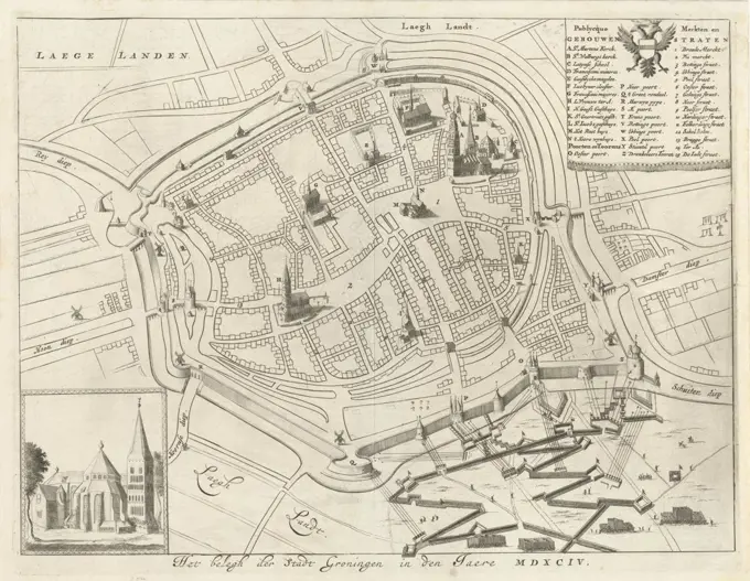
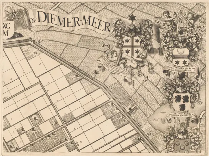
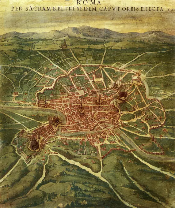
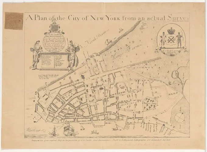
My Boards
View Pictures
  • My Boards

City Fortification Maps

Antique maps showcasing fortified cities, including detailed illustrations and historical significance, emphasizing urban defense in past eras.

Map of Groningen during the siege, 1594, The Netherlands
260 assets in this story
6145-45674155
Paris besieged by Hendrik IV and relieves by Parma, 1590; Series 4: French, German and English events, 1576-1610. Paris besieged by King Henry IV and relieved by the Duke of Parma, August 19, 1590. Map of the city of Paris with the location of the troops of Hendrik IV and the Duke of Parma. With caption of 12 rules in German. Unnumbered. Leaf from an album that has been dismantled. At the top right numbered (in pen): 220.
1788-34424
Cartography, Italy, 16th century. The city of Bologna, engraving from ""Civitates Orbis Terrarum"" by Georg Braun (1541-1622) and Franz Hogenberg (1540-1590), active in Cologne.
6145-45691004
Map of the Hondsbosche Seawall and the Dunes at Petten; Dykgraaf and Hoogwaartschap der Zebelsdelingen van den Hondsbossche and Duynen to hats. Along the top the title, including the weapons of the Dijkgraaf, high parks and steward of the Dog Bossche and Dunes Dog Paddle. At the bottom right two putti with the coat of arms of the water board, a fisherman and a cartouche with a crankcase: scale of 100 dogsbosse rod.
6145-30330820
Benjamin Cole, 1697-1783, British, A New and Correct Plan of Limestreet Ward, 1755. Engraving.
4443-21773609
Floor plan with buildings in bird's-eye view. Top left a cartouche with the title and commission, surrounded by the coats of arms of Holland and The Hague (above) and the family coats of arms of four members of the city council (left and right). Bottom left a cartouche with the names of the twelve members of the city council and the remaining eight family coats of arms. Bottom right a legend 1-71. To the left a scale stick: Scale of 60 roeden., Plattegrond van Den Haag Nieuwe platte grond van 's Gravenhage with the publicque buildings., draughtsman: anonymous, J. Rousset, Staten van Holland en West-Friesland, (mentioned on object), The Hague, in or before 1717, paper, pen, brush, h 499 mm × w 622 mm
4443-73237680
Staten van Holland en West-Friesland, Amsterdam, Schenk, Pieter (I), Noordelijke Nederlanden, On 6 October 1712, Captain Simon de Rue, with 150 men from Ostend, surprised him with the capture of Fort de Knokke, Plan of Fort Knokke, 1712, Northern Netherlands, captured by surprise by the Dutch under Simon de Ruë, October 6, 1712. With captions in Dutch and Latin. Fragment of a large plate with nine representations of events from the year 1712 of the War of the Spanish Succession., print, engraving, map, prints, Frederik Muller Historieplaten, height 163 mm, width 195 mm, 1660-12-26 - 1711, print maker, printmaker, 1712 - 1712, paper, papier, etching, etchings, Publication (Event), Publication, publisher, uitgever van privilege
1848-61444406
Historic drawing, city map of Westminster with the River Thames, 17th century, a district of London, England, Europe
1848-55029136
Map of Hamburg, Germany, in the 17th century, historical steel engraving, Europe
6145-59255461
Auxiliary troops from the German princes en route to France, 1591, 1591 - 1593 print Auxiliary troops of the German princes move on the way to France, 1591. With caption of 8 lines in German. Nummered in the bottom left: 279. The print is part of an album. Cologne paper etching communication and transport
1788-36961
Map of Rome, by Joan Blaeu (1596-1673), print from Theatrum Civitatum et Admirandorum Italiae, ad Aevi Veteris et Praesentis Temporis Faciem Expressum, Italy 17th Century. Detail.
6145-59564091
Map of Gouda, Anonymous, c. 1700 - 1728 print Map in a nutshell perspective. At the top left of the weapon of Holland with the title cartouche on the right. Under the weapon a legend A-l. Bottom left a legend 1-79. At the top right the weapon of Gouda with a cartouche with the assignment to the left. Under the weapon a legend m-y. Below that a bowl: Schala of 50 Rhynand rod.  paper etching / engraving maps of cities. coat of arms (as symbol of the state, etc.) (+ province; provincial). coat of arms (as symbol of the state, etc.) (+ city; municipal) Gouda
6145-59564116
Map of Leiden, Anonymous, 1742 - After 1780 print Map in a nutshell perspective. At the top left the title and a legend A-H. Bottom left a legend 1-29. At the bottom of the middle a bowl: 50 Rynandche rods. At the top right marked: Vereen. Nederl. Iv. Part. Bl. 499.  paper etching / engraving maps of cities Leiden
6145-58840426
Siege of Grol, 1627, 1627 - 1629 Map of the siege of Groenlo, 1627. Centrally the city of Groenlo, around the quarters of the besieging troops. At the top left a bet with a map of the city, bottom left the scale,. At the top right a cartouche with the title and the legend A-O and 1-18 in Latin. Inscriptions in the performances in French and Dutch. Part of the plates in the report of the siege and the conquest of Grol by the State Army under Frederik Hendrik, July 6 to August 19, 1627. print maker: Northern Netherlandspublisher: Amsterdam paper etching  Groenlo Map of the siege of Groenlo, 1627. Centrally the city of Groenlo, around the quarters of the besieging troops. At the top left a bet with a map of the city, bottom left the scale,. At the top right a cartouche with the title and the legend A-O and 1-18 in Latin. Inscriptions in the performances in French and Dutch. Part of the plates in the report of the siege and the conquest of Grol by the State Army under Frederik Hendrik, Jul
6145-59585191
Map of Bolsward, 1721 - 1774 print Map in a nutshell perspective. At the top left the Wapen van Friesland. At the bottom of the card shower with assignment. In addition, a bowl: scale of 50 rods. At the top right the Weapon of Bolsward.  paper engraving / etching maps of cities. coat of arms (as symbol of the state, etc.). agriculture Friesland. Bolsward
1788-35099
Map of Ferrara, Italy 17th Century.
6145-59427789
Map of the Watergraafsmeer (part at the top left), Pieter van den Berge, 1719 print Share (top left) of a map of the Watergraafsmeer. Amsterdam paper engraving / etching maps of separate countries or regions. polder, reclaimed land. coat of arms (as symbol of the state, etc.). armorial bearing, heraldry Watergraafsmeer
6145-59591868
Map of Leiden, consisting of four parts, Christiaan Hagen, in or after 1750 - in or after 1807 print At the top left a cartouche with the original privilege, published on July 12, 1675. At the top right a bowl: Schala of 50 Rhijnlandt rods, measured and drained by Iohan Douw de Ionge. Bottom left a cartouche with the legend A-Z, A and 1-110. To the right of a glued piece of paper with an explanation and a legend for the pink and yellow -colored buildings. The pink colored buildings are the buildings that were destroyed during the Leiden gunpowder disaster of January 12, 1807. The yellow -colored buildings are the buildings that have been broken off as a result of this disaster. At the bottom right a cartouche with the names of the members of the Leiden city council sitting in 1670.  paper. ink engraving / etching / letterpress printing / pen maps of cities Leiden
6145-46605621
. .
6145-59558494
Map of Amsterdam with division into regiments and civil neighborhoods, Pieter Hendricksz. Schut (Possible), After Daniel Stalpaert, After Nicolaes Pietersz Berchem, 1669 - 1673 print Map of Amsterdam with the fourth explanation (expansion) of the city according to design by Daniel Stalpaert, in a bird's flight perspective. On the map, the division into 6 regiments and 60 civilian neighborhoods (numbered) is in color. At the top left the legend 1-48. To the right of it a bowl: scale of 3000 Amsteldam feet. At the top right the Legenda 49-106. This includes the legend of the Bolwerken 1-26. At the bottom left Putti with the coat of arms of the city and children with riches from different continents. At the bottom - flanked by Juno (left) and Minerva (right) - the names of the captains of the civilian guards of each neighborhood, divided by regiment. In addition, two children with the Wapen van Holland. At the bottom right of children with the city seal and objects that refer to the marit
6145-59483367
Map of Leiden, Anonymous, 1652 print At the top left of the city coat of arms and a Dutch legend 1-10 at the bottom right. Amsterdam paper etching maps of cities Leiden
1848-55029135
Map of Frankfurt, Germany, in the 17th century, historical steel engraving, Europe
6145-59585212
Map of Stavoren, Anonymous, 1652 print Map in a nutshell perspective. At the top left of the Wapen van Friesland, in the middle title cartouche with assignment, at the top right the Wapen van Stavoren. On Verso Latin text.  paper engraving / etching / letterpress printing maps of cities. coat of arms (as symbol of the state, etc.) Friesland. Stavoren
1889-60412382
Magic lantern slide circa 1880.Victorian/Edwardian.Social History. Slide set:  Map of Newcastle upon tune in 1838 by T Oliver
1899-20225360
Brussels Topography 1777.
4443-19604889
Clerkenwell, unknown artist, after unknown artist, 1806, Engraving
6145-54548982
Orleans County. Cartographic. Atlases, Maps. 1838. Lionel Pincus and Princess Firyal Map Division. New York (State), Orleans County (N.Y.) , Maps
6145-51388162
Amesbury and Salisbury Mills, Mass : 1880 , Amesbury Mass., Aerial views, Salisbury Mass., Aerial views Norman B. Leventhal Map Center Collection
4443-73258905
Cologne, Hogenberg, French, Series 4: French, German and English Events, 1576-1610, Der Teutschen fursten neuwen zug auff richt an. 1591, Auxiliary troops of the German princes on their way to France, 1591, Auxiliary troops of the German princes march on their way to France, 1591. With an 8-line caption in German. Numbered lower left: 279. The print is part of an album., print, picture, history print, album page, prints, pictures, Frederik Muller History plates, height 208 mm, width 284 mm, Dutch, German, 1540 - 1590, print maker, printmaker, 1591 - 1593, paper, papier, etching, etchings
6145-51396466
General unsicht von Boston and der Bogelschau mit Bezeichnung des abgebrannten Stadttheiles : - Bird's eye view of Boston, showing the burned district , Great Fire, Boston, Mass., 1872, Maps, Boston Mass., Aerial views Norman B. Leventhal Map Center Collection
4443-73250992
Spruytenburgh, Jan, Amsterdam, Leth, Hendrik de, Dike Reeve and High Water Authority of the Sea Defenses of the Hondsbossche and Dunes to Petten, Map of the Hondsbossche Sea Defenses and the Dunes near Petten, The title is along the top, below that the coats of arms of the dike reeve, high water council members and steward of the high water authority of the Hondsbossche and Dunes at Petten. Bottom right two putti with the coat of arms of the water board, a fisherman and a cartouche with a scale: Scale of 100 Hondsbosse rods., print, image, map, prints, images, height mm, width mm, Noord-Nederlands, 1703-05-31 - 1766-06-17, print maker, printmaker, 1762 - 1773, silk, etching, engraving, engraving (printing process), hand colouring, brush, pencil, Work conception, after a design by, surveyor
1788-36620
Cartography, Italy, 18th century. Map of Naples and its main buildings, map of Gaeta, by Christoph Homann, Nuremberg 1727. Copperplate 49.5 x 65 cm.
6145-46546734
. Map with the location of the campsite of the Prussian troops at Barneveld on September 15, 1787. Part of a group of fourteen numbered cards of the camps of the Prussian troops during the intervention in the Netherlands in September 1787.
6145-50552778
A map of the city of Boston in Massachusetts , Boston Mass., Maps Norman B. Leventhal Map Center Collection
6145-54267954
A map of the city of Boston in Massachusetts. Includes index to points of interest.... , Massachusetts  , Suffolk  ,county   , Boston
4409-20922011
CODICE TRUJILLO DEL PERU - TOMO II, F V - PLANO DE LA CIUDAD DE TRUJILLO DEL PERU - SIGLO XVIII. Author: MARTINEZ COMPAÑON BALTASAR. Location: PALACIO REAL-BIBLIOTECA. MADRID. SPAIN.
1525-25129413
Antique map of Maestrich (Maastricht), Atlas of fortifications and battles, by Anna Beek and Gaspar Baillieu  Originally published in 17th century.
6145-59483406
Map of Utrecht, Anonymous, 1652 print Numeric legend left, title in framework at the top. Weapon at the top right. Amsterdam paper etching maps of cities Utrecht
4430-11553
cartography city maps Spain Madrid engraving Geographical Institute Weimar 1806,
1848-19360571
Augsburg, Stadtplan im Mittelalter, Schwaben, Bayern, Deutschland, Historisch, digital restaurierte Reproduktion einer Originalvorlage aus dem 18. Jah...
6145-46480864
Paris map; Paris. Paris map, in a nutshell. Part of an Atlas with 223 maps of countries and cities and war scaffolding in Europe in the period approx. 1690-1735.
1746-29011962
Plan of the palace and town of Batavia (Jakarta) in the Dutch East Indies (Indonesia) 1727.From voyages made to Persia and India 1727, by Johan Albrecht de Mandelslo (1616-1644). seventeenth-century German adventurer, who wrote about his travels through Persia and India.
4443-21803565
Part (top right) of a map of the Watergraafsmeer, Map of the Watergraafsmeer (part top right) Watergraafs or Diemer-meer , print maker: Pieter van den Berge, publisher: Pieter van den Berge, Amsterdam, 1719, paper, engraving, etching, h 445 mm × w 596 mm
1848-50260003
Augsburg, city map in the Middle Ages, Swabia, Bavaria, Germany, Historic, digitally restored reproduction of an original from the 18th century, exact original date not known, Europe
6145-29670926
Photo collection Government information service. Engraving of a face on Southwark and London to a carving of Claes Jansz Visscher from around 1614. 1614. Great Britain, London
6176-67067500
A plan of the city of Cologne. Artist: Unknown
6145-45841685
Part of the map of Haarlem. One of the four blades that together present the map of Haarlem. At the bottom left of part of text (Harl) Emum and two putti with rolls with dust. At the bottom right a numbered list of names of buildings and streets that correspond to figures on the map.
1788-37883
Cartography, France, 17th century. Map of La Rochelle.
6145-59483403
Map of Kampen, Anonymous, 1652 print At the top left a legend 1-15. Amsterdam paper etching maps of cities Match
6145-51396171
Plan of Boston , Boston Mass., Maps Norman B. Leventhal Map Center Collection
4409-25724
PLANO DE MADRID - SIGLO XVII. Author: PEDRO TEIXEIRA (1592-1662) PEDRO TEXEIRA. Location: MUSEO DE HISTORIA-MAPAS Y PLANOS. MADRID. SPAIN.
6145-59595070
Map of the Polder Zwartewaal, Jan voters, After A. Steyaart, 1701 - 1729 print Along the top the title. At the top right a cartouche with the weapon of the polder, flanked by two fishermen. At the bottom right a cartouche with information about the area and a bowl: the scale in terms of VyFtig Voornse rods. Numbered at the top right: No. XVI.  paper engraving / etching maps of separate countries or regions. coat of arms (as symbol of the state, etc.). polder, reclaimed land. fisherman. fisherman showing catch Polder Zwartewaal
1899-20226766
Head of the World 1550.
6145-59564154
Map of Rotterdam (part top left), Romeyn de Hooghe, 1691 - c. 1692 print Part (top left) of a four -part map of Rotterdam.  paper. ink etching / brush maps of cities. (story of) Mercury (Hermes). satyr(s) (in general). hoofed animals: camel Rotterdam
1746-111903706
Plan of London before the great fire of London. Created by Wenceslaus Hollar (1607-1677) Bohemian etcher, known in England as Wenceslaus or Wenceslas and in Germany as Wenzel Hollar. Dated 17th Century
4409-17349921
A Plan of the City of New York from an Actual Survey Made by James Lyne, 1728. Artist: After James Lyne (British, active 1728). Dimensions: image: 16 11/16 x 21 7/8 in. (42.4 x 55.6 cm)sheet: 19 7/8 x 27 1/4 in. (50.5 x 69.2 cm). Publisher: Published by George Hayward (American (born England), ca. 1800-ca. 1872). Date: 1834-72. Museum: Metropolitan Museum of Art, New York, USA.
4409-26442
CIVITATES ORBIS TERRARUM - BOLSWARD (PAISES BAJOS) - GRABADO - 1588. Author: GEORG BRAUN 1541-1622 / FRANS HOGENBERG. Location: PRIVATE COLLECTION.
6145-29746122
A Plan of the City of New York from an Actual Survey Made by James Lyne, 1728 1834-72 After James Lyne British. A Plan of the City of New York from an Actual Survey Made by James Lyne, 1728 386248
1899-18853677
In 1868, the medieval city of Edo, seat of the Tokugawa government, was renamed Tokyo, and the offices of Tokyo Prefecture were opened. The extent of Tokyo Prefecture was initially limited to the former Edo city, but rapidly augmented to be comparable with the present Tokyo Metropolis.
4443-21810011
Map of the unsuccessful siege of Londonderry by the army of James II, 28 April-10 August 1689. On the left the legends A-Z and 1-43 in three columns in Dutch, French and English. On the right a description of the events between 29 April and 10 August 1689, Map of the Siege of Londonderry, 1689 Pertinent Illustration Due to the Siege and Desertion of Londonderry London-Derry as it is now Sieged by Jacob the Second , print maker: anonymous, publisher: Jacobus Robijn, (mentioned on object), unknown, print maker: Northern Netherlands, publisher: Amsterdam, 1689, paper, etching, letterpress printing, h 430 mm × w 561 mm
1746-111904024
The Official Route' of the coronation procession of their majesties King George VI and Queen Elizabeth.
PREVIOUS
of 3
NEXT
2401 S. Ervay, Suite 206
Dallas, Texas 75215
United States
Get Started
Free ResearchMy BoardsMy Cart
For Creators
How To License Your ContentContributor PortalFrame of Mind
Resources
API accessPricing
Contact
+1 866 236 0087help@viewpictures.co.uk Contact form
©2026 View Pictures. All Rights Reserved. -A
This site is protected by reCAPTCHA and Google Privacy Policy and Terms of Service apply.