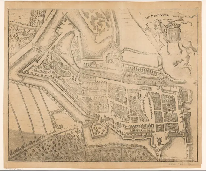
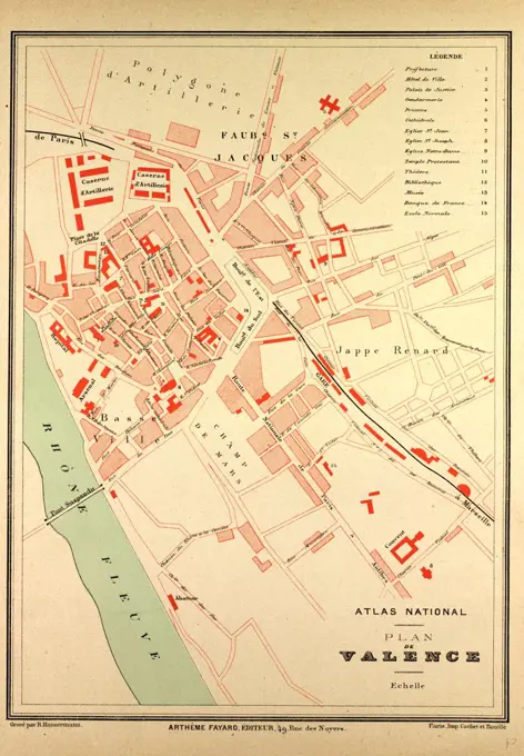
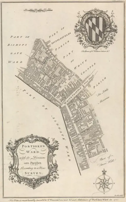
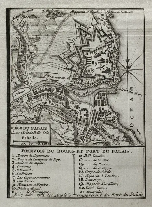
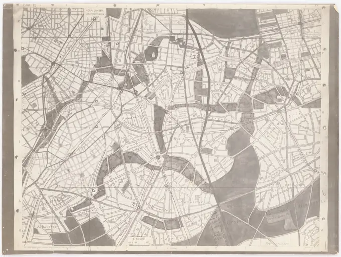
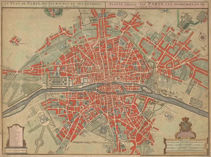
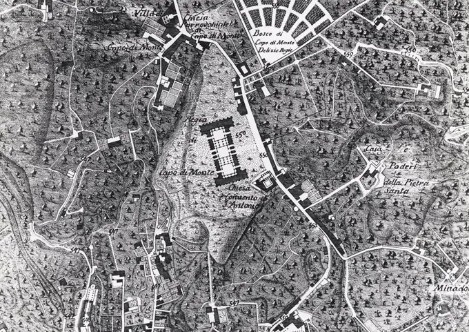
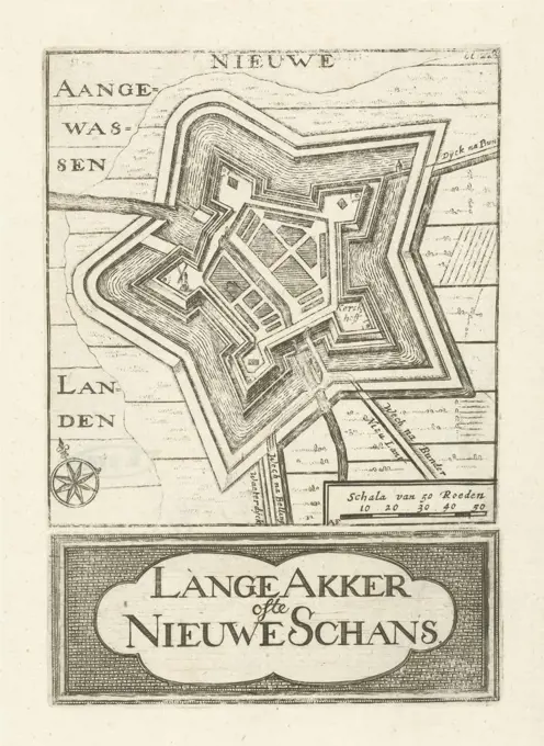
City Maps of Historical Significance

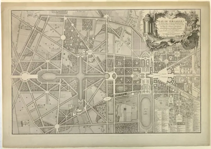
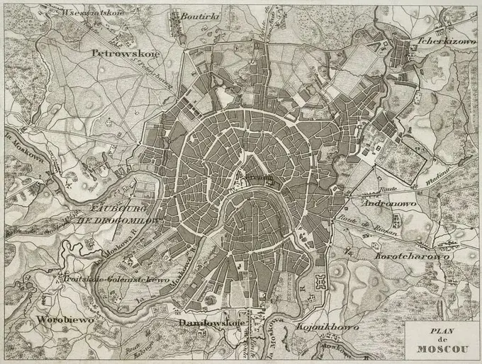
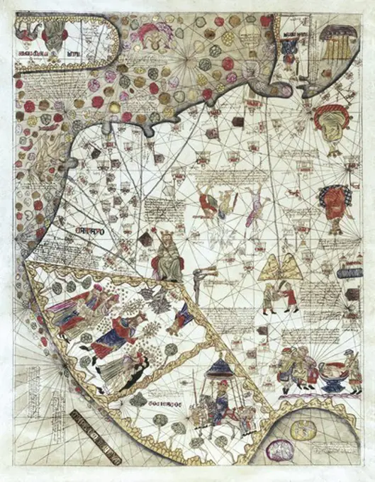
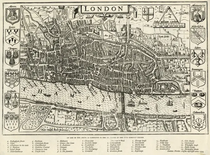
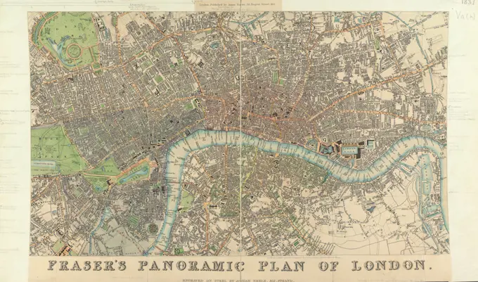
Engravings and etchings of historical city maps, showcasing urban layouts and architectural details from various notable cities.

Map of Veere, Anonymous, 1722 - 1728 print Map in a nutshell perspective. At the top right two putti with the coat of arms and a banner with the title.  paper etching maps of cities. coat of arms (as symbol of the state, etc.) (+ city; municipal) Veere
Map of Veere, Anonymous, 1722 - 1728 print Map in a nutshell perspective. At the top right two putti with the coat of arms and a banner with the title. paper etching maps of cities. coat of arms (as symbol of the state, etc.) (+ city; municipal) Veere
Map of Amsterdam, Anonymous, 1726 - 1750 print Map in a nutshell perspective. Along the top the title. Bottom left the Legenda A-Z, A-Z, A-N and 1-116. At the bottom right De Legenda 117-258 and the legend of the Bolwerken 1-26. Above that a bowl: scale of 2000 Amsterdam feet. Orientation: south -southwest above.  paper etching / engraving maps of cities AmsterdamICHNOGRAPHIAM CAMPI MARTII ANTIQUAE URBIS (Ichnographia of the Campus Martius of the AncientCity).  Artist: Giovanni Battista Piranesi, Italian, 1720-1778MAP OF VALENCE, FRANCEMap of the fortified town of Woerden. This print is part of a group of twelve prints, mostly etched and published by Gaspar Bouttats, with views of fortresses and towns conquered by the French and the Bishop of Munster in 1672. With a French and a Dutch legend, Map of Woerden, captured by the French in 1672 Twelve views of fortresses and cities captured by the French and the Bishop of Munster in 1672 Illustration of some cities and fortifications, of which differente soo ghe won and surrendered to his Majesty the Prince of Vranckerijk Lodovicus XIV and to his Lordship the Bishop of Munster Christophori Bernardus van Galen. Anno 1672 , print maker: Gaspar Bouttats, (mentioned on object), publisher: Gaspar Bouttats, (mentioned on object), Antwerp, 1672, paper, etching, h 148 mm × w 177 mmJansen Hermann (1869-1945), Planning for Plowdiw (01.12.1942): Plowdiw zone plan and the surrounding area in 16 parts, part 3D 1: 5000. Ink over pressure on transparent, 50.6 x 70.6 cm (including scan edges) Jansen Hermann  (1869-1945): Planung für PlowdiwMap of Amsterdam, 1544 (fourth part), Cornelis Anthonisz., C. 1557 print Fourth part of a map of Amsterdam in a nutshell perspective, consisting of eleven parts (twelfth part is missing).  paper  maps of cities AmsterdamBound Print (France)Map of the city of Kochi, Anonymous, 1783 print The title in French on a loosely cut piece of paper, stuck under the print.  paper engraving maps of cities KochiMap of Leuven, Anonymous, 1652 print Map of Leuven. Bottom left the title cartouche. At the top left of the weapon of Brabant and the top right the Wapen van Leuven. On the right a legend 1-74. With Dutch text on Verso.  paper etching / engraving / letterpress printing maps of cities. coat of arms (as symbol of the state, etc.) (+ province; provincial). coat of arms (as symbol of the state, etc.) (+ city; municipal) LouvainMap with the siege of Haarlem, 1572-1573; Warhaffte contrakehtung der Statt Haerlem / Mit Ihrer Jungsten Belägerung. Map with the siege of Haarlem, 1572-1573. Under the show De Legenda A-Z and A-D in German. Printed on the back with text in German.Cartography, Italy, 16th century. Map of Bologna. From Civitates Orbis Terrarum by Georg Braun (1541-1622) and Franz Hogenberg (1540-1590), Cologne. EngravingNew and neat marking of the by Gravinge that is where you / is there to start from the Stadt Utrecht to Aan / Spakenborg in the Zuyder Zee with DES Even Bakinge &Map of Tournai, Anonymous, 1582 - 1588 print Map of Tournai with buildings in a nutshell perspective. Above, to the right of the middle, the title cartouche. Bottom left a legend A-U. At the bottom right a legend 1-7, A-H and A-Z. At the top left two weapons of Tournai. At the top right the weapon of the diocese of Tournai. Numbered in the bottom right: 55.  paper etching / engraving maps of cities. coat of arms (as symbol of the state, etc.) (+ province; provincial). coat of arms (as symbol of the state, etc.) (+ city; municipal) TorlativeMap of Delft, Anonymous, c. 1700 - 1728 print Map in a nutshell perspective. At the top left of the weapon of Holland, at the top of the middle a cartouche with the title, at the top right the Wapen van Delft. Bottom left a legend 1-40 with a bowl above it: 50 Rylantse or Delflantse rods.  paper etching / engraving maps of cities. coat of arms (as symbol of the state, etc.) (+ province; provincial). coat of arms (as symbol of the state, etc.) (+ city; municipal) DelftJansen Hermann (1869-1945), Dortmund development plan (20.01.1941): Outdoor districts, map section 131/7 1: 2000. Photo on paper, 30.3 x 42.4 cm (including scan edges) Jansen Hermann  (1869-1945): Bebauungsplan DortmundGraphics. Photographs of Marshall Plan Programs, Exhibits, and PersonnelPortooken Ward, Benjamin Cole, 1697-1783, British, after unknown artist, 1755, EngravingMap of Zierikzee, Jan Luyken, 1728 print Map in a nutshell perspective. At the top right of the weapon of Zierikzee. At the bottom right the title cartouche.  paper etching maps of cities. coat of arms (as symbol of the state, etc.) (+ city; municipal) ZierikzeeMap of Vlissingen, Anonymous, 1721 - 1774 print Map in a nutshell perspective. At the top left the weapon of Zeeland with the title on the right. At the top right the Wapen van Vlissingen.  paper etching / engraving maps of cities. coat of arms (as symbol of the state, etc.) (+ province; provincial). coat of arms (as symbol of the state, etc.) (+ city; municipal) FlushingSeven Years War (1756-1763). Capture of Belle Isle (June 1761). The British succeeded in storming the main citadel of the island, located on the Atlantic coast off Brittany, after a second landing led by General Studholme Hodgson and a subsequent six-week siege. Map published in 1765 by the cartographer Jean de Beaurain (1696-1771) as an illustration of his Great Map of Germany, with the events that took place during the Seven Years War. French edition, 1765. Military Historical Library of Barcelona (Biblioteca Histórico Militar de Barcelona). Catalonia. Spain. Author: Jean de Beaurain (1696-1771). French geographer.Map of The Hague (twelfth part), 1681 - 1682 print Twelfth part of a map of The Hague. On the right the weapon of and the assignment to William III. For the weapon anchors and under the weapon Joris who kills the dragon. Numbered in the bottom right: 12.  paper etching maps of cities. armorial bearing, heraldry The HaguePlan of the Gardens at Versailles, Jean de la Grive, French, 1689 - 1757, Engraving on paper, Plan of the gardens at Versailles, showing also the layout of teh chateau and town. Upper right, cartouche bearing title, date, and scale. Lower right, key., France, 1746, architecture, Print, PrintLondon: plan of the Hospitals & Medical Schools, 1836-1837.Map of Haarlem, A. Valenduuk, 1793 - 1856 print  Haarlem paper  maps of cities HaarlemPart of the map of Haarlem, Romeyn de Hooghe, 1688 - 1689 print One of the four magazines that together represent the map of Haarlem. At the top left part of a banderol with text (vici vi) m virtus. Neptunus at the top right. Haarlem paper etching (story of) Neptune (Poseidon). maps of cities HaarlemMap of Venice 1838. Map of Orléans, Anonymous, 1657 - 1690 print This print is part of an album. publisher: Amsterdampublisher: Amsterdampublisher: AmsterdamThe Hague paper engraving maps of cities OrléansPhoto collection Government information service. Map of Leiden. undated. Leiden, Zuid-HollandJansen Hermann (1869-1945), Planning for Plowdiw (May 31, 1943): Department, land use plan in 2 parts 1: 2000 (part of Inv.No. 22321). Tusche over a break on transparent, 55.4 x 116.8 cm (including scan edges) Jansen Hermann  (1869-1945): Planung für PlowdiwMap of Siena (part at the bottom right); Senavetus civitas virginis. Part of a map of Siena. Saints above the city, bishops, cardinals and mary on clouds.Plan of EnckhuysenNapoleonic map. City of Moscow. Atlas de l'Histoire du Consulat et de l'Empire. History of the Consulate and the Empire of France under Napoleon by Marie Joseph Louis Adolphe Thiers (1797-1877). Drawings by Dufour, engravings by Dyonnet. Edited in Paris, 1864.Map of Amsterdam with design and implementation of the fourth explanation (second part); Flat-base from the old and new Royinge der Stede Amsterdam Aenworden with all its public buildings waer from the old Roying in 't Bruyn and the new in' t Bleeck wort uytgeprot; The new begins that the old shore with stained Linien is signed / Veteris Novaeque Urbis Amstelodamensis Ichnographia (...). Second part of a map of Amsterdam with design and implementation of the fourth explanation, consisting of six parts. Leged numbered: 2.Ground plan of conclave and faces on Rome. A map of the Vatican during the conclave after the death of Pope Clemens X in 1676. Above left a cartouche with text. At the bottom left a face of the Vatican. At the bottom right a face of the angel castle. At the top right two cartouches with title and a list of all cardinals that are present at the conclave. In the middle of the Holy Spirit in the form of a pigeon.Engraving, Sketch Map of Birmingham, Circa 1876 Topographical Views, Vol ii Sketch map of the centre of Birmingham, indicating the areas of proposed improvements in the 1870s, including Corporation Street, Topographical Views, Plan, Birmingham history, Map, Town PlanningHistorical map of Lyon, France, 19th century, from Meyers Konversations-Lexikon encyclopaedia, 1890, EuropePlan for parceling the general hospital area, Otto Wagner -, Formerly Owned byA new and exact plan of the cities of London and Westminster & the borough of Southwark to this present year, exhibiting in a neater and more distinct manner not only all the new buildings to this year but also a considerable number of streets lanes and alleys churches inns of court, halls hospitals &c. more than any map hitherto published : whereunto are added the rates of hackney coachmen and watermen with several other useful embellishments , London England, Maps, Early works to 1800, Westminster London, England, Maps, Early works to 1800, Southwark London, England, Maps, Early works to 1800 Norman B. Leventhal Map Center CollectionMap of the Delfland Water Board (eleventh part), Luggert van Anse, After Arnold Houbraken, After Pieter Haringh, 1712 - 1735 print Eleventh part of a map of the Delfland Water Board consisting of twenty -five parts.  paper engraving / etching maps of cities. armorial bearing, heraldry DelflandPlan of the city of Mexico with sacrificial square and imperial zoo, after the original to Emperor Charles V, historical city plan, Central America, water, houses, streets, cardinal points, symmetry, temple complex, centre, towers, fortificationEtching by Matthäus Merian the Elder depicting a 17th-century map of Münster showing streets, buildings, rivers, and surrounding landscape features.CRESQUES, Jafuda (1350-1410). Catalan Atlas. 1375. Sixth Leaf. Map of Catay (China). Reproduction of the original, which is in the National library of Paris. Miniature Painting. SPAIN. CATALONIA. Barcelona. Barcelona Maritime Museum.Map of the Place de Louis XV, Anonymous, 1763 - 1789 print Numbered at the top right: 4.  paper etching square, place, circus, etc. Place de la ConcordeVatican City, Innocent Nuova piante et alzata della città di Roma con tutte le strade piazze et edificii, Map of the city of Rome, Rome, verso - stamped, Part of a map of Rome., print, prints, height 390 mm, width 510 mm, Italian, 1643 - 1678, print maker, printmaker, 1676 - 1676, paper, etching, Work conception, own design of, Publication (Event), Publication, 1627 - 1691, publisher, 1611-05-19 - 1689-08-12, grantor of privilegeMap of Paris, Anonymous, 1721 - 1774 print   paper etching / engraving maps of cities. armorial bearing, heraldry ParisPLANO DE MADRID DE 1812 POR EL GEOGRAFO JUAN LOPEZ.Map of Shoreditch, Norton Folgate and Cripplegate, (1907). Artist: UnknownEspaña. Plano de la ciudad de Palma de Mallorca en 1805. Grabado de 1854.Map of centre of London in 1593     Date: 1593Illustration showing a plan of the exhibition areas for the Exposition Universelle of 1900. This was a fair held in Paris, France, from 14 April to 12 November 1900, to celebrate the achievements of the past century and to accelerate development into the next.GRABADO-PLATAFORMA DE AMBROSIO DE VICO - S XVI - PLANO DE GRANADA - PARTE B. Author: FRANCISCO HEYLAN (1584-1635). Location: PRIVATE COLLECTION. MADRID. SPAIN.John Norden, 1548-after 1625, British, London/Joannes Norden Anglud descripsit.Nouvelle description des chateaux et parcs de Versailles et de Marly : contenant une explication historique de toutes les peintures, tableaux, statues, vases & ornemens qui s'y voient : leurs dimensions : & les noms des peintres, des sculpteurs & des graveurs qui les ont faits. Author: Jean-Aimar Piganiol de La Force (1673-1753). Dimensions: 2 volumes : 10 folded plates, 3 folded plans ; Height: 6 11/16 in. (17 cm). Date: 1724.5th edition. Museum: Metropolitan Museum of Art, New York, USA.unknown artist, Clerkenwell, 1806. Engraving.Map of Middelburg, Anonymous, 1657 - c. 1704 print Map in a nutshell perspective. At the top left the Wapen van Zeeland. At the bottom right a cartouche with the title and the weapon of Middelburg.  paper etching / engraving maps of cities. coat of arms (as symbol of the state, etc.) (+ province; provincial). coat of arms (as symbol of the state, etc.) (+ city; municipal) MiddelburgGraphics. Photographs of Marshall Plan Programs, Exhibits, and PersonnelThe town of Dedham, Massachusetts : a pictorial map , Dedham Mass., Maps Norman B. Leventhal Map Center CollectionIllustration showing a plan of the exhibition areas for the Exposition Universelle of 1900. This was a fair held in Paris, France, from 14 April to 12 November 1900, to celebrate the achievements of the past century and to accelerate development into the next.Jansen Hermann (1869-1945), Groß-Berlin 1910 (01.12.1909): Overview plan 1: 10000. Photo on paper, 30 x 39.8 cm (including scan edges) Jansen Hermann  (1869-1945): Wettbewerb Groß-Berlin 1910Map etching by Wenzel Hollar produced between 1627 and 1677 showing Ferrara and its surroundings. The work presents urban layout, streets, waterways, and surrounding terrain in detailed cartographic style.Map of Mechelen, Anonymous, 1649 print The title has been credited to ink in the empty surface at the bottom right.  paper. ink etching / writing (processes) maps of cities MechelenJansen Hermann (1869-1945), Groß-Berlin 1910. Hackescher Markt (1908-1908): Basic plan section 1: 4000. Pressure on cardboard, 26.7 x 26.8 cm (including scan edges) Jansen Hermann  (1869-1945): Wettbewerb Groß-Berlin 1910. Hackescher MarktDarbye, the History, antiquities and topography of the town of Derby and its environs, illustrated  by S. Rayner assisted  by J. Moffat, Esq, 19th century engravingPlan of the city of Providence. Indexed. Leventhal Map Center copy gift of Bank of America.... , Rhode Island  , Providence  ,county   , ProvidenceDetail of a Plan de Belleville in the eighteenth century.. .A groundplot of part of the citty of Westminster. Sandford, Francis, 1630-1694. Cartographic. Prints, Illustrations, Maps. 1687. General Research Division. Great Britain , History , James II, 1685-1688, Coronations , Great Britain , James II, King of England, 1633-1701floor plan of Paris Flat land of Prays, its forebodings and its environs / The plan of Paris, its faubourgs and its environs, print maker: anonymous, Guillaume Delisle, (mentioned on object), publisher: Covens & Mortier, (mentioned on object), Paris, publisher: Amsterdam, 1721 - 1774, paper, etching, engraving, h 560 mm × w 758 mmLeaf N ° 7 / Revolution of Paris / 1830 / Figurative Plan / Barricades / as well as positions and movements of armed citizens and troops / during the days / July 27th and 29th. (TF)City map of Naples with Capodimonte, detail from the Duke Of Noja map, 1775, Italy, 18th century.Antique map of London, Southwark asnd Westminster, Atlas of fortifications and battles, by Anna Beek and Gaspar Baillieu  Originally published in 17th century. Map of Rome in Roman times (sixth part), Anonymous, 1773 print Sixth part of a map of Rome in Roman times, in a nutshell perspective, consisting of twelve parts. Numbered at the top right: 6. Rome paper engraving / etching maps of cities RomeVintage B&W pictorial Map of Calcutta.CanAnefo photo collection. IJ Tunnel Plan T.C. Big. September 12, 1950Herkimer County. Cartographic. Atlases, Maps. 1838. Lionel Pincus and Princess Firyal Map Division. New York (State), Herkimer County (N.Y.) , MapsH1 Cartographic. Maps. 1799. Carl H. Pforzheimer Collection of Shelley and His Circle. London (England), Fire risk assessment , England , LondonBöhmer Franz (1907-1943), urban development, bipial task 2 summer semester 1932 (10.12.1931): Task of Prof. Hermann Jansen. Pressure on paper, 62.5 x 64.2 cm (including scan edges)Map of Bruges, Anonymous, 1652 - 1662 print At the bottom right a legend 1-19. Amsterdam paper etching maps of cities UsedA map of Norwich as it looked in the 19th century. Black and White Illustration from Our Own Country Vol III published by Cassell, Petter, Galpin & Co. in the late 19th century.Map of Zaltbommel, Anonymous, 1660 print  Amsterdam paper etching maps of cities ZaltbommelBrussels, Town map, 16th cent. BELGIUM.Map of the Polder Velgersdijk, Anonymous, After Cornelis Lenartsz. Kouter, 1641 print Map of the Polder Velgersdijk. Along the top the first title. On the left a cartouche with the second title and information and above it a female figure with the weapon of the polder. At the bottom right a bowl: 80 Putse rods.  paper etching / engraving maps of separate countries or regions. coat of arms (as symbol of the state, etc.). polder, reclaimed land Voter dijkNEW STYLE OF REPORTING INDUSTRIAL DAMAGE ON "K" REPORTS (TO RIGHT OF ABOVE PHOTOGRAPH) A category is given to the damage for each important industrial target. This is the total damage to the plant or target, as follows:Plan of the town of Versailles. Brunox (Wersal ; zakład litograficzny, wydawnictwo ; ca 1850-1865), lithography atelier, unknown, graphic artistMap of Nieuweschans Lange Akker of the Nieuwe Schans (title on object), Two prints on one sheet: At the top a print with a representation of a map of Nieuweschans and below a print with the title in a cartouche. In the upper print at the bottom right a scale and top right: bl. 228, maps, atlases, Nieuweschans, Hendrik Hofsnider (mentioned on object), Groningen, 1743, paper, etching, h 101 mm × w 97 mm × h 38 mm × w 97 mmRock's illustrated map of London , Metropolitan areas, England, London, London England, Maps Norman B. Leventhal Map Center CollectionBombing Census Map of Birmingham Description: Map showing the extent of German attacks on Birmingham in November and December 1940, produced by the Research and Experiments Department of the Ministry of Home Security. Date: 1940 birmingham, map, secret, wwii, 1940, gordonstreet, blitz, bombing, secondworldwar, digbeth, snowhill, corporationstreet, towerstreet, bristolstreet, nurseryroad, cowperstreet, ministryofhomesecurityPlattegrond van de Stad Rome; New plants and raised of the city of Rome with all the streets of the squares and buildings (...). Deel Van Een PlatteGrond Van Rome.Fraser's Panoramic Plan of London, unknown artist, (  Josiah Neele ), after unknown artist, 1831, Engraving with some hand coloring, Sheet: 10 3/8 x 17 11/16in. (26.4 x 44.9cm)Map of Brussels (part in the middle), Anonymous, After Nicolaas van der Horst, 1748 print Share (in the middle of) of a map of Brussels with buildings in a nutshell perspective, consisting of six parts.  paper etching / engraving maps of cities. fortified city BrusselsMap of the city of Rome, Giovanni Battista Falda, 1676 print Part of a map of Rome. print maker: Romeafter own design by: Romepublisher: RomeVaticaanstadRomeVaticaanstad paper etching maps, atlases RomeInformation board with map of Amsterdam that can be seen where Edelsmeden lived in 1798; Johannes Schiotling exhibition. .Information board with map of Amsterdam that can be seen where Edelsmeden lived in 1768; Johannes Schiotling exhibition. .