My Boards
View Pictures
  • My Boards
← Documents & Records

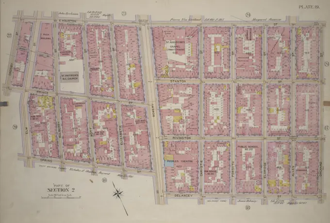
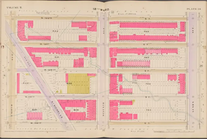
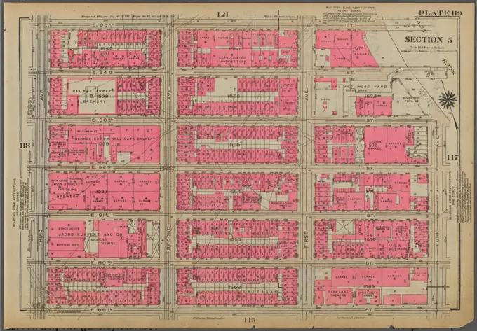
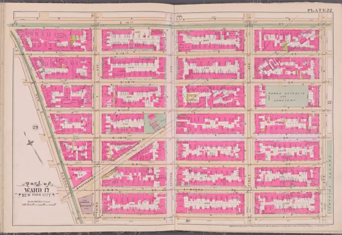
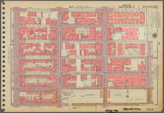
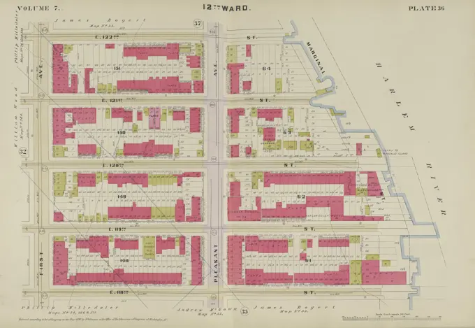
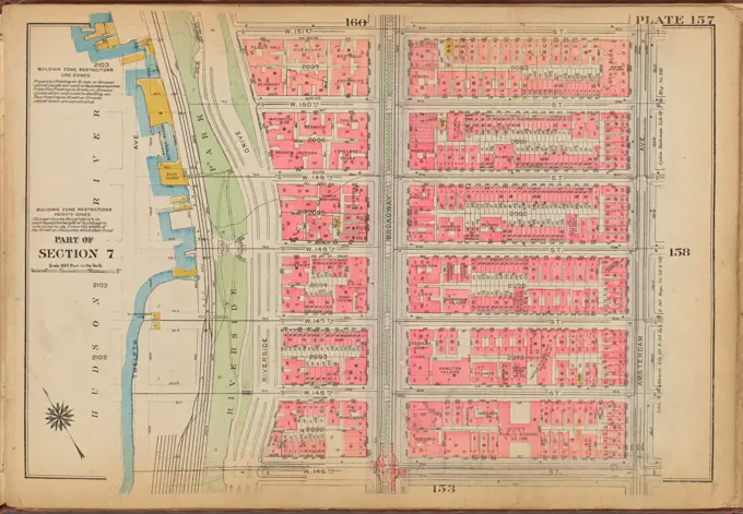
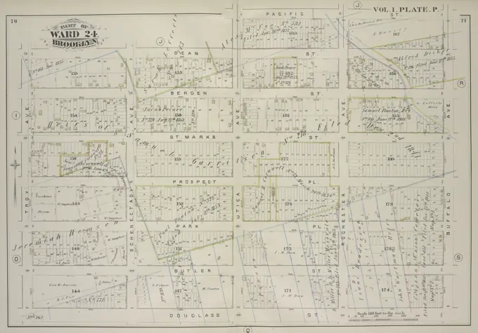
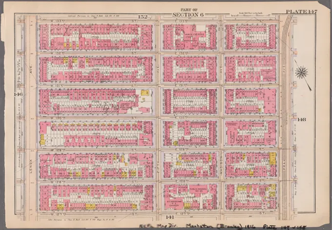
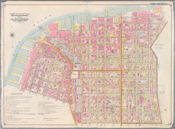
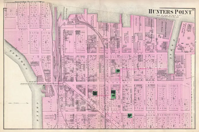
Comprehensive Maps of New York

Cartographic layouts showcasing real estate and urban planning with detailed street boundaries and land usage from various decades.

Insurance map of Boston vol. 3 (South & East Boston) : plate 65 , Fire risk assessment, Massachusetts, Boston, Maps, South Boston Boston, Mass., Maps Norman B. Leventhal Map Center Collection
275 assets in this story
4409-21521803
Plate 14, Part of Section 3: Bounded by W. 32nd Street, Fifth Avenue, W. 26th Street and Seventh Avenue.
4443-75463768
Plate 19, Part of Section 2 Bounded by E. Houston Street, Orchard Street, Delancey Street, Bowery Street, Spring Street, Elm Street, Prince Street, and Crosby Street, 1899., 1899., Philadelphia. Publisher, G.W. Bromley & Co. Manhattan (New York, N.Y.), Real property, New York (State), New York
6145-55927309
Cartographic, Maps. 1868. Lionel Pincus and Princess Firyal Map Division. Brooklyn (New York, N.Y.), Fire insurance , New York (State) , New York Brooklyn, Vol. 4, Double Page Plate No. 78; Map bounded by Roebling St. late South St., South 3rd St., South 2nd St., South 1st St., Grand St., North 1st St.; Including North 2nd St., North 3rd St., North 4th St., North 5th St., North 6th St., Bedford Ave. late 4th St.
6145-55925880
Cartographic, Maps. 1927. Lionel Pincus and Princess Firyal Map Division. Real property , New York (State) , New York, Manhattan (New York, N.Y.) Plate 134, Part of Section 7: Bounded by W. 122nd Street, Lenox Avenue, W. 116th Street and Eighth Avenue
4409-21507879
Plate 39: Bounded by Twelfth Avenue Hudson River, Riverside Drive, W. 142nd Street, 10th Avenue, W. 141st Street, Convent Avenue, and W. 125th Street.
6145-51389725
Atlas of the city of Boston, Boston proper and Back Bay : plate 28 , Boston Mass., Maps, Real property, Massachusetts, Boston, Maps, Landowners, Massachusetts, Boston, Maps, South End Boston, Mass., Maps Norman B. Leventhal Map Center Collection
6145-50511779
Plan of the city of Boston : plate 16 , Real property, Massachusetts, Boston, Maps, Boston Mass., Maps Norman B. Leventhal Map Center Collection
6145-50567970
Insurance map of Charlestown : portions of Roxbury (now annexed to Boston) and Cambridge : plate 17 , Fire risk assessment, Massachusetts, Cambridge, Maps, Real property, Massachusetts, Cambridge, Maps, Cambridge Mass., Maps Norman B. Leventhal Map Center Collection
6145-55926275
Bromley, George Washington. Cartographic, Maps, Atlases, land surveys. 1908. Lionel Pincus and Princess Firyal Map Division. Brooklyn (New York, N.Y.) , Maps Plate 15: Bounded by Teneyck Street, Morgan Avenue, Knickerbocker Avenue, Brooklyn and Newton Avenue, Harrison Avenue, Lorimer Street, Broadway and Union Avenue Plate 15
4409-21522765
Brooklyn, Vol. 5, Double Page Plate No. 13; Part of Wards 29 & 32, Section 16; Map bounded by Avenue D, E. 40th St.; Including Glenwood Road, E. 29th St.
6145-55926315
Bromley, George Washington. Cartographic, Maps, Atlases, land surveys. 1907. Lionel Pincus and Princess Firyal Map Division. Brooklyn (New York, N.Y.) , Maps Plate 8: Bounded by 58th Street, 21st Avenue, 72nd Street. and 14th Avenue Plate 8
4409-21522744
Part of Secions 5 & 6.
6145-54521826
Cartographic, Maps. 1890. Lionel Pincus and Princess Firyal Map Division. Real property , New York (State) , New York, New York (N.Y.) Plate 14 Map bounded by W. 122nd St., Lenox Ave., W. 118th St., 8th Ave.
6145-55925663
Cartographic, Maps. 1921 - 1923. Lionel Pincus and Princess Firyal Map Division. Real property , New York (State) , New York, Manhattan (New York, N.Y.) Plate 71: Bounded by W. 47th Street, Broadway, Seventh Avenue, W. 42nd Street and Ninth Avenue
6145-51390292
Atlas of the city of Boston, East Boston : plate 13 , Boston Mass., Maps, Real property, Massachusetts, Boston, Maps, Landowners, Massachusetts, Boston, Maps, East Boston Boston, Mass., Maps Norman B. Leventhal Map Center Collection
6145-55175924
Cartographic, Maps. 1857 - 1862. Lionel Pincus and Princess Firyal Map Division. Manhattan (New York, N.Y.), Real property , New York (State) , New York Plate 44: Map bounded by East 17th Street, Second Avenue, East 12th Street, Fourth Avenue
6145-50566378
Atlas of the city of Boston, Boston proper and Back Bay : plate 28 , Boston Mass., Maps, Real property, Massachusetts, Boston, Maps, Landowners, Massachusetts, Boston, Maps, South End Boston, Mass., Maps Norman B. Leventhal Map Center Collection
6145-55925587
Cartographic, Maps. 1930. Lionel Pincus and Princess Firyal Map Division. Real property , New York (State) , New York, Manhattan (New York, N.Y.) Plate 119, Part of Section 5: Bounded by E. 95th Street, East River, York Avenue, E. 89th Street and Third Avenue
6145-55176285
Cartographic, Maps. 1884 - 1936. Lionel Pincus and Princess Firyal Map Division. Fire insurance , New York (State), Real property , New York (State), Cities & towns , New York (State) Brooklyn, V. 6, Double Page Plate No. 155 Map bounded by Prospect Place, Underhill Ave., Atlantic Ave., Classon Ave.
6145-55928015
Cartographic, Maps. 1920. Lionel Pincus and Princess Firyal Map Division. Manhattan (New York, N.Y.), Real property , New York (State) , New York, New York (N.Y.) Plate 3, Part of Section 3: Bounded by E. 20th Street, Second Avenue, E. 14th Street, Union Square - East Fourth Avenue, E. 17th Street and Broadway.
6145-50566553
Atlas of the city of Boston, Charlestown and East Boston : plate 22 , Boston Mass., Maps, Real property, Massachusetts, Boston, Maps, Landowners, Massachusetts, Boston, Maps Norman B. Leventhal Map Center Collection
6145-50566885
Atlas of the city of Boston, South Boston : plate 25 , Boston Mass., Maps, Real property, Massachusetts, Boston, Maps, Landowners, Massachusetts, Boston, Maps Norman B. Leventhal Map Center Collection
6145-55926761
Cartographic, Maps. 1886. Lionel Pincus and Princess Firyal Map Division. Brooklyn (New York, N.Y.), Real property , New York (State) , New York Plate 7: Bounded by Lafayette Avenue, Marcy Avenue, Greene Avenue, Tompkins Avenue, Fulton Street, Brooklyn Avenue, Herkimer Street, Bedford Avenue, Atlantic Avenue and Washington Avenue. Plate 7: Part of Wards 7 & 23. Brooklyn, N.Y.
4409-21521527
Plate 23, Part of Section 5: Bounded by E. 71st Street, Third Avenue, E. 65th Street and Central Park Fifth Avenue.
6145-55926897
Cartographic, Maps. 1898. Lionel Pincus and Princess Firyal Map Division. Brooklyn (New York, N.Y.), Real property , New York (State) , New York Double Page Plate No. 39: Bounded by Dekalb Avenue, Cypress Avenue, Stanhope Street, St. Nicholas Avenue, Grove Street, Wyckoff Avenue, Cornelia Street and Broadway. Part of Wards 27 & 28. Land Map Section, No. 11, Volume 1, Brooklyn Borough, New York City.
6145-50569979
Atlas of the city of Boston, Dorchester : from actual surveys and official plans : plate 17 , Real property, Massachusetts, Boston, Maps, Landowners, Massachusetts, Boston, Maps, Dorchester Boston, Mass., Maps Norman B. Leventhal Map Center Collection
6145-55926394
Cartographic, Maps. 1916. Lionel Pincus and Princess Firyal Map Division. Atlases, Manhattan (New York, N.Y.), Real property , New York (State) , New York Plate 16: Bounded by Broome Street, Willet Street, Grand Street, East Broadway, Pike Street, and Orchard Street Part of Sections 1 & 2
4409-21507931
Part of Section 3 : Plate 57.
6145-55924993
Cartographic, Maps. 1925. Lionel Pincus and Princess Firyal Map Division. Real property , New York (State) , New York, Manhattan (New York, N.Y.) Plate 51, Part of Section 3: Bounded by E. 26th Street, East River Piers, Exterior Street, E. 20th Street and Second Avenue
6145-55924483
Cartographic, Maps. 1893. Lionel Pincus and Princess Firyal Map Division. New York (N.Y.) Plate 22 Map bounded by E. 14th St., Ave. A, 7th St., 4th Ave.
6145-51389746
Atlas of the city of Boston, Boston proper and Back Bay : plate 28 , Boston Mass., Maps, Real property, Massachusetts, Boston, Maps, Landowners, Massachusetts, Boston, Maps, South End Boston, Mass., Maps Norman B. Leventhal Map Center Collection
6145-55925268
Cartographic, Maps. 1955 - 1956. Lionel Pincus and Princess Firyal Map Division. Real property , New York (State) , New York (N.Y.), Manhattan (New York, N.Y.) Plate 105, Part of Section 5: Bounded by E. 65th Street, York Avenue, E. 59th Street and Third Avenue.
4409-21507726
Plate 40: Bounded by W. 136th Street, Fifth Avenue, W. 125th Street, and Morningside Avenue.
4409-21518661
Plate 24, Part of Sections 3&5: Bounded by E. 42nd Street, East River Docks First Avenue, E. 37th Street and Third Avenue.
4409-21518806
Plate 43, Part of Sections 4&5: Bounded by Central Park South, Fifth Avenue, W. 53rd Street and Seventh Avenue.
4443-75463528
Plate 36 Map bounded by E. 122nd St., Harlem River, E. 118th St., and 1st Ave., issued in 1890 by E. Robinson Co. The map depicts real property in New York, New York
6145-55926607
Cartographic, Maps. 1897. Lionel Pincus and Princess Firyal Map Division. Real property , New York (State) , New York, Manhattan (New York, N.Y.) Plate 17: Bounded by W. 36th Street, E. 36th Street, Lexington Avenue, E. 25th Street, Madison Avenue, E. 26th Street, Fifth Avenue, W. 25th Street and Eighth Avenue. Part of Section 3, New York City.
6145-55927427
E.B. Hyde & Co.. Cartographic, Maps. 1906. Lionel Pincus and Princess Firyal Map Division. Brooklyn (New York, N.Y.) , Maps, Real property , New York (State) , New York Brooklyn, Vol. 5, Double Page Plate No. 16; Part of Ward 29, Section 16; Map bounded by Nostrand Ave., Tilden Ave. (Vernon Ave.); Including Flatbush Ave., Clarkson Ave.
6145-55175773
Cartographic, Maps. 1857 - 1862. Lionel Pincus and Princess Firyal Map Division Plate 7: Map bounded by Murray Street, Broadway, Dey Street, West Street; Including Robinson Street, Park Place, Barclay Street, Vesey Street, Fulton Street, Washington Street, Greenwich Street, College Place, Church Street
4409-21522012
Brooklyn, Vol. 3, Double Page Plate No. 28; Part of Ward 28, Section 11; Map bounded by Stanhope St., St.Nicholas Ave., Boundary Line Borough of Brooklyn and Queens; Including Palmetto St., Central Ave.
4409-21519684
Part of Wards 27 & 28. Land Map Section, No. 11, Volume 1, Brooklyn Borough, New York City.
6145-55925736
Cartographic, Maps. 1921 - 1923. Lionel Pincus and Princess Firyal Map Division. Real property , New York (State) , New York, Manhattan (New York, N.Y.) Plate 157: Bounded by W. 151st Street, Amsterdam Avenue, W. 145th Street and (Hudson River, Riverside Park) Riverside Drive
6145-55924962
Cartographic, Maps. 1879. Lionel Pincus and Princess Firyal Map Division. Real property , New York (State) , New York Plate 14:: Bounded by W. 38th Street, Sixth Avenue, W. 26th Street and (Hudson River) Twelfth Avenue. Part of Ward 20.
4409-21510988
Plate 22: Bounded by Sixth Avenue, Central Park South, Fifth Avenue, E. 64th Street, Lexington Avenue, and E. 47th Street.
6145-55176050
Cartographic, Maps. 1899. Lionel Pincus and Princess Firyal Map Division. Manhattan (New York, N.Y.), Real property , New York (State) , New York Plate 21, Part of Section 3: Bounded by (W. 37th Street, Fifth Avenue, W. 32nd Street and Seventh Avenue
6145-48719911
Political map of Connecticut 1888 ; Political map of New York 1888 , Voting, Connecticut, Maps, Voting, New York State, Maps Norman B. Leventhal Map Center Collection
6145-50566749
Atlas of the city of Boston, East Boston : plate 7 , Boston Mass., Maps, Real property, Massachusetts, Boston, Maps, Landowners, Massachusetts, Boston, Maps, East Boston Boston, Mass., Maps Norman B. Leventhal Map Center Collection
6145-50566888
Atlas of the city of Boston, South Boston : plate 28 , Boston Mass., Maps, Real property, Massachusetts, Boston, Maps, Landowners, Massachusetts, Boston, Maps Norman B. Leventhal Map Center Collection
4409-21508933
Plate 27: Bounded by E. 14th Street, East River, E. 8th Street, and Avenue B.
4443-75461773
Vol. 1. Plate P. Map bound by Dean St., Pacific St., Buffalo Ave., Douglass St., Troy Ave.; including Bergen St., St. Marks St., Prospect Pl., Park Pl., Butler St., Schenectady Ave., Utica Ave., Rochester Ave., 1880., Philadelphia. Publisher, G.M. Hopkins & Co. Brooklyn (New York, N.Y.), Real property, New York (State), New York
4443-75464732
Manhattan, V. 3, Double Page Plate No. 61 Map bounded by Little 12th St., Greenwich St., Bethune St., 13th Ave., and Bloomfield St., issued by the Sanborn Map Company in New York, dated between 1884 and 1895. The map pertains to fire insurance, real property, and urban layout in New York State
6145-51391078
Atlas of the city of Somerville, Massachusetts : from actual surveys and official plans. plate 3 , Real property, Massachusetts, Somerville, Maps, Landowners, Massachusetts, Somerville, Maps, Somerville Mass., Maps Norman B. Leventhal Map Center Collection
4409-21518685
Brooklyn, Vol. 5, Double Page Plate No. 16; Part of Ward 29, Section 16; Map bounded by Nostrand Ave., Tilden Ave. Vernon Ave.; Including Flatbush Ave., Clarkson Ave.
6145-48717666
Atlas of the city of Boston : East Boston, Mass. : plate 13 , Boston Mass., Maps, Real property, Massachusetts, Boston, Maps, Landowners, Massachusetts, Boston, Maps, East Boston Boston, Mass., Maps Norman B. Leventhal Map Center Collection
6145-55925441
Cartographic, Maps. 1930. Lionel Pincus and Princess Firyal Map Division. Real property , New York (State) , New York, Manhattan (New York, N.Y.) Plate 55, Part of Section 3: Bounded by W. 32nd Street, Fifth Avenue, W. 26th Street and Seventh Avenue
6145-55927378
E.B. Hyde & Co.. Cartographic, Maps. 1904 - 1912. Lionel Pincus and Princess Firyal Map Division. Brooklyn (New York, N.Y.) , Maps, Real property , New York (State) , New York Brooklyn, Vol. 2, Double Page Plate No. 12; Part of Wards 21 & 23, Section 6; Map bounded by Sumner Ave., Putnam Ave., Madison St.; Including Marcy Ave., Hart St.
6145-55926699
Cartographic, Maps. 1916. Lionel Pincus and Princess Firyal Map Division. Atlases, Manhattan (New York, N.Y.), Real property , New York (State) , New York Plate 147: Bounded by W. 133rd Street, E. 133rd Street, Park Avenue, E. 127th Street, W. 127th Street and Lenox Avenue Part of Section 6
6145-55928926
Cartographic, Maps. 1891. Lionel Pincus and Princess Firyal Map Division. Manhattan (New York, N.Y.), Real property , New York (State) , New York Plate 14 Map bounded by W. 25th St., 2nd Ave., E. 14th St., 7th Ave.
6145-54522573
Cartographic, Maps. 1855. Lionel Pincus and Princess Firyal Map Division. Manhattan (New York, N.Y.), Real property , New York (State) , New York 4th Ward. Plate 11: Map bounded by Oak Street, Catharine Street, South Street, Roosevelt Street; Including Batavia Street, Cherry Street, Water Street, James Street, James Slip, Oliver Street
6145-55176233
Cartographic, Maps. 1884 - 1936. Lionel Pincus and Princess Firyal Map Division. Fire insurance , New York (State), Real property , New York (State), Cities & towns , New York (State) Brooklyn V. 3, Plate No. 44 Map bounded by Seigel St., Bushwick Ave., Debevoise St., Humboldt St.
6145-55926860
Cartographic, Maps. 1898. Lionel Pincus and Princess Firyal Map Division. Brooklyn (New York, N.Y.), Real property , New York (State) , New York Double Page Plate No. 1: Bounded by Marshall St., Little St., Evans St., (United States Navy Yard) Hudson Ave., Johnson St., Main Fulton St., Clark St., (East River Docks) Furman ave., Fulton St., Water St., Dock St, Plymouth St. and Pearl St. Wards 2 & 5 and Part of 1 &4. Land Map Section, No.1, Volume 1, Brooklyn Borough, New York City.
4409-21509239
Plate 17: Bounded by W. 36th Street, E. 26th Street, Lexington Avenue, E. 25th Street, Madison Avenue, E. 26th Street, and Eighth Avenue.
6145-50566415
Atlas of the city of Boston, Boston proper and Back Bay : plate 29 , Boston Mass., Maps, Real property, Massachusetts, Boston, Maps, Landowners, Massachusetts, Boston, Maps, Roxbury Boston, Mass., Maps Norman B. Leventhal Map Center Collection
4409-21518090
Brooklyn, Vol. 2, Double Page Plate No. 22; Part of Ward 24, Section 5; Map bounded by Atlantic Ave.; IncludingRalph Ave., St. Johns PL. Douglass St., Schenectady Ave.
6145-55958281
Newark, V. 2, Double Page Plate No. 48 Map bounded by Astor St., Avenue A, Poinier St., Elizabeth Ave. Cartographic. Atlases, Maps. 1911-12. Lionel Pincus and Princess Firyal Map Division. Newark (N.J.)
6145-29095575
1873 Beers Map of Hunters Point (Long Island City), Queens, New York
4409-21519533
Brooklyn, Vol. 6, Double Page Plate No. 22; Part of Ward 30, Section 19; Map bounded by 20th Ave., Benson Ave., Ruthrford Pl.; Including 17th Ave., New Utrech Ave., 78th St.
6145-55927016
Cartographic, Maps. 1880. Lionel Pincus and Princess Firyal Map Division. Brooklyn (New York, N.Y.), Real property , New York (State) , New York Vol. 1. Plate, Q. Map bound by Douglass St., Buffalo Ave., City Line, Troy Ave.; Including Degraw St., Eastern Parkway, Union St., President St., Carroll St., Crown St., Schenectady Ave., Utica Ave., Rochester Ave.
6145-55175695
Cartographic, Maps. 1880. Lionel Pincus and Princess Firyal Map Division. Brooklyn (New York, N.Y.), Real property , New York (State) , New York Vol. 6. Plate, M. Map bound by Grand St., Seventh St., Broadway, S. Sixth St., East River; Including S. First St., S. Second St., S. Third St., S. Fourth St., S. Fifth St., River St., First St., Second St., Third St., Fourth St., Fifth St., Sixth St.
6145-55176234
Cartographic, Maps. 1884 - 1936. Lionel Pincus and Princess Firyal Map Division. Fire insurance , New York (State), Real property , New York (State), Cities & towns , New York (State) Brooklyn V. 3, Plate No. 43 Map bounded by Seigel St., Humboldt St., Debevoise St., Cook St., Manhattan Ave.
4409-21508400
Part of Section 5: Plate 110.
4409-21518650
Plate 35, Part of Section 5: Bounded by E. 53rd Street, Third Avenue, E. 47th Street and Fifth Avenue.
4220-20427797
Map and location of YMCA Hotel - Chicago, USA     Date: circa 1930s
4409-21518081
Plate 16: Part of Section 7.
6145-48717456
The Seventh Ward of Philadelphia : the distribution of Negro inhabitants throughout the ward, and their social conditions , African Americans, Pennsylvania, Philadelphia, Maps, African Americans, Pennsylvania, Philadelphia, Social Conditions, Philadelphia Pa., Social conditions, Philadelphia Pa., Maps Norman B. Leventhal Map Center Collection
PREVIOUS
of 3
NEXT
2401 S. Ervay, Suite 206
Dallas, Texas 75215
United States
Get Started
Free ResearchMy BoardsMy Cart
For Creators
How To License Your ContentContributor PortalFrame of Mind
Resources
API accessPricing
Contact
+1 866 236 0087help@viewpictures.co.uk Contact form
©2026 View Pictures. All Rights Reserved. -A
This site is protected by reCAPTCHA and Google Privacy Policy and Terms of Service apply.