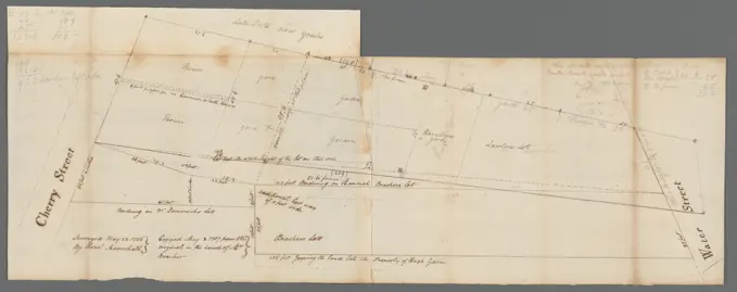
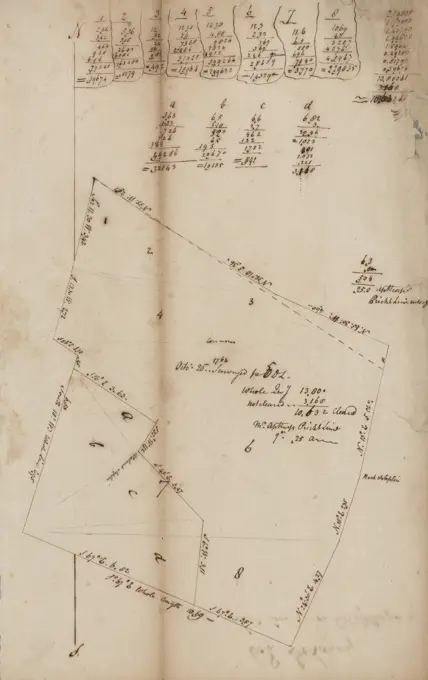
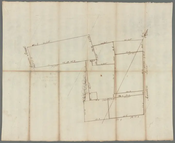
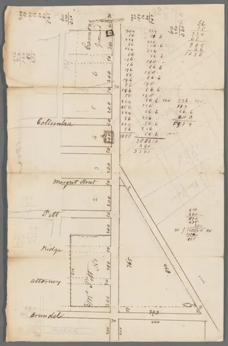
Early American Land SurveysHand-drawn plans of towns and districts from the late 18th century, detailing geographical features, property lines, and annotations by surveyors. Plan of Worthington, surveyor's name not given, dated May 15, 1795..... , 231 assets in this story6145-505112456145-487128476145-551675826145-505116106145-542688296145-559552586145-505112756145-505111846145-542685586145-551675786145-559557276145-505628886145-559550726145-559555876145-505629196145-505113666145-513864396145-505116656145-559164156145-559556716145-551674966145-559554846145-551675666145-559556496145-559556926145-505116456145-559599066145-559558396145-505110976145-542684476145-559557856145-487128816145-559551486145-559597766145-559556226145-559550736145-487128134443-754617066145-487130376145-505299036145-559557486145-487130786145-559557126145-542677836145-487131156145-559558206145-487130026145-505111156145-551673976145-551674956145-559551136145-513860836145-559596776145-505119116145-559598996145-542684306145-505115206145-542695326145-559555626145-559556206145-487326696145-559551086145-505527366145-505116156145-551675446145-559553526145-559556466145-559554246145-559555166145-559598896145-505114436145-513861256145-559163456145-551674676145-559557586145-487131696145-505629456145-559551376145-505628366145-559597866145-542686546145-559549826145-559598926145-487130186145-559551006145-487129256145-559551056145-487129996145-487131206145-505116996145-467545816145-487132026145-487132146145-487130646145-559550476145-505626686145-559596526145-505626576145-559557236145-55955286 PREVIOUS of 3 NEXT