My Boards
View Pictures
  • My Boards

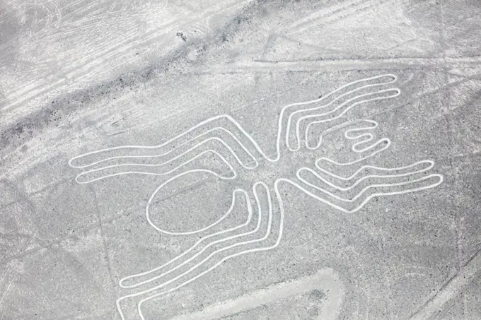
Earth and Mars Observations

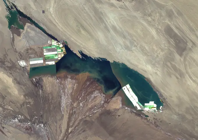
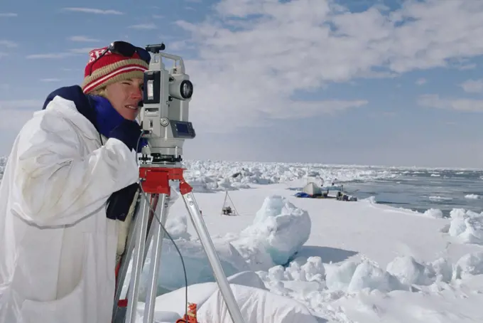
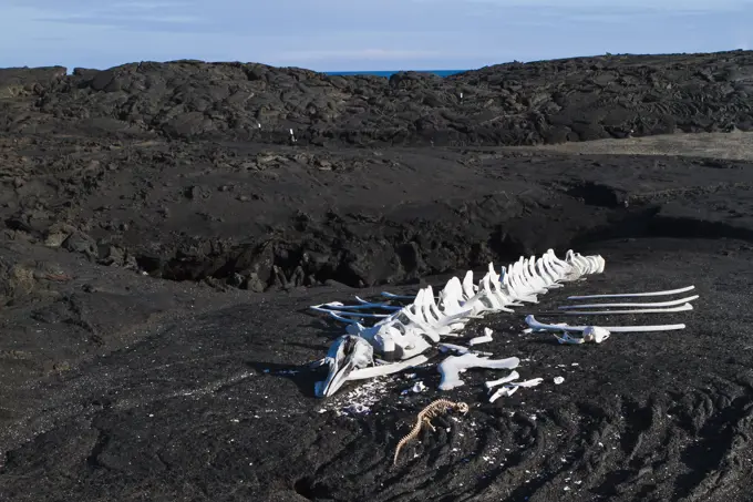
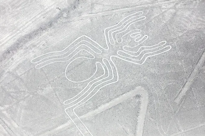
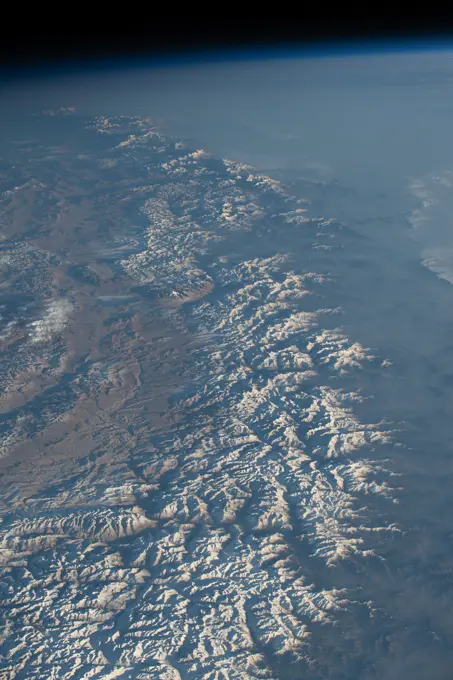
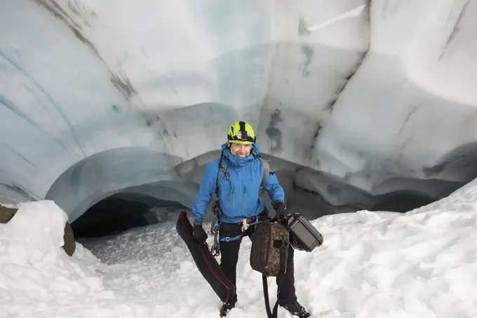
High-quality images of Earth's landscapes and Martian terrain captured from space, displaying geological formations and environmental features.

iss064e031247 (Feb. 11, 2021) --- The Himalayas separating China from India and Nepal are pictured from the International Space Station as it orbited 263 miles above northern Pakistan.
259 assets in this story
1850-5349
Antarctica, South Pole, Three Figures Launching A Balloon To Measure Amounts Of Ozone In The Air At Various Altitudes.   Us Amundsen-Scott South Pole Station.
6145-44758389
ISS019-E-005286 (8 April 2009) --- Mount Fuji, Japan is featured in this image photographed by an Expedition 19 crew member on the International Space Station. The 3,776 meters high Mount Fuji volcano, located on the island of Honshu in Japan, is one of the worlds classic examples of a stratovolcano. The volcanos steep, conical profile is the result of numerous interlayered lava flows and explosive eruption products  such as ash, cinders, and volcanic bombs  building up the volcano over time. The steep profile is possible because of the relatively high viscosity of the volcanic rocks typically associated with stratovolcanoes. This leads to thick sequences of lava flows near the eruptive vent that build the cone structure, rather than low viscosity flows that spread out over the landscape and build lower-profile shield volcanoes. According to scientists, Mount Fuji, or Fuji-san in Japan, is actually comprised of several overlapping volcanoes that began erupting in the Pleistocene Ep
4239-57494652
Artist's concept illustrating how aliens helped to build ancient Egyptian monuments.
4409-43792
ARTE PRECOLOMBINO. PREINCAICO. CULTURA NAZCA (200-900 d. C.). "LAS LINEAS". Vista aérea de una de las catorce figuras principales existentes, denominada "EL COLIBRI". Estos geoglifos están trazados en las amplias llanuras desérticas que se extienden al norte de la ciudad de NAZCA, siendo su origen y utilidad desconocidos. PERU.
6145-58966870
ISS019-E-014473 (5 May 2009) --- Salt ponds in Nueva Victoria, northern Chile are featured in this image photographed by an Expedition 19 crew member on the International Space Station. This view shows a long alluvial fan, sloping from east to west (left to right) in northern Chile with solar evaporation (or salt) ponds, some brightly colored, near the foot of the fan. The alluvial fan sediments are brown and contrast sharply with tan sediments of the Pampa del Tamarugal, the great hyper arid inner valley of Chiles northern Atacama Desert. Nitrates and many other minerals are mined in this region. A few extraction pits and ore dumps are visible at bottom right, but most of the shallow diggings (0.55 meters deep) of a mine extracting caliche deposits  a hard, cemented layer in the soil formed by downward movement and redeposition of sodium salts  lie just outside the picture. Iodine is one of the products from mining; it is first extracted by a process known as heap leaching. Waste liqu
4413-68461792
Apart from the traces of the vehicle, the ground is immaculate, raw and perfectly horizontal as far as the eye can see and 360°. Between Concordia station and Little Dome C, Antarctica
7208-70657624
Africa, Egypt, Giza plateau. Dr. Mark Lehner in royal production center.
1899-28781806
Jacques Yves Cousteau on  the oceanographic ship Calypso
4201-48035
Science research base on Ross Island with Mount Erebus behind, Antarctica
4239-57493449
An astronomer shooting the great conjunction of Jupiter and Saturn at Dinosaur Provincial Park, Alberta, Canada.
6145-44599383
ISS007-E-11609 (2 August 2003) --- This digital still camera's view from the International Space Station features early August forest fires in the Lost Creek area on the border of Alberta and British Columbia, just to the southwest of Calgary.  Across the international border, the fires were raging in the  Glacier National Park in Montana
6145-45252574
ISS012-E-09639 (29 Nov. 2005) --- The impact of an asteroid or comet several hundred million years ago, according to scientists, left scars in the landscape that are still visible in this International Space Station/Expedition 12 picture of an area in the Sahara Desert of northern Chad. The concentric ring structure is the Aorounga impact crater, with a diameter of about 17 kilometers (10.5 miles). The original crater was buried by sediments, which were then partially eroded to reveal the current ring-like appearance.  Scientists note a number of valleys cut by thousands of years of wind erosion.  The area shown is centered at approximately 19.1 degrees north latitude and 19.3 degrees east longitude.
4413-129291
Release of Concordia balloon Station Antarctica
4220-20161586
California Grey whale - Grey whales trapped in ice (Eschrichtius robustus). near Barrow, Alaska, October 1988.
1439-57956526
An explorer scanning the icy horizon with binoculars
1899-53518351
Color satellite image of Dongtai Salt Lakes, Qinghai, China in 2022, showing lithium brine extraction and evaporation ponds.
6145-44486591
Sapporo, the capital of Japan's northern island of Hokkaido, split by the Toyohira River, is pictured during an orbital night pass from the International Space Station at an altitude of 264 miles above the Sea of Japan.
5514-68358562
A weather observer, checks the temperature and other meteorological instruments on the summit of Mt. Washington.
6145-45259928
Peering into the thousands of frozen layers inside Greenlands ice sheet is like looking back in time. Each layer provides a record of what Earths climate was like at the dawn of civilization, or during the last ice age, or during an ancient period of warmth similar to the one we experience today. Scientists using ice-penetrating radar data collected by NASAs Operation IceBridge and earlier airborne campaigns have built the first-ever comprehensive map of layers deep inside the Greenland Ice Sheet. View the full video a href= http //youtu.be/u0VbPE0TOtQ rel= nofollow youtu.be/u0VbPE0TOtQ /a
4201-14244
Bowhead Whale (Balaena mysticetus) researcher surveys passing whales, Alaska
1890-151078
Whale skeleton, Fernandina Island, Galapagos Islands, UNESCO World Heritage Site, Ecuador, South America
6177-V53997161
4409-17711505
Lita Alburquerque / Stellar Axis: Antarctica (2006), Antártida.
6145-44932266
Some of the BARREL balloon launches took place at the South African National Antarctic Expedition Research base, called SANAE IV, the others at Halley Research Station. This balloon is taking flight at SANAE IV.
1890-10749
Oversnow geophysical team of the British Antarctic Survey, Antarctica, Polar Regions
6145-44922889
Liftoff!  A balloon begins to rise over the brand new Halley VI Research Station, which had its grand opening in February 2013.
4340-239
Scientist Setting a Trap
6145-44603569
ISS007-E-18086 (26 October 2003) --- The fires in the San Bernardino Mountains, fueled by Santa Ana winds, burned out of control on the morning of Oct. 26, 2003, when this image and several others were taken from the International Space Station. This frame and image numbers 18087 and 18088 were taken at approximately 19:54 GMT, October 26, 2003 with a digital still camera equipped with a 400mm lens. Lake Arrowhead and Silverwood Lake are just out of frame. Content was provided by JSC’s Earth Observation Lab. The International Space Station Program link to http://spaceflight.nasa.gov} supports the laboratory to help astronauts take pictures of Earth that will be of the greatest value to scientists and the public, and to make those images freely available on the Internet. Additional images taken by astronauts and cosmonauts can be viewed at the NASA/JSC Gateway to Astronaut Photography of Earth [link to http://eol.jsc.nasa.gov/.
4201-12739
Forty meter rainforest canopy research crane used by researchers at Smithsonian Tropical Research Institute (STRI) at Parquet Metropolitan, Panama
1848-54689868
Preparations for subglacial diving, ice diving in the frozen Black Sea, a rare phenomenon which last occured in 1977, Odessa, Ukraine, Eastern Europe, Europe
6145-45086719
Prior to launch, the team laid out the parachute and hang lines in front of SPIDER, seen in the distance. The long-duration balloon that would carry SPIDER into the sky is attached to the end of the parachute shown here in the foreground.
5514-29027786
Scientist carries video gear from glacier cave for climate research
6188-63300970
fumarole fumarole Copyright: xZoonar.com/JensxNieswandtx 982722
4201-76151
Steaming solfatare or fumarole, geothermic activity, Hveravellir, central Iceland
6145-44627244
On 26 December 2004, a magnitude 9.0 earthquake occurred off the west coast of Sumatra, Indonesia. These views were acquired by NASA's Terra spacecraft.
4340-1324
Biologists Measure Whale Blubber
5514-72864983
Time lapse cameras stand vigil over the terminus of the Columbia Glacier, near Valdez, Alaska.
4239-57492852
A photographer shooting an all-sky aurora display from the deck of Churchill Northern Studies Centre in Canada.
7221-71269265
Examining the surface of a Skeleton Coast Saltpan.
6145-44824171
Clark University student Christie Wood lowers a water sampler into a borehole on July 4, 2010, to collect water samples from below the Arctic sea ice off the north coast of Alaska. The research is part of NASA's ICESCAPE oceanographic mission to sample the physical, chemical and biological characteristics of the ocean and sea ice.  Impacts of Climate change on the Eco-Systems and Chemistry of the Arctic Pacific Environment (ICESCAPE) is a multi-year NASA shipborne project. The bulk of the research will take place in the Beaufort and Chukchi Seas in summer of 2010 and fall of 2011.
6145-44871773
On July 10, 2011, Don Perovich, of Cold Regions Research and Engineering Laboratory, maneuvered through melt ponds collecting optical data along the way to get a sense of the amount of sunlight reflected from sea ice and melt ponds in the Chukchi Sea.The ICESCAPE mission, or "Impacts of Climate on Ecosystems and Chemistry of the Arctic Pacific Environment," is NASA's two-year shipborne investigation to study how changing conditions in the Arctic affect the ocean's chemistry and ecosystems. The bulk of the research takes place in the Beaufort and Chukchi seas in summer 2010 and 2011.
6145-45114304
A member of the BARREL team prepares a payload for launch from Esrange Space Center on Aug. 29, 2016. Throughout August 2016, the BARREL team was at Esrange Space Center near Kiruna, Sweden, launching a series of six scientific payloads on miniature scientific balloons. The NASA-funded BARREL - which stands for Balloon Array for Radiation-belt Relativistic Electron Losses - primarily measures X-rays in Earths atmosphere near the North and South Poles. These X-rays are produced by electrons raining down into the atmosphere from two giant swaths of radiation that surround Earth, called the Van Allen belts. Learning about the radiation near Earth helps us to better protect our satellites. Several of the BARREL balloons also carried instruments built by undergraduate students to measure the total electron content of Earths ionosphere, as well as the low-frequency electromagnetic waves that help to scatter electrons into Earths atmosphere. Though about 90 feet in diameter, the BARREL bal
4163-8933
ANTARCTIC PENINSULA AREA, MS EXPLORER, PASSENGERS ON DECK VIEWING LANDSCAPE, MODEL RELEASE
6188-55456229
Nazca lines from the aircraft Mysterious figures Nazca desert from the aircraft Copyright: xZoonar.com/MassimoxLamax 11810735
4239-57492840
Orion and an aurora swirl over Churchill Northenr Studies Centre, Manitoba, Canada.
6145-44824170
Scientists on the sea ice in the Chukchi Sea off the north coast of Alaska disperse equipment on July 4, 2010, as they prepare to collect data on and below the ice. The research is part of NASA's ICESCAPE mission onboard the U.S. Coast Guard icebreaker Healy to sample the physical, chemical and biological characteristics of the ocean and sea ice.  Impacts of Climate change on the Eco-Systems and Chemistry of the Arctic Pacific Environment (ICESCAPE) is a multi-year NASA shipborne project. The bulk of the research will take place in the Beaufort and Chukchi Seas in summer of 2010 and fall of 2011.
6145-44932353
Earth Observations taken by Expedition 34 crewmember.
4340-230
Sorting Shares of Whale Blubber
7204-70651283
Canada, Baffin Island. Researchers in Itirbilung Fjord
6145-54461785
A member of a Navy polar research team uses a drill to test the thickness of an ice flow. Country: Antarctica (ATA)
1889-60419784
French biologists and explorers preparing a meal for the team members
6145-54515507
Iceberg Aerial Dye "Bombed" for Tracking. An iceberg off the coast of Labrador is labeled with large streaks of bright vermillion dye imbedded between its two peaks for future identification and tracking by means of a calcium chloride-rhodamine "B" dye bomb from the rear cargo doorway of a U.S. Coast Guard HC-130-B Ice Patrol plane (underpart seen overhead). The indelible stain enables Coast Guard observers to more accurately determine rate of drift and measure rates of ice deterioration over a long period. This method of iceberg marking, developed by the Coast Guard Oceanographic Unit, Washington, D.C., was used for the first time on the 1966 Ice Patrol. The bombs used were one-gallon glass jugs containing a mixture of calcium chloride pellets and rhodamine "B" dye. The calcium chloride melts grooves into the berg allowing the bright vermillion rhodamine dye to penetrate from one-half to one full inch deep, so that it remains detectable for a long period (unless the berg tumbles durin
6188-55456334
Nazca lines from the aircraft Mysterious figures Nazca desert from the aircraft Copyright: xZoonar.com/MassimoxLamax 11882743
4413-68462684
A scientist makes a series of measurements on a piece of snow to determine its structure, hardness, etc. near the feet of the Concordia station. Concordia Antarctic Research Station, Dome C plateau, East Antarctica.
6145-58971159
Teams of scientists set up equipment on sea ice not far from the U.S. Coast Guard icebreaker Healy in the Chukchi Sea on July 4, 2010, where they spent the day collecting data. The research is part of NASA's ICESCAPE oceanographic mission to sample the physical, chemical and biological characteristics of the ocean and sea ice.  Impacts of Climate change on the Eco-Systems and Chemistry of the Arctic Pacific Environment (ICESCAPE) is a multi-year NASA shipborne project. The bulk of the research will take place in the Beaufort and Chukchi Seas in summer of 2010 and fall of 2011.
6145-44742486
Antarctic Dry Valleys Expedition 1996 with Chris McKay, Ames
6145-44512415
These images from NASA's Terra satellite were captured on August 21, 2000, during Terra orbit 3600, when MISR imaged Hurricane Debby in the Atlantic Ocean.
1558-14115978
large thermometer puts in the snow, frost, cold, mountains, winters
4055-5506
Computer showing three year tracking of ocean drift and currents in the North Pacific Gyre. The ORV Alguita returns to Long beach after four months at sea sampling the waters of the great Pacific garbage patch"" in the North Pacific Subtropical  Gyre (NPSG). The Algalita Marine Research Foundation has been studying and educating the public about the effects of oceanic micro-plastic pollution on the ocean's ecosystem and marine life for over ten years. Long Beach, California, USA.
PREVIOUS
of 3
NEXT
2401 S. Ervay, Suite 206
Dallas, Texas 75215
United States
Get Started
Free ResearchMy BoardsMy Cart
For Creators
How To License Your ContentContributor PortalFrame of Mind
Resources
API accessPricing
Contact
+1 866 236 0087help@viewpictures.co.uk Contact form
©2026 View Pictures. All Rights Reserved. -B
This site is protected by reCAPTCHA and Google Privacy Policy and Terms of Service apply.