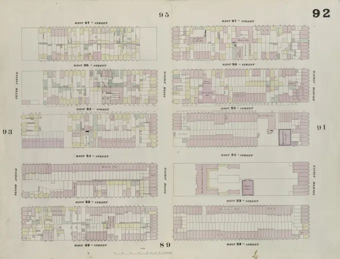
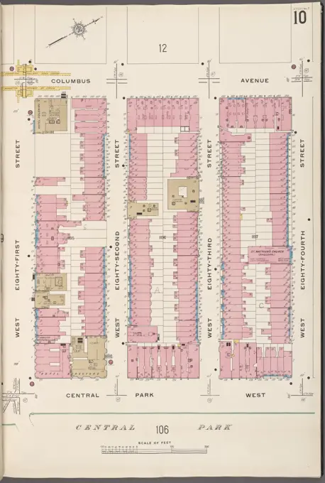
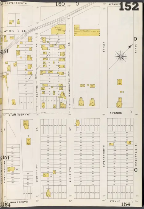
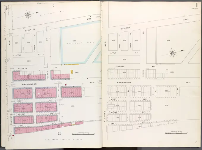
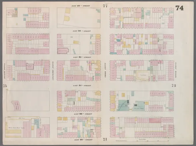
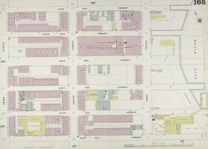
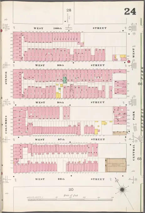
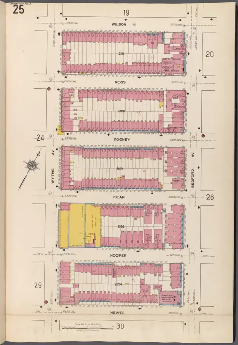
Fire Insurance Maps of New York
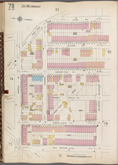
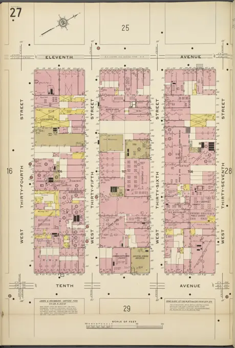
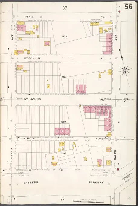
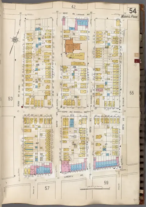
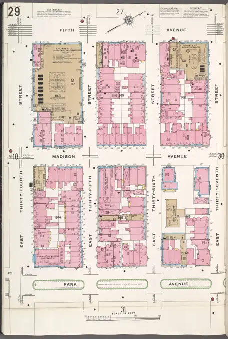
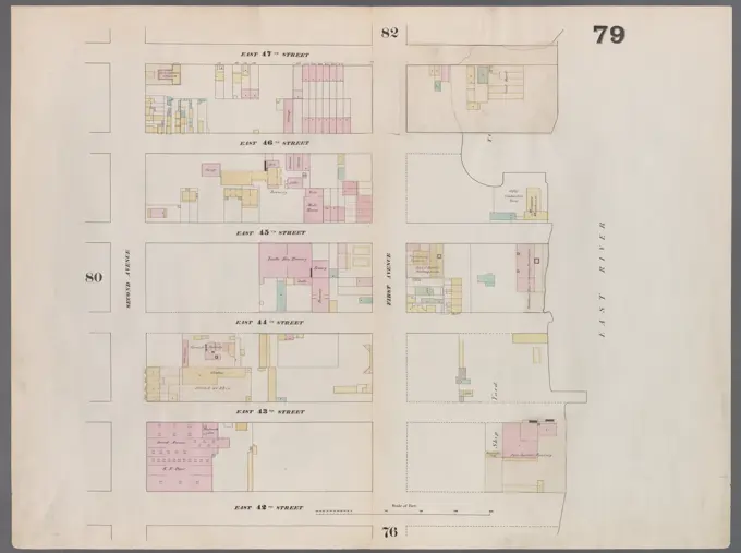
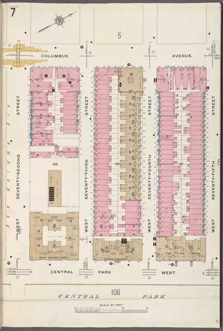
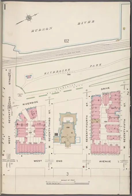
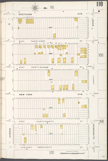
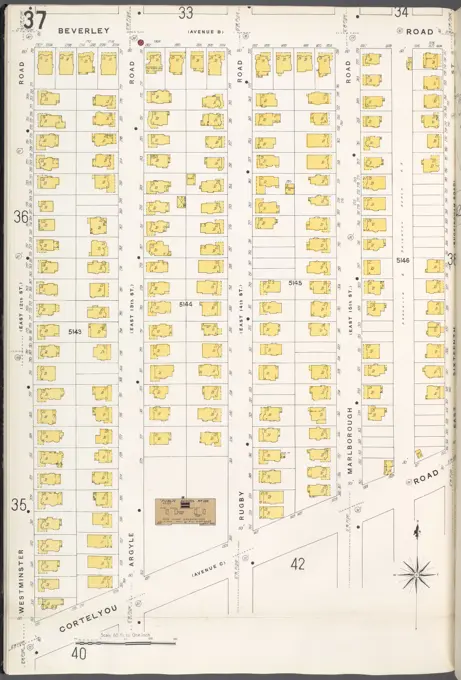
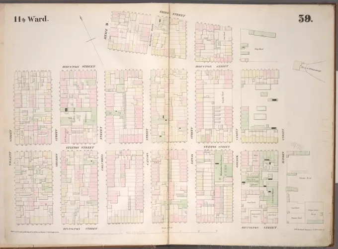
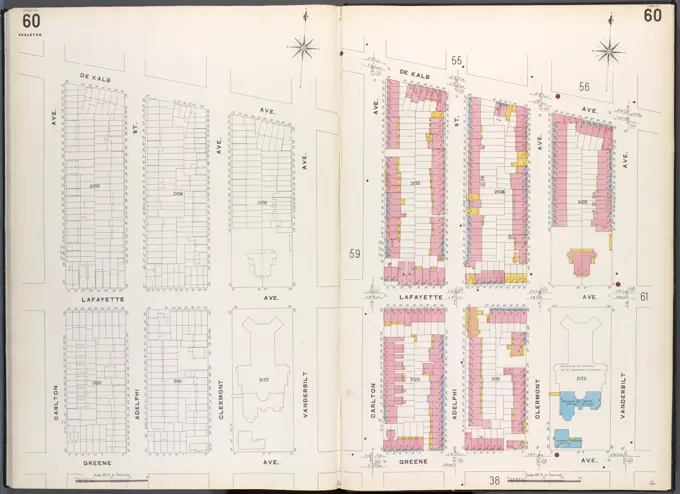
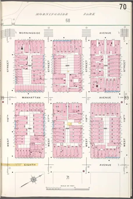
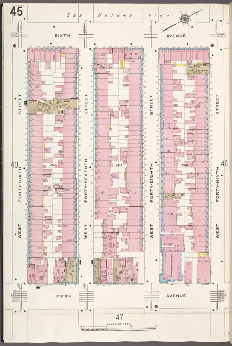
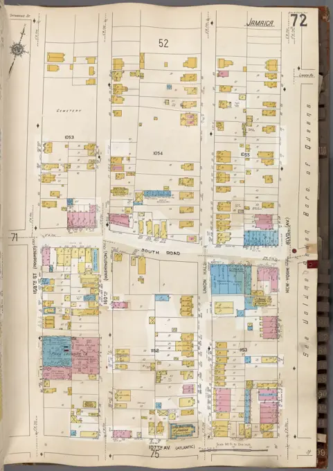
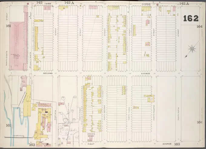
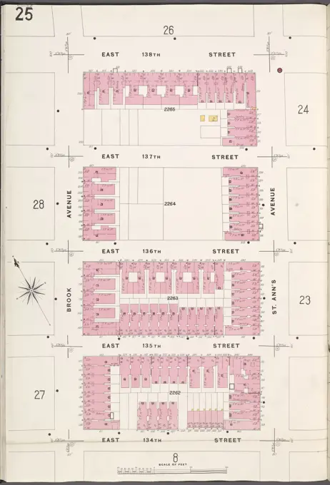
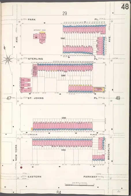
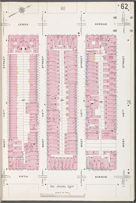
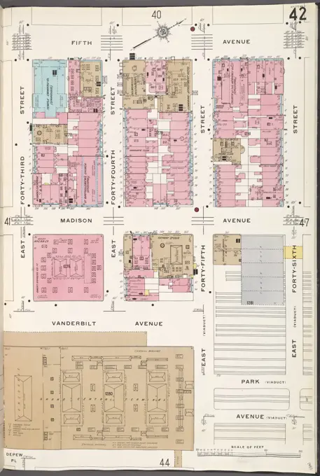
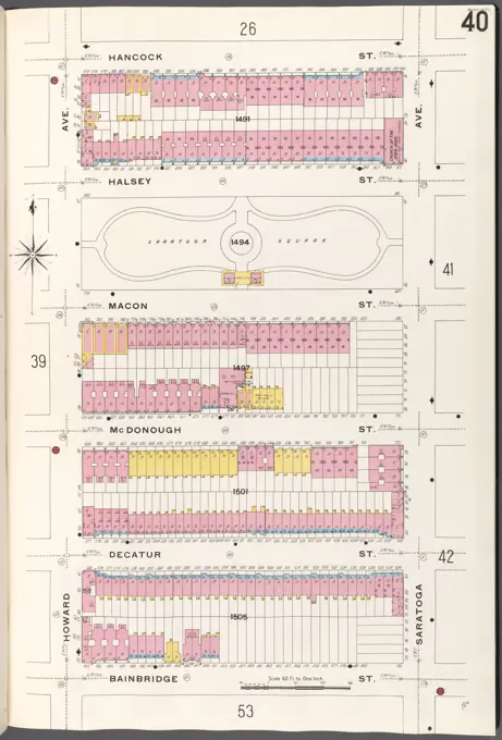
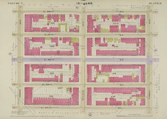
Detailed fire insurance maps from 1884 to 1936, showcasing property outlines and land use in various neighborhoods of New York City, including Brooklyn and Bronx.

Detailed fire insurance maps from 1884 to 1936, showcasing property outlines and land use in various neighborhoods of New York City, including Brooklyn and Bronx.