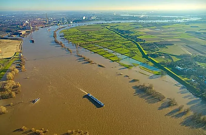
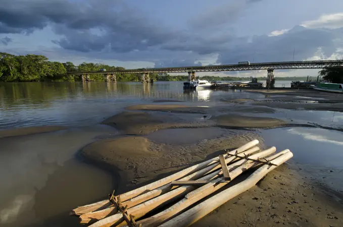
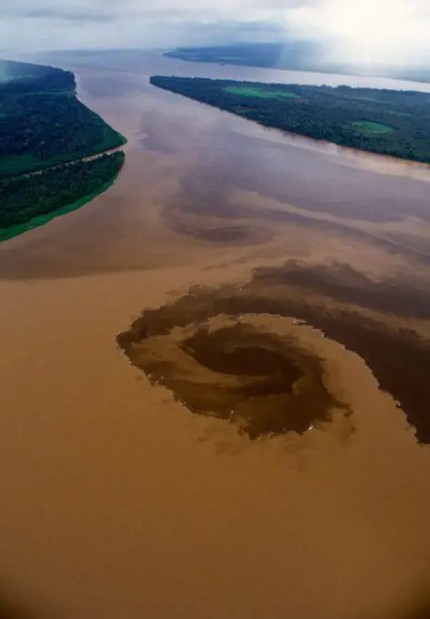
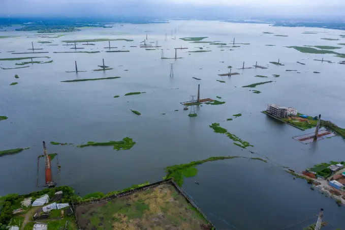
Flooded Landscapes Aerial Views

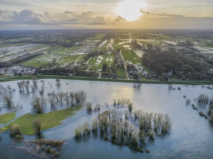
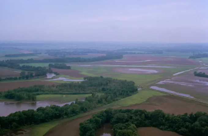
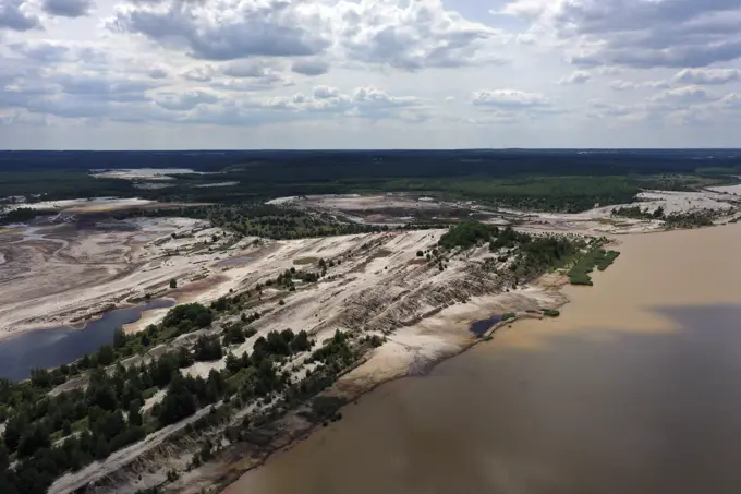
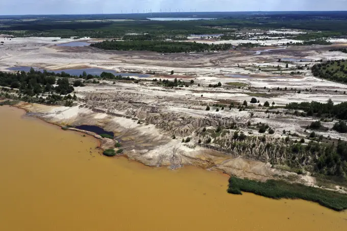
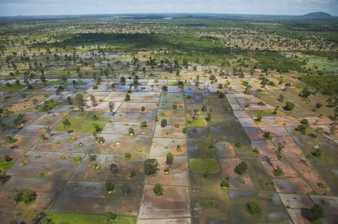
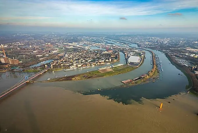
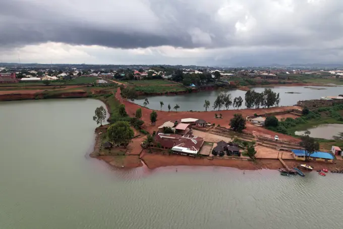
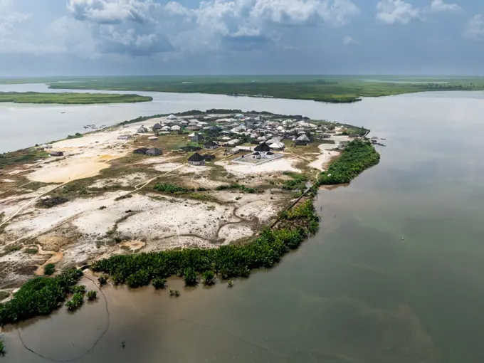
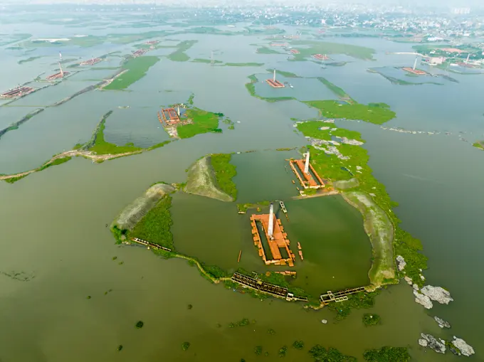
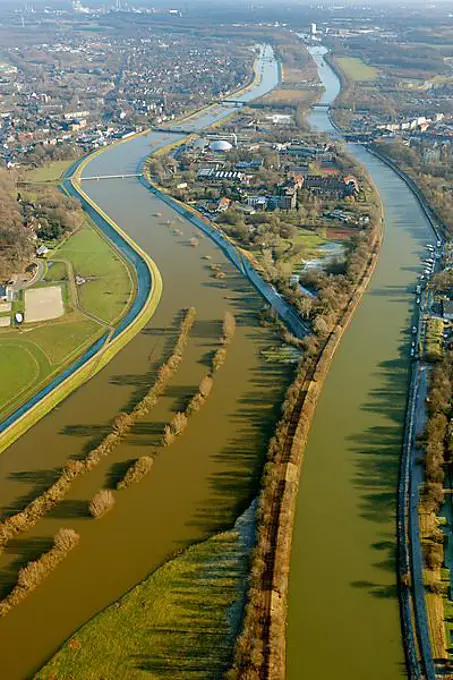
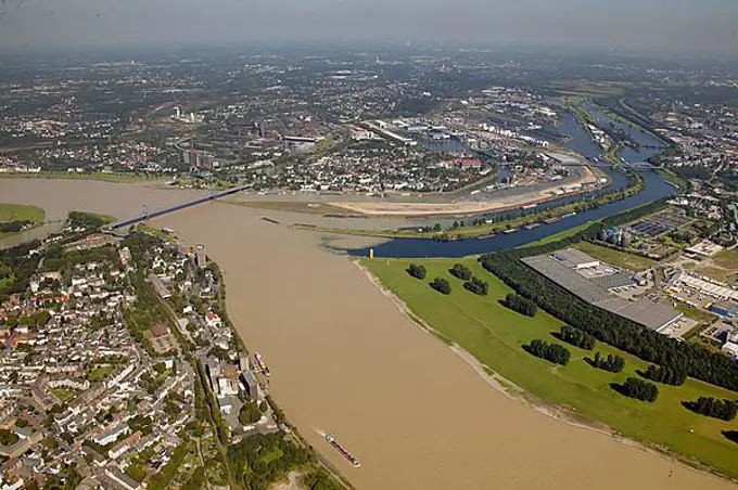
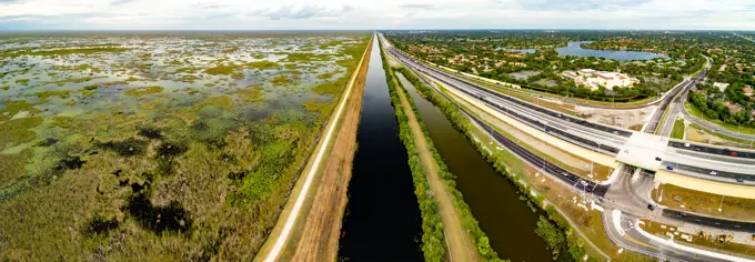
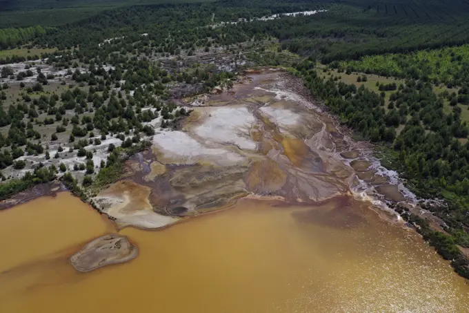
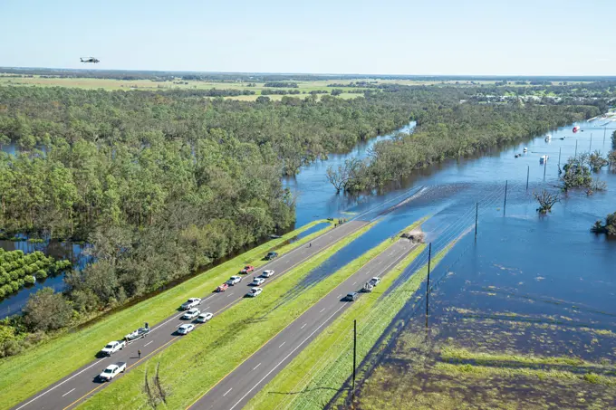
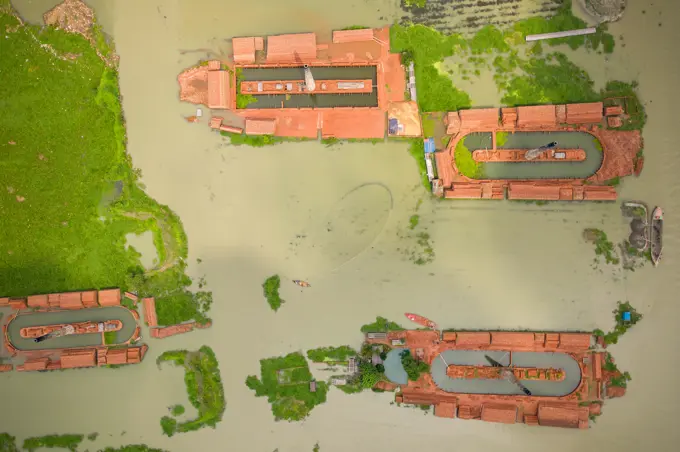
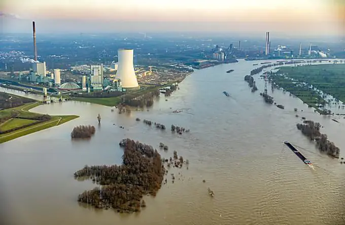
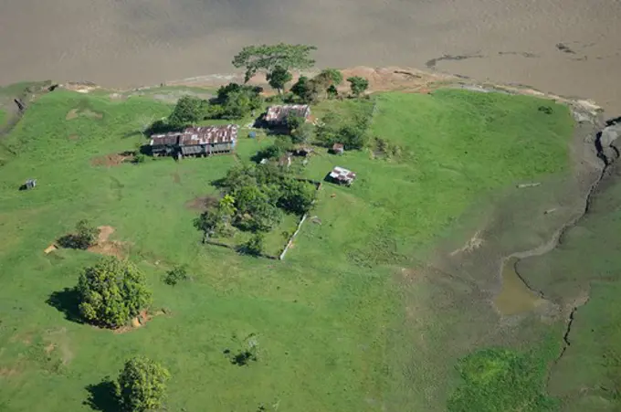
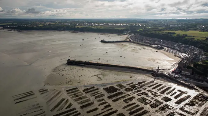
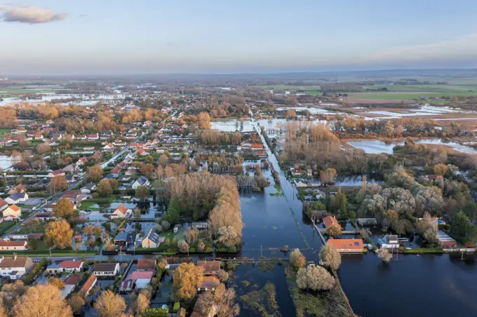
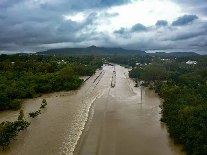
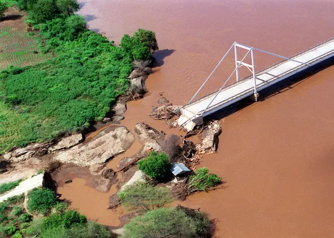
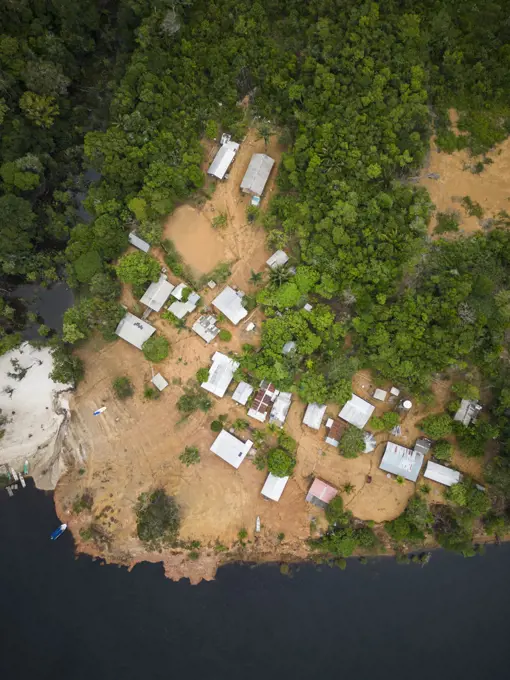
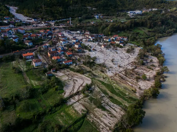
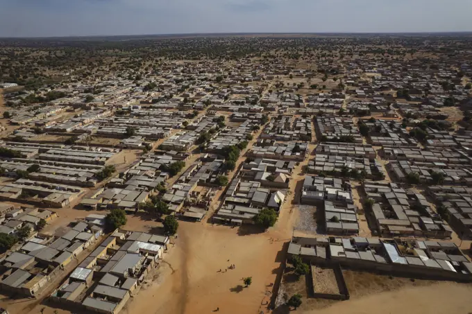
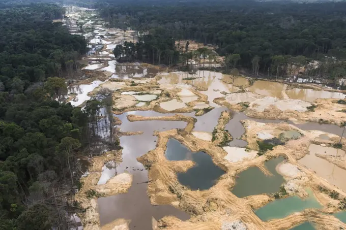
Aerial images showcasing extensive flooding in various regions, displaying flooded fields, waterways, and contrasts between water and lush greenery.

Aerial view of the winding waterways cutting through verdant mangrove forests and contrasting with the dense settlement along the shore, Port Harcourt, Rivers, Nigeria.
Aerial shot, mining in the rainforest, Guyana, South AmericaAerial view, Rhine floods near Duisburg Walsum, flooded Rhine floodplains, cargo ships, flooding on the Rhine, Duisburg, Ruhr area, North Rhine-Westphalia, Germany, DE, Europe, birds-eyes view, aerial view, aerial photography, aerial photography, overview, bird's eye view, Rhine floods, flooding on the Rhine, high water levelAerial view of post-coal landscape, now a protected nature habitat Wanninchen, Brandenburg, Germany.Aerial view of a settlement nestled amidst vibrant green vegetation alongside waterways, Egbormung Town, Andoni Local Government Area, Egbomu, Rivers, Nigeria.Balsa raft and Old Bridge crossing Napo River now being replaced with larger, dual lane bridge. Amazon Rainforest at the confluence of the Coca River and the Napo River.Aerial view of the dense vegetation and sparse buildings along the winding Obor Road, painting a vivid contrast between nature and minimal human presence, Egbema, Rivers, Nigeria.Missouri River, the DeSoto cut-off, and Lake DeSoto. In 1960, the Army Corps of Engineers finished cutting the DeSoto cut-off, stranding the former channel and stater border as a human-made oxbow lake. The DeSoto National Wildlife Refuge is the green area enclosed by the arms of the oxbow.Aerial view, extreme long shot, looking down as the Limpopo River winds its way through Southern Mozambique, where it recently crested its banks and sent floodwaters rushing through towns and farmland, forcing people from their homes and wreaking havoc with the countries infrastructure. Even though waters have receded over the past week, heavy rains seen in the distance, continue to threaten the region with more flooding. C-130 aircraft (not shown), assigned to the 37th Airlift Squadron at Ramstein Air Base, Germany, fly daily Keen Sage aerial surveillance missions over Mozambique to help find stranded flood victims and survey flood levels and damage caused by the flooding in Southern .... Complete Scene Caption: Aerial view, extreme long shot, looking down as the Limpopo River winds its way through Southern Mozambique, where it recently crested its banks and sent floodwaters rushing through towns and farmland, forcing people from their homes and wreaking havoc with the countries infAerial view, Rhine flood between Duisburg Walsum and Dinslaken / Voerde, flooded Rhine floodplains, cargo ships, flood on the Rhine, Duisburg, Ruhr area, North Rhine-Westphalia, Germany, Rheinberg, DE, Europe, birds-eyes view, aerial photography, aerial photography, overview, overview, bird's eye view, Rhine flood, flooding on the Rhine, high water levelR¡o Xingu and R¡o Tapaj¢s confluence with the Amazon mainstream.Aerial view of chimneys from local brick factories flooded by monsoon rains near Savar, Dhaka, Bangladesh.Rhine flood downstream from Beeckerwerth, Rhine flood between Duisburg, Dinslaken and Voerde in the federal state of North Rhine-Westphalia. High water level after the second Rhine flood in 2018., Duisburg, Ruhr region, North Rhine-Westphalia, Germany, DEU, Europe, aerial view, birds-eyes view, aerial photography, aerial photography, overview, bird's-eye view, Rhine flood, river traffic, Rhine between Duisburg and Dinslaken and Voerde, sediments, high levelFlooding - Velva, N. D. , June 26, 2011   Highway 52 from Velva to Minot was cut off due to flooding from the Souris River. Burleigh and Ward counties were designated a federal disaster area, opening the way for federal disaster assistance from FEMA. Andrea Booher/FEMA. North Dakota Flooding. Photographs Relating to Disasters and Emergency Management Programs, Activities, and OfficialsRhine floods between Duisburg, Dinslaken and Voerde in the federal state of North Rhine-Westphalia. High water level after the second Rhine flood in 2018. Near Emscher estuary near Dinslaken, Dinslaken, Ruhr region, North Rhine-Westphalia, Germany, DEU, Europe, aerial view, birds-eyes view, aerial photography, aerial photography, overview, bird's-eye view, Rhine flood, inland navigation, Rhine between Duisburg and Dinslaken and Voerde, sediments, high levelAerial view of a village partially submerged in floodwaters, with houses and trees clustered together creating an island of resilience, Natore, Rajshahi Division, Bangladesh.Blick auf die Flussniederung der Elbe bei Hochwasser im Dezember 2023, Luftbild, Deutschland, Mecklenburg-Vorpommern, Boizenburg aerial view of the Elbe flood plain during flooding in December 2023, Germany, Mecklenburg-Western Pomerania, Boizenburg BLWS705398 *** View at the Flussniederung the Elbe at Flood at December 2023, Aerial photo, Germany, Mecklenburg Western Pomerania, BOIZENBURG Aerial View of The Elbe Flood Plain during flooding in December 2023, Germany, Mecklenburg Western Pomerania, BOIZENBURG BLWS705398 Copyright: xblickwinkel/C.xKaiserxAn aerial photo of flooding in the Sindh region of Pakistan taken during a USAID-led humanitarian mission to deliver equipment to the region, Sep. 10, 2022. USAID leads the U.S. Government's international development and disaster assistance, helping people emerge from humanitarian crises, such as the catastrophic flooding currently plaguing Pakistan.Flooded farm in the Rhine River near Xanten, Rheinauen, Rhine floodplains, North Rhine-Westphalia, Germany, EuropeWO8722. Subjects: Scenics; Aerial photography. Location: Illinois.  . 1998 - 2011.Aerial view of post-coal landscape, now a protected nature habitat Wanninchen, Brandenburg, Germany.Aerial view of chimneys from local brick factories flooded by monsoon rains near Savar, Dhaka, Bangladesh.Pollution - ESU St. Louis Response - North Bass - 26-HK-229-174. AERIAL VIEW OF MARSH AND CANAL AREA BEHIND HWY 39 LEVEE HEADING SOUTH TO NORTH BASS FACILITY. Hurricane KatrinaAerial view of post-coal landscape, now a protected nature habitat Wanninchen, Brandenburg, Germany.Hurricane Dolly,  undetermined, TX, July 25, 2008   A flooded neighborhood in Texas. Counties in Texas were severely affected by flooding, wind damaged and loss of power. Jacinta Quesada/ FEMA.. Photographs Relating to Disasters and Emergency Management Programs, Activities, and OfficialsWaini Point. North West GuyanaAerial view of post-coal landscape, now a protected nature habitat Wanninchen, Brandenburg, Germany.Flood on the Rhine, Walsum power plant, near Dinslaken, Ruhr area, North Rhine-Westphalia, Germany, EuropeAerial view, flooding, Hitzacker, River Elbe, Lower Saxony, Germany, EuropeGold mining in rainforest, GuyanaAerial view of post-coal landscape, now a protected nature habitat Wanninchen, Brandenburg, Germany.Aerial view of farm lands in CambodiaAerial shot, silting the rainforest after mining, Guyana, South AmericaAerial view of farmland, Siem Reap, CambodiaAerial view of colorfully painted fish farms at Hau River (Bassac River), Chau Phong, Tan Chau, An Giang, Vietnam, AsiaRhine floods between Duisburg, Dinslaken and Voerde in the federal state of North Rhine-Westphalia. High level after the second Rhine flood in 2018. Estuary of the Ruhr into the Rhine with the artwork Rhine orange in high water., Duisburg, Ruhr area, North Rhine-Westphalia, Germany, DEU, Europe, aerial view, birds-eyes view, aerial photography, aerial photography, overview, bird's eye view, Rhine flood, river flow, Rhine between Duisburg and Dinslaken and Voerde, sediments, high levelEssequibo River, longest river in Guyana, and the largest river between the Orinoco and Amazon, Iwokrama Reserve, Guyana.Aerial view of the tranquil lake reflecting the overcast sky, fringed by red earth and scattered buildings, a serene contrast of water and land, Jos, Plateau, Nigeria.An aerial view of flooded fields in the aftermath of a cyclone which struck the area on April 30th. Country: Bangladesh(BGD)Aerial view of a cluster of houses with dark roofs nestled on an island surrounded by water, vibrant green vegetation contrasting with sandy shores, Egbomu, Rivers, Nigeria.Aerial view of submerged land interspersed with vibrant green patches, creating a stark contrast against the floodwaters, Aminbazar, Dhaka Division, Bangladesh.Flood water, Lippe River, Lippe Side Canal, Wesel-Datteln Canal, Dorsten, Haltern am See, North Rhine-Westphalia, Germany, EuropeAerial photograph, brown Rhine River flood water from the alpine region mixing with the clean Ruhr water at the mouth of the Ruhr River near Duisburg-Ruhrort, Duisburg, Ruhr district, North Rhine-Westphalia, Germany, EuropeAerial view of a stark contrast between the wild, sprawling Everglades and structured urban development bisected by a canal and highway, Coral Springs, Florida, United States.DA-ST-87-00650. State: Puerto Rico (PR) Country: United States Of America (USA)Aerial view of post-coal landscape, now a protected nature habitat Wanninchen, Brandenburg, Germany.Log booms in the Fraser River near Port Coquitlam, British Columbia, CanadaAustralia, Murray River Valley, Blanchetown, Murray River, houseboats, elevated viewAn illegal water village, Kampung Atas Air, along a river near Sandakan, Sabah, Borneo, East Malaysia.Air and Marine Operations air crews respond to affected areas along Florida's coast after Hurricane Ian made landfall. Crews are ready with hoist-capable aircraft to assist anyone in need of emergency extraction. Photo by Ozzy TrevinoAerial view of chimneys from local brick factories flooded by monsoon rains near Savar, Dhaka, Bangladesh.Flood on Rhine with Walsum power plant, near Duisburg, Ruhr Area, North Rhine-Westphalia, Germany, EuropeRhine floods down the Rhine from Walsum and the Walsum power plant., Rhine floods between Duisburg, Dinslaken and Voerde in the federal state of North Rhine-Westphalia. High water level after the second Rhine flood in 2018., Duisburg, Ruhr region, North Rhine-Westphalia, Germany, DEU, Europe, aerial view, birds-eyes view, aerial photography, aerial photography, overview, bird's-eye view, Rhine flood, river traffic, Rhine between Duisburg and Dinslaken and Voerde, sediments, high levelDeforestation for buffalo pasture along the river, Ucayali River, Requena, Loreto Region, PeruPhalaborwa, South Africa - 22 March 2022: Aerial View of luxurious accommodations with swimming pool immersed in the forest.Aerial picture, flooding, Hitzacker, Elbe River, Lower Saxony, Germany, EuropeRURAL HOMESTEADS - SUDAN, Kordofan Province. Village homesteads. 30 million people live in the Sahel. The area is vulnerable to erosion and drought. . France, Brittany, Cancale on 2021-06-28. Aerial view of Brittany. Photograph by Martin Bertrand.France, Bretagne, Cancale le 2021-06-28. Vue aerienne de la Bretagne. Photographie de Martin Bertrand.Aerial view, HKM Stahlwerk, Logport Duisburg, Duisport, flood on the Rhine, Duisburg, Ruhr area, North Rhine-Westphalia, Germany, DE, Europe, birds-eyes view, aerial photography, aerial photography, overview, bird's eye view, Rhine flood, flooding on the Rhine, high water levelFlooding in Pas de Calais, the village of Guînes and its surroundings, November 2023, FranceHydropower South Africa, green energy, green power, power generation, Gariep, dam, Orange River, energy shortage, Africa, Gariepdam, South Africa South AfricaLuftaufnahme einer überfluteten Stadt und eines Flusses mit braunem Hochwasser, Townsville, Queensland Aerial view of flooded town and river with brown floodwater, Townsville, Queensland. High quality photo. Aerial views of floods occurring in 2019 associated with the monsoon trough event. Copyright: xZoonar.com/ReecexFraserx 22573600Hurricane Ike,  Bolivar Peninsula, TX, September 24, 2008   A number of houses remain standing next to pilings where neighboring houses once stood. The peninsula has pockets of complete detestation from Hurricane Ike. Bolivar Peninsula, TX, September 24, 2008 -- A number of houses remain standing next to pilings where neighboring houses once stood.  The peninsula has pockets of complete devestation from Hurricane Ike.. Photographs Relating to Disasters and Emergency Management Programs, Activities, and OfficialsAn aerial photograph shows a bridge that was wiped out by the floods in the Tana River, Mombasa, Kenya. This was the biggest factor for non accessability to certain areas of the country for the re-supply of food during Joint Task Force Kenya, operation Noble Response. (Duplicate image, see also DM-SD-02-04680 or search 980303-M-4605W-005). Subject Operation/Series: NOBLE RESPONSE Base: Mombasa Country: Kenya (KEN)Beautiful aerial view to Tiririca riverside community in Rio NegroAerial view of worst flood affected village, Nikli, Kishoreganj, Bangladesh.Aerial view of mudslide devastation consumes homes and fields near the river, a somber tableau of destruction, Jablanica, Federation of Bosnia and Herzegovina, Bosnia and Herzegovina.Aerial view of worst flood affected village, Nikli, Kishoreganj, Bangladesh.Aerial view of the dusty landscape dotted with buildings and sparse vegetation under a vast sky, creating a stark contrast between earth and sky, Daura, Katsina, Nigeria.Aerial view of vibrant water slides contrasting against the green fields and distant mountains near AquaFarm water park, Battipaglia, Campania, Italy.An old unused regional airfield in a large forest in regional AustraliaGold mining in rainforest, GuyanaAerial view of Flamingo in reddish pink water, Algal Bloom, Seawoods, Navi Mumbai, India.