My Boards
View Pictures
  • My Boards

Historic Cadastral Maps

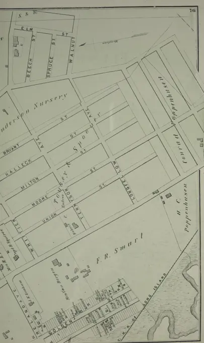
Cadastral maps from Queens and other areas, detailing property lines and urban development, useful for historical and geographical study.

Plan for proposed Charles River Park , Boston Mass., Maps, Manuscript, Cambridge Mass., Maps, Manuscript, Charles River Mass., Maps Norman B. Leventhal Map Center Collection
170 assets in this story
6145-55924826
Cartographic, Maps. 1884 - 1936. Lionel Pincus and Princess Firyal Map Division. Fire insurance , New York (State), Real property , New York (State), Cities & towns , New York (State) Key
6145-55181375
Eatontown Business Notices. ; Eatontown Village Cartographic. Atlases, Maps. 1873. Lionel Pincus and Princess Firyal Map Division. Monmouth Couty (N.J.) , Description and travel, Real property , New Jersey , Monmouth County
6145-55956542
Plan of the City of New York : showing the wards and school districts. 1870. Valentine, D. T. (David Thomas), 1801-1869. Cartographic. Maps. Lionel Pincus and Princess Firyal Map Division. Manhattan (New York, N.Y.), New York (N.Y.), Manhattan (New York, N.Y.) , Administrative and political divisions, School districts , New York (State) , New York (N.Y.)
6145-55956504
Map of the City of New York, showing its political divisions and subdivisions, August 1869 1869. Cartographic. Maps. Lionel Pincus and Princess Firyal Map Division. Manhattan (New York, N.Y.), New York (N.Y.), Administrative and political divisions , New York (State) , New York (N.Y.), Election districts , New York (State) , New York (N.Y.), School districts , New York (State) , New York (N.Y.)
6145-54549484
Index Map Cartographic. Atlases, Maps. 1883. Lionel Pincus and Princess Firyal Map Division. Utica (N.Y.)
6145-55925742
Cartographic, Maps. 1868. Lionel Pincus and Princess Firyal Map Division. Real property , New York Metropolitan Area, Westchester County (N.Y.), New York Metropolitan Area Plate 52: Sing Sing, Town of Ossining, Westchester Co.N.Y. Large folder - L1
6145-55175416
Cartographic, Maps. 1913. Lionel Pincus and Princess Firyal Map Division. Queens (New York, N.Y.), Real property , New York (State) , New York , Queens (Borough) Queens, V. 1, Double Page Plate No. 16; Part of Jamaica, Ward 4; Map bounded by Dunham Ave., Canal Ave., Morrell Ave., Jamaica Bay, Spring Creek
4409-21521504
Vol. 6. Plate, M. Map bound by Grand St., Seventh St., Broadway, S. Sixth St., East River; Including S. First St., S. Second St., S. Third St., S. Fourth St., S. Fifth St., River St., First St., Second St., Third St., Fourth St., Fifth St., Sixth St.
6145-55926092
Cartographic, Maps. 1868. Lionel Pincus and Princess Firyal Map Division. Real property , New York Metropolitan Area, Westchester County (N.Y.), New York Metropolitan Area Plate 9: Tremont : Town of West Farms. Small folder - L1
6145-55924614
G.W. Bromley & Co.. Cartographic, Maps. 1921. Lionel Pincus and Princess Firyal Map Division. Bronx (New York, N.Y.), Real property , New York (State) , New York Plate 2, Part of Sections 9&10, Borough of the Bronx. Bounded by E. 135th Street, Cypress Avenue, E. 132nd Street and Willis Avenue.
6145-54532933
Neues Reich. Dynastie XVIII. a. b. El Kab. Grab 2.; c - f Elephantine.. Weidenbach, M.. 1849 - 1856. Lepsius, Richard, 1810-1884. Prints. General Research Division. Egypt , Antiquities, Hieroglyphics, Papyrus (The plant), Elephantine (Egypt)
6145-55928771
Cartographic, Maps, Topographic maps. 1906 - 1913. Lionel Pincus and Princess Firyal Map Division. Staten Island (New York, N.Y.) Sheet No. 23. Includes Westerleigh Heights (Westerleigh), Richmond Lake, Clove Lake, (Castleton Corners) Dongan Avenue, Manor Road, Drake Avenue, Utter Avenue and Potter Avenue. Borough of Richmond, Topographical Survey.
6145-55955555
Perth Amboy 1786. Cartographic. Maps, Surveys, land surveys. Manuscripts and Archives Division
6145-54549433
City of Hudson East Part of 4th Ward Township Bourquin, F. (Frederick), 1808-. Cartographic. Atlases, Maps. 1873. Lionel Pincus and Princess Firyal Map Division. Columbia County (N.Y.), Real property , New York (State) , Columbia County, Business enterprises , New York (State) , Columbia County
4443-75471499
Map of part of New York City showing underground mains of The Edison Electric Illuminating Co. of New York, issued in 1893. Published by Edison Electric Illuminating Co. in Manhattan, New York. The map features underground utility lines and measures 38 x 21 cm
6145-55181295
Wilson Village Business Notices; Wilson Village Cartographic. Atlases, Maps. 1875. Lionel Pincus and Princess Firyal Map Division. Niagara County (N.Y.), Orleans County (N.Y.), Real property , New York (State) , Niagara County, Real property , New York (State) , Orleans County
6145-54549060
Index Map City of Elmira Cartographic. Atlases, Maps. 1896. Lionel Pincus and Princess Firyal Map Division. Elmira (N.Y.)
6145-55180958
Map of Binghamton Township Cartographic. Atlases, Maps. 1876. Lionel Pincus and Princess Firyal Map Division. Broome County (N.Y.), Binghamton (N.Y. : Town)
6145-55181206
Bayport. Village; Cartographic. Atlases, Maps. 1888. Lionel Pincus and Princess Firyal Map Division. Atlases , New York (State) , Suffolk County
4443-75466049
A map of part of Flushing in Queens County, New York, depicting various streets including Boerum Avenue, Brewster Avenue, Parsons Avenue, Sanford Avenue, Jamaica Avenue, Ireland Avenue, Whittier Avenue, Tennyson Avenue, and Longfellow Avenue. The map was published in 1873 by Beers, Comstock & Cline
4409-21522142
Brooklyn, Vol. 4, Double Page Plate No. 72; Map bounded by Jacks Creek, East 3rd St., Vernon Ave., East 11th St., East 10th St., East 9th St., East 8th St., East 7th St., East 6th St., East 5th St., East 4th St.; Including East Ave., Van Alst.
6145-55181049
Montezuma Township Cartographic. Atlases, Maps. 1875. Lionel Pincus and Princess Firyal Map Division. Cayuga County (N.Y.), Real property , New York (State) , Cayuga County
6145-54548988
Cayuga County. Cartographic. Atlases, Maps. 1838. Lionel Pincus and Princess Firyal Map Division. New York (State), Cayuga County (N.Y.) , Maps
6145-48453582
Förster Max, port facility on the Oberspree in Berlin. Schinkel competition 1893 (December 18, 1893): port and track systems. Site plan 1: 1000. Ink, ink colored watercolor on the box, 75.9 x 115.8 cm (including scan edges) Förster Max : Hafenanlage an der Oberspree, Berlin. Schinkelwettbewerb 1893
4409-21518336
Brooklyn, Vol. 4, Double Page Plate No. 77; Map bounded by Driggs St. late 5th St., North 6th St., 7th St., 8th St., 9th St., 10th St., 11th St., 12th St., 13th St., 14th St., 15th St., Wythe Ave. late 2nd St.; Including Eckford St., Van Cot.
6145-55956438
Ms. Map of the part of the Bronx bounded by the Harlem River, Third Avenue, E.135th Street & Lincoln Ave. 1900. Cartographic. Maps. Lionel Pincus and Princess Firyal Map Division
4409-21518950
Brooklyn, Vol. 4, Double Page Plate No. 67; Map bounded by Wythe Ave., North 6th St., East River, Kent Ave.; Including North 12th St., North 11th St., North 10th St., North 9th St., North 8th St., North 7th St.
4409-21519800
Brooklyn, Vol. 4, Double Page Plate No. 70; Map bounded by Vernol Ave., Manhattan Ave. late Union Ave., Commercial St., Box St., Bell St. Not Opened, Newtown Creek, River St.; Including Pier St., Dock St., South St., Flushing St., Front St.,.
6145-55175468
New York (N.Y.). Bureau of Engineering. Cartographic, Maps. 1924. Lionel Pincus and Princess Firyal Map Division. New York (N.Y.) 9C - N.Y. City (Aerial Set).
6145-55181015
Bangor Village; Bagor Business Notices. ; Town of Bugar Business Directory; Bellmont Business Notices. ; North Bangor Village; Bellmont Township Cartographic. Atlases, Maps. 1876. Lionel Pincus and Princess Firyal Map Division. Franklin County (N.Y.), Real property , New York (State)
6145-55927893
Cartographic, Maps. 1921. Lionel Pincus and Princess Firyal Map Division. Manhattan (New York, N.Y.), Real property , New York (State) , New York, New York (N.Y.) Plate 6, Part of Section 4: Bounded by W. 77th Street, Amsterdam Avenue, W. 71st Street and (Riverside Park) Riverside Drive.
4443-75475516
West Troy Business Directory, 1866., 1866., Philadelphia. Publisher, Stone & Stewart. Albany County (N.Y.), West Troy (N.Y.)
6145-55916219
Plan of building lots and land in Cambridge & Somerville belonging to Mr. Ozias Morse. Oriented with north toward the lower left. Includes illustration "View from North Avenue." "To be sold by auction on Tuesday June 24th, at 4 1/4 o'clock p.m., George R. Hichborn auctioneer."... , Massachusetts  , Middlesex  ,county   , Cambridge
6145-48454279
Jänecke Louis, expansion of the Berlin Stadtbahn. Schinkel competition 1905 (November 26, 1906): Charlottenburg train station. Location and track plan 1: 25000 (lengths), 1: 625 (widths). Ink, ink colored watercolor on the box, 65.3 x 99 cm (including scan edges) Jänecke Louis : Ausbau der Berliner Stadtbahn. Schinkelwettbewerb 1905
6145-54549522
Johnstown Business Directory; The Village of Johnstown Village Cartographic. Atlases, Maps. 1868. Lionel Pincus and Princess Firyal Map Division. Real property , New York (State) , Montgomery County, Real property , New York (State) , Fulton County, Montgomery County (N.Y.), Fulton County (N.Y.)
6145-55956534
Map of the City of New York cartographic material / engrd. for Power Press Printing by Schönberg & Co., N. York. 1870 - 1879. Power Press Printing. Cartographic. Maps. Lionel Pincus and Princess Firyal Map Division. Manhattan (New York, N.Y.), Manhattan (New York, N.Y.) , Administrative and political divisions, Central Park (New York, N.Y.), Local transit , New York (State) , New York (N.Y.)
6145-55956646
Newburgh, N.Y., 1878 Cartographic. Maps. 1878. Lionel Pincus and Princess Firyal Map Division. Newburgh (N.Y.)
6145-54548996
Orange County. Cartographic. Atlases, Maps. 1838. Lionel Pincus and Princess Firyal Map Division. New York (State), Orange County (N.Y.) , Maps
6145-55181017
Burke Village; Burke Business Notices. ; Trout River Village; Town of Chateaugay Business Notices. ; Chateaugay Village Business Notices. ; East Constable Village; Chateaugay Village Cartographic. Atlases, Maps. 1876. Lionel Pincus and Princess Firyal Map Division. Franklin County (N.Y.), Real property , New York (State)
6145-54549499
Part of Ward 2. Cartographic. Atlases, Maps. 1883. Lionel Pincus and Princess Firyal Map Division. Utica (N.Y.)
6145-55176848
Cartographic, Maps. 1873. Lionel Pincus and Princess Firyal Map Division. Long Island (N.Y.) , Description and travel Amityville, Town of Huntington.
6145-55928373
Cartographic, Maps. 1873. Lionel Pincus and Princess Firyal Map Division. Long Island (N.Y.) , Description and travel Part of Brookhaven, Suffolk Co.
6145-55926944
Cartographic, Maps. 1891. Lionel Pincus and Princess Firyal Map Division. Queens County (N.Y.) Plate 2: Map of the City of Brooklyn, Long Island, N.Y.
6145-55175372
Cartographic, Maps. 1884 - 1936. Lionel Pincus and Princess Firyal Map Division. Fire insurance , New York (State), Real property , New York (State), Cities & towns , New York (State) Key
6145-55180891
Chautauque County. Cartographic. Atlases, Maps. 1838. Lionel Pincus and Princess Firyal Map Division. New York (State), Chautauqua County (N.Y.)
6145-51394883
Map of the city of Davenport and its suburbs, Scott County, Iowa , Buildings, Iowa, Davenport, Pictorial works, Real property, Iowa, Davenport, Maps, Landowners, Iowa, Davenport, Maps, Davenport Iowa, Maps Norman B. Leventhal Map Center Collection
4443-75473272
Map of Oswego, Oswego County, New York, 1851., 1851., 7 Broad St., New York, New York. Publisher, John Bevan. Real property, Landowners, Administrative and political divisions in Oswego, New York., 1 hand-colored map; dimensions 99 x 69 cm on sheet 105 x 77 cm
6145-54549040
School District Map of Elmira Cartographic. Atlases, Maps. 1876. Lionel Pincus and Princess Firyal Map Division. Elmira (N.Y.)
6145-54548146
Horatio Street, Hudson Street, Jane Street, Greenwich Street Cartographic. Cadastral maps, Maps. 1832 - 1837. Lionel Pincus and Princess Firyal Map Division. United States , New York (State) , New York, Landowners , New York (State) , New York, Real property , New York (State) , New York, Real propery auctions , New York (State) , New York, West Village (New York, N.Y.), Manhattan (New York, N.Y.)
6145-55180901
Part of First Ward. Cartographic. Maps. 1872. Lionel Pincus and Princess Firyal Map Division. Buffalo (N.Y.)
6145-54548983
Albany. Cartographic. Atlases, Maps. 1838. Lionel Pincus and Princess Firyal Map Division. New York (State), Albany (N.Y.) , Administrative and political divisions , Maps, Albany (N.Y.) , Maps
6145-54522613
New York (N.Y.). Croton Aqueduct Department. Cartographic, Maps. 1853. Lionel Pincus and Princess Firyal Map Division. New York (N.Y.), Reservoirs , New York (State) , New York Block No. 580 Map bounded by 96th Street, 5th Avenue, 95th Street, 6th Avenue
6145-55176935
Cartographic, Maps. 1873. Lionel Pincus and Princess Firyal Map Division. Long Island (N.Y.) , Description and travel Corona or West Flushing. Tn. of Newtown, Queens Co. West Flushing. Tn. of Newtown, Queens Co.
6145-55181281
Niagara Falls Village Cartographic. Atlases, Maps. 1875. Lionel Pincus and Princess Firyal Map Division. Niagara County (N.Y.), Orleans County (N.Y.), Real property , New York (State) , Niagara County, Real property , New York (State) , Orleans County
6145-54549026
Third Ward. Cartographic. Maps. 1872. Lionel Pincus and Princess Firyal Map Division. Buffalo (N.Y.)
4443-75467392
Monmouth County, Double Page Plate No. 21 Map Bounded by Cemetery Rd., Sea Girt, South St., Glimmer Glass, Woodlawn Ave., Wolverton, Chester., 1889 ., New York. Publisher, C. Wolverton, Monmouth County (N.J.)
6145-55181302
Kendall Township; West Kendall Village; Kendall Business Notices; Kendall Village; Kendall Mills Village Cartographic. Atlases, Maps. 1875. Lionel Pincus and Princess Firyal Map Division. Niagara County (N.Y.), Orleans County (N.Y.), Real property , New York (State) , Niagara County, Real property , New York (State) , Orleans County
6145-55180906
Fifth Ward. Cartographic. Maps. 1872. Lionel Pincus and Princess Firyal Map Division. Buffalo (N.Y.)
6145-55955957
Plan of New Orleans. Mitchell, S. Augustus (Samuel Augustus), 1792-1868. Cartographic. Maps. 1863. Lionel Pincus and Princess Firyal Map Division
6145-55176946
Cartographic, Maps. 1873. Lionel Pincus and Princess Firyal Map Division. Long Island (N.Y.) , Description and travel Winfield. Tn. of Newtown, Queens Co.
6145-54521922
Cartographic, Maps. 1914. Lionel Pincus and Princess Firyal Map Division. Manhattan (New York, N.Y.), Real property , New York (State) , New York Outline map of large scale real estate atlases of New York City, Borough of Manhattan
6145-54549081
Dannemora and State Prison Village; Saranac Hollow Village; Saranac Subscriber's Business Directory.; Dannemora Subscriber's Business Directory. Cartographic. Atlases, Maps. 1869. Lionel Pincus and Princess Firyal Map Division. Clinton County (N.Y.)
6145-54549573
Islip Village and Vicinity Suffolk County, N.Y. Cartographic. Atlases, Maps. 1888. Lionel Pincus and Princess Firyal Map Division. Atlases , New York (State) , Suffolk County
6145-54549429
City of Hudson West Part of 3rd Ward Township Bourquin, F. (Frederick), 1808-. Cartographic. Atlases, Maps. 1873. Lionel Pincus and Princess Firyal Map Division. Columbia County (N.Y.), Real property , New York (State) , Columbia County, Business enterprises , New York (State) , Columbia County
6145-54548917
Map of the City of Williamsburg with part of Greenpoint. Cartographic. Maps. 1852. Lionel Pincus and Princess Firyal Map Division. Brooklyn (New York, N.Y.), Maps
6145-55181285
Pendleton Township; Pendleton Business Notices; Pendleton Village Cartographic. Atlases, Maps. 1875. Lionel Pincus and Princess Firyal Map Division. Niagara County (N.Y.), Orleans County (N.Y.), Real property , New York (State) , Niagara County, Real property , New York (State) , Orleans County
6145-55181341
South Part of Havana Village Cartographic. Atlases, Maps. 1874. Lionel Pincus and Princess Firyal Map Division. Schuyler County (N.Y.), New York (State) , Schuyler County
6145-51386014
Plan of Charlestown , Charlestown Boston, Mass., Maps Norman B. Leventhal Map Center Collection
6145-51834966
Mother and Child Ralph Albert Blakelock (American, 1847-1919). Mother and Child, ca. 1871. Pen and sepia ink on back of business card, Sheet: 4 7/8 x 3 in. (12.4 x 7.6 cm).   American Art ca. 1871
6145-52273650
Forest Heritage National Scenic Byway - Site Bulletin Board. This bulletin board at the Pink Beds Picnic Area shares key traveler information with visitors. Besides sharing emergency information, camping information and guidance to "leave no trace," the sign also informs travelers that they are on the Forest Heritage National Scenic Byway, identifying their location along the route. Pink Beds Picnic Area, North Carolina (35.353° N 82.779° W)
PREVIOUS
of 2
NEXT
2401 S. Ervay, Suite 206
Dallas, Texas 75215
United States
Get Started
Free ResearchMy BoardsMy Cart
For Creators
How To License Your ContentContributor PortalFrame of Mind
Resources
API accessPricing
Contact
+1 866 236 0087help@viewpictures.co.uk Contact form
©2026 View Pictures. All Rights Reserved. -A
This site is protected by reCAPTCHA and Google Privacy Policy and Terms of Service apply.