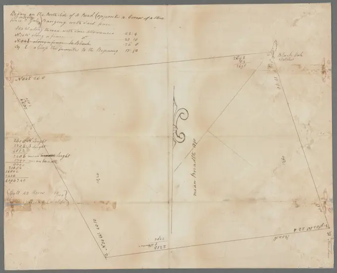
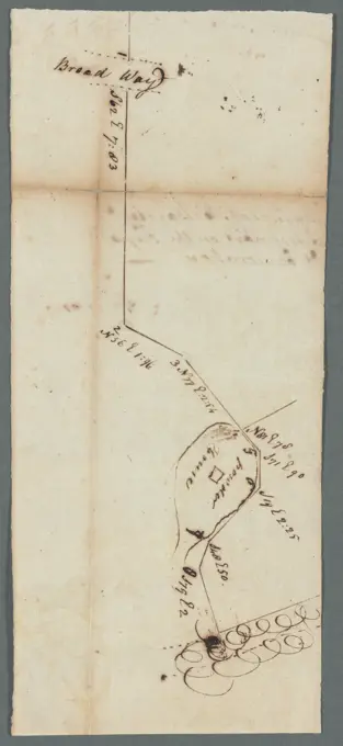
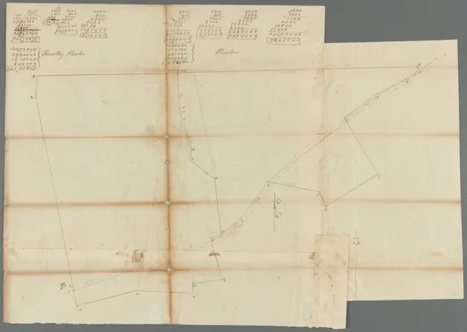
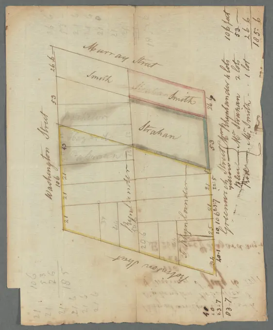
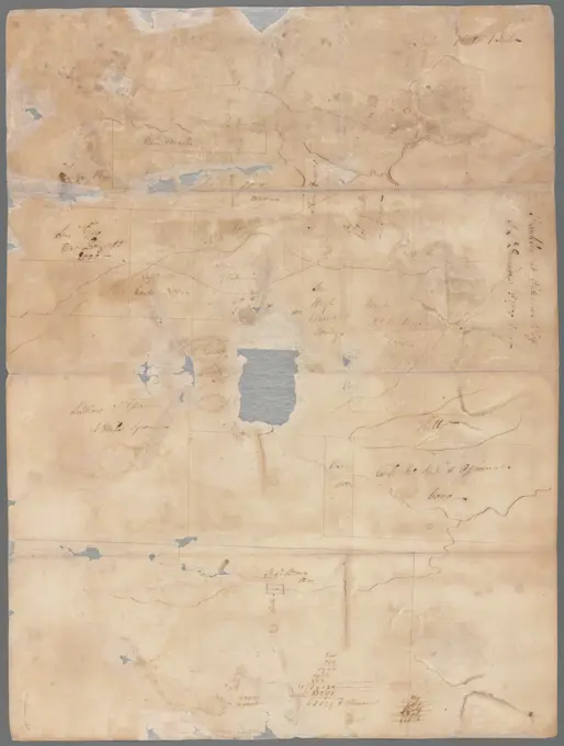
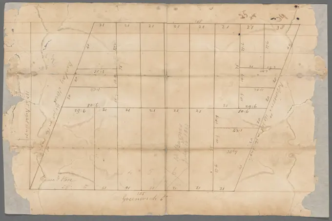
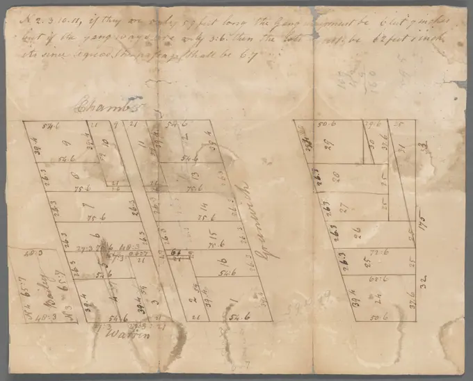
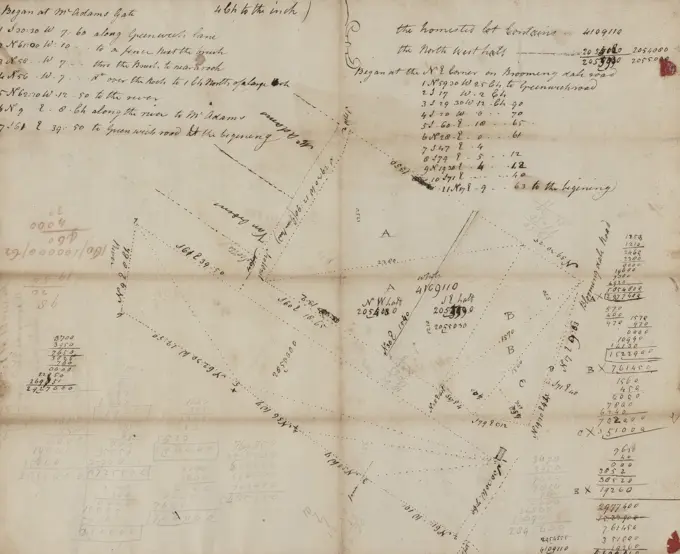
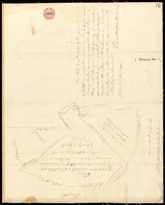
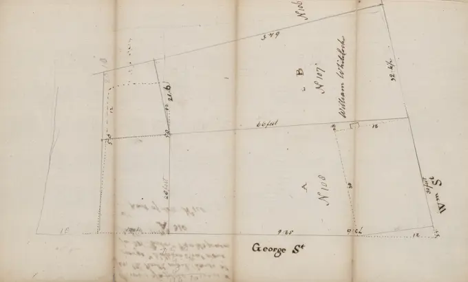
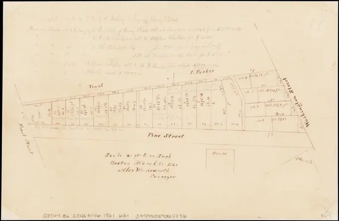
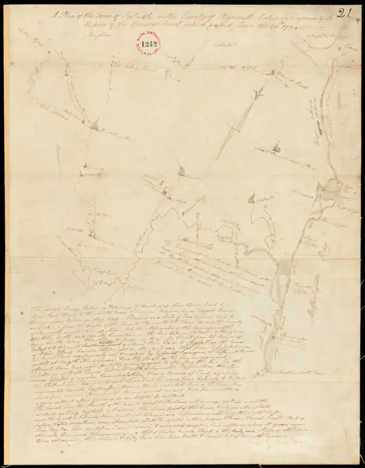
Historic Land SurveysSet of old land survey maps from the late 18th to early 19th century, showcasing detailed cartographic elements for urban plots and properties. Lot and two houses between Dock and Duke Street 1783. Cartographic. Maps, Surveys, land surveys. Manuscripts and Archives Division 220 assets in this story6145-559551106145-559550646145-559552396145-559552806145-559557746145-559553316145-559553176145-559556056145-505628156145-559558246145-559552846145-559554326145-559554166145-559555736145-542686246145-487128836145-559599656145-559599056145-505114646145-559598056145-513860396145-559558056145-559556506145-487128986145-505353496145-559553726145-559555936145-559557086145-559550196145-487131124443-754686446145-559597486145-559598856145-513862026145-514270486145-505628926145-505117254443-754730046145-559558666145-505115986145-559553516145-559599426145-559551464443-754617566145-559161616145-559598326145-519403316145-559554756145-559556976145-559554796145-559550996145-439575306145-551674916145-505118044443-754658686145-592839506145-519297286145-302089494443-754692116145-559554336145-559551066145-513860756145-506615266145-551806266145-426070536145-559556806145-513864274443-754757676145-559556936145-484880096145-485596146145-559164286145-505116876145-487521146145-505110986145-426048994443-196202806145-505504216145-505628056145-513860746145-559556676145-457857456145-301026056145-559557166145-559550576145-505112606145-528317606145-505723856145-484549526145-487130726145-485596036145-505118526145-559551216145-559557206145-559553736145-592792406145-505626556145-505119506145-559556624443-75459009 PREVIOUS of 3 NEXT