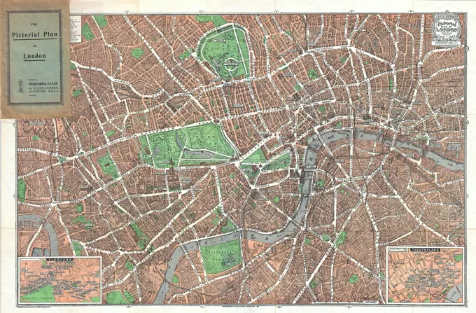
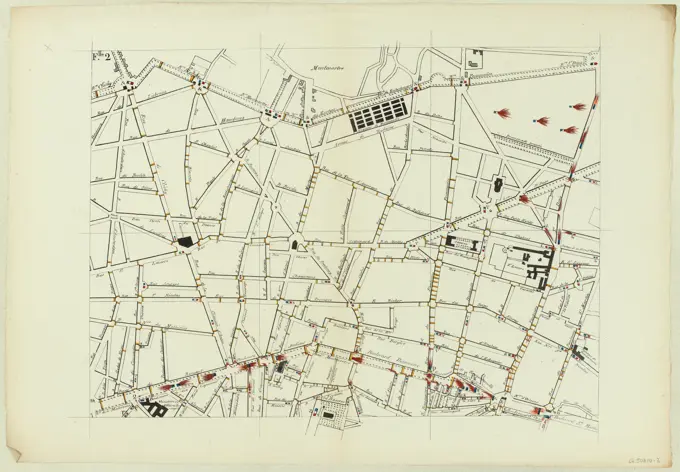
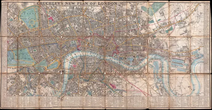
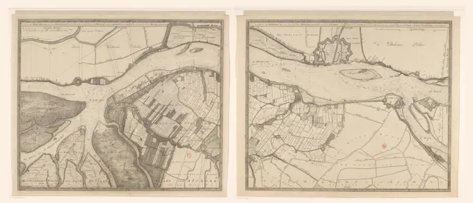
Historic Maps of London and Paris

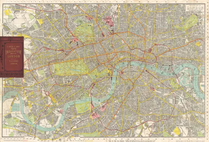
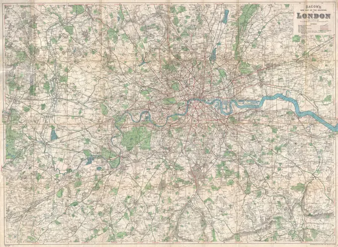
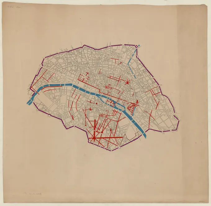
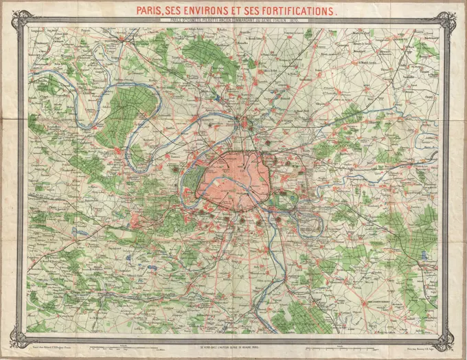
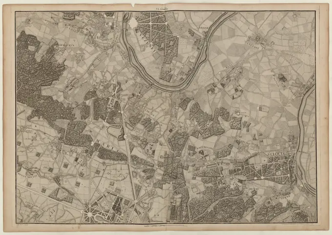
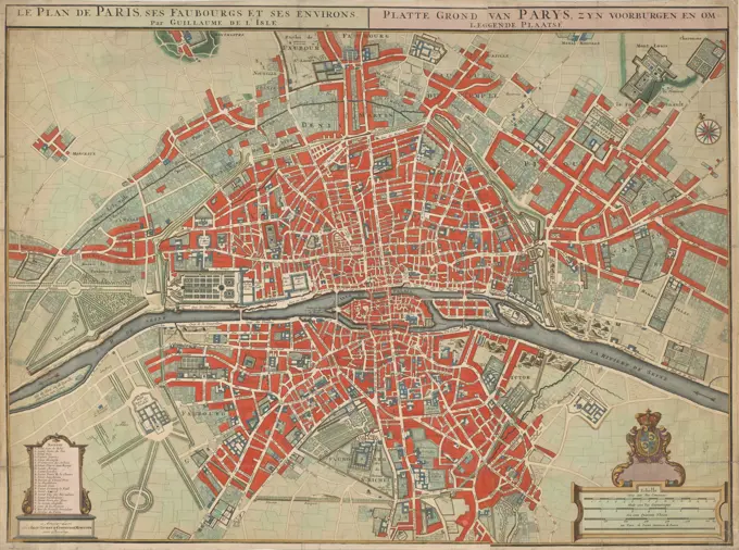
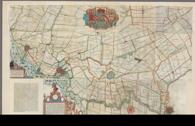
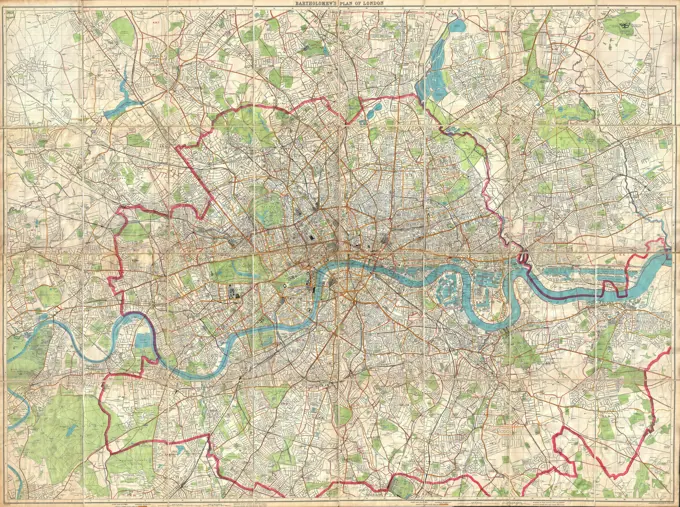
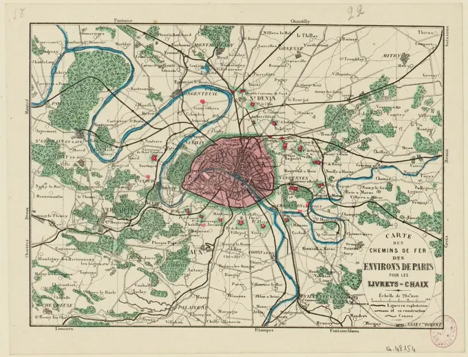
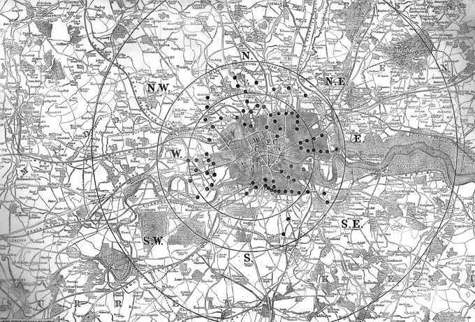
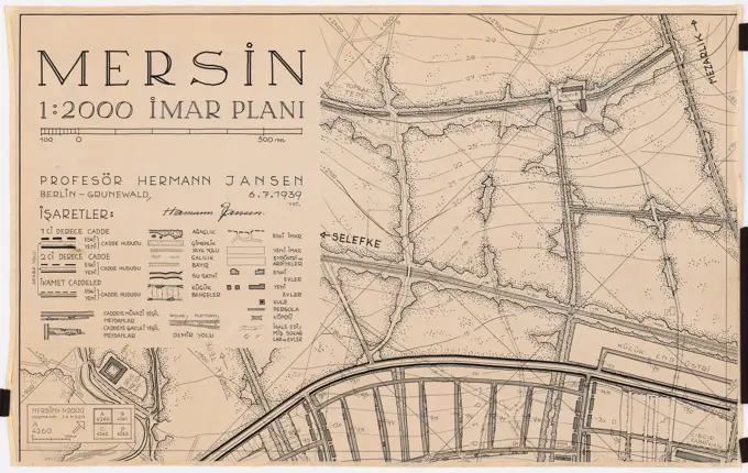
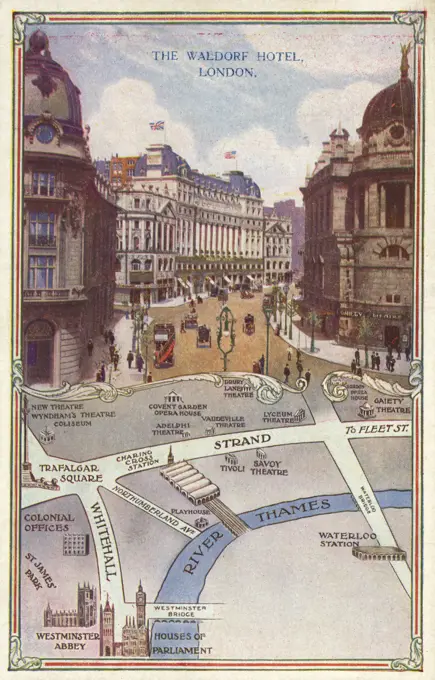
Detailed historical maps depicting London and Paris in the 19th century, showcasing streets, public buildings, and city layouts with intricate illustrations and color coding.

Nouveau plan routier de la ville et faubourgs de Paris, divisé en douze mairies, 1808. 1808 "Table alphabétique des rues" at left and right margins, indexed to squares on plan labelled horizontally A-I, K-L and vertically 1-9. Title panel at upper left. "Table alphabétique des rues qui ont changé de noms" at lower right. Boundaries of the mairies traced in color. Attached to pasteboard cover with engraved title slip: Plan de Paris. Scale not given (approximately 1:12,500) E 2º21' / N 48º51'54..
1923 Geographica Pocket Map of London, EnglandF.Lle 2 (you)Historical map, 1896, Munich, Germany, Europe1849 Cruchley Pocket Map of London, EnglandMap of the counties of Perry, Juniata and Mifflin, Pennsylvania , Real property, Pennsylvania, Perry County, Maps, Landowners, Pennsylvania, Perry County, Maps, Real property, Pennsylvania, Juniata County, Maps, Landowners, Pennsylvania, Juniata County, Maps, Real property, Pennsylvania, Mifflin County, Maps, Landowners, Pennsylvania, Mifflin County, Maps, Perry County Pa., Maps, Juniata County Pa., Maps, Mifflin County Pa., Maps Norman B. Leventhal Map Center CollectionMap of the Merwede, consisting of two parts, David Coster, After Nicolaas Cruquius, 1730 print Map of the Merwede, Van Hardinxveld Finally Loevestein. At the top left of a bowl: 300 Rhynand rods, the ten Duysend rods of the card, make a Rhynand rod. At the top right another bowl: 400 Rhynand rods. Depth lines are indicated in the river. Degree distribution along the edges.  paper etching / engraving maps of cities. river MerwedeMap of Dresden, Germany, Europe, end of the 19th century, from Meyers Konversations-Lexikon encyclopaedia, 1889, Europe1910 Smith's Tape Indicator Map of London ( Pocket Map )Jansen Hermann (1869-1945), Groß-Berlin 1910 competition: Overview plan. Pencil, ink watercolor over pressure on the cardboard, 250.00 x 290.00 cm (including scan edge). Architecture Museum of the Technical University of Berlin Inv. No. 20513. Jansen Hermann  (1869-1945): Wettbewerb Groß-Berlin 1910The district of the train station (Paris City) / Leaf 29-52 (old sheet 313)1920 Bacon Pocket Map of London, England and EnvironsPlan of the City of Vienna and the suburbs for official sources , Plan of the City of Vienna and the suburbs, Carl Gerolds son, publishing housePlan of Paris (said artists)Jansen Hermann (1869-1945), competition for the development of the inner Rayon, Cologne (1919-1919): Measuring table card, sheet V, 1: 2500. Print watercolor on the box, 74.6 x 89.2 cm (including scan edges) Jansen Hermann  (1869-1945): Wettbewerb zur Bebauung des Inneren Rayons, KölnSalpeterery district / Sheet 269 / 1965MAP OF BERLIN AND THE SURROUNDING AREA, GERMANY, 1899City map of Rome, 1:15 000, multi-color print, 1938Map of the city of Utrecht250, 000, floor plan, borough of Chelsea, Westham, Fulham, Hyde Park, Regent Park, railway line, cartography, hatching, historical illustration 1896, London and surroundings, Great Britain, England, ThamesCity map, 1892, Krefeld, Germany, Germany, digitally restored reproduction of an original 19th century map, EuropeMap of London, consisting of three parts, Anonymous, 1736 print Map of London, consisting of three parts. On the right part four faces on distinguished buildings in the city. Nuremberg paper engraving / etching maps of cities. armorial bearing, heraldry London. Saint Paul's Cathedral. Custom House. Royal Exchange (1669-1838)Floor plan of Vienna with district quarters and all suburbs , Anton Freiherr von Guldenstein, Cartographer1870 Erhard Map of Paris and Vicinity, FranceMap of St. Petersburg, historic image, Meyers Konversations-Lexikon encyclopedia, 1897Plan of Paris and its surroundings on a very large scale, made by the abbot of La Grive, geographer of the city of Paris in 1740 / 6th leaf (around St Cloud, Marly)Vintage Map  Paris  and its environs, by Guillaume Delisle,  publisher: Covens & Mortier, (mentioned on object),  circa 1750sMap of the Schieland Water Board, Balthasar Florisz. Van Berckenrode, 1611 - 1635 print Map of the Schieland Water Board. Upstairs in the middle the coat of arms of the Water Board and the weapons of the Dijkgraaf, water councils and steward secretary. Bottom left two cartouches and a text sheet with text in Dutch. At the top left a bowl: the Maet van Schielandt.  paper. ink. paint (coating) engraving / etching / brush / pen / letterpress printing maps of separate countries or regions. armorial bearing, heraldry. instruments used in geodesy, surveying instruments SchielandCity map of Milan, Italy, 1895, digitally restored reproduction of an original 19th-century map, EuropeCruchley's new plan of London shewing all the new and intended improvements to the present time , London England, Maps, Tourist maps Norman B. Leventhal Map Center Collection1899 Bartholomew Fire Brigade Map of London, EnglandSpain. Madrid. City center. Map that the king Philip IV commisioned to the Portuguesse cartographer Pedro Teixeira Albernaz (1595-1662). It was finished in 1656.Map showing the eastern end of Radnor Vale, Wales, with the ley lines drawn in by hand.     Date: 1925Railway map around Paris for booklets-chaix (IT)Parcel 10 : Sears Crescent, Government Center , Sears Crescent Boston, Mass., Maps, Office buildings, Massachusetts, Boston, Designs and plans, Government Center Boston, Mass., Maps, Parking garages, Massachusetts, Boston, Designs and plans, City planning, Massachusetts, Boston, Maps, Urban renewal, Massachusetts, Boston, MapsCruchley's new plan of London shewing all the new and intended improvements to the present time , London England, Maps Norman B. Leventhal Map Center CollectionPROYECTO PARA LA EXPO 92 DE SEVILLA.Map of the country within thirty miles of the rebel capital / G. Woolworth Colton, N.Y , Richmond Va., History, Civil War, 1861-1865, Maps Norman B. Leventhal Map Center CollectionStadtplan, 1892, Düsseldorf, Deutschland, digital restaurierte Reproduktion einer Originalvorlage aus dem 19. JahrhundertNeighborhoods flancourt and drop of gold / leaf 27-35 (old leaf 28)Antike Karte von Amsterdam aus dem frühen 20. Jahrhundert. Antique map of Amsterdam from the early 20th century. Publication of the Meyers encyclopedia, Vol. 7, Leipzig, Germany, 1910. LicenseRF Copyright: xZoonar.com/SergeyxKohlx 23253147City map of Leipzig, 1:20 000, lithograph, 1926Historical city map, 1896, Moscow, RussiaMap showing metropolitan sewerage district : January 1, 1910 , Boston Metropolitan Area Mass., Maps, Sewerage, Massachusetts, Boston Metropolitan Area, Maps, Sanitary districts, Massachusetts, Boston Metropolitan Area, Maps Norman B. Leventhal Map Center Collectionrd, Landstraßer Hauptstraße - flying, postcard, Verlag Luftbiew Ges, ProducerMap of Salzburg, historic image, Meyers Konversations-Lexikon encyclopedia, 1897Boston Elevated Railway system route map , Local transit, Massachusetts, Boston, Maps, Boston Mass., Maps, Boston Elevated Railway Company Norman B. Leventhal Map Center CollectionMap of Zeppelin and aeroplane bombs on London. From: World War I photograph album, 1919, by Herbert Green.City map, 1892, Marseille, France, France, digitally restored reproduction of an original 19th-century original, EuropePharus plan Vienna, Made based on the latest, official materials of the Vienna Magistrate , Pharus-Plan Vienna, including with District Lines and Excursion Loads for Automobile and Cycling Transport, Pharus-Verlag GmbH, Vienna, Publishing HouseGraphics. Photographs of Marshall Plan Programs, Exhibits, and PersonnelSurroundings of Vienna with handwritten entries of the city limits large-Vienna, Cartographic formerly military geographic institute in Vienna, editorSketch plan of Whitechapel District. January 01, 1950.City expansion project No, situation plan, August Sicard von Sicardsburg -, Eduard van der Nüll -The map is in Chinese and some English, but may have been made by or under the auspices of the Japanese who occupied the area of Shanghai including the (as yet unformed) 'Jewish Ghetto' in 1937 following the Battle of Shanghai. The 'Shanghai Ghetto' was established by the Japanese Occupation Authorities in 1941 and liberated in 1945.1900 U.S. Geological Survey of Boston and Vicinity, Massachusetts'Central Birmingham', c20th Century. Artist: John Bartholomew.Collection of the Dutch Heidematschappij. Maps, road improvements. undated. EnschedeRock's illustrated map of London , Metropolitan areas, England, London, London England, Maps Norman B. Leventhal Map Center CollectionBöhmer Franz (1907-1943), Business Plan of Hirschberg (1925-1925): Economic Plan of Hirschberg in the Giant Mountains 1: 10,000. Light break watercolored on paper, 74.6 x 94.3 cm (including scan edges)Watson's new map of the city of Brooklyn and environs, published by Gaylord Watson in 1868. The map measures 72 x 55 cm and features colorful detailing. It was issued in New York and provides a historical representation of Brooklyn and its surroundingsDensity of population in greater Tokyo - census of 1926. Part of a collection of 7 maps of Tokyo. Translated title, legend and some place names handwritten in ink. Conservation of this piece was funded by Arend Sluis and Mark Mulligan.... , Japan  , Tokyounknown artist, (  Josiah Neele ), Fraser's Panoramic Plan of London, 1831. Engraving with some hand coloring.Collection of the Dutch Heidematschappij. Maps, road improvements. undated. EnschedeMogg's strangers guide to London : exhibiting all the various alterations & improvements complete to the present time , London England, Maps Norman B. Leventhal Map Center Collection''Les Jours decisifs de la Marne; 5, 6, 7 septembre ', 1914. From "L'Album de la Guerre 1914-1919: Volume I". L'Illustration, Paris, 1926.Spartanburg, South Carolina : the city of success ; city map and street directory. Oriented with north toward the upper right. Includes street directory and advertisements... City map and street directory of Spartanburg, S.C. City map and street directory of Spartanburg, S.C, South Carolina  , Spartanburg  ,county   , SpartanburgAerial view of Watertown Arsenal , Armories, Watertown Arsenal Mass..  Records of U.S. Army OperationalMAPA DE MADRID Y ALREDEDORES EN 1962. Location: INSTITUTO GEOGRAFICO Y CATASTRAL. MADRID. SPAIN.MAPA DE MADRID Y ALREDEDORES EN 1969. Location: INSTITUTO GEOGRAFICO Y CATASTRAL. MADRID. SPAIN.Outline and index map of Brighton, ward 25, city of Boston , Boston Mass., Maps, Real property, Massachusetts, Boston, Maps, Landowners, Massachusetts, Boston, Maps, Brighton Boston, Mass., Maps, Allston Boston, Mass., Maps Norman B. Leventhal Map Center CollectionA map of London presented to Lord Palmerston by the Toll Reform Committee of 1857.  The committee sought to eliminate unnecessary tolls from routes into London.     Date: June 6th 1857Jansen Hermann (1869-1945), Mersin development plan (06.07.1939): Site plan in 4 parts, sheet A 1: 2000. Ink on transparent, 63.6 x 100.3 cm (including scan edges) Jansen Hermann  (1869-1945): Bebauungsplan MersinRoyal Air Force- Central Interpretation Unit / Allied Central Interpretation Unit, 1941-1945. A flight lieutenant points out details on a model of Kiel and district, Germany, completed by the RAF Model Making Section at the ACIU, Medmenham, Buckinghamshire.The Waldorf Hotel, Aldwych, London and a map of the sites in the local environs.     Date: 1922Unknown authors, advertising brochure Hotel Excelsior, Berlin (without dat.): City map of Berlin. Print colored on paper, 36.1 x 49.4 cm (including scan edges) unbek. Verfasser : Werbeprospekt Hotel Excelsior, BerlinReynolds' map of modern London divided into quarter miles sections for measuring distance Reynolds' new distance map of London and visitors guide Cartographic. Maps, Road maps. 1857. Lionel Pincus and Princess Firyal Map Division. London (England)