Historic Property Maps of New York and Boston

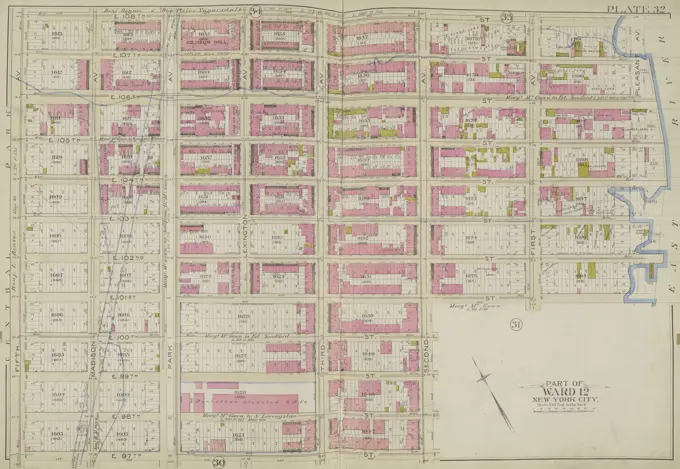
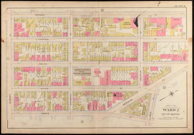
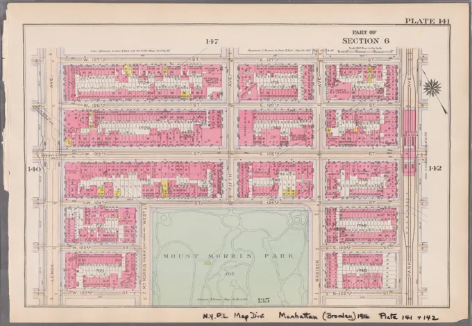
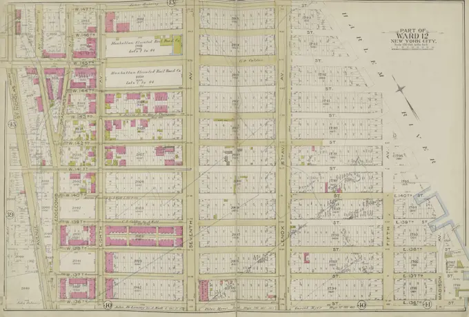
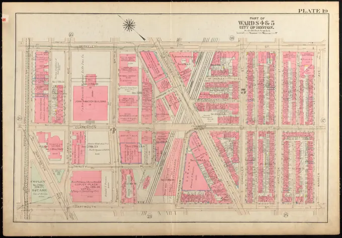
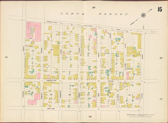
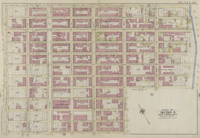
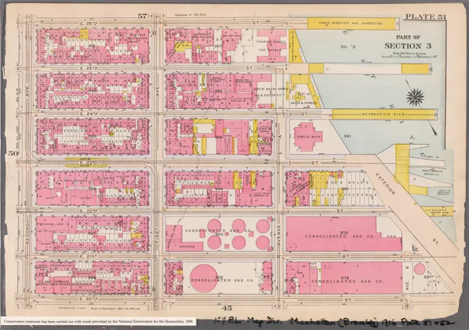
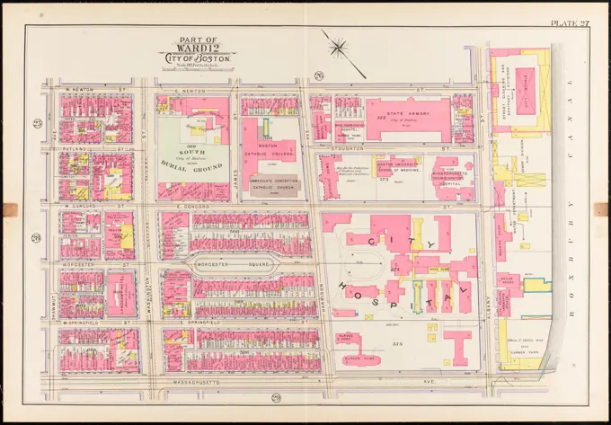
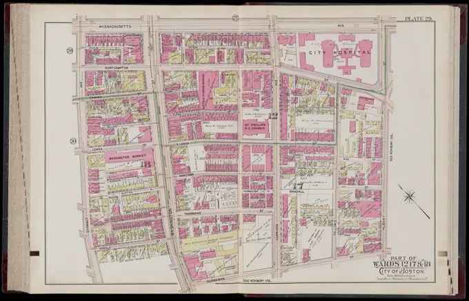
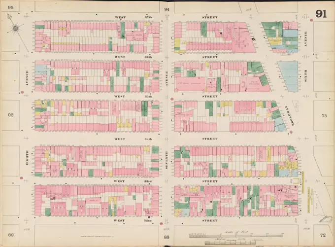
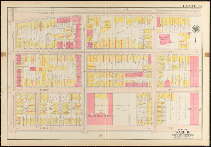
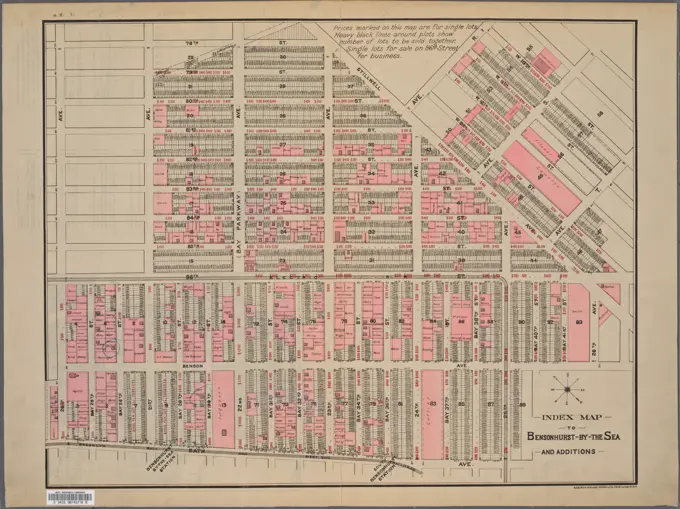
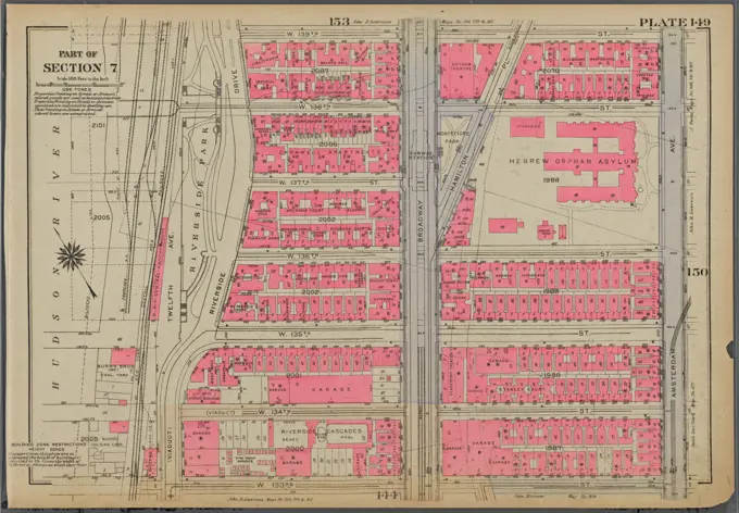
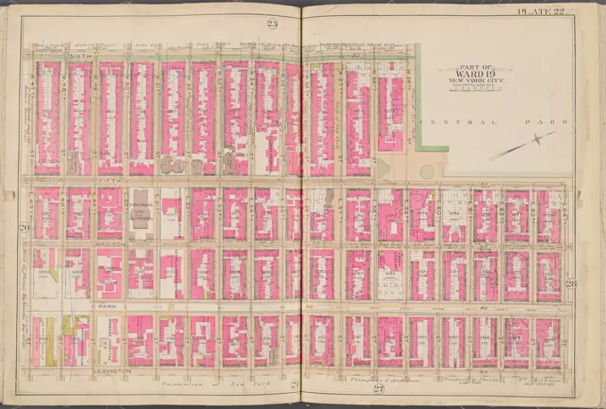
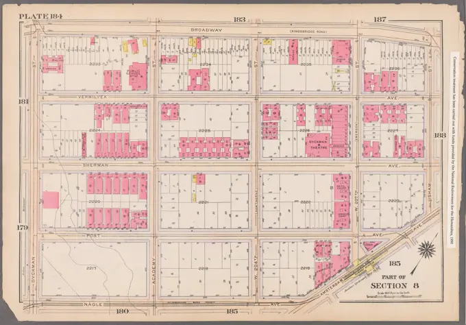
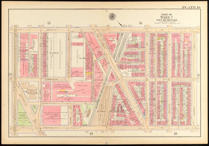
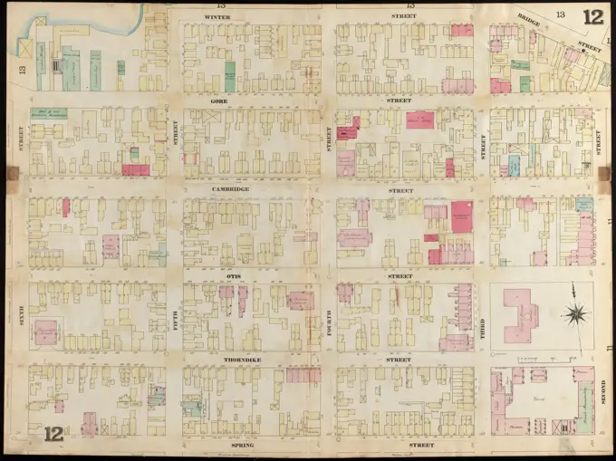
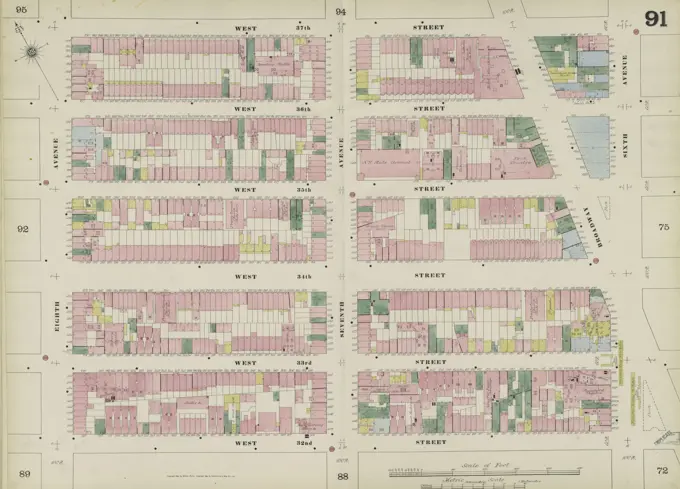
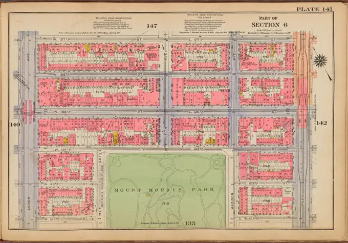
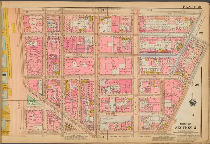
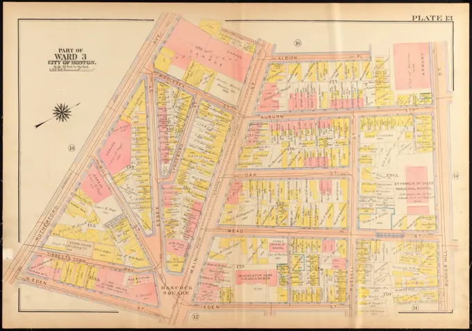
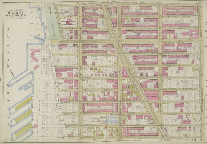
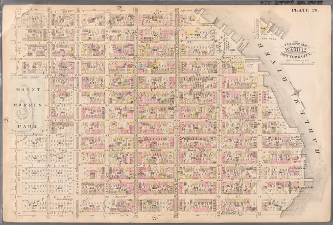
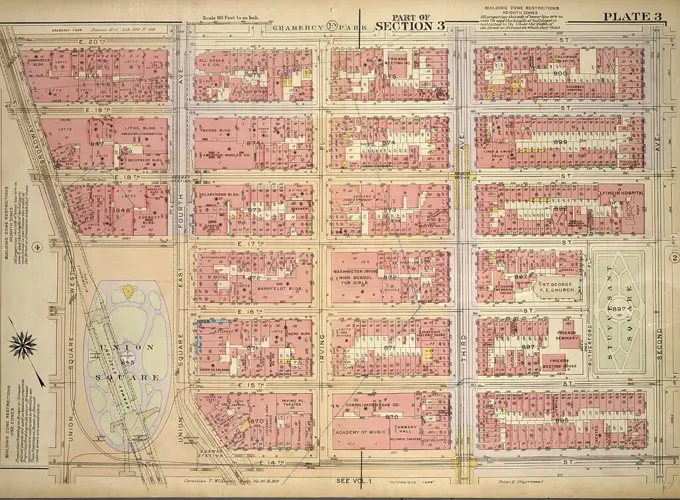
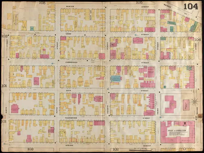
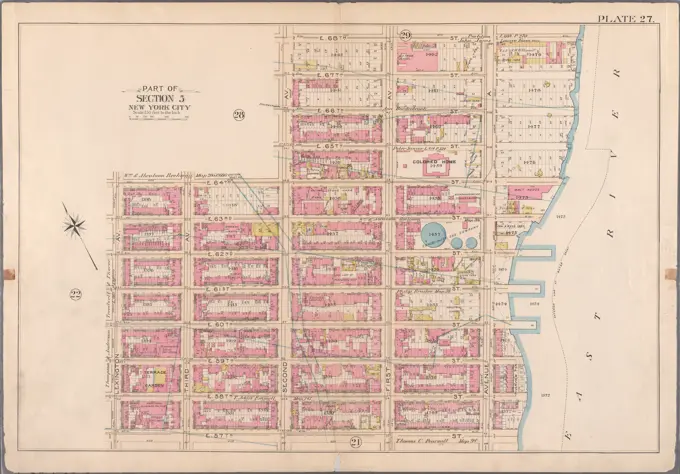
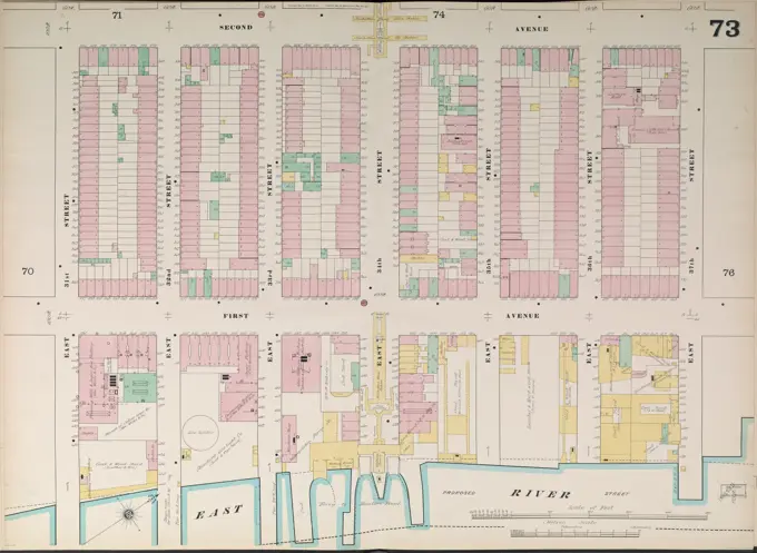
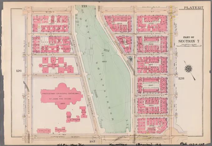
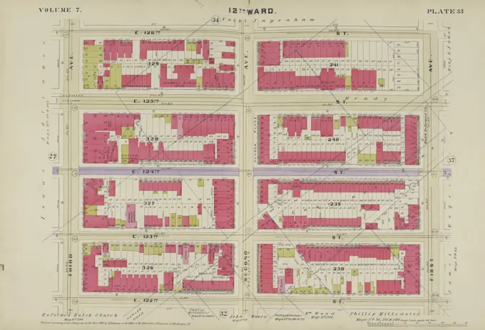
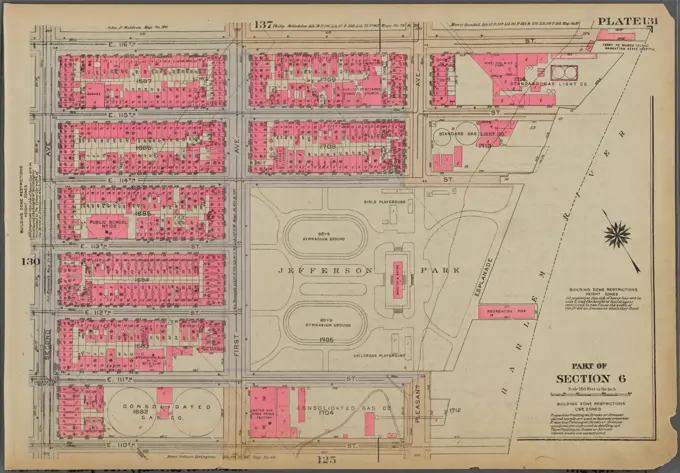
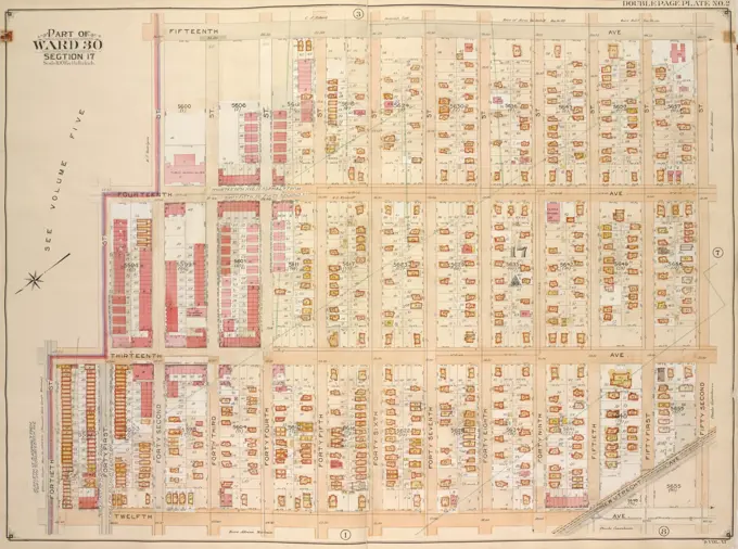
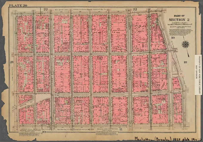
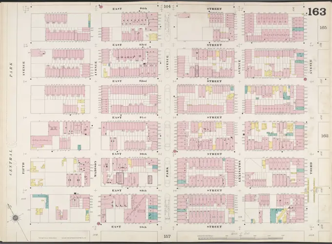
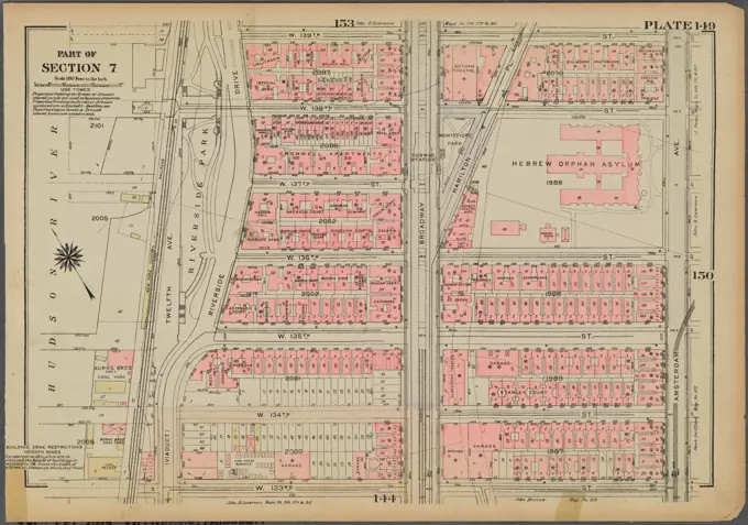
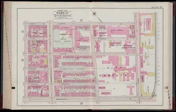
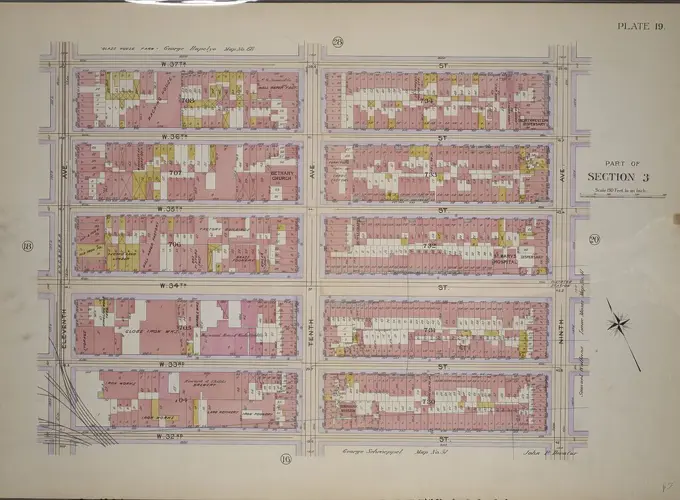
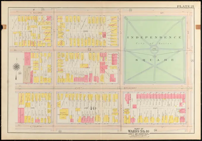
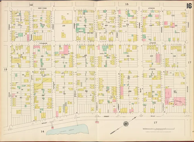
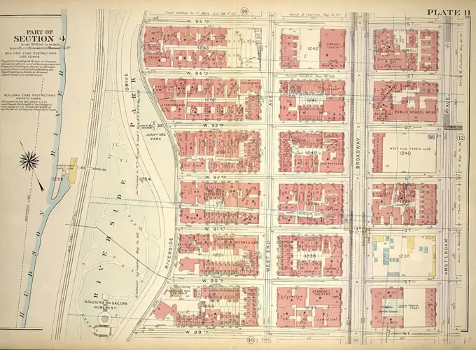
Detailed cartographic maps from 1891 and 1916 showcasing real property layouts in Manhattan and South Boston, featuring streets, blocks, and landownership details.

Plate 32 Map bounded by E. 108th St., East River, E. 97th St., 5th Ave., issued in 1891 by G.W. Bromley & Co. The map details real property in Manhattan, New York
Cartographic, Maps. 1916. Lionel Pincus and Princess Firyal Map Division. Atlases, Manhattan (New York, N.Y.), Real property , New York (State) , New York Plate 47: Bounded by W. 26th Street, Ninth Avenue, W. 20th Street, and 11th Avenue Part of Section 3Plate 32 Map bounded by E. 108th St., East River, E. 97th St., 5th Ave., issued in 1891 by G.W. Bromley & Co. The map details real property in Manhattan, New YorkAtlas of the city of Boston, volume eight, South Boston, Mass. : from actual surveys and official plans. plate 22 , Real property, Massachusetts, Boston, Maps, Landowners, Massachusetts, Boston, Maps, South Boston Boston, Mass., Maps Norman B. Leventhal Map Center CollectionAtlas of the city of Boston, volume eight, South Boston, Mass. : from actual surveys and official plans. plate 22 , Real property, Massachusetts, Boston, Maps, Landowners, Massachusetts, Boston, Maps, South Boston Boston, Mass., Maps Norman B. Leventhal Map Center CollectionCartographic, Maps. 1916. Lionel Pincus and Princess Firyal Map Division. Atlases, Manhattan (New York, N.Y.), Real property , New York (State) , New York Plate 71: Bounded by W. 47th Street, Broadway, Seventh Avenue, W. 42nd Street, and Ninth Avenue Part of Section 4Cartographic, Maps. 1916. Lionel Pincus and Princess Firyal Map Division. Atlases, Manhattan (New York, N.Y.), Real property , New York (State) , New York Plate 142: Bounded by E. 127th Street, Second Avenue, E. 122nd Street and Park Avenue Part of Section 6Atlas of the city of Boston, East Boston : plate 9 , Boston Mass., Maps, Real property, Massachusetts, Boston, Maps, Landowners, Massachusetts, Boston, Maps, East Boston Boston, Mass., Maps Norman B. Leventhal Map Center CollectionCartographic, Maps. 1921 - 1923. Lionel Pincus and Princess Firyal Map Division. Real property , New York (State) , New York, Manhattan (New York, N.Y.) Plate 60: Bounded by W. 37th Street, Fifth Avenue, W. 32nd Street and Seventh AvenueCartographic, Maps. 1911. Lionel Pincus and Princess Firyal Map Division. New York (N.Y.), Manhattan (New York, N.Y.), Real property , New York (State) , New York , Manhattan Plate 36: Bounded by W. 97th Street, Central Park West, W. 86th Street, and Hudson River, Riverside Park Riverside Drive. Part of Sections 4 &7, New York City.Part of Section 6: Plate 123.Cartographic, Maps. 1916. Lionel Pincus and Princess Firyal Map Division. Atlases, Manhattan (New York, N.Y.), Real property , New York (State) , New York Plate 141: Bounded by W. 127th Street, Park Avenue, E. 122nd Street, W. 122nd Street and Lenox Avenue Part of Section 6Cartographic, Maps. 1884 - 1936. Lionel Pincus and Princess Firyal Map Division. Fire insurance , New York (State), Real property , New York (State), Cities & towns , New York (State) Brooklyn V. 4, Double Page Plate No.110 Map bounded by Humboldt St., Stagg St., Leonard St., N. 2nd St.Plate 42 Map bounded by W. 147th St., Harlem River, W. 136th St., Avenue St., 1891, G.W. Bromley & Co., 1891, Philadelphia, Publisher, G.W. Bromley & Co., Manhattan (New York, N.Y.), Real property, New York (State), New YorkCartographic, Maps. 1892. Lionel Pincus and Princess Firyal Map Division. Fire insurance , New York (State), Real property , New York (State), Cities & towns , New York (State) Manhattan, V. 6, Double Page Plate No. 108 Map bounded by E. 57th St., East River, E. 52nd St., 2nd Ave.Atlas of the city of Boston, Boston proper and Back Bay : plate 19 , Boston Mass., Maps, Real property, Massachusetts, Boston, Maps, Landowners, Massachusetts, Boston, Maps, Back Bay Boston, Mass., Maps Norman B. Leventhal Map Center CollectionHudson County, V. 8, Double Page Plate No. 15 Map bounded by Bergen Wood, Fulton St., New York Ave., Gardner St. 1887. Cartographic. Atlases, Maps. Lionel Pincus and Princess Firyal Map Division. Hudson County (N.J.)Insurance map of Boston : volume 2 : plate 54 , Real property, Massachusetts, Boston, Maps, Fire risk assessment, Massachusetts, Boston, Maps, South Boston Boston, Mass., Maps Norman B. Leventhal Map Center CollectionCartographic, Maps. 1921 - 1923. Lionel Pincus and Princess Firyal Map Division. Real property , New York (State) , New York, Manhattan (New York, N.Y.) Plate 30: Bounded by E. 14th Street, Second Avenue, E. 8th Street and University PlaceCartographic, Maps. 1890. Lionel Pincus and Princess Firyal Map Division. Fire insurance , New York (State), Real property , New York (State), Cities & towns , New York (State) Manhattan, V. 4, Double Page Plate No. 74 Map bounded by E. 37th St., 2nd Ave., E. 32nd St., 4th Ave.Plate 32 Bounded by E. 108th Street, East River, E. 101st Street, Second Avenue, E. 97th Street, and Fifth Avenue (Central Park), 1897. Additional, Part of Section 6, New York City., 1897., Philadelphia. Publisher, G.W. Bromley & Co. Real property, New York (State), New York, Manhattan (New York, N.Y.)Cartographic, Maps. 1916. Lionel Pincus and Princess Firyal Map Division. Atlases, Manhattan (New York, N.Y.), Real property , New York (State) , New York Plate 51: Bounded by E. 26th Street, East River (Piers 74-70), Exterior Street, E. 20th Street, and Second Avenue Part of Section 3Manhattan, Double Page Plate No. 42 Map bounded by W. 147th St., Harlem River, W. 136th St., Avenue St..Atlas of the city of Boston, Boston proper and Back Bay : plate 27 , Boston Mass., Maps, Real property, Massachusetts, Boston, Maps, Landowners, Massachusetts, Boston, Maps, South End Boston, Mass., Maps Norman B. Leventhal Map Center CollectionE.B. Hyde & Co.. Cartographic, Maps. 1916. Lionel Pincus and Princess Firyal Map Division. Brooklyn (New York, N.Y.), Real property , New York (State) , New York Brooklyn, Vol. 1, 2nd Part, Double Page Plate No. 40; Part of Ward 28, Section 11; Map bounded by Cornelia St., Wyckoff Ave., Eldert St., Irving Ave.; Including Cemetery Lane, Granite St., Evergreen Ave., Moffatt St., BroadwayAtlas of the city of Boston, volume eight, South Boston, Mass. : from actual surveys and official plans. plate 24 , Real property, Massachusetts, Boston, Maps, Landowners, Massachusetts, Boston, Maps, South Boston Boston, Mass., Maps Norman B. Leventhal Map Center CollectionCartographic, Maps. 1916. Lionel Pincus and Princess Firyal Map Division. Atlases, Manhattan (New York, N.Y.), Real property , New York (State) , New York Plate 67: Bounded by E. 42nd Street, Third Avenue, E. 37th Street, and Fifth Avenue Part of Sections 3 & 5E.B. Hyde & Co.. Cartographic, Maps. 1904 - 1912. Lionel Pincus and Princess Firyal Map Division. Brooklyn (New York, N.Y.) , Maps, Real property , New York (State) , New York Brooklyn, Vol. 2, Double Page Plate No. 3; Part of Ward 20, Section 7; Map bounded by Washington Ave., Atlantic Ave.; Including South Oxford St., De Kalb Ave.Atlas of the city of Boston, South Boston : plate 5 , Boston Mass., Maps, Real property, Massachusetts, Boston, Maps, Landowners, Massachusetts, Boston, Maps Norman B. Leventhal Map Center CollectionCartographic, Maps. 1899. Lionel Pincus and Princess Firyal Map Division. Fire insurance , New York (State), Real property , New York (State), Cities & towns , New York (State) Manhattan, V. 4, Double Page Plate No. 67 Map bounded by East 26th St., Avenue A., East 22nd St., 2nd Ave.Atlas of the city of Boston, volume eight, South Boston, Mass. : from actual surveys and official plans. plate 8 , Real property, Massachusetts, Boston, Maps, Landowners, Massachusetts, Boston, Maps, South Boston Boston, Mass., Maps Norman B. Leventhal Map Center CollectionAtlas of the city of Boston, Boston proper : from actual surveys and official plans. plate 29 , Real property, Massachusetts, Boston, Maps, Landowners, Massachusetts, Boston, Maps, Boston Mass., Maps Norman B. Leventhal Map Center CollectionCartographic, Maps. 1955 - 1956. Lionel Pincus and Princess Firyal Map Division. Real property , New York (State) , New York (N.Y.), Manhattan (New York, N.Y.) Plate 119, Part of Section 5: Bounded by E. 95th Street, (East River) Franklin D. Roosevelt Drive, York Avenue, E. 89th Street and Third Avenue.Atlas of the city of Boston, Boston proper and Back Bay : plate 19 , Boston Mass., Maps, Real property, Massachusetts, Boston, Maps, Landowners, Massachusetts, Boston, Maps, Back Bay Boston, Mass., Maps Norman B. Leventhal Map Center CollectionCartographic, Maps. 1927. Lionel Pincus and Princess Firyal Map Division. Real property , New York (State) , New York, Manhattan (New York, N.Y.) Plate 72, Part of Sections 4 & 5: Bounded by W. 47th Street, Fifth Avenue, W. 42nd Street and BroadwayCartographic, Maps. 1916. Lionel Pincus and Princess Firyal Map Division. Atlases, Manhattan (New York, N.Y.), Real property , New York (State) , New York Plate 137: Bounded by E. 122nd Street, (Harlem River) Pleasant Avenue, E. 116th Street and Second Avenue Part of Section 6Cartographic, Maps. 1911. Lionel Pincus and Princess Firyal Map Division. New York (N.Y.), Manhattan (New York, N.Y.), Real property , New York (State) , New York , Manhattan Plate 42: Bounded by W. 147th Street, Harlem River (Channel Line), Madison Avenue, E. 136th Street, W. 136th Street, and St. Nicholas Avenue. Part of Sections 6 & 7, New York City.Cartographic, Maps. 1897. Lionel Pincus and Princess Firyal Map Division. Real property , New York (State) , New York, Manhattan (New York, N.Y.) Plate 40: Bounded by W. 136th Street, Fifth Avenue, W. 125th Street, and Convent Avenue. Part of Sections 6 & 7: New York City.Cartographic, Maps. 1890. Lionel Pincus and Princess Firyal Map Division. Fire insurance , New York (State), Real property , New York (State), Cities & towns , New York (State) Manhattan, V. 5, Double Page Plate No. 91 Map bounded by W. 37th St., 6th Ave., W. 32nd St., 8th Ave.Atlas of the city of Boston, South Boston : plate 24 , Boston Mass., Maps, Real property, Massachusetts, Boston, Maps, Landowners, Massachusetts, Boston, Maps Norman B. Leventhal Map Center CollectionIndex map to Bensonhurst-by-the Sea and additions Cartographic. Maps, Cadastral maps. 1895. Lionel Pincus and Princess Firyal Map Division. Brooklyn (New York, N.Y.), Bensonhurst (New York, N.Y.), Real property , New York (State) , New York, Railroads , New York (State) , New YorkCartographic, Maps. 1916. Lionel Pincus and Princess Firyal Map Division. Atlases, Manhattan (New York, N.Y.), Real property , New York (State) , New York Plate 188: Bounded by W. 214th Street, Columbus Avenue(Harlem River), W. 208th Street, Amsterdam Avenue, Ishan Street and Broadway Part of Section 8Cartographic, Maps. 1955 - 1956. Lionel Pincus and Princess Firyal Map Division. Real property , New York (State) , New York (N.Y.), Manhattan (New York, N.Y.) Plate 133, Part of Section 7: Bounded by W. 122nd Street, Eighth Avenue, W. 116th Street and Amsterdam Avenue.Cartographic, Maps. 1930. Lionel Pincus and Princess Firyal Map Division. Real property , New York (State) , New York, Manhattan (New York, N.Y.) Plate 149, Part of Section 7: Bounded by W. 139th Street, Amsterdam Avenue, W. 133rd Street and (Hudson River, Riverside Park) Riverside DrivePlate 7, Part of Section 3: Bounded by W. 26th Street, Ninth Avenue Chelsea Square, W. 20th Street, 13th Street, W. 23rd Street and Eleventh Avenue.Cartographic, Maps. 1891. Lionel Pincus and Princess Firyal Map Division. Manhattan (New York, N.Y.), Real property , New York (State) , New York Plate 22 Map bounded by 6th Ave., E. 64th St., Lexington Ave., E. 47th St.Atlas of the city of Boston, Boston proper and Back Bay : plate 29 , Boston Mass., Maps, Real property, Massachusetts, Boston, Maps, Landowners, Massachusetts, Boston, Maps, Roxbury Boston, Mass., Maps Norman B. Leventhal Map Center CollectionCartographic, Maps. 1916. Lionel Pincus and Princess Firyal Map Division. Atlases, Manhattan (New York, N.Y.), Real property , New York (State) , New York Plate 184: Bounded by Broadway (Kingsbridge Road), Isham Street, Amsterdam Avenue, Nagle Avenue and Dyckman Street Part of Section 8Atlas of the city of Boston, Boston proper and Back Bay : plate 19 , Boston Mass., Maps, Real property, Massachusetts, Boston, Maps, Landowners, Massachusetts, Boston, Maps, Back Bay Boston, Mass., Maps Norman B. Leventhal Map Center CollectionInsurance map of Charlestown : portions of Roxbury (now annexed to Boston) and Cambridge : 1868 : corrected Nov. 1871 : plate 12 , Fire risk assessment, Massachusetts, Cambridge, Maps, Real property, Massachusetts, Cambridge, Maps, Cambridge Mass., Maps Norman B. Leventhal Map Center CollectionManhattan, V. 5, Double Page Plate No. 91 Map bounded by W. 37th St., 6th Ave., W. 32nd St., 8th Ave., issued by Sanborn Map Company, New York, 1884-1890. The map features fire insurance information related to real property in New York State, focusing on cities and townsCartographic, Maps. 1911. Lionel Pincus and Princess Firyal Map Division. Bronx (New York, N.Y.), New York (N.Y.) Plate 12 Map bounded by E. 156th St., St. Anns Ave., E. 149th St., Morris Ave.Cartographic, Maps. 1898. Lionel Pincus and Princess Firyal Map Division. Fire insurance , New York (State), Real property , New York (State), Cities & towns , New York (State) Manhattan, V. 5, Double Page Plate No. 88 Map bounded by West 32nd St., 6th Ave., West 27th St., 8th Ave.Cartographic, Maps. 1955 - 1956. Lionel Pincus and Princess Firyal Map Division. Real property , New York (State) , New York (N.Y.), Manhattan (New York, N.Y.) Plate 15, Part of Section 2: Bounded by Stanton Street, Baruch Houses, (East River Park, East River) Franklin D. Roosevelt Drive, Grand Street and Willett Street.Cartographic, Maps. 1916. Lionel Pincus and Princess Firyal Map Division. Atlases, Manhattan (New York, N.Y.), Real property , New York (State) , New York Plate 89: Bounded by W. 71st Street, Central Park West, W. 65th Street, and Amsterdam Avenue Part of Section 4Cartographic, Maps. 1916. Lionel Pincus and Princess Firyal Map Division. Atlases, Manhattan (New York, N.Y.), Real property , New York (State) , New York Plate 25: Bounded by Clinton Street, Avenue B, E. 8th Street, Avenue D, Columbia Street, and Stanton Street Part of Section 2Atlas of the city of Boston, Boston proper and Back Bay : from actual surveys and official plans. plate 19 , Real property, Massachusetts, Boston, Maps, Landowners, Massachusetts, Boston, Maps, Back Bay Boston, Mass., Maps Norman B. Leventhal Map Center CollectionE.B. Hyde & Co.. Cartographic, Maps. 1906. Lionel Pincus and Princess Firyal Map Division. Brooklyn (New York, N.Y.) , Maps, Real property , New York (State) , New York Brooklyn, Vol. 5, Double Page Plate No. 20; Part of Ward 29, Section 16; Map bounded by E. 19th St., Dorchster Road; Including Argyle Road (E. 13th St.), Albemarle Road (Avenue A)Cartographic, Maps. 1921 - 1923. Lionel Pincus and Princess Firyal Map Division. Real property , New York (State) , New York, Manhattan (New York, N.Y.) Plate 141: Bounded by W. 127th Street, E. 127th Street, Park Avenue, E. 122nd Street, (Mount Morris Park) W. 122nd Street and Lenox AvenueCartographic, Maps. 1921 - 1923. Lionel Pincus and Princess Firyal Map Division. Real property , New York (State) , New York, Manhattan (New York, N.Y.) Plate 21: Bounded by King Street, Macdougal Street, Prince Street, Sullivan Street, Watts Street and West StreetAtlas of the city of Boston, Charlestown and East Boston : plate 13 , Boston Mass., Maps, Real property, Massachusetts, Boston, Maps, Landowners, Massachusetts, Boston, Maps, Charlestown Boston, Mass., Maps Norman B. Leventhal Map Center CollectionPlate 20, Part of Section 3: Bounded by W. 37th Street, Seventh Avenue, W. 31st Street and Ninth Avenue.Plate 25 Map bounded by W. 75th St., Central Park W., W. 64th St., Hudson River, issued in 1891 by G.W. Bromley & Co. This map, published in Philadelphia, details real property in Manhattan, New YorkCartographic, Maps. 1885. Lionel Pincus and Princess Firyal Map Division. Real property , New York (State) , New York, New York (N.Y.) Plate 26: Bounded by E. 128th Street, Harlem River, Pleasant Avenue, E. 115th Street, Fifth Avenue, E. 120th Street, Madison Avenue, E. 124th Street and Fifth Avenue. Part of Ward 12, New York City.Atlas of the city of Boston, Boston proper and Back Bay : plate 26 , Boston Mass., Maps, Real property, Massachusetts, Boston, Maps, Landowners, Massachusetts, Boston, Maps, South End Boston, Mass., Maps Norman B. Leventhal Map Center CollectionPlate 3, Part of Section 3: Bounded by E. 20th Street, Second Avenue, E. 14th Street, Union Square and Broadway.Cartographic, Maps. 1955 - 1956. Lionel Pincus and Princess Firyal Map Division. Real property , New York (State) , New York (N.Y.), Manhattan (New York, N.Y.) Plate 125, Part of Section 6: Bounded by E. 110th Street, (Harlem River) Franklin D. Roosevelt Drive, E. 105th Street and Third Avenue.Insurance maps of Boston volume 4 : comprising portions of Charlestown, East Cambridge, Cambridge Port, Old Cambridge & Somerville : plate 104 , Fire risk assessment, Massachusetts, Cambridge, Maps, Cambridge Mass., Maps Norman B. Leventhal Map Center CollectionCartographic, Maps. 1897. Lionel Pincus and Princess Firyal Map Division. Real property , New York (State) , New York, Manhattan (New York, N.Y.) Plate 27: Bounded by E. 64th Street, Second Avenue, East River (Avenue A), E. 57th Street, and Lexington Avenue. Part of Section 5, New York City.Cartographic, Maps. 1890. Lionel Pincus and Princess Firyal Map Division. Fire insurance , New York (State), Real property , New York (State), Cities & towns , New York (State) Manhattan, V. 4, Double Page Plate No. 73 Map bounded by 2nd Ave., E. 37th St., East River, E. 31st St.Plate 37: Bounded by W. 108th Street, Central Park West, W. 97th Street and Hudson River Riverside Drive.Cartographic, Maps. 1916. Lionel Pincus and Princess Firyal Map Division. Atlases, Manhattan (New York, N.Y.), Real property , New York (State) , New York Plate 127: Bounded by W. 116th Street, Eighth Avenue, Cathedral Parkway and Amsterdam Avenue Part of Section 7Plate 33 Map bounded by E. 126th St., 1st Ave., E. 122nd St., 3rd Ave., 1890, E. Robinson Co., 1890., New York. Publisher, E. Robinson Co. Real property, New York (State), New York, New York (N.Y.)Cartographic, Maps. 1930. Lionel Pincus and Princess Firyal Map Division. Real property , New York (State) , New York, Manhattan (New York, N.Y.) Plate 131, Part of Section 6: Bounded by E. 116th Street, Harlem River, E. 110th Street and Second AvenueE.B. Hyde & Co.. Cartographic, Maps. 1905. Lionel Pincus and Princess Firyal Map Division. Brooklyn (New York, N.Y.) , Maps, Real property , New York (State) , New York Brooklyn, Vol. 6, Double Page Plate No. 2; Part of Ward 30, Section 17; Map bounded by 15th Ave., 42nd St., New Utrecht Ave., 12th Ave.; Including 40th St., 13th Ave., 41st St., 42nd St., 14th Ave.Plate 15, Part of Section 3: Bounded by W. 31st Street, Seventh Avenue, W. 26th Street and Ninth Avenue.Part of Section 3 : Plate 60.Cartographic, Maps. 1930. Lionel Pincus and Princess Firyal Map Division. Real property , New York (State) , New York, Manhattan (New York, N.Y.) Plate 103, Part of Section 7: Bounded by Cathedral Parkway, Central Park West, W. 105th Street and Amsterdam AvenueCartographic, Maps. 1925. Lionel Pincus and Princess Firyal Map Division. Real property , New York (State) , New York, Manhattan (New York, N.Y.) Plate 20, Part of Section 2: Bounded by Prince Street, Cleveland Street, Centre Street, Grand Street and Sullivan StreetCartographic, Maps. 1897. Lionel Pincus and Princess Firyal Map Division. Real property , New York (State) , New York, Manhattan (New York, N.Y.) Plate 34: Bounded by Lenox Avenue, W. 125th Street, Third Avenue, E. 108th Street, Fifth Avenue and (Central Park) W. 110th Street. Part of Section 6, New York City.Cartographic, Maps. 1896. Lionel Pincus and Princess Firyal Map Division. Fire insurance , New York (State), Real property , New York (State), Cities & towns , New York (State) Manhattan, V. 8, Double Page Plate No. 163 Map bounded by E. 94th St., 3rd Ave., E. 88th St., 5th Ave.Cartographic, Maps. 1884 - 1936. Lionel Pincus and Princess Firyal Map Division. Fire insurance , New York (State), Real property , New York (State), Cities & towns , New York (State) Brooklyn Plate No. 29 Map bounded by W.9th St., Columbia St., Coles St., Clinton St.Atlas of the city of Boston : East Boston, Mass. : plate 15 , Boston Mass., Maps, Real property, Massachusetts, Boston, Maps, Landowners, Massachusetts, Boston, Maps, East Boston Boston, Mass., Maps Norman B. Leventhal Map Center CollectionCartographic, Maps. 1925. Lionel Pincus and Princess Firyal Map Division. Real property , New York (State) , New York, Manhattan (New York, N.Y.) Plate 141, Part of Section 6: Bounded by W. 127th Street, E. 127th Street, Park Avenue, E. 122nd Street, Mount Morris Park, W. 122nd Street and Lenox AvenueAtlas of the city of Boston, South Boston : plate 6 , Boston Mass., Maps, Real property, Massachusetts, Boston, Maps, Landowners, Massachusetts, Boston, Maps Norman B. Leventhal Map Center CollectionCartographic, Maps. 1925. Lionel Pincus and Princess Firyal Map Division. Real property , New York (State) , New York, Manhattan (New York, N.Y.) Plate 82, Part of Section 4: Bounded by W. 59th Street, Columbus Circle, Central Park South, Seventh Avenue, W. 53rd Street and Ninth AvenueCartographic, Maps. 1925. Lionel Pincus and Princess Firyal Map Division. Real property , New York (State) , New York, Manhattan (New York, N.Y.) Plate 158, Part of Section 7: Bounded by W. 151st Street, Eighth Avenue, W. 145th Street and Amsterdam AvenueCartographic, Maps. 1925. Lionel Pincus and Princess Firyal Map Division. Real property , New York (State) , New York, Manhattan (New York, N.Y.) Plate 110, Part of Section 5: Bounded by E. 77th Street, Third Avenue, E. 71st Street and (Central Park) Fifth AvenueCartographic, Maps. 1955 - 1956. Lionel Pincus and Princess Firyal Map Division. Real property , New York (State) , New York (N.Y.), Manhattan (New York, N.Y.) Plate 101, Part of Section 7: Bounded by W. 105th Street, Central Park West, W. 100th Street and Amsterdam Avenue.Cartographic, Maps. 1955 - 1956. Lionel Pincus and Princess Firyal Map Division. Real property , New York (State) , New York (N.Y.), Manhattan (New York, N.Y.) Plate 49, Part of Section 3: Bounded by W. 26th Street, E. 26th Street, Madison Avenue, E. 23rd Street, Broadway, E. 20th Street, W. 20th Street and Seventh Avenue.Cartographic, Maps. 1930. Lionel Pincus and Princess Firyal Map Division. Real property , New York (State) , New York, Manhattan (New York, N.Y.) Plate 24, Part of Section 2: Bounded by E. 4th Street, Avenue B, Clinton Street, Stanton Street, Orchard Street, E. Houston Street and Second AvenueCartographic, Maps. 1930. Lionel Pincus and Princess Firyal Map Division. Real property , New York (State) , New York, Manhattan (New York, N.Y.) Plate 44, Part of Section 3: Bounded by (Gramercy Park) E. 20th Street, Second Avenue, E. 14th Street, Union Square West and BroadwayCartographic, Maps. 1925. Lionel Pincus and Princess Firyal Map Division. Real property , New York (State) , New York, Manhattan (New York, N.Y.) Plate 149, Part of Section 7: Bounded by W. 139th Street, Amsterdam Avenue, W. 133rd Street and (Hudson River, Riverside Park) Riverside DriveHudson County, V. 8, Double Page Plate No. 1 Map bounded by Spring St., Cortland St., Hillside Rd., Paterson Plank Rd. 1887. Cartographic. Atlases, Maps. Lionel Pincus and Princess Firyal Map Division. Hudson County (N.J.)Atlas of the city of Boston, Boston proper : from actual surveys and official plans. plate 27 , Real property, Massachusetts, Boston, Maps, Landowners, Massachusetts, Boston, Maps, Boston Mass., Maps Norman B. Leventhal Map Center CollectionPlate 35, Part of Section 5: Bounded by E. 53rd Street, Third Avenue, E. 47th Street and Fifth Avenue.Plate 19, Part of Section 3: Bounded by W. 37th Street, Ninth Avenue, W. 32nd Street and Eleventh Avenue.Atlas of the city of Boston, South Boston : plate 21 , Boston Mass., Maps, Real property, Massachusetts, Boston, Maps, Landowners, Massachusetts, Boston, Maps Norman B. Leventhal Map Center CollectionHudson County, V. 8, Double Page Plate No. 16 Map bounded by New York Ave., Fulton St., Bulls Ferry Rd., Union St. 1887. Cartographic. Atlases, Maps. Lionel Pincus and Princess Firyal Map Division. Hudson County (N.J.)Plate 11, Part of Section 4: Bounded by W. 95th Street, Amsterdam Avenue, W. 89th Street and Riverside Park Riverside Drive.Plate 23: Map bounded by Broome Street, Bowery, Canal Street, Broadway. 1857, 1862, Perris and Browne, New York, USA.