My Boards
View Pictures
  • My Boards

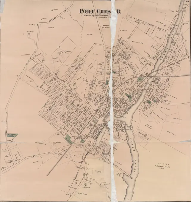
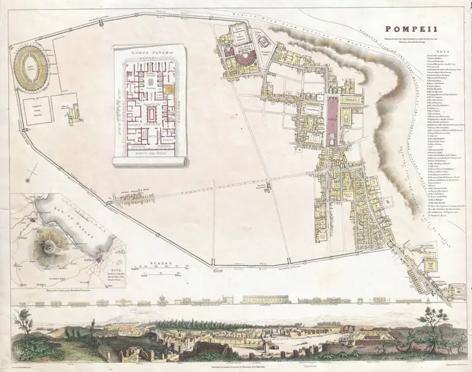
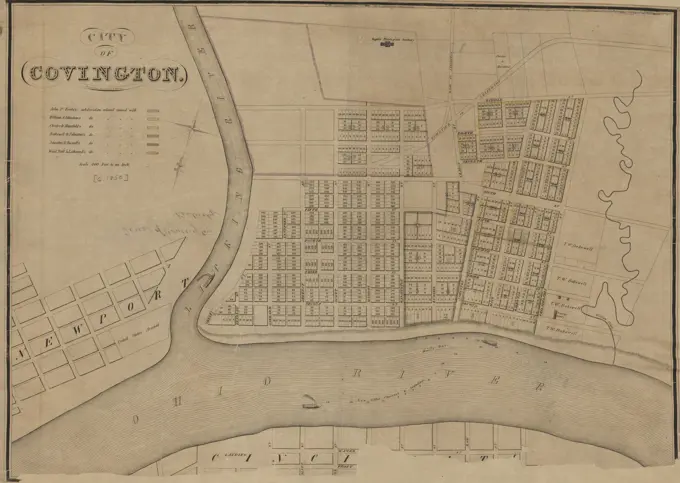
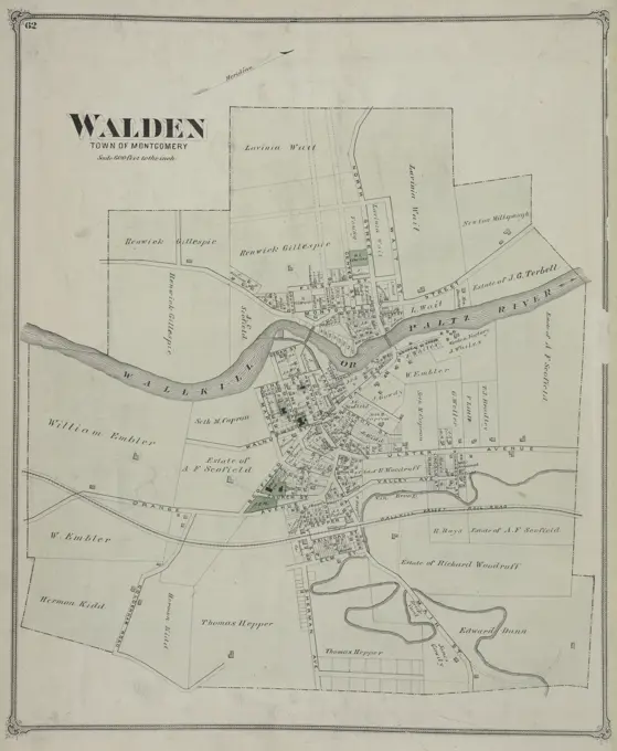
Historical Boston Maps

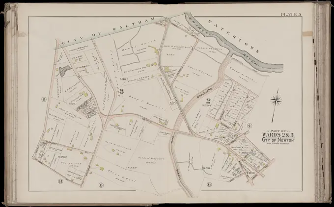
Detailed maps of various areas in Boston, showcasing land ownership and property layouts from official surveys in the 19th century.

Atlas of the city of Newton, Massachusetts : from actual surveys and official plans. plate 5 , Real property, Massachusetts, Newton, Maps, Landowners, Massachusetts, Newton, Maps, Newton Mass., Maps Norman B. Leventhal Map Center Collection
278 assets in this story
6145-55958414
Hudson County, V. 2, Double Page Plate No. 27 Map of Kearny Cartographic. Atlases, Maps. 1908 - 1909. Lionel Pincus and Princess Firyal Map Division. Jersey City (N.J.), Hudson County (N.J.)
6145-50570444
Atlas of the town of Brookline, Massachusetts : from official records, private plans and actual surveys. plate 16 , Real property, Massachusetts, Brookline, Maps, Landowners, Massachusetts, Brookline, Maps, Brookline Mass., Maps Norman B. Leventhal Map Center Collection
6145-50568898
Plan of the cemetery of Mount Auburn , Mount Auburn Cemetery Watertown and Cambridge, Mass., Maps, Cemeteries, Massachusetts, Cambridge, Maps, Cemeteries, Massachusetts, Watertown, Maps, Watertown Mass., Maps, Cambridge Mass., Maps Norman B. Leventhal Map Center Collection
6145-52360085
Philadelphia and adjacent country. Cartographic. Maps. 1818. Lionel Pincus and Princess Firyal Map Division. Pennsylvania, Philadelphia Region (Pa.) , Maps
6145-48712968
Plan of Hatfield made by Rodolphus Morton, dated August, 1830 ,. Massachusetts. Office of the Secretary of State
6145-50444278
Jansen Hermann (1869-1945), total development plan Ankara (06.05.1932): Basic plan, partial sheet 3 C. Tusche via light break on transparent, 47.4 x 55.9 cm (including scan edges) Jansen Hermann  (1869-1945): Gesamtbebauungsplan Ankara
6145-48448514
Jansen Hermann (1869-1945), Planning for Plowdiw (September 17, 1942): Grund- and Department of Plan Area between Central Station and Mariza, Verkehrtlung 1: 2000 (united with the former Inv.No. 22313). Light break on transparent, 144.2 x 89.6 cm (including scan edges) Jansen Hermann  (1869-1945): Planung für Plowdiw
4443-14135
MAP OF ST. GERMAIN
6145-50567476
Map of Boston proper, Charlestown, South Boston and East Boston : showing original territory of old Boston, the areas filled and reclaimed from tide water and the areas available for future reclamation ... port of Boston , Cities and towns, Growth, Massachusetts, Boston, Maps, Boston Mass., Maps, Boston Harbor Mass., Maps Norman B. Leventhal Map Center Collection
6145-43862129
Public reservations on the banks of the Charles River between Watertown and Cragies Bridge , Urban parks, Massachusetts, Boston, Maps, Boston Mass., Maps, Charles River Mass., Maps Norman B. Leventhal Map Center Collection
6145-54549843
Part of Babylon Cartographic. Atlases, Maps. 1915 - 1917. Lionel Pincus and Princess Firyal Map Division. Suffolk County (N.Y.)
6145-50570447
Atlas of the town of Brookline, Massachusetts : from official records, private plans and actual surveys. plate 19 , Real property, Massachusetts, Brookline, Maps, Landowners, Massachusetts, Brookline, Maps, Brookline Mass., Maps Norman B. Leventhal Map Center Collection
6145-50570261
Atlas of the county of Suffolk, Massachusetts : vol. 2nd late city of Roxbury, now wards 13-14 and 15, city of Boston : plate F , Real property, Massachusetts, Boston, Maps, Landowners, Massachusetts, Boston, Maps, Roxbury Boston, Mass., Maps Norman B. Leventhal Map Center Collection
1788-34857
Cartography, Italy, 17th century. Map of Villa Contarini at Piazzola sul Brenta, Padua province. Study on irrigation and cultivation in the Villa property.
6145-59593278
Map of the Vijfheerenlanden (part bottom right), Jan van Jagen, 1783 - 1787 print Share (bottom right) of a map of the Vijfheerenlanden, consisting of four parts. Orientation: north on the right.  paper engraving maps of separate countries or regions. polder, reclaimed land Vijfheerenlanden
6145-55958476
Jersey City, V. 4, Double Page Plate No. 24 Map bounded by Covert St., Tonnele Ave., Utica St. Cartographic. Atlases, Maps. 1873. Lionel Pincus and Princess Firyal Map Division. Jersey City (N.J.), Fire insurance , New Jersey , Jersey City
6145-54549933
Great Neck - Pt. Washington - Kesington - Sea Cliff - Plandome, Etc. Cartographic. Atlases, Maps. 1914. Lionel Pincus and Princess Firyal Map Division. Nassau County (N.Y.) , Maps, Real property , New York (State) , Nassau County
6176-66911342
Nashville, Tennessee and vicinity 1863 during USA Civil War
6145-50569104
Part of the metropolitan district , Needham Mass., Maps, Dedham Mass., Maps Norman B. Leventhal Map Center Collection
6145-50511370
Plan of Hatfield made by Rodolphus Morton, dated August, 1830 ,. Massachusetts. Office of the Secretary of State
6145-48447408
Jansen Hermann (1869-1945), Dortmund development plan (20.01.1941): Outdoor districts, map section 121/8 1: 2000. Light break on paper, 71.2 x 99.1 cm (including scan edges) Jansen Hermann  (1869-1945): Bebauungsplan Dortmund
6145-50443957
Jansen Hermann (1869-1945), development plan of the city expansion of Namslau (01.05.1928): Basic plan and site plan 1: 2500. Colored pencil on pressure on paper, 108.9 x 145.3 cm (including scan edges) Jansen Hermann  (1869-1945): Bebauungsplan der Stadterweiterung, Namslau
6145-59564111
Map of the Noordplaspolder, T. Koning, in or after 1767 print A banderole with the title at the top in the middle. Left and top right an empty cartouche for a register. Bottom left a cartouche with text, written by Klaas Vis. Under the right of the middle a bowl: size of 500 rhijnl: rods.  paper. ink engraving / etching / pen maps of separate countries or regions. polder, reclaimed land Noordplaspolder
6145-51386322
Plan of the cemetery of Mount Auburn , Mount Auburn Cemetery Watertown and Cambridge, Mass., Maps, Cemeteries, Massachusetts, Cambridge, Maps, Cemeteries, Massachusetts, Watertown, Maps, Watertown Mass., Maps, Cambridge Mass., Maps Norman B. Leventhal Map Center Collection
6145-55181561
Essex County, V. 3, Double Page Plate No. 33 Map bounded by Short Hills Millburn Township A.H. Mueller (Publisher). Cartographic. Atlases, Maps. 1906. Lionel Pincus and Princess Firyal Map Division. Essex County (N.J.), Newark (N.J.)
6145-46762631
Sala mine and silver plant chronology.sala silver mine.ur Carl Sahlin mountain historical collection.
6145-48488622
N.N., Großschiffahrtsweg, Wroclaw. Grossy lock: site plan 1: 1000. Lithograph on cardboard, 50.1 x 104.1 cm (including scan edges)
6145-51390948
Atlas of the city of Chelsea and the towns of Revere & Winthrop, Massachusetts : from actual surveys and official plans. plate 24 , Real property, Massachusetts, Revere, Maps, Landowners, Massachusetts, Revere, Maps, Revere Mass., Maps Norman B. Leventhal Map Center Collection
6145-55181410
Hewlett Bay Park Cartographic. Atlases, Maps. 1914. Lionel Pincus and Princess Firyal Map Division. Nassau County (N.Y.) , Maps, Real property , New York (State) , Nassau County
6145-50552605
Map of Bath, Maine , Bath Me., Maps Norman B. Leventhal Map Center Collection
6145-55167150
Map of Bath, Maine. Oriented with north to the right.... , Maine  , Sagadahoc  ,county   , Bath
4443-73238652
Northern Netherlands, No. 2. Camp at Barneveld, 15 Sept. 1787, Prussian Camp at Barneveld, 1787, verso - stamped, Map showing the location of the Prussian camp at Barneveld on 15 September 1787. Part of a group of fourteen numbered maps of the Prussian camps during the intervention in the Netherlands in September 1787., print, picture, map, book illustration, prints, Frederik Muller Historieplaten, height 68 mm, width 80 mm, print maker, printmaker, 1790 - 1792, paper, papier, etching, hand colouring
6145-55928436
Cartographic, Maps. 1873. Lionel Pincus and Princess Firyal Map Division. Long Island (N.Y.) , Description and travel Glen Cove, Town of Oyster Bay, Queens Co.
4443-75469716
Plate 65 Port Chester, Town of Rye, Westchester Co. N.Y., 1872, J.B. Beers & Co., 1872., New York, Westchester County (N.Y.). Real property, New York (State), Westchester County
4409-13613
PLANO DE LA PLAZA DE VERACRUZ,PUERTO Y CASTILLO S JUAN DE ULUA-MEXICO. Location: MUSEO NAVAL / MINISTERIO DE MARINA. MADRID. SPAIN.
4443-19609788
To His Royal Highness, the Prince of Wales...This print of Newmarket Heath, John Bodger, Active 1770-1821, 1787, Map: aquatint, colored by hand; vignette: engraving, colored by hand, oval with ornamental border, Sheet: 17 5/8 x 26 5/8in. (44.8 x 67.6cm)
6176-67055068
' Brikenhead Docks lie  on the Cheshire side of the River Mersey', 1936. Artist: Unknown.
6145-54524420
Cartographic, Maps. 1884 - 1936. Lionel Pincus and Princess Firyal Map Division. Fire insurance , New York (State), Real property , New York (State), Cities & towns , New York (State) Staten Island, V. 1, Plate No. 46 Map bounded by Lower New York Bay, Sand Ave., Seaside Blvd.
6145-48717845
Map of Boston , Boston Mass., Maps Norman B. Leventhal Map Center Collection
6145-29096594
1832 S.D.U.K. City Plan or Map of Pompeii, Italy
4443-75461971
A map titled 'David Provoost's lots in the swamp,' created on June 26, 1782
4443-75468557
Cooperstown Village; Laurens Business Directory, 1868, by F. W. Beers. Issued in New York, Otsego County
6145-55957646
Kings Park Cartographic. Atlases, Maps. 1915 - 1917. Lionel Pincus and Princess Firyal Map Division. Suffolk County (N.Y.)
6145-55956545
Colton's Map of New York City, Brooklyn, Jersey City, Hoboken, &c. 1873. Cartographic. Maps. Lionel Pincus and Princess Firyal Map Division
4443-73256391
Map of the Alblasserwaard, Map of the area north of the river Merwede and west of the Noorder Diep. Where these rivers meet: Dordrecht.., print, prints, height mm, width mm, print maker, printmaker, 1700 - 1750, first quarter 18th century, second quarter 18th century, paper, etching, hand coloring
6145-30310502
In memory of Vienna and the world exhibition in  , Plan of Vienna, Supplement to Achill, Gattis Foreign Leader , Leopold Sommer -, printer
6145-59244416
Map of the Kieldrechtse Polder near Hulst, ca. 1701-1715, 1701 - 1715 drawing Map of the Kieldrechtse Polder in the Waasland near the fortified city of Hulst, pierced by the French troops, ca. 1701-1715. On the left a cartouche with the legend a-o in Dutch. Part of a collection of signed plans of reinforced places in the Netherlands and surrounding countries at the time of the Spanish Succession War (part C). Netherlands paper  maps of cities. maps of separate countries or regions. fortress Holly
6145-55180932
Broome County Alms House, Binghamton, N.Y. Cartographic. Atlases, Maps. 1876. Lionel Pincus and Princess Firyal Map Division. Broome County (N.Y.), Almshouses
6145-45967883
Battle of Ramillies, 1706; Plan De La Battalie Donné a Rammelis. Battle of Ramillies between the French and the Allies under the Duke of Marlborough and Mr. van Ouwerkerk, May 23, 1706. Leaf loses in the album. Part of a collection of signed plans of enhanced places in the Netherlands and surrounding countries at the time of the Spanish Succession War (Part D).
6145-51391005
Atlas of the city of Newton, Massachusetts. section B , Real property, Massachusetts, Newton, Maps, Landowners, Massachusetts, Newton, Maps, Newton Mass., Maps Norman B. Leventhal Map Center Collection
4409-7457
PLANO PLAZA S SEBASTIAN Y CASTILLO DE STA CRUZ DE LA MOTA AÑO 1726. Location: SERVICIO GEOGRAFICO DEL EJERCITO. MADRID. SPAIN.
6145-55167500
Plan of Milton Cemetery. Oriented with north toward the lower right.... , Massachusetts  , Norfolk  ,county   , Milton
4409-17339243
Napoleonic map. City of Lleida (Catalonia, Spain). During The Peninsular War (Napoleonic Wars) the city of Lerida was besieged on 13 May, 1810 by the French army. French victory. Atlas de l'Histoire du Consulat et de l'Empire. History of the Consulate and the Empire of France under Napoleon by Marie Joseph Louis Adolphe Thiers (1797-1877). Drawings by Dufour, engravings by Dyonnet. Edited in Paris, 1864.
4443-75465374
City of Covington, 1850., 1850., Cincinnati, Ohio (inferred). Publisher, unidentified. Real property of landowners in Covington, Kentucky., 1 hand-colored map, 42 x 58 cm, on sheet 48 x 61 cm
6145-43860540
The Boone-Lincoln community where Daniel Boone was born, Berks County, Pennsylvania , Berks County Pa., Maps, Boone, Daniel, 1734-1820, Lincoln, Abraham, 1809-1865 Norman B. Leventhal Map Center Collection
6145-50570733
Atlas of the city of Cambridge, Middlesex Co., Massachusetts. plate E , Real property, Massachusetts, Cambridge, Maps, Landowners, Massachusetts, Cambridge, Maps, Cambridge Mass., Maps Norman B. Leventhal Map Center Collection
6145-48732684
Plan of Lands End, Rockport, Mass. belonging to John Tudor Gardiner, Charles S. Rackemann, Trustees ,
6145-55181409
Valley Stream Cartographic. Atlases, Maps. 1914. Lionel Pincus and Princess Firyal Map Division. Nassau County (N.Y.) , Maps, Real property , New York (State) , Nassau County
4048-3783
Maps. A plan of the town of Newport in Rhode Island. Surveyed by Charles Blaskowitz, engraved and publish'd by Willm. Faden.  London, 1777
4443-19611957
The North or Great Barn Farm at Earlham, Isaac Johnson, 1754-1835, British, 1753, Graphite, pen and brown ink, watercolor and gouache on smooth, moderately thick, white wove paper, Sheet: 14 1/2 × 22 3/4 inches (36.8 × 57.8 cm), architectural subject, house, surveys
6145-55175668
Cartographic, Maps. 1891. Lionel Pincus and Princess Firyal Map Division. Queens County (N.Y.) Plate 25: Village of Glen Cove, Town of Oyster Bay.
6145-55926148
Cartographic, Maps. 1868. Lionel Pincus and Princess Firyal Map Division. Real property , New York Metropolitan Area, Westchester County (N.Y.), New York Metropolitan Area Plate 20: Yonkers, Westchester Co. N.Y. (Spuyten Duvil.) Small folder - S1
6145-59244399
Map of Geldern, ca. 1701-1715, 1701 - 1715 drawing Map of the reinforcements around the city of Geldern, with surroundings, ca. 1701-1715. On the right-hand side the legend 1-36 in French. Part of a collection of signed plans of reinforced places in the Netherlands and surrounding countries at the time of the Spanish Succession War (part B). Netherlands paper  fortress. maps of cities Money
6145-48717850
A map of the city of Boston in Massachusetts , Boston Mass., Maps Norman B. Leventhal Map Center Collection
6145-59244383
Map of Nieuwpoort (aan de Lek), ca. 1701-1715, 1701 - 1715 drawing Map of the reinforcements around the city of Nieuwpoort (on the Lek), ca. 1701-1715. Bottom left a cartouche with the legend A-H in Dutch, with two putti with a ribbon with brushes. Part of a collection of signed plans of reinforced places in the Netherlands and surrounding countries at the time of the Spanish Succession War (part A). Netherlands paper  maps of cities. fortress Nieuwpoort (the Netherlands)
6145-50444425
Jansen Hermann (1869-1945), total development plan in Gaziantep. Sub -section, area east of the old town (November 25, 1938): Submit 3d, scale bar. Tusche over a break on transparent, 69.6 x 91.9 cm (including scan edges) Jansen Hermann  (1869-1945): Gesamtbebauungsplan, Gaziantep. Teilausschnitt, Gebiet östlich der Altstadt
6145-50571025
Map of the town of Watertown : Middlesex Co., Mass., from actual surveys , Real property, Massachusetts, Watertown, Maps, Landowners, Massachusetts, Watertown, Maps, Watertown Mass., Maps Norman B. Leventhal Map Center Collection
6145-55176051
New York (N.Y.). Department of Parks. Topographical Division. Cartographic, Maps. 1873. Lionel Pincus and Princess Firyal Map Division. Westchester County (N.Y.), New York (N.Y.) Bronx, Topographical Map Sheet 1; Map bounded by Morris St., Livingstone Ave., Hamilton Ave., Broadway, Highland Ave., Park Hill Ave., Tibbet's Brook; Including Lawrence St., New York Boston Railroad, Mosholu Ave., Old Post Road, Riverdale, Bettners Lane
6145-50561144
Charles River Basin contour map of upper basin from surveys and soundings , Charles River Dam Mass., Maps, Charles River Mass., Maps, River engineering, Massachusetts, Charles River, Maps
6145-51395178
Map of the town of Watertown : Middlesex Co., Mass., from actual surveys , Real property, Massachusetts, Watertown, Maps, Landowners, Massachusetts, Watertown, Maps, Watertown Mass., Maps Norman B. Leventhal Map Center Collection
6145-50511175
Plan of Bradford made by Benjamin Greenleaf and Jeremiah Spofford, dated 1831 ,. Massachusetts. Office of the Secretary of State
6145-55181573
Morris County, Double Page Plate No. 7 Map bounded by Passaic River, E. Madision Ave., Fairview Ave., Ridgedale Ave. 1910. Cartographic. Atlases, Maps. Lionel Pincus and Princess Firyal Map Division. Morris County (N.J.)
6145-48446717
Jansen Hermann (1869-1945), construction of a settlement for the non-profit small house construction company in Berlin-Heiligensee (June 1st, 1922): Grund- und Zebanplan 1: 1000 (from Inv.No. 21115). Light break on the cardboard, 73.2 x 111.6 cm (including scan edges) Jansen Hermann  (1869-1945): Bau einer Siedlung für die gemeinnützige Kleinhausbaugesellschaft, Berlin-Heiligensee
4443-75464963
Walden Village, 1875., 1875., Chicago. Publisher, Andreas, Baskin & Burr. Focuses on real property, history, and business enterprises in Orange County, New York
6145-55924959
Cartographic, Maps. 1879. Lionel Pincus and Princess Firyal Map Division. Real property , New York (State) , New York Plate 41:: Central Park bounded by Eight Avenue, 110th Street, Fifth Avenue and 59th Street; Blackwells Island bounded by West Channel and East Channel.
6145-50552461
The Manchester Docks , Docks, England, Manchester, Maps, Manchester Ship Canal England, Maps Norman B. Leventhal Map Center Collection
6145-55167136
The Manchester Docks. Oriented with north towards the upper left. Includes Section of south quay no. 9 dock. "9-5-10.".. Port of Manchester : plan of the Manchester Docks Plan of the Manchester Docks. Port of Manchester : plan of the Manchester Docks Plan of the Manchester Docks, England  , Manchester, City and Borough of  ,county   , Manchester England  , Manchester Ship Canal
6145-30347388
Isaac Johnson, 1754-1835, British, A Map of Pulham Farm, undated. Pen and brown ink and watercolor on vellum.
PREVIOUS
of 3
NEXT
2401 S. Ervay, Suite 206
Dallas, Texas 75215
United States
Get Started
Free ResearchMy BoardsMy Cart
For Creators
How To License Your ContentContributor PortalFrame of Mind
Resources
API accessPricing
Contact
+1 866 236 0087help@viewpictures.co.uk Contact form
©2026 View Pictures. All Rights Reserved. -A
This site is protected by reCAPTCHA and Google Privacy Policy and Terms of Service apply.