My Boards
View Pictures
  • My Boards

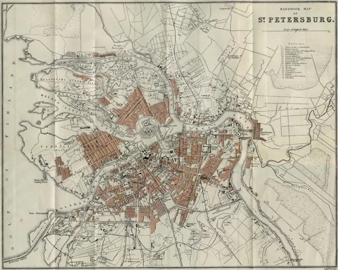
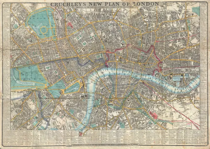
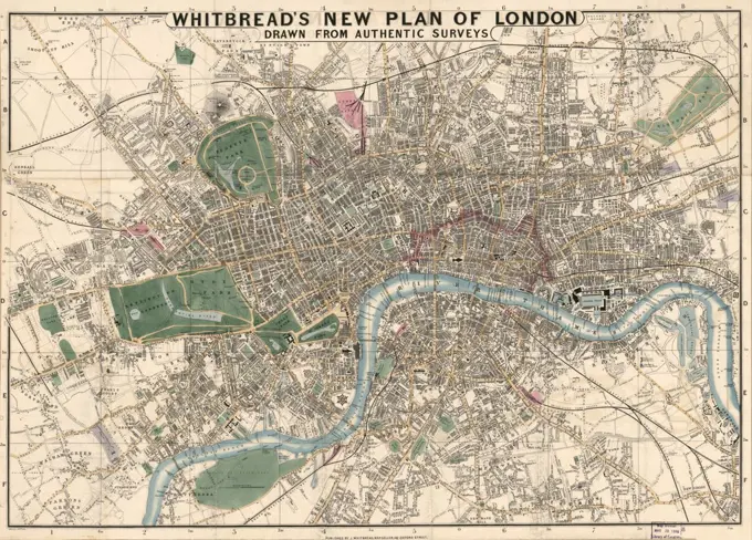
Historical City Maps

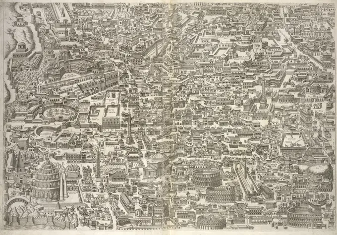
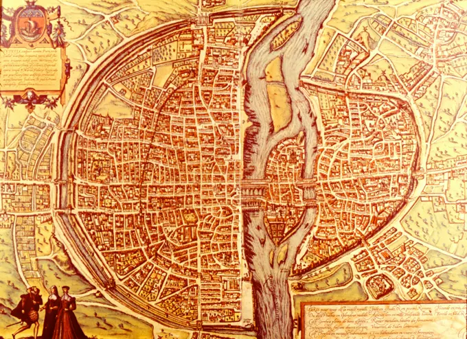
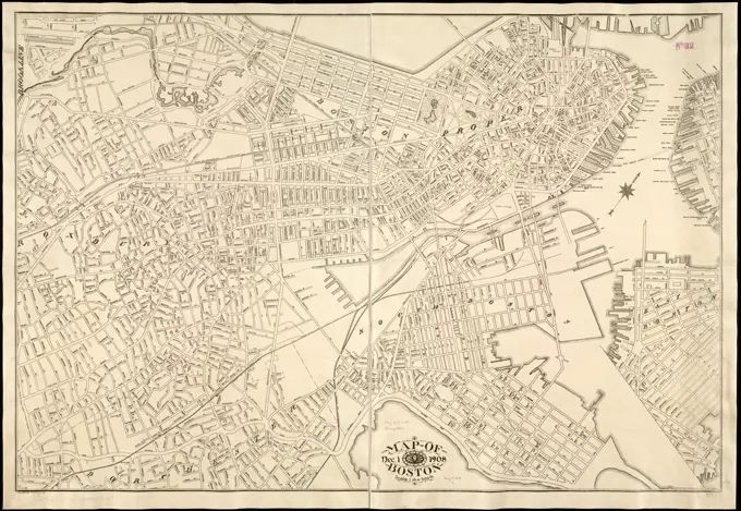
A collection of antique maps depicting various cities, including Utrecht, Tournai, and Ypres. Features ornate cartouches, coats of arms, and detailed layouts, showcasing historical city planning.

Map of Boston : Dec. 1, 1908 , Boston Mass., Maps Norman B. Leventhal Map Center Collection
450 assets in this story
6145-30262555
Overall plan of Vienna in four leaves, part nd k, Hof- und Staatsdruckerei Vienna -, printer
6145-59595071
Map of the Polder Nieuw -Helvoet, Jan voters, After A. Steyaart, 1701 - 1729 print Along the top the title. At the top left a cartouche with the weapon of the polder and two female figures with a corn sheaf. Grain is harvested in the background. At the top right a cartouche with information about the area. At the bottom right of a bowl: the scale of the scale is hundreds and vyftyh roach rods. Numbered at the top right: No. IX.  paper engraving / etching maps of separate countries or regions. coat of arms (as symbol of the state, etc.). polder, reclaimed land. harvest Polder Nieuw-Helvoet
4266-24721
Map of Petersburg by Anonymous master   Private Collection 1893 Lithograph Russia Cartography Architecture, Interior,History Graphic arts
6176-66080208
Old map of the Italian city of Venice. Italy.Venice by Adalbert de Beaumont (18091-1869) Le Tour du Monde 1862
6145-30266266
Floor plan of the city of Vienna without city fortifications according to home ownership and house numbers for the court district office, Franz Anton Joachim von Joachimsburg -, cartographer
6176-66094416
Plan of the city of Strasbourg according to the official development plan.  1904
6145-52973057
Plan and profile, the binding track
6145-29594452
Elsevier photo collection. Press conference municipal administration Amsterdam traffic plan American professor David A. Jokinen. plans, "Southern City road"; road extends ceintuurbaan (lower left) wetering circuit (top right) photo montage model. December 12, 1967. Amsterdam, Noord-Holland
6145-50568230
Bird's-eye view of Boston, showing the burned district , Great Fire, Boston, Mass., 1872, Aerial views, Boston Mass., Aerial views Norman B. Leventhal Map Center Collection
6145-55913018
Central business district urban renewal area Massachusetts r-82 A,B,C : disposition parcels. Accompanies a plan to stimulate the rehabilitation and renewal of Boston's downtown central business district area. Shows A, B and C projects in relation to the proposed overall CBD plan, pedestrian easement, truck tunnel easement and combined easement. Includes table listing parcel number, area, and permitted uses of commercial, transient housing, office, parking and public open space. "Map no. 4."... , Massachusetts  , Suffolk  ,county   , Boston  , Downtown Crossing Downtown Boston
6145-59563960
Map of Delft, Anonymous, 1652 print Map in a nutshell perspective. At the top left the Wapen van Holland, bottom left a legend 1-37. At the top right the Wapen van Delft. On Verso Dutch text.  paper engraving / etching / letterpress printing maps of cities. coat of arms (as symbol of the state, etc.) (+ province; provincial). coat of arms (as symbol of the state, etc.) (+ city; municipal) Delft
6145-50561115
Central business district urban renewal area Massachusetts r-82 A,B,C : disposition parcels , Boston Mass., Maps, Central business districts, Massachusetts, Boston, Maps, Land use, Massachusetts, Boston, Maps, City planning, Massachusetts, Boston, Maps, Urban renewal, Massachusetts, Boston, Maps, Right of way, Massachusetts, Boston, Maps
6145-50444051
Jansen Hermann (1869-1945), development plan and city expansion Anklam (12.12.1932): Grund and site plan in 2 parts, part a 1: 2000. Pressure on cardboard, 126.9 x 109.1 cm (including scan edges) Jansen Hermann  (1869-1945): Bebauungsplan und Stadterweiterung Anklam
6145-50444333
Jansen Hermann (1869-1945), Dortmund development plan (01.07.1939): Altstadt, site plan 1: 2000. Ink on transparent, 64.4 x 80.9 cm (including scan edges) Jansen Hermann  (1869-1945): Bebauungsplan Dortmund
4443-28729084
Letter from Prostitute Sono, 19th century, Sono, 11 11/16 × 22 1/4 in. (29.69 × 56.52 cm) (image)40 1/4 × 24 13/16 in. (102.24 × 63.02 cm) (mount, without roller), Ink on paper, collage mounting, Japan, 19th century, A letter from Sono, a celebrated courtesan, containing a New Year's greeting to the house in Yoshiwara in which she was formerly employed.
6145-50568621
Cruchley's new plan of London shewing all the new and intended improvements to the present time , London England, Maps Norman B. Leventhal Map Center Collection
6176-67076937
Colosseum print - north and south views, 1844. Panorama of London, one of a series made from daguerreotypes by Antoine Claudet, sketched by Henry Anelay and engraved by Ebenezer Landells. The daguerreotype images were taken from the top of York Column: 'The picture was not one complete whole, as it now appears upon the paper, but was divided upon a very great number of small silver plates. These had to be copied, and arranged each in its exact position, any small deficiences being filled in from nature. This labour required a talented artist, and occupied at the top of the column during many d
6145-54287042
Graphics. Photographs of Marshall Plan Programs, Exhibits, and Personnel
4409-26552
CIVITATES ORBIS TERRARUM - TOURNAI (BELGICA) - GRABADO - 1588. Author: GEORG BRAUN 1541-1622 / FRANS HOGENBERG. Location: PRIVATE COLLECTION.
1848-49519200
100.000, city, river Oder, map, cartography, railway lines, countryside, historical illustration 19th century, city map of Wroclaw, Poland, Europe
6176-67069359
Plan of the City of London showing churches, wards and guild halls, 1926-1927. Artist: Unknown
6145-59557821
Map of Amsterdam with the design and execution of the fourth explanation (third part), Julius Mülhüssen, After Daniel Stalpaert, 1721 - 1774 print Third part of a map of Amsterdam with the design and implementation of the fourth explanation, consisting of six parts. Numbered in the bottom right: 3.  paper etching / engraving maps of cities. coat of arms (as symbol of the state, etc.) (+ city; municipal). armorial bearing, heraldry Amsterdam
6145-59604081
Map of Landgoed Groenendaal in Heemstede, Unknown, 1940 - 1960 print   paper  maps, atlases Hemstede
463-3028
Map of city of Paris, copper engraving,
6145-51394873
Map of the city of Cambridge , Cambridge Mass., Maps Norman B. Leventhal Map Center Collection
6145-55914747
Map of the city of Cambridge. Shows wards and shows radial distances at 1/4-mile intervals from City Hall. North oriented toward upper left.... , Massachusetts  , Middlesex  ,county   , Cambridge
6145-54278656
Old Paris Map. Photographs of Marshall Plan Programs, Exhibits, and Personnel
6145-29096720
1848 Crutchley Pocket Map or Plan of London, England
6145-45869791
Map of Gorinchem, ca. 1701-1715; Gorcum. Map of the reinforcements to the city of Gorinchem, ca. 1701-1715. At the bottom left of a cartouche with the legend A-I in Dutch, decorated with four putti. Part of a collection of signed plans of reinforced places in the Netherlands and surrounding countries at the time of the Spanish Succession War (Part A).
6145-54269195
Rock's illustrated map of London. Exhibited in Faces and Places, at the Boston Public Library, Boston, MA, October 2003 - September 2004. MB (BRL). This inventive city map of London includes tiny facades of landmarks and prominent buildings such as Kensington Palace, Trafalgar Square, railway stations, wharfs, and the Houses of Parliament. The map is undated, but its time frame can be deduced from several clues. Because the map shows the Hungerford Bridge, built in 1845, but not Waterloo Station, built in 1848, it must have been printed between these two dates. Victorian London is laid out here in all its industrial triumph and tragedy. New steam railways (black solid lines) snake into the city from the edges of the map, while the orphanages, hospitals, and asylums, set aside for society's outcasts, are scattered throughout the city.. Illustrated map of London. Illustrated map of London, England  , London
4443-22033147
Sheet 3, Anteiqvae vrbis imago accvratissime ex vetvsteis monvmenteis formata, Bos, Jacobus, fl. 1549-1577, Ligorio, Pirro, ca. 1510-1583, Engraving, 15--, The 12 constituent sheets have been joined in pairs with a vertical overlap to form 6 sheets, each measuring 52 x 76 cm. and hinged in at the centerfold. If arranged in 3 horizontal rows of 2 each, the 6 double sheets would form an impression ca. 130 x 144 cm.: aerial view of Rome, 16th century. Relief shown pictorially; oriented with east at top.
6145-29907519
General Plan of the Paris Belt Railway / The Continuous Encore and its 9 sectors. (IT)
6145-59585366
Map of the city of Groningen, Anonymous, 1725 - 1790 print Map in a nutshell perspective. At the bottom left Cartouche with Legenda, the coat of arms of the city of Groningen a boy with the hate of freedom and the Dutch Lion with a bundle of arrows. At the bottom right another legend and a bowl: rod.  paper engraving / etching maps of cities. coat of arms (as symbol of the state, etc.) Groningen
7155-70378139
Paris town map (Lutetia), 16th cent. FRANCE.
4430-6056
geography/travel Turkey Istanbul view after Cristoforo Buondelmonti ""Liber insularum Archipelagi"" Venice 1422,
6145-29095802
1920 Leconte Pocket Map of Paris, France (with Eiffel Tower and Metro)
6145-48447188
Jansen Hermann (1869-1945), regulation of the old town in Stockholm (29.07.1933): Creation of the inner-city traffic roads: Basic plan 1: 6000. Light break on transparent, 34.3 x 25.4 cm (including scan edges) Jansen Hermann  (1869-1945): Regulierung der Altstadt, Stockholm
6145-59240733
Map of London after the big fire of 1666, 1666 print Map of London on which it is indicated the part of the city that was destroyed during the big fire of 12-15 September 1666. At the bottom of texts in 2 columns in Dutch, 2 columns in French and 2 columns in English with a description of the Events and a list of the burned streets and places within London. print maker: Northern Netherlandspublisher: Amsterdam paper etching / letterpress printing maps of cities London
4443-21167597
HYDE PARK. Rocque's map 1748, London, UK, 19th century engraving
6145-52359013
Map showing "52 Gramercy Park North" Cartographic. Maps. 1933 - 1939. Irma and Paul Milstein Division of United States History, Local History and Genealogy. Gramercy Park (New York, N.Y.)
6176-66087780
Map of Port Le Havre. Normandy, France. Europe. Old 19th century engraved illustration from La Nature 1888
6145-51397635
Nouveau Paris monumental : itinéraire pratique de l'etranger dans Paris , Paris France, Maps, Paris France, Description and travel, Subways, France, Paris, Maps Norman B. Leventhal Map Center Collection
6145-51395646
Mogg's strangers guide to London : exhibiting all the various alterations & improvements complete to the present time , London England, Maps Norman B. Leventhal Map Center Collection
6145-45829814
Map of London after the big fire of 1666; Flat roughly the burnt Stadt London; Image of the city of London. Asking how far the self is burned, and some plasozen nor remaining are / representation Curieuse de l'Embrasement de la Ville de Londres (...) / Delination of the citition London (...). Map of London on which the part of the city destroyed during the Great Fire from 12-15 September 1666. At the top left a commitment to the rebuilding plan. At the bottom of a bet with a face on the burning city at night. Down texts in 2 columns in Dutch, 2 columns in French and 2 columns in English with a description of the events and a list of the burned streets and places within London.
6145-50444264
Jansen Hermann (1869-1945), total development plan Ankara (November 14, 1928): Land use and traffic plan 1: 5000. Pressure on paper, 48.6 x 44.1 cm (including scan edges) Jansen Hermann  (1869-1945): Gesamtbebauungsplan Ankara
4409-4413
Plano de Madrid. Detalle de la Plaza Mayor. 17th century. Author: PEDRO TEIXEIRA (1592-1662) PEDRO TEXEIRA. Location: ARCHIVO HISTORICO DE LA VILLA. MADRID. SPAIN.
4220-21922791
Wren's plan for the rebuilding  of London after the Great  Fire.        Date: 1666
1838-22239215
Whitbread's New Plan of London, Drawn from Authentic Surveys, Published by J. Whitbread, 1853
6145-50444267
Jansen Hermann (1869-1945), total development plan Ankara (November 14, 1928): Land use and traffic plan 1: 5000. Pressure on paper, 48.5 x 44.1 cm (including scan edges) Jansen Hermann  (1869-1945): Gesamtbebauungsplan Ankara
4409-17341988
Map of the excavations of Pompeii, showing the Insulae excavated between 1874-1881 in red. Chromolithograph by J.G. Bach after an illustration by Emile Presuhn from his Les Plus Belles Peintures de Pompei (The Most Beautiful Paintings of Pompeii), Leipzig, 1881.
PREVIOUS
of 5
NEXT
2401 S. Ervay, Suite 206
Dallas, Texas 75215
United States
Get Started
Free ResearchMy BoardsMy Cart
For Creators
How To License Your ContentContributor PortalFrame of Mind
Resources
API accessPricing
Contact
+1 866 236 0087help@viewpictures.co.uk Contact form
©2026 View Pictures. All Rights Reserved. -A
This site is protected by reCAPTCHA and Google Privacy Policy and Terms of Service apply.