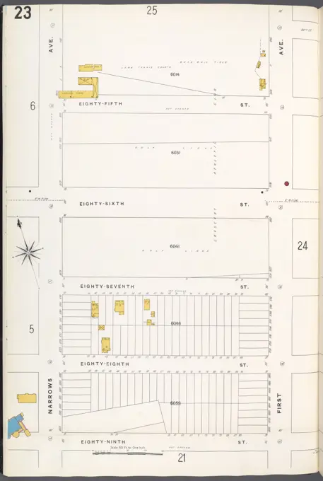
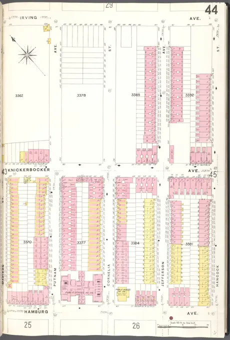
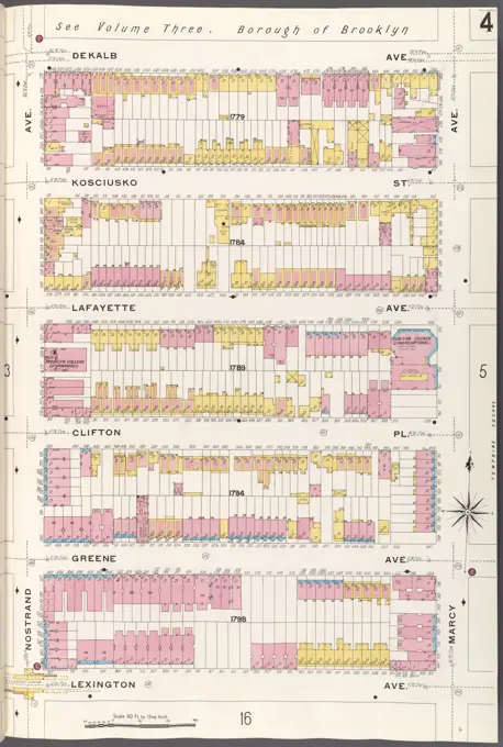
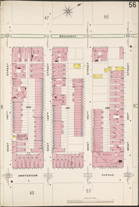
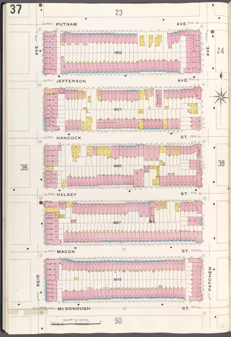
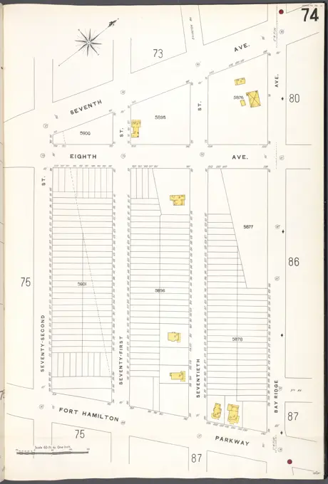
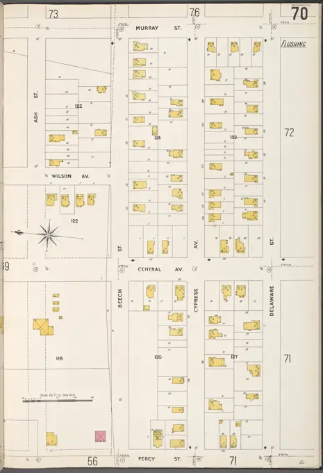
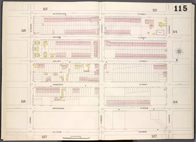
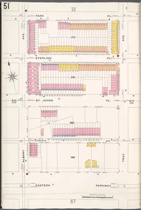
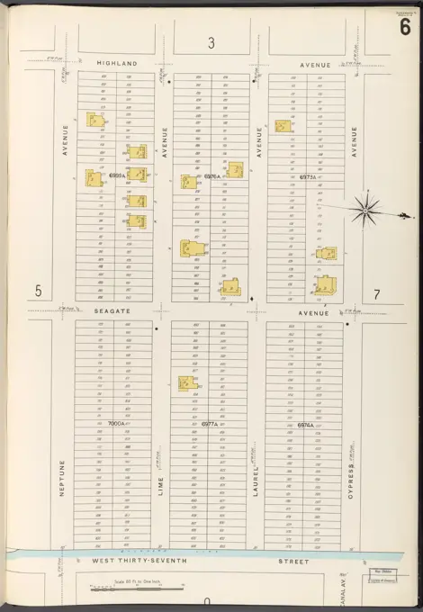
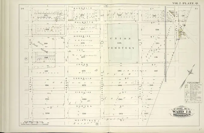
Historical Fire Insurance Maps
Detailed cartographic maps from 1884-1936 showing fire insurance information for neighborhoods in Brooklyn, NY. Features streets, properties, and urban layouts.
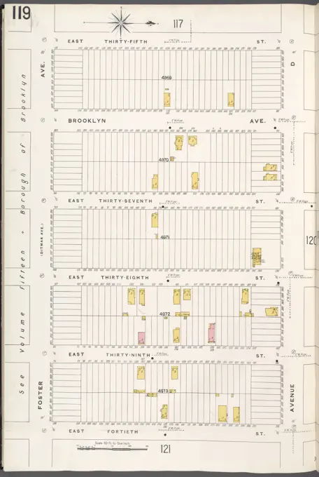
Detailed cartographic maps from 1884-1936 showing fire insurance information for neighborhoods in Brooklyn, NY. Features streets, properties, and urban layouts.