My Boards
View Pictures
  • My Boards

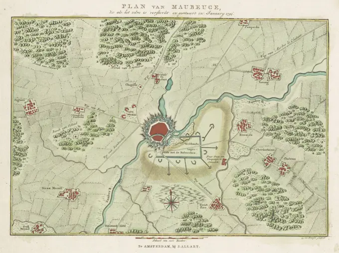
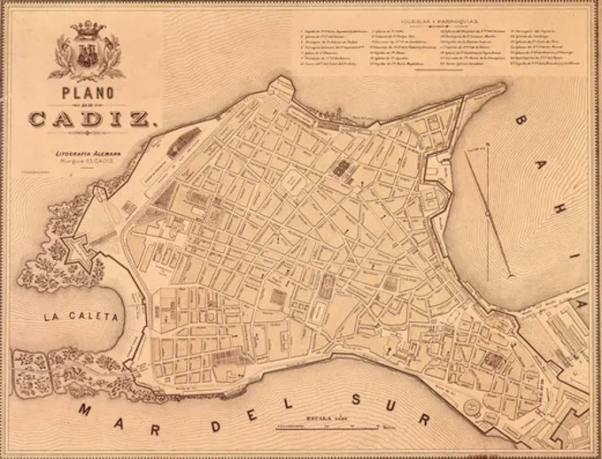
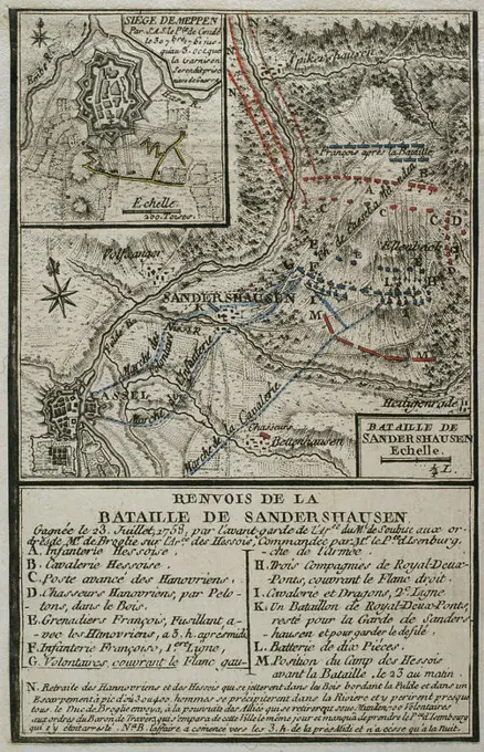
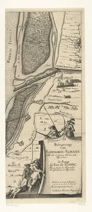
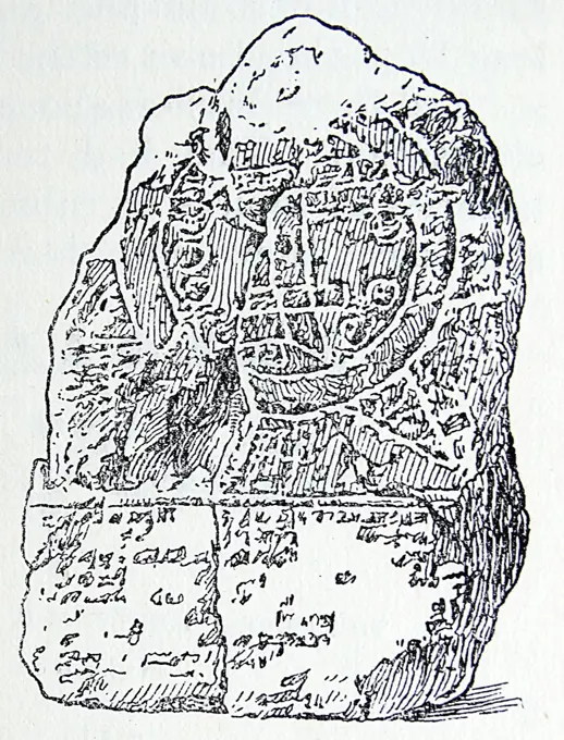
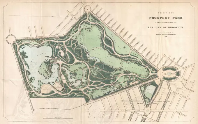
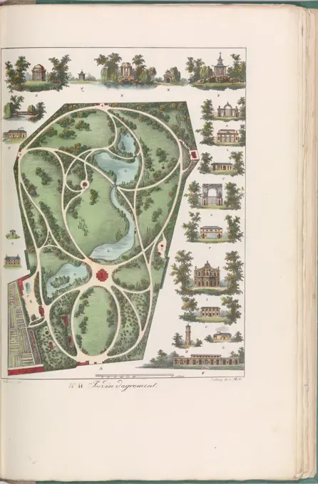
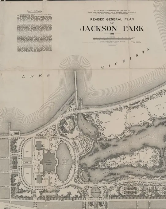
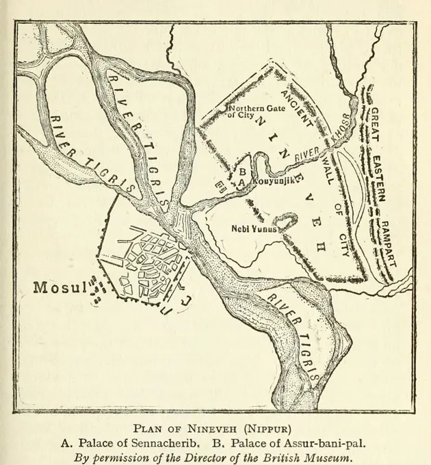
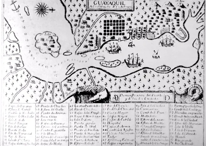
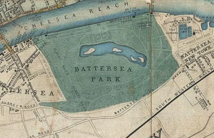
Historical Fortress Maps

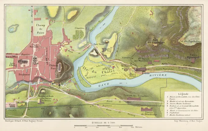
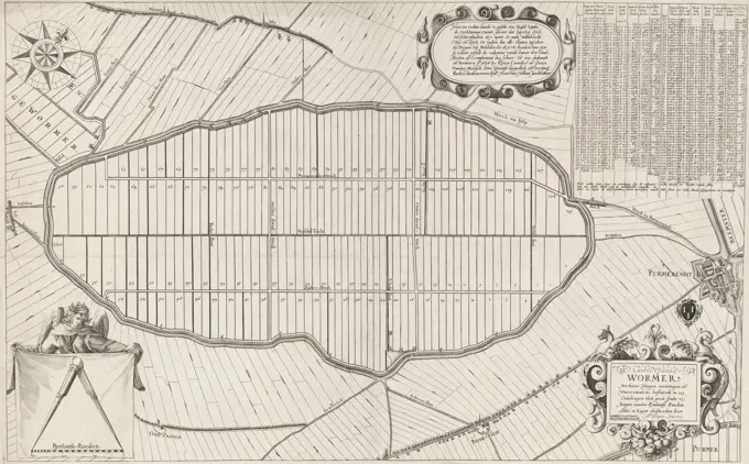
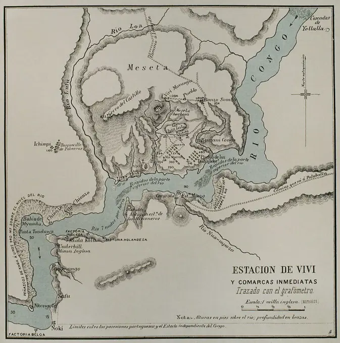
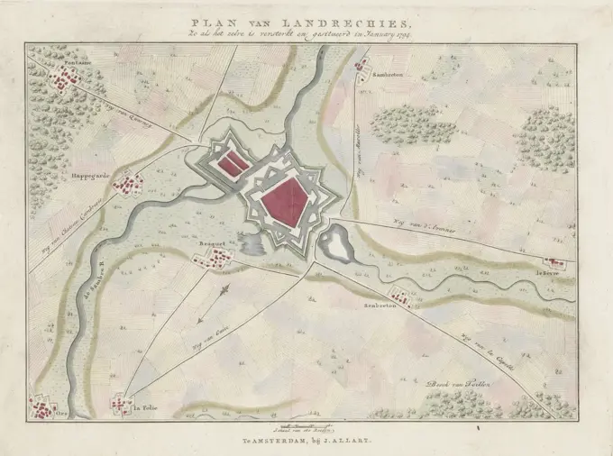
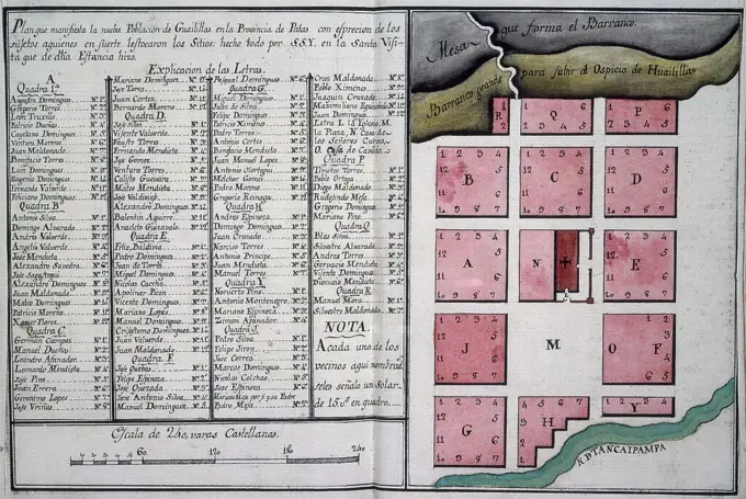
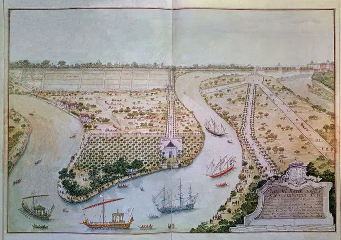
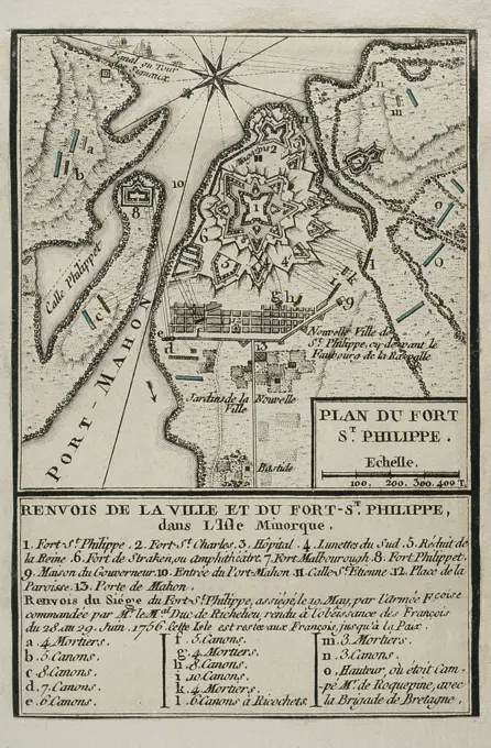
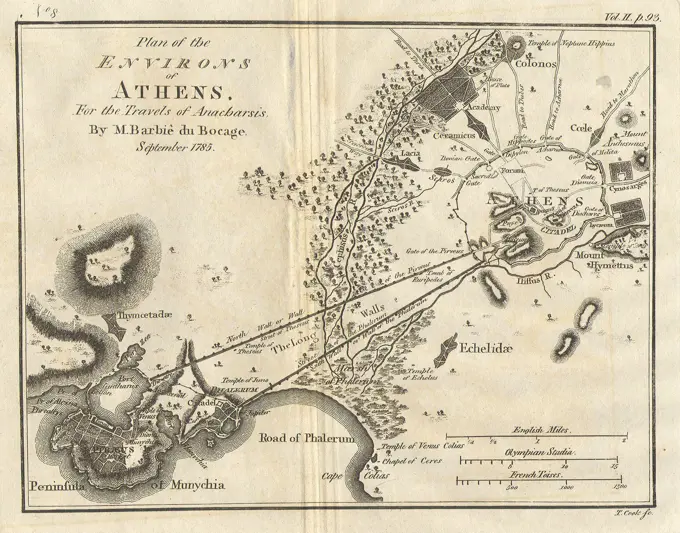
Detailed historical maps of various European fortresses, featuring intricate designs and annotations from the 17th and 18th centuries.

Map of the fortress of Bender by Wolff, Jeremias (1663-1724) / Private Collection / 1711 / Germany / Etching / History / 40,5x45 / Cartography
283 assets in this story
6145-54268439
Plan of Adams made by Thomas A. Brayton, dated June, 1831.... , Massachusetts  , Berkshire  ,county   , Adams
6145-46169161
Map of Antwerp and the Citadel, 1832; Plan of the city of Antwerp, Citadel etc: / Inclusion to the new Amsterdam Courant and the General Handelsblad, Poster No. 1. Map of Antwerp with the Citadel. In connection with the siege of the Citadel of Antwerp by the French army, December 1832. At the bottom of the legend 1-52 with the right a bet with two images of a battery on the citadel.
6145-59241794
Map of Le Quesnoy, ca. 1693-1695, 1693 - 1695 print Map of the reinforcements around the city of Le Quesnoy. Part of the third part (1695) of the print work in which the eight parts of Les Forces de l'Europe are published between 1693-1697. The printed work consists of 175 plates with plans (from Sébastien Le Prestre, Seigneur de Vauban) of renowned strong cities and fortresses in the Nine Years War. Title and inscriptions in French. print maker: Francepublisher: Paris paper etching maps of cities. fortress Quesnoy, the
6145-55914403
Map of Calhoun County, Michigan. Cadastral map showing landowners. "Entered according to Act of Congress by Geil, Harley & Siverd in the year 1858 ..." Includes county and city business directories, table of distances, and 32 ill. Insets: Ceresco -- Partello -- Harmonia -- Marengo -- Battle Creek -- Homer -- Bellevue, Eaton Co., Mich. -- Tekonsha -- Albion -- Marshall. BPL copy assembled, sectioned into 4 and mounted on cloth.... , Michigan  , Calhoun  ,county   , Battle Creek Michigan  , Calhoun  ,county   , Albion Michigan  , Eaton  ,county   , Bellevue Michigan  , Calhoun  ,county   , Ceresco Michigan  , Calhoun  ,county   , Homer Michigan  , Calhoun  ,county   , Marengo Michigan  , Calhoun  ,county   , Marshall Michigan  , Calhoun  ,county   , Partello Michigan  , Calhoun  ,county   , Tekonsha
4409-17518076
Slag bij Ramillies, 1706. Plan de la Battalie donné A Rammelis (title on object). Draughtsman: Samuel Du Ry de Champdoré (possibly). Dating: 1706. Place: Netherlands. Measurements: h 241 mm × w 220 mm. Museum: Rijksmuseum, Amsterdam.
6145-30274327
Pla,de la bataille,molwitz,du  dAvril, Plan of the Battle of Molwitz on April , Unknown
4220-21844569
The town in 1877 ; by now not  only the basilica but several  other buildings have been erected, but the riverbank is  unspoilt and the souvenir  shops have yet to come     Date: 1877
4443-21788851
Map of the polder de Wormer, or Wijdewormer, with plot division. Top left a compass rose. Bottom left an angel showing a canvas with an opened compass above a scale stick: 300 Rynlant rods. Top right a comprehensive table with information about the 119 lots numbered on the map. To its left a cartouche with ten-line text in Dutch. Bottom right the title cartouche. Above that is the coat of arms of Purmerend, next to a map of the town, Map of the Wormer lots, Caerte vande Wormer met haere wegen wateringen en waeter-molens ... (title on object), print maker: Laurens van Teylingen, (mentioned on object), print maker: Abraham Jansz. Deur, (mentioned on object), Reijer Cornelisz. Schout, (mentioned on object), Amsterdam, 1627 and/or 1668, paper, engraving, h 467 mm × w 743 mm
6145-59250683
Map of the River near Palembang, 1821, Anonymous, 1821 print Map of the river near Palembang with the location of the Dutch ships on 27 June 1821 during the second expedition to Palembang on Sumatra. On the left the legend 1-30. See also the Pendant. print maker: Netherlandspublisher: Amsterdam paper  maps of separate countries or regions Palembang
6145-44042209
Plan of the castle Sponvigen in Norway hearing under the Governement Friedrichshalle
6145-59575890
Design for defenses around the city of Maastricht, 1748, Matthaeus Seutter (III), 1748 print Plan for new defenses for Maastricht and neighborhood on the other side of the Maas, at the time of the siege of the city by the French under Maurits van Saksen and Lowendal from 15 April 1748. Fortifications designed by the engineer Albert de Herbort.  paper etching / engraving maps of cities. fortress Maastricht
6145-59239234
Siege of Schenckenschans (right magazine), 1635, 1635 print Right magazine of the map of the siege of the Fort Schenckenschans taken by the Spaniards on 28 July 1635 by the State Army under Frederik Hendrik, since July 30, 1635. Map of the river area with the Schenckenschans on the split of the Rhine and Waal. Part of the map with the advancing Spanish troops. At the bottom of a cartouche with the titles and some soldiers. The small right leaf from an unassembled whole consisting of three plates and two text magazines. The Hague paper etching capture of city (after the siege). maps of separate countries or regions Schenkhans
4409-17357859
Historia de Africa. Mapa de la estación de Vivi y comarcas inmediatas. El Congo y la Creación del Estado Independiente de este nombre. Historia de los Trabajos y Exploraciones Verificados, por Enrique M. Stanley. Editada en Barcelona, hacia 1890. España.
4443-73239178
Amsterdam, Allart, Johannes, Noordelijke Nederlanden, Baarsel, Cornelis van, Maps of fortified cities in the Austrian Netherlands in 1794, Plan van Landrechies, as it was fortified and situated in January 1794, Plan van de grenzen van Landrecies, 1794, Northern Netherlands, verso - stamped, Plan of the fortifications around the city of Landrecies, in January 1794. Part of a series of seven sheets with plans of fortified cities in the Austrian Netherlands at the time of the second French invasion under General Pichu in 1794., print, prent, map, prints, Frederik Muller Historieplaten, height 262 mm, width 352 mm, Dutch, 1761 - 1826-08-17, print maker, printmaker, 1794 - 1794, paper, papier, etching, etchings, engraving, engraving (printing process), hand coloring, Publication (Event), Publication, publisher
6176-66095035
Map and profile of Palmerston Island, part of  Cook Islands.  Vintage Illustration by Navigator Robert Henry. 1780s
6145-59237010
Map van Meurs with the reinforcements, 1597, 1647 - 1649 print Colored map of the city of Meurs with the reinforcements, at the time of the siege and the intake by the State Army under Prince Maurits and Count Willem Lodewijk van Nassau, 5 September 1597. At the top of the position of the Oversten Brederode and Duijvenvoorde. Two empty weapons in the upper corners. Double folded leaf printed on the back with text in Dutch. Northern Netherlands paper etching maps of cities. siege, position war. capture of city (after the siege) Die
6176-66916045
Plan of Union and Rebel position at Yorktown Virginia, USA Civil War 1862
6145-45767065
Plan of the Allies camp for Maastricht, 1703; Plan du Camp de l'Armée des Allies, com M Ande Par Monsr. D'Overquerque (...) 14 De May 1703. Card with the plan of the army camp of the Allies under the count of Ouwerkerk for Maastricht, May 14, 1703. Above left a cartouche for the legend AH with the Dutch lion that the French rooster with weapons threatens.
6145-48712767
Plan of Adams made by Thomas A. Brayton, dated June, 1831 ,. Massachusetts. Office of the Secretary of State
6145-59596044
Camping of the State Army near Breda, 1769, Anonymous, 1769 print View of the artillery camp of the State Army outside Breda, where the army held exercises in June 1769. At the top of a representation of the shooting exercises, below a map of the training area with the shooting area and the army camp, with a bowl of bowl at the bottom right: Echelle the 200 pass A 2 pied 1/2/size of 200 passes of 2 1/2 feet. In the middle a cartouche with the prince's tents. On the magazine under the plate legends in Dutch and French.  paper etching / engraving / letterpress printing manoeuvre ~ military training (+ artillery). (military) camp with tents Breda
6145-45825776
Siege of Alkmaar, 1573; The Siege of Alkmaar in the year 1573. The Siege of Alkmaar in 1573 with a plan of the city and the environment with the positions of the sealing Spanish troops. At the bottom left of the army camp of Don Frederik in Oudorp. In the overscription the Dutch title, in the caption of the legend 1-21.
6145-44184579
Plan of fenestrals attacked and prized by the army of his Altes the msgnr the duke of Savoye in the year 1708
4443-73239180
Amsterdam, Allart, Johannes, Northern Netherlands, Baarsel, Cornelis van, Maps of fortified towns in the Austrian Netherlands in 1794, Plan of Maubeuge, as it is fortified and situated in January 1794, Plan of the fortifications of Maubeuge, 1794, verso - stamped, Map of the fortifications around the town of Maubeuge, in January 1794. Part of a series of seven sheets with maps of fortified towns in the Austrian Netherlands at the time of the second French invasion under General Pichu in 1794., print, map, prints, Frederik Muller Historieplaten, height 257 mm, width 350 mm, Dutch, 1761 - 1826-08-17, print maker, printmaker, 1794 - 1794, paper, etching, etchings, engraving, engraving (printing process), hand coloring, Publication (Event), Publication, publisher
6145-30259601
Accurater Grund tore the city and Vestung , Ollmütz , Plan of the siege of Olmütz from, May  to July ,  with the citys floor plan, Rasp, publishing house
4435-3311
Map of Cdiz (19th c.). Engraving. SPAIN. ANDALUSIA. Cdiz. City Hall.
6145-59243254
Map of ULM, 1704, 1704 print Map of ULM, besieged by the imperial troops and taken on September 13, 1704. print maker: Northern Netherlandspublisher: The Hague paper etching maps of cities. siege, position war Ulm
6145-45995512
Military map of Lobositz; Plan De La Bataille De Lowositz. Military map of Lobositz (Czech Republic) with the battle of October 1, 1756 between the Prussians and the Austrians. This battle was the opening of the seven-year war (1756-1763).
6145-55914039
The island of St. Eustatius corruptly St. Eustatia. Relief shown by hachures. "To Monsieur le Marquis de Bouille, this plan engraved from the original in His Possession and made public by His Possession is respectfully inscribed by William Faden."... , Sint Eustatius  ,island
1788-34863
Cartography, Italy, 17th century. Map of Villa Contarini at Piazzola sul Brenta, Padua province.
4409-17221426
Map of the Battle of Sandershausen, Germany (July 23, 1758) and map of Meppen, 1761 (top). Published in 1765 by the cartographer Jean de Beaurain (1696-1771) as an illustration of his Great Map of Germany, with the events that took place during the War of the Seven Years. War from 1755 to 1763. Allied army in red and the French army in blue. Engraving. French edition, 1765. Military Historical Library of Barcelona (Biblioteca Histórico Militar de Barcelona). Catalonia. Spain. Author: Jean de Beaurain (1696-1771). French geographer.
6145-59307688
Fortress map of Blokzijl, Anonymous, c. 1650 - c. 1799 drawing At the top right of a legend, bottom right a bowl: range of 50 rods.  parchment (animal material). watercolor (paint). ink brush / pen maps of cities. fortress Blockzijl
6145-50536087
City of Lawrence, precincts 7 & 8, ward 4 ,. Lawrence Public Library Map Collection
6145-52376248
Plans ; Lan-chew in Shen-si ; Kan-chew in Shen-si; Chin-ywen fû in Quey-chew. Prints, Illustrations, Plans. 1745 - 1747. Rare Book Division
6145-30141139
Beleg van Schenckenschans (rechterblad), 1635; Belegeringe van Schencken-Schans, Met alle de nieuwe Forten ende Approchen / le Siege du Fort de schinc, Avecq toutes les Nouvelles Fortifications et Approches.Right magazine of the Map of the Siege of the Spaniards on July 28, 1635 for Surprise Fort Schenckenschans by the State Army under Frederik Hendrik, since July 30, 1635. Map of the river area with the Schenckenschans at the split of the Rhine and Waal. Part of the card with the advancing Spanish troops. At the bottom of a cartouche with the titles and a few soldiers. The small right blade from an unassembled whole consisting of three plates and two text sheets.
4409-21382693
CODEX TRUJILLO DEL PERU - MAP OF THE NEW POPULATION "GUALILLAS" IN THE PROVINCE OF PATAS - MANUSCRIPT - 18TH CENTURY. Author: MARTINEZ COMPAÑON BALTASAR. Location: PALACIO REAL-BIBLIOTECA. MADRID. SPAIN.
6145-50571242
The island of St. Eustatius corruptly St. Eustatia , Sint Eustatius, Maps, Early works to 1800 Norman B. Leventhal Map Center Collection
4409-5038
FALUAS CON FELIPE V POR EL TAJO A SU PASO POR ARANJUEZ - GRABADO SIGLO XVIII. Author: CARLO BROSCHI (1705-1782) FARINELLI. Location: PALACIO REAL-BIBLIOTECA. MADRID. SPAIN. FELIPE V DE BORBON.
6145-30259724
Incerable plan of the expansion of the city of Prague , Book illustration, Plan of the bombardment of the French PRAG by Austrian troops from August  to September , Martin Mansfeld -, Copper Engraver
6145-59587987
Map of Kennemerland and West -Friesland (part top left), Coenraet Decker, 1734 - 1739 print Part (top left) of a map of Kennemerland and West-Friesland.  paper engraving maps of separate countries or regions. coat of arms (as symbol of the state, etc.) Kennemerland. West Friesland. North Holland
4409-107002
MAPA DE NUEVA YORK - 1767 - Escala 1:10.000 (PARTE INFERIOR). Author: BERNARD RATZER (S XVIII). Location: BIBLIOTECA NACIONAL-COLECCION. MADRID. SPAIN.
6145-30259833
Plan from the Battaile which the Kaiserl, Royal = Hungarian Armée , Plan of the Battle of Didone near Piacenza on August , Unknown
6145-59244391
Map of the Fort Uitermeer, ca. 1701-1715, 1701 - 1715 drawing Map of the Fort Uitermeer aan de Vecht, ca. 1701-1715. In the middle of a cartouche with the legend a-f in Dutch, with two putti with a compass. Part of a collection of signed plans of reinforced places in the Netherlands and surrounding countries at the time of the Spanish Succession War (part A). Netherlands paper  fortress Fort Uitermeer
6145-44080187
Guastal plant
6145-30135197
Card with the location of the campsite of the Prussian troops at Rijswijk in Gelderland on September 16, 1787. Part of a group of fourteen numbered cards of the camps of the Prussian troops during the intervention in the Netherlands in September 1787.
6145-59641875
Map of the planned transformation of Lippelo Castle, Anonymous, 1877 - 1882 photomechanical print  Antwerp paper photolithography landscapes Lippel
6145-59239296
Map of Damvillers, 1637, 1670 - 1690 drawing Plan of the reinforcements around the city of Damvillers, besieged by the French army from 1 September and taken on the Spaniards on October 25, 1637. Low Countries (possibly) paper  maps of cities Damvillers
4443-19619292
A Map of Hardwick-Hall Farm, Isaac Johnson, 1754-1835, British, undated, Pen and brown ink and watercolor on vellum, Sheet: 15 × 22 1/2 inches (38.1 × 57.2 cm), architectural subject, designs, house, surveys, England, Europe, Norfolk, United Kingdom
4048-5411
1752 map of Philadelphia, Pennsylvania, the Delaware River, and regional settlements. Map includes an engraving of the 'State House,' now known as 'Independence Hall.'
4409-21478951
MAPA-PUEBLO Y FUERTE DE SAN AGUSTIN-FLORIDA-1595-CARTOGRAFIA SIGLO XVI. Location: Archivo General de Indias. Sevilla. Seville. SPANIEN.
6145-59563923
Map of the Delfland Water Board (twentieth part), Luggert van Anse, After Arnold Houbraken, After Pieter Haringh, 1712 - 1735 print Twentieth part of a map of the Delfland Water Board consisting of twenty -five parts.  paper engraving / etching maps of cities. armorial bearing, heraldry Delfland
4409-17221420
Map of Fort of St Philip (Castle of San Felipe), 1756. Island of Menorca. A British-controlled fortress, it was besieged by the French and taken on 29 June 1756. Engraving published in 1765 by the cartographer Jean de Beaurain (1696-1771) as an illustration of his Great Map of Germany, with the events that took place during the Seven Years War. French army in blue. French edition, 1765. Military Historical Library of Barcelona (Biblioteca Histórico Militar de Barcelona). Catalonia. Spain. Author: Jean de Beaurain (1696-1771). French geographer.
6176-66902484
A 1754 map of the island of St Croix by Danish cartographer I.M. Beck.
4409-21485704
American Revolutionary War (1775-1783). Map of the defense network at West Point, including the Great Chain, Constitution Island, Fort Clinton, and Fort Putnam, 1780. Engraving. Colored.
6145-59024175
Poisson, Michel, plan of the Place Louis XIV section. (Dummy title). Carnavalet museum, history of Paris.
6145-48717911
Sketch of Bunker Hill Battle , Bunker Hill, Battle of, Boston, Mass., 1775, Maps, Boston Mass., History, Revolution, 1775-1783, Maps, United States, History, Revolution, 1775-1783, Maps Norman B. Leventhal Map Center Collection
6145-30342346
unknown artist, nineteenth century, A Collection of Surveys of Scottish Estates of the Earl of Selkirk: Torrs, undated. Graphite, watercolor, gray wash, pen and black ink on slightly textured, moderately thick, cream wove paper.
6145-51392593
A description of the towne of Mannados or New Amsterdam : as it was in September, 1661, lying in lattitude 40 de. and 40 m., anno domini 1664 , Fortification, New York State, New York, Maps, Early works to 1800, Facsimiles, Manhattan New York, N.Y., Maps, Early works to 1800, Facsimiles Norman B. Leventhal Map Center Collection
6145-59587094
Fortress map of Wijk bij Duurstede, Anonymous, 1649 print Left and top right an empty coat of arms. Bottom left a bowl: 40 Rhijnlandse rods.  paper etching / engraving maps of cities Wijk bij Duurstede
1788-34345
Cartography, Italy, 16th century. Lucca, layout of the city and its defence system in the second half of the century.
6145-50661520
Utrecht in map, the dots. / The new fortifications.
6145-29096231
1785 Bocage Map of Athens and Environs, including Piraeus, in Ancient Greece
6145-59597841
Vesting map of Geldern, Caspar Merian, after Johann Merck, 1654 - c. 1700 print Vesting map of the city of Geldern. At the top left a legend 1-10. At the bottom right a bowl: Scala von 50 Ruhten.  paper etching maps of cities. coat of arms (as symbol of the state, etc.) (+ city; municipal) Money
4443-21784316
Part (top left) of a map of the Zijpe polder, Map of the Zijpe and Haze polder (top left) Image of the Zyp. Haer waere gelegentheit van dyckage, wegen, watringen en schey-slooten, alle de hofsteden, wooningen en watermolens inde selve geleegen: mitsgaders rechte aenwysinge van de scheydinge haerder groote en kleyne letteren. Begrypende in haar omring de somme van 9060 morgens, yder tot 600 Roeden Hontsbosscher maet (title on object), print maker: Reinier van Persijn, Jan Dirksz. Zoutman, hoofdingelanden en heemraden van de Zijpe- en Hazepolder Dijkgraaf, Gouda, 1665 - 1760, paper, engraving, etching, h 480 mm × w 545 mm
1746-19700292
Babylonian Map of the World on Clay. Showing the ocean surrounding the world and the position of Babylon on the Euphrates.
6145-29909547
Review July 14, 1880 / Distribution of Flags (IT)
6145-45743501
Map of Damvillers, 1637; Danvillers. Plan of the reinforcements around the city of Damvillers, besieged by the French army from 1 September and occupied on the Spaniards on October 25, 1637.
6145-29095496
1868 Vaux and Olmstead Map of Prospect Park, Brooklyn, New York
6145-29230205
Plans Raisonnés de Toutes les Espèces de Jardins 1820 Designed by Gabriel Thouin French. Plans Raisonnés de Toutes les Espèces de Jardins. 1820. plates: hand colored lithography. Published by L'Imprimerie de Lebéque , Paris. Books
6145-52359026
Tabula Asiae Ptolemy, active 2nd century. Cartographic. Maps. 1542. Rare Book Division. Atlases, Early maps, Geography
6145-30259675
The siege of the Cittad, From Mo- , dena Sambt its Kurtzen description , exercise , Plan of the siege of Modena , Unknown
1848-19367769
Karte von Jerusalem zur Zeit Jesus Christus, Historisch, digital restaurierte Reproduktion einer Originalvorlage aus dem 19. Jahrhundert
4443-75464867
Revised general plan for Jackson Park, 1895. Issued in Brookline, Mass by Olmsted, Olmsted and Eliot. The map measures 58 x 80 cm and includes the text 'The Design' at the margin. It pertains to Jackson Park in Chicago, Illinois
4128-38525022
Plan of Nineveh
6145-59244960
Map of the Battle of Dettingen, 1743, 1743 print Map of the Battle of Dettingen on 27 June 1743 between the army of the Allies (British under King George II and Germans) and the French army. The battle ended in a victory for the Allies. On the leaf under the plate a description of the course of the battle, a copy of an English letter and the Legends A-M and 1-7. print maker: Northern Netherlandspublisher: Amsterdam paper etching / letterpress printing maps of separate countries or regions. battle (+ land forces) Dettingen. Aschaffenburg
4409-17518103
Plattegrond van Schoonhoven, ca. 1701-1715. Schoonhoven (title on object). Draughtsman: Samuel Du Ry de Champdoré. Dating: 1701 - 1715. Place: Netherlands. Measurements: h 482 mm × w 616 mm. Museum: Rijksmuseum, Amsterdam.
6176-67068311
'Port of London Authority - Map', 1937. The River Thames at Tilbury, showing the docks, railway station, passenger landing stage, cargo jetty, lock and basin. From "The Said Noble River", by Alan Bell. The Port of London Authority, London, 1937
6145-59595055
Map of the Water Board of Rijnland (eighth part), Cornelis Danckerts (I), 1687 print Eighth part of a map of the Rijnland Water Board, consisting of fifteen parts.  paper engraving / etching maps of separate countries or regions. polder, reclaimed land Rhineland
6145-45870069
Map of Naarden, ca. 1701-1715; Naarden. Map of the reinforcements to the city of Naarden, ca. 1701-1715. At the bottom left of a cartouche with the legend A-F in Dutch, with three putti as a sea straight. Part of a collection of signed plans of reinforced places in the Netherlands and surrounding countries at the time of the Spanish Succession War (Part A).
1746-21120576
Map of the city of Guayaquil by Dionisio de Alcedo Herrera (1690--1777) a historian and geographer and a Spanish bureaucrat in America occupied the dignities of President of the Audiencia of Quito and Governor of Panama
6145-45392036
Wszyscy Święci w MNK unknown
4443-21725751
Plan of Slot Loevestein, ca. 1701-1715, Samuel Du Ry de Champdoré, 1701 - 1715, Plan of the fortifications around Slot Loevestein, ca. 1701-1715. Bottom right a cartouche with the legend A-D in Dutch, with three putti holding compasses and measuring tape. Part of a collection of drawn plans of fortified places in the Netherlands and surrounding countries at the time of the War of the Spanish Succession (part A)., draughtsman: Samuel Du Ry de Champdoré, Netherlands, 1701 - 1715, paper, h 482 mm × w 620 mm
6145-45870558
Map of Slot Loevestein, ca. 1701-1715; Loevestyn. Map of the reinforcements to Slot Loevestein, ca. 1701-1715. At the bottom right of a cartouche with the legend A-D in Dutch, with three putti with passers and measuring tape. Part of a collection of signed plans of reinforced places in the Netherlands and surrounding countries at the time of the Spanish Succession War (Part A).
6145-29095243
1852 Davies Case Map or Pocket Map of London, England
PREVIOUS
of 3
NEXT
2401 S. Ervay, Suite 206
Dallas, Texas 75215
United States
Get Started
Free ResearchMy BoardsMy Cart
For Creators
How To License Your ContentContributor PortalFrame of Mind
Resources
API accessPricing
Contact
+1 866 236 0087help@viewpictures.co.uk Contact form
©2026 View Pictures. All Rights Reserved. -A
This site is protected by reCAPTCHA and Google Privacy Policy and Terms of Service apply.