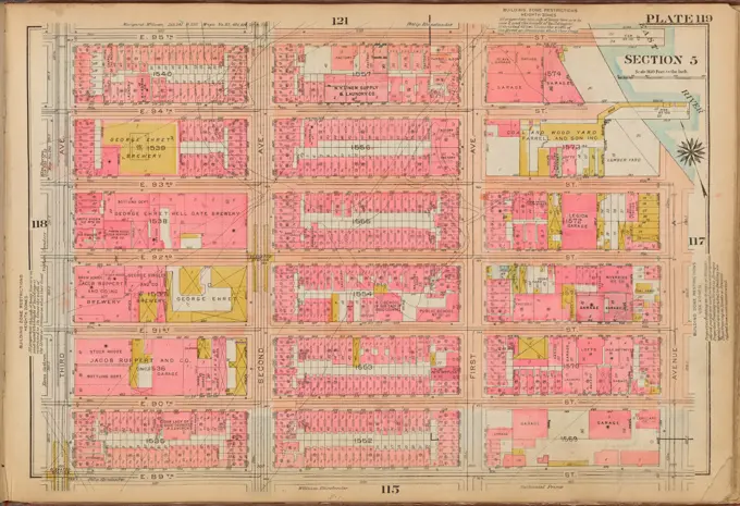
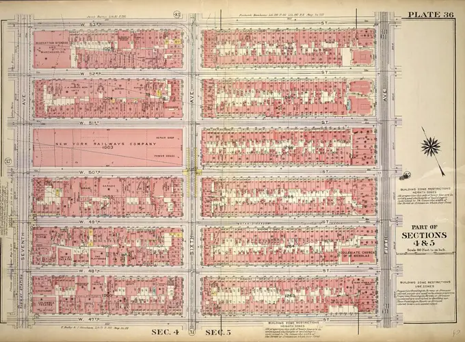
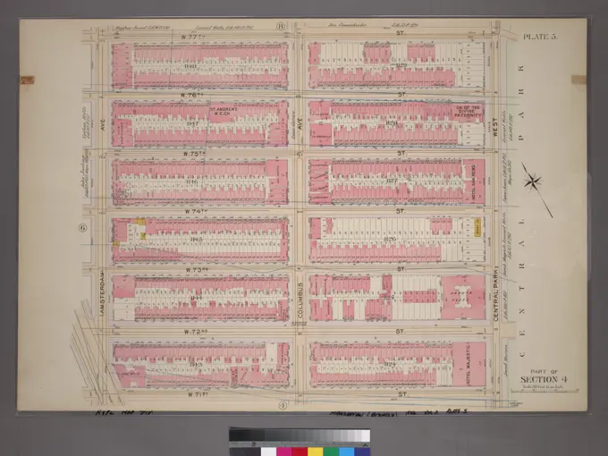
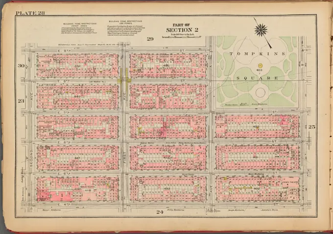
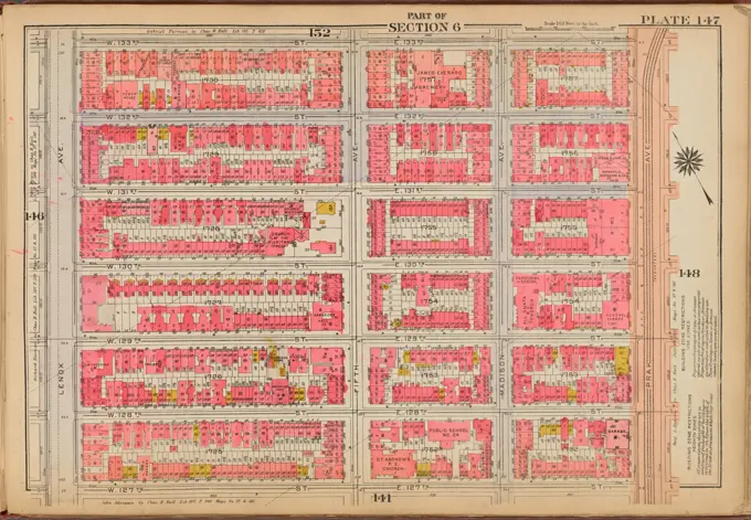
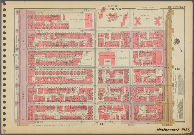
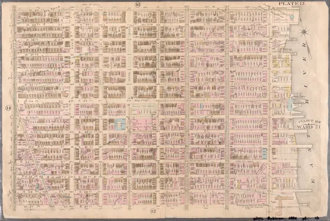
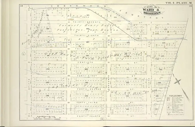
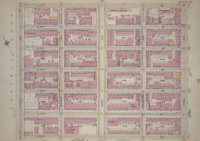
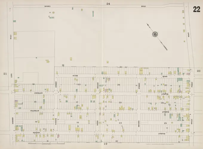
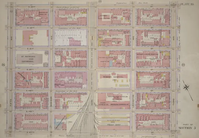
Historical Manhattan and Boston Maps
Detailed historic maps depicting sections of Manhattan and Boston, showcasing real property layouts, streets, and land use from the late 19th to early 20th centuries.
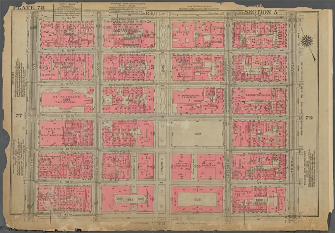
Detailed historic maps depicting sections of Manhattan and Boston, showcasing real property layouts, streets, and land use from the late 19th to early 20th centuries.