My Boards
View Pictures
  • My Boards
← Documents & Records

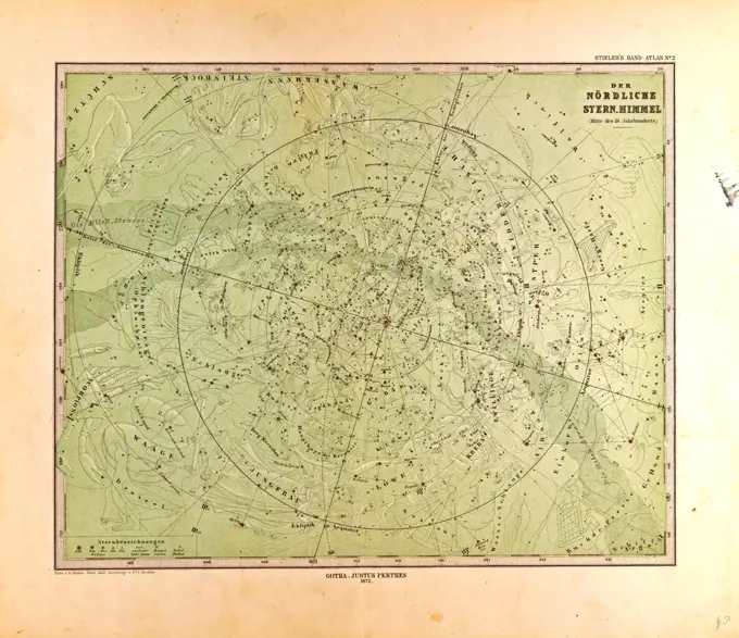
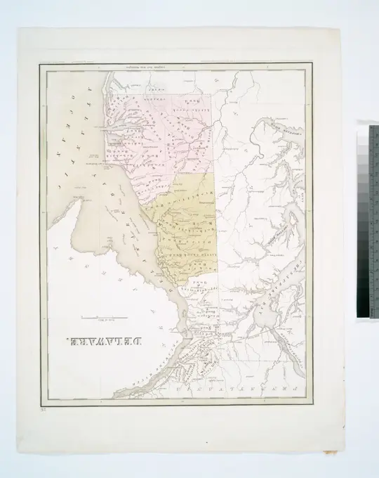
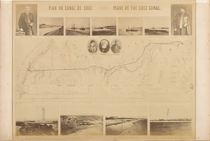
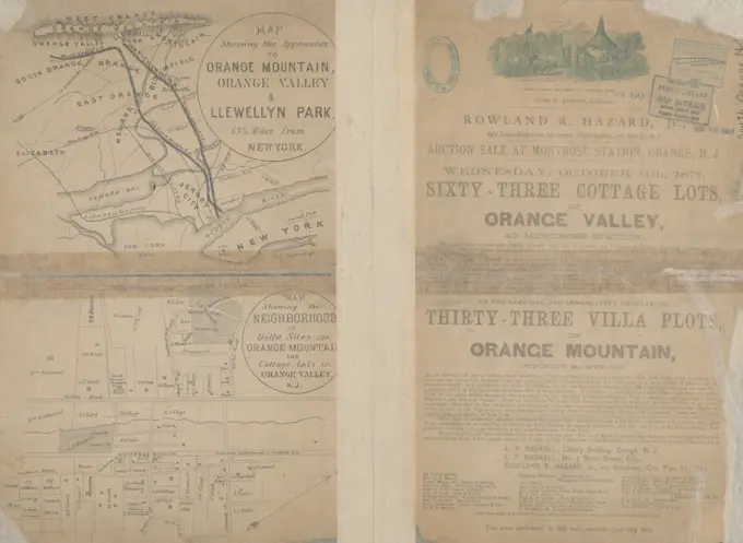
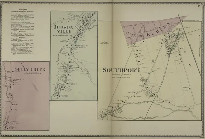
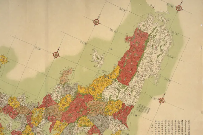
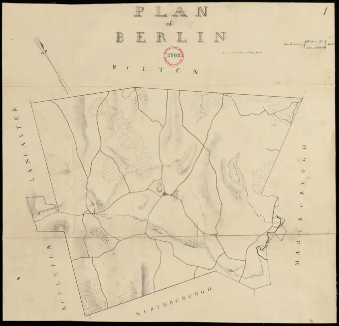
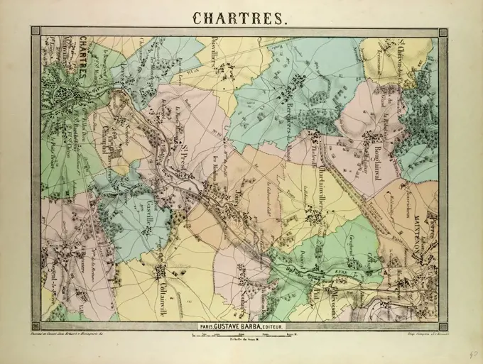
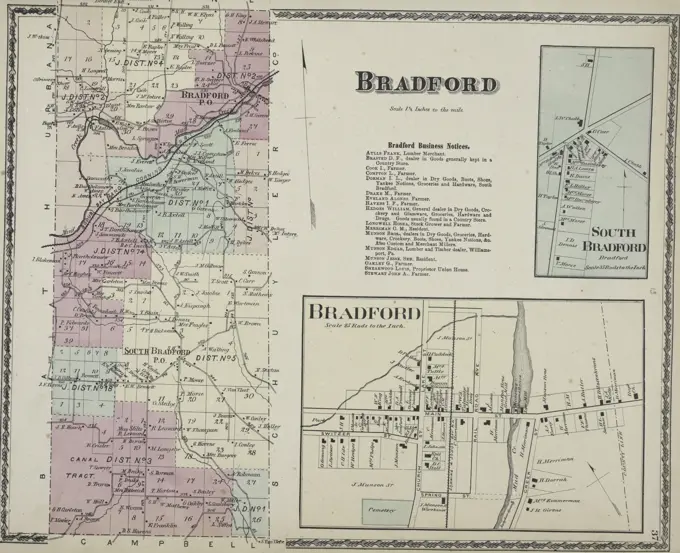
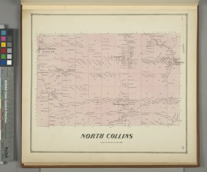
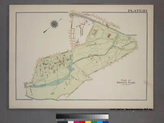
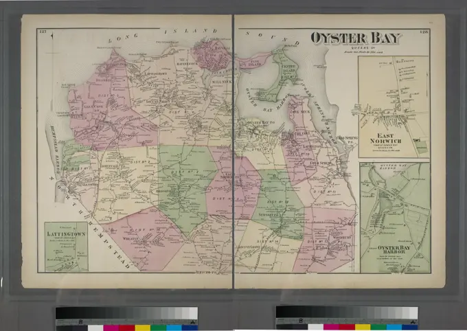
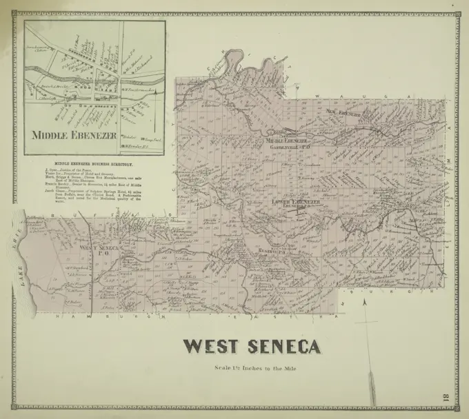
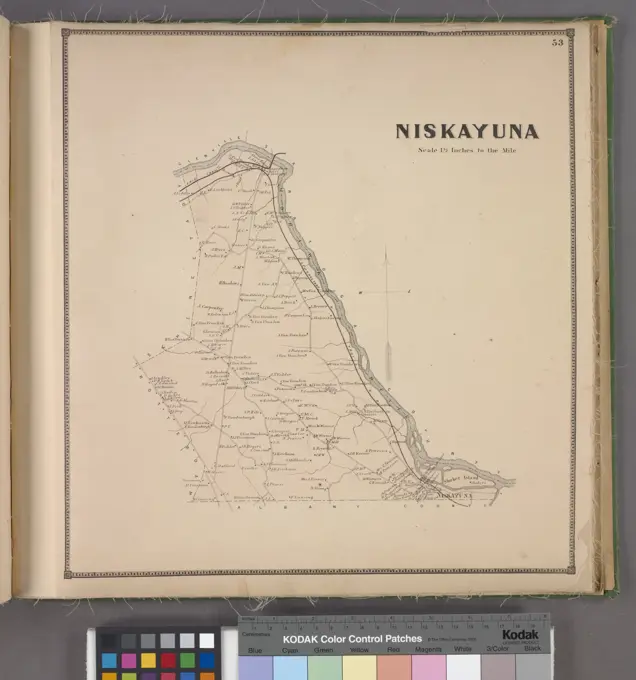
Historical Maps of America

Collection of historical maps showcasing significant battles and locations in America, featuring detailed illustrations and annotations from the 17th to 19th centuries.

Plan of Dedham made by John G. Hales, dated 1831 ,. Massachusetts. Office of the Secretary of State
263 assets in this story
6145-50512001
Plan-indicateur de la ville et de la campage de Cannes , Cannes France, Maps Norman B. Leventhal Map Center Collection
6145-55180665
Plate 78: Town of Poundridge, Westchester Co. N.Y. Cartographic. Atlases, Maps. 1872. Lionel Pincus and Princess Firyal Map Division. Westchester County (N.Y.), Real property , New York (State) , Westchester County
4443-1848
Northern Star SkyGotha, Justus Perthes, 1872, Atlas
6145-50602878
A760329 NON-EVENT SURVEILLANCE SENSORS EXP K. WILEY (PROJECT ENGINEER) MAR 12 76 EG&G/NTS PHOTO LAB Publication Date: 3/12/1976  CHARTS; EDGERTON, GERMESHAUSEN & GRIER; EG&G; EQUIPMENT & INSTRUMENTS; INSTRUMENTS & EQUIPMENT; MAPPING; MAPS; NEVADA; NEVADA TEST SITE; NTS; NUCLEAR ENERGY TECHNOLOGY; OUTSIDE; SENSORS; SURVEILLANCE SENSORS; SURVEILLANCE SYSTEMS; TEST SITES; UGT; UNDERGROUND TESTING; WILEY, K.; SURVEILLANCE SENSORS EXP  historical images. 1972 - 2012. Department of Energy. National Nuclear Security Administration. Photographs Related to Nuclear Weapons Testing at the Nevada Test Site.
6145-55958518
Map of Long Island and the southern part of Connecticut Colton's map of Long Island Cartographic. Maps. 1883. Lionel Pincus and Princess Firyal Map Division. Roads , New York (State) , Long Island (N.Y.), Railroads , New York (State) , Long Island (N.Y.), Long Island (N.Y.), Long Island (N.Y.) , Administrative and political divisions, New York (State) , Long Island (N.Y.)
6145-55955884
Map of Poland, showing the partitions, page 499 text. Maps. 1863-05-02. General Research Division
4443-75469401
District Columbia, 1828, Geographisches Institut (Weimar, Germany). Additional, Geographisch-statistische und historische Charte von Columbia., 1828., Weimar. Publisher, im Verlage des Geographischen Instituts, Washington (D.C.)., 1 map, hand-colored; 27 x 26 cm, on sheet 39 x 51 cm
6145-54302173
The Development of Southern Mexico, 1510-1543. Original caption: The Colonization of North America, 1429-1783, by H. E. Bolton & TM Marshall, page 35 New York, 1920.
6145-54549421
Gallatin Township Bourquin, F. (Frederick), 1808-. Cartographic. Atlases, Maps. 1873. Lionel Pincus and Princess Firyal Map Division. Columbia County (N.Y.), Real property , New York (State) , Columbia County, Business enterprises , New York (State) , Columbia County
6145-46758757
Kiirunavaara.Kiruna Many Kronology.ur Carl Sahlin Mountain History Collection.
6145-58892079
Land Utilization Town of Wareham. Land Utilization Town of Wareham
6145-51961198
Maps. Original caption: Miscellaneous (maps).. 1923 - 1955. Central Plains Region (Kansas City, MO). Photographic Print. Department of the Interior. Bureau of Indian Affairs. Pine Ridge Agency. 9/17/1947-. Photographs
4443-21869981
Map of Egypt 1900
6145-59618045
Map with three images of places along the Thames, in or after 1878 - in or before 1879 photomechanical print. print Right: View of Thames Ditton and on the Hampton Court Palace, right: Coronation Stone in Kingston. Surrey paper engraving river. palace Thames Ditton. Hampton Court Palace. Kingston-upon-Thames
6145-54548407
Delaware Cartographic. Maps. 1838. Lionel Pincus and Princess Firyal Map Division. Delaware , Maps
6145-55959757
New York Morse, Sidney E. (Sidney Edwards), 1794-1871. Cartographic. Maps. 1842 - 1845. Lionel Pincus and Princess Firyal Map Division. United States
6145-46232201
Photo production of a map with the range of the Suez Canal, photos of Places Ergangs and Van Ismael Pasha and Ferdinand De Lesseps. Part of photo album by Robert Daniel Crommelin (1841-1907).
6145-48680502
Outline plan showing the growth of Boston , Cities and towns, Growth, Maps, Boston Mass., Maps Norman B. Leventhal Map Center Collection
4443-75470127
Auction sale at Montrose Station, Orange, N.J. sixty-three cottage lots in Orange Valley at Montrose Station; thirty-three villa plots on Orange Mountain, opposite Montrose., 1871., 110 Broadway, cor. Pine St., New York City. Publisher, Rowland R. Hazard, Jr. Subjects include real property auctions and real property in New Jersey, particularly in Orange (N.J.) and South Orange (N.J.), within the New York Metropolitan Area., 4 maps on 1 sheet; 32 x 20 cm or smaller, on a sheet 32 x 43 cm, designed to be folded to 32 x 20 cm
4443-75465487
Business directories for Quaker Street Village, Duanesburgh Village, Bramans Corners Villages, and Mariaville Village, all published in 1866 by Stone & Stewart in Philadelphia. Contains information about each village and their respective business directories
4443-75473773
Southport Subscriber's Business Directory; Seely Creek Village; Judsonville Village; Southport Village, 1869, New York, Publisher, Beers, Ellis & Soule, Chemung County (N.Y.), Real property, New York (State), Chemung County, Business enterprises, New York (State), Chemung County
160-2663
antique map
6145-43818341
Plan of Berlin made by Henry Wilder, dated June 1830 ,. Massachusetts. Office of the Secretary of State
4443-11192
MAP OF CHARTRES, FRANCE
6145-55167637
Russell's map of Paris and fortifications.... , France  , Île-de-France  ,region   , Paris
6145-48559329
Plan of Concord River from East Sudbury to Billerica Mills, 22.15 miles : to be used on a trial in the S. J. Court, Sudbury and Eat Sudbury Meadow Corporation vs. Middlesex Canal, taken by agreement of parties , Dams, Flood control, Law & legal affairs, Floodplains, Child, David Lee, 1794-1874, Damon, Thomas, 1819-1880, Heard, David, Wight, John B. John Burt, 1790-1883, Cutting, Charles, 1822-1914, Damon, Jude, 1811-1892, Gleason, Abel, Heard, Horace, 1804-1890, Heard, Newell, 1789-1865, Heard, Richard, 1787-1872, Rice, Edward J., 1824-1892, Thomas, Samuel Maynard, 1814-1897. Wayland Historical Maps and Plans
6145-54549600
Port Ontario Village; Port Ontario Business Directory; Holmesville Business Directory; Holmesville Village; Pulaski Business Directory; Pulaski Village Cartographic. Atlases, Maps. 1867. Lionel Pincus and Princess Firyal Map Division. Oswego County (N.Y.), Real property , New York (State) , Oswego County, Business enterprises , New York (State) , Oswego County
6145-54563949
Northern Lebanon. Prints, Illustrations. 1881 - 1884. Dorot Jewish Division. Lebanon
6145-55181088
Watertown Business Directory. ; North Watertown Village; Juhelville Village Cartographic. Atlases, Maps. 1864. Lionel Pincus and Princess Firyal Map Division. Jefferson County (N.Y.), Real property , New York (State)
4443-75471316
South Bradford Village; Bradford Township; Bradford Business Notices; Bradford Village, 1873, D.G. Beers & Co., 1873, Philadelphia; Publisher, D.G. Beers; Steuben County (N.Y.), Real property, New York (State), Steuben County; Business enterprises, New York (State), Steuben County
6145-54602749
The Massachusetts interstate highway program
6145-54548449
Tableau d'assemblage pour Carte topographique de l'Égypte, en 47 feuilles et pour la Carte géographique en 3 feuilles. Gravé au Dépôt général de la guerre, à l'échelle de 1 milimètre pour 2500 mètres. Cartographic. Maps. 1828. Rare Book Division. Egypt
6145-51395130
Map of the town of Easton, Bristol County, Massachusetts : surveyed by order of the town , Real property, Massachusetts, Easton Town, Maps, Landowners, Massachusetts, Easton Town, Maps, Easton Mass. : Town, Maps Norman B. Leventhal Map Center Collection
6145-55181108
Burtonville Village; Charleston Four Cor's. Village; Charleston Business Directory; Charleston Montgomery Co. Township Cartographic. Atlases, Maps. 1868. Lionel Pincus and Princess Firyal Map Division. Real property , New York (State) , Montgomery County, Real property , New York (State) , Fulton County, Montgomery County (N.Y.), Fulton County (N.Y.)
6145-55957739
Outline map of Essex County, New York. Cartographic. Atlases, Maps. 1876. Lionel Pincus and Princess Firyal Map Division. Essex County (N.Y.), Maps
6145-55181223
Pierrepont Center Village; East Pierrepont Village; Pierrepont Centre Business Directory. ; East Pierrepont Business Directory. ; Part of Pierrepont Embracing the original Township of De Witt and part of Clare Township Cartographic. Atlases, Maps. 1865. Lionel Pincus and Princess Firyal Map Division. Saint Lawrence County (N.Y.), Real property , New York (State) , Saint Lawrence County
6145-48720014
New map of Rhodesia : compiled from the latest authentic data, private and official surveys, etc. with special inset maps , Zimbabwe, Maps Norman B. Leventhal Map Center Collection
6145-43861843
Tracciamento della strada di ferro da Milano a Como , Railroads, Italy, Lombardy, Maps, Lombardy Italy, Maps Norman B. Leventhal Map Center Collection
6145-54550439
Map showing the lines of the Interborough Rapid Transit Co. Interborough Rapid Transit Company. Cartographic. Maps. 1904. Rare Book Division. Subways , New York (State) , New York
6145-54549580
Depeyster Village; De Peyster Business Directory. ; De Peyster Township Cartographic. Atlases, Maps. 1865. Lionel Pincus and Princess Firyal Map Division. Saint Lawrence County (N.Y.), Real property , New York (State) , Saint Lawrence County
6145-50569623
Plano general del f.c. de Veracruz al Pacifico , Railroads, Mexico, Veracruz-Llave State, Maps, Veracruz-Llave Mexico : State Norman B. Leventhal Map Center Collection
6145-45636837
Map of Switzerland.
6145-55181105
Amsterdam Montgomery Co. Township; Hagman's Mills Business Directory; Rock City Business Directory; Hagmans Mills Village; Rock City Village Cartographic. Atlases, Maps. 1868. Lionel Pincus and Princess Firyal Map Division. Real property , New York (State) , Montgomery County, Real property , New York (State) , Fulton County, Montgomery County (N.Y.), Fulton County (N.Y.)
6145-51386486
Plano general del f.c. de Veracruz al Pacifico , Railroads, Mexico, Veracruz-Llave State, Maps, Veracruz-Llave Mexico : State Norman B. Leventhal Map Center Collection
6145-54549408
Columbia Co. Bourquin, F. (Frederick), 1808-. Cartographic. Atlases, Maps. 1873. Lionel Pincus and Princess Firyal Map Division. Columbia County (N.Y.), Real property , New York (State) , Columbia County, Business enterprises , New York (State) , Columbia County
6145-54548944
Map of the County of Rensselaer Cartographic. Atlases, Maps. 1829. Lionel Pincus and Princess Firyal Map Division. New York (N.Y.), New York (State), Landowners , New York (State) , Rensselaer County, Real property , New York (State) , Rensselaer County, Rensselaer County (N.Y.) , Maps
6145-52359973
Map of Saratoga and Ballston with Surroundings Cartographic. Atlases, Maps. 1876. Lionel Pincus and Princess Firyal Map Division. Real property , New York (State)
6145-55914159
Latii veteris et finitarum regionum. Relief shown by shading. Prime meridian: Rome. Insets: Regio proxima suburbana -- Villarum Tuscalanarum situs.... , Italy  , Latian  ,region
6145-59252925
Map of the Netherlands with the existing planned railway lines, 1860, 1860 print Map of the Netherlands on which the existing and the planned railways are indicated, October 1860. At the top left the names of the five applicants. print maker: Netherlandsprinter: Amsterdampublisher: Amsterdam paper  maps of separate countries or regions. railway, train Netherlands
6145-55181161
Watervliet Township; Watervliet Center Village; Watervliet Center Business Directory.; North Albany Village Cartographic. Atlases, Maps. 1866. Lionel Pincus and Princess Firyal Map Division. Albany County (N.Y.), Watervliet (N.Y.)
6145-54549122
North Collins Township Cartographic. Atlases, Maps. 1866. Lionel Pincus and Princess Firyal Map Division. Erie County (N.Y.)
6145-54522466
G.W. Bromley & Co.. Cartographic, Maps. 1921. Lionel Pincus and Princess Firyal Map Division. Bronx (New York, N.Y.), Real property , New York (State) , New York Plate 83, Part of Section 13, Borough of the Bronx. Bounded by Webster Avenue, Bronx Boulevard, White Plains Road, E. 180th Street, Boston Road, E. 188th Street, Southern Boulevard and E. Fordham Road. Plan of Bronx Park.
6145-48484569
N.N., Hydrographic map of Zeeland (1865): Seekarte of the Schelde waters in front of Walcheren, scale bar. Print on paper, 93.4 x 103.5 cm (including scan edges) N.N. : Hydrografische Karte von Zeeland
6145-55928453
Cartographic, Maps. 1873. Lionel Pincus and Princess Firyal Map Division. Long Island (N.Y.) , Description and travel Oyster Bay, Queens Co. - Lattingtown, Town of Oyster Bay. - East Norwich, Town of Oyster Bay. - Oyster Bay Harbor, Town of Oyster Bay. East Norwich, Town of Oyster Bay. Lattingtown, Town of Oyster Bay. Oyster Bay Harbor, Town of Oyster Bay.
4443-75459471
Middle Ebenezer Village; Middle Ebenezer Business Directory; West Seneca Township, 1866, Stone & Stewart, issued in Philadelphia, Erie County (N.Y.)
6145-54603654
The Boston Globe ski map of northern New England and Canada
6145-54549547
Coeymans Village; Indian Fields Business Directory Cartographic. Atlases, Maps. 1866. Lionel Pincus and Princess Firyal Map Division. Albany County (N.Y.), Coeymans (N.Y. : Town)
6145-55915696
Nieuwe gemeten Kaart van de Colonie de Berbice met der zelver Plantagien en de Namen der Bezitters. Oriented with north toward the upper right. Inset map: Nieuwe Kaart van Rivier Berbice en Suriname met de Aangrenzende Landen gelegen in Zuyd America ... 20 x 29 cm. -- shows coasts of Surinam and Guyana. Cataloging, conservation, and digitization made possible in part by The National Endowment for the Humanities: Exploring the human endeavor.... , Suriname Guyana  , Berbice River
6145-54549559
Niskayuna Township Cartographic. Atlases, Maps. 1866. Lionel Pincus and Princess Firyal Map Division. Schenectady County (N.Y.), Niskayuna (N.Y. : Town)
6145-55181217
Lisbon Township Cartographic. Atlases, Maps. 1865. Lionel Pincus and Princess Firyal Map Division. Saint Lawrence County (N.Y.), Real property , New York (State) , Saint Lawrence County
6145-54603277
Plano de la Habana : showing work done on streets during six months ending Dec. 31st, 1900
6145-51394969
Map of the Edmonton District , Edmonton Alta., Maps, Edmonton Region Alta., Maps Norman B. Leventhal Map Center Collection
1570R-119119
An architectural map
PREVIOUS
of 3
NEXT
2401 S. Ervay, Suite 206
Dallas, Texas 75215
United States
Get Started
Free ResearchMy BoardsMy Cart
For Creators
How To License Your ContentContributor PortalFrame of Mind
Resources
API accessPricing
Contact
+1 866 236 0087help@viewpictures.co.uk Contact form
©2026 View Pictures. All Rights Reserved. -A
This site is protected by reCAPTCHA and Google Privacy Policy and Terms of Service apply.