Historical Maps of America and the Caribbean

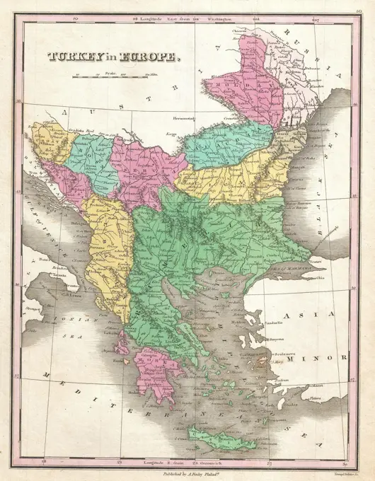
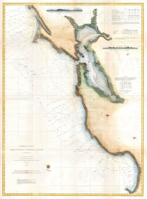
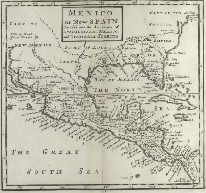
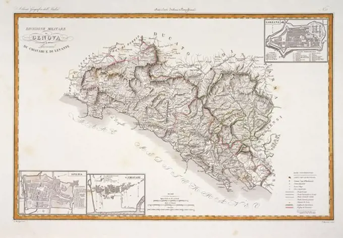
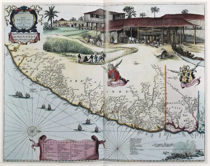
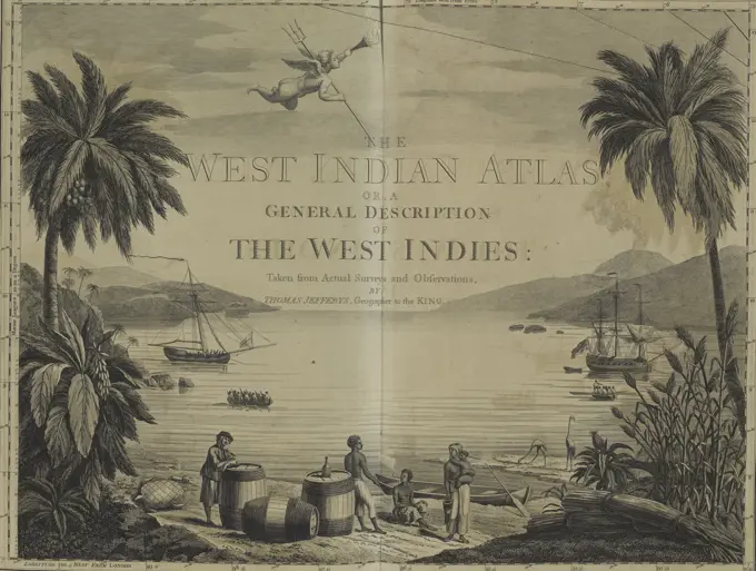
Old maps depicting various regions of Central America, the Caribbean, and parts of Africa, showcasing detailed cartographic styles and historic geographic features.

Vintage Government Map of Nicaragua 1856
War maps of Cuba, Porto Rico, and the Philippines. Illustrations of United States, Spanish and Cuban flags in margins. Flags are intended to be cut out and used to follow the progress of each force. Supplement to the Boston Sunday Herald, May 8, 1898.... , Cuba Puerto Rico  ,territory  PhilippinesGreece and Archipelago with part of Anadoli 1798 - 1804. Cartographic. Maps, Atlases. Lionel Pincus and Princess Firyal Map Division. Atlases , Great Britain, Maps in education , England, Historical geography, GreeceMap of the seat of war : showing the only practical method by which the movements of the warships of both nations can be accurately followed from day to day , Spanish-American War, 1898, Maps, West Indies, Maps, North Atlantic Ocean, Maps Norman B. Leventhal Map Center CollectionPhysical map showing approximate political frontiers in Green. The Shan and Lao states are shown independent of (or tributary to) Siam. Chiang Mai ('Tshien-Mai'and Luang Prabang are both shown lying within the frontiers of a greater Siam,, but the territoryy of Chiang Mai extends further to the northwest, into Burma's Shan State, beyond the Salween River, than it does today. Cambodia is much curtailed, with Angkor and Battambang part of Siam. Champa is still indicated in southern Vietnam ('Tshampa'), though it finally ceased to exist in 1832. The Lao kingdoms of Luang Prabang, Vientiane (Vien Tscan) and Champassak are all represented as part of Greater Siam. The Anglo-French competition for dominion over the region was just starting, and over the next 30 years Siam would lose much of its territory to the east and Northeast, as well as in the Malayan Peninsula.Map of Italy between 1815 and 1885, historical illustration, Italy, EuropeMap of Italy, about 1: 2 500 000, copper engraving, after 17151855 Colton's Map of Southern Italy, Sicily, Sardinia and MaltaMap of Mexico and Central America. Artist: Unknown.Costa Rica : from official and other sources. Relief shown by shading and spot heights.... , Costa Rica1827 Finley Map of Mexico, Upper California and TexasIsle of St. Domingo or Hispaniola , Hispaniola, Maps, Early works to 1800 Norman B. Leventhal Map Center CollectionMexico. Relief shown by hachures and spot heights. Prime meridians: Greenwich and Washington. Insets: South eastern part of Mexico -- Vera Cruz to Mexico.... , MexicoMap of Italy in the Longobard Period around 650, 1885, historical illustration, Italy, EuropeMap of the French Indies or French Caribbean circa.1760. From 'Atlas de Toutes Les Parties Connues du Globe Terrestre ' by Cartographer Rigobert Bonne. Published Geneva circa. 1760.Map of Italy; Nouvelle Carte d'Italie / New map of Italien. Map of Italy. To the map fifteen smaller faces on and floor plans of Italian cities. Part of an Atlas with 223 maps of countries and cities and war scaffolding in Europe in the period approx. 1690-1735.1862 Stieler Map of ItalyPeru, Chili and La Plata. Shows boundaries, rivers and principal settlements. Relief shown by hachures and shading. Greenwich meridian. Western South America, south of the Amazon River and north of Isla de Chiloe, corresponding to Peru, Bolivia, Chile, Paraguay and part of Argentina. Cataloging, conservation, and digitization made possible in part by The National Endowment for the Humanities: Exploring the human endeavor.... , Peru Argentina Bolivia Chile South America Paraguay South AmericaCarte de l'Amérique Septentrionale , North America, Maps Norman B. Leventhal Map Center CollectionMAP OF THE WORLD SHOWING FRANCE'S COLONIES IN 18961834 Carey Map of Upper and Lower Canada Ontario Quebec Nova Scotia New Brunswick NewfoundlandTabula Italiae antiquae geographica : quam excellentissimus dominus Dex de la Rochefoucauld in oere incidi curavit , Classical geography, Maps, Early works to 1800, Italy, Historical geography, Maps, Early works to 1800 Norman B. Leventhal Map Center Collection1827 Finely Map of GreeceMap of Sicily in Roman times with a map of Syracuse, Anonymous, 1721 - 1774 print   paper engraving / etching maps of separate countries or regions. maps of cities Sicily. SyracuseMap of 'Farther India', 1902.  Creator: Unknown.1865 Spruner Map of Northern Italy in AntiquityCarte des possessions angloises & françoises du continent de l'Amerique septentrionale Kaart van de Engelsche en Fransche bezittingen in het vaste land van Noord America Cartographic. Maps. 1755. Lionel Pincus and Princess Firyal Map Division. North AmericaAmérique Septentrionale , North America, Maps, Early works to 1800 Norman B. Leventhal Map Center CollectionMAPA GEOGRAFICO Y GENERAL DE LAS ISLAS BALEARES Y PITHYUSAS - 1793. Author: LOPEZ TOMAS. Location: BIBLIOTECA NACIONAL-COLECCION. MADRID. SPAIN.Map of the Island of Cuba (Spanish colonial period). Engraving. Crónica General de España, Historia Ilustrada y Descriptiva de sus Provincias (General Chronicle of Spain, Illustrated and Descriptive History of its Provinces), Antilles, 1871.FORTIFICATIONS OF BOMARSUND, 18541710 Ottens Map of Southeast Asia, Singapore, Thailand (Siam), Malaysia, Sumatra, Borneo1770 Janvier Map of ItalyAntique map of the Greater and Lesser Antilles. Drawing by Evremond de Berard (1824-1881) Travels to the West Indies, 1858-1859 by Anthony Trollope (1815-1882) Le Tour du Monde 1860Map of the Indonesian Archipelago, Isaac Tirion, 1744  Map of Indonesia, the different areas differently colored, in the middle of the wind rose, below title with the scale underneath in German, English and French miles. Outside the map at the top left of the leaf is: no. 90. Amsterdam paper engraving maps of separate countries or regions Indonesia. southeast Asia. MalaysiaL'Italie : publiee sous les auspices de Monseigneur le Duc d'Orleans, Premier Prince du Sang. Relief shown pictorially. Includes ornamental cartouche drawn by Coypet and engraved by Aveline. Variant with only one publishing statement. Covers also Corsica and Malta. Conservation of this piece was funded by Alan and Sherry Leventhal in memory of his father, Norman B. Leventhal whose vision to create this Map Center will inspire generations to come. Maps 13-14 in a composite atlas with the title "Atlas of the world."... , ItalyMexico, mapa de las lineas del Ferrocarril Central Mexicano y conecciones , Mexican Central Railway Co., Maps, Railroads, Mexico, Maps, Mexico, Maps Norman B. Leventhal Map Center Collection1768 Vaugondy Map of California and AlaskaMap of Papau - British New Guinea, circa 1900Suffolk text. Maps, Atlases. 1793. Lionel Pincus and Princess Firyal Map Division. Geography, Great BritainBreton Sound. Standard map series designation: Series V501. Relief shown by contours and spot heights. Depth shown by isolines. "Contour interval 50 feet.".. Breton Sound, Louisiana. Breton Sound, Louisiana, Louisiana  , Breton Sound  ,bay1827 Finley Map of Turkey in Europe, Greece and the Balkans1720 map of Baja California and northwest Mexico, showing California as an island.Map of the Netherlands Antilles; General gathering card of the Dutch West Indian possessions. Card the northern part of South America with the Dutch territories. Two bets with maps of the islands of Curaçao, Bonaire and Aruba and of the Islands of Sint-Maarten, Saba and Sint-Eustatius. Part of the sheet metal 'losses from Neerland's west-if'.Map of ancient Italy, vintage engraved illustration. Dictionary of words and things - Larive and Fleury - 1895.Karyès, Greece map of Mont Athos , 1913 - Balkans, Greece, Bulgaria - Stéphane Passet - (August 30 -October 21) (French - Karyès , Grèce Carte du Mont Athos). Christianity, Monastery, Geography, Map, Religion , Sciences , Techniques, Mont-Athos, Map, Map of Mont-Athos1866 U.S. Coast Survey Chart or Map of San Francisco BayItalie , Italy, Maps Norman B. Leventhal Map Center CollectionSpezialkarte der Samoa-Inseln , Samoan Islands, Maps Norman B. Leventhal Map Center CollectionSpezialkarte der Samoa-Inseln. Map of the former German territory islands of Samoa showing possessions of the Deutschen Handels-u. Plantagengesellschaft der Sudsee. Relief shown by shading and spot heights. In lower left margin: Gez. z. T.v. V. Geyer, autogr. v. P. Ihle. In German... Deutsche Samoa-Insel Upolu mit den landereien und pflanzungen der Deutschen Handels-u. Plantagengesellschaft der Sudsee-Inseln zu Hamburg und dem fremden grundbesitz. Deutsche Samoa-Insel Upolu mit den landereien und pflanzungen der Deutschen Handels-u. Plantagengesellschaft der Sudsee-Inseln zu Hamburg und dem fremden grundbesitz, SamoaCalifornia or New Carolina - vintage map, circa 1720Amerique du Nord. Relief shown by hachures. Manuscript map in pen-and-ink and watercolor, drawn by a schoolgirl. Date based on that shown on companion map. Companion map to author's Amerique du Sud G5200 1880 .P56.. Young European women also practiced geography in school-settings during the early 19th-century. This map of North America by Louisa Pinchon of Elbeuf, France, a village on the Seine River fifty miles northwest of Paris, may well have been part of a larger collection, as evidenced by the fold marks along the center of the sheet. Louisa signed her work under a cartouche comprised of tobacco leaves, grown extensively in Cuba and the southeastern United States. Geographic education at the time often included lessons on natural and cultural resources of an area, and most likely played a role in the mapmaker's design... , North America  ,areaA map of Mexico, or New Spain, published in 1713, showcasing the divisions into the audiencias of Guadalajara, Mexico, and Guatemala, Florida. The map measures 16 x 18 cm, folded to 20 x 12 cm. It is published in London by J. Churchill and T. Childe. The map is categorized under early works depicting Central America, Mexico, New Spain, and North America prior to 1800The map of Greece with explanation of signs on mapCartography, Italy, 19th century. Military division of Genoa, plan of Sarzana, La Spezia and Chiavari. Map by Attilio Zuccagni-Orlandini, taken from the Geographic Atlas of Italian States, Florence 1836-1845. Engraving on Copper.Mexico : showing lines of the Mexican Central Railway Co., Limited , Mexican Central Railway Co., Maps, Railroads, Mexico, Maps, Mexico, Maps Norman B. Leventhal Map Center CollectionMap of Rome and surroundings, approx. 1702; Les Environs De Rome; Les Forces de l'Europe, Asie, Afrique et Amerique, Ou Description des Principales Villes Avec Leurs Fortifications. Dessignées PAR LES MEILLEURS Engineers, private party Celles Qui Sont Sous La Domination de la France (...) Et Ornées the plusieurs Superbes Edifes. Map of Rome and surroundings. Plate No. 203 In the picture in the context of a total of 276 numbered plates of renowned strong cities and fortresses in the context of the Spanish Succession War. For most part, these plates have been copied to the anonymous French plates: in Les Forces de l'Europe and in: Le Theater de la Guerre, Dans Les Pays-Bas, both originally published by Nicolas de Fer in Paris (1693-1697) in the framework of the nine-year war. Title and inscriptions in the plate in French.Map of Ancient Sicily and southern Italy, c.278 BC.  From Cassell's Illustrated Universal History, published 1883.Karte des russisch-türkischen kriegsschauplatzes in Europa und Asien , Black Sea region, Maps, Turkey, Maps, Balkan Peninsula, Maps Norman B. Leventhal Map Center Collection'German Colonies in West Africa at the Outbreak of War, 1914', (c1920). Map of African territory occupied by European powers at the start of the First World War, including French West Africa, Gold Coast Colony, Togoland, Nigeria, Cameroon, Spanish Guinea, French Equatorial Africa and the Belgian Congo. Also shown is the 'Slave Coast'. From "The Great World War: A History", Volume V, edited by Frank A Mumby. The Gresham Publishing Company Ltd, London, c1920Western North America on the eve of the Mexican-American War (1846-48) which resulted in US annexation of over 500,000 square miles of Mexican territory.The Evening Post map of the West Indies , Spanish-American War, 1898, Maps, West Indies, Maps, Caribbean Area, Maps Norman B. Leventhal Map Center Collection1832 Delamarche Map of Spain and Portugal under the Roman Empire1866 Johnson Map of ItalyJava and Madoera : Indonesian ethnic groups, elementary education, and Christian missions , Ethnology, Indonesia, Java, Maps, Ethnology, Indonesia, Madura Island, Maps, Education, Elementary, Indonesia, Java, Maps, Education, Elementary, Indonesia, Madura Island, Maps, Missions, Indonesia, Java, Geography, Maps, Missions, Indonesia, Madura Island, Geography, Maps, Java Indonesia, Maps, Madura Island Indonesia, Maps Norman B. Leventhal Map Center CollectionRepública de Nicaragua, circa 1913PRAEFECTURAE PARANAMBUCAE PARS BOREALIS UNA CUM PRAEFECTURA DE ITAMARACA, EDITADO POR JOHANNES BLAEU EN AMSTERDAM, 1662. Author: BARLEUS GASPAR.Pictorial map of Mexico. Relief and some buildings shown pictorially. "Exclusive publisher of all the reproductions of Diego Rivera's frescoes color photo." "Registrado conforme a la ley, no. del reg. 6859, copyrighted in the U.S.A." Includes illustrations, passage about Mexico from William H. Prescott's historical series "The Nations of the World", and the opening bars of the Mexican national anthem. "The only pictorial map of the Republic of Mexico by Miguel Gomez Medina showing principal places of interest and everything typical of Mexico. Lithographed in six colors."--Envelope.... , MexicoThe Caucasus , Caucasus, Maps Norman B. Leventhal Map Center CollectionThe Caucasus. Relief shown by hachures.... , Caucasus  ,areaISLE OF WIGHTMap showing the routes of the four voyages of Christopher Columbus between 1492 and 1504.  After an early 19th century work by Jean-Baptiste-Paul Touquet.Southern Vancouver Island, British Columbia , Geology, British Columbia, Vancouver Island, Maps, Vancouver Island B.C., Maps Norman B. Leventhal Map Center CollectionCartography, 16th century. Central America. From a Portuguese planisphere, 1550. Detail.Theatre de la guerre d'orient en 1854. Prime meridian: Paris Inset maps: Russie en 1550 -- Russie en 1854. Includes text. "Paris, Imp. Bineteau." "Paris, - Imprimerie de L. Martinet,"... , Eastern Europe  ,areaLos Angeles as it appeared in 1871. - Copy 1 | Library of CongressDominican Republic road map 1:250,000 , Roads, Dominican Republic, Maps, Dominican Republic, Maps Norman B. Leventhal Map Center CollectionMap of Isle of St. Domingo or Hispaniola, Includes Haiti and Dominican Republic.  by William Faden.  1796.  Vintage Archive Map.Map of Japan Iaponia (title on object), Map of Japan with the surrounding sea and a small part of China. Top right a cartouche with the title of the print, maps or separate countries or regions, Pieter van der Keere (mentioned on object), 1628 - 1630, paper, etching, h 181 mm × w 249 mmHistory of Spain. Map of the Canary Islands. Islands of Tenerife, El Hierro, La Gomera and La Palma. Engraving. Crónica General de España, Historia Ilustrada y Descriptiva de sus Provincias (General Chronicle of Spain, Illustrated and Descriptive History of its Provinces), Canaries, 1871.Map by an unknown cartographer published by G.W. Bacon, London, showing the theatre of the Crimean War, 1853 - 1856.Plano de los canales de entrada al Puerto de Cardenas adaptado de PichardoJava and Madoera : Indonesian ethnic groups, elementary education, and Christian missions , Ethnology, Indonesia, Java, Maps, Ethnology, Indonesia, Madura Island, Maps, Education, Elementary, Indonesia, Java, Maps, Education, Elementary, Indonesia, Madura Island, Maps, Missions, Indonesia, Java, Geography, Maps, Missions, Indonesia, Madura Island, Geography, Maps, Java Indonesia, Maps, Madura Island Indonesia, Maps Norman B. Leventhal Map Center CollectionDominican Republic road map 1:250,000 , Roads, Dominican Republic, Maps, Dominican Republic, Maps Norman B. Leventhal Map Center CollectionScandinavia, Northern Europe, atlas by Th. von Liechtenstern and Henry Lange, antique map 1869Map of CubaIsland of Luzon : from the latest official sources , Luzon Philippines, Maps Norman B. Leventhal Map Center CollectionMapa ilustrado de la isla de Cuba de 1896 con mandos y ejército español, e insurrectos cubanos.Italy with Vatican City , Italy, Maps, Vatican City, Aerial views Norman B. Leventhal Map Center CollectionA map of Central America showing the locations of Nicaraguan military bases receiving Soviet military equipment. From Soviet Military Power 1985. Country: UnknownPhysical and political map of Haiti. Encapsulated Postscript File (.eps); 3507x2480.Frontispiece of 'The West-India Atlas,' published in 1775 in London by R. Sayer and J. Bennett. The work contains nautical charts and descriptions of travel in the West IndiesPhysical and political map of Cuba. Encapsulated Postscript File (.eps); 3507x2480.040916-N-0000X-001. Country: UnknownPolitical map of Caribbean