My Boards
View Pictures
  • My Boards
← Documents & Records

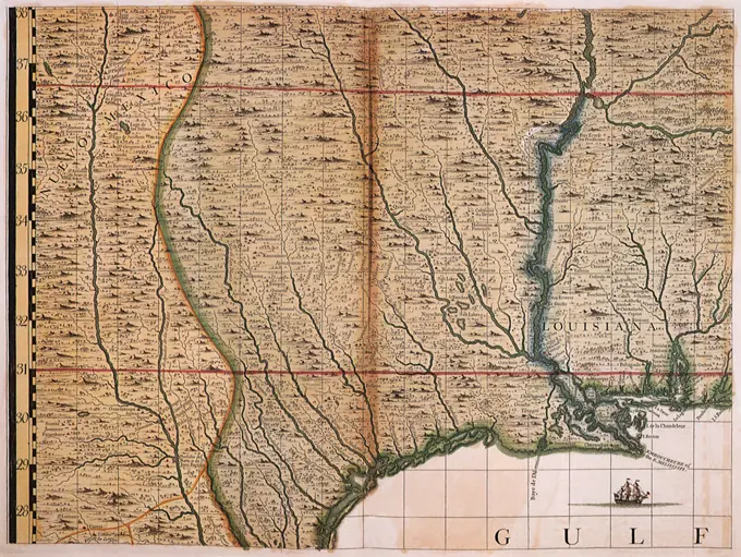
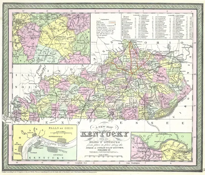
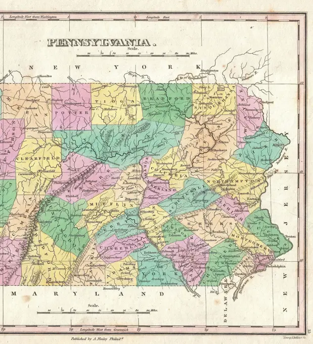
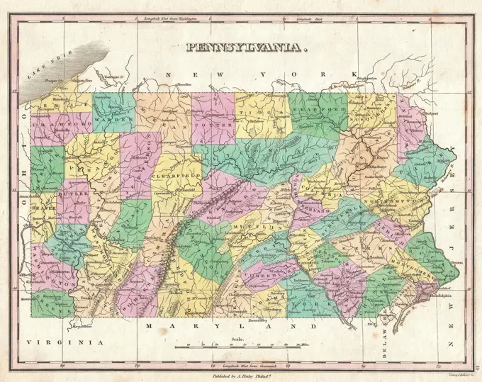
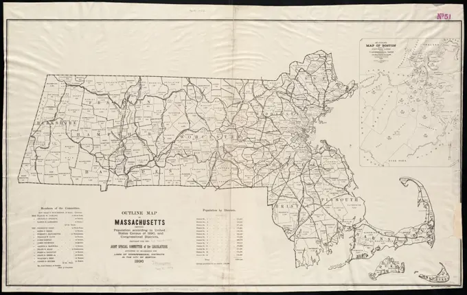
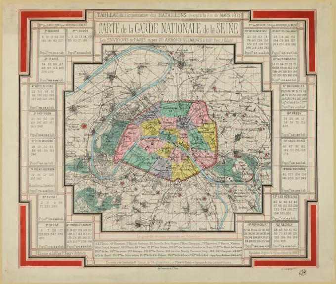
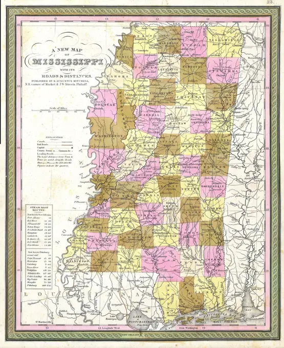
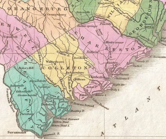
Historical Maps of America

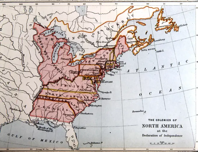
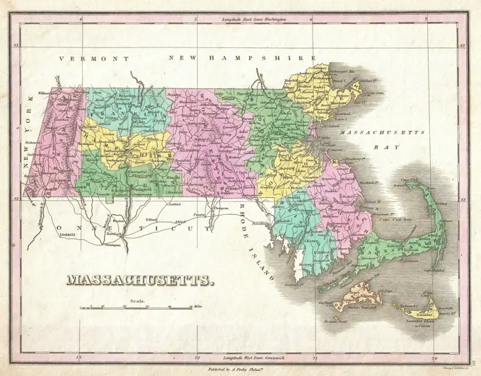
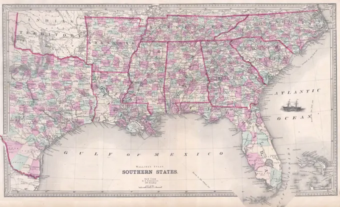
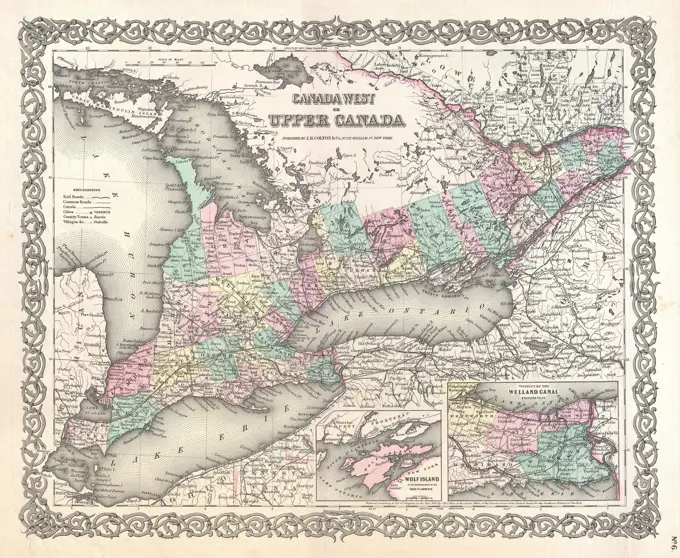
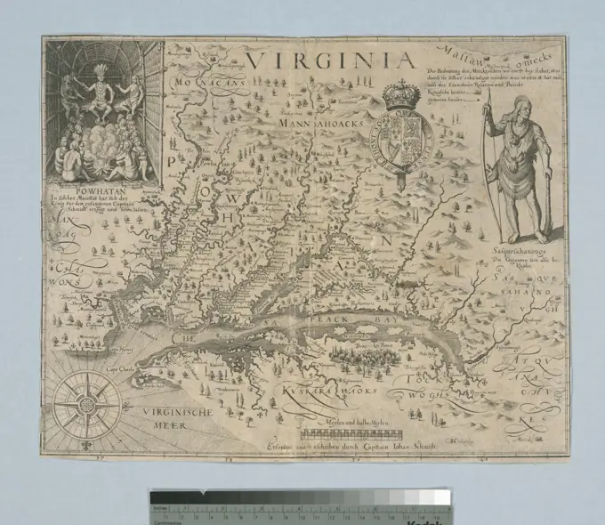
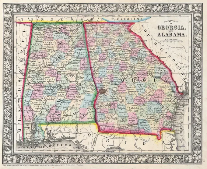
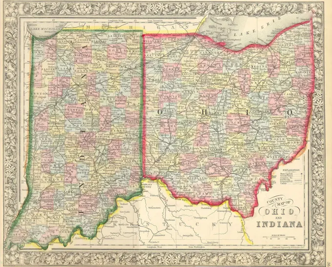
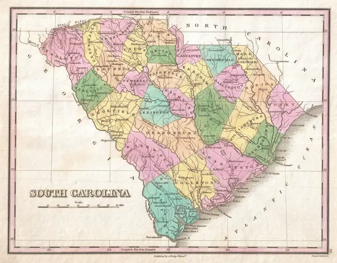
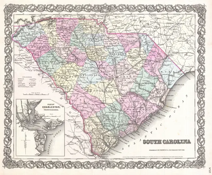
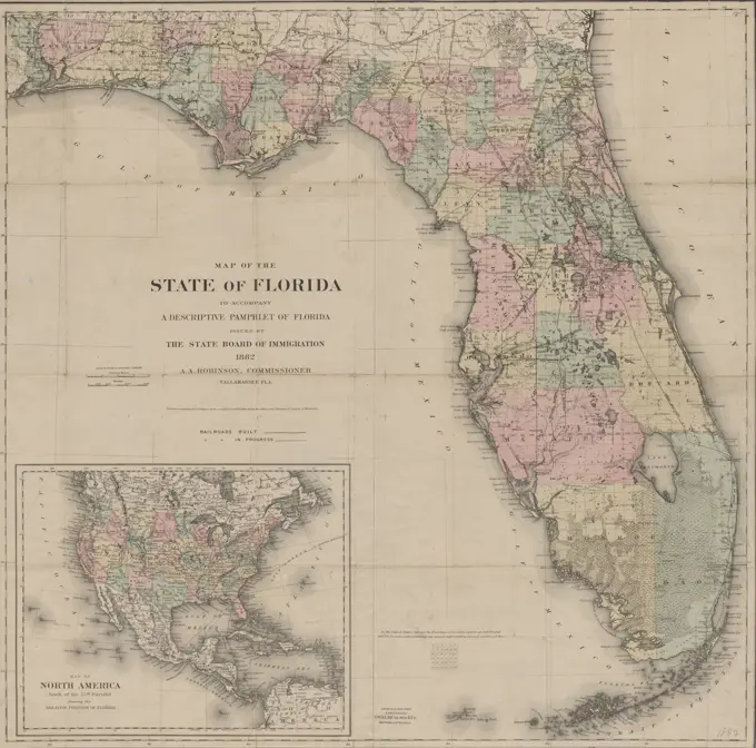
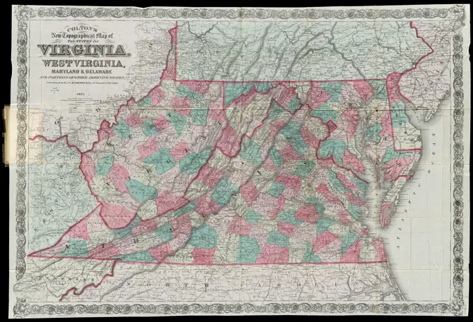
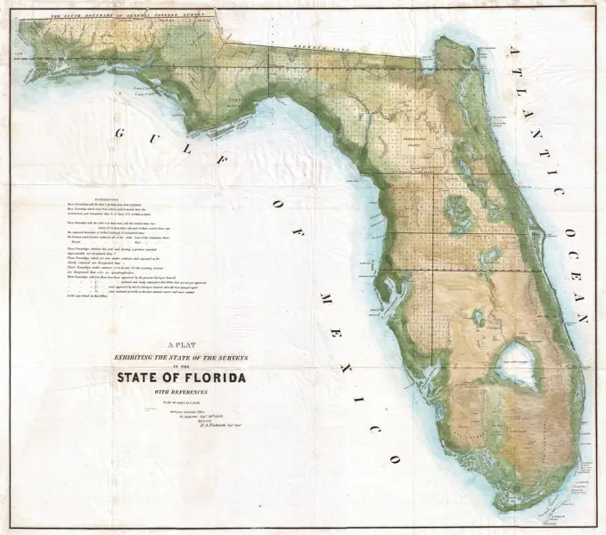
A compilation of detailed topographical maps illustrating historical regions, battlefields, and routes in the Eastern United States from the 19th century.

United States of America. Relief shown by hachures. Prime meridian: Washington. Includes 16 insets, profiles, and statistical tables.... , United States
167 assets in this story
6145-55914502
Map of Kentucky and Tennessee. Relief shown by hachures. Prime meridians: Greenwich and Washington. Includes population tables and views of Louisville and Nashville. "Entered according to Act of Congress in the year 1852 by J.H. Colton ..."... , Kentucky Tennessee
6176-66916396
Map of Empire of the Great Indian Padschach Mogolis or, according to recent voyages / 1735
1899-20225206
Louisiana and Gulf, 1733, Popple, H.
6145-51397872
Outline map of Massachusetts showing legal voters according to Massachusetts census of 1895 : prepared for the Joint Special Committee of the Legislature on Redistricting the State into Councilor and Senatorial districts , Massachusetts. Council, Election districts, Maps, Massachusetts. General Court, Election districts, Maps Norman B. Leventhal Map Center Collection
6145-51395004
Map of the middle states of America : comprehends New-York, New-Jersey, Pennsylvania, Delaware, and the territory N.W. of Ohio , Middle Atlantic States, Maps, Early works to 1800 Norman B. Leventhal Map Center Collection
6145-51394312
Lloyd's new military map of the border & southern states , Confederate States of America, History, Maps, United States, History, Civil War, 1861-1865, Maps Norman B. Leventhal Map Center Collection
6145-55914197
Lloyd's new military map of the border & southern states. Hall not credited as author on this state of map but is on the 1862 state. Important towns or sites of military actions shown by red underlining. "Territory held by rebels Feb. 15th, 1865 in Red. Territory gained from rebels since January 1st, 1862 in Yellow. Identifies major railroad routes. Southern half of Florida shown in untitled inset. Names of sales agents shown below neat line at bottom.... , Confederate States of America  ,area
6145-54269483
The United States of America laid down from the best authorities, agreeable to the Peace of 1783. Relief shown pictorially. Prime meridian: London. The first printed map known to bear the nation's standard, it appeared five months before the signing of the Treaty of Paris, and indicated the national boundaries established by same. The title cartouche is flanked by likenesses of Washington and Franklin, attended by female personifications of Columbia, Liberty and Justice.. Covers the 13 United States, Louisiana, and parts of Canada and Florida. Shows boundaries, towns and cities, forts, Indian villages and tribal territory, rivers, coast shoals and banks, and relief. The boundaries of the states of Virginia, North Carolina, South Carolina, and Georgia extend west to the Mississippi River. A broken line running north to south through the Appalachian Mountains is identified as the "Boundary of the back settlements of Indian nations." -- cf. LC Maps of North America, 1750-1789... , United
6176-62017710
19th century map of Ontario. Published in New Dollar Atlas of the United States and Dominion of Canada. (Rand McNally & Co's, Chicago, 1884).
6145-55915082
Map of the United States. Relief shown by hachures. Prime meridian: Washington, D.C. Includes population table.... , United States
4443-75477162
The Matthews-Northrup up-to-date map of Connecticut, 1898, published by Matthews-Northrup Company in Buffalo., 1 map (color); dimensions 24 x 30 cm on a sheet measuring 28 x 33 cm. Features administrative and political divisions of Connecticut
4443-75472317
A map from 1841, detailing the dates of the first settlement of the original Thirteen United States and the subsequent admission of other states into the Union. The map is attributed to an unspecified publisher in New York and measures 17 x 11 cm. It focuses on the historical geography of the United States
6176-66915128
Map of South Carolina, 1844
6145-29096750
1850 Cowperthwait Map of Kentucky
6145-43492414
Print, Map of Louisiana (Mississippi); Johann Baptista Homann (1664 - 1724); Germany; etching and engraving, hand-colored, on white laid paper; 50 x 59.2 cm (19 11/16 x 23 5/16 in.)
6145-29096535
1827 Finley Map of Eastern Pennsylvania
6145-29096565
1827 Finley Map of Pennsylvania
6145-51386634
Post route map of the states of Michigan and Wisconsin with adjacent parts of Ohio, Indiana, Illinois, Iowa and Minnesota showing post offices with the intermediate distances and mail routes in operation on the 1st. of October 1891 , Counties, Michigan, Maps, Counties, Wisconsin, Maps, Postal service, Michigan, Maps, Postal service, Wisconsin, Maps, Railroads, Michigan, Maps, Michigan, Maps, Wisconsin, Maps Norman B. Leventhal Map Center Collection
6145-52359847
Portions of Shrewsbury and Ocean Townships. Townships Cartographic. Atlases, Maps. 1873. Lionel Pincus and Princess Firyal Map Division. Monmouth Couty (N.J.) , Description and travel, Real property , New Jersey , Monmouth County
7155-70384782
Map of the colonies of North America at the Declaration of Independence. 1776.
6176-66902588
Map of Mercer County, New Jersey, circa 1849
6145-29096547
1827 Finley Map of Massachusetts
6145-29095503
1868 Walling Map of Texas, Florida and the Southern States
6145-50536559
Colton's North Carolina , Railroads, North Carolina, Maps, Forests and forestry, North Carolina, Maps, Gold mines and mining, North Carolina, Maps, Iron mines and mining, North Carolina, Maps, Copper mines and mining, North Carolina, Maps, Coal mines and mining, North Carolina, Maps, North Carolina, Maps, Beaufort N.C., Maps Norman B. Leventhal Map Center Collection
6145-54269032
Bowles's new map of the River Thames, from it's spring in Gloucester-shire, to it's influx into the sea : with a table of all the locks, wears, and bridges thereupon ; shewing the tolls payable at each and their distance by water from one another. London meridian. "J. Ellis Sculp." Table of locks, wears, bridges &c. Sandbars, shoals and soundings shown in estuary. River Thames from head near Torleton, Gloucestershire through Lechlade, Oxford, Abingdon, Wallingford, Reading, Henley, Maidenhead, Windsor, London and to the sea.... , England  , Thames  ,river
6145-51394672
Map of Massachusetts, Rhode-Island & Connecticut : compiled from the latest authorities , Factories, Massachusetts, Maps, Factories, Connecticut, Maps, Factories, Rhode Island, Maps, Railroads, Massachusetts, Maps, Railroads, Connecticut, Maps, Railroads, Rhode Island, Maps, Massachusetts, Maps, Connecticut, Maps, Rhode Island, Maps Norman B. Leventhal Map Center Collection
6145-29094882
1855 Colton Map of Upper Canada or Ontario
6145-50565932
Outline map of Massachusetts showing population according to United States Census of 1890, and Congressional districts , Boston Mass., Administrative and political divisions, Maps, Massachusetts, Population, Maps Norman B. Leventhal Map Center Collection
4443-75464795
A historical map titled 'Carte nouvelle de l'Amerique angloise,' issued in 1776 by Tobias Conrad Lotter. The map depicts the territories possessed by the English in North America, including Canada, Nova Scotia (Acadia), and the thirteen United Provinces, along with Florida. The map is hand-colored and measures 59 x 49 cm. It was published in Augsburg and is associated with the United States, Great Britain, and the Colonies in North America
6176-59912312
Novi Belgii Novaeque Angliae Nec Non Partis Virginiae, 1651-55.
6145-50569511
Map of the United States exhibiting the post-roads, the situations, connections & distances of the post-offices, stage roads, counties, ports of entry and delivery for foreign vessels, and the principal rivers , Post roads, United States, Maps, Early works to 1800, United States, Maps, Early works to 1800 Norman B. Leventhal Map Center Collection
6145-55915094
Map of the United States exhibiting the post-roads, the situations, connections & distances of the post-offices, stage roads, counties, ports of entry and delivery for foreign vessels, and the principal rivers. State 3 with surveyed townships shown in New York and Ohio. Engraved by: W. Barker. Title engraved by: W. Harrison junr. Inset: Progress of the mail on the main line. Above the upper neat line at left: Deposited as the Act directs September 26th. 1796. South of Tennessee appears: United States Territory.... , United States
6145-55915908
Outline map of Massachusetts showing population according to United States Census of 1890, and Congressional districts. Includes inset: An outline map of Boston showing the new ward lines, also the congressional lines.... , Massachusetts  , Suffolk  ,county   , Boston
1838-22212766
Map during American Civil War, North and South in 1861, The Chronicles of America, 1921,
6145-29907469
Chart of the organization of battalions until the end of March 1871 / Map of the National Guard of the Seine / The vicinity of Paris and its 20 districts. (IT)
1899-20227090
Map of Virginia and Maryland 1751.
1899-41415
Map of Louisianna and Florida circa.1760. From 'Atlas de Toutes Les Parties Connues du Globe Terrestre ' by Cartographer Rigobert Bonne. Published Geneva circa. 1760.
6145-29096727
1849 Cowperthwait - Mitchell Map of Mississippi
4409-17428059
Novi Belgii Novaeque Angliae Nec Non Partis Virginiae. Dimensions: plate: 18 1/2 x 22 in. (47 x 55.9 cm)sheet: 20 3/4 x 24 in. (52.7 x 61 cm). Publisher: Published by Nicolas Joannis Visscher (Dutch, 17th century). Date: 1651-55. Museum: Metropolitan Museum of Art, New York, USA.
6176-66917299
Map of Texas, 1844
6145-55915200
Map showing the location of battle fields of Virginia. Similar to no. 504, LC Civil War maps (2nd ed.). Relief shown by hachures. List of battle fields of Virginia on verso. "Poole Bros., Engr's, Chicago"--Lower left corner.. Shows Civil War battlefields (1861-1865), Chesapeake & Ohio Railroad lines, distinguishing between those which are pre-war and post-war, other railroads during the war, plank roads, turnpikes, other roads and light houses... , Virginia
6145-48719823
Bowles's new map of the River Thames, from it's spring in Gloucester-shire, to it's influx into the sea : with a table of all the locks, wears, and bridges thereupon ; shewing the tolls payable at each and their distance by water from one another , Thames River England, Navigation, Thames River England, Maps Norman B. Leventhal Map Center Collection
6145-51393069
Florida gebiet , Florida, Maps Norman B. Leventhal Map Center Collection
6145-50549925
Kentucky and Tennessee , Kentucky, Maps, Tennessee, Maps Norman B. Leventhal Map Center Collection
6145-55167121
Kentucky and Tennessee. Relief shown by hachures. "Entered according to Act of Congress in the year 1855, by J.H. Colton & Co. ..." Prime meridians: Greenwich and Washington... Map of Kentucky and Tennessee. Map of Kentucky and Tennessee, Kentucky Tennessee
6145-51394602
Map of existing and proposed open spaces in Massachusetts , Open spaces, Massachusetts, Maps Norman B. Leventhal Map Center Collection
6145-50568764
Map of the railroads of the state of Massachusetts : accompanying the report of the Railroad Commissioners : 1900 , Massachusetts, Maps, Railroads, Massachusetts, Maps Norman B. Leventhal Map Center Collection
6145-29095884
Counties Charleston, Colleton and Beaufort on 1827 Finley Map
6145-54548402
Virginia Cartographic. Maps. 1628. Lionel Pincus and Princess Firyal Map Division. Virginia , Maps , Early works to 1800
1899-20226735
Virginia 1606.
6145-29095294
1864 Mitchell Map of Georgia and Alabama
1848-61541278
Historical drawing, US-American history, 18th century, map of South Carolina, USA, 1730, North America
6145-29095082
1860 Mitchell's Map of Ohio and Indiana
6145-29096562
1827 Finley Map of South Carolina
6145-50569335
Gallup's map of Louisiana , Oil fields, Louisiana, Maps, Gas fields, Louisiana, Maps, Geology, Louisiana, Maps, Louisiana, Maps Norman B. Leventhal Map Center Collection
6145-55916674
Post route map of the state of Florida showing post offices with the intermediate distances on mail routes in operation on the 1st of December, 1903. Also shows counties and railroads. Inset: Western part of Florida. Includes list of counties showing relative position.... , Florida
6145-51386420
Plan of the western seat of war , Confederate States of America, History, Maps, United States, History, Civil War, 1861-1865, Maps Norman B. Leventhal Map Center Collection
6145-29094864
1855 Colton Map of South Carolina
4443-75459666
Map of the state of Florida to accompany a descriptive pamphlet, 1882., 1882., Tallahassee, Fla. Publisher, State Board of Immigration, Railroads, Florida. Administrative and political divisions., 1 map, hand colored; 65 x 65 cm, on sheet 68 x 70 cm
6145-55913295
Colton's new topographical map of the states of Virginia, West Virginia, Maryland & Delaware and portions of other adjoining states. Relief shown by hachures. Prime meridians: Greenwich and Washington... Colton's map of the states of Virginia, Maryland, Delaware, and West Virginia. Colton's map of the states of Virginia, Maryland, Delaware, and West Virginia, Virginia West Virginia Maryland Delaware
6176-66918493
J H Colton's map of Georgia, Alabama, and Florida, circa 1863
6145-50571985
Florida ,. Robert E. Diefenbach Map Collection
6145-48645863
Connecticut , Advertising cards, Specimens, Advertising, Coffee, Connecticut, Maps Norman B. Leventhal Map Center Collection
6145-43860520
Connecticut , Advertising cards, Specimens, Advertising, Coffee, Connecticut, Maps Norman B. Leventhal Map Center Collection
6145-29096730
1848 Land Survey Map of Florida
6145-51387327
Scarborough's new county and post office map of Louisiana and Mississippi : with complete index giving population and location ; compiled from the latest government surveys and other authentic sources , Louisiana, Maps, Mississippi, Maps Norman B. Leventhal Map Center Collection
6145-48507904
Booles, Raleigh Team, baseball card portrait
PREVIOUS
of 2
NEXT
2401 S. Ervay, Suite 206
Dallas, Texas 75215
United States
Get Started
Free ResearchMy BoardsMy Cart
For Creators
How To License Your ContentContributor PortalFrame of Mind
Resources
API accessPricing
Contact
+1 866 236 0087help@viewpictures.co.uk Contact form
©2026 View Pictures. All Rights Reserved. -B
This site is protected by reCAPTCHA and Google Privacy Policy and Terms of Service apply.