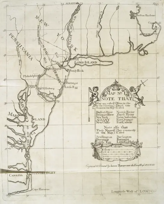
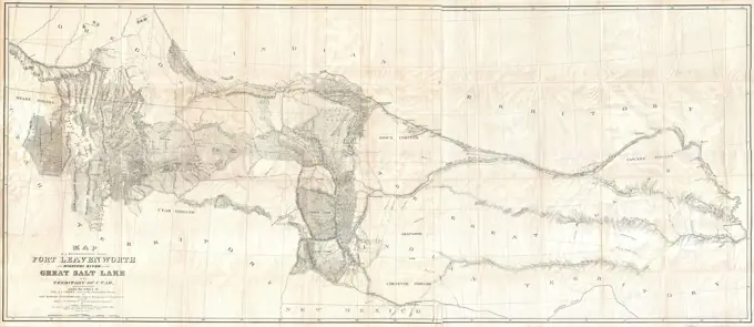
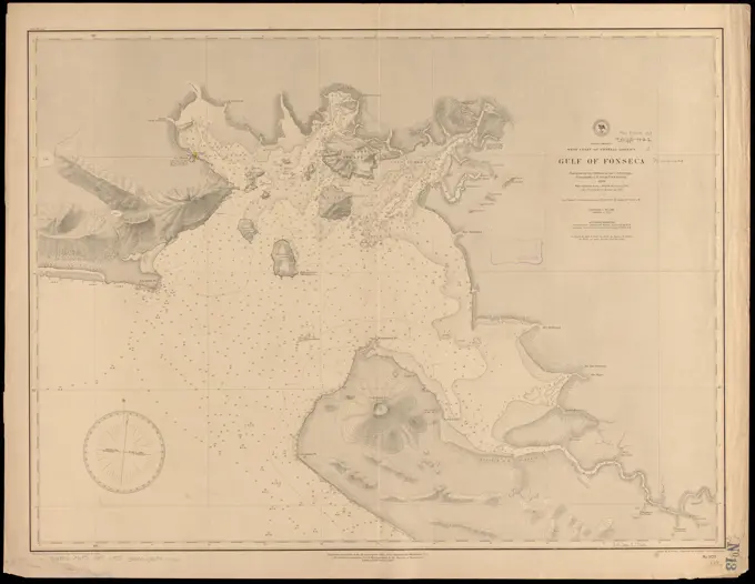
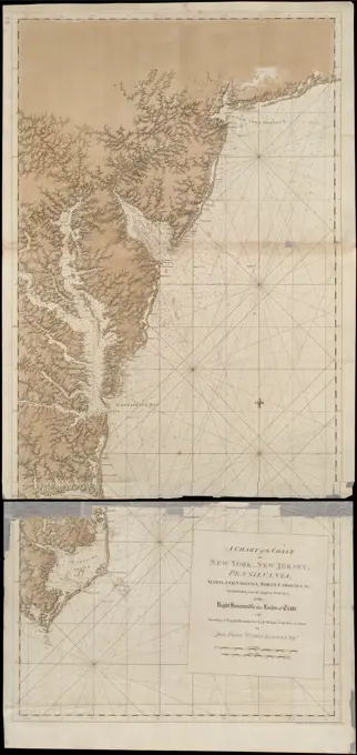
Historical Maps of Coastal Regions
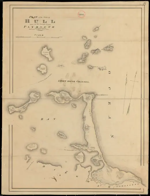
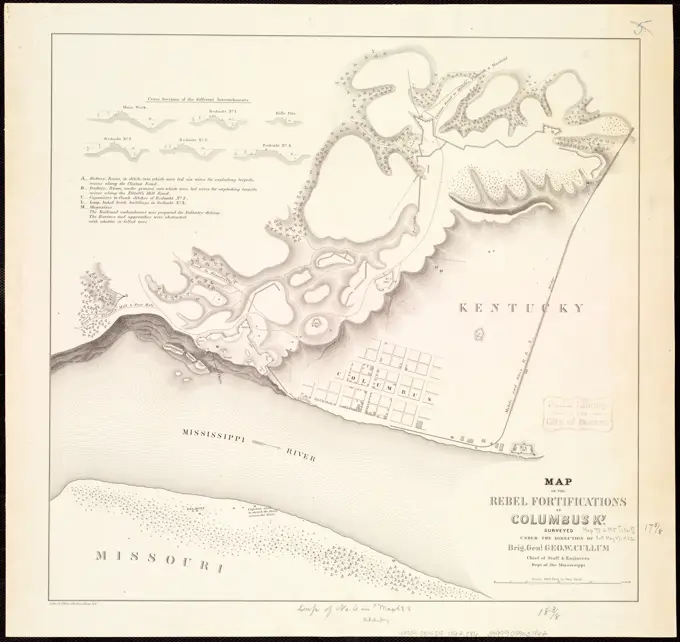
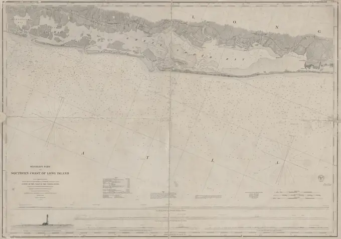
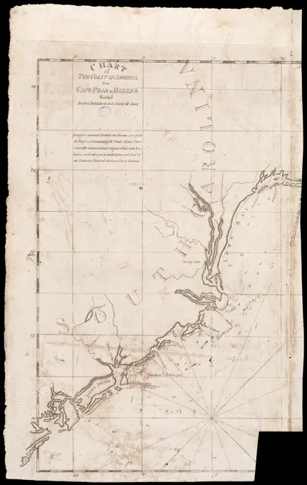
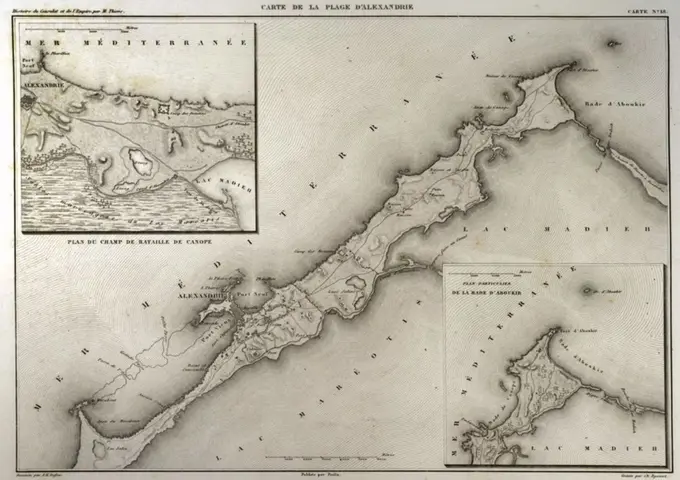
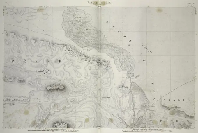
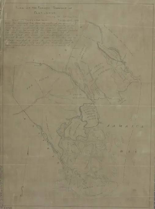
A collection of historical maps depicting coastal and inland areas, showcasing geographical features, waterways, and land divisions in Massachusetts and the West Indies.

A collection of historical maps depicting coastal and inland areas, showcasing geographical features, waterways, and land divisions in Massachusetts and the West Indies.