My Boards
View Pictures
  • My Boards
← Documents & Records

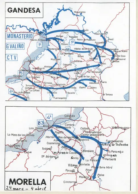
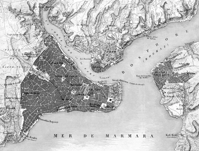
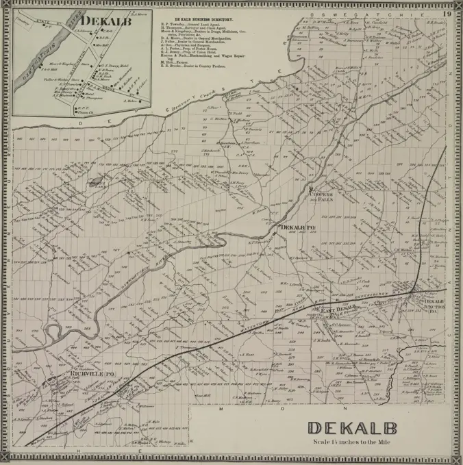
Historical Maps of Exploration

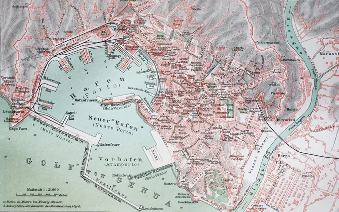
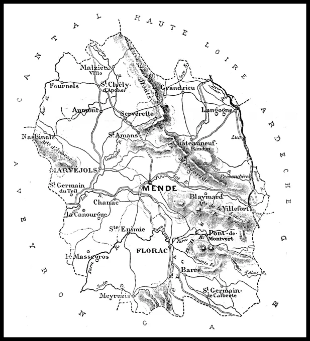
Vintage maps detailing explorations and territories in Africa, showing routes of significant marches and geographical features from the 19th century.

Map of the department of Lozere, vintage engraving. Map of the department of Lozere, vintage engraved illustration. Journal des Voyages, Travel Journal, 1879-80. Copyright: xZoonar.com/PatrickxGuenettex 10656648
167 assets in this story
6176-66088083
From Boquerón de Quindío to Buga, Cauca Department. Colombia, South America. Travel itinerary map through Equinoctial America 1875-1876 by Edward Francois Andre. Le Tour du Monde 1879
1746-29969981
Black and white photograph of World War II (1939-1945); a map of the German Offensive in the East in 1942.
6176-67049385
'L'Execution de L'Armistice; Les territoires que rendit ou livra aux allies la defaite allemande', 1918. From "L'Album de la Guerre 1914-1919, Volume 2" L'Illustration, Paris, 1924.
4409-20925942
PRINCIPALES CAMPOS DE PRISIONEROS EN FRANCIA. Location: FUNDACION PABLO IGLESIAS. MADRID. SPAIN.
1746-19678389
World War 1 - The Battle of Verdun from 21 February to 18 December 1916 - French map showing the changing positions French Forces in red, German attack lines are shown in black.
6145-29095880
Admiralty Chart No 2621 Bombay Harbor, India ( Mumbai )
1848-49519704
Strasbourg, Strasbourg and surroundings, Rhine, France, Alsace-Champagne-Ardenne-Lorraine region, German, scale, ground plan, district, Kehl, railway line, cartography, historical illustration 1896, Europe
6176-65990278
Black and White Illustration; Victorian Map of Bedford, Circa 1880
1746-29972641
A map of 13th-century Britain by Matthew Paris. Matthew Paris (1200-1259) a Benedictine monk, English chronicler, artist and cartographer. Dated 13th century
1525-27810751
Map of the department of Mayenne, vintage engraved illustration. Journal des Voyages, Travel Journal, (1879-80).
6145-50532837
Boston Elevated Railway lines 1921 , Local transit, Massachusetts, Boston, Maps, Railroads, elevated, Massachusetts, Boston, Maps, Subways, Massachusetts, Boston, Maps, Boston Mass., Maps, Boston Elevated Railway Company Norman B. Leventhal Map Center Collection
6145-54280804
Communist Maps of France. Photographs of Marshall Plan Programs, Exhibits, and Personnel
6188-55550894
Map of Paris, France. Map of Paris, France. Vintage engraving. Copyright: xZoonar.com/PatrickxGuenettex 10648400
1848-19251739
Stadtplan, 1892: Genova, Genoa, Genua, Italien, digital restaurierte Reproduktion einer Originalvorlage aus dem 19. Jahrhundert
6145-46057014
Card with the positions of the allies and French, 1793; Arrangement of allies 8 September 1793. Map of the Austrian Netherlands that states the positions of the coalition groups and the French Revolutionary Army, 8 September 1793.
6145-29606053
Collection Dutch Heidematschappij. Overview map farm people. undated. Netherlands
1746-28995619
Map illustrating an Expedition of Captain Robert Falcon Scott (1868-1912) a British Royal Navy officer and explorer of the Antarctic regions. Dated 20th Century
1889-60417148
A diagrammatic summary of current ideas of the relationship of human races.  From A Short History of the World, published c.1936
1848-50225342
Old map of Athens and Peiraieus, Greece, Historical, digitally restored reproduction of a 19th century original, exact date unknown, Europe
6176-67043526
'Map illustrating the Austrian Attack in the Trentino, May, 1916', (c1920). Italian and Austrian lines in northern Italy during the First World War. From "The Great World War: A History", Volume VI, edited by Frank A Mumby. The Gresham Publishing Company Ltd, London, c1920
6145-51395764
NASA Electronic Research Center : evaluation of proposed sites in Boston , Boston Mass., Maps, City planning, Massachusetts, Boston, Maps, Aeronautical laboratories, Massachusetts, Boston, Maps, United States. National Aeronautics and Space Administration
6145-48718148
Commercial map of China : showing treaty ports, ports of foreign control, railways, telegraphs, waterways, etc., 1899 , Commerce, China, Maps, China, Maps Norman B. Leventhal Map Center Collection
6176-55294392
. English: Map of Battleford in 1885 from page 106 of the book: The history of the North-West Rebellion of 1885: Comprising a full and impartial account of the origin and progress of the war, of the various engagements with the Indians and half-breeds, of the heroic deeds performed by officers and men, and of touching scenes in the field, the camp, and the cabin: Including a history of the Indian tribes of north-western Canada, their numbers, modes of living, habits, customs, religious rites and ceremonies: With thrilling narratives of captures, imprisonment, massacres, and hair-breadth escape
1848-53923540
Map of Havana, an illustration from Meyers Konversations-Lexikon, an encyclopedia from 1897
6176-66915361
Sketch of Port Wells, Alaska, circa 1900
6176-67070170
'The Allies' Line facing the Bulgarians in the closing Campaign of 1916', (c1920). Map of Salonika (Thessaloniki) in Greece, showing Allied positions during the First World War: Russian, French, Serbian, Franco-British and British. From "The Great World War: A History", Volume VI, edited by Frank A Mumby. The Gresham Publishing Company Ltd, London, c1920
6176-67057141
'The First Phase of the Great Retreat: Plan Showing the British Positions from August 23 to August 28, 1914', (c1920). Map of northern France and Belgium, showing battle lines during the First World War. From "The Great World War - A History" Volume I, edited by Frank A Mumby. The Gresham Publishing Company Ltd, London, c1920
4409-17368656
España. Guerra civil (1936-1939). Situación del frente de guerra y movimientos de tropas entre marzo y abril de 1938 en el Bajo Aragón.
1525-24693221
Map of Mingrelia in Svaneti, Georgia, vintage illustration. Le Tour du Monde, Travel Journal, 1881
6145-29599496
Anefo photo collection. Mn Merchant Navy / Anefo London series. Drawing "Smit's North Sea Salvage Stations". {1940-1945}
1848-61446071
Historical drawing, US-American history, 18th century, map of Washington, D.C., USA, 1793, North America
6145-54280805
Communist Maps of France. Photographs of Marshall Plan Programs, Exhibits, and Personnel
4449-85190
Position plan of the Sacred City in the Tissawewa Resthouse, an Hotel in an old colonial villa inside of the Sacred City, Anuradhapura, Sri Lanka, Asia
6145-59249139
Map with the positions of the allies and French, 1793, F. de Bas, 1793 - 1850 print Map of the Austrian Netherlands indicating the positions of the coalition forces and of the French revolutionary army, 8 September 1793. Netherlands paper etching / engraving maps of separate countries or regions Southern Netherlands
6176-66079262
Ancient map of the upper course of the Irrawaddy River and northern part of the Kingdom of Ava, Burma, Myanmar. Southeast Asia. Travel to the kingdom of Ava, 1855 by Colonel Sir Henry Yule (1820-1889) Le Tour du Monde 1860
6145-52054018
Maps and Charts - All States. Photographs Relating to National Forests, Resource Management Practices, Personnel, and Cultural and Economic History
6145-29656958
Collection of the Dutch Heidematschappij. land consolidation. undated. The Netherlands
4220-20432481
Strategic factors in the north: Swedish iron ore; Norway's coast.  A pictorial map of Scandinavia, showing the iron fields and their ports of shipment, the route from Narvik to Germany through Norwegian waters, and Allied minefields.      Date: 1940
6145-44043013
Maps for slide lectures. Reproduction of a map of Madeira. Neckline with capital Funchal
1899-65660240
This Russian map  shows how they pictured Asia in 1737.
6145-53110812
Map of five fine ferry trails, reproduction English
1848-50215964
Map of Jerusalem in 1888, Historic, digitally restored reproduction of an original 19th-century artwork
1848-54750147
Historic illustration, map of Cairo and surroundings, Egypt, 19th century, Meyers Konversations-Lexikon encyclopedia, 1889, Africa
4443-12997
MAP OF ENVIRONS OF NAPLES
6145-29605576
Collection Dutch Heidematschappij. Map. undated. Peel
6145-29305021
Anefo photo collection. Map East Java. Secret. February 5, 1948. Java
1848-49519212
City map of Munich, scale 1:100.000, Isar, state capital, districts, Schwabing, Bogenhausen, Neuhausen, map, cartography, dead-end station, railway lines, surrounding area, historical illustration 19th century
1848-49519207
100.000, capital city, districts, Herrenhausen, Ricklingen, railway lines, map, cartography, countryside, historical illustration 19th century, city map of Hannover, Lower Saxony, Germany, Europe
1848-49519718
120.000, ground plan, district Slatina, Vrbnica, railway station, railway line, mountains, cartography, hatching, historical illustration 1896, Sofia and surroundings, Bulgaria, Balkans, Europe
6176-66902133
The ethnic map of the eastern regions of the Dniester in the second half of the 19th century. Fragment from the ethnic map of European Russia.
6145-48446792
Jansen Hermann (1869-1945), total development plan Ankara (06.05.1932): Middle and lower part on the right side consisting of plaque. Light break on the cardboard, 129.8 x 60.1 cm (including scan edges) Jansen Hermann  (1869-1945): Gesamtbebauungsplan Ankara
4409-17368760
España. Guerra civil (1936-1939). Situación del frente de guerra y movimientos de tropas entre marzo y abril de 1938 en las zonas de Gandesa y Morella.
5513-111856107
Korea Truce Line Fixed -- After four ***** negotiation, United Nations and Communist negotiators have ***** out the 145-miles long ***** shown on his ***** map of the ***** Zone. The *****at the ***** talks, follows in ***** present battle front. If fill ***** agreement is reached within 30 cave of ***** fighting will end along the line The truce line will be the centre of a buffer Zone. November 28, 1951. (Photo by Reuterphoto). ;Korea Truce Line Fixed -- After four ***** negotiation, United N
1848-50242585
City map, 1892, London Underground and train, Great Britain, England, digitally restored reproduction of an original 19th-century original
6145-53124524
The Baltic exhibition 1914. Mountain with SJ emblems over a map of Sweden. Ship model. Ferry lines from Sweden to the continent.
4220-21841059
Map of Istanbul  (Constantinople).         Date: circa 1835
6145-50444202
Jansen Hermann (1869-1945), Stargard area (08.03.1934): Department 1: 25000. Ink on transparent, 40.4 x 38.3 cm (including scan edges) Jansen Hermann  (1869-1945): Flächenaufteilungsplan Stargard
6145-48447182
Jansen Hermann (1869-1945), regulation of the old town in Stockholm (29.07.1933): Rail traffic lines: Overview plan 1: 20000. Light break on transparent, 43.3 x 38 cm (including scan edges) Jansen Hermann  (1869-1945): Regulierung der Altstadt, Stockholm
6145-29605481
Collection Dutch Heidematschappij. Land consolidation Netherlands. land consolidation applied. undated. Netherlands
6145-54280906
Communist Charts (Maps). Photographs of Marshall Plan Programs, Exhibits, and Personnel
6145-42783826
Reproduction of a map of the Grappa area.
4443-75460484
Dekalb Township, 1865, by Beers, S. N. Issued in Philadelphia, Saint Lawrence County (N.Y.). Real property in New York (State), Saint Lawrence County
5513-111856114
Misc. - Maps - International. July 21, 1946. (Photo by Associated Press Photo). ;Misc. - Maps - International.
6145-48718030
Clothing recommendations for travel in China , Clothing and dress, China, Maps, China, Maps Norman B. Leventhal Map Center Collection
1746-111327772
Map of California showing proposed rural rehabilitation camps Date Created/Published: between 19350101 and 19370101
6145-29673103
Photo collection Government information service. 13th century and 20th century. undated
6145-29620537
Collection of the Dutch Heidematschappij. new condition. undated
PREVIOUS
of 2
NEXT
2401 S. Ervay, Suite 206
Dallas, Texas 75215
United States
Get Started
Free ResearchMy BoardsMy Cart
For Creators
How To License Your ContentContributor PortalFrame of Mind
Resources
API accessPricing
Contact
+1 866 236 0087help@viewpictures.co.uk Contact form
©2026 View Pictures. All Rights Reserved. -A
This site is protected by reCAPTCHA and Google Privacy Policy and Terms of Service apply.