Historical Maps of Guadeloupe and New Jersey

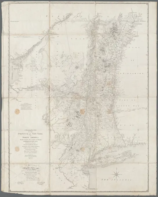
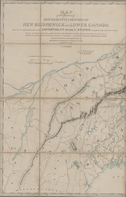
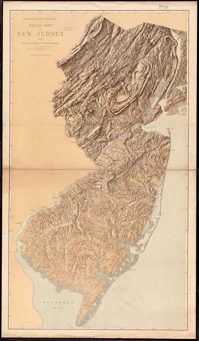
Architectural and chorographical maps featuring Guadaloupe and New Jersey, showcasing detailed reliefs, boundaries, and early cartographic style.

A map of the island of Guadaloupe , Guadeloupe, Maps, Early works to 1800, Basse-Terre Guadeloupe, Maps, Early works to 1800, Grande-Terre Island Guadeloupe, Maps, Early works to 1800 Norman B. Leventhal Map Center Collection
A map of the island of Guadaloupe , Guadeloupe, Maps, Early works to 1800, Basse-Terre Guadeloupe, Maps, Early works to 1800, Grande-Terre Island Guadeloupe, Maps, Early works to 1800 Norman B. Leventhal Map Center CollectionA map of the island of Guadaloupe. Relief shown by hachures. Oriented with north towards the upper right. Appears in Jefferys' General topography of North America and the West Indies. London: Printed for Robert Sayer, ... and Thomas Jefferys, 1768.... , Guadeloupe  ,territoryMap no. I , New Jersey, Maps, Early works to 1800, New Jersey, Boundaries, Maps, Early works to 1800, Middle Atlantic States, Maps, Early works to 1800, Stair, John Dalrymple, Earl of, 1673-1747, Bond, Benjamin Norman B. Leventhal Map Center CollectionA chorographical map of the province of New York in North America: divided into counties, manors, patents and townships : exhibiting likewise all the private grants of land made and located in that Province Cartographic. Maps. 1849. Lionel Pincus and Princess Firyal Map Division. Real property , New York (State), New York (State) , Administrative and political divisions, New York (State)The provinces of New York and New Jersey : with part of Pensilvania, and the Province of Quebec , United States, History, Revolution, 1775-1783, Maps, Early works to 1800, Northeastern States, Maps, Early works to 1800, New York State, Administrative and political divisions, Maps, Early works to 1800, New Jersey, Administrative and political divisions, Maps, Early works to 1800, Québec Province, Maps, Early works to 1800, New York N.Y., Maps, Early works to 1800, Perth Amboy N.J., Maps, Early works to 1800 Norman B. Leventhal Map Center CollectionPlan of Rowley made by Philander Anderson, dated July 1830 ,. Massachusetts. Office of the Secretary of StateMap no. I. Covers area from Boston to Cape Hatteras with New Jersey partition and northern boundary lines. Prime meridian: London. "Engraved & printed by James Turner near the Town House Boston." Includes names of the places in English and their Dutch equivalents. Includes decorative cartouche.. The Bill in the Chancery of New Jersey was filed by the Proprietors of East New Jersey to defend their position in a land dispute with settlers around Elizabeth. This is the first of the volume's three maps, which provides geographical context for the early grants and charters relevant to the dispute. The involvement of Boston engraver James Turner is evidence of the town's pre-eminence in the mid-18th century: when the Bill's author James Alexander needed the maps engraved, Benjamin Franklin advised him that Philadelphias craftsmen were not up to the job and recommended Turner instead.. Map no. 1 Map number one. Map no. 1 Map number one, New JerseyPlan of Quincy made by John G. Hales, dated 1830 ,. Massachusetts. Office of the Secretary of StateAshland & Bayfield , Bayfield County Wis., Maps, Ashland County Wis., Maps, Manuscript maps Norman B. Leventhal Map Center CollectionThe state of New York, compiled from the most authentic information, 1796 Cartographic. Maps. 1796. Lionel Pincus and Princess Firyal Map Division. New York (State)The province of New Jersey, divided into east and west, commonly called the Jerseys. Relief shown by hachures. Notation at bottom: This map has been drawn from the survey made in 1769 ... by Bernard Ratzer. Above notation: Engraved & published by Wm. Faden, Charing Cross, December 1st, 1777. Imprint of Perrier et Verrier is below neat line at bottom. French edition of state 1 of Faden's map. Engraved by: Croisey. Table of astronomical observations at lower right.... , New JerseySouth America-- west coast, Chile, Concepcion Bay : from British and French surveys. Relief shown by hachures and spot heights. Depths shown by soundings and isolines. Inset: Tome Bay... Concepcion Bay. Concepcion Bay, Chile  , Biobío  ,region   , Concepción, Bahía  ,bayGrundriss des nördlichen Theils der Neujorks Insel nebst den am 16. Novbr. 1776. eroberten Fort Washington nun das Fort Knÿphausen genannt und dem Fort Lee Cartographic. Maps. 1777. Lionel Pincus and Princess Firyal Map Division. American Revolution (1775-1783), Fort Washington (New York, N.Y.), Fort Lee (N.J.), New York (N.Y.), United States , History , Revolution, 1775-1783Plan of Yarmouth made by Benjamin Matthews, Jr., dated 1830 ,. Massachusetts. Office of the Secretary of StateSkeleton map of rail-roads between Cape Canso and St. Louis , Railroads, United States, Maps, Massachusetts, Maps, United States, Maps Norman B. Leventhal Map Center CollectionMap of the country between Washington & Pittsburg refering to the contemplated Chesapeake & Ohio Canal and its general route and profile, October 1826 , Canals, Maryland, Maps, Canals, Pennsylvania, Maps, Chesapeake and Ohio Canal Md. and Washington, D.C., Maps Norman B. Leventhal Map Center CollectionThe Great Bahama Bank with its islands cays and channels , Nautical charts, Bahamas, Great Bahama Bank, Bahamas, Maps, Great Bahama Bank Bahamas, Maps Norman B. Leventhal Map Center CollectionA sketch of the environs of Charlestown in South Carolina. Relief shown by shading. Depths shown by soundings. Includes index to events and points of interest. Second state, lacking imprint and with additional references.... , South Carolina  , Charleston  ,county   , CharlestonA new map of Carolina , North Carolina, Maps, Early works to 1800, South Carolina, Maps, Early works to 1800, South Atlantic States, Maps, Early works to 1800 Norman B. Leventhal Map Center CollectionPlan of Rowley made by Philander Anderson, dated July 1830 ,. Massachusetts. Office of the Secretary of StatePlan of Yarmouth made by Benjamin Matthews, Jr., dated 1830 ,. Massachusetts. Office of the Secretary of StateA chorographical map of the Province of New-York in North America, divided into counties, manors, patents and townships : exhibiting likewise all the private grants of land made and located in that Province. Relief shown by hachures. Depths shown by form lines. Hand colored. Prime meridian: London. Inscribed: To His Excellency Major General William Tryon ... "Advertisement. The tracts of land coloured red, are military grants ... Those with a green edge are manors, and those coloured yellow are townships ... " Appears in Thomas Jefferys' The American atlas. 1776. Cataloging, conservation, and digitization made possible in part by The National Endowment for the Humanities: Exploring the human endeavor.... , New YorkMap of Boston and the country adjacent, from actual surveys , Boston Mass., Maps Norman B. Leventhal Map Center CollectionKelley's and Bass Islands showing the harbors of refuge in their vicinity being an extract from the survey of the west end of Lake Erie made under the direction of the Bureau of Topographical Engineers, War Department in obedience to acts of Congress requiring the survey of the northern and northwestern lakes. Relief shown by hachures. Depths shown by contours and soundings. Includes notes, ranges, and sailing directions. At head of title: Seal with text "Survey of the Lakes 1852."... , Ohio  , Erie  ,county   , Kelleys IslandPlan of Orange County, New York ; Plan of Rockland Co., New York Plan of Rockland Co., New York Map of Rockland and Orange Counties, N.Y. Plan of Rockland County, New York Cartographic. Maps, Cadastral maps. 1880. Lionel Pincus and Princess Firyal Map Division. Real property , New York (State) , Rockland County, Landowners , New York (State) , Rockland County, Real property , New York (State) , Orange County, Landowners , New York (State) , Orange County, Rockland County (N.Y.), Rockland County (N.Y.) , Administrative and political divisions, Orange County (N.Y.), Orange County (N.Y.) , Administrative and political divisionsMap of the Netherlands in Roman times, Salomon Savery, After Hermann Ewich, 1652 - 1680 print Historical map of the Netherlands and part of Germany in Roman times. At the top left the title cartouche.  paper engraving maps of cities NetherlandsThe states of Maryland and Delaware, from the latest surveys , Maryland, Maps, Early works to 1800, Delaware, Maps, Early works to 1800 Norman B. Leventhal Map Center CollectionA new chart of the coast of New England, Nova Scotia, New France or Canada, with the islands of Newfoundld. Cape Breton St. John's &c : done from the original publish'd in 1744 at Paris , Canada, Maps, Early works to 1800, New France, Maps, Early works to 1800, New England, Maps, Early works to 1800 Norman B. Leventhal Map Center CollectionA new chart of the coast of New England, Nova Scotia, New France or Canada, with the islands of Newfoundld. Cape Breton St. John's &c : done from the original publish'd in 1744 at Paris. Depths shown by soundings. "T. Jefferys sculp." Inset maps: "The Atlantic Ocean," "Plan of the city and port of Louisbourg," "City of Quebec," and Fort Dauphin. Decorative title cartouche. Shows coastal landmarks and settlements, with shoals, islands and sand banks. London meridian. Cataloging, conservation, and digitization made possible in part by The National Endowment for the Humanities: Exploring the human endeavor.... , Canada New England  ,area  New France  ,former administrative divisionA plan of the operations of the King's army : under the command of General Sr. William Howe, K.B. in New York and East New Jersey, against the American forces commanded by General Washington, from the 12th of October, to the 28th of November 1776, wherein is particularly distinguished the engagement on the White Plains, the 28th of October Cartographic. Maps. 1777-02-25. Lionel Pincus and Princess Firyal Map Division. New Jersey , History , Revolution, 1775-1783 , Maps , Early works to 1800, New York (State) , History , Revolution, 1775-1783 , Maps , Early works to 1800, Westchester County (N.Y.) , History , Revolution, 1775-1783 , Maps , Early works to 1800, White Plains, Battle of, 1776Delaware, from the best authorities , Delaware, Maps Norman B. Leventhal Map Center CollectionPolders map in the quarter of Maasland, Anonymous, 1720 - 1775 print Map of the polders in the quarter of Maasland. At the top left the title cartouche. At the top right the weapon of the quarter of Maasland. Bottom left a cartouche with scale: Negeneen Hundred Rhynand rods or a common Duytse Myle. At the bottom right an empty cartouche.  paper engraving / etching maps of separate countries or regions. polder, reclaimed land. coat of arms (as symbol of the state, etc.) (+ province; provincial) Maasland. Den BoschPlan of Charlestown peninsula in the state of Massachusetts , Charlestown Boston, Mass., Maps Norman B. Leventhal Map Center CollectionWest Indies, south coast of Cuba, Port of Santiago de Cuba : from a Spanish survey in 1863 corrected for the latest information 1887 , Nautical charts, Cuba, Santiago de Cuba Bay, Santiago de Cuba Bay Cuba, Maps Norman B. Leventhal Map Center CollectionWest Indies, south coast of Cuba, Port of Santiago de Cuba : from a Spanish survey in 1863 corrected for the latest information 1887. Relief shown by shading and form lines. Depths shown by soundings and isolines. Includes View of the entrance. "Edition of June 1887." "Cor. 1888.21... Port of Santiago de Cuba. Port of Santiago de Cuba, Cuba  , Santiago de Cuba  ,province   , Santiago de CubaA map & chart of the bays harbours post roads and settlements in Passamaquoddy & Machias with the large island of Grand Manan , Coasts, Maine, Maps, Coasts, New Brunswick, Maps, Maine, Maps, Passamaquoddy Bay N.B. and Me., Maps, Grand Manan Island N.B., Maps Norman B. Leventhal Map Center CollectionMap of the progress of his majesty's armies in New York during the late campaign illustrating the accounts publish'd in the London Gazette , Campaigns & battles, War, United States, History, Revolution, 1775-1783. Ralph Finos Map CollectionUnlocked by means of 9 demarcated parts, indicated by the letters A to J (with guide map, provided with compass rose with regions), Map of Saldanha Bay and immediate surroundings., draughtsman: Robert Jacob Gordon, (attributed to), draughtsman: Johannes Schumacher, (possibly), Kaapprovincie, c. 1784, paper, pen, brush, h 1090 mm × w 760 mmMap of the progress of his majesty's armies in New York during the late campaign illustrating the accounts publish'd in the London Gazette , Campaigns & battles, War, United States, History, Revolution, 1775-1783. Ralph Finos Map CollectionA Map and chart of the Cape of Good Hope, with the soundings in Table Bay, False Bay and Saldanha Bay , Cape of Good Hope South Africa, Maps, Early works to 1800 Norman B. Leventhal Map Center CollectionChart of Narraganset Bay : surveyed in 1832 , Narragansett Bay R.I., Maps, Nautical charts, Rhode Island, Narragansett Bay Norman B. Leventhal Map Center CollectionA map of the Province of New York, with part of Pensilvania, and New England. Cartographic. Maps. 1775. Lionel Pincus and Princess Firyal Map Division. New York (State) , Administrative and political divisions, New York (State), Northeastern StatesA new and accurate chart of the Bay of Chesapeak including Delaware Bay with all the shoals, channels, islands, entrances, soundings, & sailing marks as far as the navigable part of the rivers Patowmack Patapsco & N. East , Coasts, Delaware, Early works to 1800, Coasts, Maryland, Early works to 1800, Coasts, New Jersey, Early works to 1800, Coasts, Virginia, Early works to 1800, Nautical charts, Delaware Bay Del. and N.J., Early works to 1800, Nautical charts, Chesapeake Bay Md. and Va., Early works to 1800, Delaware Bay Del. and N.J., Maps, Early works to 1800, Chesapeake Bay Md. and Va., Maps, Early works to 1800 Norman B. Leventhal Map Center CollectionA compleat map of the Holy Land ; adapted to the Old and New Testament: Part 1st 1786. Dunn, Samuel, d. 1794. Cartographic. Maps. Lionel Pincus and Princess Firyal Map Division. Atlases, British, GeographyOfficial plan of the siege of Yorktown, Va. conducted by the Army of the Potomac under command of Maj. Gen. George B. McClellan, U.S.A., April 5th to May 3rd 1862. This plan shows about half the line, including the point of attack. The Rebel works are laid down from reconnoissances sic made immediately after the evacuation, and are correctly, but very incompletely represented, owing to want of time for sketching minor details.-Our works of siege, including the approaches in the ravines of Wormley Creek, are accurately shown. Redoubts being denoted by letters, and batteries by numbers. Contains a list of the "proposed armament of batteries." Indicates headquarters of Generals McClellan, Porter, Woodbury, and Heintzelman, houses, names of residents, roads, drainage, vegetation, and relief by hachures and spot heights. Description derived from published bibliography.... , Virginia  , York  ,county   , YorktownKarte von Sud-Afrika zur ubersicht der neuesten entdeckungen von Livingstone, Moffat, Galton, Anderson : Bain's geol. aufnahme, forschungen in Benguela &.&.&. Shows exploration routes in southern, central, and eastern Africa and geologic features in the Cape area. Relief shown by hachures and spot heights. Tafel 7 from: Petermann's Geographische Mitteilungen, Jahrgang 1858. Prime meridians: Greenwich and Paris. Includes "Profil von Livingstone's Reisewege quer durch Afrika, von Loanda nach Quilimane." Insets: Physikalische skizze von Sud-Afrika. (Botanische, zoologische, ethnographische Grenzen &.&.) -- Vergleichende ubersicht der neuesten vorstellungen uber die geographie des inneren Sud-Afrika's (H. Kiepert, Nov. 1855; J. McQueen, Marz 1857; D. Livingstone, Nov. 1857).... , Southern Africa  ,areaA new and correct map of the coast of Africa, from Sta. Cruz lat. 30 north. to the coast of Angola lat 11. S. with explanatory notes of all the forts and settlements belonging to the several European powers , Coasts, Africa, Maps, Africa, Maps, Early works to 1800 Norman B. Leventhal Map Center CollectionThe state of New York , New York State, Maps Norman B. Leventhal Map Center CollectionPort Royal appellé aujourd. par les Anglois Annapolis Royal , Annapolis Royal N.S., Maps, Early works to 1800 Norman B. Leventhal Map Center CollectionPort Royal appelle aujourd. par les Anglois Annapolis Royal. Relief shown by hachures. Depth shown by soundings. Appears in the Le Rouge's Recueil des plans de l'Amerique Septentrionale.... , Canada  , Nova Scotia  ,province   , Annapolis RoyalNorth America : British provinces of New Brunswick, Nova Scotia, & part of Canada : compiled from recent surveys and adjusted to the latest astronomical observations , Maritime Provinces, Maps, Nova Scotia, Maps, Prince Edward Island, Maps, New Brunswick, Maps, Québec Province, Maps, Maine, Maps Norman B. Leventhal Map Center CollectionNew Hampshire by recent survey : made under the supreme authority and published according to law , New Hampshire, Maps, New England, Maps, United States, Maps, Hampton Beach N.H., Pictorial works, White Mountains N.H. and Me., Pictorial works Norman B. Leventhal Map Center CollectionWest Indies, south coast of Cuba, Port of Santiago de Cuba : from a Spanish survey in 1863 corrected for the latest information 1887 , Nautical charts, Cuba, Santiago de Cuba Bay, Santiago de Cuba Bay Cuba, Maps Norman B. Leventhal Map Center CollectionPlan of Truro made by John G. Hales, dated 1831 ,. Massachusetts. Office of the Secretary of StatePlan of Acton made by John G. Hales, dated 1831 ,. Massachusetts. Office of the Secretary of StateMaryland , Maryland, Maps Norman B. Leventhal Map Center CollectionMap of the disputed territories in the colonies of New Brunswick and Lower Canada, published in 1840. The map highlights areas whose ownership is contested by the United States government and includes parts of the adjacent country. It features hand coloring and consists of 9 maps on 2 sheets, with dimensions of 79 x 124 cm and 50 x 78 cm. The map was published in London, England, by the Foreign Office and relates to boundary disputes between the United States and Great BritainA topographical map of the state of New Hampshire , New Hampshire, Maps, Early works to 1800 Norman B. Leventhal Map Center CollectionThe state of New Hampshire : compiled chiefly from actual surveys. Relief shown pictorially. Prime meridians: Philadelphia and London. In upper left margin: 26. Map 26 in his Carey's general atlas. Philadelphia : Mathew Carey, 1800.... , New HampshireKaart van Java met vijf bijkaartjes.Map of Java, the borders and coasts. 5 CONDRESS: L.O. Until, .o. Plan by Palabuan Ratu or Coops Coops Bay by Capt. Bare, the western and also the eastern harbor formed by the island of Nusa Kambang'an, the bay of Pachitan, R.B.: Mineralogical map by Thomas Horsfield, 1812. m.b. Is the bowl in British and Dutch miles. Inscription; L.O.: a Map of / Java / Chiefly From Surveys Made During The / British Administration / Constructed in illustration of an / account or Java.A Map and chart of the Cape of Good Hope, with the soundings in Table Bay, False Bay and Saldanha Bay. Relief shown pictorially. Depths shown by soundings. Appears in the Political Magazine. London: J. Bew, 1781. Vol. 2, p.279.... , Cape of Good Hope  ,former administrative divisionA topographical chart of the bay of Narraganset in the province of New England : with all the isles contained therein, among which Rhode Island and Connonicut have been particularly surveyed ; shewing the true position & bearings of the banks, shoals, rocks &c. as likewise the soundings ; to which have been added the several works & batteries raised by the Americans ; taken by order of the principal farmers on Rhode Island. Relief shown by hachures. Depths shown by soundings. Inscribed "To the Right Honourable Hugh Earl Percy ... with His Lordship's permission ... by ... Wm. Faden." Includes text, "References to the batteries," and "A list of the principal farms in Rhode Island." A version of this map can be viewed as a georeferenced overlay in an interactive application made especially for We Are One: Mapping America's Road from Revolution to Independence http://d2o8owo4k087al.cloudfront.net/index.htmlmapId=65.. This topographical map of Narragansett Bay was based on surveys conductedMap of the river Sainte Mary surveyed by order of the honorable the Commissioners under the 6th and 7th articles of the Treaty of Ghent , Canada, Boundaries, United States, Maps, Saint Marys River Mich. and Ont., Maps, United States, Boundaries, Canada, Maps, United States, History, War of 1812, Territorial questions, Maps Norman B. Leventhal Map Center Collection1768 Holland - Jeffreys Map of New York and New Jersey (First Edition)United States of America : The course of the River St. Laurence, from Lake Ontario, to Manicougan Point. Imprint derived from the atlas in which the map was issued. Appears in John Thompson's New General Atlas. 1817. "J. & G. Menzies sculp. ... " Saint Lawrence map NE/SW orientated and shown in two sections split at Orleans Island. Shows rivers and principal settlements. Relief shown by hachures and shading. Greenwich meridian. Saint Lawrence River ; United States east of the Mississippi River.... , Saint Lawrence River  ,river  United StatesRelief map of New Jersey , New Jersey, Maps Norman B. Leventhal Map Center CollectionMap of the European & North American Railway and its connections , Railroads, New England, Maps, Railroads, Maritime Provinces, Maps Norman B. Leventhal Map Center CollectionTo the Hone. Ino. Hancock Esqre. president of ye Continental Congress, this map of the seat of Civil War in America... Romans, Bernard (ca. 1720-ca. 1784). Cartographic. Prints, Maps. 1775. The Miriam and Ira D. Wallach Division of Art, Prints and Photographs: Print Collection. New England, Boston (Mass.), Massachusetts , History , Revolution, 1775-1783A map of part of the N:W: Territory of the United States : compiled from actual surveys, and the best information. Relief shown pictorially. Prime meridian: Philadelphia. In upper right: 47. Map 47 in his Carey's general atlas. Philadelphia : Mathew Carey, 1800.... , Indiana Michigan OhioA new and accurate chart of the Bay of Chesapeak including Delaware Bay with all the shoals, channels, islands, entrances, soundings, & sailing marks as far as the navigable part of the rivers Patowmack Patapsco & N. East , Coasts, Delaware, Early works to 1800, Coasts, Maryland, Early works to 1800, Coasts, New Jersey, Early works to 1800, Coasts, Virginia, Early works to 1800, Nautical charts, Delaware Bay Del. and N.J., Early works to 1800, Nautical charts, Chesapeake Bay Md. and Va., Early works to 1800, Delaware Bay Del. and N.J., Maps, Early works to 1800, Chesapeake Bay Md. and Va., Maps, Early works to 1800 Norman B. Leventhal Map Center CollectionMap of the vicinity of Boston. Also shows township boundaries, roads and railroads. Relief shown by hachures. "Entered according to Act of Congress in the year 1848 by S.N. Dickinson in the Office of the District Court of Massachusetts."... , MassachusettsA map of Boston, county of Suffolk and the adjacent towns , Boston Mass., Maps, Massachusetts, Maps Norman B. Leventhal Map Center CollectionMap of the Harbor of New York to accompany the Report of the Harbor Commissioners made to the Legislature January 27th, 1857 1857. Cartographic. Maps. Lionel Pincus and Princess Firyal Map Division. New York (N.Y.), City planning, Harbors , New York (State) , New York (N.Y.)Map of the Battle of Woerth, 6 August 1870, (c1872). Map: 'Drawn under the Superintendance of Captain Hozier', showing the enemy positions. The second Battle of Wörth, also known as the Battle of Reichshoffen or the Battle of Froeschwiller, took place near the village of Woerth in Alsace (in France), in the opening stages of the Franco-Prussian War of 1870-1871. From "The Franco-Prussian War: its causes, incidents and consequences", Volume I, by Captain H M Hozier. William Mackenzie, London, 1872A plan of the operations of the King's army under the command of General Sr. William Howe, K.B. in New York and east New Jersey against the American forces commanded by General Washington from the 12th. of October, to the 28th. of November 1776 : wherein is particularly distinguished the engagement on the White Plains, the 28th. of October , White Plains, Battle of, White Plains, N.Y., 1776, Maps, Early works to 1800, New York State, History, Revolution, 1775-1783, Maps, Early works to 1800, New Jersey, History, Revolution, 1775-1783, Maps, Early works to 1800 Norman B. Leventhal Map Center CollectionMap / Department / Lower Seine. (IT)Dominion of Canada, Cape Breton Island, Saint Anne Harbor and Great Bras d'Or : from British surveys in 1848-57 , Coasts, Nova Scotia, Cape Breton Island, Maps, Nautical charts, Nova Scotia, Saint Anns Bay, Nautical charts, Nova Scotia, Great Bras d'Or, Saint Anns Bay N.S., Maps, Great Bras d'Or N.S., Maps, Cape Breton Island N.S., Maps Norman B. Leventhal Map Center CollectionChart of the Streights of Belle Isle , Coasts, Newfoundland and Labrador, Maps, Early works to 1800, Coasts, Nova Scotia, Maps, Early works to 1800, Coasts, Québec Province, Maps, Early works to 1800, Nautical charts, Belle Isle, Strait of N.L., Early works to 1800, Nautical charts, Saint Lawrence, Gulf of, Early works to 1800, Belle Isle, Strait of N.L., Maps, Early works to 1800, Newfoundland and Labrador, Maps, Early works to 1800, Québec Province, Maps, Early works to 1800, Saint Lawrence, Gulf of, Maps, Early works to 1800 Norman B. Leventhal Map Center CollectionNautical chart of the Bay and harbor of New York, published by the U.S. Coast and Geodetic Survey in 1889. The map features hand coloring and measures 119 x 97 cm. It depicts harbors, waterfronts, and coastal areas of the New York Metropolitan Area, including New York Harbor (N.Y. and N.J.) and New York Bight (N.J. and N.Y.)Chart of the coast of China and of the Japan islands : including the Marianes and part of the Philippines. Depths shown by soundings. Includes two elevations. "Drawn by Edw. Sels. Engr. by Selmar Siev" Last name indecipherable. Exhibited in Faces and Places, at the Boston Public Library, Boston, MA, October 2003 - September 2004. MB (BRL). Published by the U.S. Navy, this map of the coast of China and Japan was the direct result of Commodore Matthew C. Perry's ground-breaking diplomatic journey to Asia in 1853 -1854. Among the goals of the expedition was the completion of coastal surveys of China, Japan, and other nations in this region. The missing Korean coastline provides evidence that Perry did not travel as far north as Korea... , China JapanA plan of the river and sound of D'Awfoskee in South Carolina , Nautical charts, South Carolina, Calibogue Sound, Early works to 1800, Nautical charts, South Carolina, Tybee Roads, Early works to 1800, Calibogue Sound S.C., Maps, Early works to 1800, Sea Islands, Maps, Early works to 1800, Tybee Roads S.C., Maps, Early works to 1800 Norman B. Leventhal Map Center CollectionNew Jersey, Double Page Sheet No. 19 Map of New Jersey Relief Map Cartographic. Atlases, Maps. 1884 - 1889. Lionel Pincus and Princess Firyal Map Division. New Jersey, Geology , New JerseyPlan of Shapleigh surveyed by Daniel Sewall, dated 1794-5. ,. Massachusetts. Office of the Secretary of StateNorth America : British provinces of New Brunswick, Nova Scotia, & part of Canada : compiled from recent surveys and adjusted to the latest astronomical observations , Maritime Provinces, Maps, Nova Scotia, Maps, Prince Edward Island, Maps, New Brunswick, Maps, Québec Province, Maps, Maine, Maps Norman B. Leventhal Map Center CollectionMap of military reconnaissance from Fort Taylor to the Coeur d'Alene mission, Washington Territory. Relief shown by form lines. Shows approximate location of military road constructed 1859 to 1862. Also shows farms, camps, trails, bridges, vegetation types, rapids, rock outcrops, landings, and locations of battles. "Senate Ex. Doc. No. 43-47th Cong. 3d. Sess."... , Idaho WashingtonExactissima Helvetiae, Rhaetiae, Valesiae caeterorumque Confoederatorum ut et finitimorum populorum regionum tabula : illustrissimis, potentissimis Rebus-Publicis Helvetiorum, Tigurinae, Bernensi, Basiliensi, Scaphusinae novam hanc & postomnes alias exactissimam Helvetiae tabulam d. d. d , Switzerland, Maps, Early works to 1800 Norman B. Leventhal Map Center CollectionExactissima Helvetiae, Rhaetiae, Valesiae caeterorumque Confoederatorum ut et finitimorum populorum regionum tabula : illustrissimis, potentissimis Rebus-Publicis Helvetiorum, Tigurinae, Bernensi, Basiliensi, Scaphusinae novam hanc & postomnes alias exactissimam Helvetiae tabulam d. d. d. Relief shown pictorially. "Cum Privil. Prepotentiss. Ordinum General: Belgii Foederae." Verso is blank. Cataloging, conservation, and digitization made possible in part by The National Endowment for the Humanities: Exploring the human endeavor. Part of composite portfolio atlas with title "Collection of old maps."... , SwitzerlandMap of the United States of America, 1815, by John Melish (1771-1822). Issued in Philadelphia. Publisher, John Melish., 1 map; 34 x 44 cmA plan of the town and harbour of Boston, and the country adjacent with the road from Boston to Concord shewing the place of the late engagement between the King's troops & the provincials, together with the several encampments of both armies in & about Boston : taken from an actual survey , Concord, Battle of, Concord, Mass., 1775, Maps, Early works to 1800, Facsimiles, Boston Mass., History, Revolution, 1775-1783, Maps, Early works to 1800, Facsimiles, Boston Harbor Mass., Maps, Early works to 1800, Facsimiles Norman B. Leventhal Map Center CollectionNorth America, east coast of Newfoundland, Cape Bonavista to Bay Bulls including Trinity, & Conception Bays : from Brit. surveys 1867-1871 ; republication of Brit. Admty. chart no. 296, corrected to 1874. Relief shown by hachures and spot heights. Depths shown by soundings and isolines. Includes 6 coastal views... Newfoundland, Cape Bonavista to Bay Bulls. Newfoundland, Cape Bonavista to Bay Bulls, Canada  , Newfoundland and Labrador  ,province   , Bonavista Bay Canada  , Newfoundland and Labrador  ,province   , Trinity Bay Canada  , Newfoundland and Labrador  ,province   , Conception BayA chart of New York Island & North River, East River, passage through Hell Gate, Flushing Bay, Hampstead Bay, Oyster Bay, Huntington Bay, Cow Harbour, East Chester Inlet, Rochelle, Rye, Patrick Islands, &c. Cartographic. Maps. 1770 - 1779. Lionel Pincus and Princess Firyal Map Division. New York (N.Y.), Coasts , New York (State) , Long Island (N.Y.), Nautical charts , Long Island Sound (N.Y. and Conn.)A map of 100 miles round Boston , New England, Maps, Early works to 1800, Boston Mass., Maps, Early works to 1800 Norman B. Leventhal Map Center CollectionNautical chart of the Atlantic Coast, specifically the Chesapeake entrance to Ocracoke Inlet, issued in 1863 by the United States Coast Survey. The chart measures 70 x 43 cm and is printed on a sheet of 79 x 51 cm. It is a preliminary edition highlighting the nautical features of the coastlines of Virginia and North Carolina. The place of publication is Washington, D.CConnecticut from the best authorities , Connecticut, Maps Norman B. Leventhal Map Center CollectionCarte de la Dominique prise par les francois le 7 septembre 1778 : avec le Plan du debarquement, et de l'attague des forts et batteries par les troupes et les fregates de Sa Majeste. Relief shown by hachures. Shows parish boundaries. Dediee a M. de Sartine, Ministre et secretaire d'Etat au Departement de la marine et des colonies. Appears in Guillaume de l'Isle and the author's Atlas geographique et universal. 1781 i.e. 1784 v. 2. no. 136. Includes location map, note, and inset of "Plan du debarquement et de l'attaque des forts et batteries." Cataloging, conservation, and digitization made possible in part by The National Endowment for the Humanities: Exploring the human endeavor.... , DominicaMonmouthshire text. Maps, Atlases. 1793. Lionel Pincus and Princess Firyal Map Division. Geography, Great BritainSouth America, west coast, sheet 17, Ecuador, Ayangui Pt. to Verde Pt : republication of Brit. Admty. chart no. 1814, with additions to 1876. Relief shown by hachures and spot heights. Depths shown by soundings. Insets: Cape Pasado Anchorage -- Port Manta or Puebo... Ecuador, Ayangui Pt. to Verde Pt. Ecuador, Ayangui Pt. to Verde Pt, Ecuador  , Manabi  ,province   , Pasado, Cabo  ,cape  Ecuador  , Manabi  ,province   , Manta, Bahía de  ,bayA topographical map of the State of New Hampshire , New Hampshire, Maps, Early works to 1800, New Hampshire, Administrative and political divisions, Maps, Early works to 1800 Norman B. Leventhal Map Center CollectionMap of the Environs of Sevastopol by Wyld, James (1812-1887) / Private Collection / 1854 / Great Britain / Lithograph / History /Map of the superficial geology of the British Isles with the physical and topographical features, the line of railways , Geology, Great Britain, Maps, Geology, British Isles, Maps, British Isles, Maps, Great Britain, Maps Norman B. Leventhal Map Center Collection