My Boards
View Pictures
  • My Boards
← Documents & Records

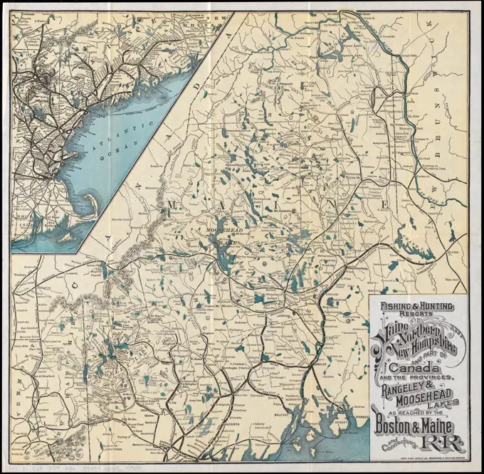
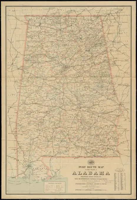
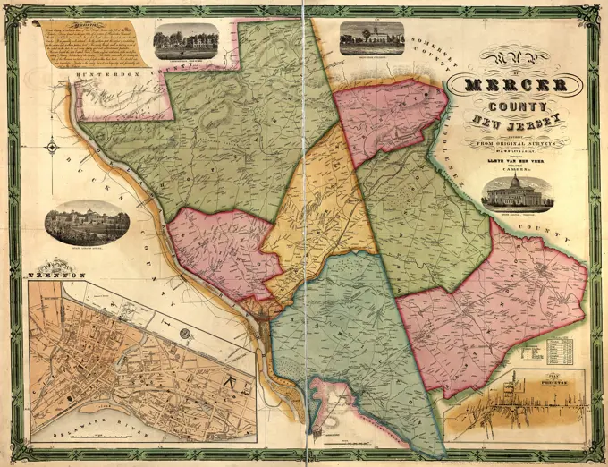
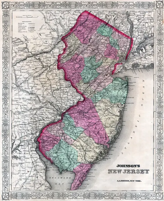
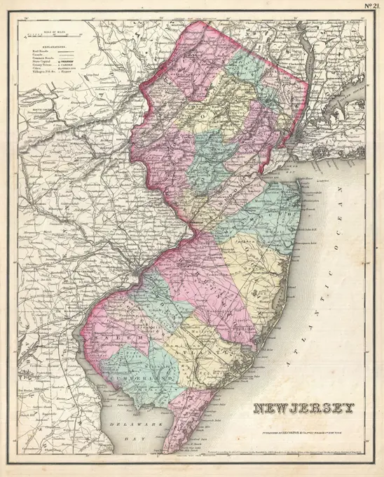
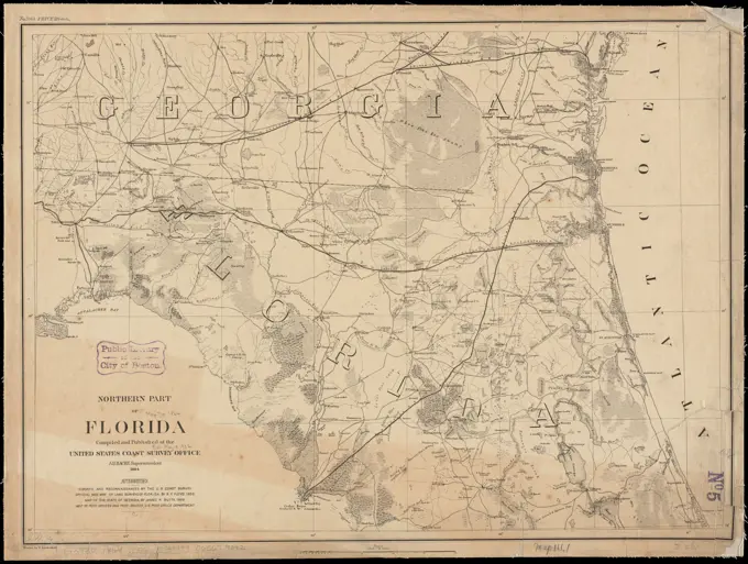
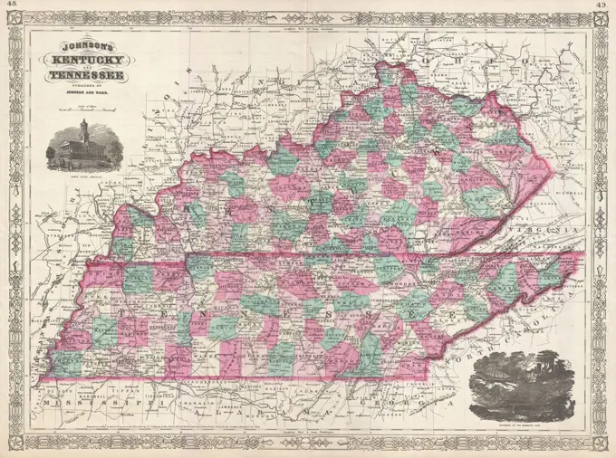
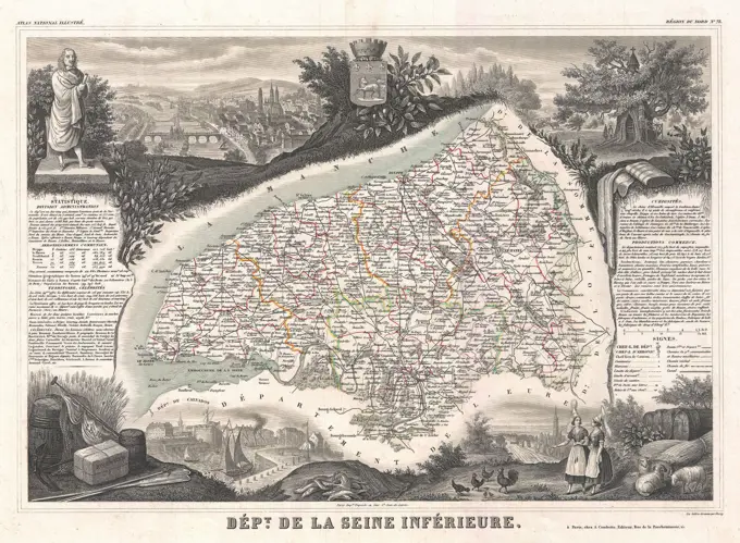
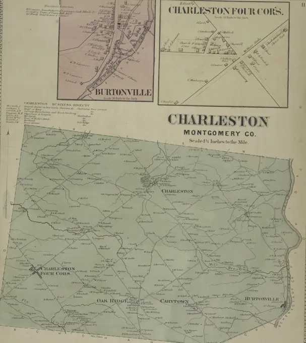
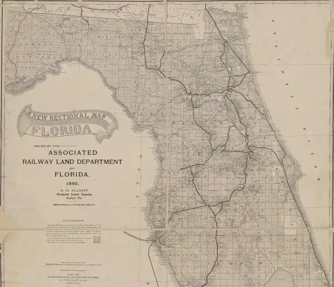
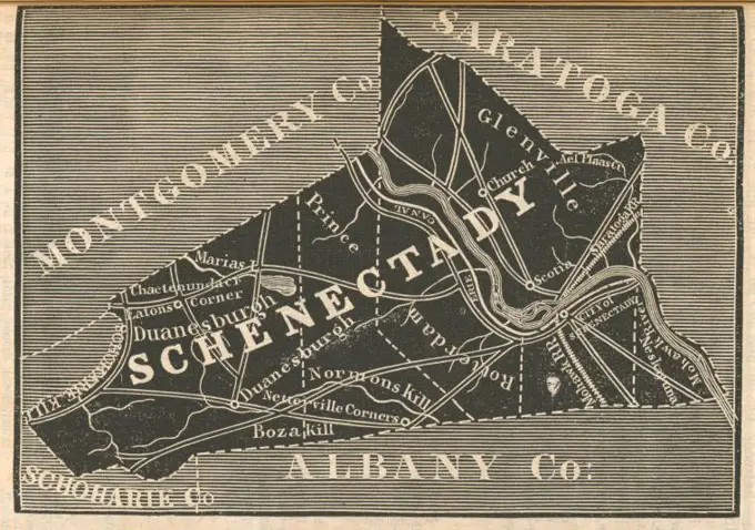
Historical Maps of New England and Beyond

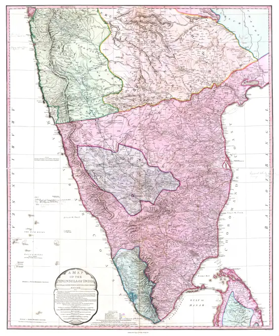
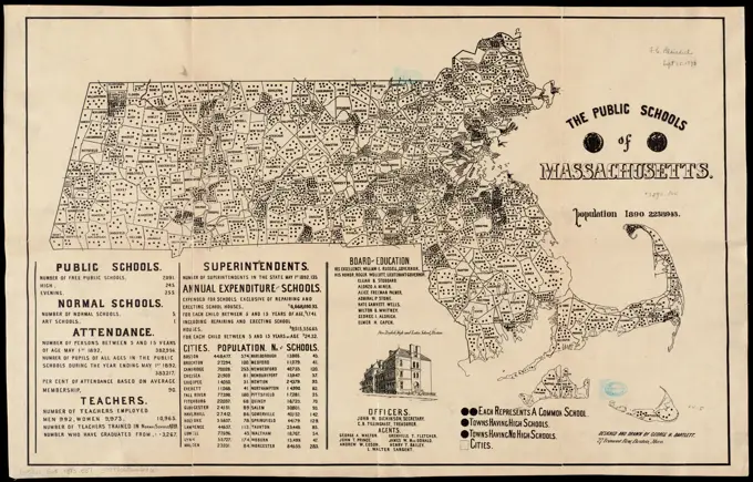
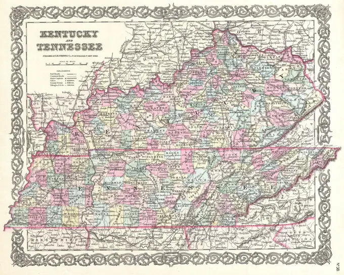
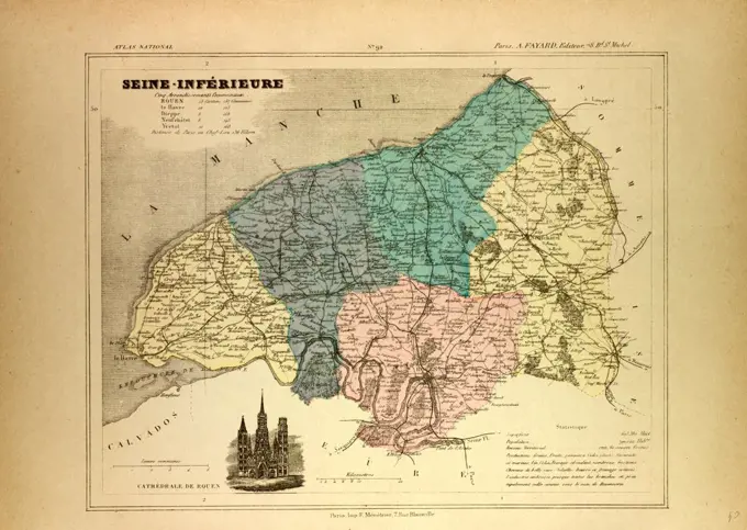
A collection of detailed historical maps featuring regions like Boston, the Adirondack wilderness, and New York, showcasing intricate boundaries and geographical features.

Map of the town of Marlborough , Landowners, Massachusetts, Marlborough, Maps, Marlborough Mass., Maps Norman B. Leventhal Map Center Collection
153 assets in this story
6145-48718735
Fishing & hunting resorts of Maine, northern New Hampshire, and part of Canada and the provinces, Rangeley & Moosehead Lakes as reached by the Boston & Maine R.R. and connections , Maine, Maps, Fishing, Maine, Maps, Hunting, Maine, Maps, Railroads, Maine, Maps, Boston and Maine Railroad Norman B. Leventhal Map Center Collection
6145-51386552
Post route map of the state of Alabama showing post offices with the intermediate distances on mail routes in operation on the 1st of December, 1903 , Counties, Alabama, Maps, Postal service, Alabama, Maps, Railroads, Alabama, Maps, Alabama, Maps Norman B. Leventhal Map Center Collection
6239-70845545
Map of Mercer County, New Jersey  | Library of Congress
6145-55914967
Map of the state of Alabama. Prime meridians: Washington and Greenwich. Relief shown by shading.... , Alabama
6145-54269262
South Africa. Relief shown by hachures. Includes illustrations of the standard of the Transvaal and the flag of the British Empire, intended to be cut out and used to track the course of the South African War.... , South Africa
6145-43862108
South Africa , South Africa, Maps Norman B. Leventhal Map Center Collection
6176-66901229
Johnson's New Jersey - Alvin Jewett - 1867
6145-55914827
Map of the county of Norfolk, Massachusetts : based upon the trigonometrical survey of the state. Relief shown by hachures. Shows land ownership, roads, railroads, mills, schools, etc. Includes 4 views of residences and boot factory, a table of distances, business directory and statistical table.... , Massachusetts  , Norfolk  ,county
6145-29094993
1857 Colton Map of New Jersey
6145-50536558
Colton's New Hampshire , New Hampshire, Maps Norman B. Leventhal Map Center Collection
6176-66921021
Map showing the Washington & St. Mary's Railroad and its proposed connections north, south, east andwest. Middle Atlantic states showing relief by hachures, drainage, counties, cities and towns, roads, and railroads with the main lines emphasized, 1887
6145-55915771
Northern part of Florida. No. 3015.... , Florida
6145-29095417
1866 Johnson Map of Kentucky and Tennessee
6145-55167022
Fishing & hunting resorts of Maine, northern New Hampshire, and part of Canada and the provinces, Rangeley & Moosehead Lakes as reached by the Boston & Maine R.R. and connections. Shows railroads with stations, and hunting and fishing camps, lodges, hotels, etc. Relief shown by hachures. Inset: Part of New England. Published in the second edition of "Summer excursions to the White Mountains, Mount Desert ..." (Boston: Passenger Dept., Boston & Maine Railroad, 1899)... Fishing and hunting resorts of Maine, northern New Hampshire, and part of Canada and the provinces, Rangeley & Moosehead Lakes as reached by the Boston & Maine R.R. and connections. Fishing and hunting resorts of Maine, northern New Hampshire, and part of Canada and the provinces, Rangeley & Moosehead Lakes as reached by the Boston & Maine R.R. and connections, Maine
6145-55917832
Worcester County : Essex County. Maps of Worcester and Essex counties, appearing in the March 6, 1812 (no. 20 of v. 1) edition of The Weekly Messenger.. During the first weeks of March 1812, several Boston newspapers published this map which inspired the creation of the gerrymander cartoon. The map illustrates the new senatorial districts in Worcester and Essex Counties. The article explains that these counties had an immense Federal majority, but would likely elect four Federalists and five Jeffersonian Democrat-Republicans, the party of Governor Elbridge Gerry. In criticizing this redistricting plan, the influential Federalist newspapers commented that the ruling party carved the Commonwealth, not  as a dish fit for Gods but hewn it as a carcase fit for hounds... , Massachusetts  , Essex  ,county  Massachusetts  , Worcester  ,county
6145-51393229
Geologic map of Illinois , Geology, Illinois, Maps Norman B. Leventhal Map Center Collection
4409-21518333
Part of Ward 26. Land Map Section, No. 14. Volume 1, Brooklyn Borough, New York City.
6145-51396191
Map of the city of Boston and vicinity , Boston Mass., Maps Norman B. Leventhal Map Center Collection
6145-52360097
County map of Kentucky and Tennessee. Mitchell, S. Augustus (Samuel Augustus), 1792-1868. Cartographic. Maps. 1863. Lionel Pincus and Princess Firyal Map Division
6145-55914968
Map of the state of Illinois. Includes time dial, distance chart, population table, ill., and 19 insets. Ill. of political figures in ornamental border. Climatological map dated 1863. Insets: Geological map of the state of Illinois -- Climatological map of the state of Illinois shewing the isothermal lines, comparative amount of rainfall &c. / by Lorin Blodget -- Peoria -- City of La Salle, La Salle Co. ; City of Peru, La Salle Co. -- Litchfield, Montgomery Co. -- City of Ottawa -- Military map of the United States -- City of Morris, Grundy Co. -- Elgin -- Galena -- City of Bloomington, McLean Co. -- City of Rockford -- Rock Island -- Springfield -- City of Bloomington, McLean Co. -- Jacksonville -- Quincy, Adams Co. -- City of Mendota -- City of Chicago.... , Illinois
6145-55915007
Map of the town of Boylston, Worcester County, Mass : surveyed by order of the town. Shows buildings with names of property owners and school districts. Relief shown by hachures. "Entered according to Act of Congress by H.F. Walling in the Clerks Office Dist. of Mass. A.D. 1856."... , Massachusetts  , Worcester  ,county   , Boylston Center
6145-29094649
1852 Levasseur Map of the Department De La Seine Inferieure, France
6145-29096383
1800 Map of Peninsular India-1795
6145-48717571
Map of the Berkshire Hills Massachusetts , Berkshire Hills Mass., Maps Norman B. Leventhal Map Center Collection
6145-51396853
Map of Warren County, New Jersey , Real property, New Jersey, Warren County, Maps, Landowners, New Jersey, Warren County, Maps, Warren County N.J., Maps Norman B. Leventhal Map Center Collection
6145-55167620
The public schools of Massachusetts. Includes statistical tables, list of members and officers of the Board of Education, and ill. of Boys English High and Latin School, Boston.. Massachusetts has historically been a leader in providing free education for children since the late 18th century. After the American Revolutionary War, public education at the elementary level was open to both male and female children, and geography was consistently part of the curriculum. George Bartlett, an artist and school principal, produced this map illustrating the number of public schools by town throughout the state in 1892. At this time, there were over 7,000 public schools throughout the commonwealth, with women accounting for over 90% of teachers... , Massachusetts
6145-50552619
Map of Boston postal stations , Postal service, Massachusetts, Boston, Maps, Boston Mass., Maps Norman B. Leventhal Map Center Collection
6145-52359843
Topographical Map of Monmouth Co., New Jersey. Cartographic. Atlases, Maps. 1873. Lionel Pincus and Princess Firyal Map Division. Monmouth Couty (N.J.) , Description and travel, Real property , New Jersey , Monmouth County
6145-50571022
Map of the town of Taunton, with a view of the public buildings , Real property, Massachusetts, Taunton, Maps, Landowners, Massachusetts, Taunton, Maps, Taunton Mass., Maps Norman B. Leventhal Map Center Collection
6145-51393994
Karte der Rheinlande , Rhineland Germany, Maps Norman B. Leventhal Map Center Collection
6145-55915583
New map of Massachusetts. Includes 5 city insets of Salem, Worcester, Boston, Springfield, Lowell, and a table of distance and population. Shows some buildings, roads, canals, mills, proposed Cape Cod Canal. Relief shown by hachures.... , Massachusetts
6145-29094835
1855 Colton Map of Kentucky and Tennessee
4443-11138
MAP OF SEINE-INFRIEURE, FRANCE
6145-52359842
West Amwell Township; West Amwell Business Notices. ; East Amwell Business Notices. Cartographic. Atlases, Maps. 1873. Lionel Pincus and Princess Firyal Map Division. Hunterdon County (N.J.) , Maps
6145-29095419
1866 Johnson Map of North Carolina and South Carolina
6145-55181269
Map of Oswego Co. Cartographic. Atlases, Maps. 1867. Lionel Pincus and Princess Firyal Map Division. Oswego County (N.Y.), Real property , New York (State) , Oswego County, Business enterprises , New York (State) , Oswego County
6145-55963725
Tri-state power map : Pennsylvania -- New York -- New Jersey
6145-50571666
Colton's new topographical map of the states of Virginia, West Virginia, Maryland & Delaware and portions of other adjoining states , Virginia, Maps, West Virginia, Maps, Maryland, Maps, Delaware, Maps Norman B. Leventhal Map Center Collection
6176-66908263
Map of Lancaster County, Pennsylvania. 1851
6145-50568520
Map of the town of Canton, Norfolk County, Mass , Landowners, Massachusetts, Canton, Maps, Canton Mass., Maps Norman B. Leventhal Map Center Collection
6145-55913773
A geographically correct county map of states traversed by the St. Louis, Iron Mountain and Southern Railway, and its connections. Relief shown by hachures. Includes advertisement. Text on verso... Great mail & paseenger through line, terminating at St. Louis, Mo., Cairo, Ill., Columbus, Ky., and Texarkana, Texas. Great mail & paseenger through line, terminating at St. Louis, Mo., Cairo, Ill., Columbus, Ky., and Texarkana, Texas, Southwest  ,area
6145-52359830
Tewksbury Township Cartographic. Atlases, Maps. 1873. Lionel Pincus and Princess Firyal Map Division. Hunterdon County (N.J.) , Maps
6145-50567801
Eastern Hungary , Ethnology, Hungary, Maps, Hungary, Maps Norman B. Leventhal Map Center Collection
6145-55913558
Eastern Hungary. Shows nationalities. In upper right: The Geographical Review, vol. VI, no. 2, 1918, pl. IX... Eastern Hungary nationalities. Eastern Hungary nationalities, Hungary
4443-75460449
Map of Chester County, Pennsylvania, issued in 1873 by A.R. Witmer. The hand-colored map measures 48 x 52 cm and features details related to railroads, postal service, and administrative and political divisions within Chester County. The map is located in Safe Harbor, PA
4443-75464834
Burtonville Village; Charleston Four Corners Village; Charleston Business Directory; Charleston Montgomery County Township, 1868., 1868., New York. Publisher, Stranahan & Nichols. Real property, New York (State), Montgomery County; Real property, New York (State), Fulton County; Montgomery County (N.Y.); Fulton County (N.Y.)
6145-51394963
Map of the County of Middlesex, New Jersey , Real property, New Jersey, Middlesex County, Maps, Buildings, New Jersey, Middlesex County, Pictorial works, Landowners, New Jersey, Middlesex County, Maps, Middlesex County N.J., Maps Norman B. Leventhal Map Center Collection
4443-75471060
A new sectional map of Florida, issued in 1890 by the Associated Railway Land Department of Florida. The map measures 109 x 79 cm, displayed on a sheet of 113 x 83 cm. It illustrates real property, railroads, and administrative and political divisions within Florida. The place of publication is Sanford, Florida
6145-55181111
St. Johnsville Montgomery Co. Township; Mohawk Montgomery Co. Township Cartographic. Atlases, Maps. 1868. Lionel Pincus and Princess Firyal Map Division. Real property , New York (State) , Montgomery County, Real property , New York (State) , Fulton County, Montgomery County (N.Y.), Fulton County (N.Y.)
6145-52359116
Alabama. Negro percentage of total population, 1900. Cartographic. Maps. 1903. Schomburg Center for Research in Black Culture, Jean Blackwell Hutson Research and Reference Division. African Americans , Employment, Population, African Americans , Alabama
6145-50570939
Map of the town of Raynham, Bristol County, Mass : surveyed by order of the town , Real property, Massachusetts, Raynham Town, Maps, Landowners, Massachusetts, Raynham Town, Maps, Raynham Mass. : Town, Maps Norman B. Leventhal Map Center Collection
4443-75477418
Mitchell's national map of the American Republic or United States of North America, 1843. Published by S. Augustus Mitchell in Philadelphia. The map includes detailed maps of the vicinities of thirty-two principal cities and towns in the union. It is a hand-colored map measuring 62 x 85 cm
6145-52359610
Schenectady County. Cartographic. Atlases, Maps. 1838. Lionel Pincus and Princess Firyal Map Division. New York (State), Schenectady County (N.Y.) , Maps
PREVIOUS
of 2
NEXT
2401 S. Ervay, Suite 206
Dallas, Texas 75215
United States
Get Started
Free ResearchMy BoardsMy Cart
For Creators
How To License Your ContentContributor PortalFrame of Mind
Resources
API accessPricing
Contact
+1 866 236 0087help@viewpictures.co.uk Contact form
©2026 View Pictures. All Rights Reserved. -A
This site is protected by reCAPTCHA and Google Privacy Policy and Terms of Service apply.