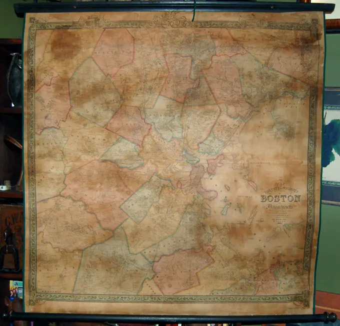
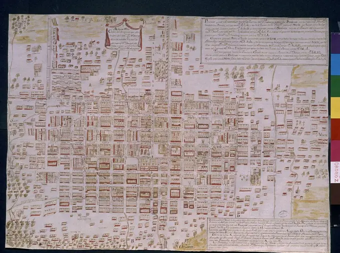
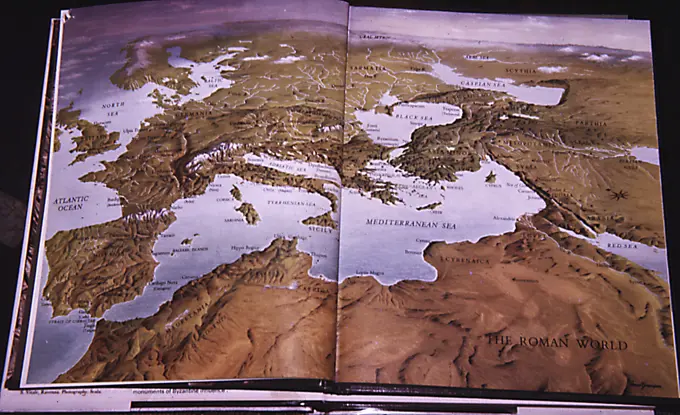
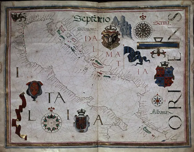
Historical Maps of North Africa and Beyond

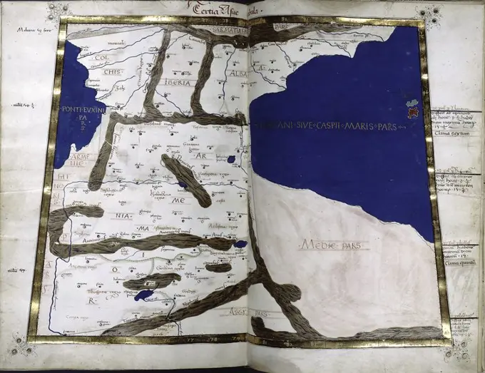
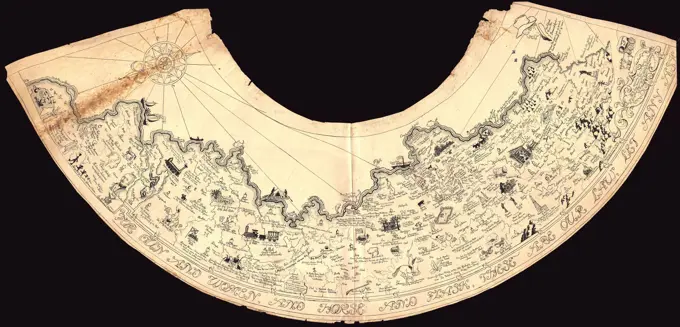
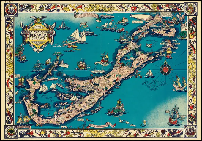
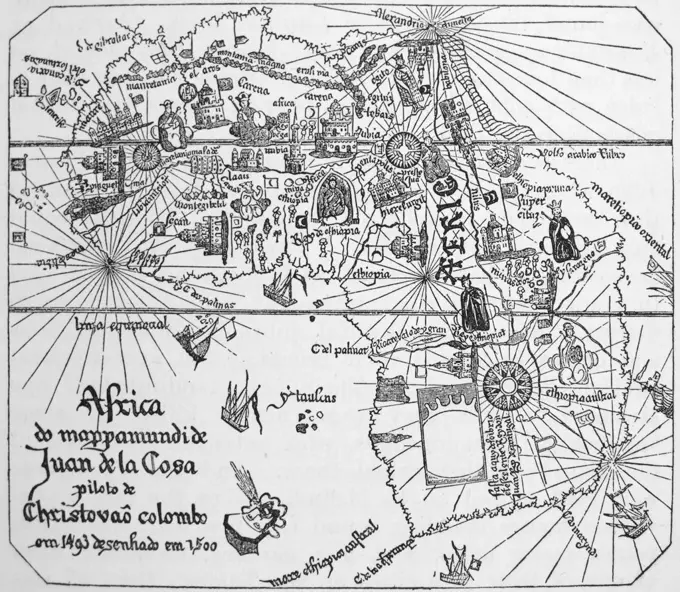
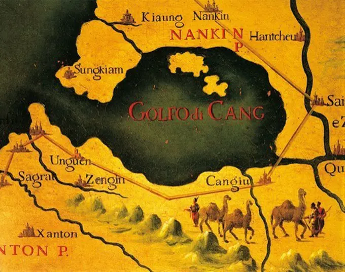
Ancient and medieval maps depicting cities and regions of North Africa and surrounding areas, illustrating historical geography and cartography techniques.

Cartography, 12th century. Parchment map representing the Holy Land and adjacent regions.
1852 Shields Wall Map of Boston and VicinityPlan of Venice 1: 2600Chūseki keishi chizu , Kyoto Japan, Maps Norman B. Leventhal Map Center CollectionMap of the city of Salem, Mass : from an actual survey , Salem Mass., Maps Norman B. Leventhal Map Center CollectionZARAGOZA - DIBUJO - 1563 - 210X605MM - PLUMA TINTA NEGRA. Author: ANTON VAN DEN WYNGAERDE 1512 o. Location: BIBLIOTECA NACIONAL-COLECCION. WIEN. AUSTRIA.PLANO DE LA CIUDAD DE MEXICO EN 1750 - SIGNATURA MP MEXICO 178. Location: Archivo General de Indias. Sevilla. Seville. SPANIEN.Solar and lunar eclipse diagrams , Lunar eclipses, Charts, diagrams, etc., Solar eclipses, Charts, diagrams, etc. Norman B. Leventhal Map Center CollectionMap of Washington County, Vermont. Cadastral map. Relief shown by hachures.. Engraved wall map. 4 views in corners, 26 village plans, table of distances, business directory and statistics. Shows buildings and householders' names, sawmill, gristmill, marble quarry... , Vermont  , Washington  ,countyScenes from The Tale of Genji left of a pair, 17th century, Tosa Mitsunari, Japanese, 1646 - 1710, 61 1/4 × 139 3/8 in. (155.58 × 354.01 cm) (image, with silver)67 1/2 × 145 5/8 × 3/4 in. (171.45 × 369.89 × 1.91 cm), ink, color, gold, and silver on paper, Japan, 17th century, Pictures and short passages of text brushed on 108 small squares of paper arranged on the surface of these screens represent the entirety of The Tale of Genji, with a text-image pairing for each of the Tales 54 chapters. Reading the passages of classical Japanese written in elegant calligraphy, or identifying a specific scene from the Tale and recalling the characters and dramas involved, could provide hours of fun for the screens owners and guests. But the screens could just as easily serve simply as a luxurious gold-and-silver backdrop for a gatheringChūseki keishi chizu , Kyoto Japan, Maps Norman B. Leventhal Map Center CollectionMap - Carte de lEurope, divisée en ses empires et royaumes, assujettie aux observations astronomiques de Mrs. de lAcadémie Royale des Sciences.Map of the history and romance of Wyoming , Literary landmarks, Wyoming, Maps, Wyoming, History, Maps Norman B. Leventhal Map Center CollectionSampler (Netherlands); silk embroidery on linen foundationEast of the Jordan and Dead Sea. Mosaic map of Jerusalem on mosaic floor 1900, Jordan, Maʾdabā, MaʾDabāBoston Harbor. Relief shown by hachures. Detached from: Whiting, William. The destruction of Boston Harbor. Boston : J.M. Hewes & Co., 1852.... , Massachusetts  , Boston HarborLife scenes in Ixlico, Mexico. Taken from the Map of Tlotzin, containing the genealogy of the State of Texcoco, Mexico from the founder Tlotzin to Fernando Cortes.Plan of Jerusalem at the time of Christ - page from the bible by the Reverend John Brown of Haddington (1722-1787), a Scottish minister well know for his theological works. The illustrations in the bible are engravings some of which were hand colored in each copy of the bible.SHUTEND ō JI, BLATT 11..The Battle of Kadesh (Qadesh) between the Egyptian Empire under Ramesses II and the Hittite Empire under Muwatalli II at the city of Kadesh on the Orontes River, near the modern Syrian-Lebanese border dated to 1274 BC. It was the largest chariot battle ever fought, involving perhaps 5,000ñ6,000 chariotsSidewall (USA); machine-printed on paper; 46 x 15 cm (18 1/8 x 5 7/8 in.)Plan of Venice 1: 2600Nouveau Paris monumental : itinéraire pratique de l'étranger dans Paris / gravé par L. Poulmaire. Monuments et vues des environs de Paris, approximately 1909. Poulmaire, L., engraver. approximately 1909 Two maps printed on a sheet of vellum paper, a bird's-eye view of Paris on recto and a vertical projection of the Paris region on verso. Undated, but view of Paris includes Metro lines in use and under construction; the latest line shown as being in use (étoile-Nation) was opened in 1909, suggesting a publication date in or about that year. Not in Vallée, who lists an edition of 1900 as well as earlier versions engraved by F. Dufour starting in 1892 (L. Vallée, Catalogue des plans de Paris, 1306-1310). Accompanying letterpress text in French, English, German and Spanish, entitled: Jours et heures d'entrée dans les bibliothèques, monuments, musées, etc., etc. Printed by Imp. Kapp. Selected buildings and monuments shown pictorially on both maps. Regional map includes rivers, railroads, anSection IV, southern close environments, Vienna-Südwest, from, Perspective map of the Archduke Austria under the Enns, Franz Xaver Schweickhardt -, cartographerMap of Port -Louis and surroundings, Anonymous, 1690 - c. 1700 print This print is part of an album. publisher: Parispublisher: AmsterdamThe Hague paper engraving / etching maps of separate countries or regions Port-LouisThird map of Asia (Caspian Sea and surrounding), in full gold border) 1460. Ptolemy, 2nd cent.. Cartographic. Religious books, Manuscripts, Maps. Manuscripts and Archives Division. Caspian SeaCartography, 16th century. Map of Island of Hispaniola (Haiti and Dominican Republic). From the Codex Raro.Map of the history and romance of Wyoming , Literary landmarks, Wyoming, Maps, Wyoming, History, Maps Norman B. Leventhal Map Center CollectionPlan of the Battle of Blenheim, 1703, by Thomas Brodrick. From The Island Race, a 20th century book that covers the history of the British Isles from the pre-Roman times to the Victorian era. Written by Sir Winston Churchill and abridged by Timothy Baker.Celestial Sky #1, Celestial & Astrological ChartsA map of the world on a globular projection : exhibiting particularly the nautical researches of Captain James Cook, F.R.S. : with all the recent discoveries to the present time. Relief shown by hachures. "Published as the Act directs ..." This large wall map, printed on four sheets, was published by Aaron Arrowsmith, one of the most respected British map makers during the late 18th and early 19th centuries. He had a reputation for collecting the latest and most accurate information which he used to compile incredibly detailed maps. On this map, he not only showed the coastal outlines and political administration of the West Indian islands and adjoining mainland territories, but he also listed variant place names for many of the major features, included place names for many smaller features such as banks or cays, displayed depth soundings in coastal areas as an aid to navigation, and portrayed the mountainous island interiors and mountain ranges of Mexico and Central America with a pic1929 Folk Art Manuscript Map of KentuckyTunis, Tunisia. Map showing battles at the North Africa American Cemetery in Carthage. (Editorial Use Only)Papyrus Fragments Inscribed in Demotic and Greek Papyrus Fragments Inscribed in Demotic and Greek, 664 B.C.E.-395 C.E. Papyrus, ink, Glass: 10 1/4 x 8 1/16 in. (26 x 20.5 cm).   Egyptian, Classical, Ancient Near Eastern Art 664 B.C.E.-395 C.E.View of the city of Paris, 1655 print View of the city of Paris, 1654. At the top left the arms of the French king. At the top right the coat of arms of the city of Paris. Print is part of an album. print maker: Frankfurt am Mainafter design by: ParisThe Hague paper engraving / etching prospect of city, town panorama, silhouette of city ParisPoster commemorating the celebration in 1858 of the new Atlantic cable with the text of telegraph messages between Britain's Queen Victoria and USA's President Buchanan.A map of the Bermuda Islands : ya des demonios, isles of the devils , Bermuda Islands, Maps, Pictorial maps Norman B. Leventhal Map Center CollectionPlan of the City of New York in North America, Surveyed in the Year 1766 and 1767. Original caption: Map showing Paulus Hook (Newark) New Jersey and ferry landing opposite Cortland Street in New York City, Time 1776-77. Plate 41, Vol. I - Iconography of New York City by I. N. Phelps Stokes, New York, 1915-1928. State: New York Place: New York City.Africa as it was known after Vasco Da Gama's expeditions. From Juan de la Costa's map of 1500.Map of the Roman World.PORTULANO MAR ADRIATICO Y COSTAS ITALIANAS S XVI. Author: DIOGO HOMEN (1521-1576). Location: MUSEO NAVAL / MINISTERIO DE MARINA. MADRID. SPAIN.Map, Balkan Train, Railways, Berlin / Strasbourg - Constantinople, Graphic, RailArtA map of the Maine coast from York Harbor to Saco Bay : reminiscent & actual , Coasts, Maine, Maps, Maine, Maps Norman B. Leventhal Map Center CollectionModel of Greenbelt, Maryland.. Photographs. 1935. The Miriam and Ira D. Wallach Division of Art, Prints and Photographs: Photography CollectionMalta. Plan of the city and harbor of Valletta and environs. History of Malta and Gozo, by Frédéric Lacroix. Panorama Universal, Spanish edition, printed in Barcelona, 1850.Maps, Spot Pond before improvement, Stoneham, Mass., ca. 1898 , waterworks, reservoirs water distribution structures, engineering mapsMap of Gothenburg; Gothenburg. Map of the reinforcements to the Swedish city of Gothenburg. Part of an Atlas with 223 maps of countries and cities and war scaffolding in Europe in the period approx. 1690-1735.Map of ItalyMANUSCRITO BELLIFORTIS-PERSONAS AHUYENTADAS DEL CASTILLO POR UN PODER MAGNETICO-S XVI. Author: KEYSER KONRAD. Location: UNIVERSIDAD. GOTTINGEN. GERMANY.A general map of California during Spanish and Mexican occupation, 1542-1847 , California, History, To 1846, Maps Norman B. Leventhal Map Center CollectionInformation board St. Peter Fort, St. Peter Castle, Museum of Underwater Archaeology, Bodrum Fortress, Mugla, Turkey, Underwater Archaeology Museum, Underwater Museum, AsiaText with red and blue initials. Map with small drawings of cities.. 1401 - 1500. Dati, Gregorio, 1362-1436. text. Religious books, Manuscripts. Manuscripts and Archives DivisionPalestine & 'Israel' subjects of 1953. Relief map of Jerusalem with barbed wire demarcation line as in 1953. 1953, JerusalemVintage compass on old map Antique map of fortifications 1540 San Francisco de Campeche, Campeche city, Campeche State, Mexico.Smolensk  a map of the abolition of the Smolensk siege in 1634  a fragment of the whole consisting of 16 boards, reflected from 12 larger and 4 smaller records Hondius, Willem (ca 1600 1660)Gates of the Arctic map. Alaska Task Force PhotographsAntique Parchment Map A detailed, aged parchment map with nautical symbols and geographical markings. This antique map depicts coastlines, islands, and potential treasure locations. Suitable for historical or fantasy-themed projects. Copyright: xkjolakxAntique brass compass over old mapBrochure from 1932 titled 'How to See Matsusima'.Historical map of Watertown, 1630-1930. Includes illustrations, notes and decorative border. Inset: The original map of Watertown. Several other printings of this map were issued, with color overprint and in various scales.. Mary Hotz designed this map as a high school student in 1930, for a poster contest celebrating the 300th anniversary of Watertown, Massachusetts. Her map of historical Watertown, complete with Native Americans, houses, churches, arsenals, courthouses, taverns, mills, schools and statues was the winning entry. Hotz combined recent and past history in this colorful and detailed map, which she shared with local community clubs, and President Calvin Coolidge, who had family ties to the town. She eventually attended art school in Boston, but never practiced professionally; however, her map appeared for years in official buildings and private residences throughout Watertown... , Massachusetts  , Middlesex  ,county   , WatertownOne of the first maps of the Pacific. From Diego Ribero's map 1529.compass on old world mapAntique map of fortifications 1540 San Francisco de Campeche, Campeche city, Campeche State, Mexico, Central AmericaThe People's Court Sud narodnyi. Moor, Dmitri Stakhievich, 1883-1946. 1919. Posters. Manuscripts and Archives Division. Soviet Union , History , 1917-1936, Political posters, RussianPLANO-AMERICA SUR-ZONA DE CARIBANA Y PERU-S XVII. Location: SERVICIO GEOGRAFICO DEL EJERCITO. MADRID. SPAIN.Mapa del caciquismo en España, 1897 por Gedeón.Navajoland, U.S.A. , Navajo Indian Reservation, Maps, Southwest, New, Maps, Navajo Indians, Pictorial works, Navajo Indians, Maps, Navajo Nation, Arizona, New Mexico & Utah Norman B. Leventhal Map Center CollectionThe Gulf of Cang near Nanjing, by Giovanni Battista Ramusio (1485-1557), 1540, Hall of Maps, The Doge's Palace (Palazzo Ducale), Venice, 16th Century. Canvas.