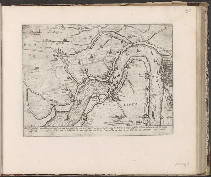
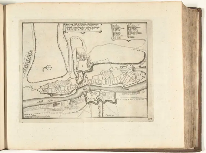
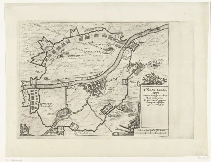
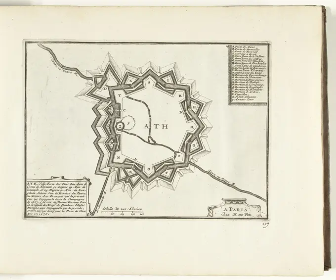
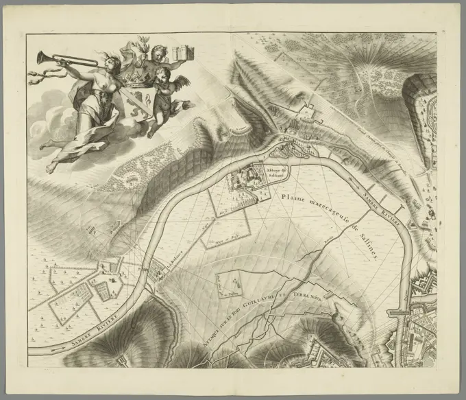
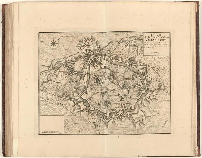
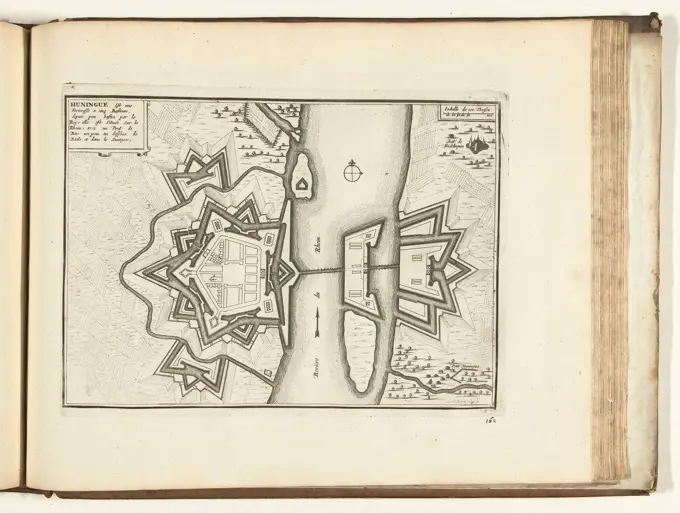
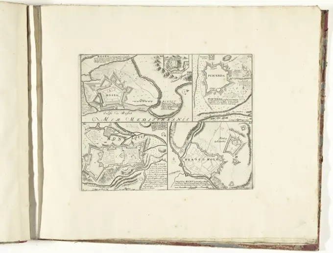
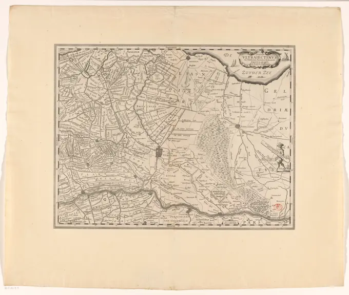
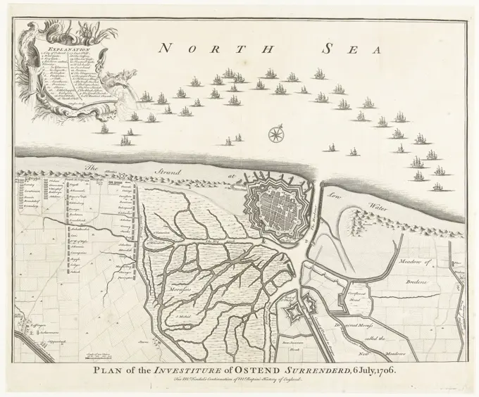
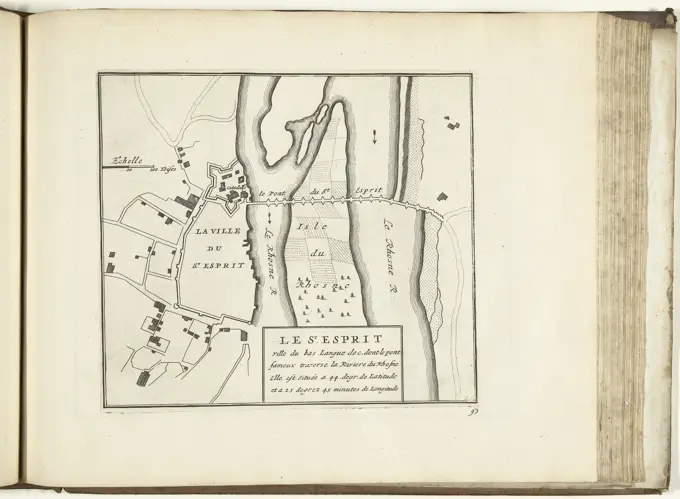
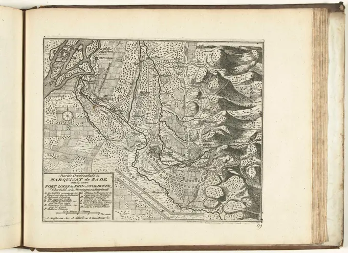
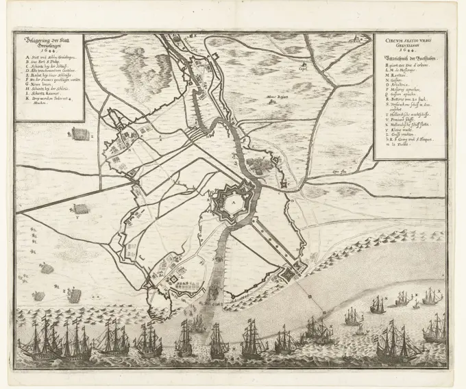
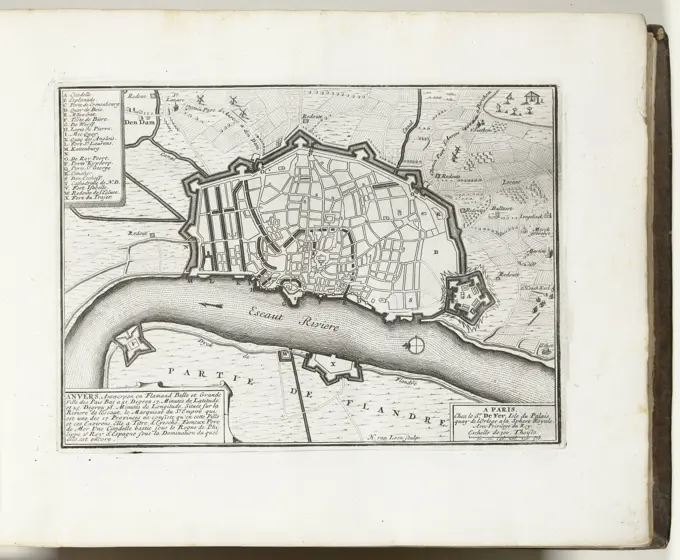
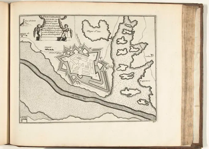
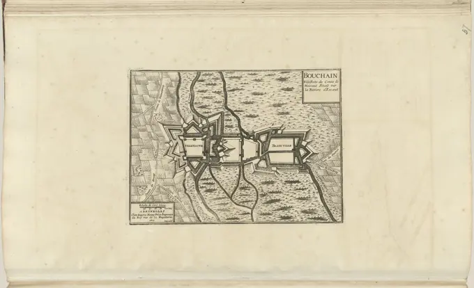
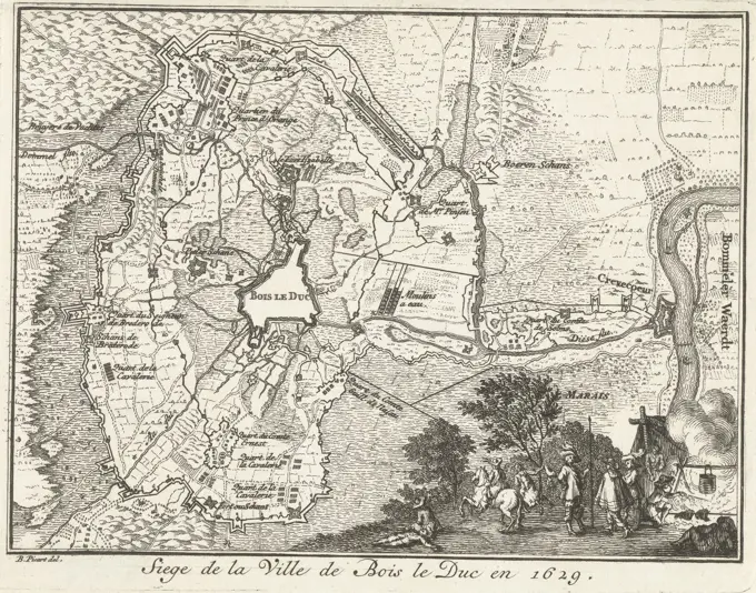
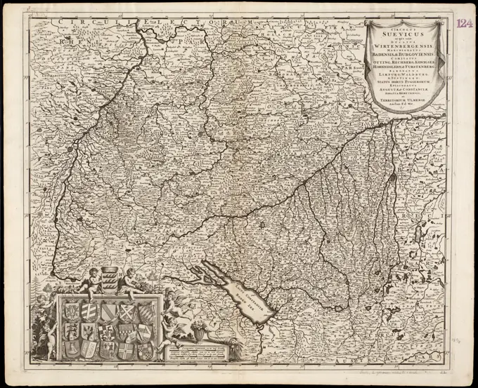
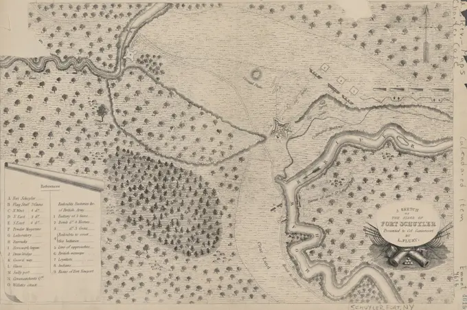
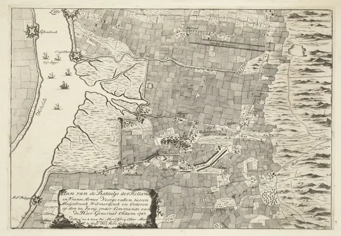
Historical Military Maps

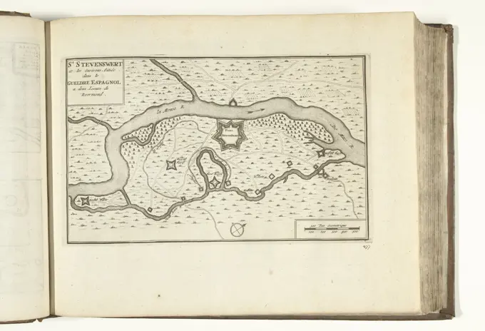
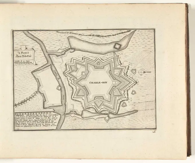
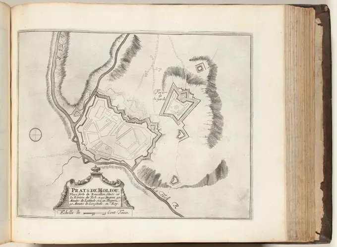
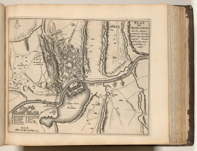
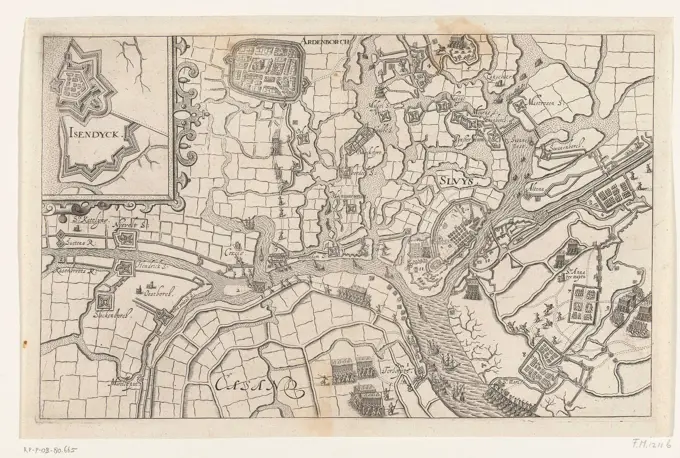
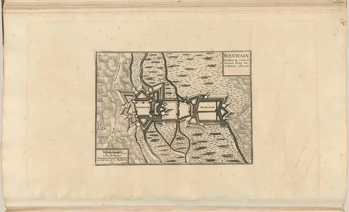
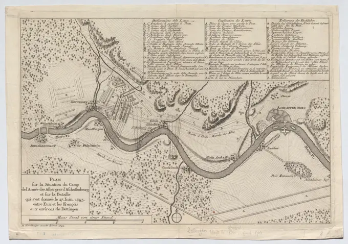
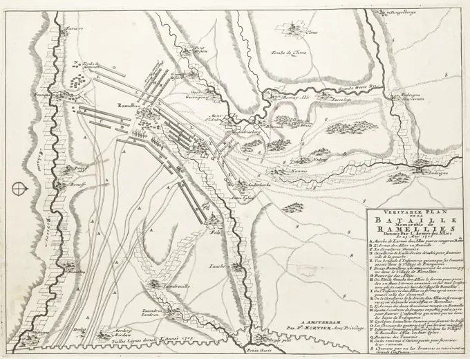
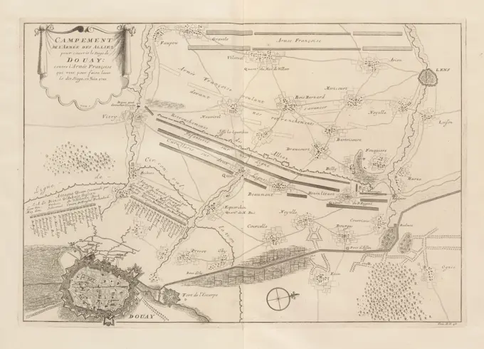
Detailed maps depicting military fortifications and strategies from the 16th to 18th centuries. Illustrations include plans of cities and troop positions.

The Hague, Kloot, Isaac van der, Northern Netherlands, Call, Pieter van (II), Camp of the Allies Army to Conquer the Siege of Douai; against the French Army which was to lead this Siege, in June 1710, Army Camp of the Allies at the Siege of Douai, 1710, Map of the army camp of the Allies at the siege of Douai by the Allies under the Prince of Orange, taken on 29 June 1710. Top right the positions of the French army that came to the relief. Numbered bottom right: Tom. II. No. 48. Illustration in the second part of: Jean du Mont, Warlike description of the battles and sieges, of the three ... world-famous warlords ... Prince Eugene of Savoy, the ... Duke of Marlborough, and the Prince of Orange and Nassau-Friesland, in the edition of 1729. This second part is mainly devoted to the deeds of the Duke of Marlborough and Prince Johan Willem Friso., print, engraving, map, books, Frederik Muller Historieplaten, height 349 mm, width 495 mm, 1688 - 1737, print maker, printmaker, 1710 - 1710, pap