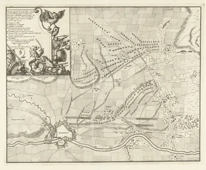
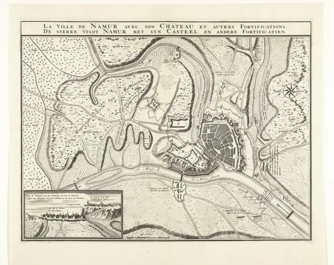
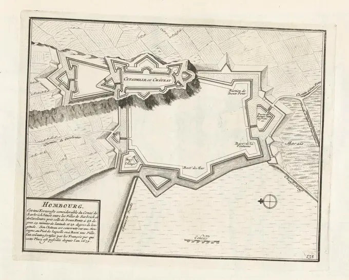
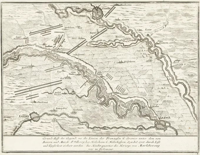
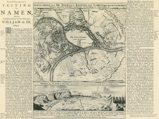
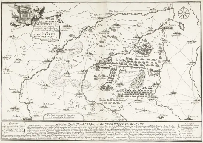
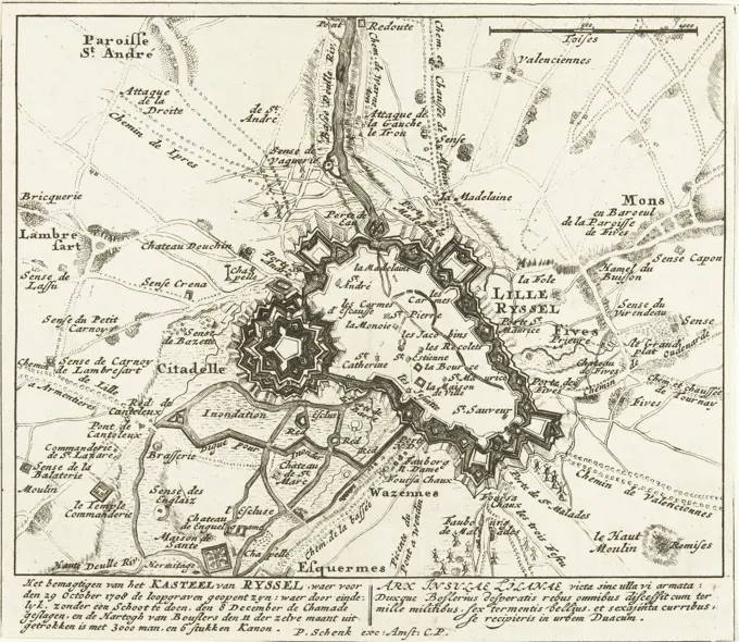
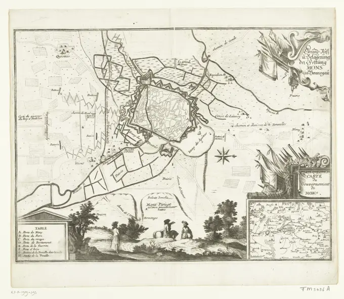
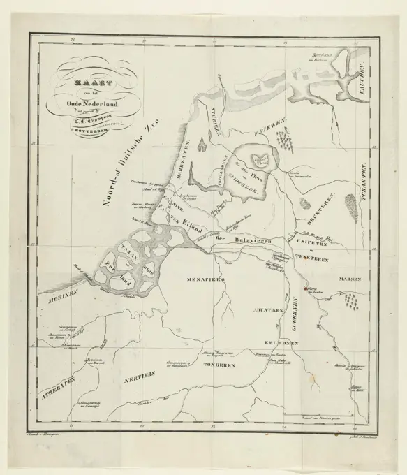
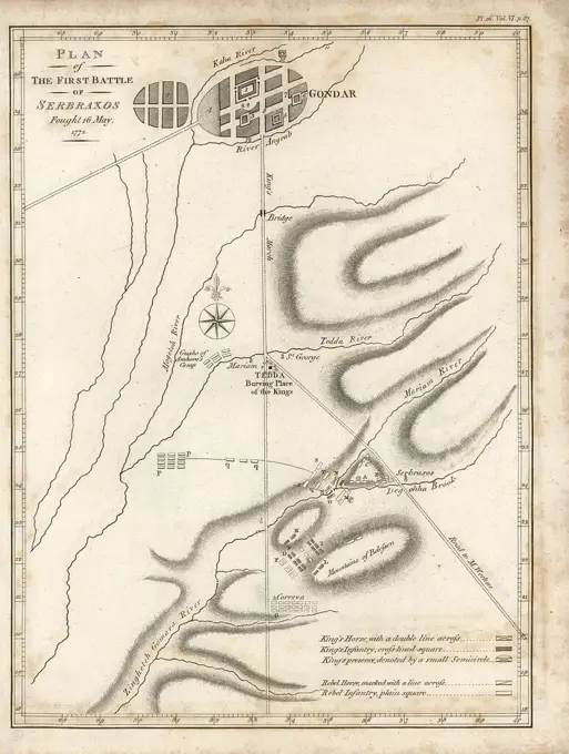
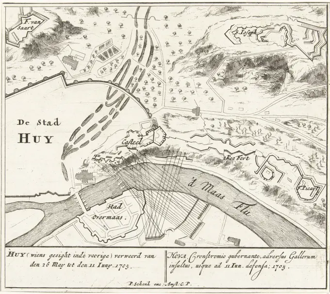
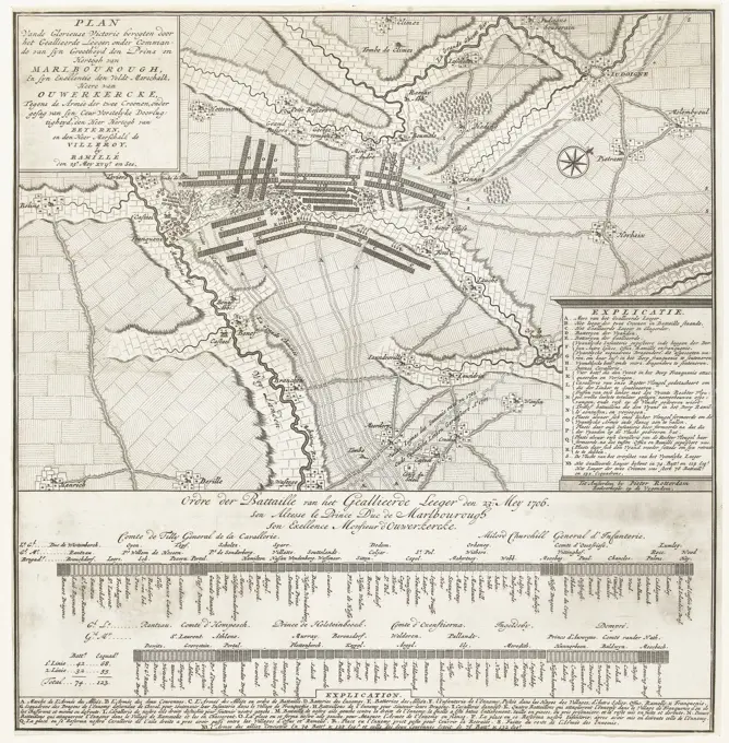
Historical Military Maps

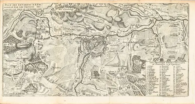
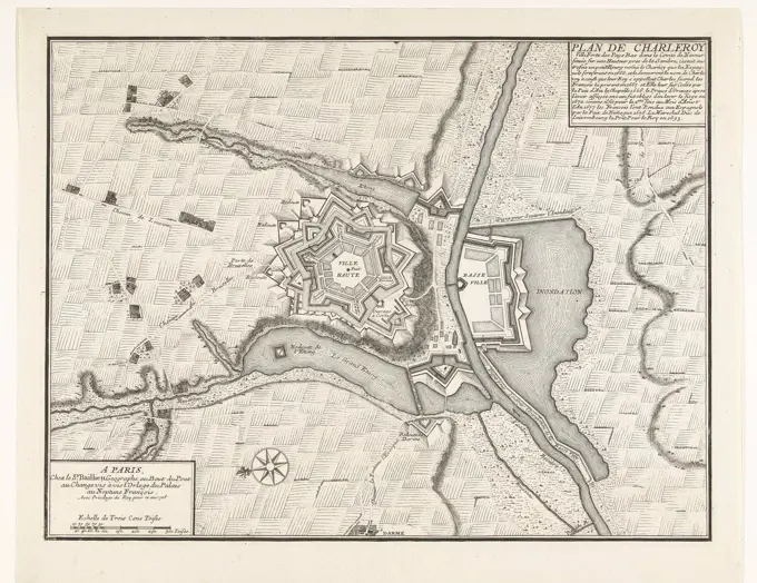
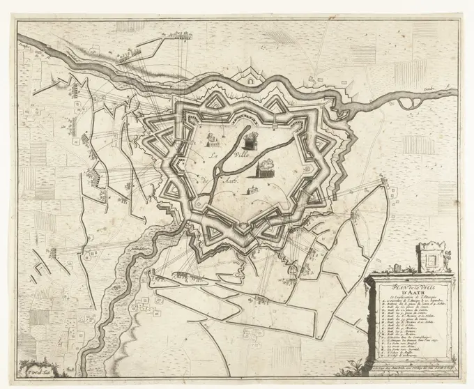
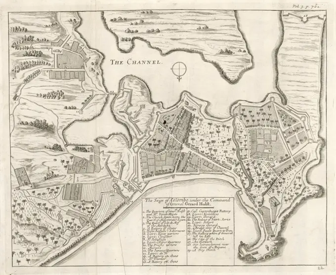
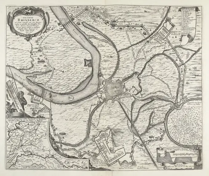
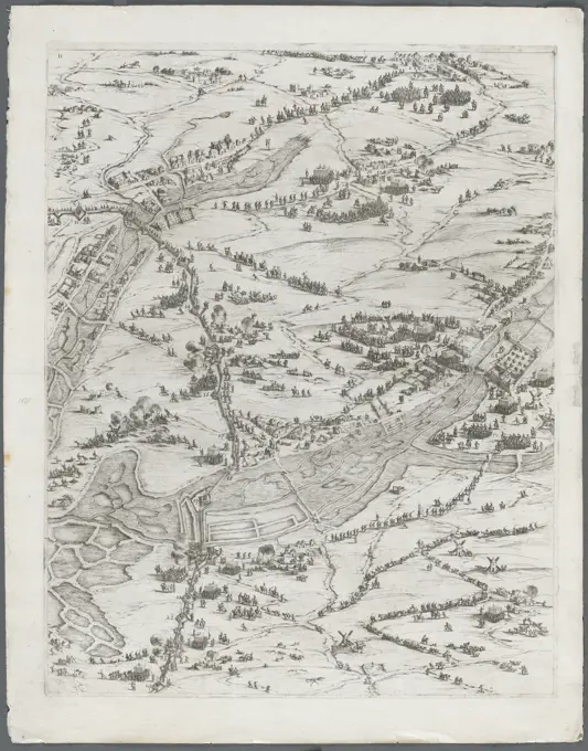
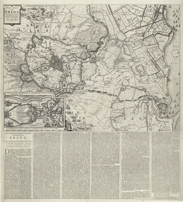
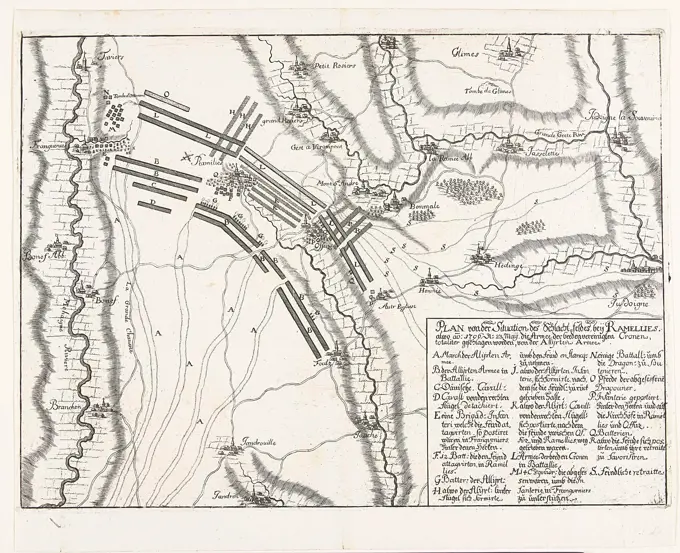
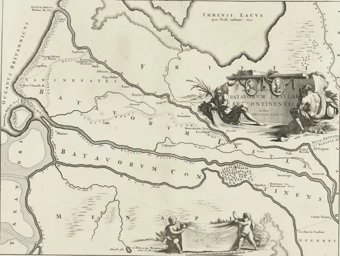
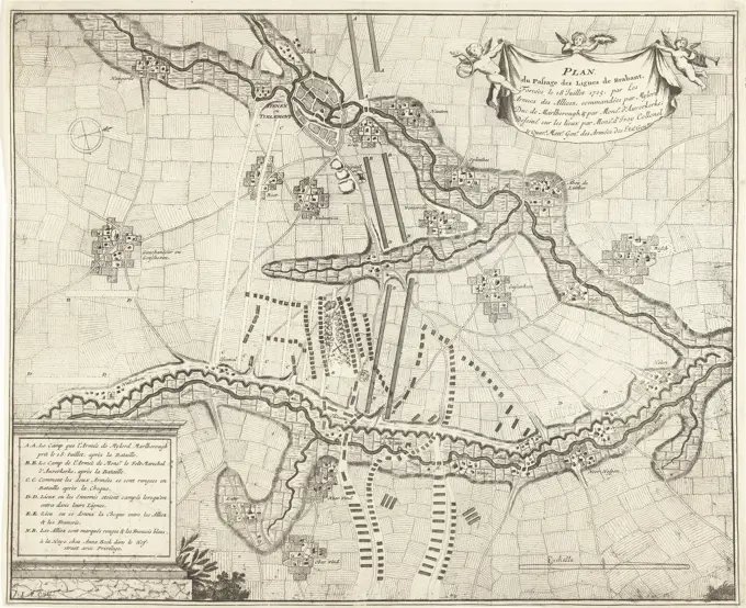
Detailed maps from the 17th and 18th centuries, illustrating military strategies and fortifications during significant historical battles.

unknown, The Hague, Beeck, Anna, Hangest-Genlis said d'Yvoy, Frederik Thomas van, Northern Netherlands, Call, Jan van (II), Plan du Passage des Lignes de Brabant, Forced on 18 July 1705, by the Armees of the Allies, Breaking through the French lines in Brabant, 1705, Map of the breaking through of the French lines in Brabant with the battle of Eliksem on 18 July 1705 by the Allies under the Duke of Marlborough and the Lord of Ouwerkerk. Bottom left the legend AA-EE in French. The map includes two text sheets., print, prent, map, prints, Frederik Muller Historieplaten, height 387 mm, width 473 mm, 1689 - 1756, print maker, printmaker, 1705 - 1705, paper, papier, etching, etchings, Nederlands, 1663-02-18 - 1727-10-24, cartographer, Publication (Event), Publication, 1657 - 1717, publisher, uitgever van privilege