My Boards
View Pictures
  • My Boards

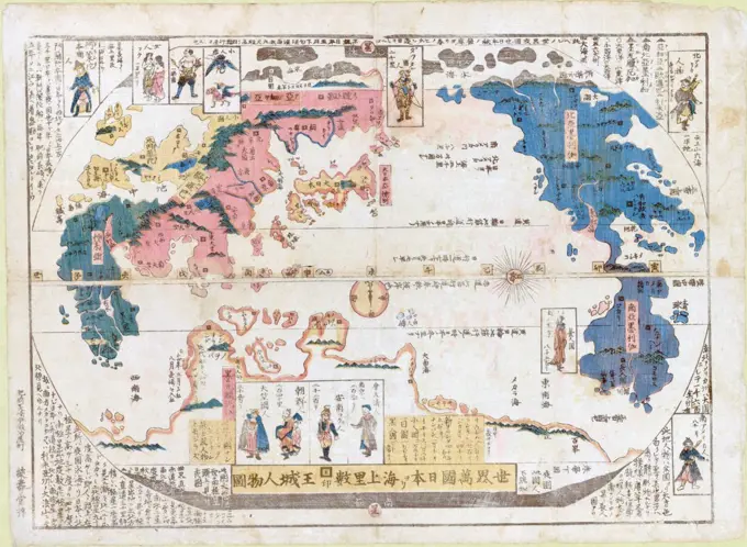
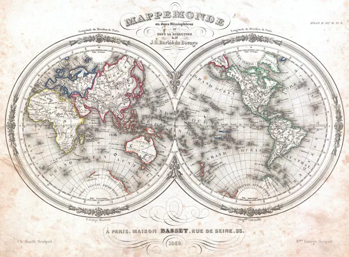
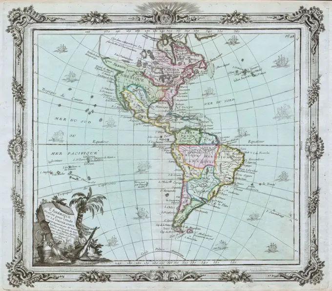
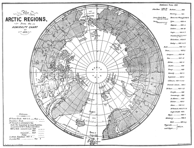
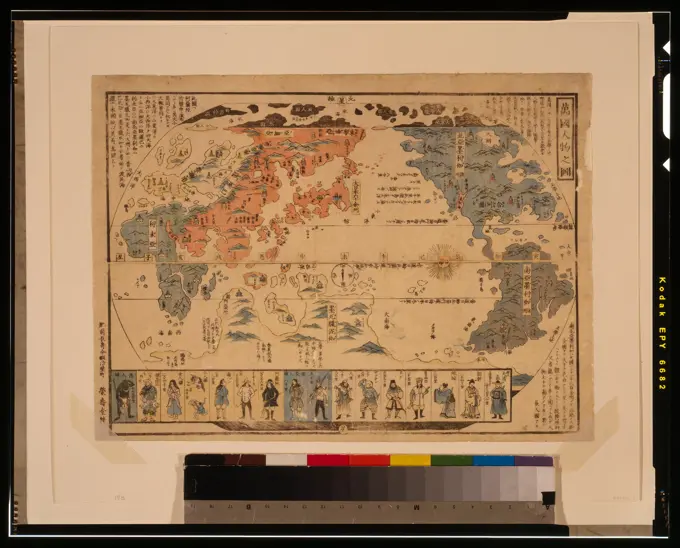
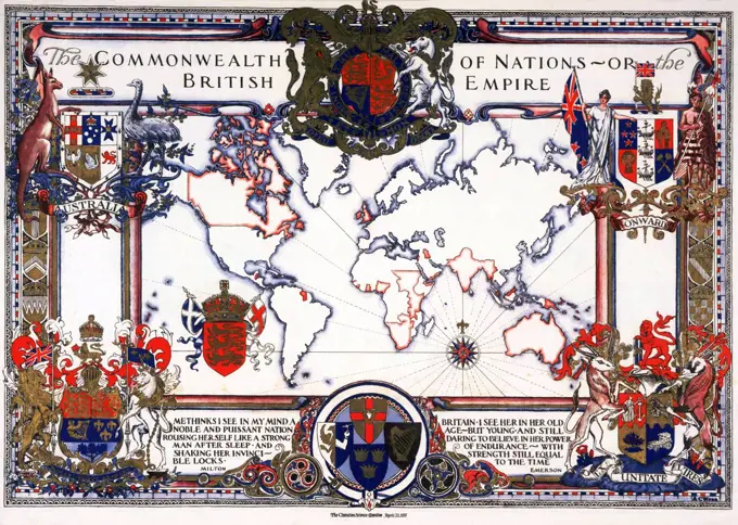
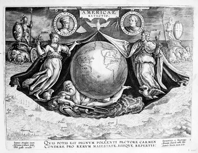
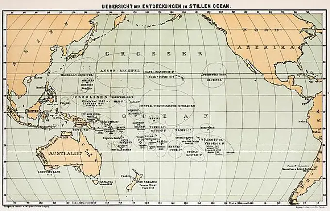
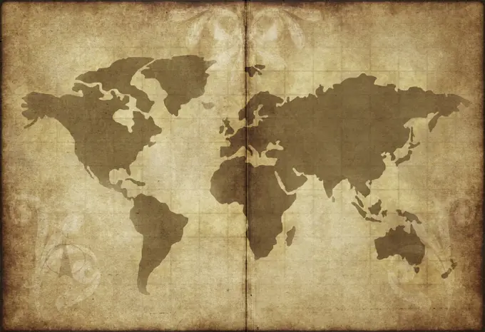
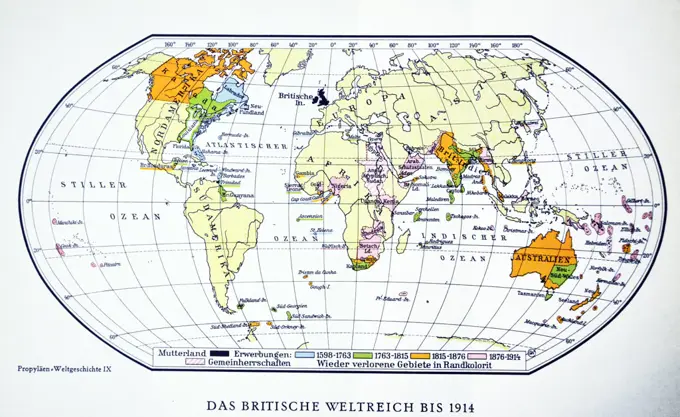
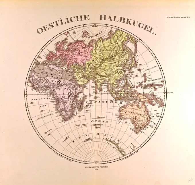
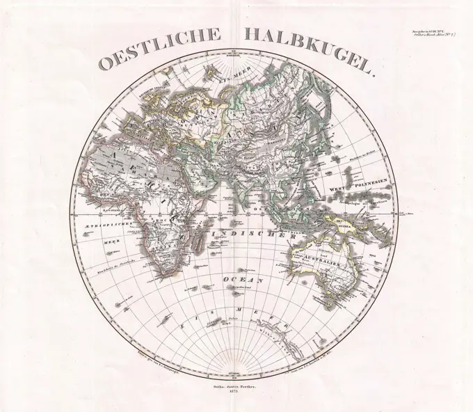
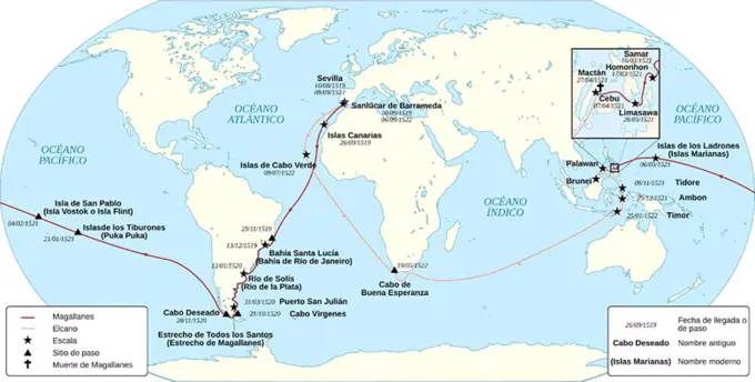
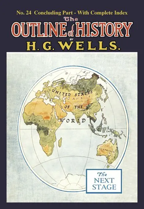
Historical World Maps

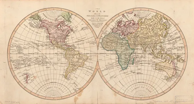
A collection of early world maps featuring intricate geographic details, varied color palettes, and historical annotations, depicting global exploration and discovery.

The world from the discoveries & observations made in the latest voyages & travels  | Library of Congress
The world from the discoveries & observations made in the latest voyages & travels | Library of Congress
252 assets in this story
1899-18795690
Map of all the countries of the world and pictures of the peoples, showing the capitals and the distances from Japan ca. 1850.
6145-51398129
Physical map of the world, April 2001 , World maps, Physical Norman B. Leventhal Map Center Collection
4409-20883638
CARTOGRAFIA. MAPA MUNDI.
6145-29096717
1848 Barbie du Bocage Map of the World in Hemispheres
6145-54268066
Map of the world on Mercator's projection, to show the populations and actual areas occupied by the various states represented in plate I. Rectangles representing population size overlaid on a world map. Areas under the dominion of the British Empire indicated in red. Also shows communication lines between parts of the British Empire. Includes text. Appears in The commonwealth of nations / edited by L. Curtis. "Plate II (see page I)." "At end of volume."... , World
6145-51386933
Reg Manning's table-top argu-map of the world , World War, 1939-1945, Caricatures and cartoons, Maps Norman B. Leventhal Map Center Collection
1525-25135948
an old world map drawn onto parchment paper
4220-20399533
Illustration of the Flags and Ships of the Steamship Companies offering ocean cruises in 1932, with a map of their routes. Lloyd Triestino, Booth, Nippon Yusen Kaisha, P.&O., Coast, B.&N., Union Castle, Canadian Pacific, Orient, Cunard, White Star, Elders & Fyffes, Bibby and Nelson are the lines depicted.     Date: 1932
4409-21018938
Historia sagrada. Creación del mundo. Separación de la tierra y los mares y formación de los continentes. Grabado de 1862.
6145-54348115
Maps and Charts - All States. Photographs Relating to National Forests, Resource Management Practices, Personnel, and Cultural and Economic History
6145-43862105
Chart of the world, on Mercator's projection : illustrative of the impolicy of slavery , Slavery, Maps, Sugar growing, Maps, World maps Norman B. Leventhal Map Center Collection
6176-66096018
This image shows a map of the world according to the Greek poet Homer. In his Iliad, the world is a round plain encircled by a great river known as Oceanus, The sky is a great concave roof propped up by pillars that the mighty Atlas upholds. On the largte, flat disc of the earth is a sort of belt or zone that includes the lands of which he was aware. To the north are milk-fed nomads. Near the banks of Oceanus are the pygmies. Mentioned are Thracia, Libya, Phryges, Pontus Pelagus, and others. Homers Odyssey includes many more names, including Scylla and Charybdis.
6145-51395487
Mercator map of the world , World maps, Pictorial works Norman B. Leventhal Map Center Collection
1795-17815533
Old map of the world from 1811
4443-21200110
Map of the world, 19th century engraving
6145-55168936
Western Lines of Colonization from Mu. Original caption: The Children of Mu, by James Churchward, page 215, New York 1931.
6145-29096032
1764 Brion de la Tour Map of America ( North America South America )
4220-20400239
Engraving showing a map of the Arctic region, produced by the British Admiralty in 1875.      Although mostly complete, the blank area around the North Pole shows the area that had not yet been visited and charted by explorers.     Date: 1875
6239-71008664
Bankoku jinbutsu no zu  | Library of Congress
1899-18788922
The British Empire comprised the dominions, colonies, protectorates, mandates and other territories ruled or administered by the United Kingdom. It originated with the overseas colonies and trading posts established by England in the late 16th and early 17th centuries. At its height, it was the largest empire in history and, for over a century, was the foremost global power. By 1922 the British Empire held sway over about 458 million people, one-fifth of the world's population at the time. The empire covered more than 33,700,000 km2 (13,012,000 sq mi), almost a quarter of the Earth's total land area. As a result, its political, legal, linguistic and cultural legacy is widespread.
6145-29672317
Photo collection Government information service. Drawing. Dutch settlements at the Eastern Hemisphere. undated
6145-45787962
Solar eclipse of July 25, 1748; Measurement-royal display of the large and brand-worthy sun eclipse. That essence will be 25. Julius 1748. How it will show, however, the city of Amsterdam and other submitting cities will show (...). Astronomical performance How the incomplete solar eclipse of 25 July 1748 will be perceptible in Amsterdam and surrounding places and how it will throw a shadow on the northern hemisphere of the earth. With different stages of the eclipse. Taked under the plate a text sheet with the title and a statement of the performance in two columns by Simon Panser.
6188-63336302
Vintage map Vintage map Copyright: xZoonar.com/MaksymxYemelyanovx 1628840
6145-44064632
Maps for slide lectures. Reproduction from an Atlas. America, Central Europe and Africa
6145-50569228
A pictorial map of North America , North America, Maps Norman B. Leventhal Map Center Collection
6145-29606400
Collection Dutch Heidematschappij. Paaiplaat. undated. Atlantic Ocean
6145-29604380
Collection Dutch Heidematschappij. forest card world. undated
6188-63336258
Vintage map Vintage map Copyright: xZoonar.com/MaksymxYemelyanovx 1628639
4409-65764833
The first geographical globe in Bulgaria made by hieromonk Neofit Rilski in 1836, Rila Monastery, founded in the 10th century, Rilski River valley, Republic of Bulgaria, Europe.
6145-54275536
Discovery of America in Bibliotheque Nationale. Photographs of Marshall Plan Programs, Exhibits, and Personnel
6145-51386520
Political map of the world, April 2001 , World maps, 2001 Norman B. Leventhal Map Center Collection
6145-46728181
Diary "During the age of Uddevalla Telestation 1920-1959", written by the telephony Elsa Carlsson during the years 1920-1959 when she worked at Uddevalla Telestation. The diary provides a unique insight into the society and work life from press clips, photographs and diary notes.
6145-54348069
Maps and Charts - All States. Photographs Relating to National Forests, Resource Management Practices, Personnel, and Cultural and Economic History
6145-29670518
Photo collection Government information service. Places of interest, Delta works exhibition. undated
1525-24688085
Vintage world map on old parchment paper texture. Vintage world map on old parchment paper
1525-25435180
map of the world on old paper
1848-50395816
Map, world map, Pacific Ocean, Pacific Ocean, continents, Oceania, Australia, North America, discoveries, travels, island groups, grid of degrees, Tropic of Capricorn, historical illustration 1885, Oceania
6145-50550786
The League of Nations, 1925 , Administrative and political divisions, Maps, League of Nations Norman B. Leventhal Map Center Collection
6145-54267750
The League of Nations, 1925. Inset: Seat of the League. Includes tables of members, of non-members, and of "territorial responsibilities of the League."... , World
6145-54348074
Maps and Charts - All States. Photographs Relating to National Forests, Resource Management Practices, Personnel, and Cultural and Economic History
6188-56042948
old wolrld map parchment paper great image of old and worn parchment with world map Copyright: xZoonar.com/PhilxMorleyx 1211715
1746-19688076
British world map 1914. World War One.
7012-69867139
Canada, Nova Scotia, Halifax. Citadel, National Historic Site. Museum interior. (Editorial Usage Only)
4443-1841
Eastern Hemisphere  Gotha, Justus Perthes, 1872, Atlas
1889-60423429
Map of the world according to Eratosthenes, 200 BC. From the book Outline of History by H.G. Wells, published 1920.
4409-28578276
Cartographic Infographic of the principal events of the XVIIth and XVIIIth centuries. QuarkXPress (.qxp); Adobe InDesign (.indd); QuarkXPress (.qxd); 5000x3229.
6145-58975337
Poster, 'A Map of Australia' posters
6145-29095620
1873 Stieler Map of the Eastern Hemisphere (Europe, Africa, Asia, Australia, Pacific)
4409-17231124
Mapa que muestra la ruta de la expedión de Magallanes-Elcano. FERNANDO DE MAGALLANES. JUAN SEBASTIAN ELCANO.
6145-54455956
DD-ST-88-09483. Base: Unknown
4408-8091
Outline of History by HG Wells, No. 24: The Next Stage, H.G. Wells Outline of History
6145-54455912
DD-ST-88-09424. Country: Unknown
PREVIOUS
of 3
NEXT
2401 S. Ervay, Suite 206
Dallas, Texas 75215
United States
Get Started
Free ResearchMy BoardsMy Cart
For Creators
How To License Your ContentContributor PortalFrame of Mind
Resources
API accessPricing
Contact
+1 866 236 0087help@viewpictures.co.uk Contact form
©2026 View Pictures. All Rights Reserved. -A
This site is protected by reCAPTCHA and Google Privacy Policy and Terms of Service apply.