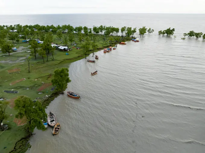
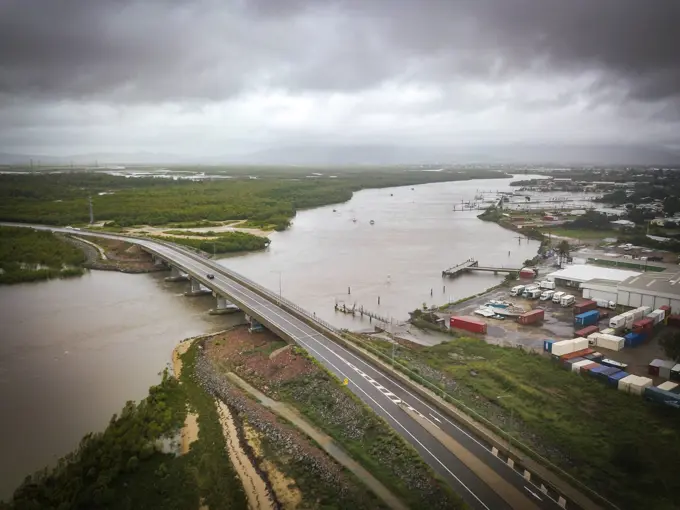
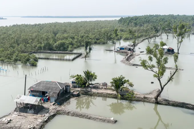
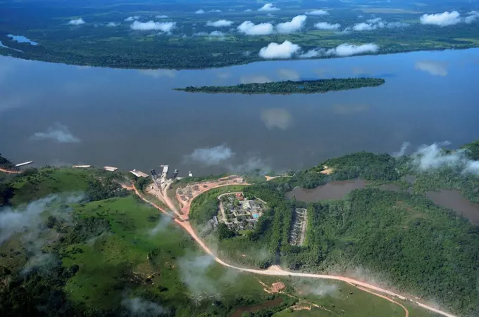
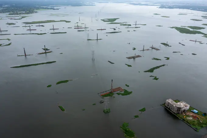
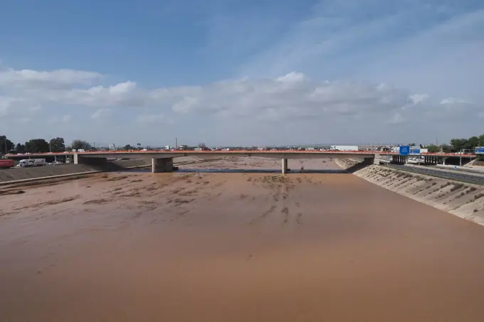
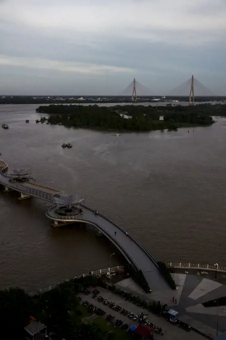
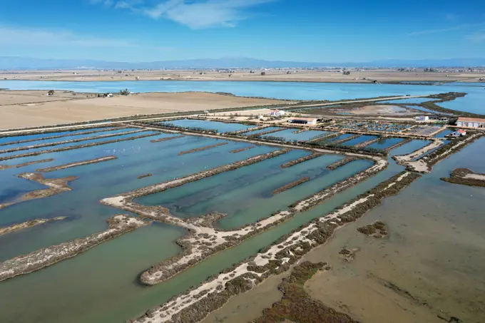
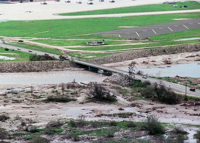
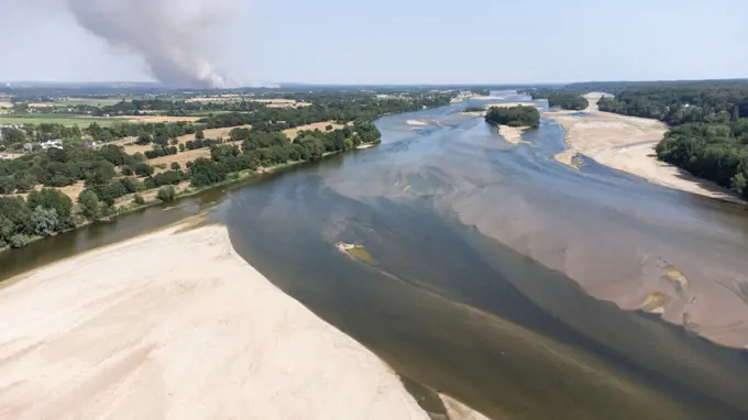
My Boards
View Pictures
  • My Boards

Hurricane Katrina Aerial Views

Aerial shots of marshy areas and flood-affected regions post-Hurricane Katrina, focusing on environmental damage and pollution.

Pollution - ESU St. Louis Response - Murphy Oil - 26-HK-244-59. Hurricane Katrina
178 assets in this story
6162-76393272
Aerial view of boats dotting the coastline where lush trees meet the muddy shore along Sitakund - Golabaria Rd, Chattogram, Chittagong Division, Bangladesh.
6145-52063862
Pollution - ESU St. Louis Response - Unwatering - 26-HK-252-91. Hurricane Katrina
6145-52067750
Pollution - ESU St. Louis Response - Sundown - 26-HK-249-95. Sundown East. Hurricane Katrina
6145-54402135
Aftermath - Miscellaneous - 26-HK-46-22. debris and displaced cargo container on beach near marshy area. Hurricane Katrina
6188-65540408
Luftaufnahme einer überfluteten Stadt und eines Flusses mit braunem Hochwasser, Townsville, Queensland Aerial view of flooded town and river with brown floodwater, Townsville, Queensland. High quality photo. Aerial views of floods occurring in 2019 associated with the monsoon trough event. Copyright: xZoonar.com/ReecexFraserx 22573708
6162-78674613
6145-52082906
ESU St. Louis - Murphy Oil - 26-HK-319-7. Overflight - Water Pump Facility. Hurricane Katrina
6145-52062805
Pollution - ESU St. Louis Response - South Bass - 26-HK-233-77. PLATFORM LOCATED IN D10. Hurricane Katrina
6145-52029993
Office of the Administrator (Lisa P. Jackson) - BP Oil Spill (Web Photographs) - Islands in the Chandeleur Island chain surrounded bt boom and sorbent boom.USEPA photo by Eric Vance , Environmental Protection Agency
6145-52061965
Overflight - Potter - Pilottown and North - 26-HK-211-58. 29 21.134N 089 30.453; Various Pics IVO Boothville. Hurricane Katrina
6162-49143310
Aerial view of post-coal landscape, now a protected nature habitat Wanninchen, Brandenburg, Germany.
6145-52067704
Pollution - ESU St. Louis Response - Shell Narin - 26-HK-247-74. Hurricane Katrina
1848-49401476
Vreeser Wiesen Bockholter Dose drone image, rewetted bog area, Bockholter Dose nature reserve, Emsland, Germany, Europe
6145-54404253
Vice Admiral Thad Allen Aerial Tour of Hancock County, Mississippi - 26-HK-20-21. Hurricane Katrina
6145-51993997
Flooding - Moorhead, Minn. , March 29, 2009   Flood waters north of the city. Photo: Michael Rieger/FEMA. North Dakota Severe Storms and Flooding. Photographs Relating to Disasters and Emergency Management Programs, Activities, and Officials
7019-69919823
USA, California, Central Valley, San Joaquin River Valley, California Aqueduct at intersection of I-5 and Rt 152, seen from levee road
6145-54316851
Flooding - Velva, N. D. , June 26, 2011   The Velva water treatment plant is inundated from the Souris River. Burleigh and Ward counties were designated a federal disaster area, opening the way for federal disaster assistance from FEMA. Andrea Booher/FEMA. North Dakota Flooding. Photographs Relating to Disasters and Emergency Management Programs, Activities, and Officials
1899-70726669
Norco, Louisiana, The U.S. Army Corps of Engineers opened the Bonnet Carre Spillway to protect New Orleans from Mississippi River flooding. The spillway can divert flood water from the Mississippi, reducing water levels at New Orleans.
6145-52082507
Photos from Aviation Training Center, Mobile - 26-HK-421-107. Hurricane Katrina
6145-54338473
Office of the Administrator (Lisa P. Jackson) - Various Images (BP Oil Spill) - Islands in the Chandeleur Island chain surrounded bt boom and sorbent boom.USEPA photo by Eric Vance , Environmental Protection Agency
6145-54338474
Office of the Administrator (Lisa P. Jackson) - ASPECT Flight over Gulfport, Mississippi (BP Oil Spill) - Storm sewer outfall, Gulfport, Mississippi. USEPA photo by Eric Vance , Environmental Protection Agency
6145-52066235
Pollution - ESU St. Louis Response - South Bass - 26-HK-234-62. Hurricane Katrina
6162-49143330
Aerial view of post-coal landscape, now a protected nature habitat Wanninchen, Brandenburg, Germany.
6162-75588040
Satkhira, Bangladesh - 20 October 2025: Aerial view of houses submerged in murky floodwaters, with glimpses of verdant trees and resilient structures standing against the reflective surface.
6145-52073977
New Orleans - 26-HK-199-65. Hurricane Katrina
6145-52061785
Pollution - ESU St. Louis Response - Murphy Oil - 26-HK-243-43. Canal and Marsh. Hurricane Katrina
1815R-13444012
Brazil, Para, Itaituba, harbor used for illegal timber export
6145-52066313
Pollution - ESU St. Louis Response - Unwatering - 26-HK-252-8. Hurricane Katrina
6145-52634339
Subjects: Wetlands; Louisiana.  . 1998 - 2011.
6145-52081430
Aftermath - New Orleans and Surrounding Areas - 26-HK-286-12. Hurricane Katrina
6162-75566628
Aerial view of submerged structures and vegetation punctuate the vast expanse of water, reflecting the overcast sky in Aminbazar, Dhaka Division, Bangladesh.
6145-52070211
New Orleans and I-90 - 26-HK-202-35. Hurricane Katrina
6145-54318991
DR-1607 Hurricane Rita.. Photographs Relating to Disasters and Emergency Management Programs, Activities, and Officials
6145-52075533
Aftermath - Aerial - 26-HK-330-88. Sunrise Flooding. Hurricane Katrina
6162-72112975
Aerial view of shimmering salt pans reflecting the sky, creating a mosaic of blues and greens, divided by earth tones, El Puerto de Santa María, Andalusia, Spain.
6145-52070376
Salvage Engineering Response Team - New Orleans - Early October - 26-HK-350-143. Hurricane Katrina
1848-50795615
Aerial of the Unesco world heritage site Kvarken archielago, Finland, Europe
6145-52080085
Aftermath - Waveland and Pass Christian, Mississippi - 26-HK-284-17. Hurricane Katrina
6145-52078205
Overflight - Chief Cox - 26-HK-207-7. Hurricane Katrina
6162-49142994
Aerial view of post-coal landscape, now a protected nature habitat Wanninchen, Brandenburg, Germany.
6162-75561466
Aerial view of tranquil waters winding through dense green forests next to a residential area, a blend of nature and habitation, Abonnema, Port Harcourt, Nigeria.
6145-52069938
New Orleans and I-90 - 26-HK-202-4. Hurricane Katrina
6162-78672184
Aerial view of boats clustered by a sandy shore, people gathered, and the river reflecting light, creating a striking contrast between earth and water, Sylhet, Sylhet Division, Bangladesh.
6145-52157725
Aerial view of Onslow Beach, Camp LeJeune's after Hurricane Bonnie. Base: Marine Corps Base, Camp Lejeune State: North Carolina (NC) Country: United States Of America (USA)
6188-65174308
Die Folgen des Hurrikans Dana in Valencia, Spanien - Schlammiger Fluss, der nach starkem Regen in Valencia unter eine Brücke fließt VALENCIA, SPAIN OCTOBER 31, 2024: Muddy river water flowing under a bridge after heavy rain, showing the devastating consequences of flooding in Valencia Copyright: xZoonar.com/DanilxRoudenkox 22444758
6096-20283200
VIETNAM - CAN THO - A CAPITAL INTERFACEThe Mekong Delta provides nearly 40% of Vietnam's food production. Can Tho, a hub city in the midst of a vast network of canals, is the nerve center of the region's commercial and cultural activities.Place of trade, the commodities of all the delta are exchanged here. On the river or under hangars, huge markets are present in the four corners of the agglomeration.Can Tho also asserts itself as a cultural center, with its unique university complex attracting students from all over the region.But his ambitions do not stop there. With 1.2 million inhabitants, it intends to continue to ride the economic boom of the Mekong Delta and fully assume its role as capital.The city of Can Tho is now connected to Ho Chi Minh City by a new highway. Modernization is under way.VIETNAM - CAN THO - UNE INTERFACE CAPITALELe Delta du Mekong assure près de 40% de la production alimentaire du Vietnam. Can Tho, ville carrefour au milieu dun vaste réseaux de canau
6145-52066320
Pollution - ESU St. Louis Response - Unwatering - 26-HK-252-9. Hurricane Katrina
6188-63265851
Ebrodelta_aufgegebene Salinen Sant Antoni noerdlich der Salinenstrasse, Luftbild, Spanien, Katalonien Ebro Delta_abandoned Sant Antoni salt works north of the salt road, aerial view, Spain, Katalonia BLWS716913 *** ebrodelta abandoned Saltworks Sant Antoni north the Salinenstrasse, Aerial photo, Spain, Catalonia Ebro Delta Abandoned Sant Antoni Salt Works North of The Salt road, Aerial view, Spain, katalonia BLWS716913 Copyright: xblickwinkel/M.xWoikex
6145-52155247
An aerial view of flood damage by the Margarita River as it rushes under Basilon Road. In the background is 22 Area Air Field. Camp Pendleton California. Base: Marine Corps Base Camp Pendleton State: California (CA) Country: United States Of America (USA)
6145-54406566
In-Situ Burn Chevron Pipeline - Empire, Louisiana - 26-HK-159-51. Hurricane Katrina
1606-58410573
Usa, Florida. Hillsborough County. Apollo beach. Teco Big Bend Station. Apollo Beach Nature Preserve
6145-54429525
DN-SC-85-08843. State: Canal Zone Country: Panama (PAN)
6162-75541362
Aerial view of Bundu Waterfront, where the river meets the city's edge, creating a vibrant contrast between the natural greens and urban structures, Port Harcourt, Rivers, Nigeria.
6145-51993990
Flooding   Winter Storm - Norman County, Minn. , March 29, 2009  Flooded farms and rural communities in Norman County adjacent to the Red River of the North. Andrea Booher/FEMA. Minnesota Severe Storms and Flooding. Photographs Relating to Disasters and Emergency Management Programs, Activities, and Officials
6145-54313493
Emmonak, Alaska, July 15, 2013   A view from up above shows the path of the receding flood waters in this community after severe flooding crippled the entire infrastructure. Federal funding in the form of Public Assistance (PA) is available to state, tribal and eligible local governments and certain nonprofit organizations on a cost sharing basis for emergency work and the repair or replacement of facilities damaged by the flooding in the Alaska Gateway Regional Educational Attendance Area (REAA), Copper River REAA, Lower Yukon REAA, Yukon Flats REAA, and the Yukon-Koyukuk REAA. Adam DuBrowa/ FEMA.. Photographs Relating to Disasters and Emergency Management Programs, Activities, and Officials
1815-55269723
Netherlands, Aerial view of river Waal flooding surrounding land after prolonged rainfall
6145-54318555
Hurricane Ike,  Galveston Island, TX, September 16, 2008   Aerial view of damage caused by Hurricane Ike. Galveston Island, TX, September 16, 2008--Aerial view of damage caused by Hurricane Ike.. Photographs Relating to Disasters and Emergency Management Programs, Activities, and Officials
6145-54318552
Hurricane Ike,  Galveston Island, TX, September 16, 2008   Aerial view of damage caused by Hurricane Ike. Galveston Island, TX, September 16, 2008--Aerial view of damage caused by Hurricane Ike.. Photographs Relating to Disasters and Emergency Management Programs, Activities, and Officials
6162-49143147
Aerial view of post-coal landscape, now a protected nature habitat Wanninchen, Brandenburg, Germany.
6145-54419949
A aerial view of flood damage caused by high tides and heavy rain on the beach area at the end of runway #21 at the Pacific Missile Test Center. Base: Naval Air Station, Point Mugu State: California (CA) Country: United States Of America (USA)
1848-51665067
Aerial view of the Rhine floods, Wesel, Niederrhein, North Rhine-Westphalia, Germany, Europe
6096-20283288
VIETNAM - CAN THO - A CAPITAL INTERFACEThe Mekong Delta provides nearly 40% of Vietnam's food production. Can Tho, a hub city in the midst of a vast network of canals, is the nerve center of the region's commercial and cultural activities.Place of trade, the commodities of all the delta are exchanged here. On the river or under hangars, huge markets are present in the four corners of the agglomeration.Can Tho also asserts itself as a cultural center, with its unique university complex attracting students from all over the region.But his ambitions do not stop there. With 1.2 million inhabitants, it intends to continue to ride the economic boom of the Mekong Delta and fully assume its role as capital.The city of Can Tho is now connected to Ho Chi Minh City by a new highway. Modernization is under way.VIETNAM - CAN THO - UNE INTERFACE CAPITALELe Delta du Mekong assure près de 40% de la production alimentaire du Vietnam. Can Tho, ville carrefour au milieu dun vaste réseaux de canau
6162-49143392
Aerial view of post-coal landscape, now a protected nature habitat Wanninchen, Brandenburg, Germany.
6145-54324846
Hurricane Katrina, New Orleans, LA, September 8, 2005 - Neighborhoods and roadways throughout the area remain flooded as a result of Hurricane Katrina. Jocelyn Augustino/FEMA
1899-18984488
Florida's mangrove forests were hard hit by the uncommonly cold temperatures in January, 2010. Here, a dull brown swath of freeze-damaged mangroves cuts across the photograph, Pinellas County, FL -  ca. May 2010.
6162-49143440
Aerial view of post-coal landscape, now a protected nature habitat Wanninchen, Brandenburg, Germany.
6145-44721150
CAPE CANAVERAL, Fla. -  Launch Pad 39A seems to be an island in the high water surrounding it caused by Tropical Storm Fay. In the distance is the Atlantic Ocean.  The storm passed over the center Aug. 20 and then stalled offshore, bringing with it heavy rain and tropical storm force wind.  Kennedy closed Aug. 19 because of Fay and reopened for normal operations Aug. 22.  Based on initial assessments, there was no damage to space flight hardware, such as the space shuttles and Hubble Space Telescope equipment. Some facilities did sustain minor damage.
5514-68354127
Clusters of fisheries and fish farms off the coast of Malaysia.
6145-52065594
New Orleans - 26-HK-200-187. Hurricane Katrina
6145-52061564
Aerial and Satellite Images - 26-HK-19-30. Hurricane Katrina
6162-75552176
Aerial view of the road cutting through the flooded fields reflecting the sky, adjacent to the lake under a cloudy sky, Minjibir, Kano, Nigeria.
6145-52078110
Overflight - Baton Rouge - New Orleans - 26-HK-214-5. Hurricane Katrina
6096-20061240
France, Maine-et-Loire, summer 2022. Aerial view of the drought and heat wave in Anjou, Maine et Loire, caused by global warming and climate change. Photograph by Martin Bertrand.France, Maine-et-Loire, ete 2022. Vue aerienne de la secheresse et de la canicule en Anjou dans le Maine et Loire entrainees par le rechauffement et le dereglement climatique. Photographie de Martin Bertrand.
6145-45117045
Launch Complex 39B is seen during an aerial survey of NASA's Kennedy Space Center in Florida on Saturday. The survey was performed to identify structures and facilities that may have sustained damage from Hurricane Matthew as the storm passed to the east of Kennedy on Oct. 6 and 7, 2016. Officials determined that the center received some isolated roof damage, damaged support buildings, a few downed power lines, and limited water intrusion. Beach erosion also occurred, although the storm surge was less than expected. NASA closed the center ahead of the storms onset and only a small team of specialists known as the Rideout Team was on the center as the storm approached and passed.
1848-49298096
Sign of the Uj cie Warty National Park, Warta River-Mouth National Park, Lubusz Voivodeship, Poland, Europe
6145-54324269
Hurricane Katrina, Biloxi, Miss., January 7 and August 8, 2006 -- The U.S. Highway 90 bridge destroyed by Hurricane Katrina (top) is now being removed to make way for a new bridge to be constructed in its place. Mark Wolfe/FEMA
6145-51876159
A USACE and SCDNR Tour of the completed Crab Bank Seabird Sanctuary
6162-49105017
Aerial view of mucilage, a gluey substance produced by excessive microorganisms due to pollution) at the Marmara Sea coast of Istanbul, Turkey.
PREVIOUS
of 2
NEXT
2401 S. Ervay, Suite 206
Dallas, Texas 75215
United States
Get Started
Free ResearchMy BoardsMy Cart
For Creators
How To License Your ContentContributor PortalFrame of Mind
Resources
API accessPricing
Contact
+1 866 236 0087help@viewpictures.co.uk Contact form
©2026 View Pictures. All Rights Reserved. -A
This site is protected by reCAPTCHA and Google Privacy Policy and Terms of Service apply.