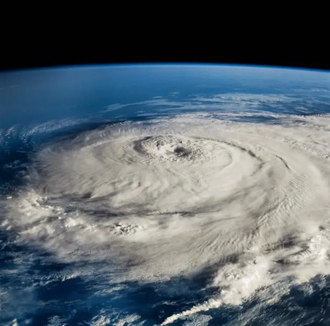
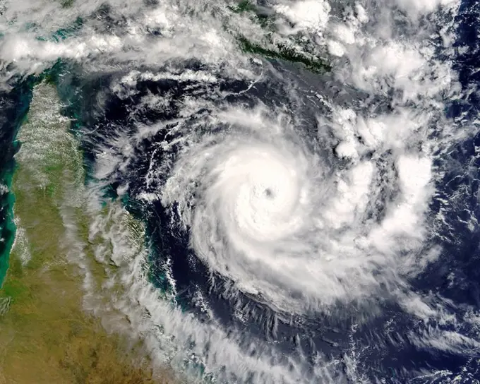
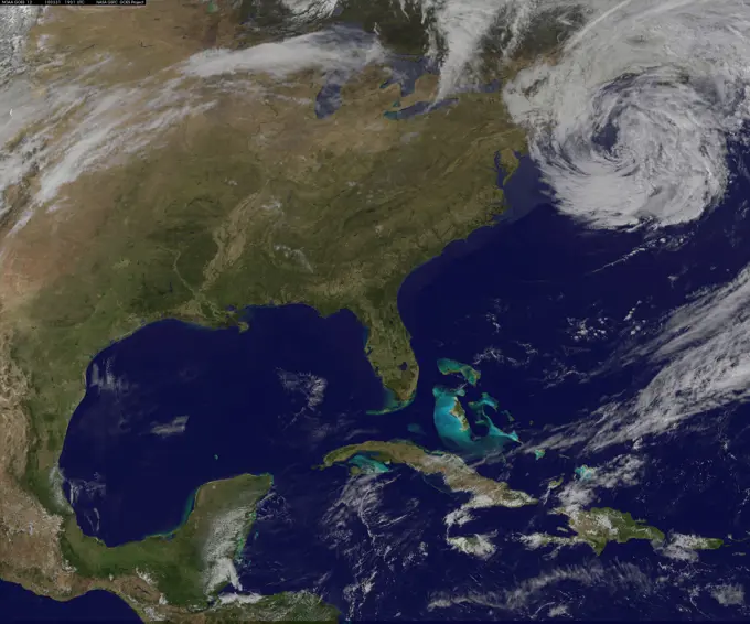
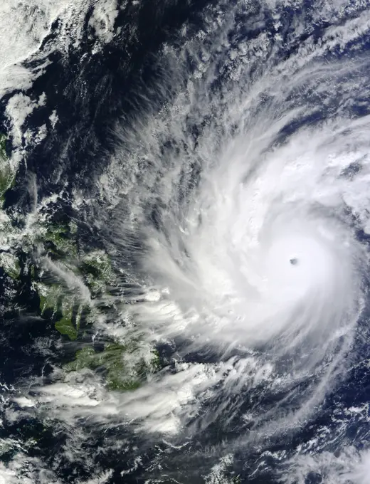
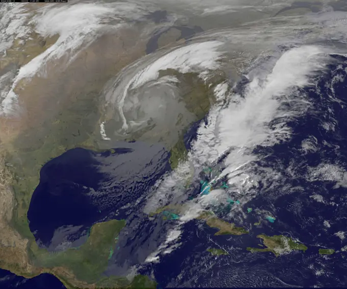
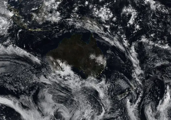
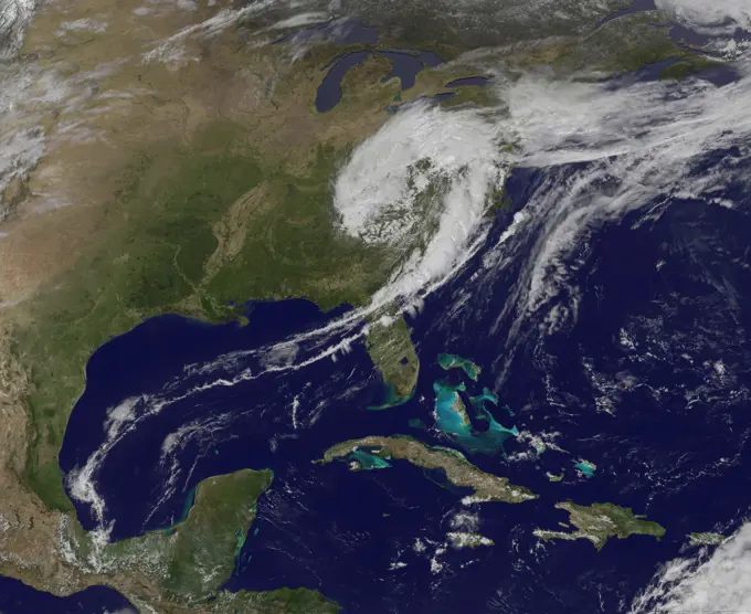
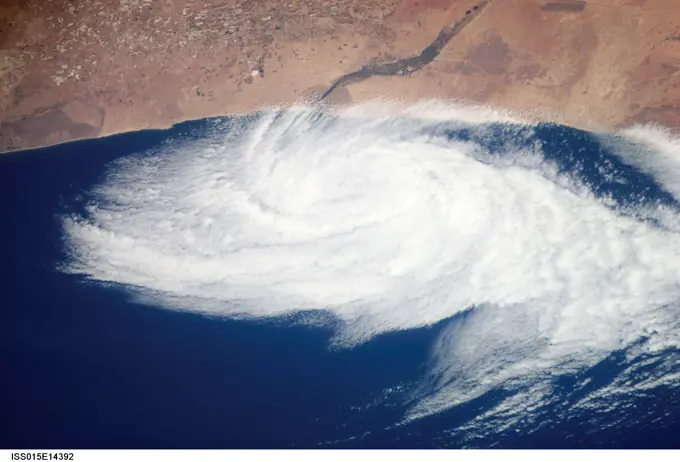
My Boards
View Pictures
  • My Boards

Hurricanes from Space

Dramatic views of hurricanes and tropical storms captured from the International Space Station, depicting swirling clouds and atmospheric patterns over Earth.

Hurricane Elena as Seen from Space Shuttle Discovery
152 assets in this story
6145-44815981
On Monday, April 19, 2010, the Advanced Spaceborne Thermal Emission and Reflection Radiometer (ASTER) instrument onboard NASA's Terra spacecraft obtained this image of the continuing eruption of Iceland's Eyjafjallajkull volcano.
6145-45261726
This NOAA's GOES satellite infrared image taken on Nov. 25 at 11 45 UTC (6 45 a.m. EST) shows two main weather systems over the U.S.
6145-45256603
NASA's Wallops Flight Facility is located on Wallops Island, Va. and is the site of tonight's moon mission launch. Satellite imagery from NOAA's GOES-East satellite shows that high pressure remains in control over the Mid-Atlantic region, providing an almost cloud-free sky. This visible image of the Mid-Atlantic was captured by NOAA's GOES-East satellite at 17 31 UTC/1 31 p.m. EDT and shows some fair weather clouds over the Delmarva Peninsula (which consists of the state of Delaware and parts of Maryland and Virginia - which together is "Delmarva") and eastern Virginia and North Carolina. Most of the region is cloud-free, making for a perfect viewing night to see a launch. NOAA operates GOES-East and NASA's GOES Project at the NASA Goddard Space Flight Center in Greenbelt, Md. creates images and animations from the data. NOAA's National Weather Service forecast for tonight, Sept. 6 calls for winds blowing from the east to 11 mph, with clear skies and overnight temperatures dr
4128R-1090
Tropical cyclone Ingrid
6145-45256898
Radar and satellite imagery indicate that the convective organization of the cyclone has improved, and the cyclone is being upgraded based on a sustained wind report of 33 kt from Settlement Point, Grand Bahama Island earlier this morning. Low shear conditions and warm sea-surface temperatures should allow for at least steady strengthening, and the cyclone is expected to become a hurricane by 72 hours. This image was taken by GOES East at 1445Z on July 1, 2014. b a href= http //goes.gsfc.nasa.gov/ rel= nofollow
1525-25769964
Middle East and Persian gulf. 3d rendering. Middle East and Persian gulf. Elements of this image furnished by NASA. 3d rendering. Middle East and Persian gulf. 3d rendering
6145-45257396
. A Night-time Look at Typhoon Soudelor from NASA-NOAA's Suomi NPP Satellite
6145-44913988
NASA image acquired October 28, 2012 b For the latest info from NASA on Hurricane Sandy go to a href= http //1.usa.gov/Ti5SgS rel= nofollow 1.usa.gov/Ti5SgS /a /b This image of Hurricane Sandy was acquired by the Visible Infrared Imaging Radiometer Suite (VIIRS) on the Suomi NPP satellite around 2 42 a.m. Eastern Daylight Time (06 42 Universal Time) on October 28, 2012. The storm was captured by a special day-night band,” which detects light in a range of wavelengths from green to near-infrared and uses filtering techniques to observe dim signals such as auroras, airglow, gas flares, city lights, and reflected moonlight. In this case, the cloud tops were lit by the nearly full Moon (full occurs on October 29). Some city lights in Florida and Georgia are also visible amidst the clouds. The Suomi NPP satellite was launched one year ago today (on October 28, 2011) to extend and enhance long-term records of key environmental data monitored by NASA, the National Oceanic and Atmospheric Adm
6145-45255609
NASA GOES-12 satellite image showing the US east coast on March 31, 2010 3 01 PM EDT. b a href= http //goes.gsfc.nasa.gov/ rel= nofollow
6145-44635350
This anaglyph from the MISR instrument aboard NASA's Terra spacecraft shows the strong convective development of Hurricane Katrina as it moved west through the Gulf of Mexico. 3D glasses are necessary to view this image.
6145-45265410
NASA's Moderate Resolution Imaging SpectroRadiometer (MODIS) instrument, aboard the Terra satellite, captured this true-color image showing the remnants of a meteor's passage, seen as a dark shadow cast on thick, white clouds on Dec. 18, 2018. MODIS captured the image at 23 50 Coordinated Universal Time (UTC).
6145-45231900
On Dec. 4 at 02 10 UTC, the MODIS instrument aboard NASA's Terra satellite took this visible image of Super Typhoon Hagupit approaching the Philippines.
6145-45251493
ISS009-E-22836 (15 September 2004) --- A look into the eye of the storm from space was provided by astronaut Edward M. (Mike) Fincke as Hurricane Ivan approached landfall on the central Gulf coast Wednesday afternoon (22:02:35 GMT, Sept. 15).  At the time, sustained winds in the eye wall were reported at about 135 mph as the storm approached the Alabama coast. Fincke, the NASA ISS Science Officer, is nearing the end of a six-month stay on the orbiting complex with Commander Gennady Padalka. This photo was taken from an altitude of about 230 miles.
6145-44405593
WASHINGTON (Oct. 26, 2012) A GOES-13 infrared satellite image of Hurricane Sandy provided by the U.S. Naval Research Laboratory (NRL) in Monterey, Calif., shows the storm at approximately 7:00 a.m. EST in the Atlantic Ocean.
6145-45259396
GOES 12 satellite image showing the US east coast on March 22, 2010 6:45 AM EST.
6145-44637440
NASA's Terra spacecraft acquired this sequence of images and cloud-top height observations for Hurricane Wilma as it progressed across the Caribbean in October 2005.
6145-44622169
NASA's Terra spacecraft captured these images and cloud-top height retrievals of Hurricane Frances on September 4, 2004, when the eye sat just off the coast of eastern Florida, and Hurricane Ivan on September 5th.
1899-35503
Oceania At Night With Cloud Coverage, True Colour Satellite Image. True colour satellite image of Oceania at night with cloud coverage. This image in Lambert Conformal Conic projection was compiled from data acquired by LANDSAT 5 & 7 satellites.
6145-45064146
ISS040-E-045643 (8 July 2014) --- One of the Expedition 40 crew members aboard the International Space Station photographed a series of images of Typhoon Neoguri in the vicinity of Japan on July 7, 2014. This 70mm near-vertical image featuring the eye was photographed at 21 54 03 GMT.
6145-44408031
120824-N-ZZ999-001WASHINGTON (Aug. 24, 2012) A GOES-13 infrared satellite image of Tropical Storm Isaac provided by the U.S. Naval Research Laboratory in Monterey, Calif., shows the storm at 8:45 a.m. EST south of Hispaniola in the Caribbean Sea. Isaac is expected to strengthen into a hurricane and impact the Gulf Coast of the United States.
6145-45093888
NASA-NOAA's Suomi NPP satellite flew over Hurricane Blanca in the Eastern Pacific Ocean and gathered infrared data on the storm that was false-colored to show locations of the strongest thunderstorms within the storm. The Visible Infrared Imaging Radiometer Suite or VIIRS instrument aboard the satellite gathered infrared data of the storm that was made into an image at the University of Wisconsin-Madison. The image was false-colored to show temperature. Coldest cloud top temperatures indicate higher, stronger, thunderstorms within a tropical cyclone. Those are typically the strongest storms with potential for heavy rainfall. VIIRS is a scanning radiometer that collects visible and infrared imagery and "radiometric" measurements. Basically it means that VIIRS data is used to measure cloud and aerosol properties, ocean color, sea and land surface temperature, ice motion and temperature, fires, and Earth's albedo (reflected light). The VIIRS image from June 5 at 8 11 UTC (4 11 a
6145-45258919
On Jan. 20 at 2 30 p.m. EST the VIIRS instrument aboard NASA-NOAA's Suomi NPP captured this image of the winter storm moving through the central U.S.
6145-44609659
NASA's Terra spacecraft acquired these natural color images and cloud top height measurements for Monty before and after the storm made landfall over the remote Pilbara region of Western Australia, on February 29 and March 2, 2004.
6145-44857436
NASA image captured April 12, 2011 at 1731 UTC (1 31 p.m. EDT) A giant swirl of clouds that form an apostrophe-like shape over the eastern U.S. was spotted in visible imagery from the Geostationary Operational Environmental Satellite, GOES-13 on April 12, 2011 at 1731 UTC (1 31 p.m. EDT). The GOES-13 satellite monitors weather over the eastern continental U.S. and Atlantic Ocean, while GOES-11 monitors the western U.S. and the Eastern Pacific Ocean. GOES-13 captured this image of the clouds associated with a strong upper level low pressure area that is moving though the Tennessee River Valley and bringing moderate to heavy rainfall as it moves eastward. The low is forecast by the National Weather Service to bring unsettled conditions to the Mid-Atlantic and then to New England late Tuesday and Wednesday as it tracks northeast. Severe thunderstorms are possible today in extreme eastern Virginia and North Carolina as the cold front associated with the low pushes through that region. Mean
6145-45256917
NOAA's GOES-East satellite captured an image of a powerful cold front that triggered flash flood watches and warnings along the U.S. East Coast on May 16. NOAA's National Weather Service noted flash flooding was possible from New England into eastern North Carolina today, May 16. The clouds associated with the long cold front was captured using visible data from NOAA's GOES-East or GOES-13 satellite on at 1900 UTC (3 00 p.m. EDT) and was made into an image by NASA/NOAA's GOES Project at NASA's Goddard Space Flight Center in Greenbelt, Md. The clouds stretched from Maine south through the Mid-Atlantic down to southern Florida with a tail of clouds extending into the western Caribbean Sea. South of Lake Michigan the rounded swirl of clouds indicates another low pressure system. GOES satellites provide the kind of continuous monitoring necessary for intensive data analysis. Geostationary describes an orbit in which a satellite is always in the same position with respect to the rotating Ea
6145-45063855
An impact crater in Isidis Planitia observed for a fifth time by NASA's Mars Reconnaissance Orbiter.
6145-44678871
ISS015-E-14392 (26 June 2007) --- This nadir view from the International Space Station, photographed at 11:43 GMT on June 26, 2007, shows a weak low pressure area off the coast of Morocco, just south of Agadir (out of frame), near the Oued Massa River at about 30 degrees north latitude and 9.5 degrees west longitude. A low pressure area like this can be caused either by the winds forming an eddy due to some land feature or a heat low has drifted off the coast.
6145-45257387
. Typhoon Soudelor's Eye Close-Up from NASA-NOAA's Suomi NPP
6145-45041194
ISS030-E-060460 (27 Jan. 2012) --- An unpiloted ISS Progress resupply vehicle approaches the International Space Station, carrying 2,050 pounds of propellant, 110 pounds oxygen and air, 926 pounds of water and 2,778 pounds of spare parts and experiment hardware for a total of 2.9 tons of food, fuel and equipment for the residents of the space station. Progress 46 docked to the stations Pirs Docking Compartment at 7:09 p.m. (EST) on Jan. 27, 2012.
6145-45255622
GOES 11 satellite image showing earth on March 25, 2010 8:00 AM EDT.
6145-45258647
. NASA-NOAA's Suomi NPP Satellite Captures Night-time Look at Cyclone Felleng
6145-44590748
Visible image of a California storm in March, 2003, as seen by the Atmospheric Infrared Sounder (AIRS) on NASA's Aqua satellite.
4239R-20480654
June 18, 2010 - Satellite view of oil leaking from the damaged Deepwater Horizon well in the Gulf of Mexico is visible in the sunglint part of this image.
1746-19663297
Ash from Icelands Eyjafjallajökull volcano, viewed here in imagery from the Multi-angle Imaging Spectroradiometer (MISR) instrument on NASAs Terra spacecraft on May 16, 2010, once again disrupted air traffic over Europe with the closure of major airports in the United Kingdom and the Netherlands. The image is a natural-colour, nadir (vertical) view of the scene, with the volcano itself located outside the upper left corner of the image. The ash plume is visible as a brownish stream of particles situated above lower-level clouds. Stereoscopic images acquired by MISRs other cameras are used to derive the height of the plume.
6145-45231858
Tropical Cyclone Debbie made landfall in Queensland bringing heavy rainfall, hurricane-force winds, rough seas, and flooding. NASA-NOAA's Suomi NPP satellite provided a visible look at the storm from space while NASA's Aqua satellite analyzed cloud temperatures to determine the location of the strongest storms within. Read more a href=
6145-45244128
Dynamics of Jupiter's Great Red Spot in the NIR filter (756 nm) of the Galileo imaging system. Each of the three frames is a mosaic of six images that have been map-projected to a uniform grid of latitude and longitude. North is at the top. There is a nine-hour separation between the first two frames and seventy minutes between the next two. All of the images were taken on June 26, 1996. The Red Spot is 20,000 km long and has been followed by observers on Earth since the telescope was invented 300 years ago. It is a huge storm made visible by variations in the composition of the cloud particles and the amount of cloud cover. Winds in the outer part of the Red Spot reach 250 mph while the center remains quiescent. These Galileo data will help scientists understand what drives this storm and why it persists for so many years. http //photojournal.jpl.nasa.gov/catalog/PIA01083
5514-60230987
Mud Volcanoes in Qobustan, Azerbaijan
6145-44932053
Earth Observations taken by Expedition 34 crewmember.
6145-45258104
This satellite imagery from Jan. 21 at 10 00 a.m. EST shows the large winter storm over near the Gulf coast and another storm approaching the Pacific coast.
6145-45258631
Ship tracks above the northern Pacific Ocean. NASA image captured July 3, 2010. Satellite Aqua NASA/GSFC/Jeff Schmaltz/MODIS Land Rapid Response Team
6145-45116809
NASA's Aqua spacecraft spied Hurricane Matthew, currently an extremely dangerous Category 4 storm on the Saffir-Simpson Hurricane Wind Scale, continues to bear down on the southeastern United States.
6145-44791935
This image shows JPL's Multi-angle Imaging SpectroRadiometer instrument onboard NASA's Terra satellite on Sunday, Nov. 8, 2009 as it passed over Hurricane Ida while situated between western Cuba and the Yucatan Peninsula.
6145-45258395
As autumn colors moved across much of the lower forty-eight states in mid-October 2015, winter weather had already arrived in Alaska. The Moderate Resolution Imaging Spectroradiometer (MODIS) aboard NASAs Terra satellite captured this true-color image of the icy scene on October 16 as it passed over the region. Point Barrow, the northern-most location in the United States sits between the Chukchi Sea (west) and the Beaufort Sea on the east. The rugged peaks of the Brooks Range can be seen along the southern section of the image. North of the Brooks Range the land is almost entirely covered with snow; to the south the tan and browns visible between snow marks uncovered land. Sea ice lies over the waters near the coasts of much of Alaskas North Slope, especially east of Point Barrow. White cloud banks are notable in the northeast and southeast sections of the image.
6145-45261738
On Saturday, Sept. 21, TRMM captured rainfall data on Typhoon Usagi as it passed between the northern Philippines and southern Taiwan. TRMM found rain falling at a rate of over 134 mm/hr (~5.2 inches) in USAGI's eye wall.
6145-44853469
NASA's Aqua satellite passed over Japan one hour and 41 minutes before the quake hit. At the time Aqua passed overhead, the Moderate Resolution Imaging Spectroradiometer (MODIS) instrument captured a visible of Japan covered by clouds. The image was taken at 0405 UTC on March 11 (1 05 p.m. local time Japan /11 05 p.m. EST March 10). The quake hit at 2 46 p.m. local time/Japan. Satellite Aqua
6177-V53471733
6145-44493778
Martian Storm 05/03/99
6145-45092061
The cloud cover over the Southern Ocean occasionally parts as it did on January 1, 2015 just west of the Drake Passage where the VIIRS instrument on the Suomi NPP satellite glimpsed the above collection of ocean-color delineated eddies which have diameters ranging from a couple of kilometers to a couple of hundred kilometers. Recent studies indicate that eddy activity has been increasing in the Southern Ocean with possible implications for climate change.
6145-44602107
These two images show Hurricane Isabel as viewed by AIRS and SeaWinds scatterometers on NASA's ADEOS-2 and QuikScat satellites in September, 2003.
6145-44971520
The winter of 2013 was among the driest on record for California, setting the stage for an active fire season. By August 26, the Rim Fire had made its way into the record books. At just 15 percent contained, the fire is now the 13th largest in California since records began in 1932. Apart from being large, the fire is also threatening one of the United States greatest natural treasures Yosemite National Park. The Visible Infrared Imaging Radiometer Suite (VIIRS) on the Suomi NPP satellite tracked the growth of the fire between August 23 and August 26 in a series of nighttime images. The VIIRS day-night band is extremely sensitive to low light, making it possible to see the fire front from space. The brightest, most intense parts of the fire glow white, exceeding the brightness of the lights of Reno, Nevada to the north. Pale gray smoke streams north away from the fire throughout the sequence. The perimeter of the fire grows from day to day along different fronts, depending on winds an
6145-44780055
NASA' satellite CloudSat captured an extraordinary eye overpass of a category 4 Hurricane Bill on August 19, 2009 at 1720 UTC (1220 EDT). Bill's maximum sustained winds are 132 mph (115 knots) with a central pressure of 947 mb.
5514-68358578
A scientific instrument records precipitation at the Mount Washington Observatory in New Hampshire.
PREVIOUS
of 2
NEXT
2401 S. Ervay, Suite 206
Dallas, Texas 75215
United States
Get Started
Free ResearchMy BoardsMy Cart
For Creators
How To License Your ContentContributor PortalFrame of Mind
Resources
API accessPricing
Contact
+1 866 236 0087help@viewpictures.co.uk Contact form
©2026 View Pictures. All Rights Reserved. -A
This site is protected by reCAPTCHA and Google Privacy Policy and Terms of Service apply.