My Boards
View Pictures
  • My Boards

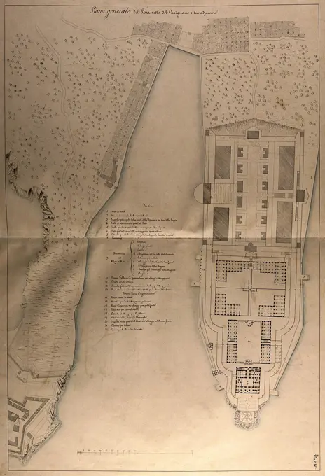
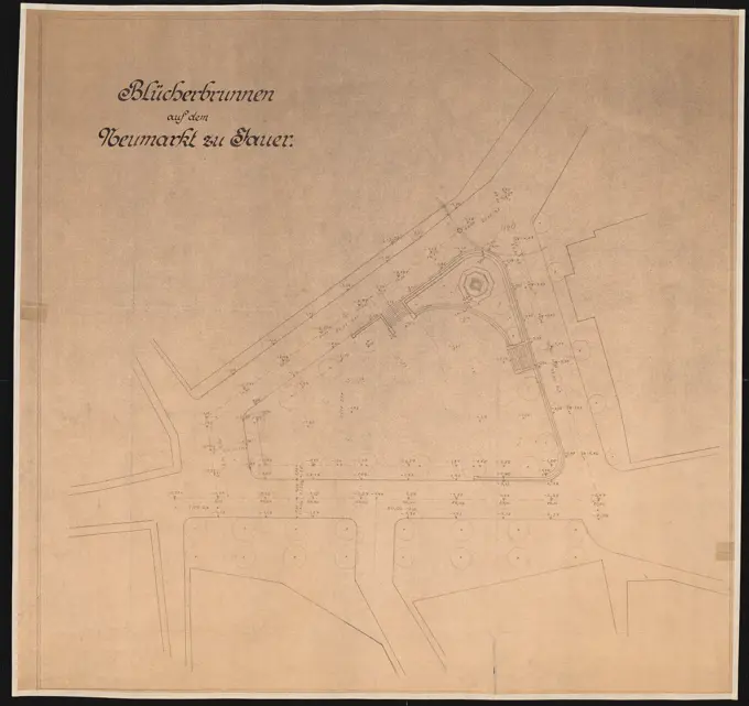
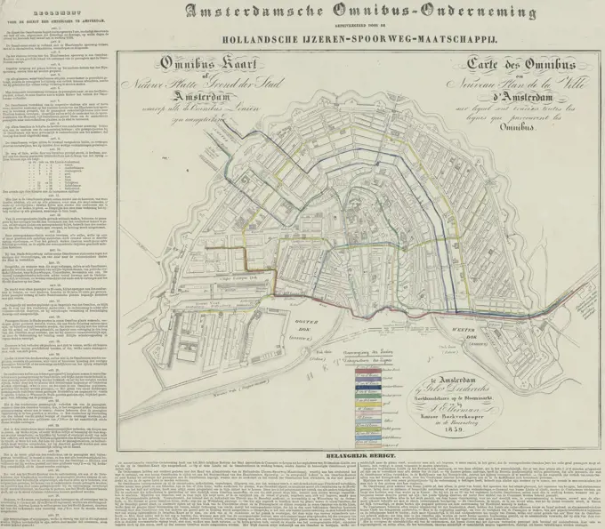
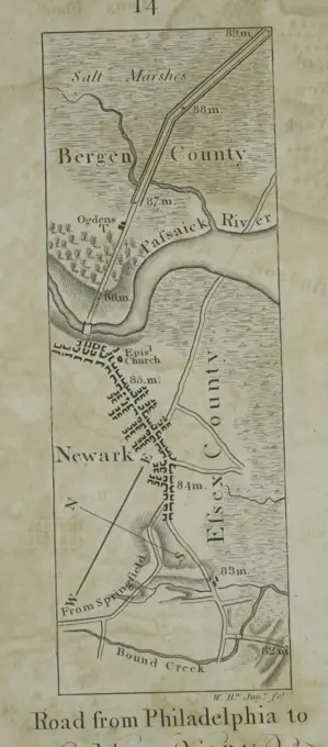
Maps and Urban Plans

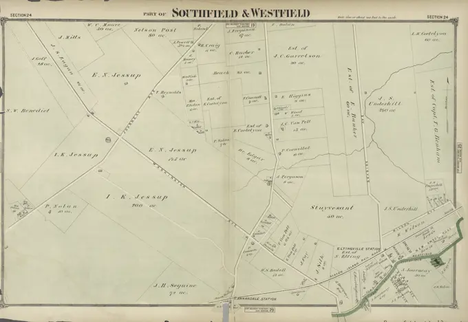
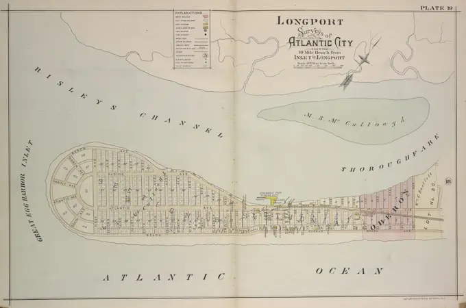
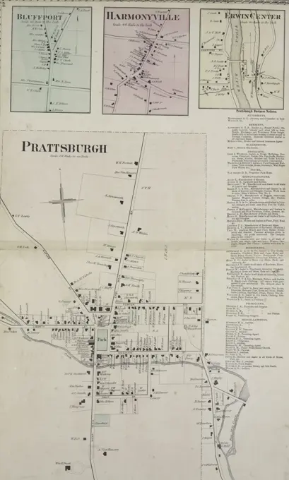
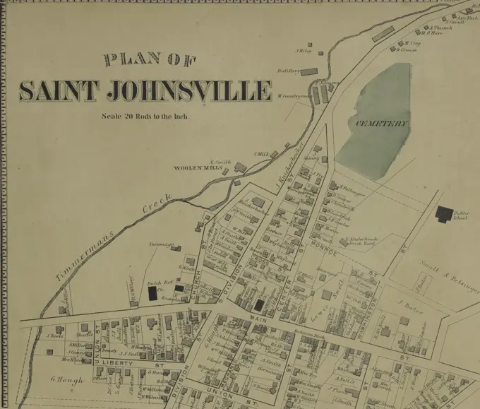
Historical maps and urban planning documents detailing land ownership, property divisions, and city layouts in Massachusetts.

Plan of land in Newton, 6th ward : being a portion of the estate of J. Willey sicEdmands, decd. ... to be sold by public-auction ... June 19th, 1878 ... Samuel Hatch & Co , Real property, Massachusetts, Newton, Maps, Landowners, Massachusetts, Newton, Maps, Edmands, J. Wiley John Wiley, 1809-1877 Norman B. Leventhal Map Center Collection
272 assets in this story
6145-55181581
Morris County, Double Page Plate No. 17 Map bounded by Hanover Ave., Ridgedale Ave., Hillairy Ave., Whippany River 1910. Cartographic. Atlases, Maps. Lionel Pincus and Princess Firyal Map Division. Morris County (N.J.)
6145-48665332
Hydrographic map of Elkhart Lake, Sheboygan Co. Wis. , Hydrology, Wisconsin, Elkhart Lake, Maps, Elkhart Lake Wis., Maps Norman B. Leventhal Map Center Collection
6145-29259621
The lazaretto of Varignano at La Spezia: floor plan. Pen drawing by I. Cremona, c. 1825.
6145-54549400
Stewarts Corners Village; East Venice Village; Venice Center Village; Poplar Ridge Village Cartographic. Atlases, Maps. 1875. Lionel Pincus and Princess Firyal Map Division. Cayuga County (N.Y.), Real property , New York (State) , Cayuga County
6145-50570566
Map of the estate of the Brookline Land Company and vicinity : showing especially the relation of this property to the park improvements now nearing completion in the Muddy River Valley , Real property, Massachusetts, Brookline, Maps, Brookline Mass., Maps Norman B. Leventhal Map Center Collection
4443-19590376
A Collection of Surveys of Scottish Estates of the Earl of Selkirk: Bishopton, unknown artist, undated, Graphite, watercolor, pen and black and brown ink on slightly textured, moderately thick, cream wove paper, Sheet: 13 × 9 3/8 inches (33 × 23.8 cm), architectural subject
4443-75463053
A new map and profile of the proposed canal from Lake Erie to the Hudson River in the State of New York, issued in 1821. The document features charts and diagrams illustrating altitudes along the Erie Canal and includes maps of the Genesee River in Pennsylvania and New York. The map extends over two sheets, measuring 38 x 170 cm in total, with individual sheet sizes of 41 x 87 cm and 41 x 86 cm. It was published by an unspecified publisher in New York
6145-51929683
Hydrographic map of Elkhart Lake, Sheboygan Co. Wis.. Also shows hotels. Depths shown by hypsometric tints, bathymetric isolines and soundings. "Contour interval = 10 ft." Includes 2 cross-sections. Explanation of map on inside of front cover. Imprint from cover... Hydrographic map of Elkhart Lake, Sheboygan County, Wis.. Hydrographic map of Elkhart Lake, Sheboygan County, Wis., Wisconsin  , Sheboygan  ,county   , Elkhart Lake
6145-50569116
Map of New Bedford , New Bedford Mass., Maps Norman B. Leventhal Map Center Collection
6145-55952257
King's bird's eye view of Greater New York King's views of New York. cartographic. Maps, Aerial views. 1907. Lionel Pincus and Princess Firyal Map Division. Manhattan (New York, N.Y.), New York (N.Y.), New York Metropolitan Area
6145-48718676
Map of the city of Beloit, Wisconsin, 1887 , Landowners, Wisconsin, Beloit, Maps, Beloit Wis., Maps Norman B. Leventhal Map Center Collection
6145-55957985
Monroe County, Double Page Plate No. 31 Map of Despatch town of Pittsford and Perinton, Penfield Cartographic. Atlases, Maps. 1902. Lionel Pincus and Princess Firyal Map Division. Monroe County (N.Y.), Real property , New York (State) , Monroe County
6145-50443740
Poelzig Hans (1869-1936), Blucherbrunnen on the Neumarkt, Jauer (without year): site plan. Light break on paper, 73.4 x 77.9 cm (including scan edges)
6145-51392395
Copy of a plan of South Bay , Boston Harbor Mass., Maps, Boston Mass., Maps Norman B. Leventhal Map Center Collection
6145-51397722
Ocean View, extreme end of Cape Ann, Pigeon Cove, Mass. ,
6145-55926972
Cartographic, Maps. 1891. Lionel Pincus and Princess Firyal Map Division. Queens County (N.Y.) Plate 31: Town of Hempstead.
6145-55957081
University Park, Brooklyn, N.Y.: general improvement plan Cartographic. Maps. 1890 - 1899. Lionel Pincus and Princess Firyal Map Division. Brooklyn (New York, N.Y.), Prospect Park (New York, N.Y.), Parks , New York (State) , New York
6145-48446895
Jansen Hermann (1869-1945), Waldsiedlung Hasenholz (03.1929): Department 1: 2500. Ink on transparent, 33.2 x 58 cm (including scan edges) Jansen Hermann  (1869-1945): Waldsiedlung Hasenholz
6145-48712918
Plan of Dunstable and Tyngsborough made by John G. Hales, dated 1831 ,. Massachusetts. Office of the Secretary of State
6145-48717979
Plan of Charles River : from the Waltham line to Boston harbor , Charles River Mass., Maps Norman B. Leventhal Map Center Collection
6145-54268676
Plan of house lots in Braintree : to be sold at public auction on Saturday May 25th 1850 at 3 o'clock p.m. on the premises. Oriented with north toward the upper left. "Loring, Porter & Co., auctioneers."... , Massachusetts  , Norfolk  ,county   , Braintree
6145-51390055
Atlas of the city of Boston, Charlestown and East Boston : plate 18 , Boston Mass., Maps, Real property, Massachusetts, Boston, Maps, Landowners, Massachusetts, Boston, Maps, Charlestown Boston, Mass., Maps Norman B. Leventhal Map Center Collection
6145-55914852
Map of the estate of the Brookline Land Company and vicinity : showing especially the relation of this property to the park improvements now nearing completion in the Muddy River Valley. Oriented with north toward the upper right.... , Massachusetts  , Norfolk  ,county   , Brookline
4409-21521185
Part of Northfield & Middletown. Staten Island, 1874.
6145-48732640
Plan of Beach Street, Rockport, Mass., from Main St. to King St. , Streets
6145-29929309
Map of the new village of Maine's pavement.
6145-50511823
Plan of the Norwood Headland in Rockport, Mass. ,
6145-50570136
Atlas of the city of Boston, volume seven, Brighton, Mass. : from actual surveys and official plans. plate 15 , Real property, Massachusetts, Boston, Maps, Landowners, Massachusetts, Boston, Maps, Brighton Boston, Mass., Maps Norman B. Leventhal Map Center Collection
6145-50570931
Plan for laying out the village of Oak Bluffs, Martha's Vineyard , Real property, Massachusetts, Oak Bluffs, Maps, Oak Bluffs Mass., Maps Norman B. Leventhal Map Center Collection
6145-50661519
Extract from the cadastral plan. / Municipality of Utrecht / Section C.
6145-55180948
Port Dickinson Cartographic. Atlases, Maps. 1876. Lionel Pincus and Princess Firyal Map Division. Broome County (N.Y.), Port Dickinson (N.Y.)
6145-48454870
Koss Achmed (1887-1914), port system for Gdansk-Neufahrwasser. Schinkel competition 1914 (14.03.1914): Department 1: 5000. Ink, ink colored watercolor over a break on the box, 69.9 x 142.5 cm (including scan edges) Koss Achmed  (1887-1914): Hafenanlage, Danzig-Neufahrwasser. Schinkelwettbewerb 1914
6145-59334587
View of a flood defense in Thames near Hurley, Henry W. Taunt, 1871 photograph  Berkshire photographic support albumen print river. sluice, weir Thames
6145-55914356
Map of Boston Common and Public Garden. Oriented with north toward the upper right.. Whereas Boston Common was established on existing dry ground, the Public Garden was created between 1838 and 1860 on made land upon what was originally a salt marsh. Designed by George Meacham in response to New Yorks Central Park, the Garden features undulating pathways arranged to encourage leisurely strolls among the exotic plant life. As superintendent of Bostons Common and Public Grounds, William Doogue envisioned Americas first public botanical park as a pleasure ground to the mass of Gods people, without any distinction as to race, color, or condition. This map includes the names and locations of the trees and lays out the arrangement of the tulips... , Massachusetts  , Suffolk  ,county   , Boston  , Boston Common  ,park  Massachusetts  , Suffolk  ,county   , Boston  , Public Garden  ,park
6145-30296176
Plan of the Danube near Vienna with the draft regulation of Florian Pasetti, Stephan Weiß, Drawer
4443-21813247
Map of the city of Amsterdam showing the lines of the omnibus of the Amsterdamsche Omnibus-Onderneming. In the middle the map with the coloured routes, on the left the regulations for the services and on the right the description of the 18 lines, Map with the lines of the Amsterdam Omnibus, 1839 Omnibus Kaart of Nieuwe Platte Grond der Stad Amsterdam, waarop alle de Omnibus Linin zijn aangeteekend, Carte des Omnibus ou Nouveau Plan de la Ville d'Amsterdam , print maker: anonymous, publisher: Gebroeders Diederichs, (mentioned on object), publisher: J. Ellerman, (mentioned on object), Amsterdam, 1839, paper, h 413 mm × w 545 mm
4443-75459226
Road from Philadelphia to New York, seg. 14., 1802, by Mathew Carey (1760-1839). Issued in Philadelphia by M. Carey. This guidebook details roads in the Middle Atlantic States of the United States, with a focus on the route from Philadelphia to New York
6145-48453553
Gerlach Friedrich (1856-1938), port and channel facility in Berlin-Gesundbrunnen (north Canal). Schinkel competition 1886 (June 18, 1886): sewer mouth and lock. Site plan 1: 1000. Ink, ink colored, watercolor on cardboard, 50.4 x 67.9 cm (including scan edges) Gerlach Friedrich  (1856-1938): Hafen- und Kanalanlage, Berlin-Gesundbrunnen (Nordkanal). Schinkelwettbewerb 1886
6145-51392020
Charles River Basin contour map of upper basin from surveys and soundings , Charles River Dam Mass., Maps, Charles River Mass., Maps, River engineering, Massachusetts, Charles River, Maps
6145-50570312
Atlas of the county of Suffolk, Massachusetts : vol. 6th including the late city of Charlestown, now wards 20,21 and 22, city of Boston : from actual survey & official records : plate N , Real property, Massachusetts, Boston, Maps, Landowners, Massachusetts, Boston, Maps, Charlestown Boston, Mass., Maps Norman B. Leventhal Map Center Collection
6145-55916441
Plan of South Reading Common, Nov. 19, 1826. Map depicts South Reading (Wakefield) common as it appeared on November 19, 1826, showing buildings and streets, property lines and owners.... , Massachusetts  , Middlesex  ,county   , Wakefield
6145-55955940
Map of 5 valuable lots of ground in the 15th Ward of the city of New-York, to be sold at auction by Messrs. R.R. Minturn & Co. on Wednesday the 4th day of February, 1835, at 12 o'clock at the Merchts. Exchange Cartographic. Cadastral maps, Maps. 1835. Lionel Pincus and Princess Firyal Map Division. United States , New York (State) , New York, Landowners , New York (State) , New York, Real property , New York (State) , New York, Real propery auctions , New York (State) , New York, SoHo (New York, N.Y.), Manhattan (New York, N.Y.)
6145-55925169
Cartographic, Maps. 1955 - 1956. Lionel Pincus and Princess Firyal Map Division. Real property , New York (State) , New York (N.Y.), Manhattan (New York, N.Y.) Explanation
4443-75477293
Part of Southfield & Westfield, Section 24, issued in 1874 by J.B. Beers & Co., New York
6145-51390031
Atlas of the city of Boston, Charlestown and East Boston : plate 18 , Boston Mass., Maps, Real property, Massachusetts, Boston, Maps, Landowners, Massachusetts, Boston, Maps, Charlestown Boston, Mass., Maps Norman B. Leventhal Map Center Collection
6145-54268125
Mediterranean Sea, west coast of Italy, Avenza Road. Depths shown by soundings and isolines. Includes coastal view drawn by G.P. Colvocoresses. Lt. U.S.N.... , Italy  , Tuscany  ,region   , Massa-Carrara  ,province   , Avenza Italy  , Tuscany  ,region   , Massa-Carrara  ,province   , Marina di Carrara
6145-54549080
Plan of Champlain Village; Champlain Subscriber's Business Directory. Cartographic. Atlases, Maps. 1869. Lionel Pincus and Princess Firyal Map Division. Clinton County (N.Y.)
6145-54525697
Cartographic, Maps. 1873. Lionel Pincus and Princess Firyal Map Division. Long Island (N.Y.) , Description and travel Canarsie. Town of Flat Lands, Kings Co.
6145-55957937
Buffalo, V. 3, Double Page Plate No. 2 Map bounded by City of Buffalo, Olcott Ave., Lake Erie Cartographic. Atlases, Maps. 1915. Lionel Pincus and Princess Firyal Map Division. Buffalo Metropolitan Area (N.Y.) , vMaps.
6145-54549509
Colchester Village; Hubbardsville Village; Earlville Business Notices; Earlville Village Cartographic. Atlases, Maps. 1875. Lionel Pincus and Princess Firyal Map Division. Madison County (N.Y.), Real property , New York (State) , Madison County, Business enterprises , New York (State) , Madison County
6145-54268468
Plan of Berlin made by Henry Wilder, dated June 1830.... , Massachusetts  , Worcester  ,county   , Berlin
6145-55176896
Cartographic, Maps. 1873. Lionel Pincus and Princess Firyal Map Division. Long Island (N.Y.) , Description and travel Part of Flushing. Town of Flushing, Queens Co. Includes Bayside Avenue, Broadway, Sanford Avenue, Queens Avenue, Walnut Avenue, Murray Avenue, Rodman Street, Percy Street, Parsons Avenue and Bowne Avenue.
6145-55926823
Cartographic, Maps. 1874. Lionel Pincus and Princess Firyal Map Division. Staten Island (New York, N.Y.) Part of Westfield & Southfield Section 29
6145-55956559
Double Page Plate No. 10: Westchester County - Irvington - Tarrytown to Sing Sing - East to State Line Cartographic. Atlases, Maps, Maps, Topographic maps. 1891. Lionel Pincus and Princess Firyal Map Division. New York (N.Y.), New York Metropolitan Area
6145-48712827
Plan of Bradford made by Benjamin Greenleaf and Jeremiah Spofford, dated 1831 ,. Massachusetts. Office of the Secretary of State
6145-55928465
Cartographic, Maps. 1873. Lionel Pincus and Princess Firyal Map Division. Long Island (N.Y.) , Description and travel Richmond Hill.
6145-51391128
Atlas of the county of Suffolk, Massachusetts : vol. 1st including Boston proper : from actual surveys and official records : plate P , Real property, Massachusetts, Boston, Maps, Landowners, Massachusetts, Boston, Maps, Boston Mass., Maps Norman B. Leventhal Map Center Collection
6145-50566583
Atlas of the city of Boston, Charlestown and East Boston : plate 18 , Boston Mass., Maps, Real property, Massachusetts, Boston, Maps, Landowners, Massachusetts, Boston, Maps, Charlestown Boston, Mass., Maps Norman B. Leventhal Map Center Collection
6145-50569401
Olmsted Park master plan , Parks, Massachusetts, Boston, Maps, City planning, Massachusetts, Boston, Maps, Urban renewal, Massachusetts, Boston, Maps, Jamaica Plain Boston, Mass., Maps Norman B. Leventhal Map Center Collection
6145-55181591
Monmouth County, Double Page Plate No. 5 Map of Seabright and part of Rumson Neck 1889. Breou, Forsey. Cartographic. Atlases, Maps, Surveys, Plans. Lionel Pincus and Princess Firyal Map Division. Monmouth County (N.J.)
6145-30267957
nd, plan of the K, Prater with the requested park, Unknown
4443-75457935
Atlantic City, Double Page Plate No. 19 Map bounded by Risleys Channel, Atlantic Ocean, and Great Egg Harbor Inlet, issued in 1896 by A.H. Mueller Co., Philadelphia, New Jersey
6145-55181356
High Bridge Village; East High Bridge or Everettsville. Village Cartographic. Atlases, Maps. 1873. Lionel Pincus and Princess Firyal Map Division. Hunterdon County (N.J.) , Maps
6145-55956501
Peremptory sale at auction : James M. Miller, auct'r, on Monday, March 15, at the Exchange salesroom, no. 111 Broadway, at 12 m., will sell 48 parcels of land containing about 181 lots, estate of Lewis G. Morris. 1869. Baker & Godwin. Cartographic. Maps. Lionel Pincus and Princess Firyal Map Division. New York (N.Y.), Manhattan (New York, N.Y.), Bronx (New York, N.Y.), Real property , New York (State) , New York (N.Y.), Real property auctions , New York (State) , New York (N.Y.), Morris, Lewis G. (Lewis Gouverneur), 1808-1900 , Estate
4443-75461407
A publication titled 'Prattsburgh Business Notices,' issued in 1873 by D.G. Beers & Co. The publication covers villages such as Prattsburgh, Bluffport, Harmonyville, and Erwin Center, and focuses on real properties and business enterprises in Steuben County, New York. The place of publication is Philadelphia
4443-75466062
Plan of Saint Johnsville Village from the St. Johnsville Business Directory, issued in 1868. Published by Stranahan & Nichols, the plan illustrates real property in Saint Johnsville, located in Montgomery and Fulton Counties, New York
6145-51387319
Satsuma, Putnam County, Florida : the property of Whitney, Gold and Hodges , Landowners, Florida, Satsuma, Maps, Real property, Florida, Satsuma, Maps, Satsuma Fla., maps Norman B. Leventhal Map Center Collection
4409-66885791
St. Louis in 1780 / from the original made by Auguste Chouteu ; constructed and engraved for Campbell's gazetteer of Missouri ; Chas. Juehne, lithographer.
4443-75469405
Map of Roanoke, Virginia, issued in 1890, showing the location of the Roanoke Development Company's property. The map is hand-colored and measures 30 x 49 cm on a sheet that is 34 x 51 cm. It was published by G. Wm. Baist and includes details relevant to real estate development and city planning in Roanoke, Virginia
6176-66917422
The field of Bull Run : showing the positions of the armies at 4:30 p.m. on August 29, 1862. The Second Battle of Bull Run - American Civil War
6145-55928508
Cartographic, Maps. 1873. Lionel Pincus and Princess Firyal Map Division. Long Island (N.Y.) , Description and travel Gravesend. Kings Co. L.I.
6145-55181596
Monmouth County, Double Page Plate No. 7 Map of Monmouth Beach 1889. Breou, Forsey. Cartographic. Atlases, Maps, Surveys, Plans. Lionel Pincus and Princess Firyal Map Division. Monmouth County (N.J.)
PREVIOUS
of 3
NEXT
2401 S. Ervay, Suite 206
Dallas, Texas 75215
United States
Get Started
Free ResearchMy BoardsMy Cart
For Creators
How To License Your ContentContributor PortalFrame of Mind
Resources
API accessPricing
Contact
+1 866 236 0087help@viewpictures.co.uk Contact form
©2026 View Pictures. All Rights Reserved. -B
This site is protected by reCAPTCHA and Google Privacy Policy and Terms of Service apply.