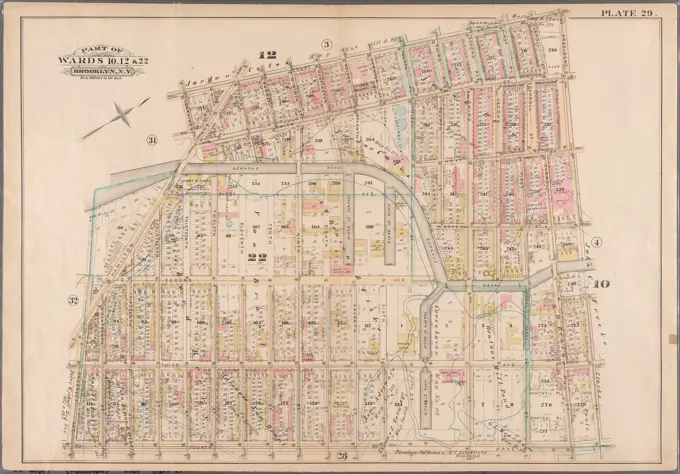
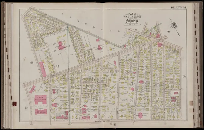
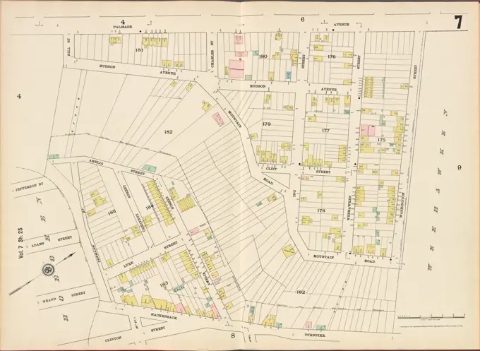
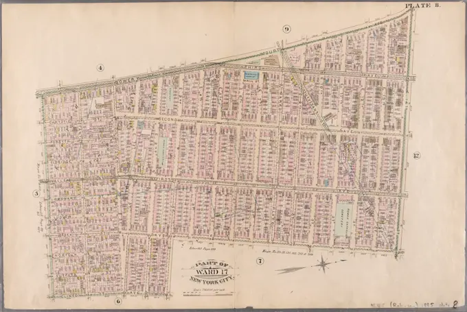
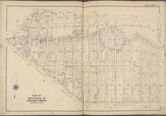
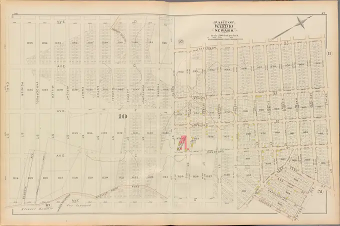
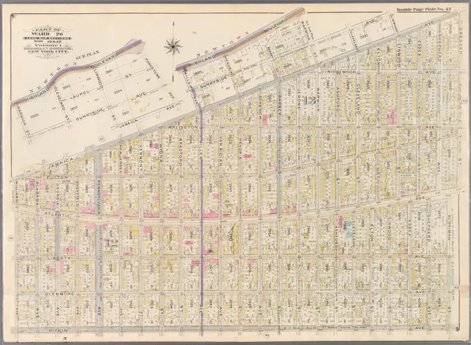
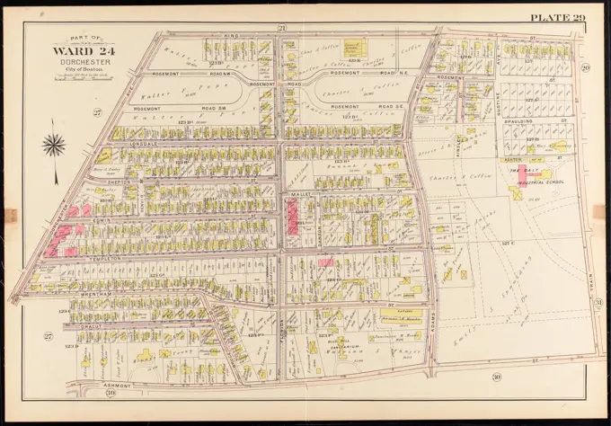
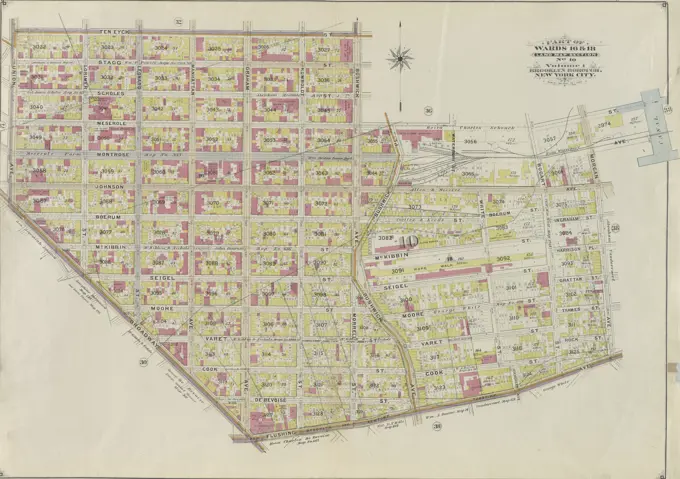
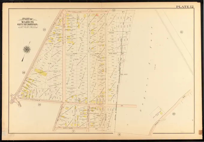
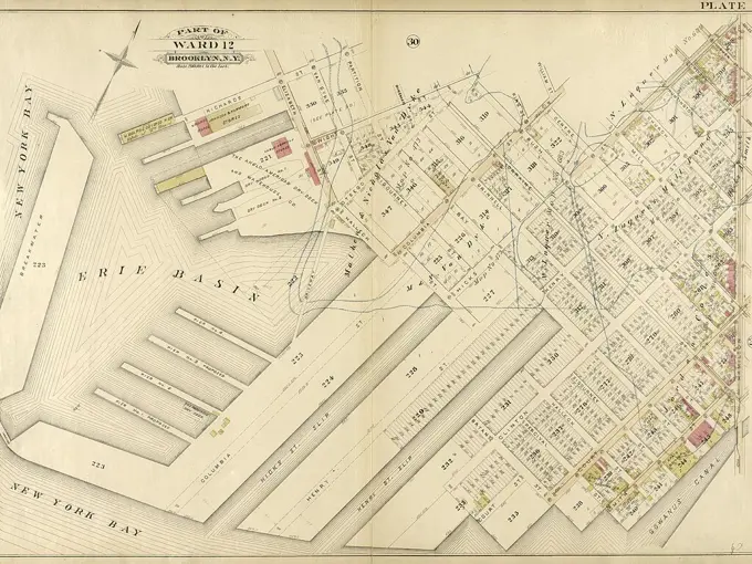
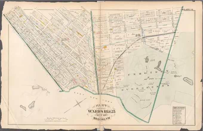
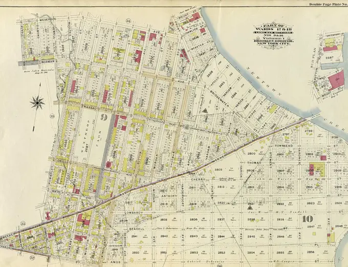
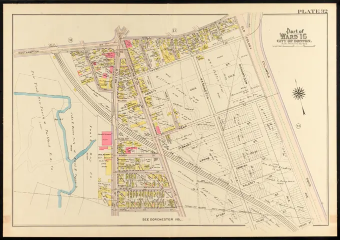
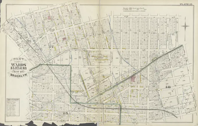
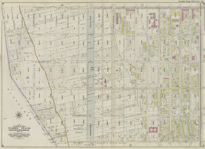
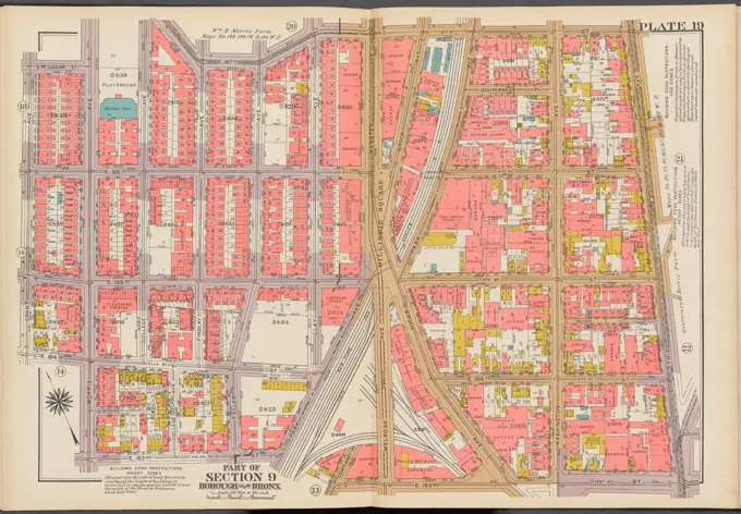
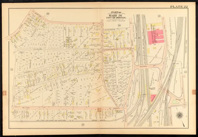
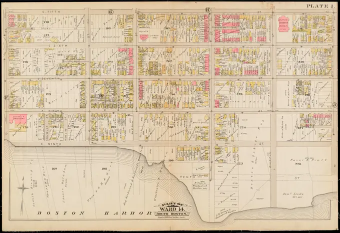
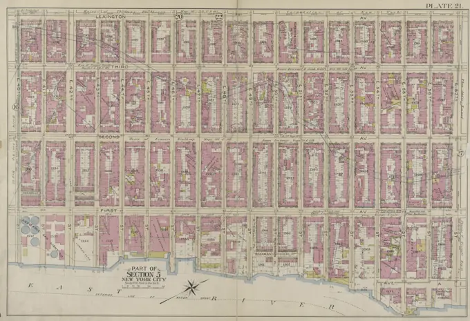
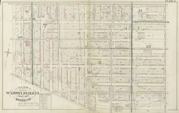
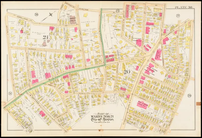
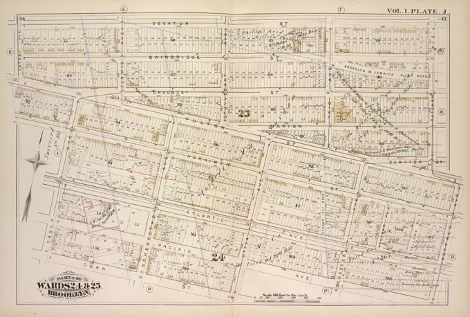
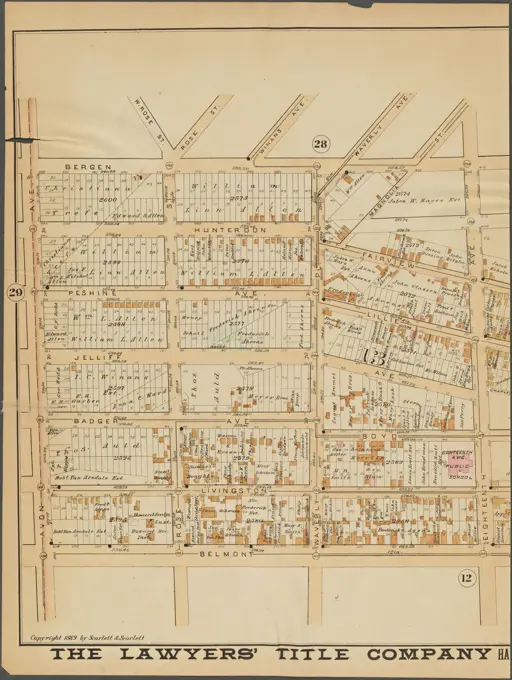
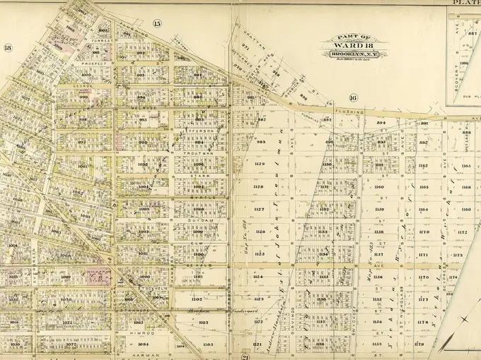
Maps of Boston and Brooklyn Neighborhoods

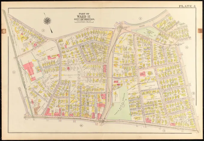
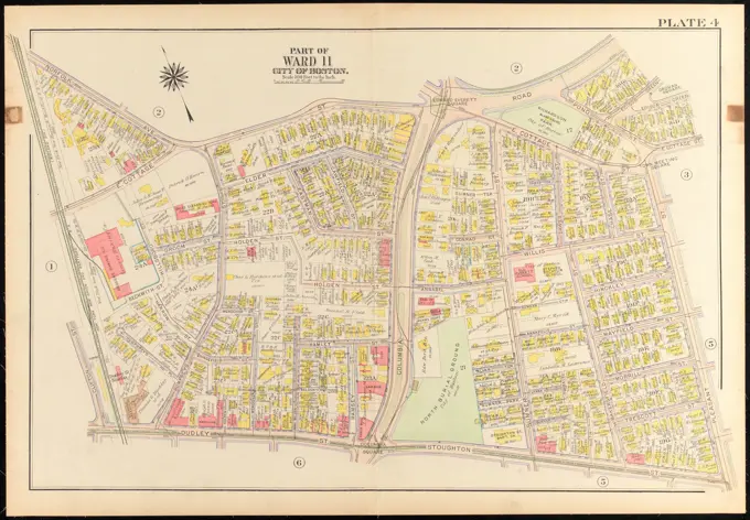
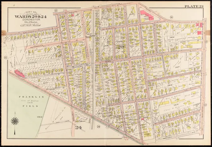
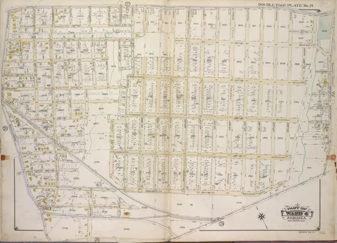
Detailed cartographic maps showcasing various wards in Boston and parts of Brooklyn, highlighting landownership and property divisions in vibrant colors.

Atlas of the city of Boston, wards 25 & 26, Brighton : plate 13 , Boston Mass., Maps, Real property, Massachusetts, Boston, Maps, Landowners, Massachusetts, Boston, Maps, Brighton Boston, Mass., Maps Norman B. Leventhal Map Center Collection
Atlas of the city of Boston, wards 25 & 26, Brighton : plate 13 , Boston Mass., Maps, Real property, Massachusetts, Boston, Maps, Landowners, Massachusetts, Boston, Maps, Brighton Boston, Mass., Maps Norman B. Leventhal Map Center CollectionAtlas of the city of Boston : Dorchester, Mass. : plate 27 , Boston Mass., Maps, Real property, Massachusetts, Boston, Maps, Landowners, Massachusetts, Boston, Maps, Dorchester Boston, Mass., Maps Norman B. Leventhal Map Center CollectionMount Vernon, Double Page Plate No. 26 Map bounded by 7th St., Winyah Ave., 4th St., River Ave. Cartographic. Atlases, Maps. 1908. Lionel Pincus and Princess Firyal Map Division. Real property , New York (State) , Mount Vernon, Mount Vernon (Westchester County, N.Y.), Real property , New York (State) , Pelham, Pelham (N.Y.)Atlas of the city of Boston : Charlestown and Brighton : plate C , Boston Mass., Maps, Real property, Massachusetts, Boston, Maps, Landowners, Massachusetts, Boston, Maps, Charlestown Boston, Mass., Maps Norman B. Leventhal Map Center CollectionCartographic, Maps. 1886. Lionel Pincus and Princess Firyal Map Division. Brooklyn (New York, N.Y.), Real property , New York (State) , New York Plate 29: Bounded by Court Street, President Street, Fourth Avenue, Prospect Avenue, Hamilton Avenue and Lorraine. Plate 29: Part of Wards 10, 12 & 22. Brooklyn, N.Y.Atlas of the city of Boston, Dorchester : plate 30 , Boston Mass., Maps, Real property, Massachusetts, Boston, Maps, Landowners, Massachusetts, Boston, Maps, Dorchester Boston, Mass., Maps Norman B. Leventhal Map Center CollectionAtlas of the city of Cambridge, Massachusetts : from actual surveys and official plans. plate 31 , Real property, Massachusetts, Cambridge, Maps, Landowners, Massachusetts, Cambridge, Maps, Cambridge Mass., Maps Norman B. Leventhal Map Center CollectionAtlas of the city of Cambridge, Massachusetts : from actual surveys and official plans. plate 14 , Real property, Massachusetts, Cambridge, Maps, Landowners, Massachusetts, Cambridge, Maps, Cambridge Mass., Maps Norman B. Leventhal Map Center CollectionAtlas of the city of Boston, Dorchester : plate 23 , Boston Mass., Maps, Real property, Massachusetts, Boston, Maps, Landowners, Massachusetts, Boston, Maps, Dorchester Boston, Mass., Maps Norman B. Leventhal Map Center CollectionCartographic, Maps. 1880. Lionel Pincus and Princess Firyal Map Division. Brooklyn (New York, N.Y.), Real property , New York (State) , New York Plate 24: Bounded by Emery Street, Sutton Street, Bridgewater Street, Hausman Street, Nassau Avenue, Eckford Street, Meserole Street, Oakland Street and (Newtown Creek) Paidge Avenue. Plate 24: Part of Ward 17. City of Brooklyn.Atlas of the city of Boston, Dorchester, Mass., vol. 5 : from actual surveys and official plans : plate 5 , Real property, Massachusetts, Boston, Maps, Landowners, Massachusetts, Boston, Maps, Dorchester Boston, Mass., Maps Norman B. Leventhal Map Center CollectionAtlas of the city of Cambridge, Massachusetts : from actual surveys and official plans. plate 28 , Real property, Massachusetts, Cambridge, Maps, Landowners, Massachusetts, Cambridge, Maps, Cambridge Mass., Maps Norman B. Leventhal Map Center CollectionAtlas of the city of Cambridge, Massachusetts : from actual surveys and official plans. plate 29 , Real property, Massachusetts, Cambridge, Maps, Landowners, Massachusetts, Cambridge, Maps, Cambridge Mass., Maps Norman B. Leventhal Map Center CollectionCartographic, Maps. 1886. Lionel Pincus and Princess Firyal Map Division. Brooklyn (New York, N.Y.), Real property , New York (State) , New York Plate 27: Bounded by Bedford Avenue, Montgomery Street, Flatbush Avenue, Underhill Place, Underhill Avenue and Atlantic Avenue. Plate 27: Part of Wards 9 & 24. Brooklyn, N.Y.Hudson County, V. 8, Double Page Plate No. 7 Map bounded by Palisade Ave., Washington St., Hackensack Turnpike, Hermann St., Hill St. 1887. Cartographic. Atlases, Maps. Lionel Pincus and Princess Firyal Map Division. Hudson County (N.J.)Atlas of the city of Boston, West Roxbury : plate 25 , Boston Mass., Maps, Real property, Massachusetts, Boston, Maps, Landowners, Massachusetts, Boston, Maps, West Roxbury Boston, Mass., Maps Norman B. Leventhal Map Center CollectionCartographic, Maps. 1885. Lionel Pincus and Princess Firyal Map Division. Real property , New York (State) , New York, New York (N.Y.) Plate 8: Bounded by Bowery, Fourth Avenue, E. 14th Street, Avenue A, E. 3rd Street, Clinton Avenue, and Rivington Street. Part of Ward 17, New York City.Atlas of the city of Cambridge, Massachusetts : from actual surveys and official plans. plate 30 , Real property, Massachusetts, Cambridge, Maps, Landowners, Massachusetts, Cambridge, Maps, Cambridge Mass., Maps Norman B. Leventhal Map Center CollectionAtlas of the city of Boston : Dorchester, Mass. : plate 28 , Boston Mass., Maps, Real property, Massachusetts, Boston, Maps, Landowners, Massachusetts, Boston, Maps, Dorchester Boston, Mass., Maps Norman B. Leventhal Map Center CollectionAtlas of the city of Cambridge, Massachusetts : from actual surveys and official plans. plate 29 , Real property, Massachusetts, Cambridge, Maps, Landowners, Massachusetts, Cambridge, Maps, Cambridge Mass., Maps Norman B. Leventhal Map Center CollectionCartographic, Maps. 1913. Lionel Pincus and Princess Firyal Map Division. Bronx (New York, N.Y.), New York (N.Y.) Plate 8 Map bounded by Pitman Ave., Seton Ave., Strang Ave., E. 233rd St.Atlas of the city of Boston, Dorchester : plate 4 , Boston Mass., Maps, Real property, Massachusetts, Boston, Maps, Landowners, Massachusetts, Boston, Maps, Dorchester Boston, Mass., Maps Norman B. Leventhal Map Center CollectionAtlas of the city of Boston, Dorchester : plate 11 , Boston Mass., Maps, Real property, Massachusetts, Boston, Maps, Landowners, Massachusetts, Boston, Maps, Dorchester Boston, Mass., Maps Norman B. Leventhal Map Center CollectionAtlas of the city of Boston, Dorchester : plate 4 , Boston Mass., Maps, Real property, Massachusetts, Boston, Maps, Landowners, Massachusetts, Boston, Maps, Dorchester Boston, Mass., Maps Norman B. Leventhal Map Center CollectionAtlas of the city of Cambridge, Massachusetts : from actual surveys and official plans. plate 29 , Real property, Massachusetts, Cambridge, Maps, Landowners, Massachusetts, Cambridge, Maps, Cambridge Mass., Maps Norman B. Leventhal Map Center CollectionCartographic, Maps. 1898. Lionel Pincus and Princess Firyal Map Division. Brooklyn (New York, N.Y.), Real property , New York (State) , New York Double Page Plate No. 38: Bounded by Flushing Avenue, Morgan Avenue, Montrose Avenue, Varick Avenue, Meserole Street, City Line and De Kalb Avenue. Part of Wards 18 & 27. Land Map Sections, Nos. 18 & 27. Volume 1, Brooklyn Borough, New York City.Essex County, Left Page Plate: Map bounded by Avenue D, Thomas St., Avenue H, Earl St. Cartographic. Atlases, Maps. 1881. Lionel Pincus and Princess Firyal Map Division. Essex County (N.J.), Real property , New Jersey , Essex CountyAtlas of the city of Chelsea and the towns of Revere and Winthrop : from actual surveys and official plans. plate I , Real property, Massachusetts, Chelsea, Maps, Landowners, Massachusetts, Chelsea, Maps, Chelsea Mass., Maps Norman B. Leventhal Map Center CollectionCartographic, Maps. 1898. Lionel Pincus and Princess Firyal Map Division. Brooklyn (New York, N.Y.), Real property , New York (State) , New York Double Page Plate No. 42: Bounded by Jamaica Avenue, Miller Avenue, Highland Boulevard, Forcetube Avenue, Jamaica Avenue, Dresden Street, Atlantic Avenue, Berriman Street, Pitkin Avenue and Williams Avenue. Part of Ward 26. Land Map Sections, Nos. 12 & 13. Volume 1, Brooklyn Borough, New York City.Cartographic, Maps. 1898. Lionel Pincus and Princess Firyal Map Division. Brooklyn (New York, N.Y.), Real property , New York (State) , New York Double Page Plate No. 18: Bounded by Albany Avenue, Atlantic Avenue, Buffalo Avenue and East New York Avenue. Part of Wards 24 & 29. Land Map Section, No. 5, Volume 1, Brooklyn Borough, New York City.Atlas of the city of Boston, Dorchester : plate 21 , Boston Mass., Maps, Real property, Massachusetts, Boston, Maps, Landowners, Massachusetts, Boston, Maps, Dorchester Boston, Mass., Maps Norman B. Leventhal Map Center CollectionAtlas of the city of Boston, Dorchester : from actual surveys and official plans : plate 25 , Real property, Massachusetts, Boston, Maps, Landowners, Massachusetts, Boston, Maps, Dorchester Boston, Mass., Maps Norman B. Leventhal Map Center CollectionCartographic, Maps. 1886. Lionel Pincus and Princess Firyal Map Division. Brooklyn (New York, N.Y.), Real property , New York (State) , New York Plate 25: Bounded by Rochester Avenue, Carroll Street, Schenectady Avenue, Crown Street, Troy Avenue, Montgomery Street, Albany Avenue, Malbone Street, Kingston Avenue and Atlantic Avenue. Plate 25: Part of Ward 24. Brooklyn, N.Y.Atlas of the city of Boston, West Roxbury : plate 17 , Boston Mass., Maps, Real property, Massachusetts, Boston, Maps, Landowners, Massachusetts, Boston, Maps, Roslindale Boston, Mass., Maps Norman B. Leventhal Map Center CollectionAtlas of the city of Boston : Roxbury, Mass. : volume four : from actual surveys and official records : plate 43 , Real property, Massachusetts, Boston, Maps, Landowners, Massachusetts, Boston, Maps, Roxbury Boston, Mass., Maps Norman B. Leventhal Map Center CollectionCartographic, Maps. 1911. Lionel Pincus and Princess Firyal Map Division. Bronx (New York, N.Y.), New York (N.Y.) Plate 9 Map bounded by E. 173rd St., E. 174th St., Fulton Ave., E. 171st St., Teller Ave., Eastburn Ave.Atlas of the city of Boston, Dorchester, Mass. : plate 29 , Boston Mass., Maps, Real property, Massachusetts, Boston, Maps, Landowners, Massachusetts, Boston, Maps, Dorchester Boston, Mass., Maps Norman B. Leventhal Map Center CollectionE.B. Hyde & Co.. Cartographic, Maps. 1916 - 1920. Lionel Pincus and Princess Firyal Map Division. Brooklyn (New York, N.Y.), Real property , New York (State) , New York Brooklyn, Vol. 3, Double Page Plate No. 10; Part of Ward 31, Section 20-21; Map bounded by Avenue R, W. 6th St., Kings Highway; Including E. 2nd St., Avenue U, Stillwell Ave.Mount Vernon, Double Page Plate No. 16 Map bounded by S. Grand St., Rich Ave., Primrose Ave., Bronx St., Bronx River Cartographic. Atlases, Maps. 1899. Lionel Pincus and Princess Firyal Map Division. Real property , New York (State) , Mount Vernon, Mount Vernon (Westchester County, N.Y.), Real property , New York (State) , Pelham (Town), Pelham (N.Y. : Town)Atlas of the city of Boston : Roxbury, Mass. : volume four : from actual surveys and official records : plate 43 , Real property, Massachusetts, Boston, Maps, Landowners, Massachusetts, Boston, Maps, Roxbury Boston, Mass., Maps Norman B. Leventhal Map Center CollectionBuffalo, Double Page Plate No. 10 Map bounded by Summer St., Main St., Allen St., West Ave. Cartographic. Atlases, Maps. 1891. Lionel Pincus and Princess Firyal Map Division. Real property , New York (State) , zBuffaloCartographic, Maps. 1898. Lionel Pincus and Princess Firyal Map Division. Brooklyn (New York, N.Y.), Real property , New York (State) , New York Double Page Plate No. 45: Bounded by Atlantic Avenue, Eldert's Lane, Glen Street, Forbell Avenue, Magenta Street, Drew Street, Broadway, Ruby Street, Belmont Avenue, Drew Street, Dumont Avenue, Holly Street, Blake Avenue, Montauk Avenue, Dumont Avenue and Berriman Street. Part of Ward 26. Land Map Section, No. 13. Volume 1, Brooklyn Borough, New York City.Double Page Plate No. 37 Bounded by Ten Eyck Street, Bushwick Avenue, Meserole Street, Morgan Avenue, Flushing Avenue, Broadway, and Union Avenue, 1898, E.B. Hyde & Co. Additional, Part of Wards 16 & 18. Land Map Section, No. 10, Volume 1, Brooklyn Borough, New York City., 1898., New York. Publisher, E.B. Hyde & Co., Brooklyn (New York, N.Y.). Real property, New York (State), New YorkAtlas of the city of Boston, volume five, Dorchester Mass. : from actual surveys and official plans. plate 6 , Real property, Massachusetts, Boston, Maps, Landowners, Massachusetts, Boston, Maps, Dorchester Boston, Mass., Maps Norman B. Leventhal Map Center CollectionAtlas of the city of Boston, ward 26, Hyde Park : plate 12 , Boston Mass., Maps, Real property, Massachusetts, Boston, Maps, Landowners, Massachusetts, Boston, Maps, Hyde Park Boston, Mass., Maps Norman B. Leventhal Map Center CollectionAtlas of the city of Boston, ward 25, Brighton : plate 1 , Boston Mass., Maps, Real property, Massachusetts, Boston, Maps, Landowners, Massachusetts, Boston, Maps, Brighton Boston, Mass., Maps Norman B. Leventhal Map Center CollectionBergen County, V. 2, Double Page Plate No. 18 Map bounded by Hackensack River, Lookout Ave., Grove Ave., Maywood Ave., Main St. Cartographic. Atlases, Maps. 1912 - 1913. Lionel Pincus and Princess Firyal Map Division. Bergen County (N.J.)Atlas of the city of Boston, Charlestown and East Boston : plate 25 , Boston Mass., Maps, Real property, Massachusetts, Boston, Maps, Landowners, Massachusetts, Boston, Maps Norman B. Leventhal Map Center CollectionPlate 31: Bounded by Richards Street, Partition Street, Dwight Street, Bush Street, Columbia Street, Centre Street, Hicks Street, Luquer Street, Henry Street, Nelson Street, Hamilton Avenue, Smith Street, Percival Street, Court Street, Bryant Street, Cli.Atlas of the city of Boston, West Roxbury : plate 20 , Boston Mass., Maps, Real property, Massachusetts, Boston, Maps, Landowners, Massachusetts, Boston, Maps, West Roxbury Boston, Mass., Maps Norman B. Leventhal Map Center CollectionCartographic, Maps. 1886. Lionel Pincus and Princess Firyal Map Division. Brooklyn (New York, N.Y.), Real property , New York (State) , New York Plate 14: Bounded by Bayard Street, Graham Avenue, Meeker Avenue, N. Henry Street, Herbert Street, Kingsland Avenue, Division Place, Morgan Avenue, Ten Eyck Street and Union Avenue. Plate 14: Part of Wards 15, 17 & 18. Brooklyn, N.Y.Plate 23: Bounded by Oakland Street, Meserole Street, Eckford Street, Norman Street, 15th Street, East River West Street, Commercial Street and Ash Street.Cartographic, Maps. 1884 - 1936. Lionel Pincus and Princess Firyal Map Division. Fire insurance , New York (State), Real property , New York (State), Cities & towns , New York (State) Brooklyn V. 4, Double Page Plate No.87 Map bounded by Wythe Ave., N. 9th St., East River, Quay St., Franklin St.Essex County, Left Page Plate: Map bounded by Plane St., Passaic River, Market House, Cedar St., Warren St. Cartographic. Atlases, Maps. 1881. Lionel Pincus and Princess Firyal Map Division. Essex County (N.J.), Real property , New Jersey , Essex CountyAtlas of the city of Cambridge, Massachusetts : from actual surveys and official plans. plate 25 , Real property, Massachusetts, Cambridge, Maps, Landowners, Massachusetts, Cambridge, Maps, Cambridge Mass., Maps Norman B. Leventhal Map Center CollectionAtlas of the city of Boston, Boston proper and Roxbury : plate 39 , Boston Mass., Maps, Real property, Massachusetts, Boston, Maps, Landowners, Massachusetts, Boston, Maps, Roxbury Boston, Mass., Maps Norman B. Leventhal Map Center CollectionAtlas of the city of Cambridge, Massachusetts : from actual surveys and official plans. plate 5 , Real property, Massachusetts, Cambridge, Maps, Landowners, Massachusetts, Cambridge, Maps, Cambridge Mass., Maps Norman B. Leventhal Map Center CollectionMount Vernon, Double Page Plate No. 27 Map bounded by 4th St., 1st St., Hutchinson River Cartographic. Atlases, Maps. 1908. Lionel Pincus and Princess Firyal Map Division. Real property , New York (State) , Mount Vernon, Mount Vernon (Westchester County, N.Y.), Real property , New York (State) , Pelham, Pelham (N.Y.)Cartographic, Maps. 1880. Lionel Pincus and Princess Firyal Map Division. Brooklyn (New York, N.Y.), Real property , New York (State) , New York Plate 34: Bounded by Ralph Avenue, Fulton Street, Howard Avenue, Sumpter Street, Saratoga Avenue, Bainbridge Street, Hopkinson Avenue, Mc. Donough Street, Schaffer Street, Knickerbocker Avenue, Granite Street, Bushwick Avenue, Conway Street, Broadway, Trauxton Street, Stone Avenue and Atlantic Avenue. Plate 34: Part of Wards 23 & 25. City of Brooklyn.Atlas of the city of Boston : city proper : plate I , Boston Mass., Maps, Real property, Massachusetts, Boston, Maps, Landowners, Massachusetts, Boston, Maps, Chinatown Boston, Mass., Maps Norman B. Leventhal Map Center CollectionPart of Wards 17 & 18. Land Map Sections, No. 9 & 10, Volume 1, Brooklyn Borough, New York City.Plate 16: Part of Wards 6 & 12. City of Brooklyn.Atlas of the city of Boston, South Boston : plate 32 , Boston Mass., Maps, Real property, Massachusetts, Boston, Maps, Landowners, Massachusetts, Boston, Maps Norman B. Leventhal Map Center CollectionAtlas of the city of Boston, Dorchester : from actual surveys and official plans : plate 5 , Real property, Massachusetts, Boston, Maps, Landowners, Massachusetts, Boston, Maps, Dorchester Boston, Mass., Maps Norman B. Leventhal Map Center CollectionAtlas of the city of Chelsea and the towns of Revere & Winthrop, Massachusetts : from actual surveys and official plans. plate 5 , Real property, Massachusetts, Chelsea, Maps, Landowners, Massachusetts, Chelsea, Maps, Chelsea Mass., Maps Norman B. Leventhal Map Center CollectionPlate 25 Bounded by 2nd Street, Norman Avenue, Oakland Street, Nassau Avenue, Hausman Street, Meeker Street, Vandervoort Avenue, Parker Street, Kingsland Avenue, Withers Street, Union Street, Vancott Street, and N. 14th Street, 1880. Additional, Part of Wards 15, 17, & 18, City of Brooklyn., 1880., New York. Publisher, G. W. Bromley & E. Robinson, Brooklyn (New York, N.Y.). Real property, New York (State), New YorkPart of the city of East Orange. Double Page Plate No. 12 Map bounded by North St., S. 14th St., Central Ave., Munn Ave. Cartographic. Atlases, Maps, Cadastral maps. 1904. Lionel Pincus and Princess Firyal Map Division. Essex County (N.J.), Real property , New Jersey , Essex County (N.J.)Atlas of the city of Cambridge, Massachusetts : from actual surveys and official plans. plate 27 , Real property, Massachusetts, Cambridge, Maps, Landowners, Massachusetts, Cambridge, Maps, Cambridge Mass., Maps Norman B. Leventhal Map Center CollectionAtlas of the city of Cambridge, Massachusetts : from actual surveys and official plans. plate 7 , Real property, Massachusetts, Cambridge, Maps, Landowners, Massachusetts, Cambridge, Maps, Cambridge Mass., Maps Norman B. Leventhal Map Center CollectionDouble Page Plate No. 18 Bounded by Albany Avenue, Atlantic Avenue, Buffalo Avenue, and East New York Avenue, 1898. Additional, Part of Wards 24 & 29. Land Map Section, No. 5, Volume 1, Brooklyn Borough, New York City., 1898. Publisher, E.B. Hyde & Co., Brooklyn, New York. Real property, New York (State), New YorkPlate 39: Part of Ward 26. Brooklyn, N.Y.Cartographic, Maps. 1942. Lionel Pincus and Princess Firyal Map Division. Real property , New York (State) , New York (N.Y.), Bronx (New York, N.Y.) , Maps Double Page Plate No. 19, Part of Section 9, Borough of the Bronx: Bounded by E. 167th Street, Third Avenue, E. 163rd Street, Morris Avenue, E. 164th Street, Grant Avenue, McClellan Street and Morris AvenueAtlas of the city of Boston, Charlestown and East Boston : plate 30 , Boston Mass., Maps, Real property, Massachusetts, Boston, Maps, Landowners, Massachusetts, Boston, Maps Norman B. Leventhal Map Center CollectionAtlas of the city of Boston : Dorchester, Mass. : plate 17 , Boston Mass., Maps, Real property, Massachusetts, Boston, Maps, Landowners, Massachusetts, Boston, Maps, Dorchester Boston, Mass., Maps Norman B. Leventhal Map Center CollectionBergen County, V. 2, Double Page Plate No. 29 Part of the TWP. of Hills Dale and Borough of Wood Cliff Cartographic. Atlases, Maps. 1912 - 1913. Lionel Pincus and Princess Firyal Map Division. Bergen County (N.J.)Atlas of the city of Boston, Dorchester, Mass. : plate 23 , Boston Mass., Maps, Real property, Massachusetts, Boston, Maps, Landowners, Massachusetts, Boston, Maps, Dorchester Boston, Mass., Maps Norman B. Leventhal Map Center CollectionCartographic, Maps. 1891. Lionel Pincus and Princess Firyal Map Division. Manhattan (New York, N.Y.), Real property , New York (State) , New York Plate 38 Map bounded by Hudson River, W. 125th St., 9th Ave., W.1 08th St.Queens, Vol. 1, Double Page Plate No. 5; Sub Plan; Map bounded by Division Ave.; Including Market St., Church St., Richmond Hill St., Drive, Walnut St.;Part of ward 4, Jamaica; Map bounded by Newtown Road, Whitepot Road, Cottage Ave., Richmo.Bromley, George Washington. Cartographic, Maps, Atlases, land surveys. 1907. Lionel Pincus and Princess Firyal Map Division. Brooklyn (New York, N.Y.) , Maps Plate 23: Bounded by Avenue I., Ocean Avenue, Cedar Avenue, Bay Avenue, Elm Avenue, Coney Island Avenue, Avenue M. and Gravesend Avenue Plate 23Atlas of the city of Boston, ward 26, Hyde Park : plate 22 , Boston Mass., Maps, Real property, Massachusetts, Boston, Maps, Landowners, Massachusetts, Boston, Maps, Hyde Park Boston, Mass., Maps Norman B. Leventhal Map Center CollectionAtlas of the city of Boston : South & East Boston : plate I , Boston Mass., Maps, Real property, Massachusetts, Boston, Maps, Landowners, Massachusetts, Boston, Maps, South Boston Boston, Mass., Maps Norman B. Leventhal Map Center CollectionPlate 21 Bounded by Lexington Avenue, E. 57th Street, Avenue A, E. 54th Street, First Avenue (East River), and E. 40th Street. Additional, Part of Section 3, New York City., 1897., Philadelphia. Publisher, G.W. Bromley & Co. Real property, New York (State), New York, Manhattan (New York, N.Y.)Cartographic, Maps. 1895. Lionel Pincus and Princess Firyal Map Division. Fire insurance , New York (State), Real property , New York (State), Cities & towns , New York (State) Manhattan, V. 3, Double Page Plate No. 64 Map bounded by Hudson River, W. 17th St., 10th Ave., Bloomfield St.Atlas of the city of Boston : East Boston, Mass. : plate 5 , Boston Mass., Maps, Real property, Massachusetts, Boston, Maps, Landowners, Massachusetts, Boston, Maps, East Boston Boston, Mass., Maps Norman B. Leventhal Map Center CollectionCartographic, Maps. 1886. Lionel Pincus and Princess Firyal Map Division. Brooklyn (New York, N.Y.), Real property , New York (State) , New York Plate 22: Bounded by Halsey Street, Knickerbocker Avenue, Pilling Street, Hamburg Avenue, Granite Street (Evergreen Cemetery), Evergreen Avenue, Furman Avenue, Bushwick Avenue, Vanderveer Street and Broadway. (includes sub-plan: Vanderveer St. - Bushwick Ave. - Conway St. - Broadway.) Plate 22: Part of Ward 18. Brooklyn, N.Y.Atlas of the city of Boston : East Boston, Mass. : plate 5 , Boston Mass., Maps, Real property, Massachusetts, Boston, Maps, Landowners, Massachusetts, Boston, Maps, East Boston Boston, Mass., Maps Norman B. Leventhal Map Center CollectionAtlas of the city of Boston, ward 25, Brighton : plate 13 , Boston Mass., Maps, Real property, Massachusetts, Boston, Maps, Landowners, Massachusetts, Boston, Maps, Brighton Boston, Mass., Maps Norman B. Leventhal Map Center CollectionPlate 8 Bounded by De Kalb Avenue, Nostrand Avenue, Hancock Street, Franklin Avenue, Putnam Avenue, Fulton Street, and Clinton Avenue, 1880, G.W. Bromley & Co. Additional, Part of Wards 7, 20, 21 & 23, City of Brooklyn., 1880., New York. Publisher, G. W. Bromley & E. Robinson, Brooklyn (New York, N.Y.). Real property, New York (State), New YorkAtlas of the city of Boston : city proper and Roxbury : plate 30 , Boston Mass., Maps, Real property, Massachusetts, Boston, Maps, Landowners, Massachusetts, Boston, Maps, Roxbury Boston, Mass., Maps Norman B. Leventhal Map Center CollectionHudson County, V. 1, Double Page Plate No. 10 Map bounded by Oakland Ave., Central Ave., Franklin St., Jersey Ave., 12th St., Washburn St. Cartographic. Atlases, Maps. 1908 - 1909. Lionel Pincus and Princess Firyal Map Division. Jersey City (N.J.), Hudson County (N.J.)Atlas of the county of Suffolk, Massachusetts : vol. 4th including East Boston, city of Chelsea, Revere and Winthrop : from actual survey official records & private plans : plate A , Real property, Massachusetts, Chelsea, Maps, Landowners, Massachusetts, Chelsea, Maps, Chelsea Mass., Maps Norman B. Leventhal Map Center CollectionQueens, Vol. 2, Double Page Plate No. 10; Part of Long Island City ward One Part of Old Ward Five; Map bounded by Winthrop Ave., Albert St., Flushing Ave.; Including Woolsey Ave., Boulevard.Cartographic, Maps. 1880. Lionel Pincus and Princess Firyal Map Division. Brooklyn (New York, N.Y.), Real property , New York (State) , New York Vol. 1. Plate, J. Map bound by Decatur St., Patchen Ave., Buffalo Ave., Pacific Ave., Dean St., Troy Ave., Yates Ave.; Including Bainbridge St., Chauncey, Marion St., Sumpter St., Fulton St., Herkimer St., Atlantic Ave., Pacific Ave., Lewis Ave., Schenectady Ave., Stuyvesant Ave., Utica Ave., Reid Ave., Rochester Ave., Suydam Pl., Fellows Pl.Newark, Double Page Plate No. 13 Map bounded by Bergen St., 15th Ave., Belmont Ave., Avon Ave. 1889. Cartographic. Atlases, Maps, Plans, Surveying. Lionel Pincus and Princess Firyal Map Division. Newark (N.J.)Atlas of the city of Boston, Dorchester : from actual surveys and official plans : plate 5 , Real property, Massachusetts, Boston, Maps, Landowners, Massachusetts, Boston, Maps, Dorchester Boston, Mass., Maps Norman B. Leventhal Map Center CollectionPlate 17: Bounded by Flushing Avenue, Knickerbocker Avenue, Grattan Street, Flushing Avenue, Covert Avenue, Myrtle Avenue, Cypress Street, Standhope Street, St. Nicholas Avenue, Harman Street, Bushwick Avenue and Bremen Street.Cartographic, Maps. 1898. Lionel Pincus and Princess Firyal Map Division. Brooklyn (New York, N.Y.), Real property , New York (State) , New York Double Page Plate No. 17: Bounded by (Proposed Bay Ridge Parkway) Shore Road, Narrows Avenue, 60th Street, Third Avenue, Senator Street, Second Avenue and 77th Street. Part of Ward 30, Land Map Section, No. 18. Volume 2, Brooklyn Borough, New York City.Atlas of the city of Boston, Dorchester : plate 8 , Boston Mass., Maps, Real property, Massachusetts, Boston, Maps, Landowners, Massachusetts, Boston, Maps, Dorchester Boston, Mass., Maps Norman B. Leventhal Map Center CollectionCartographic, Maps. 1918. Lionel Pincus and Princess Firyal Map Division. Queens (New York, N.Y.), Real property , New York (State) , New York , Queens (Borough) Queens, Vol. 1A, Double Page Plate No. 21; Part of Ward 4 Jamaica. Map bounded by Merrick Rd., Brookville Blvd., 141st Ave., Springfield Blvd.Cartographic, Maps. 1903. Lionel Pincus and Princess Firyal Map Division. Queens (New York, N.Y.) Queens, Vol. 2, Double Page Plate No. 14; Part of Ward Two Winfield; Map bounded by Worthington St., 1st St., Grove St., Woodside Ave., Broadway, Shell Road (Newtown and Bushwick Turn Pike), Thomson Ave.; Including Maurice Ave., Manilla St., Calamus Road, William St., Bowne Ave., Hicks Ave., Green Point Ave.; Sub Plan; Map bounded by Trains Meadow Road, Forest St.; Including Worthington St., Grove St., 1st St.; Sub Plan; Map bounded by Cleveland St., Bowne Ave.; Including Maurice Ave.