My Boards
View Pictures
  • My Boards
← Documents & Records

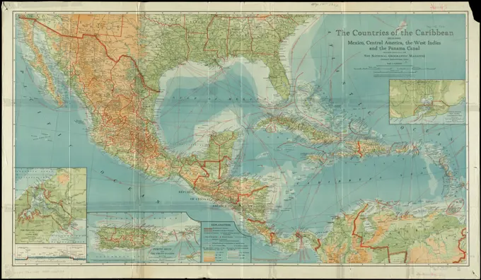
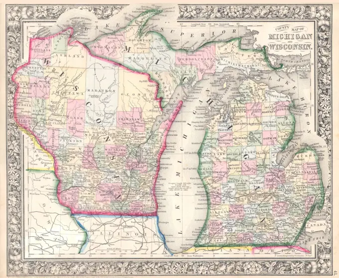
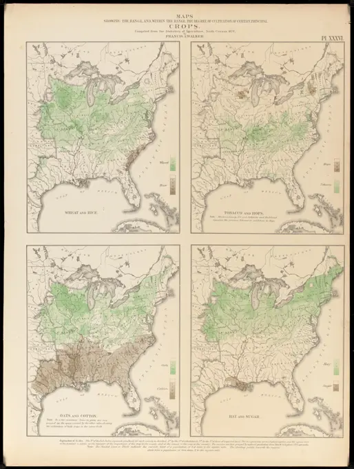
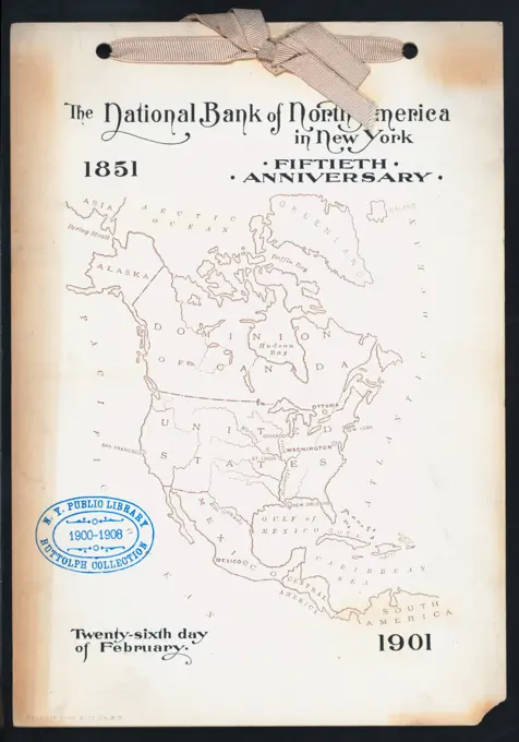
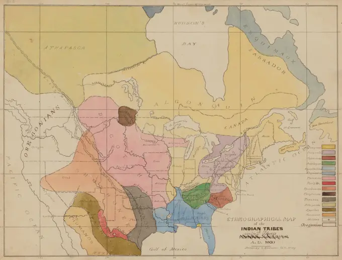
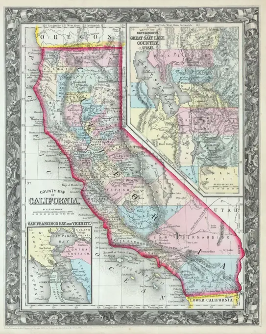
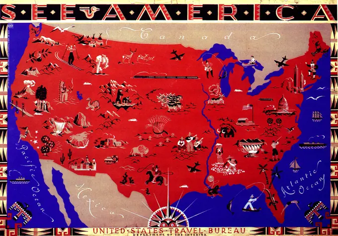
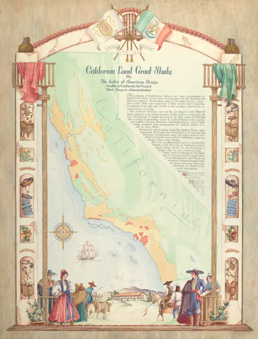
Maps of North America

Historical maps showcasing major regions in the United States and surrounding areas, detailing transportation and geography.

Map North America, 19th century engraving
160 assets in this story
6176-65989539
Map showing the American Provinces in 1763: Illustration from Cassell's History of England, King's Edition Part 33
6145-50552748
Map of southeastern portion of United States showing the location of battles in the Civil War 1861-1865 , Confederate States of America, History, Maps, United States, History, Civil War, 1861-1865, Maps Norman B. Leventhal Map Center Collection
6145-55913355
The countries of the Caribbean : including Mexico, Central America, the West Indies and the Panama Canal. Relief shown by gradient tints and spot heights. Depths shown by gradient tints. Insets: Guantanamo Bay, Cuba approximately 1:400,000 -- Porto Rico and the Virgin Islands approximately 1:1,300,000 -- The Panama Canal and the Canal Zone and cross-section showing extent of canal excavation approximately 1:500,000.... , Mexico Mesoamerica  ,area  Panama  , Canal Zone  ,area  Cuba  , Guantánamo  ,province   , Guantánamo, Bahía de  ,bay  West Indies Caribbean Sea
6145-55958863
Plate XVIII: A general map of the empire of Germany, Holland, the Netherlands, Switzerland, the Grisons, Italy, Sicily, Corsica, and Sardinia Gillet, Thomas. Cartographic. Maps. 1800-06-04. Lionel Pincus and Princess Firyal Map Division. Europe , Maps
6145-55915194
Map showing the Atchison, Topeka and Santa Fe railroad system : with its connections. Relief shown by hachures. "January 1st, 1885." Includes miles of railroad in the states of Kansas, Missouri, Colorado, New Mexico, Texas, Arizona, and Mexico.... , Western United States  ,area
6145-55913584
Electric transmission systems of the United States, showing all transmission lines and interconnections above 11,000 volts also all generating stations : based upon data collected by the United States Geological Survey and the Electrical World. Supplement to Electrical World, Jan. 5, 1924.... , United States
6145-54550522
Amérique septentrionale dressée sur les relations les plus modernes des voyageurs et navigateurs ou se remarquent les Etats unis. Cartographic. Maps. 1783. Lionel Pincus and Princess Firyal Map Division. North America , Maps , Early works to 1800
6145-51394001
Karte von Nord-America für den schul- und privatgebrauch , United States, Maps, North America, Maps Norman B. Leventhal Map Center Collection
6176-66910558
USA Presidential Election of 1844 in which Democratic Candidate James Polk defeated Whig Candidate Henry Clay 170 to 105
6145-51395615
Military map of the United States of America showing location of all forces in training , United States. Army, United States. Navy, United States. Marine Corps, Military training camps, United States, Maps, Military bases, United States, Maps, Air bases, United States, Maps, Navy-yards and naval stations, United States, Maps, World War, 1914-1918, United States, Maps, Railroads, United States, Maps, National parks and reserves, United States, Maps, United States, National Guard, United States, Maps Norman B. Leventhal Map Center Collection
6145-55917798
What the administration has done : map showing the progress of the national armies during the years 1861, 1862, 1863, and 1864. Includes text describing points of difference in Republican and Democratic platforms.... , United States
6145-29095312
1864 Mitchell Map of Michigan and Wisconsin
6145-50552935
Map showing mounted police stations in north-western Canada , Police stations, Canada, Maps, Railroads, Canada, Maps, Canada, Maps, Royal Canadian Mounted Police Norman B. Leventhal Map Center Collection
6145-52360101
County map of Michigan, and Wisconsin. Mitchell, S. Augustus (Samuel Augustus), 1792-1868. Cartographic. Maps. 1863. Lionel Pincus and Princess Firyal Map Division
6145-50539171
Distribution of the colored population of the United States : 1890 , United States, Population, Maps, United States, Census, 1890, African Americans, Population, Maps Norman B. Leventhal Map Center Collection
6145-51396701
Regni Mexicani seu Novae Hispaniae, Ludovicianae, N. Angliae, Carolinae, Virginae et Pensylvaniae necnon insularum archipelagi Mexicani in America Septentrionali , North America, Maps, Early works to 1800, New Spain, Maps, Early works to 1800 Norman B. Leventhal Map Center Collection
6145-51393498
H.H. Lloyd & Co's campaign military charts showing the principal strategic places of interest , United States, History, Civil War, 1861-1865, Maps Norman B. Leventhal Map Center Collection
6145-54603348
Progress chart of the Survey of the Northern & North Western Lakes, July 1st, 1873 : primary triangulation, telegraphic longitudes, shore line, topography and hydrography
6176-66914796
MAP of Plan of the Rebel attack on Washington, D.C., 11th & 12th July 1864, USA Civil War
6145-51386940
Regni Mexicani seu Novae Hispaniae, Ludovicianae, N. Angliae, Carolinae, Virginae et Pensylvaniae necnon insularum archipelagi Mexicani in America Septentrionali , North America, Maps, Early works to 1800, New Spain, Maps, Early works to 1800 Norman B. Leventhal Map Center Collection
6145-50552831
Map of the Mexican National Railway : showing also its relative position to the railway system of the United States, both as to the eastern & western halves of the continent , Mexican National Railway Company of Mexico, Maps, Railroads, Mexico, Maps, Railroads, United States, Maps, Mexico, Maps, United States, Maps Norman B. Leventhal Map Center Collection
6145-55914094
Johnson's new rail road & county copper plate map of the Southern States from the latest and best information. Entered according to Act of Congress in the year 1859 ... Relief shown by hachures. Includes views of Mount Vernon, General Post Office, Patent Office, Smithsonian Institute, and Treasury buildings.... , Southern United States  ,area
6145-51394552
Map of California and Nevada , California, Maps, Nevada, Maps Norman B. Leventhal Map Center Collection
6145-51396961
Phelps & Watson's new map of the United States , United States, Maps Norman B. Leventhal Map Center Collection
6145-54268109
Maps showing the range, and, within the range, the degree of cultivation of certain principal crops. From Statistical atlas of the United States based on the results of the ninth census 1870 / Francis A. Walker. New York: Julius Bien, lith., 1874. "Pl. XXXVI.". America Transformed: Agricultural production in the eastern United States is represented by this plate from the statistical atlas illustrating the 1870 census. There are four maps, each showing the distribution and degree of cultivation of two major crops. As the first national atlas, this prize-winning volume was a landmark publication displaying an unprecedented number of visual statistics and thematic maps. It was compiled by Francis Amasa Walker, Superintendent of the ninth and tenth censuses (taken in 1870 and 1880) and Commissioner of Indian Affairs (1871-1872). Walker transformed the census, acquiring and tabulating vast quantities of geographic information about the rapidly expanding country. However, this furthered the
1525-28047491
The map of Russia and Romania with explanation of signs on map.
6145-50567211
British Columbia , British Columbia, Maps Norman B. Leventhal Map Center Collection
6145-51398112
Phelps & Watson's new map of the United States , United States, Maps Norman B. Leventhal Map Center Collection
6145-51395239
Map of the Yougoslav countries , Yugoslavia, Maps Norman B. Leventhal Map Center Collection
1788-34454
Cartography, 19th century. Map of Bolivia and Peru before the War of the Pacific, published in New York, 1878.
6145-54552162
50TH ANNIVERSARY held by NATIONAL BANK OF NORTH AMERICA IN NEW YORK at "METROPOLITAN CLUB, NY" (CLUB). Buttolph, Frank, 1850-1924. Menus. 1901. Rare Book Division
4443-28737565
Ethnographic Map of the Indian Tribes of the United States, A.D. 1600, 1849-1855, Seth Eastman, American, 1808-1875, 9 × 12 in. (22.86 × 30.48 cm) (image)9 11/16 × 12 7/8 in. (24.61 × 32.7 cm) (sheet), Pen, ink, and watercolor, United States, 19th century, This map of Native languages is based on one by Albert Gallatin (1761-1849), a geographer and diplomat who was the first to classify these linguistic boundaries, in 1826. The vivid colors (Minnesota is pink) are especially well preserved. Map-making had always been Seth Eastmans love. He even wrote a textbook on topographical drawing used at West Point, his alma mater.
6145-54269199
Routes of Grand Trunk Pacific Steamships : Pacific coast service. Relief shown by shading and spot heights. Inset: Grand Trunk Pacific from Edmonton to Prince Rupert.... , Canada  , Province of British Columbia  ,province  Alaska
6145-54688725
A Map of the United States of America. Country: UK Printed By: Fosh & Cross Ltd.. 1942 - 1945.  Office for Emergency Management. Office of War Information. Domestic Operations Branch. Bureau of Special Services. 3/9/1943-9/15/1945. World War II Foreign Posters
6145-50571250
Map of the United States and territories, showing the possessions and aggressions of the slave power , Slavery, United States, Maps Norman B. Leventhal Map Center Collection
6145-51387989
America : beauty, wonders, inspiration, progress, without end , United States, Maps Norman B. Leventhal Map Center Collection
6145-55938023
Illustrated map by children in the school at Arthurdale, West Virginia. 1937. Photographs. The Miriam and Ira D. Wallach Division of Art, Prints and Photographs: Photography Collection
6176-61904759
Map of The American Colonies and Canada, showing the British Forts in 1755. From The Story of England, published 1930.
6145-55956135
Map of Mexico, Central America, and the West Indies ; Map of the Island of Cuba inset; Map of the Island of Jamaica inset; Map of the Bermuda Islands inset; Map of the Panama Railroad inset. Mitchell, S. Augustus (Samuel Augustus), 1792-1868. Cartographic. Maps. 1863. Lionel Pincus and Princess Firyal Map Division
6145-55913485
Dominion of Canada. Relief shown by shading. Shows provinces, territories and districts. Inset: Northern continuation of Greenland.... , Canada Greenland  ,territory
1746-29999900
Illustration showing Map of time zones into which the US was divided after the adoption of Standard Time on 18 November 1883.
6145-29095080
1860 Mitchell's Map of California
6145-52359014
Standard Railway Time (outline map) Allen, William Frederick, 1846-1915. Cartographic. Maps. 1883. Manuscripts and Archives Division
6176-66910297
Colton's map of the southern states. Including Maryland, Delaware, Virginia, Kentucky, Tennessee, Missouri, North Carolina, South Carolina, Georgia, Alabama, Mississippi, Arkansas, Louisiana, and Texas. Showing also part of adjoining states & territories locating the forts & military stations of the U. States & showing all the rail roads, r. r. stations, & other internal improvements.  1861
6145-55915413
National highways map of the United States showing principal transcontinental highways and connecting system of one hundred thousand miles of national highways proposed by the National Highways Association. Published under direction of the National Highways Association. "This map shows tentative locations for a system of 100,000 miles of national highways." Includes text and ill.... , United States
6145-29094806
1855 Colton Map of Balochistan
6145-50571551
William Gropper's America, its folklore , United States, Maps, Folklore, United States, Maps Norman B. Leventhal Map Center Collection
6145-54269461
Transportation lines between the United States and Mexico, showing differences of elevation. Relief shown by gradient tints.... , Southwest  ,area  Mexico Southern United States  ,area
6145-55913995
Indians of the U.S.A.. Shows locations of Native American tribes in the United States and southeastern Canada. Relief shown pictorially. From Earle F. Dexter's This is the Indian (New York : Friendship Press, 1944). Includes notes, illustrations, decorative border and inset of Alaska... Indians of the United States of America. Indians of the United States of America, United States
6145-54268133
Mexico, mapa de las lineas del Ferrocarril Central Mexicano y conecciones. Relief shown by hachures. Prime meridian: Mexico City. Includes elevation profile.... , Mexico
6145-51398046
Paul Sample's America, its soil , United States, Maps, Agriculture, United States, Maps, Land use, Rural, United States, Maps, Natural resources, United States, Maps Norman B. Leventhal Map Center Collection
4048-5362
1851 map of the upper Great Plains and Rocky Mountains region shows territories of various North American Indian tribes.
6145-50522787
A Texan's map of the United States of Texas , United States, Humor, Maps, Texas, Humor, Maps, Pictorial maps, Mental maps Norman B. Leventhal Map Center Collection
6145-54267601
Growth of the Commonwealth (A). Shows relative size of the British Isles overlaid on a map of the United States. Includes references. Appears in The commonwealth of nations / edited by L. Curtis. "Plate XII." "To face page 647."... , British Isles  ,area  United States
1899-20228295
Map of United States.
1746-57661771
The Compromise of 1850 was a package of five separate bills passed by the United States Congress in September 1850 that defused a political confrontation between slave and free states on the status of territories acquired in the Mexican-American War. Map illustration
6145-29859836
Hal Blakeley, Map  California Land Grant Study, 1935 1942 Map: California Land Grant Study
6145-43687564
Electoral votes for President in 1916 and for Congress in 1918 : make your guess for 1920 , Elections, United States, Maps, United States, Maps Norman B. Leventhal Map Center Collection
6176-66916413
The Lincoln Highway route : it's ideals and purposes : a connected improved highway extending from New York City to San Francisco ... 1914
6145-50577503
Monrovia, Calif. , Maps, Tichnor Brothers Collection, postcards of the United States
PREVIOUS
of 2
NEXT
2401 S. Ervay, Suite 206
Dallas, Texas 75215
United States
Get Started
Free ResearchMy BoardsMy Cart
For Creators
How To License Your ContentContributor PortalFrame of Mind
Resources
API accessPricing
Contact
+1 866 236 0087help@viewpictures.co.uk Contact form
©2026 View Pictures. All Rights Reserved. -B
This site is protected by reCAPTCHA and Google Privacy Policy and Terms of Service apply.