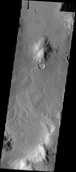
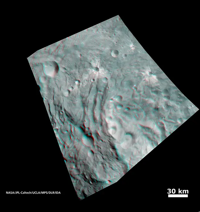
My Boards
View Pictures
  • My Boards

Mars Geological Features

High-resolution imagery of Martian landscapes, showcasing craters, lava flows, and valleys. The images exhibit a gray scale, highlighting surface textures and geological formations.

Channels
Channels
270 assets in this story
6145-44972571
Flying V
6145-45119992
This image captured by NASA's 2001 Mars Odyssey spacecraft shows a group of craters in Terra Sirenum.
6145-44576714
The eastern rim of this unnamed crater in Southern Arabia Terra, imaged by NASA's Mars Odyssey, is very degraded, indicating that it's an ancient crater that's been subjected to erosion and bombardment from impactors such as asteroids and comets.
6145-44606235
Spirit has Landed!
6145-45299021
Today's VIS image shows a portion of an unnamed channel in northern Arabia Terra. Numerous channels dissect this region of Arabia Terra where it borders the northern lowlands. Orbit Number 81196 Latitude 36.607 Longitude 35.816 Instrument VIS Captured 2020-04-04 00 06
6145-44917736
The streamlined island in this image captured by NASA's 2001 Mars Odyssey spacecraft is located in the channel of Marte Vallis.
6145-45104687
This image captured by NASA's 2001 Mars Odyssey spacecraft shows an unnamed crater located northwest of Elysium Mons. This crater contains a central pit, which formed at the time of impact.
6145-45113971
This image captured by NASA's 2001 Mars Odyssey spacecraft shows a very small portion of the extensive lava flows of the Tharsis volcanic complex.
6145-44916102
The linear depression in this image from NASA's 2001 Mars Odyssey spacecraft is a volcanic vent in the lava plains east of Pavonis Mons.
6145-44632204
Collapse Features on Arsia Mons
6145-44585226
Like many of the craters in the Oxia Palus region of Mars, Trouvelot Crater, shown in this NASA Mars Odyssey image, hosts an eroded, light-toned, sedimentary deposit on its floor.
6145-44591536
The fluidized impact crater ejecta and flat crater floors observed in this image from NASA's Mars Odyssey spacecraft suggest near-surface volatiles once played an important role in modifying the Martian surface.
6145-44664395
Flows in Athabasca Valles Source Region
6145-45094433
This image from NASA's 2001 Mars Odyssey spacecraft is of an unnamed crater located on the floor of the much larger Newton Crater. This crater had a central peak, gullies on the inner rim and dunes on the northern part of the crater floor.
6145-45050518
The windstreak in this image from NASA's 2001 Mars Odyssey spacecraft is located on Tharsis volcanic lava flows east of Olympus Mons.
6145-44623014
Rover Tracks Seen from Orbit
6145-44587054
This area of Mars imaged by NASA's Mars Odyssey shows a wonderful example of relative geologic dating. Ancient lava flows and escarpments are mantled by younger impact ejecta, which was cut by a younger graben and resurfaced by smaller impact craters.
6145-45263811
Osuga Valles is a complex set of channels located near Eos Chasma. Orbit Number 71243 Latitude -15.2123 Longitude 321.617 Instrument VIS Captured 2018-01-05 06 57
6145-44647169
This crater appears to be in the process of being covered over by downslope movement of material. These large slopes of material are common in Deuteronilus Mensae
6145-44668410
The three landslides in this image are located within an unnamed crater in Noachis Terra
6145-44666555
This unnamed crater east of Herschel Crater contains both a large landslide and a field of small dark sand dunes
6145-52930442
Memnonia Fossae. Fossae are long linear depressions called graben and are formed by extension of the crust and faulting. When large amounts of pressure or tension are applied to rocks on timescales that are fast enough that the rock cannot respond by deforming, the rock breaks along faults. In the case of a graben, two parallel faults are formed by extension of the crust and the rock in between the faults drops downward into the space created by the extension. The graben in this VIS image are part of Memnonia Fossae. Memnonia Fossae, Mangala Fossae and Sirenum Fossae are all long graben systems that stretch from eastern Terra Sirenum into western Daedalia Planum. Orbit Number 92952 Latitude -20.9228 Longitude 201.274 Instrument VIS Captured 2022-11-27 22 30 https //photojournal.jpl.nasa.gov/catalog/PIA25807
6145-58971789
This VIS image shows part of Granicus Valles. Granicus Valles is a complex channel system located west of Elysium Mons. The system is approximately 750km long (466 miles). It is likely that both water and lava played a part in creation of the feature. Orbit Number 94807 Latitude 28.4465 Longitude 130.95 Instrument VIS Captured 2023-04-29 17 14
6145-44647951
These streamlined islands are located in Mangala Vallis
6145-44891473
The solitary windstreak in today's image from NASA's 2001 Mars Odyssey spacecraft is located on the volcanic plains of Daedalia Planum. The windstreak appears to represent two different wind directions.
6145-44587053
Islands of older high-standing terrain rise above a sea of relatively young, platy lava flows between two of the largest volcanoes in the solar system in this image from NASA's Mars Odyssey spacecraft.
6145-44669712
The cliff-like feature in this north polar image is called Abalos Scopuli. Scopuli means scarp
6145-58971911
The linear depressions in this VIS image are tectonic graben. These graben are called Icaria Fossae and are located in Terra Sirenum. Graben are created in regions of extensional tectonic stress, where the bedrock is faulted and pulled apart, allowing linear sections of the surface to drop downward along paired faults. Orbit Number 83941 Latitude -43.6426 Longitude 238.128 Instrument VIS Captured 2020-11-15 23 39
6145-44712416
THEMIS ART #93
6145-44976243
Part of the summit caldera of Olympus Mons is visible at the bottom of this image as seen by NASA's 2001 Mars Odyssey spacecraft.
6145-44665513
Buttes in Arabia Region
6145-44913955
A Closer Look at Eminescu
6145-52960798
. Ascraeus Mons. This VIS image shows part of the summit of Ascraeus Mons. Ascraeus Mons is the northernmost and tallest of the three large aligned Tharsis volcanoes. Calderas are found at the tops of volcanoes and are the source region for magma that rises from an underground lava source to erupt at the surface. Volcanoes are formed by repeated flows from the central caldera. The final eruptions can pool within the summit caldera, leaving a flat surface as they cool. Calderas are also a location of collapse, creating rings of tectonic faults that form the caldera rim. Ascraeus Mons has several caldera features at its summit. Ascraeus Mons is 18 km (11 miles) tall, for comparison Mauna Kea - the tallest volcano on Earth - is 10 km tall (6.2 miles, measured from the base below sea level). Orbit Number 94653 Latitude 10.5186 Longitude 256.223 Instrument VIS Captured 2023-04-17 00 48
6145-44586276
This scene from NASA's Mars Odyssey spacecraft shows several interesting geologic features associated with impact craters on Mars.
6145-44577515
Kasei Valles is one of the largest outflow channels on Mars. This NASA Mars Odyssey image is of the northern branch of Kasei Valles and shows the channel floor and northern channel wall.
6145-45292408
The linear depressions in this VIS image are part of Sirenum Fossae. Depressions of this type are called graben, which form by the down drop of material between two parallel faults. The faults are caused by tectonic stresses in the region. The Sirenum Fossae graben are 2735km (1700 miles) long. Orbit Number 84092 Latitude -32.8748 Longitude 203.947 Instrument VIS Captured 2020-11-28 09 58
6145-44589747
The sinuous channel in this NASA Mars Odyssey image begins at the edge of Cerulli Crater in northern Arabia and snakes its way across 1,000 km (621 miles) of cratered highlands before reaching Deuteronilus Mensae at the boundary of the northern lowlands.
6145-45051830
Many small channels are visible in this image of Arabia Terra as seen by NASA's 2001 Mars Odyssey spacecraft.
6145-44924896
The lava flows in image from NASA's 2001 Mars Odyssey spacecraft are part of the vast flow field originating from Arsia Mons.
6145-45039435
The windstreaks in this image captured by NASA's 2001 Mars Odyssey spacecraft are located on the volcanic plains northeast of Olympus Mons.
6145-44591537
The floor of the crater in this NASA Mars Odyssey image displays interesting textures and it appears to have been flooded by some type of material. It is unclear if this material was fluvially emplaced mud (hyperconcentrated flows) or lava.
6145-58967400
Smooth Operator
6145-45049966
A multitude of dust devil tracks mark the suface in this region of Utopia Planitia. This image is from NASA's 2001 Mars Odyssey spacecraft.
6145-45088804
This image captured by NASA's 2001 Mars Odyssey spacecraft show numerous gullies dissect the rim of this unnamed crater in Terra Cimmeria.
6145-45040143
This image from NASA's Dawn spacecraft shows a large crater with several smaller craters at the edge on the giant asteroid Vesta. Rough texture in the crater wall at far right may be the underlying bedrock.
6145-44962658
On the Splendor of Abedin
6145-45058891
The numerous dust devil tracks in this image captured by NASA's 2001 Mars Odyssey spacecraft are located in Utopia Planitia.
6145-44909537
Southern Belle
6145-44630345
Kasei Vallis Topography
6145-45042285
Target Lock
6145-44693592
Windstreaks
6145-45292435
The THEMIS VIS camera contains 5 filters. The data from different filters can be combined in multiple ways to create a false color image. These false color images may reveal subtle variations of the surface not easily identified in a single band image. Today's false color image shows a crater in Arabia Terra. Dark blue in this filter combination indicates basaltic sand. Orbit Number 69458 Latitude 35.4862 Longitude 0.619413 Instrument VIS Captured 2017-08-11 05 43
6145-45134981
The THEMIS camera contains 5 filters. The data from different filters can be combined in multiple ways to create a false color image. This image from NASA's 2001 Mars Odyssey spacecraft shows part of the northern rim of Horowitz Crater.
6145-45096949
The THEMIS VIS camera contains 5 filters. The data from different filters can be combined in multiple ways to create a false color image. This image from NASA's 2001 Mars Odyssey spacecraft shows part of the plains of Terra Sabaea.
6145-45104198
This image captured by NASA's 2001 Mars Odyssey spacecraft shows a small crater located on the floor of a larger crater. Sand dunes are visible on the floors of both craters.
6145-58971915
The linear depression in this VIS image is part of Sirenum Fossae. Depressions of this type are called graben, which form by the down drop of material between two parallel faults. The faults are caused by tectonic stresses in the region. The Sirenum Fossae graben are 2735km (1700 miles) long. Orbit Number 83300 Latitude -38.3682 Longitude 187.612 Instrument VIS Captured 2020-09-24 05 29
6145-44577250
This NASA Mars Odyssey image is of the ridged plains of Lunae Planum in the northern hemisphere of Mars. Wrinkle ridges, a very common landform on Mars, Mercury, Venus, and the Moon, are found mostly along the eastern side of the image.
6145-45124242
The THEMIS camera contains 5 filters. The data from different filters can be combined in multiple ways to create a false color image. This image from NASA's 2001 Mars Odyssey spacecraft shows part of Gale Crater.
6145-44588696
This image from NASA's Mars Odyssey spacecraft shows an impact crater with a rampart ejecta blanket in Arabia Terra.
6145-52960761
. Hebrus Valles. Located west of the Elysium Volcanic complex, Hebrus Valles is a complex channel system that flowed to the north. The start of the channel is visible in this image. There are fluid created channels and tectonic formed depressions in this image, while in other portions of the valles, there are pits and collapse features which appear to have formed by material falling into subsurface voids. These are common features in regions of volcanic activity where lava tubes run below the surface. Both water and lava contributed to the formation of Hebrus Valles. Hebrus Valles is 325km (202 miles) long. Orbit Number 94308 Latitude 17.8126 Longitude 128.079 Instrument VIS Captured 2023-03-19 15 06
6145-45263106
This image shows a bright, rectangular-looking landform surrounded by a dark floor. How did this feature get here if it looks so different than its surroundings The feature resembles a plateau. Dark streaks mark steep slopes on its sides while the top appears flat. The slope streaks are not all the same age, as we see a variation in colors from faint to dark. Craters in a variety of sizes and ages pepper the entire rectangle, but the dark, textured floor has very few noticeable craters. The evidence suggests that this rectangular feature is a high-standing island of older land surrounded by one or more younger lava flows. This landmass is located in Amazonis Planitia, a smooth plains area potentially formed by large-scale lava floods between the Tharsis and Elysium volcanic regions. As lava flowed into this area, the rectangular plateau was too high to cover completely, leaving a bright spot sticking out of the dark basalt floor for us to find.
6145-44747757
Tartarus Colles
6145-44586539
These pit-chain features in this NASA Mars Odyssey image of south Noctis Labryinthus are oriented parallel to grabens in the area, suggesting that tensional stresses may have been responsible for their formation.
6145-45266650
The linear depressions in this VIS image are graben called Labeatis Fossae. Graben are formed when extension between paired faults causes the material to move downward. Orbit Number 77282 Latitude 26.3831 Longitude 278.283 Instrument VIS Captured 2019-05-17 17 04
6145-44483385
The linear feature in this VIS image is part of Labeatis Fossae. Fossae are linear depressions, most often caused by extensional tectonic forces pulling the crust apart and allowing material to slide downward between bounding faults. However, in this image, the feature has several circular features within the fossae. In regions of volcanic flows, the depression may be caused by roof collapse into an underlying void left by a lava tube. As this feature is located in the Tharsis volcanic region, it is likely that this feature was primarily created by volcanic collapse rather tectonic stress. Orbit Number 88875 Latitude 22.9953 Longitude 266.918 Instrument VIS Captured 2021-12-27 06 40
6145-45010500
In this image, obtained by NASA's Dawn spacecraft from above the surface of the giant asteroid Vesta, topography in the area surrounding the south pole area shows impact craters, ridges and grooves. You need 3D glasses to view this image.
6145-44687742
A Scene of Craters
6145-44664961
Chasma Boreale
6145-44881310
This image, from NASA's Dawn spacecraft, shows rock material that has moved across the surface and flowed into a low area in the ridged floor of the Rheasilvia basin on asteroid Vesta.
6145-44681572
Dust Devil Tracks
PREVIOUS
of 3
NEXT
2401 S. Ervay, Suite 206
Dallas, Texas 75215
United States
Get Started
Free ResearchMy BoardsMy Cart
For Creators
How To License Your ContentContributor PortalFrame of Mind
Resources
API accessPricing
Contact
+1 866 236 0087help@viewpictures.co.uk Contact form
©2026 View Pictures. All Rights Reserved. -A
This site is protected by reCAPTCHA and Google Privacy Policy and Terms of Service apply.